
Follows the little-studied 1889 Pevtsov Expedition in Central Asia.
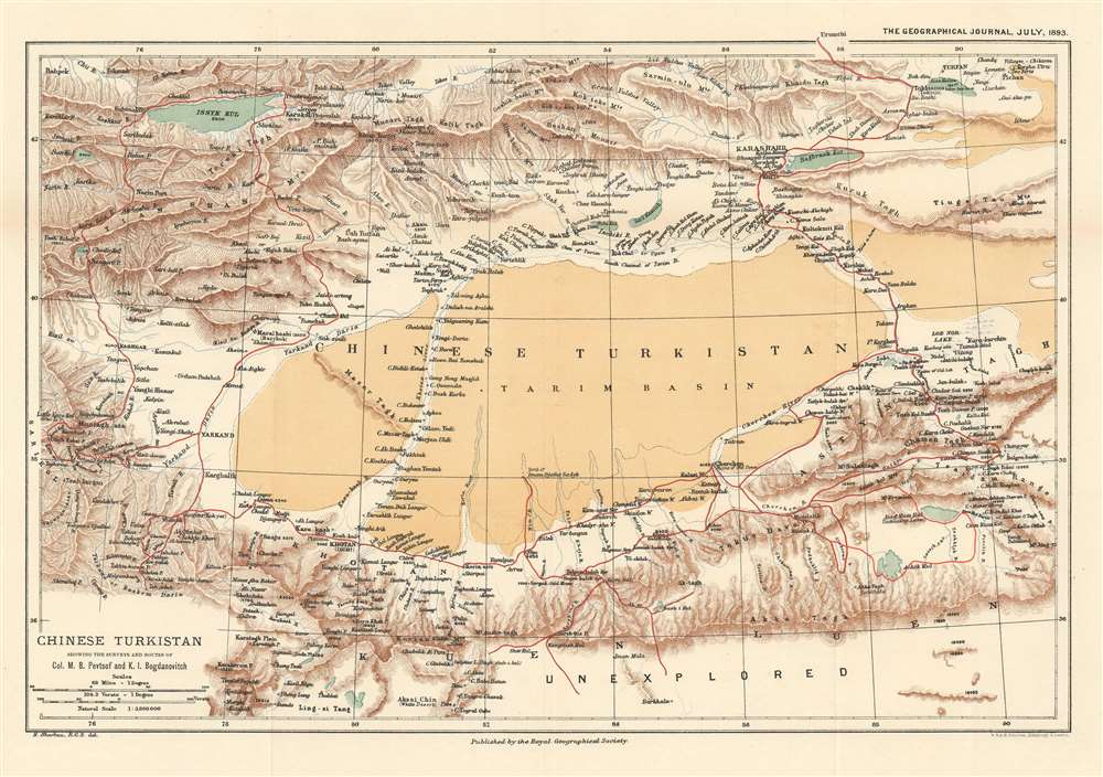
Chinese Turkistan Showing the Surveys and Routes of Col. M.B. Pevtsof and K.I. Bogdanovitch.
sold
- Digital Map Information
- Suitable for large format printing
- File Size: 11.36 MB
- File Type: ZIP / TIFF
- ICC color profile embedded
- Delivered instantly via download link
This is an 1893 Henry Sharbau map of Xijiang Province in China and Kyrgyzstan. The map depicts the movements of the 1889 Imperial Russian Geographical Society expedition to Central Asia led by Mikhail Vasilievich Pevtsov, which are traced by the thick red line. An impressive level of detail is present. Numerous towns and villages are identified, as are rivers and mountain peaks. Issyk Kul, the second largest salt water lake in the world, is situated in the upper left corner. (more details)
A rare map of the Arabian Peninsula published with a history of Western knowledge of the region.
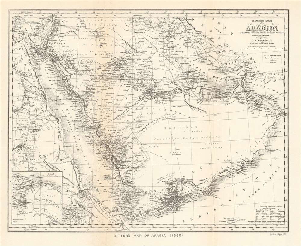
Ritter's Map of Arabia (1852).
$250.00
Acquire
- Digital Map Information
- Suitable for large format printing
- File Size: 7.3 MB
- File Type: ZIP / TIFF
- ICC color profile embedded
- Delivered instantly via download link
This is a 1904 John Bartholomew map of the Arabian Peninsula. A reduction of Heinrich Kiepert’s Ubersichts-Karte von Arabien, the map centers on the Arabian Peninsula and depicts from Egypt to the Gulf of Oman and from Jerusalem to the Bab-el-Mandeb, the strait between Yemen and Djibouti and Eritrea. Cities, towns, and villages throughout the region are labeled, including Jerusalem, Basra, Kuwait City, and Mecca. The route of the Hajj is noted, as are other trade routes and the routes of two German explorers. (more details)
Red overprinted numbers announcing the size of each state's Congressional delegation provide an interesting look into the history of American representative government.
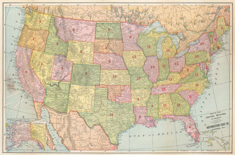
Map of the United States of America.
sold
- Digital Map Information
- Suitable for large format printing
- File Size: 21.62 MB
- File Type: ZIP / TIFF
- ICC color profile embedded
- Delivered instantly via download link
This is a rare c. 1899 Fort Dearborn Publishing Company and Northwestern Yeast Company map of the United States. States and territories are shaded different colors to allow for easy differentiation. The extensive rail network is illustrated, although is completely unlabeled. (more details)
Abundantly Data-Rich Midcentury Map of New York City.

The City of New York.
sold
- Digital Map Information
- Suitable for large format printing
- File Size: 78.57 MB
- File Type: ZIP / TIFF
- ICC color profile embedded
- Delivered instantly via download link
This 1939 Richard Edes Harrison map of New York City - published in conjunction with the New York World’s Fair – represents a triumph of the visual display of quantitative information. Its aesthetic impact is all the more impressive in its clear expression of municipal and demographic data, making this a map of the people of New York City, as much as of the physical city itself. All five boroughs are represented in the primary map. On it, Harrison’s masterful use of vivid color to distinguish between residential, commercial, industrial, and federal use of land is clear yet supple, able to make distinction (for example) of low-income housing projects using the same palette. Parks and cemeteries both appear as green spaces, with white spots - evoking headstones - indicating the difference between the two. The two major airports (Floyd Bennett Field and North Beach Airport) are given their own color as well. The city’s industrial areas, shown in black, dominate the East River and Hudson coastlines, a reminder of the centrality of trade to the city’s development and history. (more details)
Revolutionary War Map of Amelia Island.
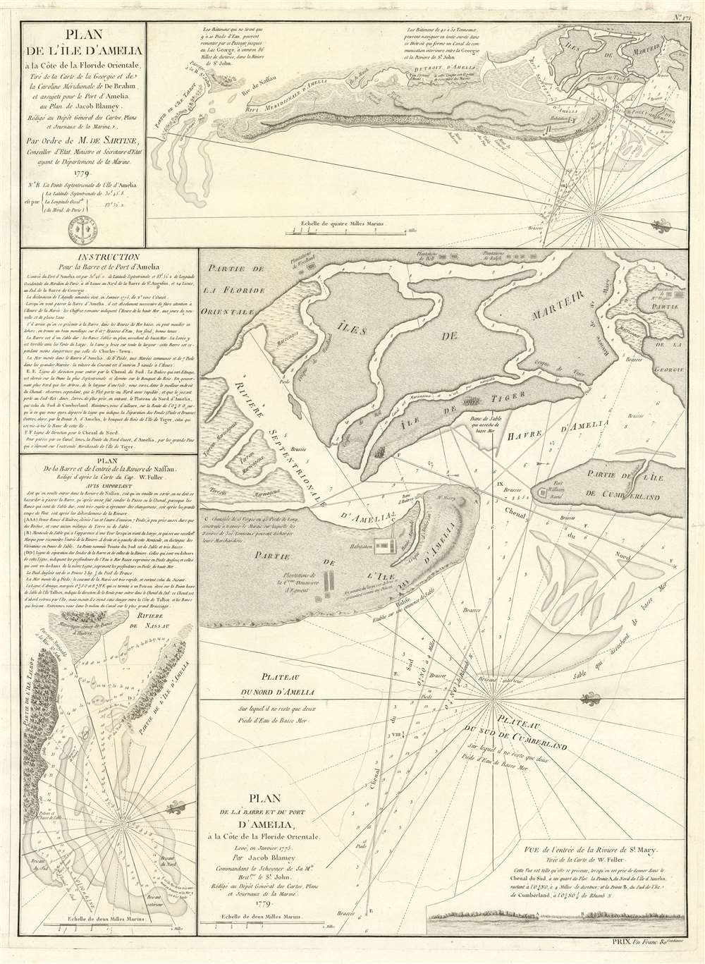
Plan de l'île d'Amelia à la Côte de la Floride Orientale. / Plan de la Barre et et de l'entrée de la Riviere de Nassau. / Plan de la Barre et du port d'Amelia, à la Côte de la Floride Orientale.
sold
- Digital Map Information
- Suitable for large format printing
- DPI: 600
- File Size: 24.35 MB
- File Type: ZIP / TIFF
- ICC color profile embedded
- Delivered instantly via download link
This is a rare 1779 American Revolutionary War map of Amelia Island, Florida, issued by Antoine de Sartine (1729 - 1801) and Jean-Nicholas Buache de Neuville (1741 - 1825). The chart was issued following the 1778 Treaty of Alliance, in which France formally recognized the United States and offered to aid the fledgling country against the British. Early in the war, French aid was primarily maritime, so the Depot de Marine recognized the need for better nautical charts and began to compile and improve British charts of the North American coastline. (more details)
An Essential American Revolutonary War map rvised to reflect the independence of the United States.
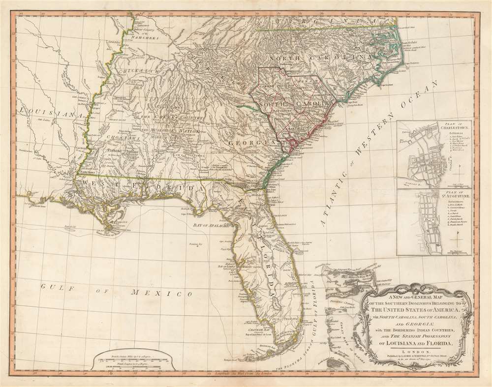
A New and General Map of the Southern Dominions Belonging to The United States of America, viz: North Carolina, South Carolina, and Georgia: with the Bordering Indian Countries, and The Spanish Possessions of Louisiana and Florida.
sold
- Digital Map Information
- Suitable for large format printing
- DPI: 600
- File Size: 24.8 MB
- File Type: ZIP / TIFF
- ICC color profile embedded
- Delivered instantly via download link
A scarce 1794 map of the southeastern part of the United States and Florida issued by the London firm of Laurie and Whittle. The coverage extends from North Carolina to the Florida Keys and from just beyond the Mississippi River to the Atlantic seaboard and the Bahamas. It encompasses the modern-day states of North Carolina, South Carolina, Georgia, Kentucky, Tennessee, Alabama, Mississippi, Louisiana (very little detail), and Florida. At right, there are inset detail maps of Charleston and St. Augustine. (more details)
The World, Centered on the Holy Land

Die eigentliche warhafftige gestalt der Erden und des Meers. Cosmographia Universalis.
sold
- Digital Map Information
- Suitable for large format printing
- DPI: 600
- File Size: 13.84 MB
- File Type: ZIP / TIFF
- ICC color profile embedded
- Delivered instantly via download link
This is Heinrich Bünting's 1585 map of the world. Bünting's more famous 'cloverleaf' world was not so much a literal depiction of geography, as it was an expression of patriotic devotion (the cloverleaf was the sigil of his birth-city, Hanover.) This map, which appeared in the same work, does represent an effort to show the actual shape and positions of the continents as they were understood in the early 16th century. (more details)
America's emergence as a colonizing power!
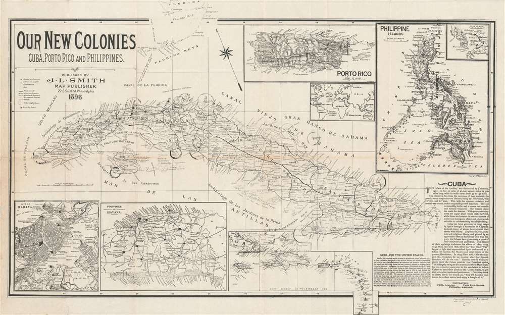
Our New Colonies. Cuba, Porto Rico and Philippines.
sold
- Digital Map Information
- Suitable for large format printing
- File Size: 17.99 MB
- File Type: ZIP / TIFF
- ICC color profile embedded
- Delivered instantly via download link
This is an 1898 John L. Smith persuasive map celebrating the U.S. conquest of Cuba, Puerto Rico, and the Philippines during the Spanish-American War. Cuba is the primary focus of the map, with impressive detail naming cities, towns, railroads, and coastal points and bays are labeled throughout. An inset of the Philippine Islands occupies the upper right corner, with a sub-inset of Manila Bay, where Admiral Dewey won his celebrated victory against the Spanish Navy. A second inset to the left of the Philippines details Puerto Rico (Porto Rico), while a third, still smaller inset situates these three new territories on a world map. Insets along the bottom detail the city of Havana, the Province of Havana, and the West Indies from Cuba to Granada. (more details)
Jazz Age Map of New York City in Vivid Color
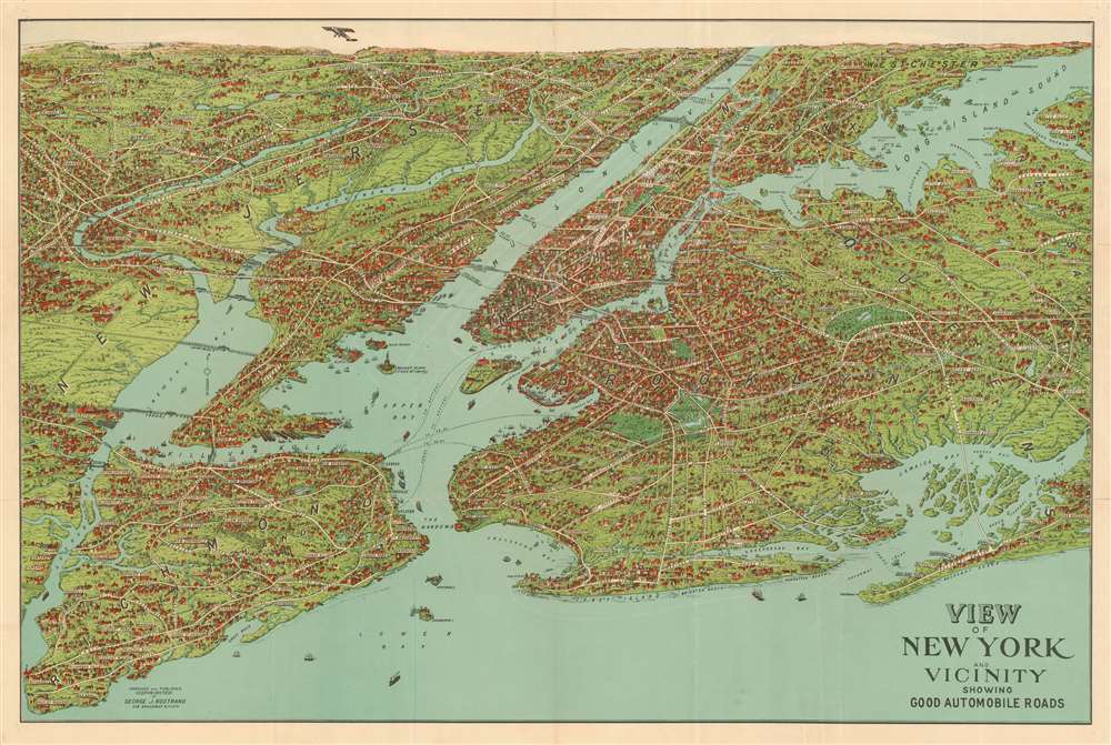
View of New York and Vicinity Showing Good Automobile Roads.
sold
- Digital Map Information
- Suitable for large format printing
- Full resolution TIFF file
- ICC color profile embedded
- Delivered instantly via download link
This is an engaging 1928 birds-eye view map of New York City and vicinity by George J. Nostrand. Brightly colored and evocative, the view presents New York City and its surrounds at the height of 'the Roaring Twenties.' As the title suggests, it was meant to highlight the most auto-friendly of New York City’s roads during an era in which the automobile was still a relative novelty and the outer boroughs not yet fully developed. Ferry routes are prominently shown, and the East River is spanned by the Brooklyn, Manhattan, Williamsburg and Queensboro Bridges. All five New York City Boroughs are represented, and the map encompasses Westchester County, Bergen County and Nassau County in Long Island. In addition to major roads, the map details specific neighborhoods, the character of their development and topography beautifully rendered. Individual landmarks, buildings and bridges are illustrated throughout, including the Statue of Liberty, Ellis Island, Grand Central, Madison Square Garden, Museum of Natural History, and Metropolitan Museum of Art. The harbor is full of ships while an airplane - in fact, Charles Lindbergh's Spirit of St. Louis - soars over Paterson. (more details)
Depicts the newly surveyed border between British and Portuguese Central East Africa.
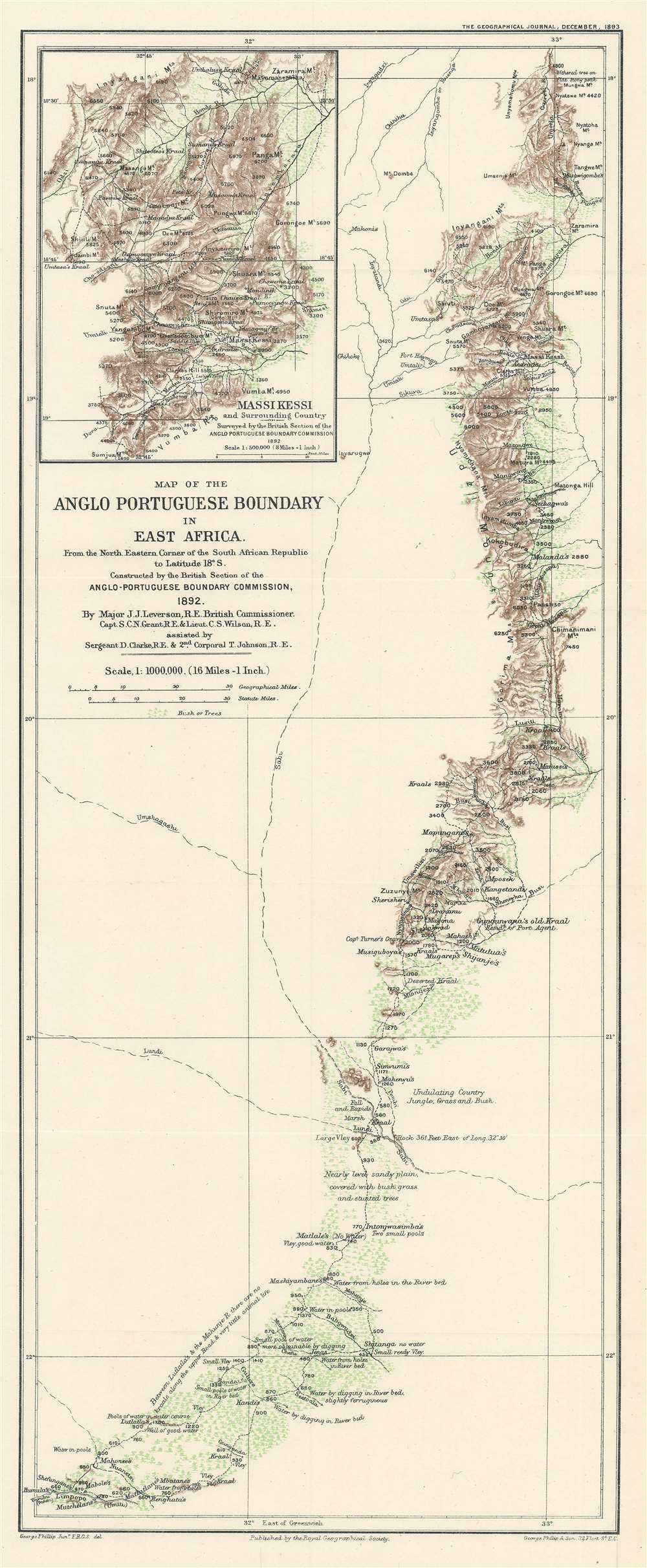
Map of the Anglo Portuguese Boundary in East Africa.
sold
- Digital Map Information
- Suitable for large format printing
- File Size: 7.43 MB
- File Type: ZIP / TIFF
- ICC color profile embedded
- Delivered instantly via download link
This is an 1893 George Philip map of the border between British and Portuguese Central East Africa decided upon in the Anglo-Portuguese Treaty of 1891. Depicting the border as it was surveyed by the Anglo-Portuguese Delimination Commission in 1892, innumerable rivers, mountain peaks, and roads are identified. Green is used to highlight areas of trees and brush, while brown marks the spine of mountains that forms part of the newly designated border. Notes provide commentary on the terrain, water supply, vegetation, and animal life. (more details)
Illustrates the hypothetical trajectories of the Apollo 8, 10, and 11 missions.
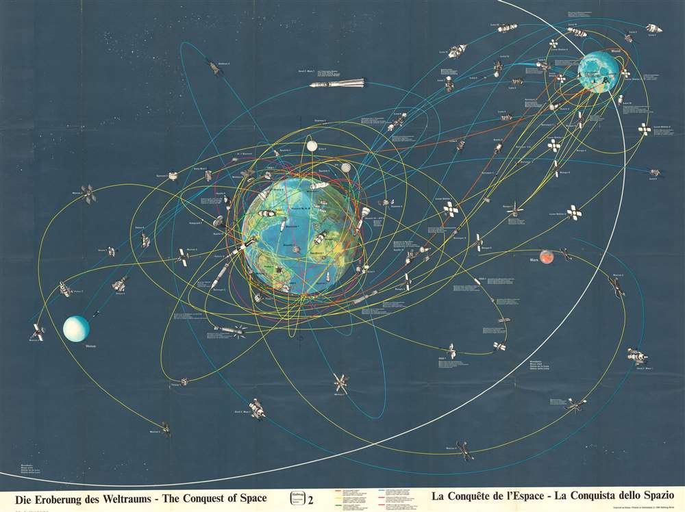
Die Eroberung des Weltraums - The Conquest of Space - La Conquête de l'Espace - La Conquista dello Spazio.
sold
- Digital Map Information
- Suitable for large format printing
- File Size: 118.85 MB
- File Type: ZIP / TIFF
- ICC color profile embedded
- Delivered instantly via download link
This is a 1969 Hallwag pictorial map of space exploration, created shortly after American astronauts Neil Armstrong and Buzz Aldrin landed on the Moon. The map depicts the trajectories of both manned and unmanned spacecraft in orbit around the Earth, the Moon, and flying by Mars. These trajectories are printed in different colors so that each spacecraft can be properly attributed to the nation responsible for its construction and subsequent launch. (more details)
A city map of Cuba created by the Instituto Cartografico Nacional from aerial photographs provided by the U.S. Air Force.
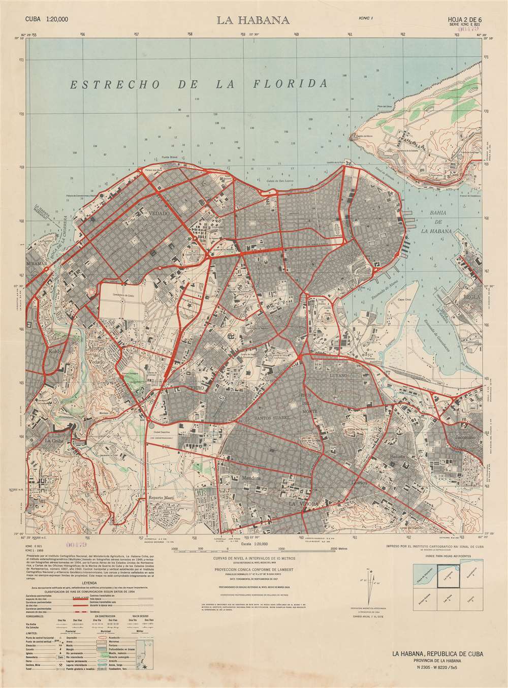
La Habana.
sold
- Digital Map Information
- Suitable for large format printing
- File Size: 29.99 MB
- File Type: ZIP / TIFF
- ICC color profile embedded
- Delivered instantly via download link
This is a 1955 Instituto Cartográfico Nacional city plan or map of Havana (La Habana), Cuba issued at the height of the Cuban Revolution (1953 - 1959). This map was compiled by the Batista regime and its U.S. allies to help strategize defense against the encroaching Revolutionaries under Fidel Castro. Streets are illustrated throughout and buildings outside the main city center are depicted ichnographically. The city's fortresses are illustrated and labeled, along with its port and railway network. Depth soundings are provided in the Strait of Florida and Havana Bay. (more details)
Fascinating Chart Tracking Four Great Circumnavigators' Passage through the Society Islands
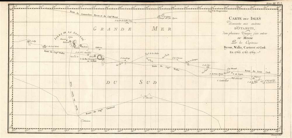
Carte Des Isles Decouvertes Aux Environs D'Otahiti, dans Plusieurs Voyages Faits Autour Du Monde Par Les Capitaines Byron, Wallis, Carteret et Cook. En 1765, 1767,1769.
sold
- Digital Map Information
- Suitable for large format printing
- DPI: 600
- File Size: 10.93 MB
- File Type: ZIP / TIFF
- ICC color profile embedded
- Delivered instantly via download link
This is a 1774 map showing the explorations of Captains Cook, Byron, Wallis and Carteret in the vicinity of Tahiti and the Society Islands from 1765 to 1769. The chart extends from the Scilly Islands in the west to Whitsunday Island in the east, and from Tepoto Island in the north to Oheiroa in the south. Each of the circumnavigators' tracks are shown as they tacked through the islands. Tahiti, Bora Bora, Otaha, Marma, Ulietea, and other islands are named and shown. These voyages represented the first recorded European contacts with many of these remote places. (more details)
Comprised of six charts on one sheet illustrating rain and snow fall, temperature, river basins, and vegetation in the Arctic Basin.
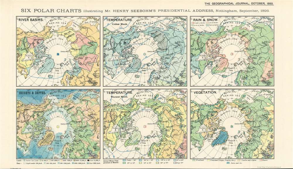
Six Polar Charts illustrating Mr. Henry Seebohm's Presidential Address, Nottingham, September, 1893.
sold
- Digital Map Information
- Suitable for large format printing
- File Size: 8.66 MB
- File Type: ZIP / TIFF
- ICC color profile embedded
- Delivered instantly via download link
This is an 1893 Ernst Georg Ravenstein map of the Arctic consisting of six small maps printed on one sheet created to help illustrate Mr. Henry Seebohm’s address to the Royal Geographical Society. Each map illustrates a different aspect of the Arctic Basin, with a map focusing on river basins, temperature (coldest month), rain and snow, heights and depths, temperature (coldest month), and vegetation. An incredible amount of detail is present on each map. For example, four different colors are used to illustrate variations in precipitation and temperature in three of the maps, while five colors are employed to highlight different vegetation zones. The map detailing heights and depths, which would more traditionally be referred to as a topographic map, very much resembles other maps within that genre. (more details)
A charming pictorial map of New England lighthouses from Maine to Connecticut.
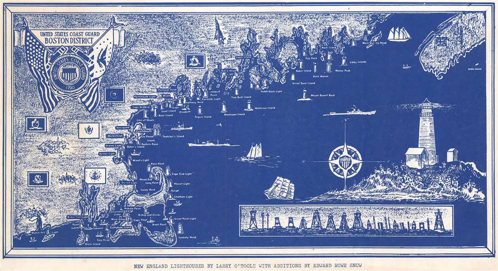
New England Lighthouses by Larry O'Toole with Additions by Edward Rowe Snow.
sold
- Digital Map Information
- Suitable for large format printing
- File Size: 12.76 MB
- File Type: ZIP / TIFF
- ICC color profile embedded
- Delivered instantly via download link
This is a c. 1945 Larry O'Toole and Edward Rowe Snow pictorial map of New England Lighthouses. Depicting the coastline from Watch Hill and Block Island to West Quoddy Head, numerous lighthouses are illustrated and labeled. Little inland detail is present, only the state flags identify the six states in the region. Boats ply the waters of the Atlantic and a large illustration of a lighthouse occupies the lower right. An inset illustrates several different types of buoys that are also used to mark navigation hazards. (more details)
Details the planned layout for Cape Coral, Florida.

See How Cape Coral's Extraordinary Long Term Small Payment Plan Brings the Best of Cape Coral Within the Affordable Reach of Everyone.
sold
- Digital Map Information
- Suitable for large format printing
- File Size: 73.9 MB
- File Type: ZIP / TIFF
- ICC color profile embedded
- Delivered instantly via download link
This is a proof state 1961 plat or real-estate city map of the development of Cape Coral, Florida. Lots, or 'sites', are numbered and shaded to differentiate price points. All prices are listed on the verso next to the corresponding color 'zone'. The larger waterfront lots being the most valuable. None of the streets are labeled, although several of the lakes have been named. 'Sites' reserved for civic use, parking areas, utilities, and parks are coded white. Small inset maps inform the viewer which part of Cape Coral is depicted. (more details)
Early view of what would become New York City's Central Park.

View from Mount Prospect [Central Park], Looking East.
sold
- Digital Map Information
- Suitable for large format printing
- File Size: 5.01 MB
- File Type: ZIP / TIFF
- ICC color profile embedded
- Delivered instantly via download link
This is an unusual c. 1860 Augustus Rubstein view looking east from Mount Prospect (the Great Hill), Central Park, New York City. In the foreground, we see a couple and a child standing on what is today the known as the Great Hill, looking toward the East River and beyond to pasture lands. A train can be seen crossing a bridge. McGowan's Pass and the Mount St. Vincent Convent - which was subsequently relocated to the Bronx, where it still exists, can be seen in the center. (more details)
A Large, Superbly Detailed Map of Western Washington by its Premier Civil Engineer
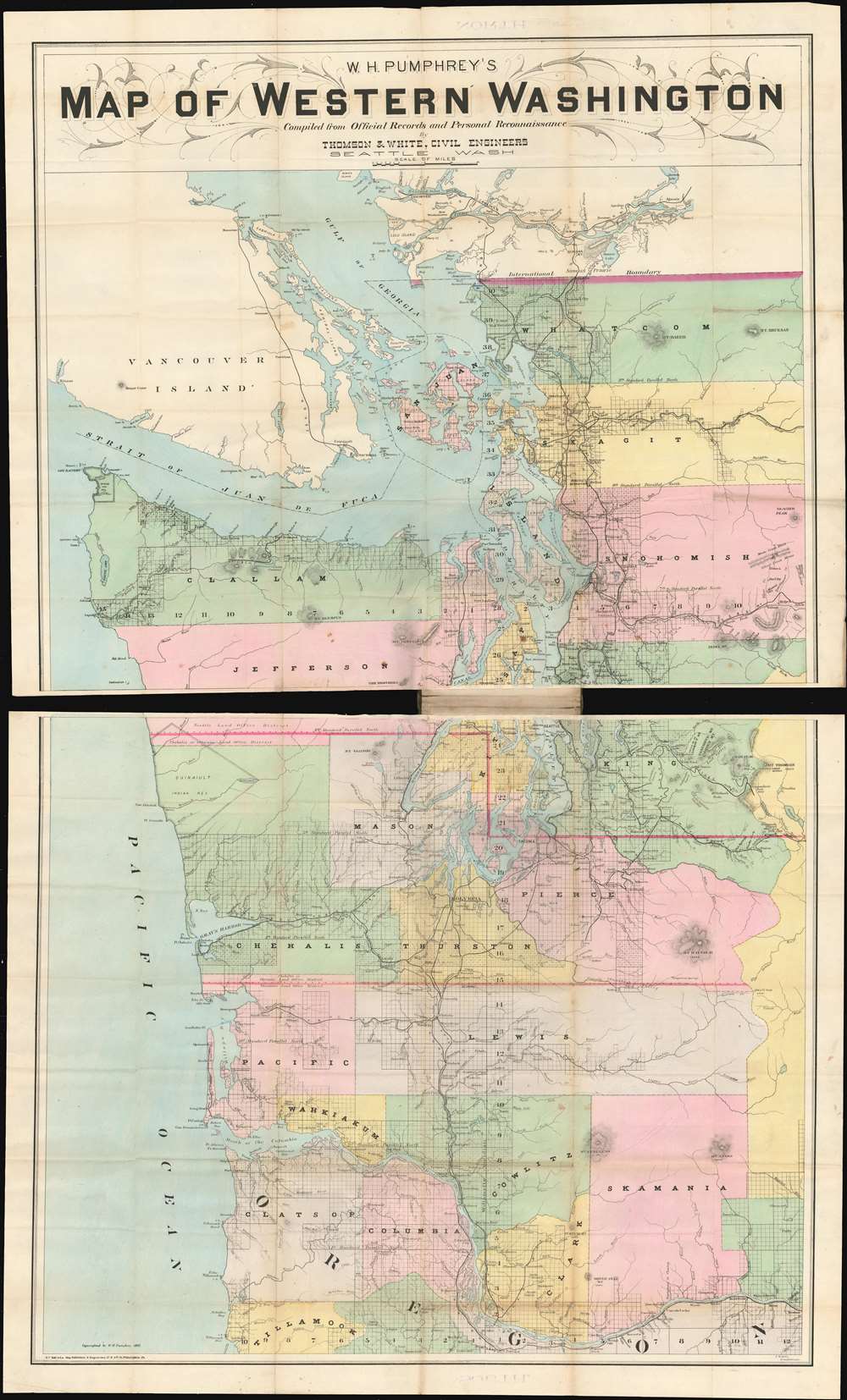
W.H. Pumphrey's map of western Washington: compiled from official records and personal reconnaissance.
sold
- Digital Map Information
- Suitable for large format printing
- File Size: 52.72 MB
- File Type: ZIP / TIFF
- ICC color profile embedded
- Delivered instantly via download link
This rare, detailed map is W. H. Pumphrey's 1892 Map of Western Washington: Compiled from Official Records and Personal Reconnaissance. Pumphrey, a respected Seattle fixture and proprietor of one of its finest stationers, sold the map: it was printed by the powerhouse Philadelphia map publisher Edward Noll and drawn by the Norwegian/ American draftsman F. M. Dehly. (more details)
An extremely rare French pictorial map of the world published in the United States to celebrate the Centennial.
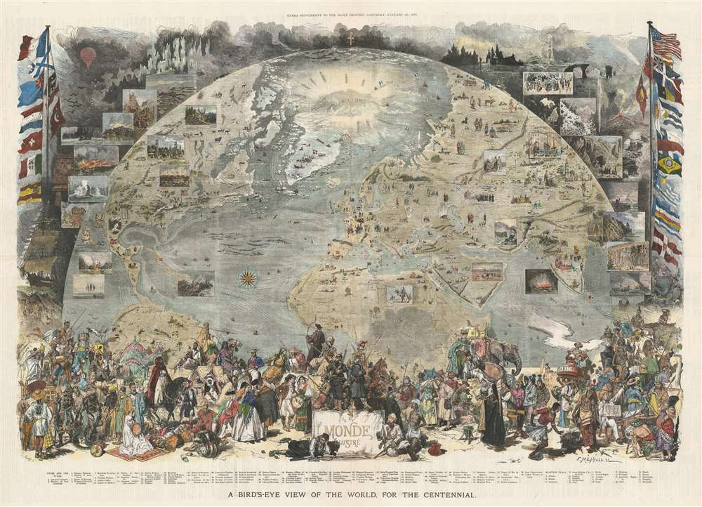
A Bird's-Eye View of the World, for the Centennial.
sold
- Digital Map Information
- Suitable for large format printing
- File Size: 92.08 MB
- File Type: ZIP / TIFF
- ICC color profile embedded
- Delivered instantly via download link
This is an 1876 Scott and Vierge pictorial map of the world. Projected as a view from space, the map depicts the world roughly from the Equator to the North Pole and from California to India. The idea is to, essentially, illustrate the late 19th century work in a single 'blink-of-the-eye' glance that encompasses geography, cultural diversity, scientific achievement, and various archeological 'wonders.' Pictorial vignettes dot the globe and highlight covered wagons and the Union Pacific Railroad in the U.S., Mayan and Aztec ruins in Mexico, the Pyramids of Giza in Egypt, and the Winged Bull of Nineveh in Iran. Transatlantic trade lines between New York and France are marked and the nations of the world are labeled and marked by their respective flags. The routes of Arctic explorers are noted as well, with a large notation of 'Mer Libre?' just above Greenland, which likely refers to the continued hope of finding a Northwest Passage. Views are included all around the world and highlight natural wonders (Niagara Falls, avalanches), fauna (bison), and people (American Indians, Touaregs). Seventy-nine illustrations of people from all over the world in their traditional dress are situated along the bottom border. (more details)
One of the Earliest Detailed Maps of the American Southeast
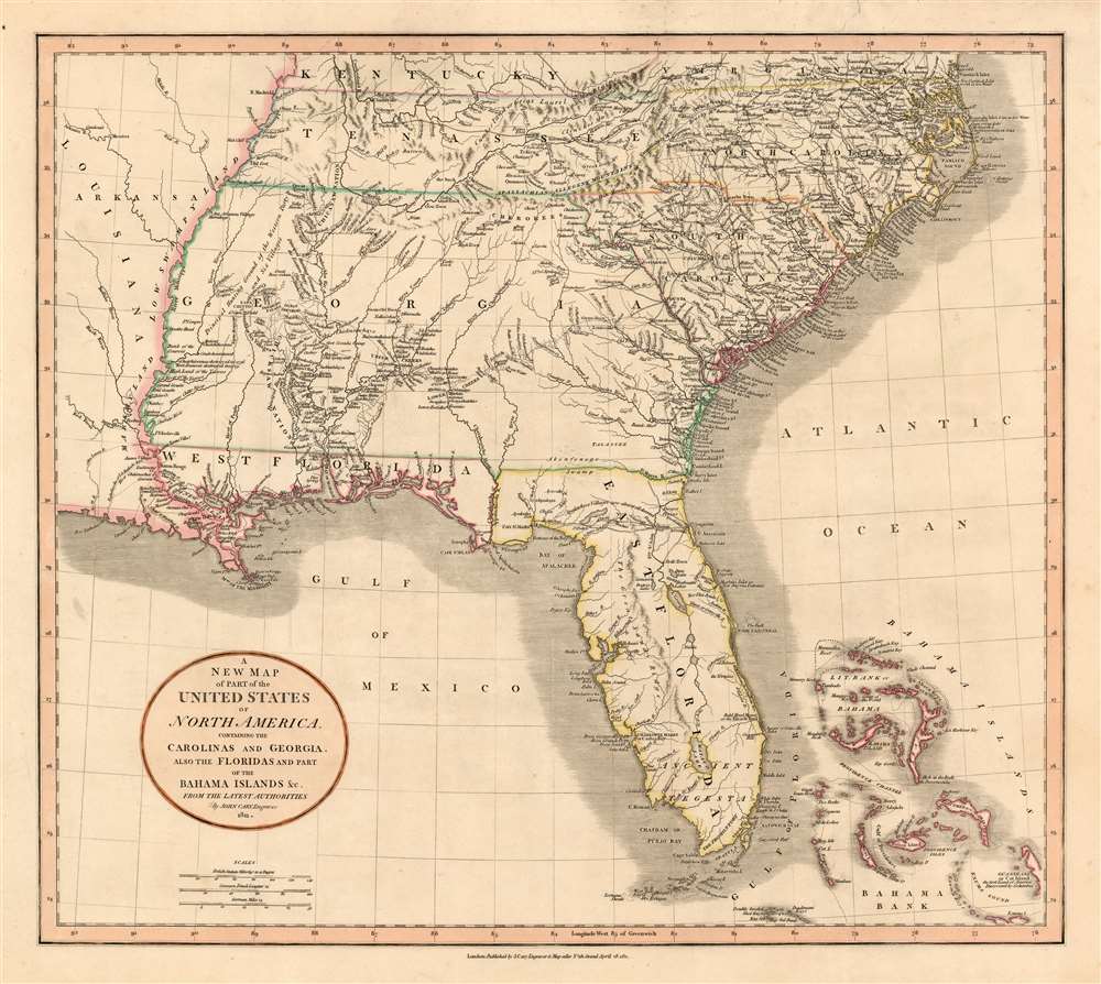
A New Map of Part of the United States of North America, Containing the Carolinas and Georgia, also the Floridas and Part of the Bahama Islands etc.
sold
- Digital Map Information
- Suitable for large format printing
- DPI: 600
- File Size: 22.69 MB
- File Type: ZIP / TIFF
- ICC color profile embedded
- Delivered instantly via download link
Executed by John Cary in 1806, this is one of the most interesting and attractive maps of the American southeast to appear in the first years of the 19th century. The map extends from Kentucky and Virginia in the north to include all of modern day North Carolina, South Carolina, Tennessee, Georgia, Alabama, Mississippi and Florida. Georgia is shown extending westward as far as the Mississippi River, despite the Mississippi Territory having been created in 1798. Florida is divided at the Appalachicola River into eastern and western sections. West Florida, ostensibly part of the Louisiana Purchase, was claimed by the Spanish and remained under their control until 1812. (more details)