
Published two days before the Allies resumed their offensive to liberate North Africa.
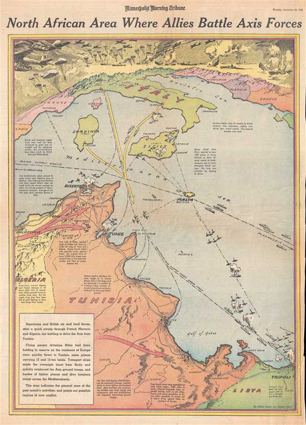
North African Area Where Allies Battle Axis Forces.
sold
- Digital Map Information
- Suitable for large format printing
- File Size: 10.14 MB
- File Type: ZIP / TIFF
- ICC color profile embedded
- Delivered instantly via download link
This is a Tuesday, December 22, 1942 Charles Hamilton Owens and Minneapolis Morning Tribune pictorial map of Tunisia and the Mediterranean Sea. The map depicts the region from southern Europe, including France, Italy, and the Balkans to Tunisia, Algeria, and Libya. ... (more details)
An official map created by the Anglo-French Boundary Commission.

Map of Boundary between Sierra Leone and French Guinea, as demarcated by the Anglo-French Boundary Commission.
sold
- Digital Map Information
- Suitable for large format printing
- File Size: 21.52 MB
- File Type: ZIP / TIFF
- ICC color profile embedded
- Delivered instantly via download link
This is an 1897 War Office Intelligence Division map of the border between Sierra Leone and French Guinea printed on two sheets. The map depicts the region from Kiragba, Sierra Leone to Mount Konkonante in French Guinea. A highly detailed depiction of the boundary ... (more details)
One of the earliest maps to show Mercator's speculative Arctic islands, the apocryphal Friesland, and Zeno's fraudlent version of Labrador, Estotiland.
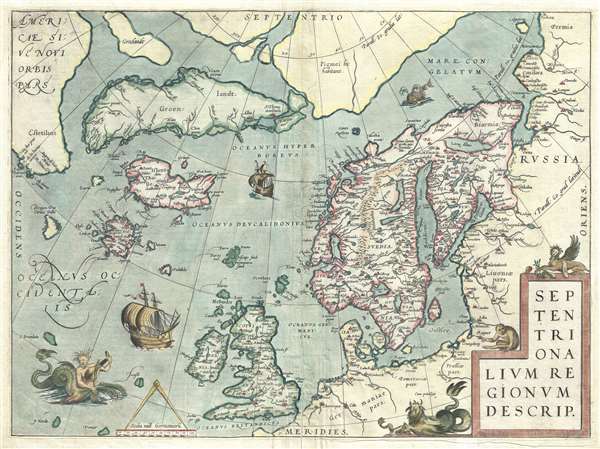
Septentrionalum Regionum Desrip.
sold
- Digital Map Information
- Suitable for large format printing
- DPI: 300
- File Size: 11.16 MB
- File Type: ZIP / TIFF
- ICC color profile embedded
- Delivered instantly via download link
One of Abraham Ortelius' most interesting maps, this is his 1570 map of Scandinavia and the Arctic. During the Age of Discovery, these northern parts of the world represented regions as remote and unfamiliar as the coasts of America, Africa, and Asia. (more details)
Scarce French mapping of Penang and the Malacca Strait.
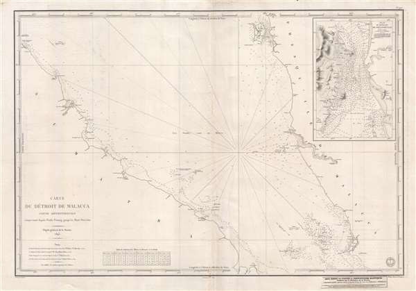
Carte Du Détroit de Malacca Partie Septentrionale comprenant depuis Poulo Penang jusqu'au Mont Parcelar.
sold
- Digital Map Information
- Suitable for large format printing
- DPI: 300
- File Size: 16.89 MB
- File Type: ZIP / TIFF
- ICC color profile embedded
- Delivered instantly via download link
An uncommon 1843 first edition French chart of the Strait of Malacca with an inset of the island of Penang in the vicinity of George Town. The chart covers the Strait of Malacca and the Malaysian coastline from Pulau Penang (Poulo Penang) to the Klang River (Rio ... (more details)
The first published representation of the pre-Columbian Aztec pilgrimage from Aztlan (Utah?) to Chapultepec (Mexico City).

The copy of a antient picture kept by D. Carlos Siguenza in which is drawn and describ'd the road the antient Mexicans travell'd when they came from the Mountains to inhabit the Lake, call'd at present of Mexico, with the Hieroglyphicks signifying the names of places and other things.
sold
- Digital Map Information
- Suitable for large format printing
- DPI: 300
- File Size: 6.11 MB
- File Type: ZIP / TIFF
- ICC color profile embedded
- Delivered instantly via download link
This unusual 1704 map, drawn by Giovanni Francesco Gemelli Careri, is the first published representation of the legendary Aztec migration from Aztlan, a mysterious paradise somewhere to the north of Mexico, possibly in the vicinity of the Great Salt Lake, Utah, ... (more details)
Japanese propaganda map of China from World War II.
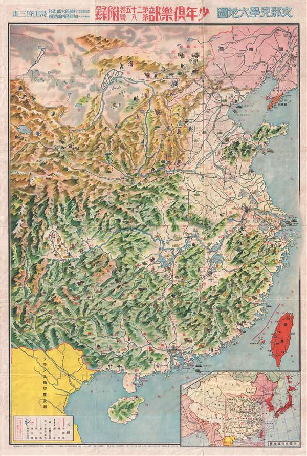
支那見學大地圖 / Large Map of China.
sold
- Digital Map Information
- Suitable for large format printing
- File Size: 33.48 MB
- File Type: ZIP / TIFF
- ICC color profile embedded
- Delivered instantly via download link
A rare 1938 Showa 13 World War II manga style propaganda map of China by the Japanese painter and manga artist Kato Takashiro. Published for the Japanese Youth Club or Shonan Club, this map illustrates all of China with manga style illustrations of Chinese ... (more details)
Depicts the Great Wall of China.
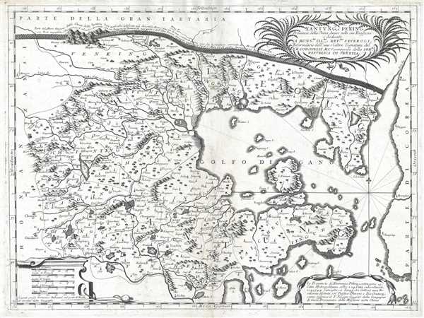
Xantung, e Peking Provincie della China, divise nelle sue Reggioni.
sold
- Digital Map Information
- Suitable for large format printing
- DPI: 300
- File Size: 9.92 MB
- File Type: ZIP / TIFF
- ICC color profile embedded
- Delivered instantly via download link
This is a c. 1690 Vincenzo Maria Coronelli map of the Xantung (Shandong) and Peking (Hebei) provinces in China. The map depicts the region from Henan and Shanxi Provinces to the Korean Peninsula and from Inner Mongolia to Shandong Province. Highly detailed, ... (more details)
Rare German-American map of the Philippines.

Kemlein and Johnson's Pocket Map of the Philippine Islands.
sold
- Digital Map Information
- Suitable for large format printing
- File Size: 20.8 MB
- File Type: ZIP / TIFF
- ICC color profile embedded
- Delivered instantly via download link
A rare first edition 1907 pocket map of the Philippines issued by the Manila-based German-American publishers Kemlein and Johnson. The map covers all of the Philippine Islands with provided defined by color coding. Extant railways, as well as projected ... (more details)
Includes a detailed depiction of the Philippines.
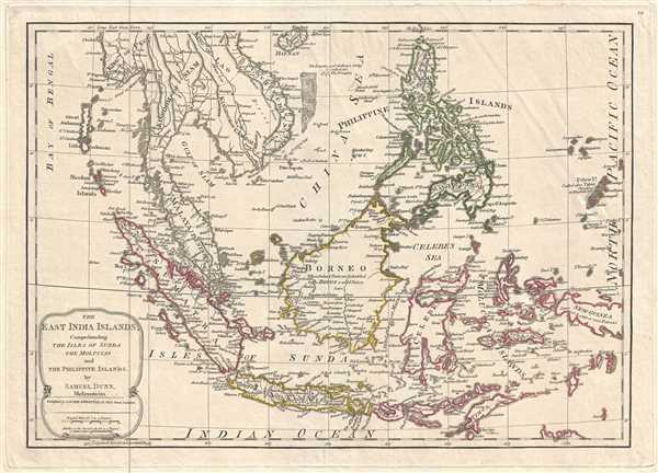
The East India Islands, Comprehending the Isles of Sunda the Maluccas and the Philippine Islands.
sold
- Digital Map Information
- Suitable for large format printing
- DPI: 300
- File Size: 6.24 MB
- File Type: ZIP / TIFF
- ICC color profile embedded
- Delivered instantly via download link
This is a 1794 Samuel Dunn and Laurie and Whittle map of the East Indies and Southeast Asia. The map depicts the region from the Bay of Bengal to Palau and from Hainan to Java, Timor, and the Indian Ocean. Highly detailed, locations throughout the region ... (more details)
The last known edition of Berghaus's great world map.
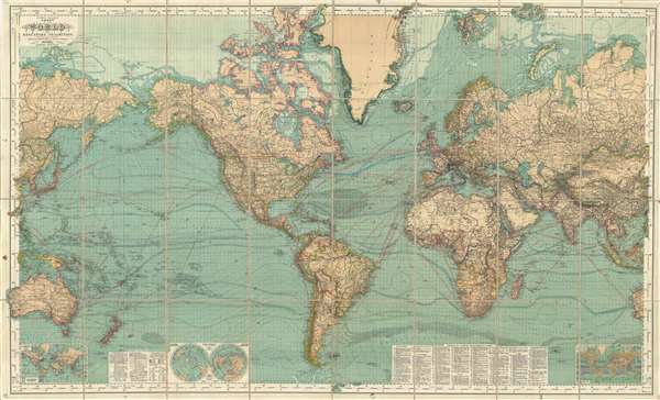
Hermann Berghaus: Chart of the World on Mercators Projection.
sold
- Digital Map Information
- Suitable for large format printing
- File Size: 93.12 MB
- File Type: ZIP / TIFF
- ICC color profile embedded
- Delivered instantly via download link
This is a very rare late 1909 edition of Hermann Berghaus's famous map of the world. Presented on a Mercator Projection, this map is centered on the Atlantic and covers the entire world. Through the map exhibits the density of information for which ... (more details)
Approximates the home region of over 100 different Native American tribes.
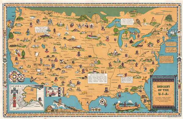
Indians of the U.S.A.
sold
- Digital Map Information
- Suitable for large format printing
- File Size: 14.58 MB
- File Type: ZIP / TIFF
- ICC color profile embedded
- Delivered instantly via download link
This is a 1944 Louise E. Jefferson pictorial map of the United States illustrating the historic home regions of Native American tribes. The map depicts the continental United States from the Pacific Ocean to the Atlantic Ocean and from Canada to the ... (more details)
Features an unusual depiction of the Republic of Texas.
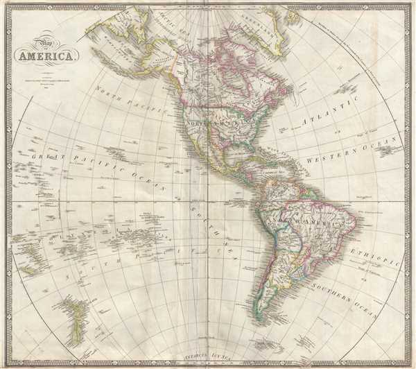
Map of America.
sold
- Digital Map Information
- Suitable for large format printing
- DPI: 300
- File Size: 8.84 MB
- File Type: ZIP / TIFF
- ICC color profile embedded
- Delivered instantly via download link
This is an 1841 James Wyld map of the Western Hemisphere, including the Republic of Texas. The map depicts the region from the New Hebrides and New Caledonia in the Pacific to the Cape Verde Islands in the Atlantic and from the Arctic Ocean to New ... (more details)
A beautifully engraved map of Corsica.
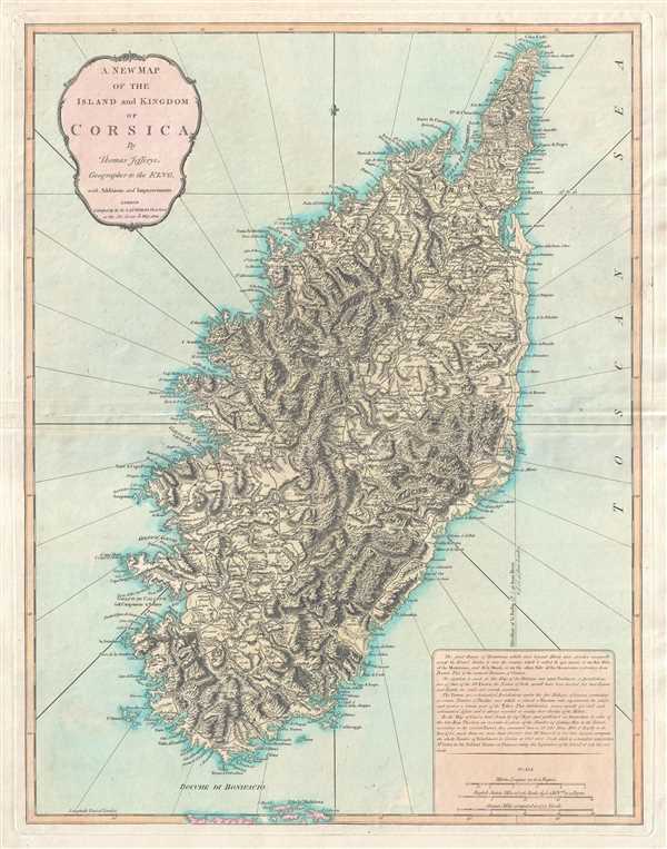
A New Map of the Island and Kingdom of Corsica.
sold
- Digital Map Information
- Suitable for large format printing
- DPI: 300
- File Size: 14.74 MB
- File Type: ZIP / TIFF
- ICC color profile embedded
- Delivered instantly via download link
This is an 1823 Thomas Jefferys and Richard Holmes Laurie map of Corsica. Beautifully engraved, the map depicts the entire island in considerable detail along with the extreme northern region of Sardinia. Myriad cities, towns, and villages are ... (more details)
The region made famous by Bram Stoker's classic novel Dracula.

Kingdom of Hungary, Principality of Transilvania, Sclavonia, Croatia, with a Part of Valakla, Bulgaria, Bosnia and Servia from the Latest Surveys ascertained by Astronomical Observations.
sold
- Digital Map Information
- Suitable for large format printing
- Full resolution TIFF file
- ICC color profile embedded
- Delivered instantly via download link
A rare and attractive 1794 map of the Kingdom of Hungary by Laurie and Whittle. The map depicts the Kingdom of Hungary and its surrounding states, including Transylvania (modern-day Romania), Bulgaria, Bosnia, Croatia, and Serbia. Highly ... (more details)
Labels Texas, then a part of Mexico.
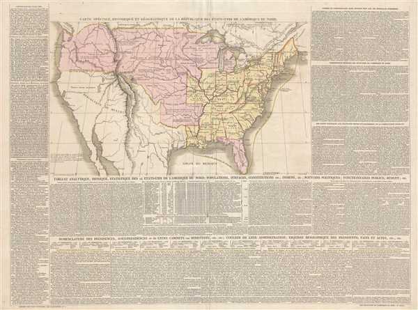
Carte Spéciale, Historique, et Géographique de la République des États-Unis de L'Amérique du Nord.
sold
- Digital Map Information
- Suitable for large format printing
- DPI: 300
- File Size: 15.7 MB
- File Type: ZIP / TIFF
- ICC color profile embedded
- Delivered instantly via download link
This is a c. 1835 Emmanuel, Comte de Las Cases and Paul Renouard map of the United States. The map depicts the region from the Pacific Ocean to the Atlantic Ocean and from Canada to northern Mexico. Highly detailed, each state that had ... (more details)
Rare painting by one of the greatest mid-19th century British maritime artists.

[Bonita]
sold
- Digital Map Information
- Suitable for large format printing
- File Size: 2.49 MB
- File Type: ZIP / TIFF
- ICC color profile embedded
- Delivered instantly via download link
A signed and dated nautical oil on canvas painting of a steamboat by Thomas Goldsworth Dutton, considered the greatest English painter of mid-19th century sail/steam powered merchant ships. The painting illustrating the 1,886 ton 300 ... (more details)
One of only 2 Japanese serio-comic maps illustrating World War I.
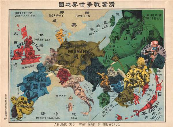
Kokkei Sensou Sekai Chizu. / Ahumoros Wap Map of the World. / 滑馨戰争世界地圖
sold
- Digital Map Information
- Suitable for large format printing
- File Size: 17.14 MB
- File Type: ZIP / TIFF
- ICC color profile embedded
- Delivered instantly via download link
A very rare Japanese broadsheet serio-comic map of Europe and Asia drawn just following the outbreak of World War I. This map was drawn by Ryōzō Tanaka and published by the Shobido Company of Tokyo. The map covers all of Europe ... (more details)
Rare separate issue Hulst Van Keulen map of Jamaica - possibly in a proof state.

[Jamaica]
sold
- Digital Map Information
- Suitable for large format printing
- DPI: 300
- File Size: 10.49 MB
- File Type: ZIP / TIFF
- ICC color profile embedded
- Delivered instantly via download link
A rare and attractive 1783 separate-issue map of Jamaica issued by Gerard Hulst Van Keulen. The map covers all of Jamaica without sounding along the south cost, particularly to the west of Kingston. While there is little inland ... (more details)
Florida during the second Spanish period when it became a refuge for escaped slaves and American Indian tribes who regularly raided the United States.
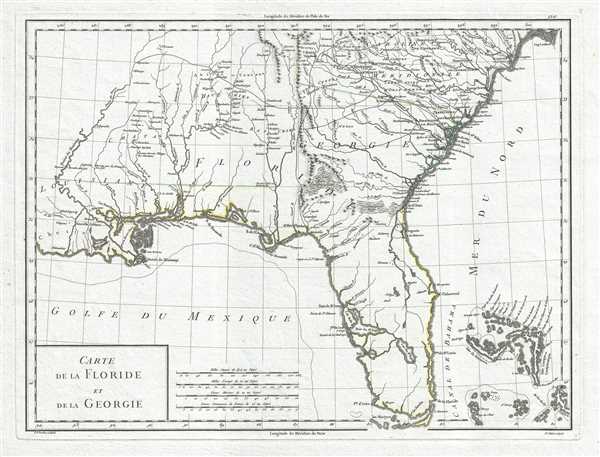
Carte de la Floride et de la Georgie.
sold
- Digital Map Information
- Suitable for large format printing
- DPI: 300
- File Size: 5.76 MB
- File Type: ZIP / TIFF
- ICC color profile embedded
- Delivered instantly via download link
This is a stunning 1798 Pierre Antoine-François Tardieu map of Florida and Georgia. The map depicts the region from Louisiana to the Atlantic Ocean and from South Carolina to the Gulf of Mexico. Some Historical Context Created ... (more details)
Includes an unusual depiction of Novaya Zemla along the northern coast of Russia.
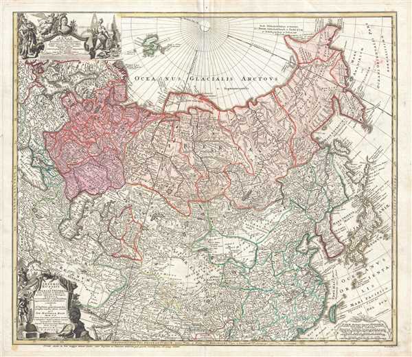
Imperii Russici et Tatariae Universal.
sold
- Digital Map Information
- Suitable for large format printing
- DPI: 300
- File Size: 15.46 MB
- File Type: ZIP / TIFF
- ICC color profile embedded
- Delivered instantly via download link
This is a 1739 Johann Matthias Hase and Homann Heirs map of Russia and Asia. The map depicts the region from Denmark, Norway, and the Black Sea to Japan and the Pacific Ocean and from the Arctic Ocean to India. Two intriguing ... (more details)