
New Jersey (sold)
Exceptional complete example of the First American Road Atlas!
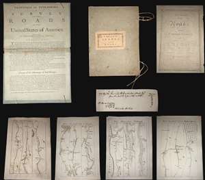
A superb example, entirely complete, of Christopher Colles' 1789 - 1790 A Survey of the Roads of the United States of America. This is the First American Road atlas, wherein at least some of the plates represent the first American maps engraved by a female - Colles' 13-year-old daughter Eliza. Covering depictions from Albany, New York to Williamsburg, Virginia, Colles' atlas consists of a prospectus, a title page, and 83 separate strip maps, each covering some 12 miles of roads and offering invaluable detail about the natural and human landscape of late 18th-century America and was published in commemoration of the founding of the new republic in 1789.
Bringing European Cartographic Ideas to America
The maps appear in a strip-map style previously unknown in North America, but common in European road maps, such as the 1720 Britannia Depicta, or Ogilby Improv'd. Colles' issued the work in separate sheets that could be mixed and matched in a modular format, as needed. This modular format was his own innovation and challenged the user to interpret American roads linearly, as only a traveler can (and must).
The atlas includes 83 separate sheet maps, numbered 1-33, 40-86, and 45*, 46* and 47*. The sheets are laid loose in their original portfolio, with Colles' pastedown title, the original ties and the prospectus pasted to the inside of the front board, as found in most examples. The title page bears the date 1789. It is important to note that it was believed, until recently, that the maps were issued in parts through 1792. However, a hand-written note, laid in by an early-though sadly unnamed-owner, demonstrates that the maps were in fact complete and delivered to subscribers by 1790.
A Federalist Document
In the words of historian Trish Loughran, writing in the The Republic in Print (page 236),
Colles originally intended to survey and map each and every road personally, and many of the maps are indeed based upon his own work. To accomplish this task Colles invented a new kind of perambulator - essentially a modified wagon wheel of a fixed circumference attached to counting cogs that could be used to record distances, a great improvement over the more traditional surveyor's chain. Colles found, however, that completion of the surveys was beyond his limited means, and so, relied upon existing work by military surveyors Simeon DeWitt and Robert Erskine for the maps of Maryland and Virginia. Ultimately, Colles never fully completed his atlas, with only 83 of the originally intended 100 maps published.
Engraved by Americas First Female Map Engraver - Eliza Colles
The maps were drafted by Colles, then engraved by Cornelius Tiebout, and later by his daughter Eliza Colles. It would seem that sometime in the middle of the engraving process, Colles had a falling out with Tiebout and recruited his 13-year-old daughter, Eliza, who may have been Tiebout's apprentice, to complete the engravings. Eliza thus became the first American female engraver. While there is no definitive proof that Eliza engraved for the Survey of Roads, many scholars note that the engraving style of the individual sheets does change, suggesting at least two different engravers were active. In particular the notion is supported by Walter Ristow (page 164) and Benson Lossing, who wrote in his History of New York,
A Financial Failure
Colles sold the maps found in his Survey of Roads by subscription, charging a quarter dollar up front, plus an eighth of a dollar for each delivered section of six sheets. (Nonsubscribers were charged 3 cents per sheet.) Despite a fair price (compare to Abraham Bradley's 1796 map of the United States at 3 1/2 - 5 dollars), accuracy, and fine workmanship, indeed ahead of its time, A Survey of the Roads of the United States of America floundered financially. The intended impact of the work; to promote travel, trade and real-estate transactions, failed to attract sufficient subscribers. As a result, the completed work was offered only in New York and Philadelphia. Deep in debt, Colles began to sell the completed sections of the work separately, with most buyers only acquiring those portions of the maps which they deemed most useful - thus the incompleteness of most known examples. (more details)
Bringing European Cartographic Ideas to America
The maps appear in a strip-map style previously unknown in North America, but common in European road maps, such as the 1720 Britannia Depicta, or Ogilby Improv'd. Colles' issued the work in separate sheets that could be mixed and matched in a modular format, as needed. This modular format was his own innovation and challenged the user to interpret American roads linearly, as only a traveler can (and must).
The atlas includes 83 separate sheet maps, numbered 1-33, 40-86, and 45*, 46* and 47*. The sheets are laid loose in their original portfolio, with Colles' pastedown title, the original ties and the prospectus pasted to the inside of the front board, as found in most examples. The title page bears the date 1789. It is important to note that it was believed, until recently, that the maps were issued in parts through 1792. However, a hand-written note, laid in by an early-though sadly unnamed-owner, demonstrates that the maps were in fact complete and delivered to subscribers by 1790.
A Federalist Document
In the words of historian Trish Loughran, writing in the The Republic in Print (page 236),
Colles placed the year 1789 on the title page in order to make the book's publication coincide with the ratification of the Constitution and the formation of the new government. Indeed, Colles even goes so far as to begin the book's fictional journey on Plate 1 at New York's Federal Hall, which was in 1789, the new national capitol and the recent site of Washington's inauguration. In this way, the book makes the continual literal and symbolic reference to the newly invented nation-state even as it attempts to collect and contain a map to every known space within it in the highly singular space of a book. That it does so in such a way that each represented space can also be experienced locally, by the body hold up any given map on any given road, makes this an exceptional artifact in the production of federalist space.The Work of a Mad Tinkerer
Colles originally intended to survey and map each and every road personally, and many of the maps are indeed based upon his own work. To accomplish this task Colles invented a new kind of perambulator - essentially a modified wagon wheel of a fixed circumference attached to counting cogs that could be used to record distances, a great improvement over the more traditional surveyor's chain. Colles found, however, that completion of the surveys was beyond his limited means, and so, relied upon existing work by military surveyors Simeon DeWitt and Robert Erskine for the maps of Maryland and Virginia. Ultimately, Colles never fully completed his atlas, with only 83 of the originally intended 100 maps published.
Engraved by Americas First Female Map Engraver - Eliza Colles
The maps were drafted by Colles, then engraved by Cornelius Tiebout, and later by his daughter Eliza Colles. It would seem that sometime in the middle of the engraving process, Colles had a falling out with Tiebout and recruited his 13-year-old daughter, Eliza, who may have been Tiebout's apprentice, to complete the engravings. Eliza thus became the first American female engraver. While there is no definitive proof that Eliza engraved for the Survey of Roads, many scholars note that the engraving style of the individual sheets does change, suggesting at least two different engravers were active. In particular the notion is supported by Walter Ristow (page 164) and Benson Lossing, who wrote in his History of New York,
Colles constructed and published a series of sectional road maps which were engraved by his daughter.It should be underlined that Eliza also engraved another of Colles' extremely rare but monumental Geographical Ledger, which appeared in 1794 shortly after the Survey of Roads and bears Eliza's imprint.
A Financial Failure
Colles sold the maps found in his Survey of Roads by subscription, charging a quarter dollar up front, plus an eighth of a dollar for each delivered section of six sheets. (Nonsubscribers were charged 3 cents per sheet.) Despite a fair price (compare to Abraham Bradley's 1796 map of the United States at 3 1/2 - 5 dollars), accuracy, and fine workmanship, indeed ahead of its time, A Survey of the Roads of the United States of America floundered financially. The intended impact of the work; to promote travel, trade and real-estate transactions, failed to attract sufficient subscribers. As a result, the completed work was offered only in New York and Philadelphia. Deep in debt, Colles began to sell the completed sections of the work separately, with most buyers only acquiring those portions of the maps which they deemed most useful - thus the incompleteness of most known examples. (more details)
First map to name the United States and a contemporaneous illustration of the American Revolutionary War.
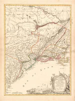
Carte du Théatre de la Guerre actuel entre les Anglais et les Trieze Colonies Unies de l'Amerique Septentrionale dressée par J. B. Eliot Ingénieurs des Etats Unis 1778.
sold
- Digital Map Information
- Suitable for large format printing
- DPI: 600
- File Size: 30.62 MB
- File Type: ZIP / TIFF
- ICC color profile embedded
- Delivered instantly via download link
A 1778 first edition American Revolutionary War era map of the northeastern United States by J. B. Elliot, considered to be of extreme significance. This is generally regarded as the earliest map to use the name 'United States', or in this case, 'Etats Unis'. Drawing on previously unused sources, Eliot's map illustrates the events of the Revolutionary War contemporaneously with the action, making it, essentially a living account of the War of Independence. Margaret Pritchard and Henry Taliaferro, published an essay on this map in Degrees of Latitude, Map 58, describing its significance in great detail, of which this is a short excerpt,
The map of the theater of war between Great Britain and America by J.B. Eliot is important because of its title, Les Treize Colonies Unies de l'Amerique Septentrionale, may include the first reference on a map to the United States. The cartographer was identified as Ingenieurs des Etats Unis. On November 15, 1777, the Continental Congress selected 'The United States of America,' as the name of the thirteen colonies that formed a government under the Articles of Confederation. One month later, French authorities learned of the victory at Saratoga and decided to recognize American independence. By January 8, French foreign minister, Charles Gravier, Comte de Vergennes, informed American envoys that France was ready to engage in an alliance. It is not surprising that the name United States was first mentioned on a map published in Paris in 1778.A decorative cartouche in the lower right incorporates a battle scene wherein British soldiers bombard a small town - possibly Valley Forge? (more details)
… It is also curious that he did not indicate on the map the general's 1777 winter headquarters at Valley Forge, misspelled Walay Forge. What Eliot did illustrate were the lines' march taken by the British and American forces during the campaign in 1777, including Lieutenant Colonel Barry St. Ledger's unsuccessful diversionary expedition down the Mohawk Valley, Burgoyne's march from Crown Point to Albany, and Howe's campaign to take Philadelphia.
… As was usually the case, Eliot appears to have borrowed from several sources in compiling the geography. Some areas were designated by French place-names while others are predominantly English, specifically in the northwestern territories that the French knew best. It is clear they were aware of the latest intelligence relating to the Revolutionary War.
Earliest Acquirable, Separate Issue.
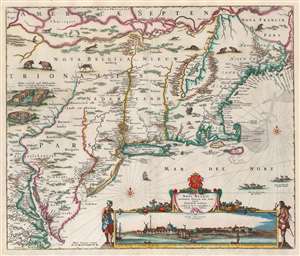
Novi Belgii Novaeque Angliae nec non Partis Virginiae Tabula multis in locis emendata a Nicolao Joannis Visschero.
sold
- Digital Map Information
- Suitable for large format printing
- Full resolution TIFF file
- ICC color profile embedded
- Delivered instantly via download link
This is the rare, c. 1656 second state of the Jansson/ Visscher map of the New Netherlands and New England. It is the earliest acquirable state of this work: the first, 'proof state', of this masterwork is an unobtainable rarity, known in only four examples in institutional and private collections. (more details)
Unusual fisheye view of New York with early Baseball imagery in the Elysian Fields.
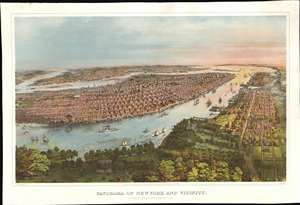
Panorama of New York and Vicinity.
sold
- Digital Map Information
- Suitable for large format printing
- File Size: 74.95 MB
- File Type: ZIP / TIFF
- ICC color profile embedded
- Delivered instantly via download link
A rich and striking large-format 1866 John Bachmann panoramic three-color chromolithograph view of New York City as seen from a point high over the Elysian Fields (baseball) of Hoboken. The view is expansive and utilizes an unusual fish-eye perspective. It looks on Manhattan from the west, with the area of focus roughly corresponding to 32nd Street. Coverage extends north to Central Park, south to Sandy Hook, and east to include parts of Brooklyn and Queens. Manhattan's major parks are recognizable, including Madison Square, Gramercy, Washington Square, City Hall, and the still under construction Central Park. Vast swathes of lotted but undeveloped land are evident along Park Avenue north of Bryant Park. Along the Hudson, there are also a number of large gentlemanly estates - survivors of a bygone era that would soon disappear entirely. The Hudson River is busy with an assortment of sail and steamships. On the right side of the map, Hoboken and beyond, Jersey City, are evident. In the foreground there is a prominent display of the Elysian Fields, where two different baseball games are in progress. (more details)
The Earliest Acquirable, Separate Issue.

Novi Belgii Novaeque Angliae nec non Partis Virginiae Tabula multis in locis emendata a Nicolao Joannis Visschero.
sold
- Digital Map Information
- Suitable for large format printing
- Full resolution TIFF file
- ICC color profile embedded
- Delivered instantly via download link
This is the rare, c. 1656 second state of the Jansson/ Visscher map of the New Netherlands and New England. It is the earliest acquirable state of this work: the first, 'proof state', of this masterwork is an unobtainable rarity, known in only four examples in institutional and private collections. (more details)
Best map of the Hudson Valley at the outset of the American Revolution.
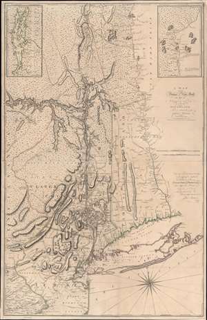
A Map of the Province of New-York, with Part of Pensilvania, and New England.
sold
- Digital Map Information
- Suitable for large format printing
- Full resolution TIFF file
- ICC color profile embedded
- Delivered instantly via download link
This is John Montresor's striking 1775 map of New York and the surrounding regions - considered the best and most authoritative map of the region at the beginning of the American Revolutionary War (1775 - 1783). (more details)
Likely used in the field during the American Revolutionary war.
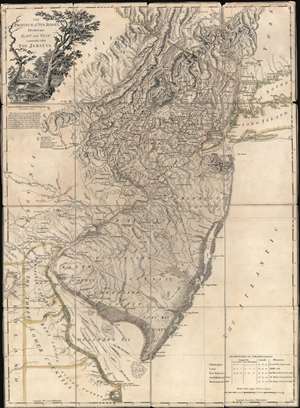
The Province of New Jersey Divided into East and West, commonly called The Jerseys.
sold
- Digital Map Information
- Suitable for large format printing
- Full resolution TIFF file
- ICC color profile embedded
- Delivered instantly via download link
A most fascinating 1777 first-state first-edition map of New Jersey by William Faden and Bernard Ratzer likely used in the field during the American Revolutionary War by the German Hessian supply officer, Friedrich Wilhelm von Wurmb. While focused on New Jersey, coverage extends to include eastern Pennsylvania, Delaware, and New York City. It captures the state's complex topography, noting the Jersey Highlands and the Palisades in the north and the Pine Barrens and coastal marshes in the south. New Jersey is here broken down into 12 counties, as they existed at the time, as well as multiple towns and roads. Note that there are no coastal routes through Monmouth County, requiring travelers instead to travel inland to Crosswicks, then south east to Egg Harbor, before continuing south. There is also an annotation regarding the settlement of Fort Helsingburg, near Salem on the Delaware River, where in 1640, Swedish settlers attempt to establish a colony. (more details)
Strong first-edition strike!
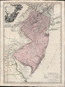
The Province of New Jersey Divided into East and West, commonly called The Jerseys.
sold
- Digital Map Information
- Suitable for large format printing
- Full resolution TIFF file
- ICC color profile embedded
- Delivered instantly via download link
A fine 1777 first-state first-edition map of New Jersey by William Faden and Bernard Ratzer - exhibiting the fine strong strike only evident on first editions. Focused on New Jersey, coverage extends to include eastern Pennsylvania, Delaware, and New York City. It captures the state's complex topography, noting the Jersey Highlands and the Palisades in the north and the Pine Barrens and coastal marshes in the south. New Jersey is here broken down into 12 counties, as they existed at the time, as well as multiple towns and roads. Note that there are no coastal routes through Monmouth County, requiring travelers instead to travel inland to Crosswicks, then south east to Egg Harbor, before continuing south. There is also an annotation regarding the settlement of Fort Helsingburg, near Salem on the Delaware River, where in 1640, Swedish settlers attempt to establish a colony. (more details)
Iconic early map of New England and New York with 'Visscher View' of New Amsterdam.
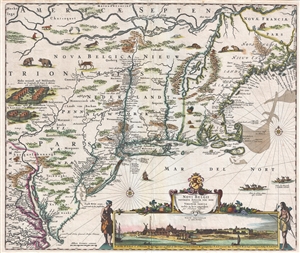
Novi Belgii Novaeque Angliae Nec Non Pennsylvaniae et Partis Virginiae Tabula multis in locis emendata.
sold
- Digital Map Information
- Suitable for large format printing
- DPI: 300
- File Size: 15.13 MB
- File Type: ZIP / TIFF
- ICC color profile embedded
- Delivered instantly via download link
A map of extreme importance, this is a fine example of Nicholaas Visscher's 1684 Novi Belgii or map of New York, New England, Pennsylvania, and Virginia. This is the first map in the Jansson-Visscher Series here presented in its 4th state (Burden, 315). Like most ... (more details)
Iconic early map of New England and New York with 'Visscher View' of New Amsterdam.
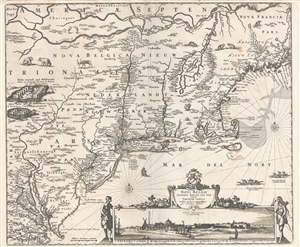
Novi Belgii Novaeque Angliae Nec Non Pennsylvaniae et Partis Virginiae Tabula multis in locis emendata.
sold
- Digital Map Information
- Suitable for large format printing
- DPI: 300
- File Size: 14.86 MB
- File Type: ZIP / TIFF
- ICC color profile embedded
- Delivered instantly via download link
A map of extreme importance, this is a fine example of Nicholaas Visscher's 1684 Novi Belgii or map of New York, New England, Pennsylvania, and Virginia. This is the first map in the Jansson-Visscher Series here presented in its 4th state (Burden, 315). Like most ... (more details)
A scarce map of exceptional importance illustrating early Swedish settlements in New Jersey, Pennsylvania, and Delaware.
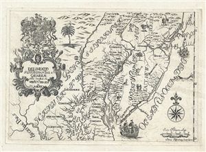
Delineatio Pennsilvaniae et Caesareae, nov. occident seu West N. Iersey in America
sold
- Digital Map Information
- Suitable for large format printing
- DPI: 300
- File Size: 3.74 MB
- File Type: ZIP / TIFF
- ICC color profile embedded
- Delivered instantly via download link
This is an extremely rare whimsical 1731 map focusing on the remnants of the ephemeral colony of New Sweden by Jonas Silferling and Tobias Biorck. New Sweden, which by 1731 had been assimilated into British New York, occupied parts of Delaware, New Jersey and ... (more details)
One of the Finest Northeast Charts of the Dutch Period.
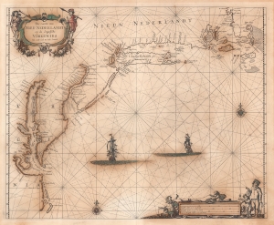
Pas Caerte van Nieu Nederlandt en de Engelsche Virginies van Capo Cod to Cabo Canrick.
sold
- Digital Map Information
- Suitable for large format printing
- Full resolution TIFF file
- ICC color profile embedded
- Delivered instantly via download link
A striking original color 1666 Pieter Goos nautical chart or maritime map of New England, New York, New Jersey, and Virginia. Coverage follows the coast of North America from Boston Harbor to Cape Hatteras, thus embracing one of the more active mid-17th century maritime corridors in North America. At the center of the map, two Dutch ships ply the seas. Finely engraved decorative cartouche work in the upper left and lower right emphasizes the region's rich fur trade and abundant fisheries. (more details)
The rare propaganda-ish 'Farm Animal' variant on the Visscher-Jansson Series map of New York, Virginia, and New England.
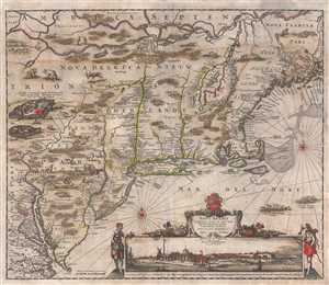
Novi Belgii Novaeque Angliae Nec Non Pennsylvaniae et Partis Virginiae Tabula multis in locis emendata.
sold
- Digital Map Information
- Suitable for large format printing
- Full resolution TIFF file
- ICC color profile embedded
- Delivered instantly via download link
An attractive old color example of Justus Danckerts' 1684 Novi Belgii or map of New York, New England, Pennsylvania, and Virginia. Some call this the 'farm animal map' for its novel incorporation of farm animals, ranging from horses and cows to chicken and ... (more details)
A Beautiful Turn-Of-The-Century Bird's Eye View of New York City
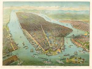
New-York.
sold
- Digital Map Information
- Suitable for large format printing
- File Size: 73.88 MB
- File Type: ZIP / TIFF
- ICC color profile embedded
- Delivered instantly via download link
This is a late 19th or early 20th century German chromolithograph bird's eye view of New York City, produced for use in schools. New York was not only one of the largest harbor cities in the world, but was also home to a burgeoning German immigrant community: it would have been a natural focus for a German audience. The 'East River Bridge' is beautifully depicted, and is labeled with that name, dating the piece prior to 1915 when the bridge was renamed 'The Brooklyn Bridge'. Governor's Island is shown, featuring Fort Jay and Castle Williams. (more details)
Most Finely Detailed Dutch Map of the Northeast from the 17th Century.
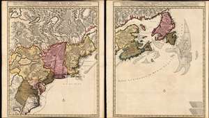
Nova Tabula Geographica Complectens Borealiorem Americae Partem: in qua Exacte Delineatae Sunt Canada sive Nova Francia, Nova Scotia, Nova Anglia, Novum Belgium, Pensylvania, Virginia, Carolina et Terra Nova, cum Omnibus Littorum. Pulvinorumque Profunditatibus. Amstelodami. à Nicolao Visscher. Cum Privilegio Ordinum Generalium Foederati Belgii./ Carte Nouvelle contenant la Partie d'Amerique la Plus Septentrionale, ou Sont Exactement Dècrites les Provinces Suivantes comme le Canada ou Nouvelle France, La Nouvelle Ecosse, la Nouvelle Angleterre, les Nouveaux Païs Bas, la Pensylvanie, la Virginie, la Caroline et l'Ile de Terre Neuve avec les profondeuis le Long des Côtes et sur les Bancs. Par Nicolas Visscher avec Privilege des Etats Géneraux.
sold
- Digital Map Information
- Suitable for large format printing
- DPI: 600
- File Size: 121.39 MB
- File Type: ZIP / TIFF
- ICC color profile embedded
- Delivered instantly via download link
This is Nicolas Visscher II's 1696 two-sheet map of the North American eastern seaboard and the Canadian Maritimes, in a beautiful example of its earliest acquirable state with rich original color. It represents the 17th century's most finely-detailed mapping of the coast from the Carolinas to Labrador. Also, it is the first Dutch map of the region to diverge from the 'Jansson-Visscher' precursor maps. (more details)
Scarce final issue of the important Holland-Jefferys Map New York, New Jersey, and the Hudson Valley on the brink of the American Revolutionary War. The best obtainable Revolutionary War Era map of this region.
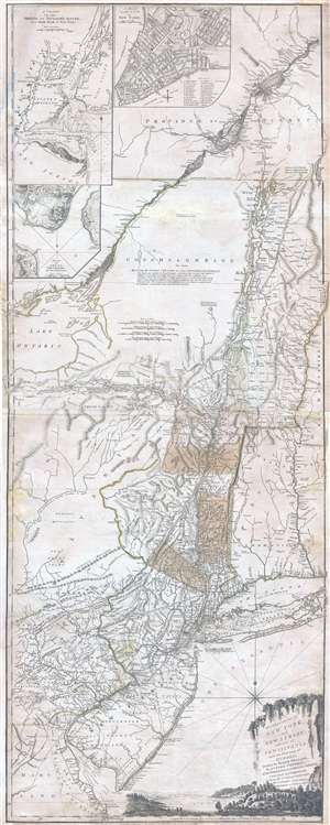
The Provinces of NEW YORK, and NEW JERSEY; with part of PENSILVANIA, and the Governments of TROIS RIVIERES, and MONTREAL: drawn by Major Holland, Surveyor General, of the Norther District in America. / A Chorographical Map of the Country between Albany, Oswego, Fort Frontenac, and Les Trois Rivieres; Exhibiting all the Grants made by the French Governors on Lake Champlain; & between that Lake & Montreal.
sold
- Digital Map Information
- Suitable for large format printing
- DPI: 300
- File Size: 26.6 MB
- File Type: ZIP / TIFF
- ICC color profile embedded
- Delivered instantly via download link
One of the most important, influential, and comprehensive American Revolutionary War Era map of New York, New Jersey, Vermont, and the Hudson Valley corridor, this is an final 1776 state of Major Samuel Holland and Thomas Jeffrey's Provinces of New York ... (more details)
Essential Canadianum: 'The primary map of this period... influenced the cartography of Canada for the next fifty years.' - Kershaw
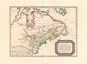
Le Canada, ou Nouvelle France...
sold
- Digital Map Information
- Suitable for large format printing
- DPI: 600
- File Size: 26.16 MB
- File Type: ZIP / TIFF
- ICC color profile embedded
- Delivered instantly via download link
This is Nicolas Sanson's 1656 map of Canada, the Northeast and the Great Lakes, in a superb, untrimmed example. It was among the most influential and important maps of the north part of the Americas to be printed in the 17th century - its depiction of Canada was not superseded until De l'Isle's 1703 Carte du Canada, and it featured the finest depiction of the Great Lakes until the 1687 Coronelli-Nolin. It is among the first printed maps to be informed by the reports of French Jesuit explorers, whose exploration of the Great Lakes region after Champlain's initial explorations was stalled by the 1648 escalation of the Beaver Wars (1603 - 1701) with the Iroquois Confederacy. Following the 1653 pause in the war, Jesuit and French fur traders resumed their push west, gradually revealing the form of the Great Lakes.
The map's treatment of the Arctic waters and Maritime Canada builds on Champlain's basic model, adding place names derived from Dutch and English exploration and preserving Button's explicit northwest passage leading from Button's Bay. (more details)
The map's treatment of the Arctic waters and Maritime Canada builds on Champlain's basic model, adding place names derived from Dutch and English exploration and preserving Button's explicit northwest passage leading from Button's Bay. (more details)
The rare propaganda-ish 'Farm Animal' variant on the Visscher-Jansson Series map of New York, Virginia, and New England.
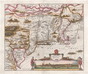
Novi Belgii Novaeque Angliae Nec Non Pennsylvaniae et Partis Virginiae Tabula multis in locis emendata.
sold
- Digital Map Information
- Suitable for large format printing
- DPI: 300
- File Size: 10.83 MB
- File Type: ZIP / TIFF
- ICC color profile embedded
- Delivered instantly via download link
A magnificent example of Justus Danckerts' 1690 Novi Belgii or map of New York, New England, Pennsylvania, and Virginia. Some call this the 'farm animal map' for its novel incorporation of farm animals, ranging from horses and cows to chicken and sheep, ... (more details)
The rarest and earliest state of a seminal map.
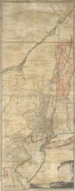
The Provinces of NEW YORK and NEW JERSEY with part of PENSILVANIA, and the Governments of TROIS RIVIERES, and MONTREAL: drawn by Capt. Holland. / A Chorographical Map of the Country between Albany, Oswego, Fort Frontenac, and Les Trois Rivieres; Exhibing all the Grands made by the French Governors on Lake Champlain; & between that Lake & Montreal.
sold
- Digital Map Information
- Suitable for large format printing
- Full resolution TIFF file
- ICC color profile embedded
- Delivered instantly via download link
A first issue first edition example of a seminal map. This is a rare and unusual version of the 1768 first edition of Holland and Jefferys seminal map of New York and New Jersey. Depicts the important trade corridor between New York and Montreal, ... (more details)
A cornerstone map of New Jersey: the first 'official' state map and the first large detailed map of the state. -John Delaney
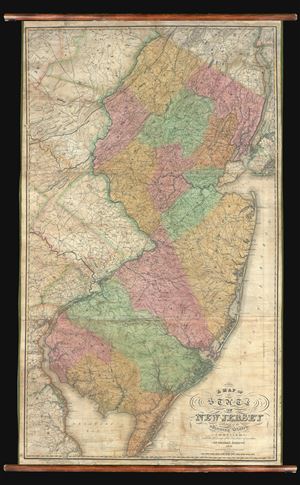
A Map of the State of New Jersey with part of the adjoining states compiled under the Patronage of the Legislature of said State by Thomas Gordon 1828.
sold
A seminal production, this is the first edition, first state, of Thomas Gordon's impressive wall map of New Jersey. This is the first large scale map of New Jersey to be printed in the United States. Gordon's map, issued at the behest of the New ... (more details)
The largest and most detailed map of New Jersey to appear in the 19th century - a seminal production.
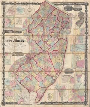
Topographical map of the State of New Jersey together with the vicinities of New York and Philadelphia, and with most of the state of Delaware from the State Geological Survey and the U.S. Coast Survey, and from surveys by G. Morgan Hopkins, civil engineer.
sold
- Digital Map Information
- Suitable for large format printing
- File Size: 166.59 MB
- File Type: ZIP / TIFF
- ICC color profile embedded
- Delivered instantly via download link
Magnificently detailed, visually stunning, and monumentally proportioned, this is William Kitchell's seminal 1860 case map of New Jersey. Dissected and mounted on thirty-six linen backed panels, this map covers the entire state of New Jersey as ... (more details)
Urbanization of Elizabeth, New Jersey.
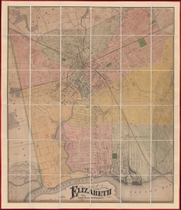
Map of the City of Elizabeth.
sold
- Digital Map Information
- Suitable for large format printing
- File Size: 95.52 MB
- File Type: ZIP / TIFF
- ICC color profile embedded
- Delivered instantly via download link
This is a previously uncatalogued 1871 Ernest L. Meyer and W. F. Wonneberg cadastral wall map of Elizabeth, New Jersey. This map is a unique record of the urban expansion of Elizabeth through the late 19th century. (more details)
'The primary map of this period... influenced the cartography of Canada for the next fifty years.' - Kershaw

Le Canada, ou Nouvelle France...
sold
- Digital Map Information
- Suitable for large format printing
- Full resolution TIFF file
- ICC color profile embedded
- Delivered instantly via download link
This is Nicolas Sanson's 1656 map of Canada, the Northeast, and the Great Lakes, in an attractive, untrimmed example. It ranks among the most influential and important maps of the north part of the Americas to be printed in the 17th century - its depiction of Canada was not superseded until De l'Isle's 1703 Carte du Canada, and it features the finest depiction of the Great Lakes until the 1687 Coronelli-Nolin. It is among the first printed maps to be informed by the reports of French Jesuit explorers, whose exploration of the Great Lakes region after Champlain's initial explorations was stalled by the 1648 escalation of the Beaver Wars (1603 - 1701) with the Iroquois Confederacy. Following the 1653 pause in the war, Jesuit and French fur traders resumed their push west, gradually revealing the form of the Great Lakes. (more details)
Extraordinary and rare blueback nautical chart of the East Coast.
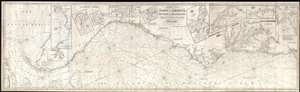
Chart of the Coast of America, from New York and Philadelphia, to the Strait or Gulf of Florida, and from thence to the Mississippi.
sold
- Digital Map Information
- Suitable for large format printing
- Full resolution TIFF file
- ICC color profile embedded
- Delivered instantly via download link
An utterly spectacular and sprawling 1850 John Williams Norie blueback nautical chart or maritime map depicting the North American coastline from New York to the Florida Keys. The map is oriented to the west, as a navigator from Europe would ... (more details)
The largest and most detailed map of New Jersey to appear in the 19th century - a seminal production.
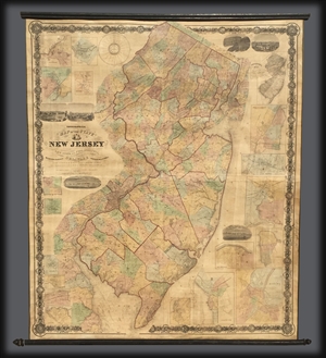
Topographical map of the State of New Jersey together with the vicinities of New York and Philadelphia, and with most of the state of Delaware from the State Geological Survey and the U.S. Coast Survey, and from surveys by G. Morgan Hopkins, civil engineer.
sold
Magnificently detailed, visually stunning, and monumentally proportioned, this is William Kitchell's seminal 1860 wall map of New Jersey. This is the largest map of New Jersey printedi n the 19th century. Mounted on linen with rollers, this ... (more details)
German edition of Sauthier's influential Revolutionary War Era map of New York and New Jersey.
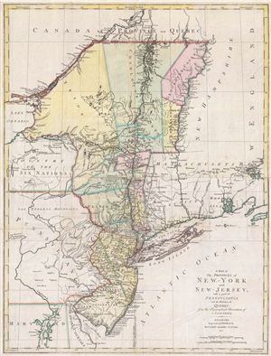
A Map of The Provinces of New-York and New-Jersey, with a part of Pennsylvania and the Province of Quebec from the Topographical Observations of C. J. Sauthier.
sold
- Digital Map Information
- Suitable for large format printing
- DPI: 300
- File Size: 23.99 MB
- File Type: ZIP / TIFF
- ICC color profile embedded
- Delivered instantly via download link
An important 1777 Revolutionary War era map of New York and New Jersey by Claude Joseph Sauthier and Matthew Lotter. This map is Lotter's German edition of Sauthier's map of 1776. The map covers from Quebec and Lake Champlain along the ... (more details)
Among the earliest Dutch attempts to map the Great Lakes and an important early representation New England and New Amsterdam (New York).
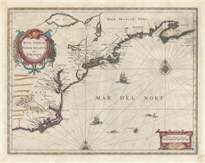
Nova Anglia Novum Belgium et Virginia.
sold
- Digital Map Information
- Suitable for large format printing
- Full resolution TIFF file
- ICC color profile embedded
- Delivered instantly via download link
A fine first edition first state old color example of Jan Jansson's 1636 map of the northeast American coastline from Cape Lookout (here identified as C. of Feare) to Nova Scotia. The map includes parts of modern day North Carolina, ... (more details)
One of Lotter's most iconic maps.
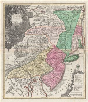
Pensylvania Nova Jersey et Nova York cum Regionibus Ad Fluvium Delaware In America Sitis, Nova Delinatione ob oculos posita . . .
sold
- Digital Map Information
- Suitable for large format printing
- DPI: 300
- File Size: 24.1 MB
- File Type: ZIP / TIFF
- ICC color profile embedded
- Delivered instantly via download link
A fine c. 1756 example of one of Tobias Conrad Lotter's most iconic maps. This is Lotter's important map of the Middle Atlantic and New England regions during the British colonial period. One of the most desirable, interesting and ... (more details)
Among the earliest Dutch attempts to map the Great Lakes and an important early representation New England and New Amsterdam (New York).
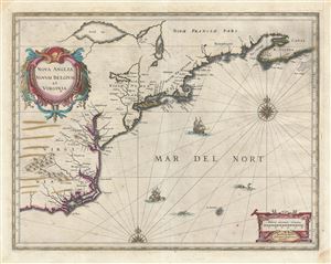
Nova Anglia Novum Belgium et Virginia.
sold
- Digital Map Information
- Suitable for large format printing
- DPI: 300
- File Size: 16.02 MB
- File Type: ZIP / TIFF
- ICC color profile embedded
- Delivered instantly via download link
A fine first edition first state old color example of Jan Jansson's 1636 map of the northeast American coastline from Cape Lookout (here identified as C. of Feare) to Nova Scotia. The map includes parts of modern day North Carolina, ... (more details)
A land of plenty.
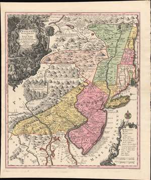
Pensylvania Nova Jersey et Nova York cum Regionibus Ad Fluvium Delaware In America Sitis, Nova Delinatione ob oculos posita ...
sold
- Digital Map Information
- Suitable for large format printing
- DPI: 600
- File Size: 40.3 MB
- File Type: ZIP / TIFF
- ICC color profile embedded
- Delivered instantly via download link
A c. 1750 example of Matthäus Seutter's map of the Middle Atlantic and New England regions during the British colonial period. It encompasses the Middle English Colonies, particularly New York, New Jersey, and Pennsylvania, capturing a period of rapid westward expansion and encouraging German emigration and settlement. (more details)
One of the few views of to show a walled New York.
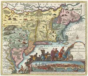
Recens Edita Totius Novi Belgii, in America Septentrionali siti, delineatio cura et sumtibus Tob. Conr. Lotteri, Sac. Caes. Maj. Geographi August. Vind.
sold
- Digital Map Information
- Suitable for large format printing
- Full resolution TIFF file
- ICC color profile embedded
- Delivered instantly via download link
This is Conrad Tobias Lotter's 1777 map of the Northeast and New York, the final map in the Jansson-Visscher series. Despite the map's cartography being over a century old, this map continued to capture the idea of this part of the world for Europeans in general and a German audience in particular. (more details)
Scarce birds-eye view of Morristown - one of the first such views to incorporate photography.
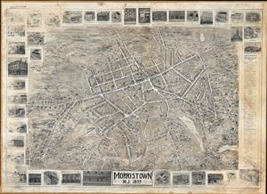
Morristown N.J. 1899.
sold
- Digital Map Information
- Suitable for large format printing
- File Size: 75.49 MB
- File Type: ZIP / TIFF
- ICC color profile embedded
- Delivered instantly via download link
An extremely scarce and dramatic large format 1899 view of Morristown, New Jersey. Prepared by the Newark firm of Landis and Alsop, this view depicts Morristown from somewhere high above the eastern part of town looking west. The ... (more details)