
Pennsylvania (sold)
Beautiful and extremely rare plan of Philadelphia while it was still the capital of the United States.
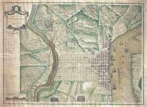
To the Citizens of Philadelphia: This Plan of the City and its Environs is respectfully dedicated by the Editor.
sold
- Digital Map Information
- Suitable for large format printing
- DPI: 300
- File Size: 18.82 MB
- File Type: ZIP / TIFF
- ICC color profile embedded
- Delivered instantly via download link
This is a 1796 Peter Charles Varlé city map or plan of Philadelphia, Pennsylvania. At this point in history, Philadelphia remained the capital of the United States, since the transfer to Washington, D.C. would not take place until 1800. The map depicts the city of ... (more details)
Best colonial map of Virginia and Maryland.
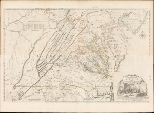
A Map of the most Inhabited part of Virginia containing the whole Province of Maryland with Part of Pensilvania, New Jersey and North Carolina drawn by Joshua Fry and Peter Jefferson in 1775.
sold
- Digital Map Information
- Suitable for large format printing
- Full resolution TIFF file
- ICC color profile embedded
- Delivered instantly via download link
This is the monumental 1775 Fry/Jefferson map of Virginia and Maryland, the most important colonial map of Virginia, in its original four-sheet English version. Drawn by Joshua Fry and Peter Jefferson in 1751 and first printed in 1753, this was the first accurate survey of the interior of Virginia. It was the first printed map to approximate the parallel ridges and valleys of the Appalachian Mountains, and the first to accurately depict the Blue Ridge Mountains. Following the revision of the map in 1755, this was the first map to include Virginia's road system, also marking routes used by frontier traders and Native Americans. Following that revision, it contained the best mapping of the Upper Ohio Valley and the Virginia frontier produced during the French and Indian War (1754 - 1763) and remained the prototype for all subsequent maps of Virginia until the 19th century. As both Fry and Jefferson were denizens of the colony, this further represents the first map of Virginia produced by Virginians. (more details)
First map to name the United States and a contemporaneous illustration of the American Revolutionary War.
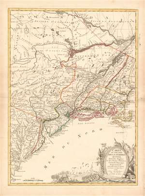
Carte du Théatre de la Guerre actuel entre les Anglais et les Trieze Colonies Unies de l'Amerique Septentrionale dressée par J. B. Eliot Ingénieurs des Etats Unis 1778.
sold
- Digital Map Information
- Suitable for large format printing
- DPI: 600
- File Size: 30.62 MB
- File Type: ZIP / TIFF
- ICC color profile embedded
- Delivered instantly via download link
A 1778 first edition American Revolutionary War era map of the northeastern United States by J. B. Elliot, considered to be of extreme significance. This is generally regarded as the earliest map to use the name 'United States', or in this case, 'Etats Unis'. Drawing on previously unused sources, Eliot's map illustrates the events of the Revolutionary War contemporaneously with the action, making it, essentially a living account of the War of Independence. Margaret Pritchard and Henry Taliaferro, published an essay on this map in Degrees of Latitude, Map 58, describing its significance in great detail, of which this is a short excerpt,
The map of the theater of war between Great Britain and America by J.B. Eliot is important because of its title, Les Treize Colonies Unies de l'Amerique Septentrionale, may include the first reference on a map to the United States. The cartographer was identified as Ingenieurs des Etats Unis. On November 15, 1777, the Continental Congress selected 'The United States of America,' as the name of the thirteen colonies that formed a government under the Articles of Confederation. One month later, French authorities learned of the victory at Saratoga and decided to recognize American independence. By January 8, French foreign minister, Charles Gravier, Comte de Vergennes, informed American envoys that France was ready to engage in an alliance. It is not surprising that the name United States was first mentioned on a map published in Paris in 1778.A decorative cartouche in the lower right incorporates a battle scene wherein British soldiers bombard a small town - possibly Valley Forge? (more details)
… It is also curious that he did not indicate on the map the general's 1777 winter headquarters at Valley Forge, misspelled Walay Forge. What Eliot did illustrate were the lines' march taken by the British and American forces during the campaign in 1777, including Lieutenant Colonel Barry St. Ledger's unsuccessful diversionary expedition down the Mohawk Valley, Burgoyne's march from Crown Point to Albany, and Howe's campaign to take Philadelphia.
… As was usually the case, Eliot appears to have borrowed from several sources in compiling the geography. Some areas were designated by French place-names while others are predominantly English, specifically in the northwestern territories that the French knew best. It is clear they were aware of the latest intelligence relating to the Revolutionary War.
Earliest Acquirable, Separate Issue.
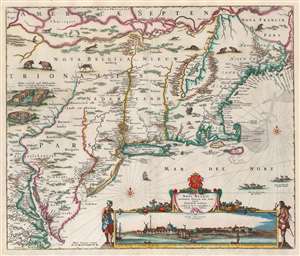
Novi Belgii Novaeque Angliae nec non Partis Virginiae Tabula multis in locis emendata a Nicolao Joannis Visschero.
sold
- Digital Map Information
- Suitable for large format printing
- Full resolution TIFF file
- ICC color profile embedded
- Delivered instantly via download link
This is the rare, c. 1656 second state of the Jansson/ Visscher map of the New Netherlands and New England. It is the earliest acquirable state of this work: the first, 'proof state', of this masterwork is an unobtainable rarity, known in only four examples in institutional and private collections. (more details)
The Earliest Acquirable, Separate Issue.

Novi Belgii Novaeque Angliae nec non Partis Virginiae Tabula multis in locis emendata a Nicolao Joannis Visschero.
sold
- Digital Map Information
- Suitable for large format printing
- Full resolution TIFF file
- ICC color profile embedded
- Delivered instantly via download link
This is the rare, c. 1656 second state of the Jansson/ Visscher map of the New Netherlands and New England. It is the earliest acquirable state of this work: the first, 'proof state', of this masterwork is an unobtainable rarity, known in only four examples in institutional and private collections. (more details)
Best map of the Hudson Valley at the outset of the American Revolution.
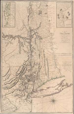
A Map of the Province of New-York, with Part of Pensilvania, and New England.
sold
- Digital Map Information
- Suitable for large format printing
- Full resolution TIFF file
- ICC color profile embedded
- Delivered instantly via download link
This is John Montresor's striking 1775 map of New York and the surrounding regions - considered the best and most authoritative map of the region at the beginning of the American Revolutionary War (1775 - 1783). (more details)
Iconic early map of New England and New York with 'Visscher View' of New Amsterdam.
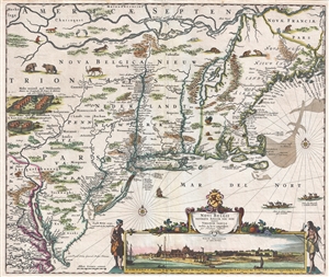
Novi Belgii Novaeque Angliae Nec Non Pennsylvaniae et Partis Virginiae Tabula multis in locis emendata.
sold
- Digital Map Information
- Suitable for large format printing
- DPI: 300
- File Size: 15.13 MB
- File Type: ZIP / TIFF
- ICC color profile embedded
- Delivered instantly via download link
A map of extreme importance, this is a fine example of Nicholaas Visscher's 1684 Novi Belgii or map of New York, New England, Pennsylvania, and Virginia. This is the first map in the Jansson-Visscher Series here presented in its 4th state (Burden, 315). Like most ... (more details)
Iconic early map of New England and New York with 'Visscher View' of New Amsterdam.
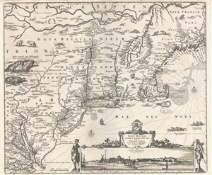
Novi Belgii Novaeque Angliae Nec Non Pennsylvaniae et Partis Virginiae Tabula multis in locis emendata.
sold
- Digital Map Information
- Suitable for large format printing
- DPI: 300
- File Size: 14.86 MB
- File Type: ZIP / TIFF
- ICC color profile embedded
- Delivered instantly via download link
A map of extreme importance, this is a fine example of Nicholaas Visscher's 1684 Novi Belgii or map of New York, New England, Pennsylvania, and Virginia. This is the first map in the Jansson-Visscher Series here presented in its 4th state (Burden, 315). Like most ... (more details)
Remarkable book with a railroad magnate's appended manuscript maps and annotations relating to the Battle of Gettysburg. Also, an unrecorded early printed map of the Battle of Gettysburg.
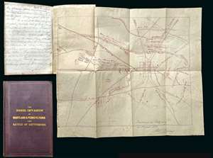
A remarkable discovery, this is a fine example of Michael Jacob's scarce 1864 book on the Confederate invasion of Pennsylvania and the Battle of Gettysburg. While the book itself is uncommon and interesting, the most exciting aspects of the piece are manuscript notes, tipped-in maps, and annotations, by railroad magnate Robert S. Hollins, describing the Battle of Gettysburg and its aftermath. Along with the usual map that accompanies this book, the present example contains additional two tipped-in maps. One a unique manuscript dated to August of 1863, making it one of the earliest known maps of the battle, drawn just days after the conflict. The other is a small but previously unknown printed map of the town and battlefield published by Andrew J. Cross, a clergyman of Baltimore. The extensive manuscript notes, by Baltimore railroad man Robert S. Hollins, describe horse thievery by New Jersey soldiers from Pennsylvania farmers shortly after the battle as well as the acquisition of the maps. (more details)
A scarce map of exceptional importance illustrating early Swedish settlements in New Jersey, Pennsylvania, and Delaware.
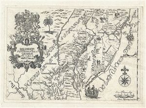
Delineatio Pennsilvaniae et Caesareae, nov. occident seu West N. Iersey in America
sold
- Digital Map Information
- Suitable for large format printing
- DPI: 300
- File Size: 3.74 MB
- File Type: ZIP / TIFF
- ICC color profile embedded
- Delivered instantly via download link
This is an extremely rare whimsical 1731 map focusing on the remnants of the ephemeral colony of New Sweden by Jonas Silferling and Tobias Biorck. New Sweden, which by 1731 had been assimilated into British New York, occupied parts of Delaware, New Jersey and ... (more details)
The rare propaganda-ish 'Farm Animal' variant on the Visscher-Jansson Series map of New York, Virginia, and New England.
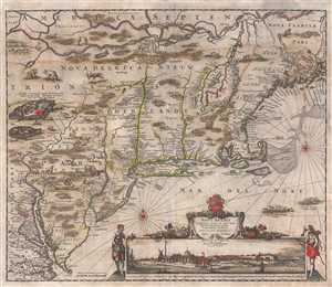
Novi Belgii Novaeque Angliae Nec Non Pennsylvaniae et Partis Virginiae Tabula multis in locis emendata.
sold
- Digital Map Information
- Suitable for large format printing
- Full resolution TIFF file
- ICC color profile embedded
- Delivered instantly via download link
An attractive old color example of Justus Danckerts' 1684 Novi Belgii or map of New York, New England, Pennsylvania, and Virginia. Some call this the 'farm animal map' for its novel incorporation of farm animals, ranging from horses and cows to chicken and ... (more details)
Turning Point of the Civil War.
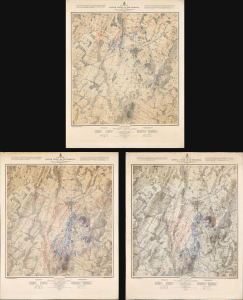
Map of the Battle Field of Gettysburg. July 1st, 2nd, 3rd 1863. First Day's Battle / Second Day's Battle / Third Day's Battle.
sold
- Digital Map Information
- Suitable for large format printing
- Full resolution TIFF file
- ICC color profile embedded
- Delivered instantly via download link
This is John Badger Bachelder's foundational 1876 set of three large-format maps of the Battle of Gettysburg, the definitive turning point of the American Civil War (1861 - 1865). Bachelder had dedicated much of the 13 years since the battle had taken place to researching it, making him the foremost authority on it, resulting in these maps being the definitive contemporaneous account. (more details)
The most iconic view of the Battle of Gettysburg.
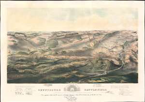
Gettysburg Battle-Field.
sold
- Digital Map Information
- Suitable for large format printing
- File Size: 43.53 MB
- File Type: ZIP / TIFF
- ICC color profile embedded
- Delivered instantly via download link
A remarkable and scarce 1863 proof state of the most iconic view of the American Civil War Battle of Gettysburg printed. This bird's eye view of the Battle of Gettysburg was issued by John Bachelder just months after the actual event. Within days of the battle, Bachelder arrived in Gettysburg where he spent the subsequent 84 days completing a meticulous study of both the battle and the battlefield. Bachelder walked the field daily, interviewed thousands of recovering soldiers on both sides, both commanders and enlisted men, and reconstructed all three days of the battle. (more details)
A scarce proof state of the most iconic view of the Battle of Gettysburg ever published.
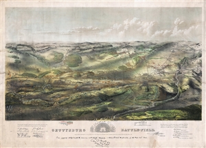
Gettysburg Battle-Field.
sold
- Digital Map Information
- Suitable for large format printing
- File Size: 37.34 MB
- File Type: ZIP / TIFF
- ICC color profile embedded
- Delivered instantly via download link
A remarkable and scarce 1863 proof state of the most iconic view of the American Civil War Battle of Gettysburg printed. This bird's eye view of the Battle of Gettysburg was issued by John Bachelder just months after the actual event. Within days of the ... (more details)
The most iconic view of the Battle of Gettysburg.
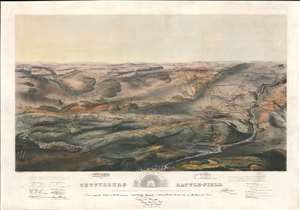
Gettysburg Battle-Field.
sold
- Digital Map Information
- Suitable for large format printing
- File Size: 48.93 MB
- File Type: ZIP / TIFF
- ICC color profile embedded
- Delivered instantly via download link
A remarkable and scarce 1863 proof state of the most iconic view of the American Civil War Battle of Gettysburg printed. This bird's-eye view of the Battle of Gettysburg was issued by John Bachelder just months after the actual event. Within days of the battle, Bachelder arrived in Gettysburg where he spent the subsequent 84 days completing a meticulous study of both the battle and the battlefield. Bachelder walked the field daily, interviewed thousands of recovering soldiers on both sides, both commanders and enlisted men, and reconstructed all three days of the battle. (more details)
Most Finely Detailed Dutch Map of the Northeast from the 17th Century.
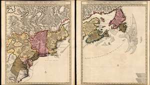
Nova Tabula Geographica Complectens Borealiorem Americae Partem: in qua Exacte Delineatae Sunt Canada sive Nova Francia, Nova Scotia, Nova Anglia, Novum Belgium, Pensylvania, Virginia, Carolina et Terra Nova, cum Omnibus Littorum. Pulvinorumque Profunditatibus. Amstelodami. à Nicolao Visscher. Cum Privilegio Ordinum Generalium Foederati Belgii./ Carte Nouvelle contenant la Partie d'Amerique la Plus Septentrionale, ou Sont Exactement Dècrites les Provinces Suivantes comme le Canada ou Nouvelle France, La Nouvelle Ecosse, la Nouvelle Angleterre, les Nouveaux Païs Bas, la Pensylvanie, la Virginie, la Caroline et l'Ile de Terre Neuve avec les profondeuis le Long des Côtes et sur les Bancs. Par Nicolas Visscher avec Privilege des Etats Géneraux.
sold
- Digital Map Information
- Suitable for large format printing
- DPI: 600
- File Size: 121.39 MB
- File Type: ZIP / TIFF
- ICC color profile embedded
- Delivered instantly via download link
This is Nicolas Visscher II's 1696 two-sheet map of the North American eastern seaboard and the Canadian Maritimes, in a beautiful example of its earliest acquirable state with rich original color. It represents the 17th century's most finely-detailed mapping of the coast from the Carolinas to Labrador. Also, it is the first Dutch map of the region to diverge from the 'Jansson-Visscher' precursor maps. (more details)
Scarce final issue of the important Holland-Jefferys Map New York, New Jersey, and the Hudson Valley on the brink of the American Revolutionary War. The best obtainable Revolutionary War Era map of this region.
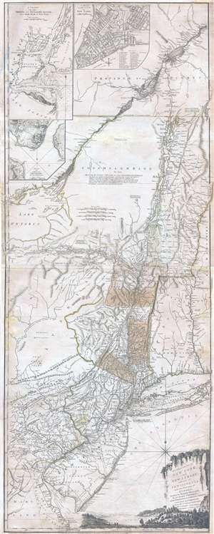
The Provinces of NEW YORK, and NEW JERSEY; with part of PENSILVANIA, and the Governments of TROIS RIVIERES, and MONTREAL: drawn by Major Holland, Surveyor General, of the Norther District in America. / A Chorographical Map of the Country between Albany, Oswego, Fort Frontenac, and Les Trois Rivieres; Exhibiting all the Grants made by the French Governors on Lake Champlain; & between that Lake & Montreal.
sold
- Digital Map Information
- Suitable for large format printing
- DPI: 300
- File Size: 26.6 MB
- File Type: ZIP / TIFF
- ICC color profile embedded
- Delivered instantly via download link
One of the most important, influential, and comprehensive American Revolutionary War Era map of New York, New Jersey, Vermont, and the Hudson Valley corridor, this is an final 1776 state of Major Samuel Holland and Thomas Jeffrey's Provinces of New York ... (more details)
Map that brought the French into the American Revolutionary War.
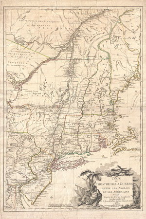
Carte du Theatre de la Guerre entre les Anglais et Les Americains.
sold
- Digital Map Information
- Suitable for large format printing
- DPI: 300
- File Size: 28.67 MB
- File Type: ZIP / TIFF
- ICC color profile embedded
- Delivered instantly via download link
First edition example of an extremely significant map of New York and New England. Issued by Brion de la Tour in 1777, this map was intended to illustrate the important events at the height of the American Revolutionary War. Brion's map covers from ... (more details)
The rare propaganda-ish 'Farm Animal' variant on the Visscher-Jansson Series map of New York, Virginia, and New England.
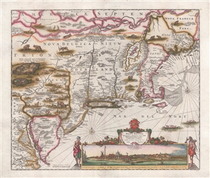
Novi Belgii Novaeque Angliae Nec Non Pennsylvaniae et Partis Virginiae Tabula multis in locis emendata.
sold
- Digital Map Information
- Suitable for large format printing
- DPI: 300
- File Size: 10.83 MB
- File Type: ZIP / TIFF
- ICC color profile embedded
- Delivered instantly via download link
A magnificent example of Justus Danckerts' 1690 Novi Belgii or map of New York, New England, Pennsylvania, and Virginia. Some call this the 'farm animal map' for its novel incorporation of farm animals, ranging from horses and cows to chicken and ... (more details)
Unique encyclopedic record of Native American toponomy.
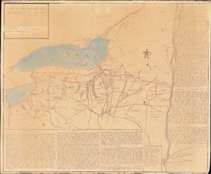
An extraordinary 1962 diazotype map by Eber Russell displaying the Native American (Iroquoian) toponymy for settlements, waterways, and other features in upstate New York and portions of Pennsylvania. One of just 4 surviving examples, this map is the product of more than 50 years of research, and an invaluable resource for understanding the pre-colonial Native American presence in New York. The present work was compiled by Eber Russell, who substantially reworked a 19th century map by Lewis Henry Morgan and Adirondack specialist Ely Samuel Parker, two of the most prominent experts on Native American cultures in their time. Compared to its predecessor, Russell's map is a significantly different work on all levels: substantially larger, more focused, more toponymy, and heavily annotated. (more details)
One of only three known examples, this map marks a major milestone in the urban mapping of Philadelphia, and is one of the first to show Fairmount Park's design.
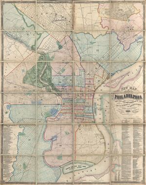
New Map of the City of Philadelphia, reduced by Photography from a large survey made expressly for the City and corrected from Plans and Draughts in the Department of Surveys, by John. H. Dye, Draughtsman and Surveyor.
sold
- Digital Map Information
- Suitable for large format printing
- File Size: 104.62 MB
- File Type: ZIP / TIFF
- ICC color profile embedded
- Delivered instantly via download link
An exceptional 1869 folding wall map of Philadelphia, Pennsylvania by John H. Dye and Henry J. Toudy. This map covers the urban center of Philadelphia along both sides the Delaware and Lehigh Rivers from roughly Germantown to Red Bank and from ... (more details)
The most important map of Delaware County, PA.
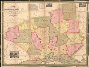
Map of Delaware County Pennsylvania.
sold
- Digital Map Information
- Suitable for large format printing
- File Size: 104.62 MB
- File Type: ZIP / TIFF
- ICC color profile embedded
- Delivered instantly via download link
One of only 4 known surviving examples of Joshua W. Ash's important 1848 map of Delaware, County Pennsylvania. Delaware county, located just southwest of Philadelphia, is one of Pennsylvania's oldest and most historic areas, the home of Swarthmore College, the Haverford School (Haverford Friends School), the Elwyn Institute, and numerous other institutions. It was here, at Chester, that William Penn first landed in 1682, founding the Quaker colony of Pennsylvania. At the time this map was made Chester was a region of rolling hills and gentlemanly estates - including the mapmaker Ash's own family properties. (more details)
The American Revolutionary Capital Revealed.
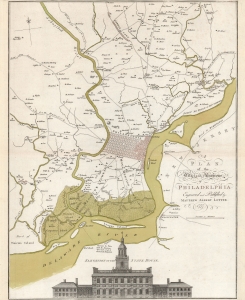
A Plan of the City and Environs of Philadelphia Engraved and Published by Matthew Albert Lotter.
sold
- Digital Map Information
- Suitable for large format printing
- DPI: 600
- File Size: 58.15 MB
- File Type: ZIP / TIFF
- ICC color profile embedded
- Delivered instantly via download link
This is Matthäus Albrecht Lotter's beautiful 1777 edition of the Scull and Heap map of Philadelphia and its environs, an essential Revolutionary War (1775 - 1783) map. The map represents the pinnacle of Philadelphia area cartography when it was the capital of the American Revolution and, as this map went to press, a focus for global attention. Lotter likely published the map to capitalize on German interest in the war. German Hessian mercenaries fought on behalf of the British as early as the August 15, 1776 landing at Staten Island and throughout the remainder of the War. (more details)
Photograph of the Battlefield of Gettysburg.
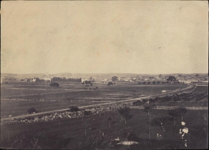
This is an 1863 albumen print of a Timothy O'Sullivan photograph of the Battlefield of Gettysburg. Brady's photo-documentation of the Civil War is significant and played a role much like television journalism did during the Vietnam War - it brought the horrors and violence of the war to the home front, informing public opinion. (more details)
One of Lotter's most iconic maps.
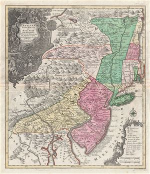
Pensylvania Nova Jersey et Nova York cum Regionibus Ad Fluvium Delaware In America Sitis, Nova Delinatione ob oculos posita . . .
sold
- Digital Map Information
- Suitable for large format printing
- DPI: 300
- File Size: 24.1 MB
- File Type: ZIP / TIFF
- ICC color profile embedded
- Delivered instantly via download link
A fine c. 1756 example of one of Tobias Conrad Lotter's most iconic maps. This is Lotter's important map of the Middle Atlantic and New England regions during the British colonial period. One of the most desirable, interesting and attractive ... (more details)
One of the Earliest Acquirable Views of Philadelphia.
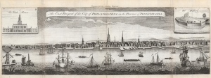
The East Prospect of the City of Philadelphia, in the Province of Pennsylvania.
sold
- Digital Map Information
- Suitable for large format printing
- Full resolution TIFF file
- ICC color profile embedded
- Delivered instantly via download link
This is a superb example of the 1761 London Magazine edition of the famous Heap and Scull view of Philadelphia, one of the earliest acquirable and most important views of the city. (more details)
A land of plenty.
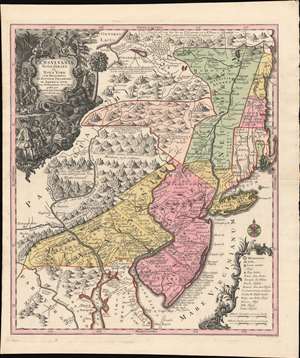
Pensylvania Nova Jersey et Nova York cum Regionibus Ad Fluvium Delaware In America Sitis, Nova Delinatione ob oculos posita ...
sold
- Digital Map Information
- Suitable for large format printing
- DPI: 600
- File Size: 40.3 MB
- File Type: ZIP / TIFF
- ICC color profile embedded
- Delivered instantly via download link
A c. 1750 example of Matthäus Seutter's map of the Middle Atlantic and New England regions during the British colonial period. It encompasses the Middle English Colonies, particularly New York, New Jersey, and Pennsylvania, capturing a period of rapid westward expansion and encouraging German emigration and settlement. (more details)
One of the few views of to show a walled New York.
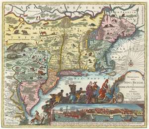
Recens Edita Totius Novi Belgii, in America Septentrionali siti, delineatio cura et sumtibus Tob. Conr. Lotteri, Sac. Caes. Maj. Geographi August. Vind.
sold
- Digital Map Information
- Suitable for large format printing
- Full resolution TIFF file
- ICC color profile embedded
- Delivered instantly via download link
This is Conrad Tobias Lotter's 1777 map of the Northeast and New York, the final map in the Jansson-Visscher series. Despite the map's cartography being over a century old, this map continued to capture the idea of this part of the world for Europeans in general and a German audience in particular. (more details)
The finest example of Homann's significant map of New England.
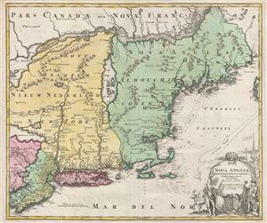
Nova Anglia Septentrionali Americae Implantata Anglorumque Coloniis Florentissima Geographice Exhibita a Joh. Baptista Homann.
sold
- Digital Map Information
- Suitable for large format printing
- DPI: 300
- File Size: 2.51 MB
- File Type: ZIP / TIFF
- ICC color profile embedded
- Delivered instantly via download link
A significant though often overlooked piece, this is J. B. Homann's c. 1716 map of New England, New York, and New Jersey. Though titled 'Nova Anglia,' (New England) Homann's map actually covers a much broader area from New France (Canada) to the Delaware Bay, and from Philadelphia to Nova Scotia, inclusive of all of New England, New York, and New Jersey, as well as parts of adjacent Canada and Pennsylvania. The map identifies both European and American Indian settlements, differentiating between the two by rendering indigenous settlements as pictorial villages, huts and all, and European towns as small circles, major cities like Philadelphia and Boston being the exception. (more details)
A cartographic landmark in the mapping of Pennsylvania.
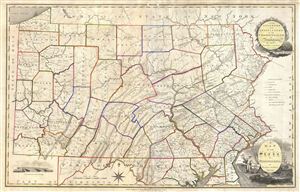
A Map of the State of Pennsylvania by Reading Howell MDCCCXI.
sold
- Digital Map Information
- Suitable for large format printing
- DPI: 300
- File Size: 25.69 MB
- File Type: ZIP / TIFF
- ICC color profile embedded
- Delivered instantly via download link
This map, which was first issued by Reading Howell in 1791, is considered to be one of the most important maps of Pennsylvania ever issued as well as the finest of the 18th century. Howell, a landowner and surveyor of Pennsylvania, was ... (more details)
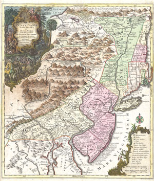
Pensylvania Nova Jersey et Nova York cum Regionibus Ad Fluvium Delaware In America Sitis, Nova Delinatione ob oculos posita . . .
sold
- Digital Map Information
- Suitable for large format printing
- DPI: 300
- File Size: 10.35 MB
- File Type: ZIP / TIFF
- ICC color profile embedded
- Delivered instantly via download link
A fine and rare 1756 example of Tobias Conrad Lotter's important map of the Middle Atlantic and New England regions during the British colonial period. One of the most desirable, interesting and attractive pre-Revolutionary maps of the ... (more details)
Philadelphia at the beginning of its industrialization.
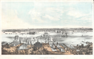
Philadelphia.
sold
- Digital Map Information
- Suitable for large format printing
- Full resolution TIFF file
- ICC color profile embedded
- Delivered instantly via download link
A stunning large-format 1850 panoramic view of Philadelphia from Camden, across the Delaware River. It was drawn by John William Hill and Benjamin Franklin Smith and lithographed by Smith. (more details)