
Pennsylvania
Best map of the Hudson Valley at the outset of the American Revolution.
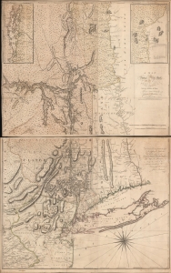
A Map of the Province of New-York, with Part of Pensilvania, and New England.
$16,000.00
Acquire
- Digital Map Information
- Suitable for large format printing
- Full resolution TIFF file
- ICC color profile embedded
- Delivered instantly via download link
This is John Montresor's striking 1775 map of New York and the surrounding regions - considered the best and most authoritative map of the region at the beginning of the American Revolutionary War (1775 - 1783). (more details)
Most important map in 18th century American history.
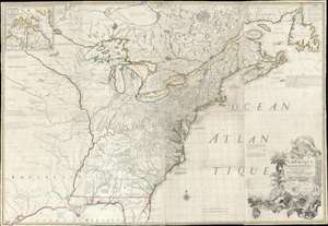
Amerique Septentrionale avec Les Routes, Distances et miles, Villages et Etablissements François et Anglois Par le Docteur Mitchel.
$12,000.00
Acquire
- Digital Map Information
- Suitable for large format printing
- Full resolution TIFF file
- ICC color profile embedded
- Delivered instantly via download link
This is the important 1777 Georges Le Rouge French edition of the seminal John Mitchell map of the eastern part of North America. The Mitchell map is considered the single most important map in 18th-century American history. It was used as a primary reference for nearly every treaty and boundary dispute in colonial North America from the French and Indian War (1754 - 1763) through the late 19th century. The map is all the more astounding because this is Mitchell's one and only map - a truly remarkable feat of virtuosity. (more details)
First large-scale map to show American postal routes.
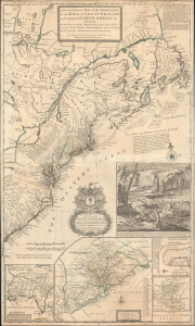
A New and Exact Map of the Dominions of the King of Great Britain on ye Continent of North America. Containing Newfoundland, New Scotland, New England, New York, New jersey, Pensilvania, Maryland, Virginia and Carolina.
$11,000.00
Acquire
- Digital Map Information
- Suitable for large format printing
- File Size: 44.83 MB
- File Type: ZIP / TIFF
- ICC color profile embedded
- Delivered instantly via download link
This is Herman Moll's 1715 'Beaver Map' of the British Colonies in America, here in its 1733 state (see below). In addition to its iconic and namesake image of Niagara Falls and the rich American peltries, this map is also significant as one of the most accurate maps of the period and the first large-scale map to show American postal routes. (more details)
Piracy of a seminal map detailing Trans-Appalachia.
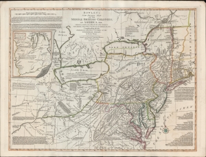
Bowles's New Pocket Map of the Middle British Colonies, in America, Vis. Virginia, Maryland, Delaware, Pensylvaia, New Jersey, New York, Connecticut and RHode Island. Comprending also the Habitations and Hunting Countries of the Confederate Indians: by Lewis Evans.
$6,500.00
Acquire
- Digital Map Information
- Suitable for large format printing
- DPI: 600
- File Size: 659.83 MB
- File Type: ZIP / TIFF
- ICC color profile embedded
- Delivered instantly via download link
A fine example of the 1780 Carington Bowles edition of the Lewis Evans map of the Middle British Colonies - one of the most important maps to emerge out of the French and Indian War (1754 - 1763). Essentially a piracy of a piracy, this is the Carington Bowles 1780 piracy of the 1771 Kitchen/Jefferys piracy of the 1755 Lewis Evans map - here given new relevance in the context of the American Revolutionary War (1775 - 1783). There are numerous subtle changes over earlier editions although the essential Lewis Evans chart - the finest and most comprehensive treatment of the Trans-Appalachia and the Ohio Valley from the French and Indian War through the Revolutionary period - remains the core. Pre-release editions of this map were circulated among British officers, including Major-General Edward Braddock (1695 - 1755), who consulted them during his disastrous 1755 expedition against the French-occupied Ohio River Valley (he was killed in the effort - but not for lack of cartographic reconnaissance). (more details)
Important State of the dominant chart of Colonial Virginia.
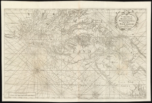
Virginia, Maryland, Pennsilvania, East and West New Jarsey...
$4,000.00
Acquire
- Digital Map Information
- Suitable for large format printing
- DPI: 600
- File Size: 89.65 MB
- File Type: ZIP / TIFF
- ICC color profile embedded
- Delivered instantly via download link
This is a superb example of William Mount and Thomas Page's large nautical map of the Chesapeake Bay and Delaware Bay in the 1742 first state. It represents the dominant English depiction of the water approaches to Virginia, Maryland, Delaware, and New Jersey for most of the Colonial Period. (more details)
Striking early example of Chromolithographic Viewmaking.
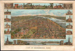
View of Harrisburg, Penn.
$4,000.00
Acquire
- Digital Map Information
- Suitable for large format printing
- File Size: 51.36 MB
- File Type: ZIP / TIFF
- ICC color profile embedded
- Delivered instantly via download link
This is a rare 1855 J. T. Williams view of Harrisburg, Pennsylvania. It is a stunning early use of chromolithography for viewmaking. The view captures Harrisburg as a prosperous regional railroad hub, fast becoming the nation's 'coal gateway,' connecting the state's vast mineral wealth to the Atlantic coast and beyond. (more details)
On the cover of Ristow's 'Maps and Mapmakers.'
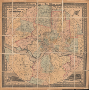
Map of the Circuit of Ten Miles Around the City of Philadelphia With the names of Villages, Roads, Milles, Property Owner, Taverns, etc. / Sidney's Map of Ten Miles round.
$3,800.00
Acquire
- Digital Map Information
- Suitable for large format printing
- File Size: 35.64 MB
- File Type: ZIP / TIFF
- ICC color profile embedded
- Delivered instantly via download link
This is an attractive example of J. C. Sidney's 1847 map of Philadelphia, covering the city and its vicinity 'Ten Miles round'. Smith, the publisher, considered this one of the 'most successful of his maps'. Water Ristow, in American Maps and Mapmakers, placed this map on the cover, devoted a full-page illustration to it, and included several pages of text, underscoring its significance as an example of mid-19th-century American map publishing. Indeed, its producers were a who's who of Philadelphia map publishing: Robert Persall Smith, Norman Friend, Augustus Köllner, Peter Steven Duval, and James Charles Sidney. (more details)
One of the few views of to show a walled New York.
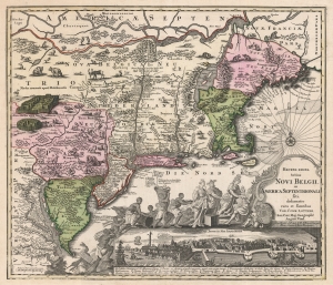
Recens Edita Totius Novi Belgii, in America Septentrionali siti, delineatio cura et sumtibus Tob. Conr. Lotteri, Sac. Caes. Maj. Geographi August. Vind.
$3,500.00
Acquire
- Digital Map Information
- Suitable for large format printing
- DPI: 600
- File Size: 74.88 MB
- File Type: ZIP / TIFF
- ICC color profile embedded
- Delivered instantly via download link
This is Conrad Tobias Lotter's 1757 map of New York, New England, and the mid-Atlantic colonies. It represents the final map in the Jansson-Visscher series. Despite the map's cartography being over a century old, this map continued to capture the idea of this part of the world for Europeans in general and a German audience in particular. (more details)
Pennsylvania Anthracite Boom - driving the Industrial Revolution.
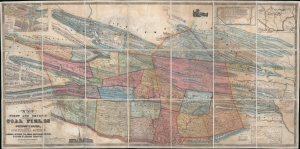
Map of the First and Second Anthracite Coal Fields in Pennsylvania; embracing Schuylkill County and parts of Carbon, Luzerne, Columbia, Northumberland, Dauphin and Lebanon Counties.
$3,500.00
Acquire
- Digital Map Information
- Suitable for large format printing
- DPI: 600
- File Size: 211.86 MB
- File Type: ZIP / TIFF
- ICC color profile embedded
- Delivered instantly via download link
This is a large-scale 1849 Peter W. Sheafer and Robert P. Smith map of northeastern Pennsylvania illustrating the peak of the Anthracite Coal Boom - one of the driving factors of American industrial development in the 19th century. (more details)
Inset of Boston - first map of an English colonial city on a non-English map.
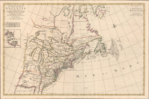
Carte Nouvelle De L'Amerique Angloise Contenant La Virginie, Maryland, Caroline, Pensylvania, Nouvelle Iorck, N. Iarsey, N.France, Et Les Terres Nouvellement Decouverte...
$3,200.00
Acquire
- Digital Map Information
- Suitable for large format printing
- Full resolution TIFF file
- ICC color profile embedded
- Delivered instantly via download link
An impressive large-scale Pierre Mortier 1700 map of the British Colonies in North America. The map features an important inset of Boston - the first map of a British colonial city on a non-British map (Burden). It was issued to capitalize on popular interest in King William's War (1689 - 1697). (more details)
Transformed by Coal and the Industrial Revolution.
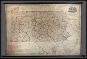
Map Of Pennsylvania, constructed from the County Surveys authorized by the State; and other original Documents.
$3,000.00
Acquire
A striking 1848 first edition example of William Ellis Morris' map of Pennsylvania. It reflects the dramatic transformation of Pennsylvania in the early 18th century when it became the hub of American coal production - the fuel for the Industrial Revolution in the United States. Although based on the 1822 Melish, this is a fully new production surpassing all previous maps of the state. (more details)
Civil War era map of Philly!
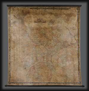
Map of the Vicinity of Philadelphia.
$2,500.00
Acquire
- Digital Map Information
- Suitable for large format printing
- Full resolution TIFF file
- ICC color profile embedded
- Delivered instantly via download link
An impressive 1861 Civil War Era wall map of Philadelphia, Pennsylvania, and vicinity by Silas N. Beers and J. E. Gillette. Centered on Philadelphia, coverage extends roughly 25 miles around in all directions. There is a large inset of Philadelphia in the upper right as well as a city directory along the left side. In addition, there are numerous smaller inset plans detailing surrounding towns and communities. (more details)
Near unrecorded view of Pennsylvania's capital at the height of the state's coal and steel booms.
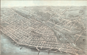
[Harrisburgh, Penna. 1881.]
$2,500.00
Acquire
- Digital Map Information
- Suitable for large format printing
- File Size: 81.91 MB
- File Type: ZIP / TIFF
- ICC color profile embedded
- Delivered instantly via download link
This is a striking 1881 Jacob Knaubner chromolithograph bird's-eye view map of Harrisburg, the capital of Pennsylvania. This map captures Harrisburg at the peak of the Pennsylvania coal and steel booms. Although appearing in Reps, there are no digitized examples, and this is the only verifiable example. (more details)
A fine decorative map depicting colonial America during the Spanish War of Succession.
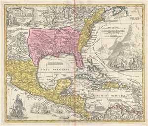
Regni Mexicani seu Novae Hispaniae, Floridae, Novae Angliae, Carolinae, Virginiae et Pensylvaniae, nec non Insularum, Archipelagi Mexicani in America Septentrionali.
$2,400.00
Acquire
- Digital Map Information
- Suitable for large format printing
- Full resolution TIFF file
- ICC color profile embedded
- Delivered instantly via download link
This is a 1715 J. B. Homann's decorative map of Mexico, Florida, New England, the West Indies, and the Mississippi Valley (Louisiana). Centered on the Mississippi River Valley, Homann's map depicts from Sinaloa (Mexico) eastwards to the Atlantic Coast and from the ... (more details)
Rochambeau's March to Yorktown.
[Revolutionary War Map Showing Rochambeau's March from Boston to the Chesapeake.]
$2,200.00
Acquire
- Digital Map Information
- Suitable for large format printing
- File Size: 18.32 MB
- File Type: ZIP / TIFF
- ICC color profile embedded
- Delivered instantly via download link
This is the first edition of François Soulés map of the American coast during the Revolutionary War, illustrating Rochambeau's epic march from Boston to the Chesapeake Bay and Yorktown - a key achievement that contributed to the decisive American victory at Yorktown. (more details)
Railroads in the Eastern Theater of the American Civil War.
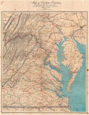
Map of Eastern Virginia.
$2,000.00
Acquire
- Digital Map Information
- Suitable for large format printing
- Full resolution TIFF file
- ICC color profile embedded
- Delivered instantly via download link
This is an 1862 Walter L. Nicholson map of eastern Virginia and Maryland, published during the second year of the American Civil War (1861 - 1865). The map embraces the Eastern Theater of war, from Pennsylvania south to the North Carolina - Virginia border. Washington, D.C. stands out on the Potomac River, while red concentric circles in ten mile increments focus upon Richmond. No battlefields are explicitly marked, but landmarks for which battles were named both before and after this map was published, including Fredericksburg, Chancellorsville, Spotsylvania Court House, and Gettysburg, appear. Red overprinting illustrates the railroad network, which proved critical to both the Union and Confederate war effort. Both sides used the railroads to move men and supplies to and from battlefields. Railroads and railroad hubs thus became strategic targets for raids and advancing armies. (more details)
Religious Refuge on the American Frontier.
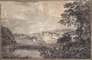
[A View of Bethlem, the great Moravian settlement in the province of Pennsylvania / Vue de Bethlem, principal etablissement des Freres Moraves dans la province de Pennsylvania].
$2,000.00
Acquire
- Digital Map Information
- Suitable for large format printing
- Full resolution TIFF file
- ICC color profile embedded
- Delivered instantly via download link
This is Thomas Pownall and Paul Sandby's depiction of the town of Bethlehem, Pennsylvania, that appeared in the 1761 Six Remarkable Views in the Provinces of New York, New Jersey and Pennsylvania (and later the Scenographia Americana), published in London. At the time, the town was among the most unusual and innovative in Britain's American colonies, being home to a strict and industrious Moravian community. (more details)
Updating the Evans Map: First Map with Louisville
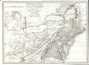
Carte Generale des Etats de Virginie, Maryland, Delaware, Pensilvanie, Nouveau-Jersey, New-York, Connecticut et Isle de Rhodes Ainsi que des Lacs Erie, Ontario, et Champlain. D'Apres la Carte Ameriquaine de Louis Evans et la Carte Anglaise de Thomas-Jefferys, pour les Lettres d'un Cultivateur Amériquain.
$1,950.00
Acquire
- Digital Map Information
- Suitable for large format printing
- DPI: 600
- File Size: 68.46 MB
- File Type: ZIP / TIFF
- ICC color profile embedded
- Delivered instantly via download link
An elegant 1787 French edition of Louis Evans' seminal and influential map of the Middle British Colonies, one of the most important maps of the British colonies and the best colonial mapping of the Ohio River Valley. It was issued for Michel Guillaume St. Jean de Crevecoeur's 1787 Lettres d'un Cultivateur Ameriquain, one of the most influential works on colonial America. (more details)
Best 18th century map of the Ohio River Valley.
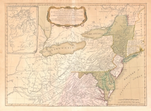
A New and General Map of the Middle Dominions Belonging to the United States of America, viz. Virginia, Maryland, the Delaware-Counties, Pennsylvania, New Jersey etc…
$1,850.00
Acquire
- Digital Map Information
- Suitable for large format printing
- DPI: 600
- File Size: 27.56 MB
- File Type: ZIP / TIFF
- ICC color profile embedded
- Delivered instantly via download link
This is the Laurie and Whittle 1794 updated edition of Lewis Evans' foundational 1755 map of the middle part of the British Colonies in North America. Evans' map was the earliest to accurately detail the American frontier at the time of its original publication. It exhibits superb detail in the northern Appalachian Mountains and the Ohio River Valley, providing information about Native American tribes and transport, French and English forts, and other details pertinent to the frontiersman, including sources of salt, roads, and trails. It was hailed by Schwartz and Ehrenberg as 'the most ambitious performance of its kind undertaken in America up to that time.' So widely was the excellence of Evans' map recognized that he was unable to make any money on it at all, as it was promptly pirated by Jefferys, Sayer, Kitchen, Bowles, Crevecoeur, and, as here, Laurie and Whittle. This 1794 edition, at least, updates the map to indicate the outcome of the American Revolution - it names the United States and includes the boundary line between the United States and Canada as determined by the 1783 Treaty of Paris. This is also the first edition of the Evans map to include the new state of Kentucky - although erroneously positioned north of the Ohio River. (more details)
First state of this rare, important map.
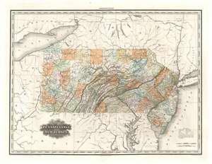
Map of Pennsylvania and New Jersey by H. S. Tanner.
$1,500.00
Acquire
- Digital Map Information
- Suitable for large format printing
- DPI: 600
- File Size: 32.45 MB
- File Type: ZIP / TIFF
- ICC color profile embedded
- Delivered instantly via download link
The rare first state of H. S. Tanner's 1823 map of Pennsylvania and New Jersey. This elephant folio map covers all of Pennsylvania and New Jersey in detail, as well as sketching in the adjacent parts of New York, Ohio, Virginia, and Maryland. The map shows rivers, canals, cities, towns and roadways. Topography is indicated with hachure. In particular, Pennsylvania's early industrial history is captured here, showing sawmills, iron mines and iron works, salt and limestone mines, and even coal mines in Clearfield and Centre Counties (including specifically the Allegheny Coal Company). (more details)
Success and failure of British mapping in the Americas.
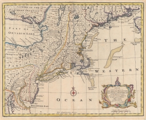
A New and Accurate Map of New Jersey, Pensilvania, New York and New England with the adjacent Countries.
$1,200.00
Acquire
- Digital Map Information
- Suitable for large format printing
- DPI: 600
- File Size: 30.31 MB
- File Type: ZIP / TIFF
- ICC color profile embedded
- Delivered instantly via download link
A 1747 Emmanuel Bowen map of the New England and Middle-Atlantic colonies, covering New Jersey, New York, Pennsylvania, Maine, New Hampshire, and Connecticut. Covering from the Chesapeake Bay to Lake Champlain and Lake Ontario to Nova Scotia, this map exemplifies the successes and failures of 18th-century English mapping in the American colonies. It also makes evident the challenges of the European map publisher in piecing together disparate reports and mappings into a single cohesive cartographic entity. (more details)
Supporting Union Troops.
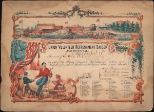
Union Volunteer Refreshment Saloon and Hospital.
$1,100.00
Acquire
- Digital Map Information
- Suitable for large format printing
- File Size: 2.69 MB
- File Type: ZIP / TIFF
- ICC color profile embedded
- Delivered instantly via download link
A unique survival from the American Civil War, this is a c. 1861 James Queen Union Volunteer Refreshment Saloon and Hospital donation certificate. Dating from the American Civil War (1861 - 1865), this certificate commemorates a donation to one of Philadelphia's 'refreshment saloons' in support of Union soldiers. Such saloons fed, housed, and treated hundreds of thousands of Union soldiers en route to and from the front. (more details)
New England during the War of 1812.
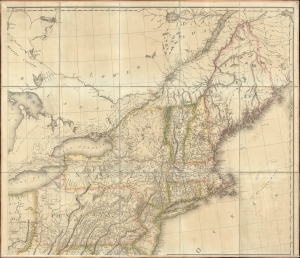
[New England].
$1,000.00
Acquire
- Digital Map Information
- Suitable for large format printing
- File Size: 36.52 MB
- File Type: ZIP / TIFF
- ICC color profile embedded
- Delivered instantly via download link
The northeastern sheet of Pierre Francois Tardieu's 1812 four-sheet map of the United States of America, based on Aaron Arrowsmith's seminal 1796 map of the same. Its publication coincided with the outbreak of the War of 1812 (1812 - 1815). Aside from its aesthetic qualities and level of detail, the map is notable for demonstrating the territorial evolution of the new republic. (more details)
Proof State of a Rare College View.
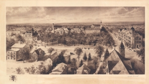
[Dickinson College.]
$1,000.00
Acquire
- Digital Map Information
- Suitable for large format printing
- File Size: 28.7 MB
- File Type: ZIP / TIFF
- ICC color profile embedded
- Delivered instantly via download link
This is a scarce, 1910 Richard Rummell view of Dickinson College, in Carlisle, Pennsylvania. The sepia coloring of this print is consistent with other first editions of Rummell's views. The presence both of the Littig imprint and also Rummell's hand signature reinforces the assessment of this as a first edition. Moreover, the presence of only tracings of the view's title, just discernible in the bottom margin, indicates that it is likely a proof. (more details)
1817 Thomson Map of the Southeastern United States: Georgia, Carolina, Virginia, Tennessee, Kentucky
A young nation looking west.
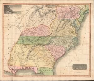
Southern Provinces of the United States.
$950.00
Acquire
- Digital Map Information
- Suitable for large format printing
- DPI: 600
- File Size: 633.59 MB
- File Type: ZIP / TIFF
- ICC color profile embedded
- Delivered instantly via download link
A scarce first edition of John Thomson's 1817 map of the southeastern part of the United States. Thomson prepared this map during a transitional period of expansion shortly following the American Revolutionary War and is among most thorough treatments of this region prior to the U.S. Government Surveys. It records early U.S. efforts to acquire and assimilate American Indian territories west of the Appalachian Mountains. (more details)
Electric railways in Ohio and parts of Indiana and Pennsylvania.
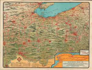
Dell's Electric Railway Map Showing the Various Electric Systems in Operation and Under Construction in Western New York and Pennsylvania, Northern West Virginia, Ohio, Eastern Indiana, and Southern Michigan.
$950.00
Acquire
- Digital Map Information
- Suitable for large format printing
- File Size: 40.77 MB
- File Type: ZIP / TIFF
- ICC color profile embedded
- Delivered instantly via download link
This is a 1907 Dell's Electric Railway chromolithograph map of Ohio, Indiana, and Pennsylvania. Depicting from Indianapolis to Pittsburgh and from Detroit to Louisville, solid red lines trace electric railways currently in operation and dashed red lines mark those under construction. Cities and towns with stations are labeled along the routes, many of which are illustrated with electric train cars. Some networks, particularly around major cities, are extensive and can stretch hundreds of miles, while other rural systems only connect a handful of small towns. Two insets are included in the lower right corner. One illustrates the electric rail network between Syracuse, Buffalo, and Niagara Falls, while the smaller inset focuses on the small network between Shingle House and Salamanca in New York. Stylistically this map is similar to other semi-view style maps issued to promote New England electric railways. (more details)
Philly makes its mark.
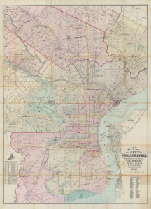
New map of the city of Philadelphia : from the latest city surveys.
$850.00
Acquire
- Digital Map Information
- Suitable for large format printing
- File Size: 53.93 MB
- File Type: ZIP / TIFF
- ICC color profile embedded
- Delivered instantly via download link
A rare 1882 first edition example of John L. Smith's large-scale folding map of Philadelphia. It depicts the city at a time when it was growing quickly and undertaking projects to reflect its size and ambition, such as the enormous new city hall, constructed between 1871 and 1901. (more details)
Pennsylvania Coal Boom!
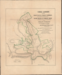
Coal Lands of the Hopewell Iron Works.
$800.00
Acquire
- Digital Map Information
- Suitable for large format printing
- File Size: 15.3 MB
- File Type: ZIP / TIFF
- ICC color profile embedded
- Delivered instantly via download link
This is an unrecorded and likely unique 1853 promotional broadside with significant manuscript annotations, printed by Augustus Köllner for a land auction held in Philadelphia. The land being sold, located in Bedford County in southern Pennsylvania, was rich in coal deposits and historically supplied the Hopewell Furnace, a legendary American ironworks located in Berks County which supplied cannon and other war materials during American Revolution. By this time, the Hopewell Furnace had long ceased to operate, but its valuable coal-land, as here, took on new significance with the emergence of the Industrial Revolution. (more details)
Rare Advertisment for Civil War-era Lithographic Printer
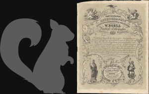
Photographic Lithographic Drawing, Engraving and Printing Office W. Boell Practical Lithographer 311 Walnut Street Philadelphia.
$750.00
Acquire
- Digital Map Information
- Suitable for large format printing
- File Size: 5.15 MB
- File Type: ZIP / TIFF
- ICC color profile embedded
- Delivered instantly via download link
This is a rare and unusual c. 1866 letter sheet trade advertisement for the Philadelphia lithographer William Boell. It reflects the developing sophistication of lithographic printing at the time, including ornate flourishes and cursive text. (more details)
A unique woven silk view of the signing of the Declaration of Independence.
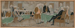
Declaration of Independence July 4th, 1776.
$750.00
Acquire
- Digital Map Information
- Suitable for large format printing
- Full resolution TIFF file
- ICC color profile embedded
- Delivered instantly via download link
This is an 1893 Stevengraph Works woven silk view of the signing of the Declaration of Independence. The view depicts the Continental Congress in Philadelphia signing the Declaration of Independence, with Thomas Jefferson standing in the foreground in a black coat flanked by other members of the Congress. There is some confusion over which painting acts as the view's inspiration, but most believe it to be John Trumbull's monumental painting, which currently hangs in the rotunda of the United States Capitol Building. The silk itself measures 2.5 x 7.25 inches. It is mounted on its original board, which bears the inscription 'Woven in pure silk at the Columbian Exposition, Chicago, 1893, by the Stevengraph Works, Coventry, England. (more details)
Illustrates land reserved for U.S. Soldiers after the American Revolutionary War.
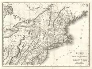
Carte De La Partie Septentrionale Des Etats-Unis.
$600.00
Acquire
- Digital Map Information
- Suitable for large format printing
- DPI: 600
- File Size: 21.41 MB
- File Type: ZIP / TIFF
- ICC color profile embedded
- Delivered instantly via download link
An important and highly detailed 1801 map of the northeastern United States by Pierre Francis Tardieu. The map was issued to a accompany Michel Guillaume de Crevecoeur's Le Voyage dans la Haute Pennsylvania et dans l'État de New-York, one of the most important post-Revolutionary War books about life and economy in the fledgling United States. Coverage extends from Maine to the District of Columbia and west as far as Ohio and the Connecticut Reserve, including modern-day New England, New York, New Jersey, Pennsylvania, and parts of Maryland, Delaware, and West Virginia. The map is notable for its exceptional detail, naming towns and roads, as well as surveyed military tracts intended to compensate Revolutionary War soldiers for their war effort. (more details)
The Roaring Twenties in Philadelphia.
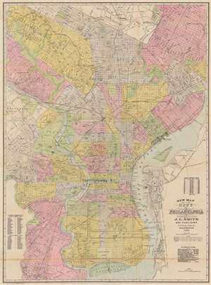
New Map of the City of Philadelphia.
$600.00
Acquire
- Digital Map Information
- Suitable for large format printing
- Full resolution TIFF file
- ICC color profile embedded
- Delivered instantly via download link
This is a 1920 John L. Smith city plan or map of Philadelphia, Pennsylvania, presents a snapshot of the city at the beginning of the 'Roaring Twenties'. Coverage extends from Cheltenham south to League Island Navy Yard and from Haddington east to the U.S. Arsenal on the banks of the Delaware River. Parks, cemeteries, college campuses, the zoological garden, and other open spaces break up Philadelphia's street grid. Streets, identified throughout, appear along with the railroad network, including the Baltimore and Ohio Railroad, and the Pennsylvania Railroad. Wharves along the Delaware River are labeled by owner, including ferries, cargo companies, and railroads. (more details)