
South America (sold)
First detailed, printed map specifically of South America.
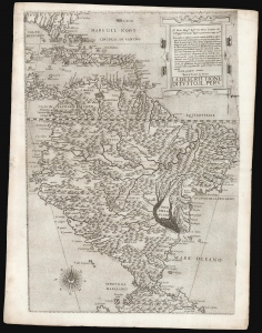
La descrittione di tutto il Peru.
sold
- Digital Map Information
- Suitable for large format printing
- DPI: 600
- File Size: 42.91 MB
- File Type: ZIP / TIFF
- ICC color profile embedded
- Delivered instantly via download link
A superb, untrimmed, first-state example of Paolo Forlani's rare 1562 map of South America. It is the first large-scale, accurate printed map of the southern part of the Americas and is the only map of South America to be produced in the 'Lafreri School' of mapmaking. It is among Forlani's greatest works, and is a prize map not only for collectors of South America in particular, but also the Caribbean, Florida and Bermuda. Through its connection to the 1562 map of Diego Gutiérrez, it offers the most direct available link to contemporaneous Spanish mapping of her American colonies obtainable. (more details)
Unique espionage portrait Paraguay under the Lopez dictatorship.
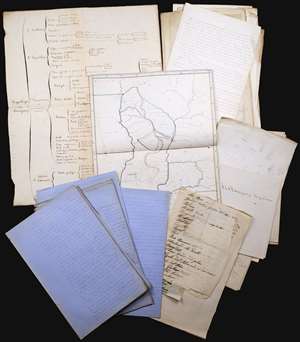
This is an incomparable find: an unpublished manuscript set, dated approximately 1860, consisting of maps, surveys, charts, and research notes pertaining to Paraguay, written by French naval officer and hydrographer Ernest Amédée Barthélemy Mouchez (1821 - 1892). It describes in detail Paraguay's volatile situation under dictator Carlos Antonio López Ynsfrán (née 1792, ruled 1841 - 1862,) whose autocracy set the stage for the disastrous reign of his son, Francisco Solano López Carrillo. (1827 - 1870) (more details)
One of the first dedicated maps of South America, and the first to hint at the location of El Dorado.
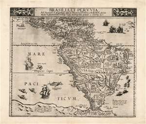
Brasilia et Peruvia.
sold
- Digital Map Information
- Suitable for large format printing
- Full resolution TIFF file
- ICC color profile embedded
- Delivered instantly via download link
This is Cornelis De Jode's 1593 map of South America, the second, full-size map of the area to appear in an atlas, predated only by the 1578 map produced by his father, Gerard De Jode. This rare map, printed in a single edition, outstripped contemporaneous efforts by De Bry and Ortelius in terms of accuracy and beauty. The map covers from Central America and the Caribbean to embrace all of South America; beyond the Strait of Magellan Tierra del Fuego appears, not as a small island or archipelago but extending into a massive 'Terra Australis.' The Amazon River is shown, along with the notation that its denizens practiced cannibalism (Vespucci's sensationalistic description to this effect had long legs; note also the cannibal scene adorning Brazil.) (more details)
A Sumptuous Example of a Rare Map of the Americas and the Pacific
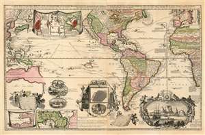
Carte Nouvelle de la Mer du Sud, dressee par Ordre des principaux Directeurs des Memoires les plus recents et des Relations des Navigateurs les plus Modernes.
sold
- Digital Map Information
- Suitable for large format printing
- Full resolution TIFF file
- ICC color profile embedded
- Delivered instantly via download link
A superb example of a rare map, by Hendrik De Leth, presenting the reader with a compendium of European exploration and discovery. Not confined to the Pacific Ocean - as suggested by the title - the map includes richly detailed mapping of the Americas and coastal Africa as well as the Pacific, Southeast Asia, and Australia. Though it is clearly based in part on de Fer's map of 1713 and the 1719 Chatelain, this finely engraved map is easily the match of its predecessors for the elegance of its decorative vignettes. These include - along the bottom center of the map - scenes depicting the manner of turtle-hunting on Pacific Islands, the operation of a sugar mill, gold mining and bird hunting in Mexico, the manner of human sacrifice in mezo America, and a depiction of Cortez destroying Mexican idols. To the lower right is a magnificent scene of the Cape Town settlement, filled with ships and surrounded by a magnificent frame decorated with lions, monkeys, and native figures. (more details)
One of the most beautiful and sumptuously illustrated maps of the 18th century.
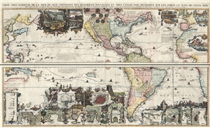
Carte très curieuse de la Mer du Sud, contenant des Remarques Nouvelles et très utiles non seulement sur des Ports et Îles de cette Mer, mais aussy sur les principaux Pays de l'Amerique tant Septentrionale que Méridionale en a été faite.
sold
- Digital Map Information
- Suitable for large format printing
- DPI: 300
- File Size: 52.8 MB
- File Type: ZIP / TIFF
- ICC color profile embedded
- Delivered instantly via download link
One of the most spectacularly decorative maps of the 18th century, this is Henri Chatelain's magnificent 1719 map of the Americas and the Pacific. This sumptuously engraved map is centered on the American continent, but extends west to include all of the pacific ... (more details)
One of the most beautiful and sumptuously illustrated maps of the 18th century.
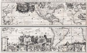
Carte très curieuse de la Mer du Sud, contenant des Remarques Nouvelles et très utiles non seulement sur des Ports et Îles de cette Mer, mais aussy sur les principaux Pays de l'Amerique tant Septentrionale que Méridionale en a été faite.
sold
- Digital Map Information
- Suitable for large format printing
- DPI: 300
- File Size: 76.5 MB
- File Type: ZIP / TIFF
- ICC color profile embedded
- Delivered instantly via download link
One of the most spectacularly decorative maps of the 18th century, this is Henri Chatelain's magnificent 1719 map of the Americas and the Pacific. This sumptuously engraved map is centered on the American continent, but extends west to include all of the pacific ... (more details)
Dramatic Sea of the West.
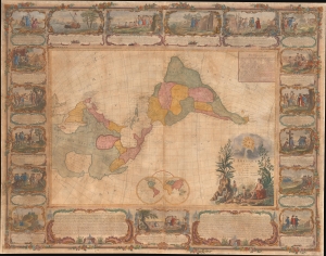
L'Amerique Divisee En Tous Ses Pays Et Etats dressée sur de nouveaux Memoires et sur les derniers Observations.
sold
- Digital Map Information
- Suitable for large format printing
- File Size: 185.45 MB
- File Type: ZIP / TIFF
- ICC color profile embedded
- Delivered instantly via download link
This is a dramatic 1754 east-oriented wall map of the Americas by Jean Janvier and Sebastian G. Longchamps - better known as Voltaire's valet. The dramatic map includes one of cartography's boldest iterations of the Sea of the West. This map appeared at the outset of the French and Indian War (1754 - 1763) and correspondingly details France's bold claims to much of North America. (more details)
A Magnificent, Boldly Decorative Wall Map of the Americas.
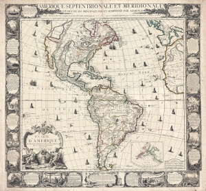
Amerique Septentrionale et Meridionale Divisée en ses Principaux Pais et Subdivisée par Audience. / Nle. Carte D'Amerique Dressée sur les Mémories le plus récens et assujetie aux derniers Observations Astronomiques.
sold
- Digital Map Information
- Suitable for large format printing
- Full resolution TIFF file
- ICC color profile embedded
- Delivered instantly via download link
A rare and highly decorative 1761 French wall map of America issued by Louis Charles Desnos. The map covers all of America, from the northern reaches of Hudson Bay to Tierro del Fuego - which just breaks the lower border. Items of note include a bold depiction of the imaginary Sea of the West (Mer d l'Ouest) and a large 'Lac des Zarayes' in South America. An inset in the lower right details the Pacific Northwest and the Bering Strait, incorporating the Sea of the West with the Apocryphal voyages of Admiral Bartholomew de Fonte and the Chinese legends of an American colony named 'Fusang'. A wealth of ships fill the seas as well as nautical routes by famous explorers. The whole is surrounded by a strikingly engraved border illustrating the indigenous peoples of the Americas - frequently in the processes of martyring missionaries and worshiping idols, but also engaging in trade, fishing, and other more mundane activities. (more details)
Earliest Acquirable map to name 'America'
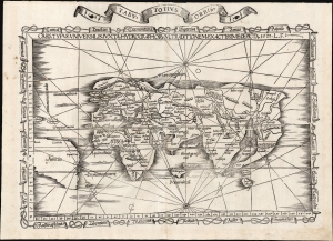
Orbis Typus Universalis Iuxta Hydrographorum Traditionem Exactissime Depicta. 1522 L. F.
sold
- Digital Map Information
- Suitable for large format printing
- File Size: 17.38 MB
- File Type: ZIP / TIFF
- ICC color profile embedded
- Delivered instantly via download link
This is Lorenz Fries' 1522 map of the world in its 1535 edition: a key discovery-era document, being the second earliest acquirable printed map to name 'America' (appearing here in South America). (more details)
Earliest Acquirable use of 'America' on a map.
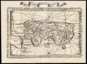
Orbis Typus Universalis Iuxta Hydrographorum Traditionem Exactissime Depicta. 1522 L. F.
sold
- Digital Map Information
- Suitable for large format printing
- File Size: 19.83 MB
- File Type: ZIP / TIFF
- ICC color profile embedded
- Delivered instantly via download link
This is a superb example of Lorenz Fries's 1522 map of the world in its 1535 edition: a key discovery-era document, being the second earliest, acquirable, printed map to name 'America' (appearing here in South America). (more details)
One-of-a-Kind Manuscript of The Banda Oriental and the Captaincy of Rio Grande de São Pedro.
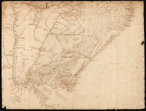
[Untitled Manuscript Map of Uruguay and the Banda Oriental.]
sold
- Digital Map Information
- Suitable for large format printing
- DPI: 600
- File Size: 33.21 MB
- File Type: ZIP / TIFF
- ICC color profile embedded
- Delivered instantly via download link
This is a meticulous c. 1753 manuscript map of the Banda Oriental, the region that became Uruguay, as well as parts of neighboring Argentina and southern Brazil. The anonymous Portuguese author likely penned the map after the 1750 Treaty of Madrid, which fixed the border between Spanish and Portuguese territory along the Uruguay River. (more details)
Revelatory map of the Americas.
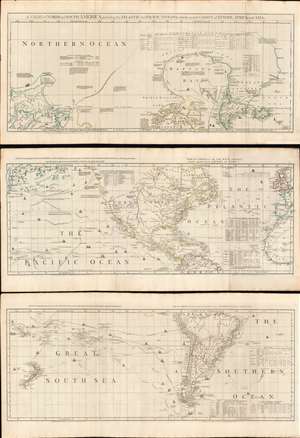
A Chart of North and South America, including the Atlantic and Pacific Oceans, with the nearest Coasts of Europe, Africa, and Asia.
sold
- Digital Map Information
- Suitable for large format printing
- Full resolution TIFF file
- ICC color profile embedded
- Delivered instantly via download link
A wonderful 1775 map of the Americas or Western Hemisphere by John Green, also known as Braddock Mead. The map in fact consists of three related maps covering, from top: Canada and the Arctic; the modern day United States, Central America, and the West Indies; and South America. The map is a masterpiece of late 18th century cartography by one of the least understood and most controversial cartographers of his age. Mead composed the map in protest to what he believed to be the flagrantly spurious and irresponsible speculative cartography of Frenchmen Joseph-Nicolas De l'Isle (1688 - 1768) and Phillipe Buache (1700 - 1773). (more details)
Only know example of George Thompson's 1799 broadside map of the Americas.
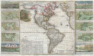
New Map of America divided into its Kingdoms, States, Governments and other Subdivisions, from the latest observations.
sold
- Digital Map Information
- Suitable for large format printing
- DPI: 300
- File Size: 24.5 MB
- File Type: ZIP / TIFF
- ICC color profile embedded
- Delivered instantly via download link
An exceptionally rare separately issued 1799 broadside map of America by the English printer and mapmaker George Thompson. Thompson's map covers the Americas from the Arctic Circle (Arctic Land) to Tierra de Fuego and Cape Horn. It extends westward into the ... (more details)
Reconciling New Discovery with Ptolemy.
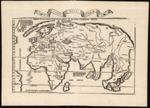
Tabu. Nova Orbis.
sold
- Digital Map Information
- Suitable for large format printing
- Full resolution TIFF file
- ICC color profile embedded
- Delivered instantly via download link
A superb example of Lorenz Fries's 1522 map of the world. This is one of the great Discovery-Era world maps, capturing the impact of contemporary exploration on the late-Roman cartographic models of Ptolemy. (more details)
Extremely Rare: the first detailed map of the Republic of Uruguay.
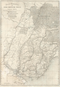
Carta Geografica del Estado Oriental del Uruguay y Posesiones Adyacentes Trazada segun los documentes mas recentes y exactes.
sold
- Digital Map Information
- Suitable for large format printing
- DPI: 600
- File Size: 83.16 MB
- File Type: ZIP / TIFF
- ICC color profile embedded
- Delivered instantly via download link
This is an extremely rare, separately issued lithograph 1841 map of the Republic of Uruguay during the early years of Uruguay's Independence and civil war. It was published in Paris on behalf of the French diplomat, Aimé Roger, and can be considered the first, detailed map of the independent Republic. (more details)
One of the Most Informative American Maps of its Period.
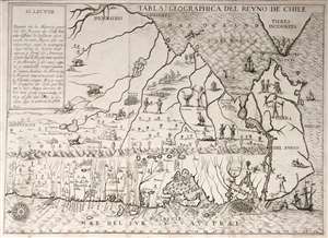
Tabla Geographica del Reyno de Chile.
sold
- Digital Map Information
- Suitable for large format printing
- Full resolution TIFF file
- ICC color profile embedded
- Delivered instantly via download link
This is an extremely rare Spanish edition of Alonso de Ovalle's map of Chile - arguably the most important early map of Chile, as it is the first printed map of the region produced by someone who actually lived there. it was published to illustrate Ovalle's Historia relacion del Reyno de Chile, the first history of that country. This Spanish edition of the map is significantly rarer than the Italian edition of the same year - we see no separate examples of the map in institutional collections. (more details)
Scarce Map of La Plata.
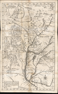
Descripción de las Provincias del Chaco, y confinantes segun las relaciones modernas, y noticias aquiridas por diversas entradas de los Missioneros de la Companía de Iesus que se han hecho en este siglo de 1700.
sold
- Digital Map Information
- Suitable for large format printing
- File Size: 14.5 MB
- File Type: ZIP / TIFF
- ICC color profile embedded
- Delivered instantly via download link
This rare 1733 Pedro Lozano map of central South America, engraved by Giovanni Petroschi, is the first appearance of Antonio Machoni's amendments to Juan Francisco D’Avila's foundational map of the La Plata region. These changes were made both to the Chaco region on the west bank of the Paraguay River (the location of Machoni's missionary work) and the southern coast of what would become Uruguay. The region was a key theatre of Jesuit missionary activity; consequently, the Jesuits produced the first accurate maps of the complex river systems emptying into the Rio de la Plata. The present work illustrates the process of revision over the 18th century, with the contributions of key cartographers and missionaries. (more details)
'Away! to the wilds of the far, far, west,
Which the foot of man hath never prest...'
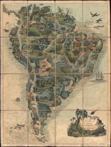
Wallis's New Game of Wanderers in the Wilderness.
sold
- Digital Map Information
- Suitable for large format printing
- File Size: 38.13 MB
- File Type: ZIP / TIFF
- ICC color profile embedded
- Delivered instantly via download link
This is Edward Wallis' striking 1844 gameboard and map of South America. The game encourages players to explore the flora and fauna of the continent, which the British public would have imagined as wild and untamed. (more details)
Richly Detailed Brazilian Manuscript from the War of the Triple Alliance
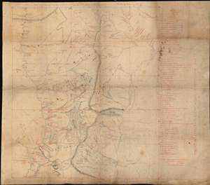
Esboco do Theatro das Operacoes das Cordilheiras do e do Norte do Paraguay organisado pela Commisao d'Engenheiros. V. do Rosario Febereiro de 1870
sold
- Digital Map Information
- Suitable for large format printing
- File Size: 50.08 MB
- File Type: ZIP / TIFF
- ICC color profile embedded
- Delivered instantly via download link
This is a one-off manuscript map of the border region between Paraguay and Brazil, a mountainous region northeast of Asunción, Paraguay, and the main theatre of war during the Paraguayan War (also known in Paraguay as The Great War) between 1864 and 1870. ... (more details)
Guide to the Golden Age of Piracy. Full old color.
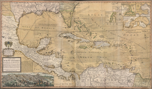
A Map of the West-Indies or the Islands of America in the North Sea; with ye adjacent Countries; explaining what belongs to Spain, England, France, Holland etc. also ye Trade Winds, and ye several Tracts made by ye Galeons and Flota from place to place. According to ye newest and most exact observations, by Herman Moll, Geographer.
sold
- Digital Map Information
- Suitable for large format printing
- Full resolution TIFF file
- ICC color profile embedded
- Delivered instantly via download link
Published in 1726, this is an early printing of Herman Moll's superb map of the West Indies, Caribbean, Gulf of Mexico, Mexico, and the Spanish Main - with full old color. Monumental in proportion, rich in descriptive text, and exhaustive in its attention to detail, this map is best understood as a guide to English piracy and privateering in the West Indies. Moll, most likely through his acquaintance with pirates William Dampier and Woodes Rogers, offers a wealth of information on the traffic of silver bearing Spanish treasure fleets en route from the Mexican port of Veracruz, through the islands, to Spanish ports in Europe. (more details)
An highly influential and often under appreciated map. Second American commercial map published as a foreign National Map. Map that led to the bankruptcy of the Colton firm and contributed to the rise of the Johnson firm.
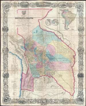
Mapa de la Republica de Bolivia mandado publicar pr el Gobierno de la Nacion en la Administracion del Presidente Doctor José Maria Linares... Levantado y organindo en los años de 1842 à 1859 Por el Teniente Coronel Juan Ondarza, Commandante Juan Mariano Mujia y Mayor Lucio Camacho.
sold
- Digital Map Information
- Suitable for large format printing
- File Size: 91.32 MB
- File Type: ZIP / TIFF
- ICC color profile embedded
- Delivered instantly via download link
A magnificent and important map of extreme and often underappreciated multilevel significance; this is J. H. Colton and Juan Ondarza Lara's great national map of Bolivia. This map is highly significant and influential on a number of levels, any of ... (more details)
First specific map to reveal America as separate continent. First European map to show Japan. First map to identify the Pacific Ocean.

Die neuwen inseln so hinder Hispanien gegen Orient bey dem land Indie ligen.
sold
- Digital Map Information
- Suitable for large format printing
- Full resolution TIFF file
- ICC color profile embedded
- Delivered instantly via download link
A fine 1554 example of Sebastian Munster's map of America or the New World. This is one the earliest and most influential obtainable maps of the Americas. This is the first specific published map to reveal all of North and South America in clear ... (more details)
Earliest published sea chart focusing on the California coast!
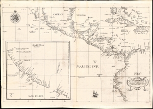
Carta prima generale d'America dell'India Occidentale e Mare del Zur.
sold
- Digital Map Information
- Suitable for large format printing
- File Size: 22.42 MB
- File Type: ZIP / TIFF
- ICC color profile embedded
- Delivered instantly via download link
This is the 1646 first state of Robert Dudley's chart of the middle part of the Americas, illustrating the proximity of the Caribbean Sea and the Pacific Ocean and emphasizing the narrow parts of Central America dividing the two bodies of water. The chart features the western part of the Caribbean, but it is particularly noted for being the first printed sea chart to focus on the Pacific coast, including California. It is, along with Dudley's more narrowly focused charts, the first printed chart of the West Indies and South Florida to employ the Mercator Projection. An inset chart in the lower left focuses specifically on the coast of California, from Baja to Cap Mendocino. (more details)
First specific map to reveal America as separate continent. First map to identify the Pacific Ocean.
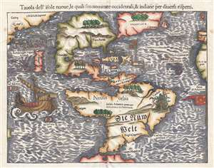
Tavola dell'isole nuove, le quali son nominate occidentali, et indiane per diversi rispetti.
sold
- Digital Map Information
- Suitable for large format printing
- DPI: 300
- File Size: 4.95 MB
- File Type: ZIP / TIFF
- ICC color profile embedded
- Delivered instantly via download link
This is a scarce 1558 Italian edition of Sebastian Münster's map of America, the first printed map of the Western Hemisphere. The map first appeared in Münster’s 1540 edition of Ptolemy's Geographia, one of the earliest versions of the classical work to systematically include maps showing contemporary geographical knowledge. Beginning in 1544 it would be included in Münster’s magnum opus, Cosmographia Universalis, which for over forty years would be the primary source of information for anyone who wished to know about the rest of the world: consequently this map would have had a disproportionate impact, providing the first glimpse of the New World to literate laypeople in Europe nearly half a century. (more details)
Outstanding 1849 broadside promoting routes the California Gold Rush.
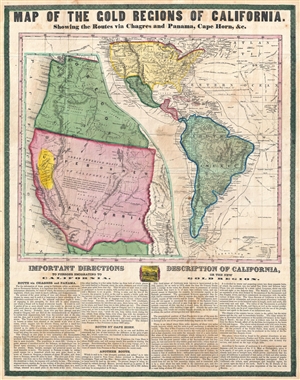
Map of the Gold Regions of California. Showing the Routes via Chagres and Panama, Cape Horn, & c.
sold
- Digital Map Information
- Suitable for large format printing
- DPI: 300
- File Size: 14.37 MB
- File Type: ZIP / TIFF
- ICC color profile embedded
- Delivered instantly via download link
A rare and remarkable example of Ensign and Thayer's 1849 promotional broadside map illustrating routes to and from the California Gold Fields. 'Forty-Niners' traveling across the continent to California faced a daunting and dangerous voyage. ... (more details)
American published Bolivian National Map.
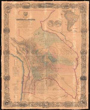
Mapa de la Republica de Bolivia mandado publicar pr el Gobierno de la Nacion en la Administracion del Presidente Doctor José Maria Linares... Levantado y organindo en los años de 1842 à 1859 Por el Teniente Coronel Juan Ondarza, Commandante Juan Mariano Mujia y Mayor Lucio Camacho.
sold
- Digital Map Information
- Suitable for large format printing
- File Size: 216.5 MB
- File Type: ZIP / TIFF
- ICC color profile embedded
- Delivered instantly via download link
A magnificent and important map of extreme significance, this is J. H. Colton and Juan Ondarza Lara's great 1859 national map of Bolivia. This map is highly significant and influential on multiple levels. First, it is the largest and most important map of Bolivia to appear in the 19th century. Second, it is the second national map produced by an American commercial publisher, J. H. Colton, at the behest of a foreign government. Third, (and unfortunately) Colton was never paid for this map, which forced him into bankruptcy in 1859 and thus into a business arrangement with A. J. Johnson, whose use of Colton's map plates catalyzed his rise to become, for a time, the world's largest map publisher. (more details)
American published Bolivian National Map.
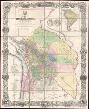
Mapa de la Republica de Bolivia mandado publicar pr el Gobierno de la Nacion en la Administracion del Presidente Doctor José Maria Linares... Levantado y organindo en los años de 1842 à 1859 Por el Teniente Coronel Juan Ondarza, Commandante Juan Mariano Mujia y Mayor Lucio Camacho.
sold
- Digital Map Information
- Suitable for large format printing
- Full resolution TIFF file
- ICC color profile embedded
- Delivered instantly via download link
A magnificent map of extreme significance, this is J. H. Colton and Juan Ondarza Lara's great 1859 national map of Bolivia. This map is highly significant and influential on multiple levels. First, it is the largest and most important map of Bolivia to appear in the 19th century. Second, it is the second national map produced by an American commercial publisher, J. H. Colton, at the behest of a foreign government. Third, (and unfortunately) Colton was never paid for this map, which forced him into bankruptcy in 1859 and thus into a business arrangement with A. J. Johnson, whose use of Colton's map plates catalyzed his rise to become, for a time, the world's largest map publisher. (more details)
Sole known example of this grand view of Montevideo.
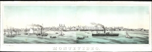
Montevideo.
sold
- Digital Map Information
- Suitable for large format printing
- File Size: 38.11 MB
- File Type: ZIP / TIFF
- ICC color profile embedded
- Delivered instantly via download link
An astonishing survival, this beautiful, grand lithograph is the sole recorded example of Luciano Mége's c. 1862 panoramic view of the capital of Uruguay, Montevideo. It is one of the earliest, if not the earliest, views of the city that was printed in Montevideo. (more details)
The first accurate map of the La Plata Basin w/manuscript letter calling for French colonization.
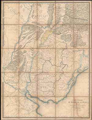
Carte Générale du Bassin de La Plata Dressée d'après des documents recueillis sur les lieux, et les milleurs plans partiels de cette contrée par m. Coffinières, Lt. Cnel. du Génie.
sold
- Digital Map Information
- Suitable for large format printing
- Full resolution TIFF file
- ICC color profile embedded
- Delivered instantly via download link
A fascinating 1853 Grégoire-Gaspard-Félix Coffinières map of the La Plata Basin, covering parts of modern-day Argentina, Uruguay and Paraguay. When it was issued, in 1853, this was by far the finest map of the territory lying north of the Rio de la Plata and east of the Paraná River yet produced. It was the product of French colonial ambitions and, appropriately, features manuscript shading and annotation in French highlighting the highly desirable yet only tenuously claimed Misiones region. This is supplemented by a three-page manuscript report in French describing the bounty of the Misiones region and calling for 'European' (no doubt 'French') occupation and development. (more details)
Guide to the Golden Age of Piracy.
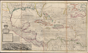
A Map of the West-Indies or the Islands of America in the North Sea; with ye adjacent Countries; explaining what belongs to Spain, England, France, Holland etc. also ye Trade Winds, and ye several Tracts made by ye Galeons and Flota from place to place. According to ye newest and most exact observations, by Herman Moll, Geographer.
sold
- Digital Map Information
- Suitable for large format printing
- File Size: 59.66 MB
- File Type: ZIP / TIFF
- ICC color profile embedded
- Delivered instantly via download link
Published in 1726, this is an early printing of Herman Moll's superb map of the West Indies, Caribbean, Gulf of Mexico, Mexico, and the Spanish Main. Monumental in proportion, rich in descriptive text, and exhaustive in its attention to detail, this map is best understood as a guide to English piracy and privateering in the West Indies. Moll, most likely through his acquaintance with pirates William Dampier and Woodes Rogers, offers a wealth of information on the traffic of silver bearing Spanish treasure fleets en route from the Mexican port of Veracruz, through the islands, to Spanish ports in Europe. (more details)
An highly influential and often underappreciated map. First American commercial map published as a foreign National Map. Map that led to the bankruptcy of the Colton firm and contributed to the rise of the Johnson firm.
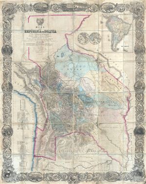
Mapa de la Republica de Bolivia mandado publicar pr el Gobierno de la Nacion en la Administracion del Presidente Doctor José Maria Linares... Levantado y organindo en los años de 1842 à 1859 Por el Teniente Coronel Juan Ondarza, Commandante Juan Mariano Mujia y Mayor Lucio Camacho.
sold
- Digital Map Information
- Suitable for large format printing
- File Size: 24.31 MB
- File Type: ZIP / TIFF
- ICC color profile embedded
- Delivered instantly via download link
A magnificent and important map of extreme and often underappreciated multilevel significance; this is J. H. Colton and Juan Ondarza's great map of Bolivia. This map is highly significant and influential on a number of levels, any of which ... (more details)
Historical Justifications for Argentinian Territorial Claims in La Plata.
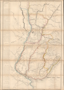
Carta esferica de la confederacion Argentina y de las republicas del Uruguay y del Paraguay.
sold
- Digital Map Information
- Suitable for large format printing
- File Size: 47.3 MB
- File Type: ZIP / TIFF
- ICC color profile embedded
- Delivered instantly via download link
This is the sole edition of Jose Maria Cabrer's 1826 map of the Argentine Confederation, Paraguay, and Uruguay, based on his surveys executed between 1777 and 1802. Despite its excellence, it was not published during the author's lifetime and did not appear in print before this Paris edition of 1853. The original manuscript has not survived. Cabrer, a Spanish military engineer, had been assigned to survey the borders of the Spanish and Portuguese empires in South America following the 1777 Treaty of Ildefonso; the present work encapsulates two decades of arduous, well-respected surveys, compiled 'unofficially' by Cabrer in 1802. (more details)