
South America
Spectacular 18th century wall map published during the American Revolution.
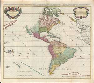
L'Amérique divisée en septentrionale et méridionale subdivisée en ses principales parties. / L'Amérique divisée en ses principales parties sçavoir dans la Septentrionale les Terres Arctiques, le Canada ou Nouvelle France, la Floride, la Nouvelle Espagne et le Nouveau Mexique ; dans la Méridionale la Terre Ferme, le Pérou, le Chili, la Terre Magellanique, le Paraguay, le Brésil. Les isles de Terre Neuve, Antilles, Magellaniques et de Californie.
$9,000.00
Acquire
- Digital Map Information
- Suitable for large format printing
- Full resolution TIFF file
- ICC color profile embedded
- Delivered instantly via download link
A spectacular 1782 wall map of North America and South America issued at the height of the American Revolutionary War, by Louis Charles Desnos, after Alexis-Hubert Jaillot. The map captures French ambitions to reclaim its American territories in the wake of the American Revolution. It also features the wealth of cartographic speculation of the era, including an unexplored Pacific Northwest and Arctic. The lower quadrants also reveal vestiges of the 16th century Terre Australis - the mythical southern continent disproven by Cook's first two voyages (His third voyage returned in 1880, but information about its discoveries had not yet been disseminated). (more details)
First Swedish printed description of the Americas.
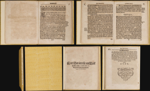
This rare volume is the first and only edition of Ambrosius Svenonis Nidelberg's 1675 description of the New World: it is the earliest substantial Swedish printed work pertaining to America. Sabin described it as 'one of the scarcest of the Swedish typographical productions of the seventeenth century on America.' The work is both geographical and ethnographic: it is the first Swedish description of North America's indigenous population. In particular, it is the first Swedish description of the English colonies in Bermuda and Virginia. (more details)
Second earliest, and earliest obtainable scientific map of the Galapagos.
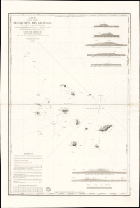
Carte d'une Partie de L'Archipel des Galapagos Levée et dressée en 1838 à bord de la Vénus...
$7,500.00
Acquire
- Digital Map Information
- Suitable for large format printing
- File Size: 2032.23 MB
- File Type: ZIP / TIFF
- ICC color profile embedded
- Delivered instantly via download link
An extraordinary discovery, this is Urbain Dortet de Tessan's 1842 nautical map of the Galapagos Islands, considered the second scientific map of the Galapagos. The map is the result of survey work performed in July of 1836 on the westward circumnavigation of the Vénus under Admiral Abel Aubert Dupetit-Thouars. The Vénus's visit to the Galapagos followed Darwin by just one year, and thus Beagle hydrographer Robert Fitzroy's contemporaneous mapping of the archipelago. This chart, published in 1842, and Fitzroy's chart, published in 1841, constitute the first comprehensive nautical overview of the islands and are comparable in both rarity and significance. (more details)
Earliest published sea chart focusing on the California coast!
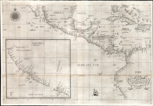
Carta prima generale d'America dell'India Occidentale e Mare del Zur.
$7,000.00
Acquire
- Digital Map Information
- Suitable for large format printing
- File Size: 26.19 MB
- File Type: ZIP / TIFF
- ICC color profile embedded
- Delivered instantly via download link
This is the 1646 first state of Robert Dudley's chart of the middle part of the Americas, illustrating the proximity of the Caribbean Sea and the Pacific Ocean and emphasizing the narrow parts of Central America dividing the two bodies of water. The chart features the western part of the Caribbean, but it is particularly noted for being the first printed sea chart to focus on the Pacific coast, including California. It is, along with Dudley's more narrowly focused charts, the first printed chart of the West Indies and South Florida to employ the Mercator Projection. An inset chart in the lower left focuses specifically on the coast of California, from Baja to Cap Mendocino. (more details)
Diplomat's synthesis of Paraguayan Geography.
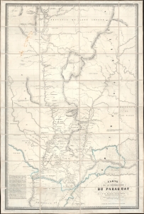
Carte de la Républiuque Du Paraguay dédiée et présentée à sa Majesté Napoléon III Empereur des Français, par le Comte Lucien de Brayer Consul de France au Paraguay. Publiée pat en 1863.
$7,000.00
Acquire
- Digital Map Information
- Suitable for large format printing
- File Size: 62.01 MB
- File Type: ZIP / TIFF
- ICC color profile embedded
- Delivered instantly via download link
This is an extremely rare 1863 map of Paraguay, produced by Alfred Lucien de Brayer, Napoleon III of France's consul to the South American country. It was published to commemorate the 10th year of France's diplomatic recognition of Paraguay's independence and probably as an attempt to bolster de Brayer's damaged reputation with the Emperor. The map is superbly detailed, laying out Paraguay and its frontier regions. It details the administrative regions within the country; neighboring indigenous tribes and nations are noted, as well as the bordering regions of Brazil and Argentina. (more details)
A diplomat's synthesis of Paraguayan Geography.
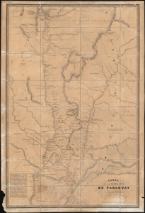
Carte de la Républiuque Du Paraguay dédiée et présentée à sa Majesté Napoléon III Empereur des Français, par le Comte Lucien de Brayer Consul de France au Paraguay.. Publiée pat en 1863.
$7,000.00
Acquire
- Digital Map Information
- Suitable for large format printing
- File Size: 214.29 MB
- File Type: ZIP / TIFF
- ICC color profile embedded
- Delivered instantly via download link
This is an extremely rare 1863 map of Paraguay, produced by Alfred Lucien de Brayer, Napoleon III of France's consul to the South American country. It was published to commemorate the 10th year of France's diplomatic recognition of Paraguay's independence, and probably as an attempt to bolster de Brayer's damaged reputation with the Emperor. The map is superbly detailed, laying out Paraguay and its frontier regions. It details the administrative regions within the country; neighboring indigenous tribes and nations are noted as well as the bordering regions of Brazil and Argentina. (more details)
Baroque Masterpiece in the Mapping of America.
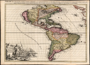
L'Amerique selon les Nouvelles Observations de Messrs. de l'Academie des Science, etc./ America in Praecipuas ipsius Partes Distributa, ad Observationes Academiae Regiae Scientiarum, et Exquisitissimas Tabulas, quae nunquam Antehac Lucem Viderunt, Excusa A Francisco Halma, Cum privilegio Ordinum Hollandiae et Westfrisiae.
$6,000.00
Acquire
- Digital Map Information
- Suitable for large format printing
- Full resolution TIFF file
- ICC color profile embedded
- Delivered instantly via download link
This is the rare first state of François Halma's c. 1699 separately-issued map of America. Its unusually large folio size, bold and sophisticated engraving, and rich original color set this map apart as one of the most beautiful late-17th-century maps of the Americas available to the collector. It dramatically presents some of the most notable geographic ideas of its era, including a prominent insular California after the Sanson model. The Great Lakes and the course of the Mississippi, as well as the rest of the American coastline, closely resembles that of Nicolas de Fer's 1699 L'Amerique. (more details)
After the Revolution.
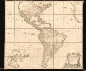
L'Amérique Septentrionale et Méridionale divisée suivant ses différens pays.
$4,500.00
Acquire
- Digital Map Information
- Suitable for large format printing
- Full resolution TIFF file
- ICC color profile embedded
- Delivered instantly via download link
A spectacularly presented c. 1787 Charles-François Delamarche / Robert de Vaugondy map of America. The map reflects the ephemeral political comportment of North America shortly after the American Revolutionary War (1775 - 1783). In South America, it illustrates the complex balance of territories, missions, and indigenous cultures that, within a decade, would give way to an extended period of conflict, wars of liberation, and civil strife. The beautifully presented map is laid down on unusual patterned linen and set into a fine royal blue slipcase with gold gilt tooling. (more details)
Futuristic city of Anarchy, with a death ray.
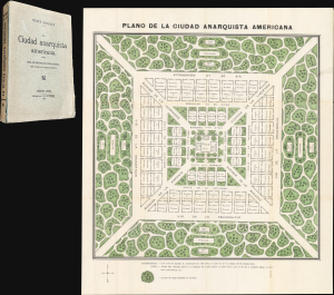
La Ciudad Anarquista Americana. / La Ciudad Anarquista Americana: Obra de Construcción Revolucionaria.
$3,750.00
Acquire
- Digital Map Information
- Suitable for large format printing
- Full resolution TIFF file
- ICC color profile embedded
- Delivered instantly via download link
This is a rare 1914 color-printed folding plan of French-Argentine Pierre Quiroule's Ciudad Anarquista Americana, a cartographic vision of an ideal anarchist city. Conceived as the physical setting for Quiroule's revolutionary utopian novel, La Ciudad Anarquista Americana: Obra de Construcción Revolucionaria, the plan translates radical political and social philosophy into a rigorously ordered urban landscape of monumental avenues, communal institutions, gardens, schools, and public gathering places. (more details)
Matched pair of beautiful, large maps of the Americas.
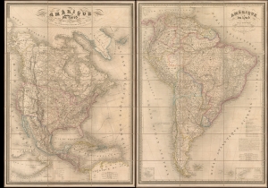
Amérique du Nord. / Amérique du Sud.
$3,500.00
Acquire
- Digital Map Information
- Suitable for large format printing
- Full resolution TIFF file
- ICC color profile embedded
- Delivered instantly via download link
This is a beautiful 1851 pair of A. H. Dufour large-format folding maps of North America and South America, presented together in an original slipcase. The North America map captures an ephemeral look at the Transmississippi in the year after the Treaty of Guadalupe Hidalgo - including a most unusual mapping of the borders of Texas.The South America map shows the political divisions just prior to the Platine War, between the Empire of Brazil and the Argentine Confederation. (more details)
By the greatest German cartographer of the 19th century.
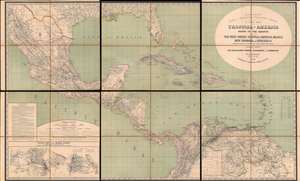
H. Kiepert's Karte des Nördlichen Tropischen America. A New Map of Tropical - America North of the Equator Comprising the West - Indies, Central - America, Mexico, New Cranada and Venezuela.
$3,500.00
Acquire
- Digital Map Information
- Suitable for large format printing
- Full resolution TIFF file
- ICC color profile embedded
- Delivered instantly via download link
This is a large and impressive 1858 map of Florida, the Gulf of Mexico, Central America, the West Indies, and northern South America, compiled by Heinrich Kiepert, the greatest German cartographer of the 19th century. The map presents the region in detail, with color coding to differentiate between countries and a key situated in the lower left. (more details)
Classic Dutch Map of the Caribbean.
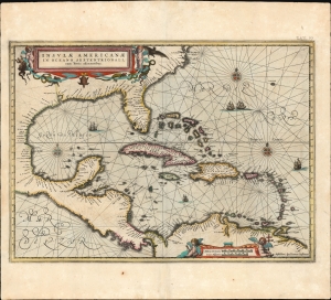
Insulae Americanae in Oceano Septentrionali cum Terris adiacentibus.
$3,000.00
Acquire
- Digital Map Information
- Suitable for large format printing
- Full resolution TIFF file
- ICC color profile embedded
- Delivered instantly via download link
This is a beautiful 1637 example of Jan Jansson's 1636 map of the Caribbean Islands and the adjacent coastlines of North and South America. It is among the most beautiful maps of the region produced in the first half of the 17th century. Moreover, the present example is in superb condition with gorgeous, bright original color. (more details)
Bowles's map of the Americas before American independence.
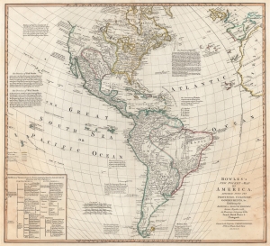
Bowles's New Pocket-Map of America, Divided into its Provinces, Colonies, Governments, etc. Exhibiting the British and Spanish Empires therein; Together with the Territories belonging to the French, Dutch, Danes, and Portuguese.
$2,950.00
Acquire
- Digital Map Information
- Suitable for large format printing
- DPI: 600
- File Size: 48.74 MB
- File Type: ZIP / TIFF
- ICC color profile embedded
- Delivered instantly via download link
This is a c. 1780 Carington Bowles map of North America and South America. The map depicts the increasingly complex and unstable political situation following the French and Indian War (1754 - 1763). It also highlights French and English ambitions for an inland Northwest Passage via Hudson Bay and speculations about a 'Sea of the West' dominating the Pacific Northwest - one of the last and greatest cartographic myths of the 18th century. (more details)
Russian Interest in the Americas.
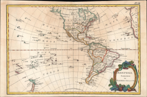
Америка раздѣленная на главныя области / [America Divided into Its Main Regions].
$2,800.00
Acquire
- Digital Map Information
- Suitable for large format printing
- File Size: 11.78 MB
- File Type: ZIP / TIFF
- ICC color profile embedded
- Delivered instantly via download link
This is a 1793 Russian-language map of the Americas produced for the 'New Atlas' (Novyy Atlas / Новый атлас), an important work that made the latest French cartography available to a Russian audience. (more details)
Earliest specific map of Brazil.
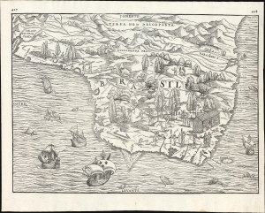
[Brasil].
$2,500.00
Acquire
- Digital Map Information
- Suitable for large format printing
- File Size: 13.62 MB
- File Type: ZIP / TIFF
- ICC color profile embedded
- Delivered instantly via download link
This is Giovanni Battista Ramusio's scarce 1565 map of Brazil, the first printed map to focus specifically on the area. It first appeared in Ramusio's 1556 Navigationi et Viaggi, the first collection of explorers' first-hand accounts of their travels. The woodcut represents the first specific glimpse, in print, of Brazil. While the map's geographical information is frequently credited to Giacomo Gastaldi (1500 - 1566), Ramusio's map is far more likely to have been drawn from his own French sources. (more details)
Northwest Passage - Reconciling fact, fiction, and wishful thinking.
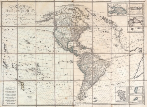
Carte de l'Amérique Septentrionale et Meridionale, ou se trouveur les Trois Voyages de Cook et Ceux de MacKenzie, Vancouver et La Perouse, Parry et Franklin, Dresée par Herisson, eleve de Bonne, ancien Ingénieuo hydrographe de la Marine.
$2,500.00
Acquire
- Digital Map Information
- Suitable for large format printing
- Full resolution TIFF file
- ICC color profile embedded
- Delivered instantly via download link
A most unusual and intriguing 1833 wall map of America by Eustache Hérisson. The map makes a number of interesting and curious claims regarding multiple possibilities for a Northwest Passage - attempting to reconcile factual discovery, with apocryphal popular legends, and outright wishful thinking. It covers the western hemisphere, focusing on North and South America, and the surrounding oceans. Full coverage extends east to include the coasts of Europe and Africa, and west as far as New Caledonia and New Hebrides. As the title suggests, tracks follow the maritime routes of important explorers, including Cook, Vancouver, La Perouse. The map also notes the overland expeditions of Mackenzie (1780) and Hearne (1772). Further north, the 1819 - 1820 discoveries of William Edward Parry, and John Franklin's 1819 Coppermine Expedition and 1823 Mackenzie River Expeditions are noted. (more details)
Argentina's Population, Railway, and Agriculture Boom.
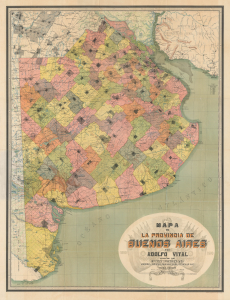
Mapa de la Provincia de Buenos Aires.
$2,500.00
Acquire
- Digital Map Information
- Suitable for large format printing
- File Size: 110.63 MB
- File Type: ZIP / TIFF
- ICC color profile embedded
- Delivered instantly via download link
This is a large-format 1910 chromolithograph map of Buenos Aires Province in Argentina, prepared by Adolfo Vital and published by Guillermo van Woerden to coincide with the Argentinian Centennial. It documents the province at a time of rapid immigration, expansion of railways, and increased agricultural output. (more details)
From Imperial to Republican Capital.
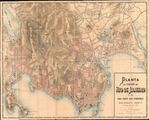
Planta da Cidade do Rio de Janeiro e de Uma Parte dos Suburbios.
$2,500.00
Acquire
- Digital Map Information
- Suitable for large format printing
- Full resolution TIFF file
- ICC color profile embedded
- Delivered instantly via download link
This is the rare 1891 large-scale edition of Eduardo Maschek's map of Rio de Janeiro, considered the best map to illustrate the liminal moment between the city's prominence as an old imperial capital and its emergence as a modern economic powerhouse. The map captures Rio on the brink of modernization when, flush with American and European capital, it embarked on large-scale infrastructure and urban development. Archaeologists and historians have used this map, preserved at the Biblioteca Luso-Brasileira, to rediscover lost monuments of Rio de Janeiro's past, from forgotten neighborhoods to vanished hippodromes. (more details)
Rare Early State of an Elegant, French Map of the Western Hemisphere

L'Amerique, meridionale, et septentrionale Dressée selon les Dernieres Relations et suivant les Nouvelles Decouvertes dont les pounts prin= cipaux sont placez sur les Observations de Mrs. de l'Academie Royale des Sciences.
$2,500.00
Acquire
- Digital Map Information
- Suitable for large format printing
- Full resolution TIFF file
- ICC color profile embedded
- Delivered instantly via download link
This is Nicolas de Fer's 1699 map of America, in a lovely old color example of the second state, printed in 1705. Both of the first two states of this map were separately issued, and are consequently rare. This detailed and richly annotated map, derived from De Fer's own 1698 L'Amerique Divisée Selon Letendue de set Principales Parties, shows the Americas during a period in which France was dominant in the exploration and mapping of North America. Its superb engraving is the work of Harmanus Van Loon, who also engraved De Fer's larger-scale work. (more details)
First Scientific Mapping of the Andes.
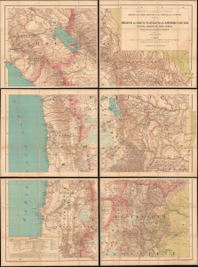
Régions des Hauts-Plateaux de l'Amérique du Sud (Bolivie, Argentine, Chili, Pérou) parcourues par la mission française. Carte dressée par V. Huot, d'après les travaux des membres de la mission, les sources originales inédites et les documents les plus récents.
$2,200.00
Acquire
- Digital Map Information
- Suitable for large format printing
- Full resolution TIFF file
- ICC color profile embedded
- Delivered instantly via download link
This is a scarce, monumental map of the South American highlands of Bolivia, Argentina, Chile, and Peru. The map was executed by the cartographer Victor Huot in 1905 based on extensive surveys performed by the 1903 - 1904 French Scientific Mission of Georges de Créqui-Montfort and anthropologist Eugene Sénéchal de la Grange. The Mission was multidisciplinary: in addition to its cartographic contributions, its members made forays into anthropology, linguistics, paleontology, and studies of the flora and fauna of the South American highlands. The survey was immediately hailed for the advances it represented in many fields. The map, in particular, was recognized as a foundational work: the Mission's surveys being the first scientific, firsthand mapping of the Andes. (more details)
Promoting European investment in the dream of a unified independent Latin America.
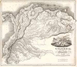
Colombia, from Humboldt and other Recent Authorities.
$2,200.00
Acquire
- Digital Map Information
- Suitable for large format printing
- Full resolution TIFF file
- ICC color profile embedded
- Delivered instantly via download link
This is the rare and important 1823' Zea Map of Colombia', one of the earliest specific maps of Gran Colombia at its height. This map was printed on behalf of the Colombian vice president under Simón Bolívar, Francisco Antonio Zea (1766 - 1822), to court European, and specifically British, investment in the new Republic, which was in dire need of financial support. The title references the naturalist Alexander von Humboldt, not for any cartographic contributions, as the map is based on the maps of John Arrowsmith, but rather for his unwavering support of an independent Gran Colombia and his promotion of its natural wealth. (more details)
Jesuit Missions in 18th Century Venezuela.
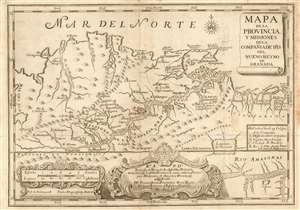
Mapa de la provincia y missiones de la compañia de IHJ del Nuevo Reyno de Granada.
$2,200.00
Acquire
- Digital Map Information
- Suitable for large format printing
- DPI: 600
- File Size: 13.1 MB
- File Type: ZIP / TIFF
- ICC color profile embedded
- Delivered instantly via download link
This is an elegantly-engraved and scarce 1741 Jesuit map of Venezuela and Colombia, produced by a longtime Jesuit missionary active in the region. The author, Joseph Gumilla, had been born in Spain but spent most of his life in the Orinoco river valley in New Granada, now modern-day Columbia and parts of Venezuela. (more details)
Highly decorative map of America.
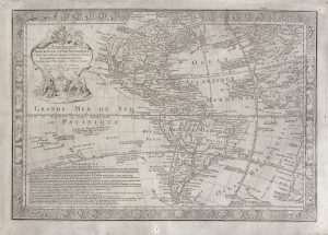
L'Amérique Méridionale et Septentrionale dressée sur les Nouv.les Decouv.tes et Dernieres Relations des Meilleurs Navigateurs decetemps Conformes aux Observations Astronomiques.
$2,000.00
Acquire
- Digital Map Information
- Suitable for large format printing
- DPI: 600
- File Size: 103.61 MB
- File Type: ZIP / TIFF
- ICC color profile embedded
- Delivered instantly via download link
This is a scarce, separately-issued 1731 Guillaume Danet map of America. The map combines the cartographic innovation of Guillaume De L'Isle with the decorative flourishes of Nicholas De Fer. (more details)
Amazon navigation at the height of the Rubber Boom.

Plano del Rio 'Amazonas' desde Iquitos hasta Manaos: levantado por orden del Señor Prefecto del Departamento de Loreto Coronel D. Pedro Portillo Segun el Plano proporcionado por la Compañía de Vapores 'Booth and Co. Iquitos - Liverpool'
$2,000.00
Acquire
- Digital Map Information
- Suitable for large format printing
- File Size: 24.55 MB
- File Type: ZIP / TIFF
- ICC color profile embedded
- Delivered instantly via download link
This is a 1906 Carlos Hoempler and Pedro Portillo Silva 10 1/2 foot-long map covering over 1,000 miles of the Amazon River, from Iquitos, Peru, to Manaus, Brazil - highlighting a primary artery of the Amazon Rubber Boom (1879 - 1912). When issued, it was by far the most detailed map of this part of the Amazon River yet produced, illustrating navigation and commerce in one of the world's most extreme climates. (more details)
Paraguay of El Stronato.
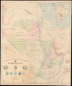
This large, scarce, detailed map is an official map of the Republic of Paraguay, published by that country's Dirección del Servicio Geográfico Militar. The map was printed in 1984, in the last years of the dictatorial regime - known as El Stronato, or el Stronismo - of President General don Alfredo Stroessner. A military, corporate work, there are no specific cartographers named. It is imposing, color-printed to four sheets, and joined as a wall map. (more details)
The Americas crafted into a unique puzzle!
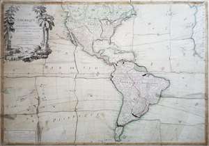
L'Amerique divisée en ses principaux états, assujetie aux observations astronomiques par le Sr. Janvier Geographe. A Paris.
$2,000.00
Acquire
This is Jean Janvier's 1760 rare, separately issued map of the western hemisphere, in its 1784 Paris edition. This map has, at an early date, been pasted down and hand-cut to form a simple jigsaw puzzle. Although the map does not name the new country, the colored national borders reflect the formation of the United States, which had been set according to the Treaty of Paris the year before this map was printed. The substance of the map is somewhat changed - dotted colonial borders have been burnished out and replaced with new ones, but the bulk of the engraving remains true to the 1760 edition. (more details)
Americas in the Midst of Revolutions.
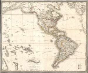
Carte de l'Amerique dressée d'après les meilleurs materiaux anglais, francais et sur les observations astronomiques de Mr. de Humboldt.
$1,800.00
Acquire
- Digital Map Information
- Suitable for large format printing
- File Size: 53.66 MB
- File Type: ZIP / TIFF
- ICC color profile embedded
- Delivered instantly via download link
This is Franz Fried's scarce 1818 folding map of the Americas, published by Artaria of Vienna. The map is significant for capturing the fast-paced political changes sweeping the continent in the wake of the Napoleonic Wars (1803 - 1815) and the breakdown of Spanish hegemony in Latin America. (more details)
If all you care about is here, this is a good place to be. -Emile de Becque
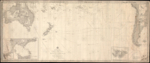
This Chart of the Indian and Pacific Oceans, compiled chiefly from Documents deposited in the Hydrographic Office of the British Admiralty is respectfully dedicated to Adm. Sir. F. Beaufort, F. R. L....
$1,800.00
Acquire
- Digital Map Information
- Suitable for large format printing
- File Size: 116.18 MB
- File Type: ZIP / TIFF
- ICC color profile embedded
- Delivered instantly via download link
An expansive and rare 1880 blueback nautical map or chart of the South Pacific by Richard Holmes Laurie. (more details)
The Original Bolivarian Revolution.
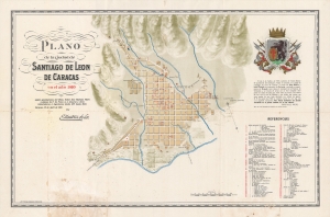
Plano de la ciudad de Santiago de Leon de Caracas en el ano 1810 segun apuntaciones del ilustrisimo Senor Don Mariano Martin y planos de F. de Pons; A.J. Jesurun y otros, historiadores e ingenieros, desde 1771 hasta 1843.
$1,800.00
Acquire
- Digital Map Information
- Suitable for large format printing
- File Size: 32.67 MB
- File Type: ZIP / TIFF
- ICC color profile embedded
- Delivered instantly via download link
A scarce, unrecorded map of Caracas, Venezuela published in 1910 by Enrique Mendoza Solar and printed by Litografía y Tipografía del Comercio in Caracas. It celebrates the centenary of the Revolution of April 19, 1810, which ousted the Spanish colonial government, leading to a formal Venezuelan declaration of independence the following year. (more details)
First specific map of the Atacama Desert.
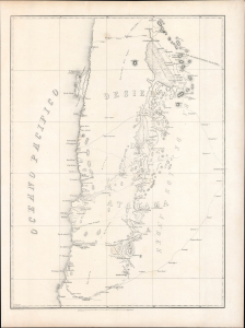
[Desierto De Atacama].
$1,500.00
Acquire
- Digital Map Information
- Suitable for large format printing
- Full resolution TIFF file
- ICC color profile embedded
- Delivered instantly via download link
Likely the first specific map of Chile's Atacama Desert, this is Wilhelm Döll's 1854 survey of Atacama, prepared during Rodolfo Amando Philippi's government-sponsored expedition into the largely uncharted interior. Extending from Cobija to Copiapó and eastward across salt flats, volcanic ranges, mining districts, and high Andean routes, it captures the Atacama at a pivotal moment—when scientific exploration, indigenous geography, silver discoveries, and competing Chilean and Bolivian territorial ambitions were beginning to transform the desert. Both a record of extraordinary fieldwork under conditions of extreme aridity and a harbinger of the mineral development and international conflict that followed, the map helped establish the geographical foundations for Chile's expanding interest in its northern frontier. (more details)
Novel Mapping the Sea of the West.
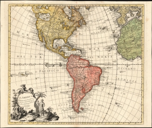
La America Dispuesta segun las ultimas y nuevas observationes de las Accademias, y de Paris, y de Londres.
$1,500.00
Acquire
- Digital Map Information
- Suitable for large format printing
- File Size: 25.48 MB
- File Type: ZIP / TIFF
- ICC color profile embedded
- Delivered instantly via download link
This is a scarce c. 1756 Spanish-language map of the Americas attributed to Pedro Gendron. This map is significant for its novel illustration of de L'Isle's Sea of the West. (more details)
Rare Edition Mapping the Spread of Christianity in America.
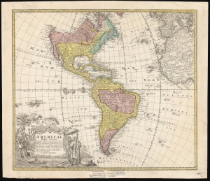
Americae Mappa Generalis.
$1,500.00
Acquire
- Digital Map Information
- Suitable for large format printing
- File Size: 24.72 MB
- File Type: ZIP / TIFF
- ICC color profile embedded
- Delivered instantly via download link
This is an elegant 1746 map of the Americas, prepared for Homann Heirs by the mathematicians and geographers Johann Matthias Hase and A. Gottlob Böhme. The present example includes a color key indicating the dominant religions on the map, a feature unique to an extremely rare 1754 edition of the work. (more details)