
Ptolemy, Claudius (sold)

Claudius Ptolemy (83 - 161 AD) is considered to be the father of cartography. A native of Alexandria living at the height of the Roman Empire, Ptolemy was renowned as a student of Astronomy and Geography. His work as an astronomer, as published in his Almagest, held considerable influence over western thought until Isaac Newton. His cartographic influence remains to this day. Ptolemy was the first to introduce projection techniques and to publish an atlas, the Geographiae. Ptolemy based his geographical and historical information on the "Geographiae" of Strabo, the cartographic materials assembled by Marinus of Tyre, and contemporary accounts provided by the many traders and navigators passing through Alexandria. Ptolemy's Geographiae was a groundbreaking achievement far in advance of any known pre-existent cartography, not for any accuracy in its data, but in his method. His projection of a conic portion of the globe on a grid, and his meticulous tabulation of the known cities and geographical features of his world, allowed scholars for the first time to produce a mathematical model of the world's surface. In this, Ptolemy's work provided the foundation for all mapmaking to follow. His errors in the estimation of the size of the globe (more than twenty percent too small) resulted in Columbus's fateful expedition to India in 1492.
Ptolemy's text was lost to Western Europe in the middle ages, but survived in the Arab world and was passed along to the Greek world. Although the original text almost certainly did not include maps, the instructions contained in the text of Ptolemy's Geographiae allowed the execution of such maps. When vellum and paper books became available, manuscript examples of Ptolemy began to include maps. The earliest known manuscript Geographias survive from the fourteenth century; of Ptolemies that have come down to us today are based upon the manuscript editions produced in the mid 15th century by Donnus Nicolaus Germanus, who provided the basis for all but one of the printed fifteenth century editions of the work.
Ptolemy's text was lost to Western Europe in the middle ages, but survived in the Arab world and was passed along to the Greek world. Although the original text almost certainly did not include maps, the instructions contained in the text of Ptolemy's Geographiae allowed the execution of such maps. When vellum and paper books became available, manuscript examples of Ptolemy began to include maps. The earliest known manuscript Geographias survive from the fourteenth century; of Ptolemies that have come down to us today are based upon the manuscript editions produced in the mid 15th century by Donnus Nicolaus Germanus, who provided the basis for all but one of the printed fifteenth century editions of the work.
Earliest Acquirable Printed Map of Arabia.
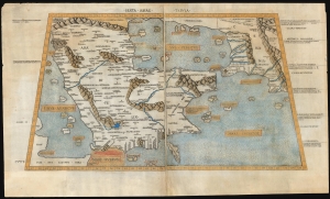
Sexta Asiae Tabula.
sold
- Digital Map Information
- Suitable for large format printing
- Full resolution TIFF file
- ICC color profile embedded
- Delivered instantly via download link
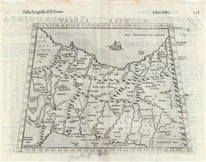
A foundational work of Renaissance cartography: this is the first acquirable printed map of the Arabian Peninsula. Appearing in the Rome edition of Ptolemy, in its 1478 printing, it is preceded only by the unacquirable 1477 Bologna Ptolemy. Ptolemy's 2nd-century innovation of representing the three-dimensional world on a grided mathematical projection provided the basis of all modern cartography. Of all the early printed versions of Ptolemy's maps, those produced for the Rome edition are considered the finest until Mercator's 1578 edition. The present example is embellished with attractive old hand color. (more details)
Finest Early Copperplate Map of the World.
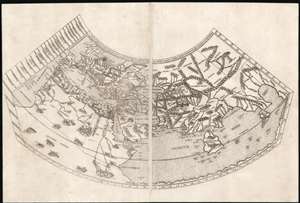
Untitled Map of the World.
sold
- Digital Map Information
- Suitable for large format printing
- Full resolution TIFF file
- ICC color profile embedded
- Delivered instantly via download link
A foundational work of Renaissance cartography: this is the first, acquirable, printed map attempting a measured representation of the known world. The world map from the Rome edition of Ptolemy, in its 1478 printing it is preceded only by the unacquirable 1477 Bologna Ptolemy, the Medieval mappamundi of the Rudimentum Novitorum and the schematic 1472 Isidorus T-O map. Ptolemy's second-century innovation in representing the three-dimensional world with a grid on a projection, using mathematical methods to produce an accurate map, provided the basis of all modern cartography. Of all the early, printed versions of Ptolemy's maps, those produced for the Rome edition are considered to be the finest until Mercator's 1578 edition of the work. (more details)
With the only pre-1500 map reflecting the Age of Discovery.
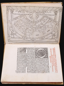
This is a rare, important 1482 incunable edition of Pomponius Mela's Cosmographi Geographica or De situ orbis, the only full Latin text on geography to have survived the classical era. This 1482 edition is doubly important as the first geographical text to include a map, as opposed to an atlas. Moreover, it is the only map of the pre-1500 era to show evidence of the Portuguese voyages of discovery. (more details)
The Most Beautiful 15th Century Map of the World.
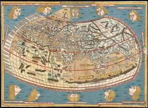
[Untitled map of the World].
sold
- Digital Map Information
- Suitable for large format printing
- DPI: 600
- File Size: 18.86 MB
- File Type: ZIP / TIFF
- ICC color profile embedded
- Delivered instantly via download link
This is a beautiful example, in rich original color, of the world map of the 1486 Ulm Ptolemy: regarded as the most beautiful, printed world map of the 15th century. The present example is one of the finest to appear on the market in recent years. It appeared in the first edition of Ptolemy printed north of the Alps, and as such it provided the foundation for the revolution in geographical knowledge that occurred in the opening years of the 16th century. The 'world' as depicted here is mainly the Oikumene, the inhabited world as it was known to 2nd century Romans. It covers the 'Old World' from the islands of the Atlantic Ocean (both real and legendary) to Indochina, and from the Arctic to the Tropic of Capricorn. But this was also the first printed world map to depart from a purely Ptolemaic model, offering more contemporaneous knowledge: the early depiction of Scandinavia and Iceland. (more details)
A Rare Fifteenth-Century Map of the World.
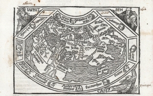
Der welt das xiii blat.
sold
- Digital Map Information
- Suitable for large format printing
- Full resolution TIFF file
- ICC color profile embedded
- Delivered instantly via download link
This is the rare 1496 first edition of the rare Hans Schönsperger world map, a reduced version of the map appearing in Hartmann Schedel's 1493 Nuremberg Chronicle. Rarer than its 1493 model, Schönsperger's map is one of the earliest acquirable printed maps of the world, one of only a handful of world maps printed in the fifteenth century. (more details)
First map of the region printed in color.
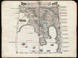
Undecima Asiae Tabula
sold
- Digital Map Information
- Suitable for large format printing
- File Size: 19.28 MB
- File Type: ZIP / TIFF
- ICC color profile embedded
- Delivered instantly via download link
This is a rare example of Bernard Sylvanus' 1511 Ptolemaic map of Southeast Asia and the Malay Peninsula. Printed in a single edition, it is one of the most visually distinctive early woodcut maps of the Far East, an area known to ancient geographers as 'India Extra Gangem' or 'India Beyond the Ganges'. By Ptolemy's reckoning, this map depicted the easternmost extreme of the Indian Ocean. This part of the world would soon be revealed to contain the East Indies and the Spice Islands. (more details)
'Visually, it is one of the most attractive Ptolemaic world maps produced' - Rodney Shirley
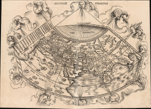
Generale Ptholemei.
sold
- Digital Map Information
- Suitable for large format printing
- Full resolution TIFF file
- ICC color profile embedded
- Delivered instantly via download link
This is Martin Waldseemüller's 1513 rendition of the Ptolemaic map of the world: 'Visually, it is one of the most attractive Ptolemaic world maps produced' (Shirley) and one of the earliest acquirable woodcut maps of the ancient world. It appeared in Waldseemüller and Ringmann's 1513 Geographie Opus Novissima, the most comprehensively edited and amended edition of Claudius Ptolemy's 2nd-century geography. Moreover, this map was the largest-format edition of Ptolemy's map produced to date. (more details)
One of the Earliest Printed Maps of Arabia.
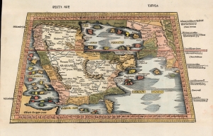
Sexta Asie Tabula.
sold
- Digital Map Information
- Suitable for large format printing
- Full resolution TIFF file
- ICC color profile embedded
- Delivered instantly via download link
This is the Waldseemüller / Ringmann 1513 map of Arabia, considered one of the earliest acquirable maps of the Arabian Peninsula and essential to any serious Arabia collection. It was issued for Waldseemüller and Ringmann's 1513 Geographie Opus Novissima, then the most thoroughly edited and amended edition of Ptolemy. Moreover, this map was the most detailed map of the Arabian Peninsula to have been produced to date, illustrating and naming many of the islands of the Red Sea and the Persian Gulf, and including comprehensive interior detail. Despite presenting ancient geography, the detail of Ptolemaic maps of the region had yet to be improved upon significantly, and so this map remained one of the most detailed maps of the Arabian Peninsula available, illustrating and naming many of the islands of the Red Sea and the Persian Gulf, and including comprehensive interior detail. (more details)
The earliest acquirable map to name America.
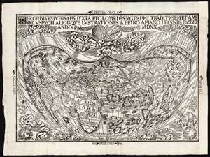
Tipus Orbis Universalis Iuxta Ptolomei Cosmographi Traditionem Et Americi Vespucii Aliorque Lustrationes A Petro Apiano Leysnico Elucbrat An. Do. MDXX.
sold
- Digital Map Information
- Suitable for large format printing
- Full resolution TIFF file
- ICC color profile embedded
- Delivered instantly via download link
This is an attractive example of Petrus Apianus's 1520 map of the world, the earliest acquirable map to include the place name 'America.' In this respect it is pre-dated only by Waldseemüller's 1507 wall map, which exists in a sole surviving example held by the Library of Congress. Apianus was a well-respected and better-connected scholar, and in some respects his map's use of the name 'America' for the new world had broader impact even than the map on which the name first appeared. The map's projection and the lion's share of its geographical information derive from the 1507 Waldseemüller map of the world. In place of the hemisphere views present on the 1507 map, Apianus' displays in the upper decorative border an armillary sphere and a graticule, tools whose geometrical features allowed the composition of the map's projection. (more details)
One of the Earliest Modern Maps of the Indian Ocean.
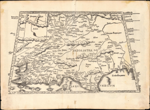
[Tabula X. Asiae.]
sold
- Digital Map Information
- Suitable for large format printing
- Full resolution TIFF file
- ICC color profile embedded
- Delivered instantly via download link
This is Laurent Fries' 1535 edition of Martin Waldseemüller's Ptolemaic map of India, one of the earliest acquirable maps of the area and an essential step in the subcontinent's cartographic evolution. (more details)
The Silk Road between the Caspian Sea and the Hindu Kush.
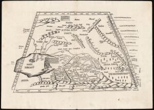
[Tabula Septima Asiae].
sold
- Digital Map Information
- Suitable for large format printing
- Full resolution TIFF file
- ICC color profile embedded
- Delivered instantly via download link
This is Laurent (Lorenz) Fries' 1522 map of central Asia and the Silk Road, among the earliest acquirable maps of Central Asia east of the Caspian Sea. Although presenting 2nd-century Ptolemaic geography, this map remained relevant as the best map of the region available. Additionally, Fries' iteration of this Ptolemaic map is distinct from any other in its incorporation of contemporary information about the denizens of the region - in this case, drawn from the texts on Waldseemüller's 1516 Carta Marina. (more details)
Ancient Persia.
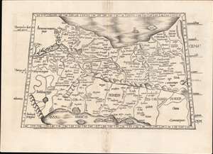
[Tabula V. Asiae].
sold
- Digital Map Information
- Suitable for large format printing
- Full resolution TIFF file
- ICC color profile embedded
- Delivered instantly via download link
This is Laurent Fries' Ptolemaic map of Persia, one of the earliest generally acquirable maps of what would become Iran and Iraq. The map spans from Mesopotamia - the Tigris and Euphrates Rivers valleys - to a mountain range roughly corresponding with the Masjed Mountains of easternmost Persia, embracing modern-day Iran, Iraq, the Caspian Sea, and the Persian Gulf. (more details)
Western China, Mongolia and Central Asia North of the Himalayas
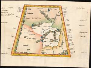
(Tabula VIII Asiae)
sold
- Digital Map Information
- Suitable for large format printing
- DPI: 600
- File Size: 17.68 MB
- File Type: ZIP / TIFF
- ICC color profile embedded
- Delivered instantly via download link
This map depicts the area now known as China and Mongolia. Specifically, it shows the lands known to Strabo and Ptolemy as Scythia Extra Imaum and Serica. Scythia Extra Imaum refers to the territory of the nomadic Scythians to the east of the Tian Shan mountain range, while Serica was a mysterious land thought to be the source of silk: indeed, the place name literally means “the land where silk comes from.” The map includes specific descriptors for some of the people to be found in the region: in the northwestern extreme of the map, Hippophagi (horse-eaters) and Anthropophagi (cannibals) can be found. Since this map covers one of the norther nmost regions addressed in Ptolemy's work, it includes notation in its margins indicating the increase in the length of the days as one travels north, a phenomenon not easily observed during Ptolemy's time but one with which northern European travelers of the 16th century would have been growing familiar. (more details)
Habitable world as known to the ancients.
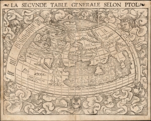
La Seconde Table Generale Selon Ptol.
sold
- Digital Map Information
- Suitable for large format printing
- Full resolution TIFF file
- ICC color profile embedded
- Delivered instantly via download link
An attractive example of Sebastian Münster's 1540 map of the world, according to Claudius Ptolemy, in a 1568 French text edition. The map details the Oikumene, the inhabited world as it was known to the Roman Empire of the second century, well before the Age of Discovery. It covers only the 'Old World' from the Atlantic (Pillars of Hercules) to Indochina, and from the Arctic to the Tropic of Capricorn. The map is surrounded by aeoli and clouds. (more details)
India-Beyond-The-Ganges as known to Ancient Rome.
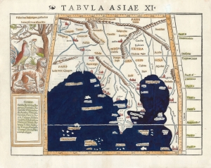
Tabulas Asiae XI.
sold
- Digital Map Information
- Suitable for large format printing
- Full resolution TIFF file
- ICC color profile embedded
- Delivered instantly via download link
This is a 1540, first edition first state example of Sebastian Münster's Ptolemaic map of Southeast Asia and the Malay Peninsula. The region was known to ancient geographers as 'India Extra Gangem,' or 'India Beyond the Ganges.' (more details)
Early ptolemaic map of Central Asia!
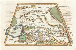
[Title on Verso] Tabula Septima Asiae Complectitur Margianam, Bactrianam, Sogdianam, Sacas, & Scythiam, Intra Imaum Montem.
sold
- Digital Map Information
- Suitable for large format printing
- DPI: 300
- File Size: 5.73 MB
- File Type: ZIP / TIFF
- ICC color profile embedded
- Delivered instantly via download link
A fine example of the 1541 Vienne-in-the-Dauphane edition of Lorenz Fries' Ptolemaic map of central Asia. The map's coverage extends from the western Caspian Sea and the Central Asian Steppe, Afghanistan, including all or parts of modern day Kazakhstan, Turkmenistan, Iran, Afghanistan, Uzbekistan, and Iran. The Himalayas are evident at the base of the map and have a rope-like aspect. The map exhibits the typical trapezoidal projection common to early Ptolemaic maps. (more details)
2nd Century Persian Empire.
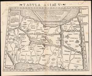
Tabula Asiae V.
sold
- Digital Map Information
- Suitable for large format printing
- Full resolution TIFF file
- ICC color profile embedded
- Delivered instantly via download link
This is a 1542 example of Sebastian Münster's Ptolemaic map of Persia, the fifth of Ptolemy's Asia maps. The map covers modern-day Iraq and Iran, extending from the Fertile Crescent to the desert south of the Caspian Sea. In the 1st and 2nd centuries CE, these territories were occupied by the Persian Empire, and its vassal kingdoms Carmania, Hyrcania, Parthia, Media, Assyria, Susiana (Elam), and Babylonia. The western limit of the map is marked by the Tigris and Euphrates Rivers; and the eastern by the Masdoranus Mountains (roughly corresponding to the Eastern Iranian Range). The map is bordered on the south by the Persian Gulf, and on the north by the southern shores of the Caspian Sea (then conceived as a wide and oval). (more details)
The Ptolemaic World.
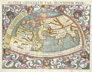
Altera generalis tab. Secundum Ptol.
sold
- Digital Map Information
- Suitable for large format printing
- DPI: 300
- File Size: 6.61 MB
- File Type: ZIP / TIFF
- ICC color profile embedded
- Delivered instantly via download link
An attractive c. 1550 example of Sebastian Munster's map of the world according to Claudius Ptolemy. The map details the world prior to the great age of discovery. As such, it covers only the 'Old World' from the Atlantic (Pillars of Hercules) to Indochina and ... (more details)
The Ptolemaic World.

Altera generalis tab. Secundum Ptol.
sold
- Digital Map Information
- Suitable for large format printing
- DPI: 300
- File Size: 4.78 MB
- File Type: ZIP / TIFF
- ICC color profile embedded
- Delivered instantly via download link
An attractive c. 1550 example of Sebastian Munster's map of the world according to Claudius Ptolemy. The map details the world prior to the great age of discovery. As such, it covers only the 'Old World' from the Atlantic (Pillars of Hercules) to Indochina and ... (more details)
Afghanistan and Pakistan as known in the Classical Era
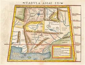
Tabula Asiae IX.
sold
- Digital Map Information
- Suitable for large format printing
- DPI: 600
- File Size: 8.71 MB
- File Type: ZIP / TIFF
- ICC color profile embedded
- Delivered instantly via download link
This 1552 Munster map depicts the areas west of the Indus River Delta, including present-day Pakistan, Afghanistan, and eastern Iran as they were known to the second-century geographer, Claudius Ptolemy. It appeared in the final, 1552 Munster edition of Ptolemy's Geographia. The regions of Aria, Drangiana and Arachosia refer to Afghanistan; Gedrosia is roughly equivalent to the Pakistani province of Baluchistan. The portions of Parthia and Carmania shown in the western part of the map are part of modern-day Iran. Despite being shown pictorially, the course of the Indus River and the depiction of the mountainous region bordering Persia is remarkably correct. The table at lower right indicates place names that had changed between Ptolemy’s time and that of Munster. (more details)
Russia and the Ukraine as known in the Classical Era
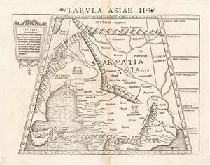
Tabula Asiae II.
sold
- Digital Map Information
- Suitable for large format printing
- Full resolution TIFF file
- ICC color profile embedded
- Delivered instantly via download link
This 1552 example of the second Asian map from Sebastian Munster's Ptolemy shows the lands in Asia occupied in the 1st and 2nd centuries CE by the Sarmatians, a large Iranian confederation who during the classical era were based in the steppes north of the Black Sea and the Caspian Sea. The region includes today's South-Eastern Ukraine, Southern Russia, and the Caucasus. Visible on the map are the northern parts of the Black Sea and the Caspian Sea, as well as the Maeotian sea - now known as the Sea of Azov. The Volga River dominates the map, albeit with its Ptolomaic toponym 'Rha.' The map includes historical references to the campaigns of Alexander the Great against the Scythians, noting the presence of monuments left by that emperor both in European and Asian Sarmatia. (more details)
Mid-point of the Silk Route.
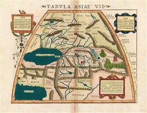
Tabula Asiae VII.
sold
- Digital Map Information
- Suitable for large format printing
- Full resolution TIFF file
- ICC color profile embedded
- Delivered instantly via download link
This is a 1552 example of Ptolemy's map of the Silk Road, the seventh Asian map from Sebastian Munster's Ptolemy. The map covers Central Asia east of the Caspian Sea. In the 1st and 2nd centuries CE, these territories were occupied by the Sogdiana, an ancient Iranian civilization that included parts of present-day Kazakhstan, Tajikistan, and Uzbekistan. To the north are the lands of the nomadic Scythians. (more details)
16th Century Woodcut Map of Kazakhstan, Tajikistan, and Uzbekistan as known to Ptolemy
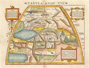
Tabula Asiae VII.
sold
- Digital Map Information
- Suitable for large format printing
- DPI: 600
- File Size: 9.61 MB
- File Type: ZIP / TIFF
- ICC color profile embedded
- Delivered instantly via download link
This is a 1552 example of Ptolemy's map of the Silk Road. The seventh Asian map from Sebastian Munster's Ptolemy, it shows the lands in Central Asia, east of the Caspian Sea. These were occupied in the 1st and 2nd centuries CE by the Sogdiqna, an ancient Iranian civilization that at different times included territory located in present-day Kazakhstan, Tajikistan, and Uzbekistan. To the north are shown the lands of the nomadic Scythians.
Centrally, the lands of the Sogdiana sit astride what we know now to be the Silk Road. At the eastern extent of the map is shown Turris Lapid, the 'Stone Tower' (λίθινος πύργος in Greek) which marked the midpoint on the ancient Silk Road – the network of overland trade routes taken by caravans between Europe and Asia. The tower was the most important landmark on this route, where caravans stopped on their difficult and dangerous journeys to allow travellers to take on provisions, rest, and trade goods before continuing on. (more details)
Centrally, the lands of the Sogdiana sit astride what we know now to be the Silk Road. At the eastern extent of the map is shown Turris Lapid, the 'Stone Tower' (λίθινος πύργος in Greek) which marked the midpoint on the ancient Silk Road – the network of overland trade routes taken by caravans between Europe and Asia. The tower was the most important landmark on this route, where caravans stopped on their difficult and dangerous journeys to allow travellers to take on provisions, rest, and trade goods before continuing on. (more details)
Eastern Europe and Russia as known in the Classical Era
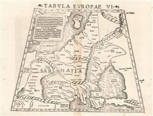
Tabula Europae VI.
sold
- Digital Map Information
- Suitable for large format printing
- File Size: 8.99 MB
- File Type: ZIP / TIFF
- ICC color profile embedded
- Delivered instantly via download link
This 1552 woodcut map of Eastern Europe is not the sixth, but the eighth European map from Sebastian Munster's Ptolemy. It shows the lands in Europe occupied in the 1st and 2nd centuries CE by the Sarmatians, a large Iranian confederation who during the classical era were pressing from the steppes north of the Black Sea into the region of Russia, the Ukraine, Poland and Hungary. Black Sea and the Caspian Sea, as well as the Maeotian sea - now known as the Sea of Azov. The map includes historical references to the campaigns of Alexander the Great against the Scythians, noting the presence of monuments left by that emperor both in European Sarmatia. The addition of Gothia, part of the kingdom of the Danes and Norway to the map are modern innovations on Munster's part, as these places were unknown to Ptolemy. (more details)
A foundational map.
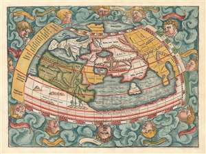
[La Secunde Table Generale Selon Ptol.]
sold
- Digital Map Information
- Suitable for large format printing
- Full resolution TIFF file
- ICC color profile embedded
- Delivered instantly via download link
An attractive 1556 example of Sebastian Münster's map of the world, according to Claudius Ptolemy. The map thus details the Oikumene, the inhabited world as it was known to the Roman Empire of the second century, well before the Age of Discovery. It covers only the 'Old World' from the Atlantic (Pillars of Hercules) to Indochina, and from the Arctic to the Equator. The map is surrounded by aeoli and clouds. (more details)
Northeastern limits of Ptolemy's landlocked Indian Ocean.
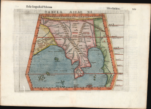
Tabula Asiae XI.
sold
- Digital Map Information
- Suitable for large format printing
- Full resolution TIFF file
- ICC color profile embedded
- Delivered instantly via download link
This is Girolamo Ruscelli's 1561 / 1598 map of Southeast Asia and the Malay Peninsula. The region was known to ancient geographers as 'India Extra Gangem,' or 'India Beyond the Ganges'. (more details)
Northeastern limits of Ptolemy's landlocked Indian Ocean.
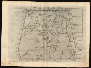
Tabula Asiae XI.
sold
- Digital Map Information
- Suitable for large format printing
- Full resolution TIFF file
- ICC color profile embedded
- Delivered instantly via download link
This is a handsome example of Girolamo Ruscelli's 1561 / 1574 map of Southeast Asia and the Malay Peninsula. The region was known to ancient geographers as 'India Extra Gangem,' or 'India Beyond the Ganges'. (more details)
Mapping the Northern Limits of the Roman Empire.
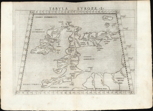
Tabula Europae I.
sold
- Digital Map Information
- Suitable for large format printing
- Full resolution TIFF file
- ICC color profile embedded
- Delivered instantly via download link
This is a handsome example of Girolamo Ruscelli's 1561 Ptolemaic map of the British Isles. The map captures the northwest limits of what Ancient Rome knew of the world, reflecting Julius Caesar and Claudius' invasions of England. (more details)
Latin Edition of an Influential Geography
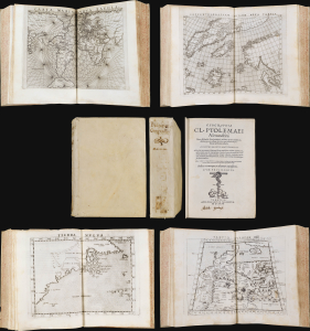
This is a superb example of Girolamo Ruscelli's Geographia Cl. Ptolemaei Alexandrini, the 1562 edition of his expanded Ptolemy, featuring the new Latin re-translation of the work by Giuseppe Moleto, amending Willibald Pirckheimer's translation of Ptolemy's text. Ruscelli's Geographia was a tour de force and, in this Latin edition, it reached its broadest audience, marking this as the most important edition of Ruscelli's Ptolemy. With its complement of maps beautifully engraved by Giulio Sanuto (particularly the Zeno map of the North Atlantic), the work had a long-standing influence on European geographical thought. The maps here are all in their first state and are thus most desirable. (more details)
One of the rarest, separately-issued 'Lafreri' style maps of Africa,
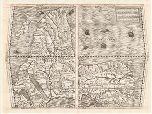
Prima Tavola.
sold
- Digital Map Information
- Suitable for large format printing
- DPI: 600
- File Size: 54.43 MB
- File Type: ZIP / TIFF
- ICC color profile embedded
- Delivered instantly via download link
This beautifully engraved map is Ferando Bertelli's map of Africa, in most respects closely copying the engraved 1563 map of Africa replacing the woodcut provided in 1554 by Giacomo Gastaldi for inclusion in Giovanni Battista Ramusio's Delle Navigationi et Viaggi when the blocks for that work were destroyed by fire. The map's title - Prima Tavola - is in reference to its place alongside a second map of Arabia and India (Seconda Tavola) and a third (Terza Tavola) of Southeast Asia. (The text box in the upper right describes the trio of maps as a sequence.) The map's southern orientation is the most obvious element setting it apart from other maps of Africa from this era, but it should be noted that this map shares that orientation with both others of the trio. The orientation of these three maps appears to have been Ramusio's decision: perhaps the presentation of Africa as viewed from Europe, and in progression from west to east, suited Ramusio's narrative collection of voyages better than following the Ptolemaic convention of having north to the top. Gastaldi's own maps of these regions were oriented to the north, and the other maps appearing in Ramusio's Viaggi - showing west Africa, Sumatra, Brazil, and New France - all adhered to a traditional northern orientation. (more details)
A foundational map.
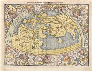
Ptolemaisch general Tafel/ begreissend die halbe kugel der Welt.
sold
- Digital Map Information
- Suitable for large format printing
- Full resolution TIFF file
- ICC color profile embedded
- Delivered instantly via download link
An attractive 1572 example of Sebastian Münster's map of the world, according to Claudius Ptolemy. The map thus details the Oikumene, the inhabited world as it was known to the Roman Empire of the second century, well before the Age of Discovery. It covers only the 'Old World' from the Atlantic (Pillars of Hercules) to Indochina, and from the Arctic to the Equator. The map is surrounded by aeoli and clouds. (more details)
The legendary island of Tapobrana!
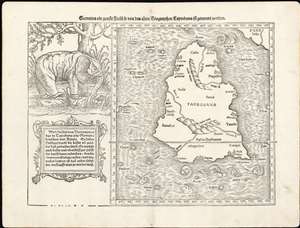
Sumatra Ein Grosse Insel, So Von Den Alten Geographen Taprobana, Ist Genent Worden.
sold
- Digital Map Information
- Suitable for large format printing
- DPI: 600
- File Size: 13.49 MB
- File Type: ZIP / TIFF
- ICC color profile embedded
- Delivered instantly via download link
This is Sebastian Münster's 1574 map of Sumatra - using the Ptolemaic model for the map of Taprobana, which earlier mapmakers typically conflated with Sri Lanka. The map is oriented to the north and includes all of ‘Taprobana’ with a nineteen surrounding islands. The mainland of the appears above and to the right, which would correspond to the Malay peninsula were the map correctly identified with Sumatra, although this map roughly identifies to Sri Lanka's tear shape. To the left of the map is a naturalistic illustration of an elephant and ten lines of text describing the pepper trade - explicitly identifying the island as Sumatra. In doing so, Münster is differentiating himself from earlier cartographers whose versions of this map reproduced Ptolemy's map by rote - though he adds no new specific data to the map, his innovation is in the application of a specific modern interpretation of the ancient geographical data. (more details)
A fine early map of Ceylon depicting an Elephant.
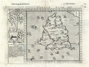
Tabula Asiae XII.
sold
- Digital Map Information
- Suitable for large format printing
- DPI: 300
- File Size: 3.34 MB
- File Type: ZIP / TIFF
- ICC color profile embedded
- Delivered instantly via download link
A highly appealing 1574 map of Ceylon, Sri Lanka, or as it was then known, Tapobrana. The first mention of Tapobrana is in the Geographia of Claudius Ptolemy. Today, Ptolemy's Taprobana is considered by some scholars to be entirely mythological and by others ... (more details)
Reflects the curious Ptolemaic convention of a landlocked Indian Ocean
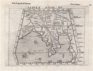
Tabula Asiae XI.
sold
- Digital Map Information
- Suitable for large format printing
- DPI: 300
- File Size: 3.2 MB
- File Type: ZIP / TIFF
- ICC color profile embedded
- Delivered instantly via download link
This is an uncommon 1588 Ptolemaic map of Southeast Asia and the Malay Peninsula issued for Girolamo Ruscelli's Italian edition of the Geografia di Tolomeo . Cartographically Ruscelli based this map on interpretations of Claudius Ptolemy's Geographica by ... (more details)
The World as known to Rome.
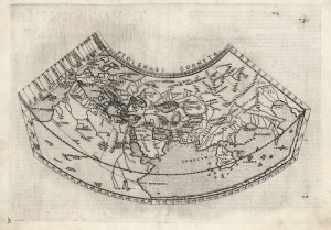
Ptolemaei Cognita.
sold
- Digital Map Information
- Suitable for large format printing
- Full resolution TIFF file
- ICC color profile embedded
- Delivered instantly via download link
This is Girolamo Ruscelli's 1574 edition of a foundational work of Renaissance cartography: the map of the known world as understood at the time of the Roman Empire. Claudius Ptolemy's 2nd-century innovation in representing the three-dimensional world projected on a grid via mathematical formulae provided the basis of all modern cartography. Consequently, his Geographia and the maps derived from it remained canonical and continued to be printed well into the 17th century. This is the first appearance of this specific map in Ruscelli's Ptolemy. (more details)
16th Century Woodcut Map of Africa as Ancient Rome Knew It
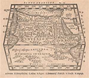
Untitled Map of Africa
sold
- Digital Map Information
- Suitable for large format printing
- DPI: 600
- File Size: 3.17 MB
- File Type: ZIP / TIFF
- ICC color profile embedded
- Delivered instantly via download link
An attractively-executed map 16th-century woodcut map of Africa. The most general of the Ptolemaic maps of Africa, extending far enough south to fully show Ptolemy’s mythical source of the Nile River in the ‘Mountains of the Moon.’ The continent ... (more details)
Silk Road Caravans and Caspian Sturgeon
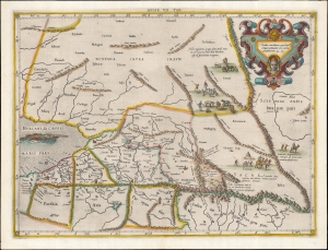
Asiae VII Tab.
sold
- Digital Map Information
- Suitable for large format printing
- DPI: 600
- File Size: 36.51 MB
- File Type: ZIP / TIFF
- ICC color profile embedded
- Delivered instantly via download link
This is an edition of Gerard Mercator's superb Ptolemaic map of central Asia and the Silk Road. The seventh Asian map from Ptolemy's Geography, it depicts the lands in Central Asia, east of the Caspian Sea. These were occupied in the 1st and 2nd centuries CE by the Sogdiana, an ancient Iranian civilization that at different times included territory located in present-day Kazakhstan, Tajikistan, and Uzbekistan. To the north are shown the lands of the nomadic Scythians. (more details)
One of Münster's Scarcest Maps: The Holy Land and Fertile Crescent
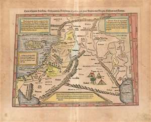
Cyria/ Cypern/ Palestina//Mesopotamia/Chaldea/und zwei Arabia/mit Bergen/Wåssern und Stetten.
sold
- Digital Map Information
- Suitable for large format printing
- Full resolution TIFF file
- ICC color profile embedded
- Delivered instantly via download link
This is Sebastian Münster's 1540 map of the Holy Land, Cyprus and the Fertile Crescent, from the 1578 German edition of Munster's Cosmographia Universalis. One of Münster's scarcest maps, it is one of his Ptolemaic works - derived from the Alexandrian geographer's second century geographic information, as passed along (probably) via Waldseemüller's 1513 Quarta Asiae Tabula. Being a smaller woodcut, Münster's work necessarily simplifies the 1513 map, but what it lacks in size the present work makes up for in its informative qualities: four typeset text boxes describe the contents of the map in detail (here in German: the text was re-set for the various editions.) (more details)
Superb example of the most finely-engraved Ptolemy, with beautiful original color.
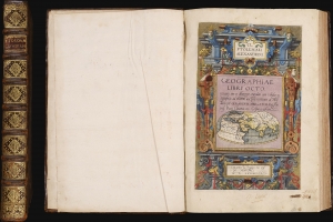
Cl Ptolemaei Alexandrini Geographiae libri octo: recognitiiam diligenter emendati cum tabulis geographicis ad mentem auctoris restitutis ac emendatis, per Gerardum Mercatorem.
sold
This is a superb example of Gerard Mercator's Cl Ptolemaei Alexandrini Geographiae Libri Octo: the 1584 first edition of the full proto-atlas, featuring Willibald Pirckheimer's translation of Claudius Ptolemy's text edited by Arnold Mylius, accompanied by 28 maps in rich, original color. Moreover, the present volume is bound with Mercator's contemporary atlas of France and the Low Countries, Galliae Tabule Geographicae. These volumes were probably joined in the 18th century when this volume was bound. The book thus presents Mercator's earliest published books in a superb, unique example. It is one of the few of Mercator's books to be published in his lifetime. (more details)
Most finely-engraved Ptolemaic map of Arabia.
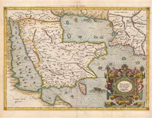
Asiae VI Tab.
sold
- Digital Map Information
- Suitable for large format printing
- Full resolution TIFF file
- ICC color profile embedded
- Delivered instantly via download link
This is Gerard Mercator's map of the Arabian Peninsula, based on the second-century mapping of Claudius Ptolemy (c. 100 - 170), the progenitor of modern geography. Mercator executed this map for his 1578 Duisberg edition of Ptolemy's Geographia, intended to be the definitive edition of that foundational work. (more details)
Fascinating early map of India.
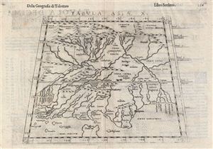
Tabula Asiae X.
sold
- Digital Map Information
- Suitable for large format printing
- DPI: 300
- File Size: 3.58 MB
- File Type: ZIP / TIFF
- ICC color profile embedded
- Delivered instantly via download link
This is an uncommon 1588 Ptolemaic map of India issued for Girolamo Ruscelli's Italian edition of the Geografia di Tolomeo . Cartographically Ruscelli based this map on interpretations of Claudius Ptolemy's Geographica by Bernard Sylvanus and ... (more details)
Fascinating 16th century map depicting modern day Iran and Iraq.
Tabula Asiae V.
sold
- Digital Map Information
- Suitable for large format printing
- DPI: 300
- File Size: 3.61 MB
- File Type: ZIP / TIFF
- ICC color profile embedded
- Delivered instantly via download link
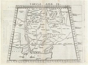
This is an uncommon 1588 Ptolemaic map of Persia issued for Girolamo Ruscelli's Italian edition of the Geografia di Tolomeo . Cartographically Ruscelli based this map on interpretations of Claudius Ptolemy's Geographica by Bernard Sylvanus ... (more details)
Fascinating 16th century map depicting modern day Afghanistan, Iran, and Pakistan.
Tabula Asiae IX.
sold
- Digital Map Information
- Suitable for large format printing
- Full resolution TIFF file
- ICC color profile embedded
- Delivered instantly via download link
This is an uncommon 1588 Ptolemaic map of Persia, Afghanistan, and Pakistan issued for Girolamo Ruscelli's Italian edition of the Geografia di Tolomeo . Cartographically Ruscelli based this map on interpretations of Claudius Ptolemy's ... (more details)
Reflects the curious Ptolemaic convention of a landlocked Indian Ocean.
Tabula Asiae XI.
sold
- Digital Map Information
- Suitable for large format printing
- DPI: 300
- File Size: 3.45 MB
- File Type: ZIP / TIFF
- ICC color profile embedded
- Delivered instantly via download link
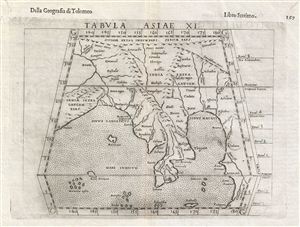
This is an uncommon 1588 Ptolemaic map of Southeast Asia and the Malay Peninsula issued for Girolamo Ruscelli's Italian edition of the Geografia di Tolomeo . Cartographically Ruscelli based this map on interpretations of Claudius ... (more details)
Tabula Asiae IX.
sold
- Digital Map Information
- Suitable for large format printing
- Full resolution TIFF file
- ICC color profile embedded
- Delivered instantly via download link
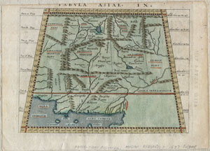
A scarce and unusual 1597 Ptolemaic map of what constitutes modern day Iran, Pakistan and Afghanistan. Presented on a trapezoidal projection with bold mountain ranges dividing the region. This map was engraved by G. Magini and ... (more details)
The World Known to Rome.
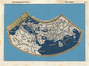
Ptolemaei Cognita.
sold
- Digital Map Information
- Suitable for large format printing
- DPI: 600
- File Size: 9.42 MB
- File Type: ZIP / TIFF
- ICC color profile embedded
- Delivered instantly via download link
This is Girolamo Ruscelli's 1599 edition of a foundational work of Renaissance cartography: The map of the known world as understood at the time of the Roman Empire. Claudius Ptolemy's second-century innovation in representing the three-dimensional world projected on a grid via mathematical formulae provided the basis of all modern cartography. Consequently, his Geographia and the maps derived from it remained canonical and continued to be printed well into the 17th century. (more details)
Attractive Woodcut, Foundational map.
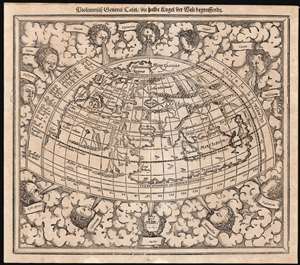
Ptolemeisch General Tafel die halbe Kugel der Welt begreissende.
sold
- Digital Map Information
- Suitable for large format printing
- Full resolution TIFF file
- ICC color profile embedded
- Delivered instantly via download link
An attractive 1614 example of Sebastian Münster's map of the world, according to Claudius Ptolemy. Added to Münster's Cosmographia in 1588, it replaced a similar, albeit smaller and simpler, woodcut which had been in use since 1540. As a Ptolemaic map, it details the Oikumene, the inhabited world as it was known to 2nd century Romans, well before the Age of Discovery. It covers only the 'Old World' from the Atlantic (Pillars of Hercules) to Indochina, and from the Arctic to the Tropic of Capricorn. The map is surrounded by aeoli and clouds. (more details)
Decorative Ptolemaic map of Spain and Portugal.

Tab. II. Europae, Hispaniam ac Lusitaniam Complectens.
sold
- Digital Map Information
- Suitable for large format printing
- DPI: 300
- File Size: 7.53 MB
- File Type: ZIP / TIFF
- ICC color profile embedded
- Delivered instantly via download link
This is an attractive example of the 1730 Witstein and Smith edition of the Mercator/Hondius Ptolemaic map of Spain and Portugal. The map covers the entire Iberian Peninsula according to the 2nd century Alexandrian cartographer Claudius Ptolemy, as interpreted by Gerard Mercator. (more details)