
European Cities (sold)
Best 19th century map of London.
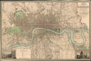
Map of London, from An Actual Survey made in the Years 1824, 1824 and 1826 by C. and J. Greenwood.
sold
- Digital Map Information
- Suitable for large format printing
- File Size: 284.14 MB
- File Type: ZIP / TIFF
- ICC color profile embedded
- Delivered instantly via download link
This is the rare 1830 second edition of Christopher and John Greenwood's large-scale map of London, here in a spectacularly preserved example. It is considered the largest and finest plan of London to appear in the 19th century. The present example is linen-backed and accompanied by its original green leather slipcase. (more details)
The best 19th century map of London.
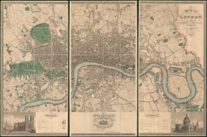
Map of London, from An Actual Survey made in the Years 1824, 1824 and 1826 by C. an J. Greenwood.
sold
- Digital Map Information
- Suitable for large format printing
- Full resolution TIFF file
- ICC color profile embedded
- Delivered instantly via download link
This is the rare first edition of Christopher and John Greenwood's large-scale 1827 map of London, here in a spectacularly preserved example. It is considered the largest and finest plan of London to appear in the 19th century. The present example is presented in three linen-backed folding sections, and is accompanied by its original leather slipcase. (more details)
One of the world's most iconic city plans, it renders Rome in mond-blowing detail.
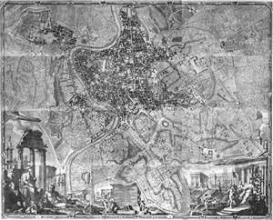
Alla Santita' Di Nostro Signore Papa Benedetto XIV La Nuova Topografia Di Roma Ossequiosamente Offerisce E Dedica L'Umilissimo Servo Giambattista Nolli Comasco.
sold
This is a 1748 Giambattista Nolli city map or plan of Rome, which ranks as one of the best city plans ever produced. The map depicts the city in astonishing detail from the Villa Pamphili to the Tempio di Venere e Cupido and from the Vatican to the Porta San Sebastiano. Commissions by Pope Benedict XIV in an attempt to better understand the formal demarcations between Rome fourteen Rioni (traditional districts dated to the 12th century), Nolli's plan is impressive not only for its scale and accuracy, but because it is an ichnographic plan. (more details)
Leiden as Rembrandt Knew It.
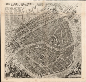
Lugdunum Batavorum. Die Stadt Leyden.
sold
- Digital Map Information
- Suitable for large format printing
- File Size: 29.02 MB
- File Type: ZIP / TIFF
- ICC color profile embedded
- Delivered instantly via download link
This is a rare, beautifully engraved, and influential c. 1630 Frans Huys and Peter Bast map of Leiden, The Netherlands, at the time of Rembrandt. It is one of just two known examples of the map, in this state, and is unrecorded in institutional collections. (more details)
Lost treasure of Parisian Cartography.
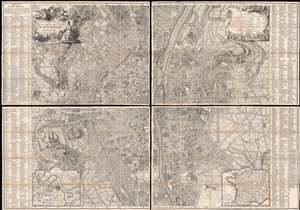
Plan de la Ville de Paris et de ses Faubourgs dédié au Roi.
sold
- Digital Map Information
- Suitable for large format printing
- Full resolution TIFF file
- ICC color profile embedded
- Delivered instantly via download link
The only known example, in this edition, of Bernard-Antoine Jaillot's 1748/1767 large-scale map of Paris. The map is centered on the Île de la Cité and is oriented to the southeast, with the Seine running vertically through the center of the map - a convention established in 1713 by the author's father Bernard-Jean-Hyacinthe Jaillot and followed in 1736-8 by Louis Bretez, and again, here. Coverage extends from the Faubourg Saint-Antoine to the Île des Cygnes that (attached to the Champ de Mars in the late 18th century), and from the Faubourg de Glories to the modern-day 14th arrondissement. Elaborate allegorical cartouches by Pierre-Alexandre Aveline appear in the upper left and right and feature titling and a legend, respectively. In the lower-left and right, inset maps detail the environs of Paris and France in general. The main map is flanked on either side by an exhaustive index of streets and important civic, military, government, mercantile, and ecclesiastical centers. (more details)
Manuscript of the finest map of the Bosporus in the year of the Great Istanbul Earthquake.
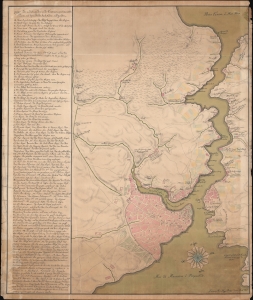
[Bosporus / Istanbul].
sold
- Digital Map Information
- Suitable for large format printing
- Full resolution TIFF file
- ICC color profile embedded
- Delivered instantly via download link
A unique 1766 manuscript map of Istanbul and the Bosporus drawn by the Slovenian surveyor and engineer Anton Mrak (1739 - 1801). This map represents the state-of-the-art mapping of the region in the year of the disastrous Great Istanbul Earthquake. The finely executed hand-drawn map is oriented loosely to the north, and covers the entirety of the Bosporus, the walled city of Istanbul, and the surrounding communities. Istanbul itself is mapped with great care, with coverage detailing the Sultanahmet, Eminoönü, Beyazit, and Fatih districts. Locations along the Bosporus are noted with detail. Curiously, the map is in Italian, but the alphanumeric key appearing along the left is in a combination of German and Ottoman Turkish. (more details)
First Detailed, Dedicated Plan of London.
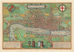
Londinum Feracissimi Angliae Regni Metropolis.
sold
- Digital Map Information
- Suitable for large format printing
- DPI: 600
- File Size: 46.69 MB
- File Type: ZIP / TIFF
- ICC color profile embedded
- Delivered instantly via download link
This is Georg Braun and Franz Hogenberg's plan of London, the first surviving, single-sheet, printed map of London. The significance of this seems not to have been lost on the authors, who made it the first plan in their Civitatis Orbis Terrarum, the first published collection of city plans and views. It is one of the few acquirable depictions of the city made before the Great Fire of 1666 (Howgego notes that it was the Great Fire itself, and the problems attendant to land ownership and rebuilding that led to proper surveys of the city in the first place.) (more details)
Extraordinary original wall map of Lyon, France - gastronomic capital of the world!
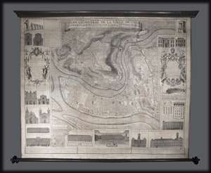
Plan Géometral de la Ville de Lyon.
sold
- Digital Map Information
- Suitable for large format printing
- Full resolution TIFF file
- ICC color profile embedded
- Delivered instantly via download link
A large wall map of Lyon, France by R. P Grégorie and Claude Seraucourt. Oriented to the east, this map centers on the convergence of the Rhone and Saone Rivers and the presqu'Ile , or peninsula, thus formed. It covers modern day Lyon's 1st and 2nd ... (more details)
Considered one of the best bird's-eye views of Paris.
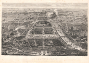
Le Nouveau Paris Panorama de Tous Ses Monuments, Jardins, Promenades; Pris sous un Aspect Nouveau.
sold
- Digital Map Information
- Suitable for large format printing
- File Size: 57.13 MB
- File Type: ZIP / TIFF
- ICC color profile embedded
- Delivered instantly via download link
This is the extremely rare 1865 Guesnu / Chardon bird's-eye view of Paris, France. This is the 'new' Paris, transformed by the Haussmann renovations - celebrated by many, cursed by others. This view stunningly captures the changes by exaggerating the perspective of the new avenues and grand new buildings. (more details)
Largest and Best 17th century view of Krakow.
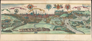
Cracovia Metropolis Regni Poloniae.
sold
- Digital Map Information
- Suitable for large format printing
- File Size: 934.03 MB
- File Type: ZIP / TIFF
- ICC color profile embedded
- Delivered instantly via download link
This is the largest and best 17th-century view of Krakow, Poland. The view was published in c. 1657 by Jan Jansson for his edition of Georg Braun and Franz Hogenberg's Civitatus Orbis Terrarum. (more details)
Considered one of the best Bird's-eye views of Paris.
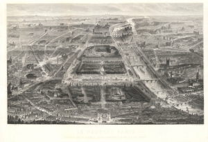
Le Nouveau Paris Panorama de Tous Ses Monuments, Jardins, Promenades; Pris sous un Aspect Nouveau.
sold
- Digital Map Information
- Suitable for large format printing
- File Size: 126.58 MB
- File Type: ZIP / TIFF
- ICC color profile embedded
- Delivered instantly via download link
This is the extremely rare 1865 Guesnu / Chardon bird's-eye view of Paris, France. This is the 'new' Paris, transformed by the Haussmann renovations - celebrated by many, cursed by others. This view stunningly captures the changes by exaggerating the perspective of the new avenues and grand new buildings. (more details)
The most beautiful example of Blaeu's city map of Moscow.
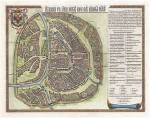
Царствающои град Москва началнои город всех московских государствах. / Carstvajuščoi grad Moskva načalo I gorod všeh Moskovech I carstvach. Urbis Moskvae.
sold
- Digital Map Information
- Suitable for large format printing
- DPI: 300
- File Size: 10.89 MB
- File Type: ZIP / TIFF
- ICC color profile embedded
- Delivered instantly via download link
This is a 1642 Hessel Gerritsz city map or plan of Moscow, Russia. With the Kremlin at its center, the map depicts the city from the city from the Moscow River to Zemlyanoy Gorod, which is surrounded by ramparts and a moat. This historical district in ... (more details)
The Ringstrasse - planning the democratization of Vienna.
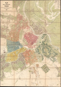
Plan der Haupt-u. Residenz Stadt Wein mit der neuen Bezirkseintheilung, Strassenbenennung under Häuser-Nummerirung.
sold
- Digital Map Information
- Suitable for large format printing
- File Size: 283.83 MB
- File Type: ZIP / TIFF
- ICC color profile embedded
- Delivered instantly via download link
A rare and significant 1866 official planning map of Vienna (Wein) drawn by Ludwig Zettle, one of the civil engineers working on the development of the Ringstrasse and the expansion of the city beyond its historic walls. The work represents a transitional moment, both for Vienna and for the Austrian Empire as a whole. One year after this map was issued, the Hapsburg Empire was reorganized as the constitutional Austro-Hungarian Monarchy. Likewise, the deconstruction of Vienna's walls, the expansion of the city, and the integration of the existing suburbs are evidence of an ongoing democratization of Austria and Europe in general. (more details)
Magnificent, iconic, and highly detailed twenty page wall map of Paris, France.
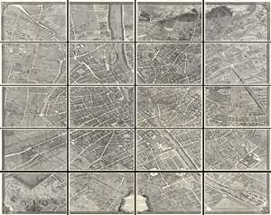
This is the c. 1900 Taride edition of Louis Bretez and Michel-Etienne Turgot's monumental 1739 map of Paris. Turgot's map of Paris is possibly the most ambitious urban mapping ever undertaken. This map shows the whole of 18th century Paris and offers a wonderful perspective on the city before Baron Georges Eugène Haussmann's 19th-century redesign. Turgot, who held the mayor-like office of Prevôt des Marchands de Paris , commissioned Louis Bretez and Claude Lucas to produce this map in 1734. Oriented to the east on an axonometric projection, this map is best understood as an aerial view where in every building, window, tree, shadow, and park are shown. It took the team nearly five years of exhaustive sketching and surveying to assemble this masterpiece. In order to produce the thousands of sketches and surveys required to complete this map, Bretez was issued a permit to enter every building in Paris. (more details)
Dominant 16th century mapping of Paris.
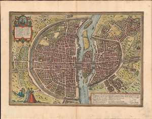
Lutetia vulgari Nomine Paris, Urbs Galliae Maxima, Sequana Navigabili Flumine Irrigatur...
sold
- Digital Map Information
- Suitable for large format printing
- Full resolution TIFF file
- ICC color profile embedded
- Delivered instantly via download link
A handsome example of the Braun and Hogenberg's 1572 map and view of Paris, France. With the Seine flowing at center around the Île de la Cité, this view looks on Paris from the northwest, with the top oriented to the southeast. The city is presented from an equidistant bird's-eye perspective wherein all structures are rendered in view form, but from a uniform height and angle relative to all individual points. Fertile fields surround the city, and the river bustles with boats, suggesting richness and prosperity. In the bottom left corner, a man greets two women, all wearing clothing corresponding to the Spanish-influenced fashion norms of 1560 - 1570. The Bastille, a prison infamous even prior to the French Revolution, appears here at top center, surrounded by a moat. The 1550 bastion, appearing to the left of the main structure of the Bastille is also evident. The map's title 'Lutetia,' is the Latin name for Paris which, by the 16th century, had largely been phased out but still appeared in academic references. (more details)
Dominant 16th century mapping of Paris.
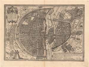
Lutetia vulgari Nomine Paris, Urbs Galliae Maxima, Sequana Navigabili Flumine Irrigatur...
sold
- Digital Map Information
- Suitable for large format printing
- Full resolution TIFF file
- ICC color profile embedded
- Delivered instantly via download link
A handsome example of the Braun and Hogenberg's 1572 map and view of Paris, France. With the Seine flowing at center around the Île de la Cité, this view looks on Paris from the northwest, with the top oriented to the southeast. The city is presented from an equidistant bird's-eye perspective wherein all structures are rendered in view form, but from a uniform height and angle relative to all individual points. Fertile fields surround the city, and the river bustles with boats, suggesting richness and prosperity. In the bottom left corner, a man greets two women, all wearing clothing corresponding to the Spanish-influenced fashion norms of 1560 - 1570. The Bastille, a prison infamous even prior to the French Revolution, appears here at top center, surrounded by a moat. The 1550 bastion, appearing to the left of the main structure of the Bastille is also evident. The map's title 'Lutetia,' is the Latin name for Paris which, by the 16th century, had largely been phased out but still appeared in academic references. (more details)
The dominant 16th Century mapping of Paris.
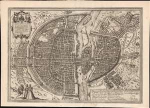
Lutetia vulgari Nomine Paris, Urbs Galliae Maxima, Sequana Navigabili Flumine Irrigatur...
sold
- Digital Map Information
- Suitable for large format printing
- Full resolution TIFF file
- ICC color profile embedded
- Delivered instantly via download link
A handsome example of the Braun and Hogenberg's 1572 map and view of Paris, France. With the Seine flowing at center around the Île de la Cité, this view looks on Paris from the northwest, with the top of the map oriented to the southeast. The city is presented on from equidistant bird's-eye perspective wherein all structures are rendered in view form but from a uniform height and angle relative to all individual points. Fertile fields surround the city, and the rivers bustles with boats, suggesting richness and prosperity. In the bottom left corner, a man greets two women, all wearing clothing corresponding to the Spanish influenced fashion norms of 1560 - 1570. The Bastille, an infamous prison prior to the French Revolution, appears here at top center, surrounded by a moat. The 1550 bastion, appearing to the left of the main structure of the Bastille is also evident. The map's title 'Lutetia' refers to the roman name for Paris which, by the 16th century, had largely been phased out but still appeared in academic references. (more details)
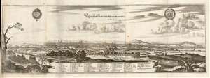
First plate of the elder Merian's self-referential panorama of Paris.
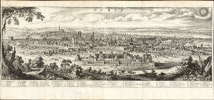
Parys.
sold
- Digital Map Information
- Suitable for large format printing
- File Size: 30.67 MB
- File Type: ZIP / TIFF
- ICC color profile embedded
- Delivered instantly via download link
This is a superb example of Matthaus Merian's view of Paris, France - arguably the most desirable of Merian's panoramas in that it is also a self-portrait. (more details)
The height of Venetian culture.
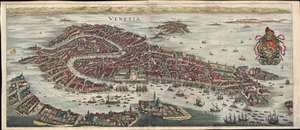
Venetia.
sold
- Digital Map Information
- Suitable for large format printing
- Full resolution TIFF file
- ICC color profile embedded
- Delivered instantly via download link
This is a beautiful full-color example of Matthäus Merian c. 1642 view of Venice at the height of its prosperity. The view looks directly north on Venice from a fictional highpoint in the Adriatic just south of Giudecca. The Piazza San Marco appears at center, with the Grand Canal winding its way through the neighboring islands Murano, Burano, Torcello, and Mazorbo, among others. The harbor is particularly bustling, with ships of all sizes and shapes waiting to dock. The armorial crest of the Republic of Venice appears in the upper right, crowned by the Doge's cap and the winged Lion of Venice at center. (more details)
Best Acquirable View of London Prior to the Great Fire.
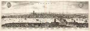
London.
sold
- Digital Map Information
- Suitable for large format printing
- Full resolution TIFF file
- ICC color profile embedded
- Delivered instantly via download link
This is a Matthäus Merian view of London, engraved in 1638 for inclusion in his Archontologia cosmica. It was based on an earlier, 1616 panorama of the city by Claes Visscher (1587 - 1652.) The four-sheet, nearly seven-foot-long Visscher is an all but unobtainable rarity, with only a handful of known copies in institutional and private hands. (An example sold at Christies in 2018 for nearly $150,000.) The Merian expertly reduces the image, preserving much of its detail and elegance. The detail and recognizability of the image are particularly remarkable, given that neither Merian nor Visscher ever had visited London; Visscher's view was based on traditional printed maps (possibly including John Norden's Civitas Londini, which survives in a single copy in the Royal Library in Stockholm) and the reports of visitors at the turn of the century. Visscher's publisher, Jodocus Hondius, lived in London from 1587 to 1593, and he may have been consulted. Thus, despite being engraved during the reign of Charles I, the view is a depiction of Elizabethan London c. 1600; it remains one of the very few acquirable views of the city as it stood prior to the 1666 Great Fire of London. (more details)
Monumental twelve panel map of Paris.
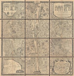
Plan De Paris, Leve Par Les Ordres Du Roy Et Par Les Soins De Messieurs Les Prevost Des Marchands Et Eschevins.
sold
This majestic twelve panel map or plan of Paris is the c. 1900 Taride reissue of an important map originally prepared by Pierre Bullet, Francois Blonde, A. Bonnardt, and Bernard J. H. Jaillot. Like many early maps of Paris, the present example is ... (more details)
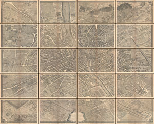
Plan de Paris.
sold
- Digital Map Information
- Suitable for large format printing
- File Size: 39.19 MB
- File Type: ZIP / TIFF
- ICC color profile embedded
- Delivered instantly via download link
This is the c. 1900 Taride edition of Louis Bretez and Michel-Etienne Turgot's monumental 1739 map of Paris. Turgot's map of Paris is possibly the most ambitious urban mapping ever undertaken. Shows the whole of 18th century Paris and offers a ... (more details)
Two weeks before the Siege of Paris.
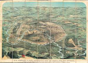
No. 8. Stannard and Son's, Perspective View of Paris and its Environs, Shewing All the Fortifications and Redoubts, Together with the Lines of Defense Recently Thrown Up, and the Roads, Rivers, and Railways Communication with the Interior.
sold
- Digital Map Information
- Suitable for large format printing
- File Size: 61.17 MB
- File Type: ZIP / TIFF
- ICC color profile embedded
- Delivered instantly via download link
Published eighteen days before the beginning of the Siege of Paris on September 17, 1870, this 1870 Alfred Concanen view of Paris and its environs details the newly constructed defensive works around the French capital. Paris itself occupies the center of the view, and the Louvre and Notre Dame are easily identifiable, along with the Arc de Triomphe, the Panthéon, and the Invalides. The city's walls encircle the entire city, spanning 20.5 miles. A series of sixteen disconnected forts, constructed to protect the city gates, surround the city. Redoubts and other fortifications were built as well to supplement the forts. (more details)
Stunning view of Venice.
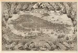
Venetien.
sold
- Digital Map Information
- Suitable for large format printing
- Full resolution TIFF file
- ICC color profile embedded
- Delivered instantly via download link
This beautiful, rare engraving is an unrecorded variant of Vincenzo Coronelli's bird's-eye view of Venice. While the work is unsigned, it has been attributed to the Dutch engraver Jan Lamsvelt (or Lansvelt.) The city's unmistakable, archipelagic layout is portrayed in meticulous detail, and the waters around the city are teeming with ships and galleys (including the state barge of the Doge of Venice, Il Bucintoro). The engraving is a reduced (approximately 2/3) version of Vincenzo Coronelli's 1693 Citta di Venezia, which combined Matthias Merian's meticulous bird's-eye view with a superbly-composed ribbon-and-laurel border, embellished with the coats of arms of the various dominions of the Venetian Republic. In addition to the change of scale, the engraver has translated the bulk of the text in the body of the map from the original Italian to French, to conform to the language of the 1699 Voyages du Mr. Du Mont printed in the Hague, for which this engraving was intended. At some point that year, the plate was amended, changing the title and the two instances of the name for the Venetian Lagoon from French to Dutch. This rather hasty alteration was made for the inclusion of the plate in the Dutch edition of Du Mont's Voyages printed in Utrecht, also in 1699. None of the rest of the French text has been changed, and the plate numbering engraved in the upper left corner is unchanged between the two states of the view. That the plate was first engraved in the French, followed with the minor alteration to create a Dutch version, seems self-evident. (more details)
Bucolic Panorama of Paris and her Countryside.
Prosp. der Statt Parys wie solche an ietzo an zusehen.
sold
- Digital Map Information
- Suitable for large format printing
- Full resolution TIFF file
- ICC color profile embedded
- Delivered instantly via download link
This is a 1655 Caspar Merian view of Paris, France - a superbly executed view showing that in artistry Caspar was indeed his father's son. The view is oriented to the west-south-west, from a perspective both further from the city and more to the east than the elder Merian's 1638 view. Rather than border the view with stylized or fanciful floral decoration, Caspar Merian has - following the lead of his father - chosen to frame the panorama in realistic semi-wild trees and bracken of the hillside from which the view was drawn, which has the effect of emphasizing that it was drawn from life. (more details)
One of the most beautiful old color large format 19th century maps of Paris.
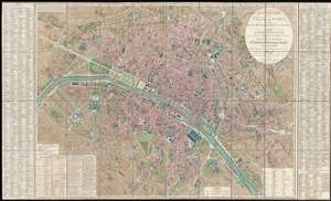
Plan Routier de la Ville de Paris, divise en XII Arrondissements ou Mairies et en Quarante Huit Quartiers, avec tous le Changements et Projets ordonnes par le Gouvernement.
sold
- Digital Map Information
- Suitable for large format printing
- DPI: 300
- File Size: 86.66 MB
- File Type: ZIP / TIFF
- ICC color profile embedded
- Delivered instantly via download link
This is a stunning large format map of Paris issued in 1839 by Pierre-Jacques Picquet. Centered on the Seine River, the map covers from the Champ de Mars eastward to Place du Trone. This map was first issued for administrative use during the ... (more details)
Best and largest map of Liverpool of the 19th century.
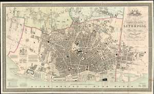
This Trigonometrical Plan of the Town and Port of Liverpool including the environs of Kirkdale Everton Low Hill Edge Hill and Toxteth Park from Actual Survey.
sold
- Digital Map Information
- Suitable for large format printing
- DPI: 600
- File Size: 159.52 MB
- File Type: ZIP / TIFF
- ICC color profile embedded
- Delivered instantly via download link
The finest 19th century large format city plan or map of Liverpool, England. Published by Michael Alexander Gage, this first edition map is oriented to the northeast and details the city from Kirkdale to Toxteth Park and eastward as far as Edge Hill. Throughout the plan exhibits extraordinary and meticulous detail, noting every house with its layout, as well as roads, churches, parks, and even individual trees - a testament to Gage's often overshadowed skills as an engraver. In addition, important businesses, including foundries, lumber yards, cooperages, shipbuilders, chrome works, color works, soap makers, breweries, and more are noted - often by their individual company names. (more details)
A celebration of English engraving and design.
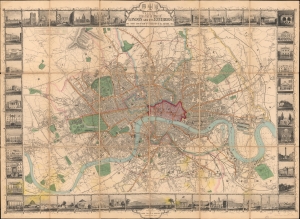
Tallis's Illustrated Plan of London and its Environs in commemoration of the Great Exhibition of Industry of all Nations, 1851.
sold
- Digital Map Information
- Suitable for large format printing
- Full resolution TIFF file
- ICC color profile embedded
- Delivered instantly via download link
A superbly decorative 1851 John Tallis city plan or map of London with elaborate pictorial surround, this map was touted on its release as 'the most beautiful and perfect Plan of London ever produced'. With a finely engraved border consisting of forty illustrated views of London's 'public buildings and places of amusement', the map lives up to the publisher's boastful claim. (more details)
Pre-Baroque Rome!
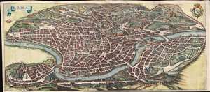
Roma.
sold
- Digital Map Information
- Suitable for large format printing
- Full resolution TIFF file
- ICC color profile embedded
- Delivered instantly via download link
An important and stunning c. 1642 bird's eye view and map of Rome by Matthäus Merian. Merian's panoramic view of Rome, based on the eastward oriented model established in 1593 by Antonio Tempesta, reveals the city at the height of the Italian Renaissance. The view looks on Rome from the northwest - thus looking roughly southwest. This map follows shortly after Pope Sixtus V's ambitious civic redesign of Rome and yet predates the massive rebuilding that occurred during the Baroque Period, thus encapsulating the city during an ephemeral but significant period. The axonometric projection that Merian utilizes lends this map a special significance to historians and architects who can thus visualize many buildings that were demolished or fell into ruin during the subsequent era. (more details)
One of the most decorative maps of London of the 19th century.
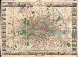
Tallis's Illustrated Plan of London and its Environs in commemoration of the Great Exhibition of Industry of all Nations, 1851.
sold
- Digital Map Information
- Suitable for large format printing
- Full resolution TIFF file
- ICC color profile embedded
- Delivered instantly via download link
A superbly decorative 1851 John Tallis map of London with elaborate pictorial surround, this map was touted on its release as 'the most beautiful and perfect Plan of London ever produced.' With a finely engraved border consisting of forty illustrated views of London 'public buildings and places of amusement', the map lives up to the publisher's boisterous claim. Centered on Charing Cross, coverage extends from Stamford Hill to West Ham and from Brixton to Shepherds Bush. The map was issued to showcase the genius of British cartography, printing, and engraving at the 1851 Great Exhibition of the Works of Industry of All Nations, held in London. (more details)
Majestic and revolutionary multi panel wall map of Paris.
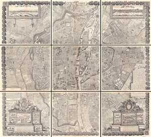
Lutetia Paris.
sold
- Digital Map Information
- Suitable for large format printing
- Full resolution TIFF file
- ICC color profile embedded
- Delivered instantly via download link
This majestic nine panel plan of Paris is the c. 1900 Taride reissue of an important map originally issued in 1652 by Jacques Gomboust. Gomboust held the position of Ingenieur du Roi and, in that capacity completed several important surveys of ... (more details)
Majestic and revolutionary multi panel wall map of Paris.
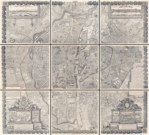
Lutetia Paris.
sold
- Digital Map Information
- Suitable for large format printing
- Full resolution TIFF file
- ICC color profile embedded
- Delivered instantly via download link
This majestic nine panel plan of Paris is the c. 1900 Taride reissue of an important map originally issued in 1652 by Jacques Gomboust. Gomboust held the position of Ingenieur du Roi and, in that capacity completed a number of important ... (more details)