
London (sold)
Best 19th century map of London.
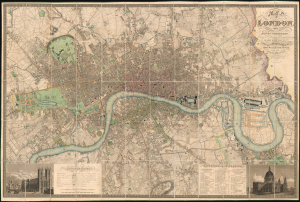
Map of London, from An Actual Survey made in the Years 1824, 1824 and 1826 by C. and J. Greenwood.
sold
- Digital Map Information
- Suitable for large format printing
- File Size: 284.14 MB
- File Type: ZIP / TIFF
- ICC color profile embedded
- Delivered instantly via download link
This is the rare 1830 second edition of Christopher and John Greenwood's large-scale map of London, here in a spectacularly preserved example. It is considered the largest and finest plan of London to appear in the 19th century. The present example is linen-backed and accompanied by its original green leather slipcase. (more details)
The best 19th century map of London.
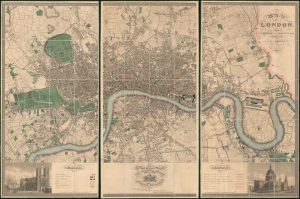
Map of London, from An Actual Survey made in the Years 1824, 1824 and 1826 by C. an J. Greenwood.
sold
- Digital Map Information
- Suitable for large format printing
- Full resolution TIFF file
- ICC color profile embedded
- Delivered instantly via download link
This is the rare first edition of Christopher and John Greenwood's large-scale 1827 map of London, here in a spectacularly preserved example. It is considered the largest and finest plan of London to appear in the 19th century. The present example is presented in three linen-backed folding sections, and is accompanied by its original leather slipcase. (more details)
The largest original map of Victorian London obtainable.
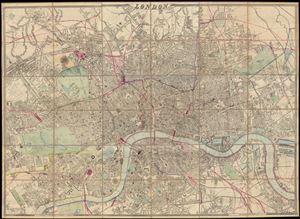
London.
sold
- Digital Map Information
- Suitable for large format printing
- File Size: 25.36 MB
- File Type: ZIP / TIFF
- ICC color profile embedded
- Delivered instantly via download link
A remarkable and monumental map of London, this is Weller and Cassell's 1866 wall map of London. When it was first issued in 1861 this was the largest scale map of London yet produced. Cassell was justly proud of his map bragging, 'as well as being the largest, ... (more details)
Unique record of Mayfair WWII nightlife at the height of the Blitz.
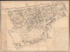
[Mayfair / Soho, London]
sold
- Digital Map Information
- Suitable for large format printing
- Full resolution TIFF file
- ICC color profile embedded
- Delivered instantly via download link
An extraordinary artifact of wartime London, this unique 1941 manuscript map captures the theaters, nightclubs, restaurants, hotels, pubs, illicit establishments, and air-raid shelters of Mayfair, Soho, and the West End at the height of the Blitz. It documents London balanced precariously between pleasure and destruction: orchestras played, couples danced, and fashionable clubs welcomed servicemen, aristocrats, refugees, actors, diplomats, and intelligence officers even as blackout curtains smothered windows and German bombs fell overhead. Its remarkable annotations offer an intimate, street-level portrait of London nightlife under siege. (more details)
London gets an upgrade.
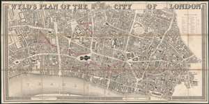
Wyld's Plan of the City of London.
sold
- Digital Map Information
- Suitable for large format printing
- Full resolution TIFF file
- ICC color profile embedded
- Delivered instantly via download link
An exceptionally striking large scale 1842 map of the 'City of London' issued by James Wyld to illustrate new and proposed streets. Wyld presents a highly detailed focus, with coverage extending from roughly St. Clement Danes Church to Minories, and from Charter House Square to the Thames. Notably, it names and numbers individual property lots. The map is surmounted with bold titling in large decoratively engraved letters. (more details)
Remarkable presentation issue of an iconic birds-eye view of London, England.

Panorama of the River Thames in 1845. Given with the London Illustrated News.
sold
- Digital Map Information
- Suitable for large format printing
- Full resolution TIFF file
- ICC color profile embedded
- Delivered instantly via download link
This is a dramatic presentation copy of the scarce 1845 London Illustrated News panorama of London, England. Measuring some 96 inches long, this enormous production presents a birds-eye view of London as seen from far above the southern shore of the Thames, ... (more details)
A celebration of English engraving and design.
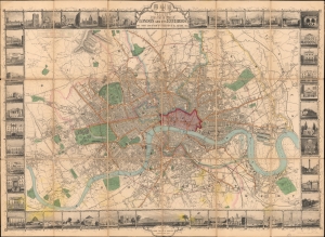
Tallis's Illustrated Plan of London and its Environs in commemoration of the Great Exhibition of Industry of all Nations, 1851.
sold
- Digital Map Information
- Suitable for large format printing
- Full resolution TIFF file
- ICC color profile embedded
- Delivered instantly via download link
A superbly decorative 1851 John Tallis city plan or map of London with elaborate pictorial surround, this map was touted on its release as 'the most beautiful and perfect Plan of London ever produced'. With a finely engraved border consisting of forty illustrated views of London's 'public buildings and places of amusement', the map lives up to the publisher's boastful claim. (more details)
Elphinstone's map of London, with original silk roll-bag.
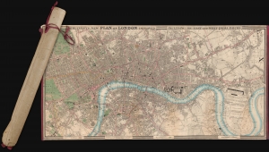
Cruchley's New Plan of London Improved including the East and West India Docks.
sold
- Digital Map Information
- Suitable for large format printing
- Full resolution TIFF file
- ICC color profile embedded
- Delivered instantly via download link
A fine example of the scarce 1831 edition of George Frederick Cruchley's large and famous city plan or map of London, contained within its original rolled silk slip-bag, a unique presentation giving the piece an authentic objective tactility. (more details)
One of the most decorative maps of London of the 19th century.
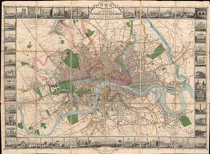
Tallis's Illustrated Plan of London and its Environs in commemoration of the Great Exhibition of Industry of all Nations, 1851.
sold
- Digital Map Information
- Suitable for large format printing
- Full resolution TIFF file
- ICC color profile embedded
- Delivered instantly via download link
A superbly decorative 1851 John Tallis map of London with elaborate pictorial surround, this map was touted on its release as 'the most beautiful and perfect Plan of London ever produced.' With a finely engraved border consisting of forty illustrated views of London 'public buildings and places of amusement', the map lives up to the publisher's boisterous claim. Centered on Charing Cross, coverage extends from Stamford Hill to West Ham and from Brixton to Shepherds Bush. The map was issued to showcase the genius of British cartography, printing, and engraving at the 1851 Great Exhibition of the Works of Industry of All Nations, held in London. (more details)
An incredible 19th century view of London.

[London Illustrated New Panorama View of London and the River Thames].
sold
- Digital Map Information
- Suitable for large format printing
- DPI: 600
- File Size: 117.23 MB
- File Type: ZIP / TIFF
- ICC color profile embedded
- Delivered instantly via download link
This is a scarce 1845 London Illustrated News panorama of London, England. Measuring some 96 inches long, this enormous production presents a birds-eye view of London as seen from far above the southern shore of the Thames, covering from Vauxhall to Greenwich. There is much of interest throughout, from lively shipping at the East and West India Docks; to Nelson's Column, only erected three years before; to the short-lived Hungerford Suspension Bridge (1845-1862, when it was removed and the chain used on the Clifton Suspension Bridge over the Avon); and Buckingham Palace, completed in 1837, still with the Marble Arch as the gateway (re-erected in Hyde Park 1851). (more details)
Only known example of Lucas Schnitzer's view of London before the Great Fire of 1666.
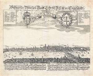
London. / Bildnus de Troffen Statt London in Engeland.
sold
- Digital Map Information
- Suitable for large format printing
- DPI: 300
- File Size: 6.11 MB
- File Type: ZIP / TIFF
- ICC color profile embedded
- Delivered instantly via download link
An exceedingly rare c. 1650 view of London, England, of which there are no other known examples. The view looks north from the south side of the Thames River and extends roughly from modern day Waterloo Bridge to modern day Canary Warf, revealing London ... (more details)
One of the most decorative maps of London of the 19th century.
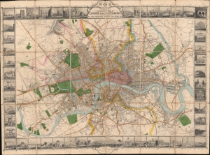
Tallis's Illustrated Plan of London and its Environs in commemoration of the Great Exhibition of Industry of all Nations, 1851.
sold
- Digital Map Information
- Suitable for large format printing
- DPI: 600
- File Size: 109.86 MB
- File Type: ZIP / TIFF
- ICC color profile embedded
- Delivered instantly via download link
A superbly decorative 1851 John Tallis map of London with elaborate pictorial surround, this map was touted on its release as 'the most beautiful and perfect Plan of London ever produced'. With a finely engraved border consisting of forty illustrated views of London's 'public buildings and places of amusement', the map lives up to the publisher's boastful claim. (more details)
The only known example.
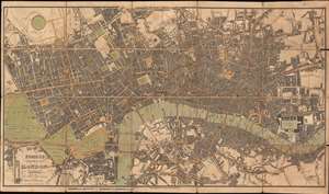
Fores's New Plan of London Including the New Improvements.
sold
- Digital Map Information
- Suitable for large format printing
- Full resolution TIFF file
- ICC color profile embedded
- Delivered instantly via download link
This is an 1822 Samuel William Fores city plan or map of London, England. Focusing on central London in the vicinity of the Thames River, the map depicts from Hyde Park to Bethnal Green and from Regent's Park to Rotherhithe. Numerous landmarks, including the Tower of London, London Bridge, St. Paul's Cathedral, the British Museum, and Buckingham Palace (labeled here as Buckingham House), all appear. Streets, squares, and other buildings are identified. (more details)
Rare plan detailing Christopher Wren's proposed reconstruction following the 1666 Great Fire of London.
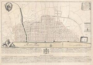
Ichnographia urbis Londinii… (A Plan of the City of London, after the great FIRE, in the Year of Our Lord 1666.)
sold
- Digital Map Information
- Suitable for large format printing
- DPI: 300
- File Size: 17.58 MB
- File Type: ZIP / TIFF
- ICC color profile embedded
- Delivered instantly via download link
An extremely scarce 1744 map of London showing Sir Christopher Wren's plan for reconstructing the city following the 1666 Great Fire of London. In 1666 the Great Fire swept through the old Roman portions of London, laying waste to most of the original ... (more details)
Extremely rare case map of the area 24 miles around London, England.
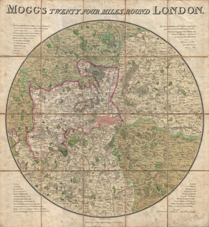
Mogg's Twenty Four Miles Round London.
sold
- Digital Map Information
- Suitable for large format printing
- DPI: 300
- File Size: 22.86 MB
- File Type: ZIP / TIFF
- ICC color profile embedded
- Delivered instantly via download link
Edward Mogg's extraordinary 1820 case map of the region 24 miles around London, England. Covers from Ryegate in the south to Hertfort in the north, and from Windsor in the west to Gravesend in the east. Mogg first issued this revolutionary circular ... (more details)
A magnificently engraved and historic plan of London.
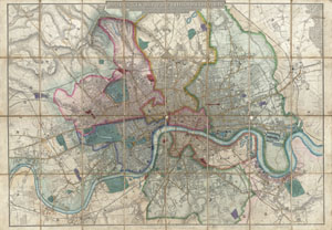
Davies's New Map of the British Metropolis, The Boundaries of the Boroughs, County Court Districts, Railways, and Modern Improvements.
sold
- Digital Map Information
- Suitable for large format printing
- DPI: 300
- File Size: 45.55 MB
- File Type: ZIP / TIFF
- ICC color profile embedded
- Delivered instantly via download link
A rare, extraordinary, and beautifully engraved 1852 case map or pocket plan of London, England, by B. R. Davies. Covers the center of London from Chiswick east to Bugsby's Reach and the Victoria Docks, extends north as far as Stamford Hill, and south ... (more details)
Extraordinary first edition of Mogg's rare and important map of London, England.
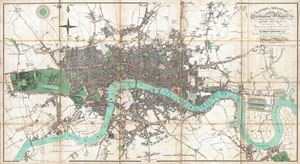
London in Miniature, with the Surrounding Villages Entire New Plan in which the Improvements both present and intended are actually reduced (by permission) from the surveys of the Several Proprietors.
sold
- Digital Map Information
- Suitable for large format printing
- DPI: 300
- File Size: 28.43 MB
- File Type: ZIP / TIFF
- ICC color profile embedded
- Delivered instantly via download link
An extraordinary first edition example of Edward Mogg's important 1806 case map of London, England. Covers the central part of London from Kensington to Greenwich and the East India Docks. Of this stunning map, Mogg writes ...like the clue of ... (more details)
Scarce pocket map of London in its first edition.
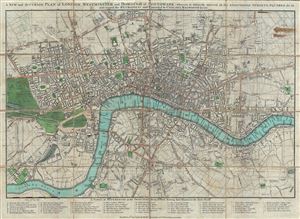
A New and Accurate Plan of London, Westminster and Borough of Southwark; Wherein is Distinctly Inserted All the Additional Streets, Squares and c in and Round the Metropolis and Extended to Chelsea, Walworth …
sold
- Digital Map Information
- Suitable for large format printing
- Full resolution TIFF file
- ICC color profile embedded
- Delivered instantly via download link
A scarce Robert Sayer plan or map of London, England presented here in its 1792 first edition. The map covers from Pentonville to Stepney Church and from Walworth to the Serpentine (Hyde Park). The City of London is highlighted in red ... (more details)
Highly decorative first editon map of London with vingette advtising 'Wyld's Great Globe' in Leicester Square.
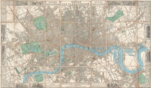
Wyld's New Plan of London.
sold
- Digital Map Information
- Suitable for large format printing
- File Size: 24.91 MB
- File Type: ZIP / TIFF
- ICC color profile embedded
- Delivered instantly via download link
A thoroughly decorate 1851 first edition plan or map of London, England by James Wyld. Centered on Blackfriars Bridge, the map coves central London from Islington to North Brixton and from the East India Docks to Holland Park. Roads, ... (more details)
Garbutt return's the Underground Map to Beck's Values.
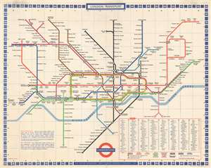
London Transport. Underground.
sold
- Digital Map Information
- Suitable for large format printing
- File Size: 82.02 MB
- File Type: ZIP / TIFF
- ICC color profile embedded
- Delivered instantly via download link
A c. 1972 large format map of the London Underground as drawn by Paul E. Garbutt made for in-station display. This map, or rather schematic transport diagram, is drawn on the c. 1930s Harry Beck model. In 1960, when the Victoria Line was introduced, the classic Beck map had to be redrawn. The job fell to publicity artist Harold Hutchison, who redesigned the Beck map, replacing Beck's curves with unpopular angles and square interchanges. The map was so unpopular, that in 1962 London Transit worker Paul E. Garbutt, again redesigned it, returning to the Beck style, but retaining some of Huchinson's ideas, including black rings for interchanges and lower-case text for non-interchange stations. Around this time Garbutt also introduced the distinctive bottle shape of the Circle Line which, years later, Absolute Vodka was able to leverage for some clever advertising. This version of the underground map was prepared in 1972 and includes plans to extend the Piccadilly Line to Hattan Cross and Heathrow Airport, a project that was not completed until 1977. (more details)
Scarce broadside satirizing the folly of England's 18th century Bubble economics, specifically the disastrous South Sea Bubble.
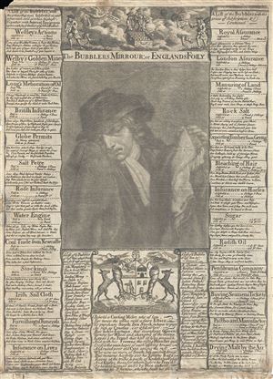
The Bubblers Mirrour: or Englands Folly.
sold
- Digital Map Information
- Suitable for large format printing
- DPI: 300
- File Size: 6.22 MB
- File Type: ZIP / TIFF
- ICC color profile embedded
- Delivered instantly via download link
An exceptional 1720 Thomas Bowles broadside satirizing the rise and fall of the South Sea Company. The South Sea Company was an English joint-stock venture dreamed up by John Blunt in 1711. Blunt developed a complicated scheme ... (more details)
The finest map of London issued in 1823.
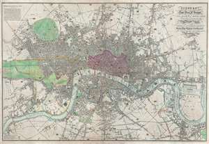
Pigot and Co's New Plan of London, Taken from the best Authorities with the Geographical bearings from the Dome of St. Paul's And formed into Divisions by means of circular lines each division being referred to in their list of Streets and Public Buildings in the Metropolis, The whole forming the most complete guide to London and ITS VICINITY YET PUBLISHED.
sold
- Digital Map Information
- Suitable for large format printing
- DPI: 300
- File Size: 19.16 MB
- File Type: ZIP / TIFF
- ICC color profile embedded
- Delivered instantly via download link
An attractive first edition example of James Pigot's 1823 map of London, England. Centered on the Thames River, Pigot's map covers from Islington to the East India Dock and from Camberwell to Kensington Gardens. The City of London is highlighted in red and the various parks in green. All streets, bridges, and important buildings are meticulously identified. Circular distance markers appear each 3/4th mile from Charing Cross. (more details)
Beautifully engraved large format map of Victorian London.
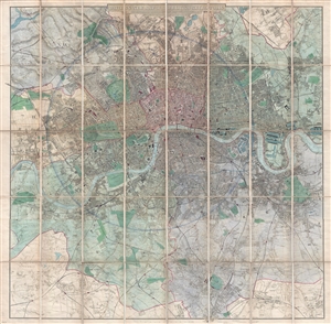
Davies's New Map of the British Metropolis. The Boundaries of the Boroughs, County Court Districts, Railways, and Modern Improvements.
sold
- Digital Map Information
- Suitable for large format printing
- File Size: 50.4 MB
- File Type: ZIP / TIFF
- ICC color profile embedded
- Delivered instantly via download link
A fine 1885 example of Davies's fine large scale map of London. Roughly centered on Charing Cross the Thames River, the map covers from Brent Reservoir to Bromley, and from New Wanstead to Cottenham Park. A shaded circular ... (more details)
Designed for the Crystal Palace Exhibition.
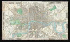
Wyld's New Plan of London.
sold
- Digital Map Information
- Suitable for large format printing
- DPI: 600
- File Size: 1025.05 MB
- File Type: ZIP / TIFF
- ICC color profile embedded
- Delivered instantly via download link
A decorative 1851 first edition plan or map of London, England by James Wyld. It was published to be of use to visitors to London's 1851 Great Exhibition of the Works of Industry of All Nations, also known as the Crystal Palace Exhibition. (more details)
An unusual early case map of London.
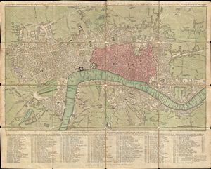
The London Directory or a New & Improved Plan of London, Westminster & Southwark; with the adjacent Country, the New Buildings, the New Roads and the late alterations by Opening of New Streets, & Widening of others 1790.
sold
- Digital Map Information
- Suitable for large format printing
- DPI: 300
- File Size: 15.2 MB
- File Type: ZIP / TIFF
- ICC color profile embedded
- Delivered instantly via download link
A highly appealing 1790 map of London by Robert Sayer. Centered on the Thames River, this map details central London from Islington to Shadwell and from Newington Butts to Tyburn. Only three bridges cross the Thames: ... (more details)
One of the first maps to depict the London Underground.
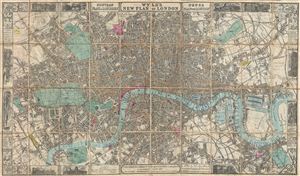
Wyld's New Plan of London.
sold
- Digital Map Information
- Suitable for large format printing
- Full resolution TIFF file
- ICC color profile embedded
- Delivered instantly via download link
A large and appealing pocket map of London, england issued by James Wyld in 1863. Centered on the Thames, this map covers central London from Paddington Cemetery in the northwest to Hudson Town in the northeast, and ... (more details)
The finest map of London issued in 1823.
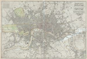
Pigot and Co's New Plan of London, Taken from the best Authorities with the Geographical bearings from the Dome of St. Paul's And formed into Divisions by means of circular lines each division being referred to in their list of Streets and Public Buildings in the Metropolis, The whole forming the most complete guide to London and ITS VICINITY YET PUBLISHED.
sold
- Digital Map Information
- Suitable for large format printing
- DPI: 300
- File Size: 28.68 MB
- File Type: ZIP / TIFF
- ICC color profile embedded
- Delivered instantly via download link
An attractive 1823 first edition example of James Pigot's map of London, England. Centered on the Thames River, Pigot's map covers from Islington to the East India Dock and from Camberwell to Kensington Gardens. ... (more details)
London from above.
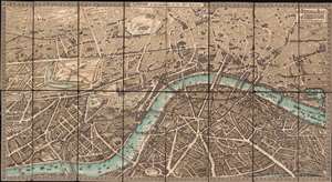
The Pictorial Plan of London.
sold
- Digital Map Information
- Suitable for large format printing
- Full resolution TIFF file
- ICC color profile embedded
- Delivered instantly via download link
A striking chromolithograph Edwardian Era pictorial plan of London issued in 1901 by Charles Baker and Co. Ltd. Centered on Charing Cross, the map covers from Albert Bridge and Kensington Palace to the London Docks and Southwark Park. It extends south to the Grand Surrey Canal and north to include all of Regents Park and Kings Cross Station. The cartographer combines pictorial elements with axonometrical style mapping in which important buildings are represent from equidistant elevated perspective - similar to the great 1738 Bretez/Turgot Plan of Paris, if not on so grand a scale. (more details)
Extraordinary panoramic view of London.
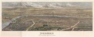
London from the south side of the Thames.
sold
- Digital Map Information
- Suitable for large format printing
- File Size: 43.63 MB
- File Type: ZIP / TIFF
- ICC color profile embedded
- Delivered instantly via download link
An impressive panoramic bird's-eye view of London, England as seen from the south side of the Thames River. The view centers on St. Paul's cathedral with the Thames just below it stretching across the entire ... (more details)
An example of an early edition of one of the most celebrated maps of London.
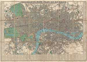
Cruchley's New Plan of London. Shewing All the New and Intended Improvements to the Present Time.
sold
- Digital Map Information
- Suitable for large format printing
- DPI: 300
- File Size: 14.97 MB
- File Type: ZIP / TIFF
- ICC color profile embedded
- Delivered instantly via download link
This is an 1834 edition of George Frederick Cruchley's famous city map or plan of London, England. The map depicts the city from Hyde Park to the London Docks and from Regent's Park and the Regents Canal to ... (more details)
Scarce pocket map of London, edition not in Howgego.
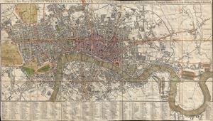
Smith's New Plan of London, Westminster and Southwark: Comprehending All the New Buildings and 350 References to the Principal Streets with the New Docks at Wapping and Blackwell.
sold
- Digital Map Information
- Suitable for large format printing
- DPI: 300
- File Size: 21.65 MB
- File Type: ZIP / TIFF
- ICC color profile embedded
- Delivered instantly via download link
A scarce 1822 dissected pocket map of London, England, by Charles Smith. Centered on the Thames River, this map covers from Paddington to Greenwich and from Chelsea Common to Stratford. The City of ... (more details)
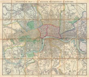
Stanford's Map of the British Metropolis & Suburbs.
sold
- Digital Map Information
- Suitable for large format printing
- File Size: 39.81 MB
- File Type: ZIP / TIFF
- ICC color profile embedded
- Delivered instantly via download link
An extremely attractive 1861 pocket or case map of London, england, by edward Stanford. Centered on the Thames River, Stanford's folding case map covers central London from Holloway to Blackwall and ... (more details)