
Mexico - Central America (sold)
First printed nautical chart of the Gulf of Mexico and Florida.
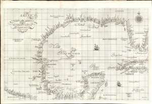
Carta particolare della Baia di Messico con la Costa.
sold
- Digital Map Information
- Suitable for large format printing
- Full resolution TIFF file
- ICC color profile embedded
- Delivered instantly via download link
A seminal production, this is a fine first-edition, first-state example of Sir Robert Dudley's 1645 - 47 maritime map of the Gulf of Mexico, the first printed nautical chart of that region. It is also the first to be printed using Mercator's Projection - thus making it the first to be practical for actual navigation. Likewise it is also the first to accurately indicate prevailing winds and ocean currents in the Gulf. Coverage extends from the Pacific Coast of Mexico to eastern Florida, and from Galveston Bay (Texas) to modern day Belize and the Bay of Honduras), inclusive of the Yucatan Peninsula and western Cuba. The whole is stunningly engraved in Antonio Francesco Lucini's masterful Italian baroque hand, complete with fine calligraphy and idiosyncratic styling. (more details)
The rarest of the Texas 'Treaty Map' series.
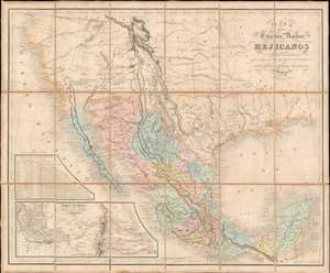
Mapa De Los Estados Unidos Mejicanos Arreglado a la distribucion que en diversos decretos ha hecho del territorio el Congreso General Mejicano.
sold
- Digital Map Information
- Suitable for large format printing
- Full resolution TIFF file
- ICC color profile embedded
- Delivered instantly via download link
The extremely rare 1851 edition of the Jean-Frédéric Rosa Map of Texas, California, and Mexico - considered the rarest of the 'Treaty Maps' used to settle the Mexico-Texas border between 1847 and 1853. This is grand map covering all of Mexico and much the southwestern part of the United States from the Pacific to the Apalachicola River and extending as far north as Great Salt Lake (Timpanogos). It was published in Paris by Jean-Frédéric Rosa on behalf of the Mexican Congreso General in anticipation of renewed negotiations over that part of the southwest that would eventually be annexed to the United States as part of the Gadsden Purchase. The map, generally based upon the 1826 Tanner map of Mexico, offers much of interest, including a recognition of American claims in Texas and Upper California, and multiple border configurations within Texas itself. It is the rarest of the three maps, along with the Tanner and Disturnell, used to negotiate the Gadsden Purchase. (more details)
One of the first dedicated maps of South America, and the first to hint at the location of El Dorado.
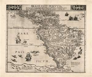
Brasilia et Peruvia.
sold
- Digital Map Information
- Suitable for large format printing
- Full resolution TIFF file
- ICC color profile embedded
- Delivered instantly via download link
This is Cornelis De Jode's 1593 map of South America, the second, full-size map of the area to appear in an atlas, predated only by the 1578 map produced by his father, Gerard De Jode. This rare map, printed in a single edition, outstripped contemporaneous efforts by De Bry and Ortelius in terms of accuracy and beauty. The map covers from Central America and the Caribbean to embrace all of South America; beyond the Strait of Magellan Tierra del Fuego appears, not as a small island or archipelago but extending into a massive 'Terra Australis.' The Amazon River is shown, along with the notation that its denizens practiced cannibalism (Vespucci's sensationalistic description to this effect had long legs; note also the cannibal scene adorning Brazil.) (more details)
The only known example of Grierson's 1732 piracy of Herman Moll's Codfish Map of North America.
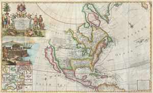
To His Grace Hugh, Lord Archbishop of Armagh, Primate and Metropolitan of all Ireland and One of the Lords Justices of the said Kingdom this map of North America According to the Newest and most Exact Observations is most humbly Dedicated by your Graces most humble Serv: Geo: Grierson.
sold
- Digital Map Information
- Suitable for large format printing
- Full resolution TIFF file
- ICC color profile embedded
- Delivered instantly via download link
An antique map discovery of the utmost rarity. Ostensibly, this is a fine example of Hermann MollÂ's important and highly desirable 1720 Codfish Map, entitled 'To the Right Honourable John Lord Sommers...' Upon closer inspection however, an entirely different ... (more details)
The earliest known urban map of Oaxaca.
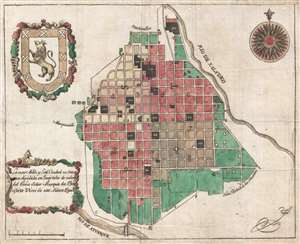
La mas Noble y Leal Ciudad de Oaxaca dividida en Quarteles de orden del exmo. Señor Marques de Branciforte Virei de esta Nueva España.
sold
- Digital Map Information
- Suitable for large format printing
- Full resolution TIFF file
- ICC color profile embedded
- Delivered instantly via download link
This is the earliest known specific printed city plan of Oaxaca de Juarez, Oaxaca, Mexico. The map was printed in Mexico City by the widow of envraver Manuel Galicia de Villavicencio around 1795 under the auspices of the Don Miguel de la Grúa Talamanca de ... (more details)
'The first large-scale printed chart of the Texas coast based on actual soundings and explorations.' - Martin and Martin
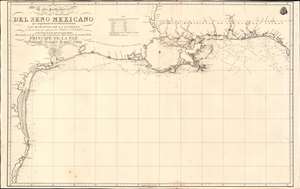
Carta Particular de las Costas Setentrionales del Seno Mexicano que comprende las de Florída Ocidental Las Margenes de la Luisiana y toda la rivera que sigue por la Bahia de S. Bernardo y el Rio Bravo del Norte hasta la Laguna Madre.
sold
- Digital Map Information
- Suitable for large format printing
- Full resolution TIFF file
- ICC color profile embedded
- Delivered instantly via download link
One of the most important maps of Texas, considered 'the first large-scale printed chart of the Texas coast based on actual soundings and explorations' (Martin and Martin). This is the 1807 Spanish Direccion Hidrografica map of the Gulf Coast in the vicinity of Texas and Louisiana. The chart follows directly on the seminal Jose Antonio de Evia (1740 - 18??) survey of the Gulf Coast, conducted between 1785 and 1786. This was the first scientific mapping of this region, resulting in, among other things, the naming of Galveston Bay. The Evia survey resulted in two subsequent maps, the 1799 Carta Esferica que Comprehende las Costas del Seno Mexicano - essentially a general chart of the Gulf of Mexico, and this more specific 1807 map offering considerably more detail to the costliness of Texas and Louisiana. (more details)
A landmark - a great cartographical achievement … -Wheat
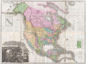
A Map of North America Constructed According to the Latest Information by H. S. Tanner.
sold
- Digital Map Information
- Suitable for large format printing
- DPI: 300
- File Size: 70.48 MB
- File Type: ZIP / TIFF
- ICC color profile embedded
- Delivered instantly via download link
An attractive example of Henry Schenk Tanner's remarkable 1825 landmark map of North America, considered to be the most important map of North America of the 19th century. Revolutionary in countless ways, this is the most accurate map of North America, in ... (more details)
A landmark - a great cartographical achievement … -Wheat
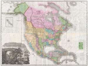
A Map of North America Constructed According to the Latest Information by H. S. Tanner.
sold
- Digital Map Information
- Suitable for large format printing
- DPI: 300
- File Size: 68.73 MB
- File Type: ZIP / TIFF
- ICC color profile embedded
- Delivered instantly via download link
An attractive example of Henry Schenk Tanner's remarkable 1825 landmark map of North America, considered to be the most important map of North America of the 19th century. Revolutionary in countless ways, this is the most accurate map of North America, in ... (more details)
'... of the utmost typographical and historical importance' - Stevens
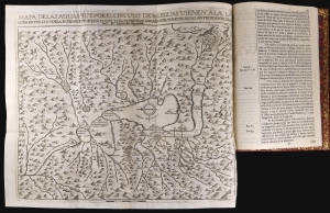
Extracto de los autos de diligencias, y reconocimientos de los rios, lagunas, vertientes, y desagues de la capital Mexico, y su valle.
sold
An essential, groundbreaking work of Mexican geography, this is Joseph Francisco Cuevas Aguirre y Espinosa's foundational 1748 study of the drainage of the region around Mexico City. It is the earliest systematic study of flooding endemic to the Mexican capital. The work contains the first printed version of Carlos Sigüenza y Gongora's map of the area encompassing 90 miles surrounding Mexico City, the first printed map of the region not derived from the 1524 Cortez map, and the first map of the region produced by a Mexican. It has long been recognized for its importance - even the 19th-century bookseller and bibliophile Henry Stevens proclaimed, 'This book is of the utmost typographical and historical importance' both in terms of its content and its superb production. The work is also significant for being printed by a woman, Rosa Maria Teresa de Poveda (c. 1710 - 1755), the widow of deceased printer Jose Bernardo de Hogal. (more details)
Spain recognizes the Republic of Texas?
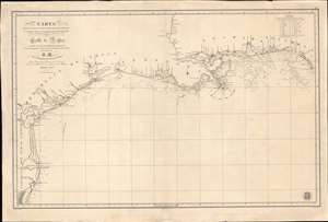
Carta de Las Costas de la Escambia, Alabama y Bocas del rio Misisipi, La Luisiana, tejas, Con la Provincia del Nuevo Santander en el Golfo de Mejico.
sold
- Digital Map Information
- Suitable for large format printing
- DPI: 600
- File Size: 1349.98 MB
- File Type: ZIP / TIFF
- ICC color profile embedded
- Delivered instantly via download link
An unusual 1846 Spanish Direccion Hidrografía nautical chart of the Gulf of Mexico recognizing the Republic of Texas. It is one of very few official Spanish publications to name the Republic of Texas, which Spain never formally recognized. The map emerged during a time of strife, both for Texas, which was involved in its own Texan Revolution (1835 - 1836) followed by the Mexican American War (1846 - 1848), but also in Spain, which was devolving into the Second Carlist War (1846 - 1849). Nonetheless, its production points to the complexity of Spanish-Texan relations during the Revolutionary years, when Texas was blockading Mexican trade and the Spanish West Indies in dire need of fresh trading partners. (more details)
Guide to the Golden Age of Piracy. Full old color.
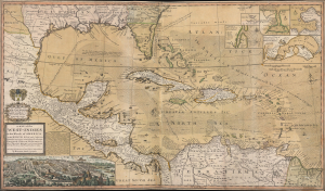
A Map of the West-Indies or the Islands of America in the North Sea; with ye adjacent Countries; explaining what belongs to Spain, England, France, Holland etc. also ye Trade Winds, and ye several Tracts made by ye Galeons and Flota from place to place. According to ye newest and most exact observations, by Herman Moll, Geographer.
sold
- Digital Map Information
- Suitable for large format printing
- Full resolution TIFF file
- ICC color profile embedded
- Delivered instantly via download link
Published in 1726, this is an early printing of Herman Moll's superb map of the West Indies, Caribbean, Gulf of Mexico, Mexico, and the Spanish Main - with full old color. Monumental in proportion, rich in descriptive text, and exhaustive in its attention to detail, this map is best understood as a guide to English piracy and privateering in the West Indies. Moll, most likely through his acquaintance with pirates William Dampier and Woodes Rogers, offers a wealth of information on the traffic of silver bearing Spanish treasure fleets en route from the Mexican port of Veracruz, through the islands, to Spanish ports in Europe. (more details)
Earliest published sea chart focusing on the California coast!
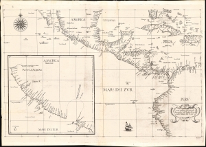
Carta prima generale d'America dell'India Occidentale e Mare del Zur.
sold
- Digital Map Information
- Suitable for large format printing
- File Size: 22.42 MB
- File Type: ZIP / TIFF
- ICC color profile embedded
- Delivered instantly via download link
This is the 1646 first state of Robert Dudley's chart of the middle part of the Americas, illustrating the proximity of the Caribbean Sea and the Pacific Ocean and emphasizing the narrow parts of Central America dividing the two bodies of water. The chart features the western part of the Caribbean, but it is particularly noted for being the first printed sea chart to focus on the Pacific coast, including California. It is, along with Dudley's more narrowly focused charts, the first printed chart of the West Indies and South Florida to employ the Mercator Projection. An inset chart in the lower left focuses specifically on the coast of California, from Baja to Cap Mendocino. (more details)
A must-have for the early mapping of the American west.
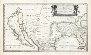
Le Nouveau Mexique, et la Floride: Tirées de diverses Cartes, et Relations. Par N. Sanson d'Abbeville Geogr ordre du Roy. A Paris. Chez Pierre Mariette, Rue S. Jacque a l'Esperance Avec Privilege du Roy, pour vingt Ans. 1656.
sold
- Digital Map Information
- Suitable for large format printing
- DPI: 600
- File Size: 36.2 MB
- File Type: ZIP / TIFF
- ICC color profile embedded
- Delivered instantly via download link
This is a beautiful example of Nicolas Sanson's 1656 map of New Mexico and Florida: the first atlas map to emphasize this geographical focus. It also presented arguably the most influential depiction of California-as-an-island, providing the dominant model of that cartography for the remainder of the seventeenth century, reaching into the eighteenth. (more details)
Guide to the Golden Age of Piracy.
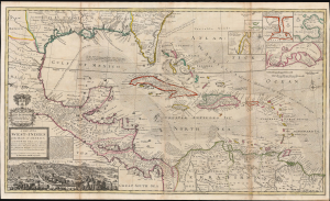
A Map of the West-Indies or the Islands of America in the North Sea; with ye adjacent Countries; explaining what belongs to Spain, England, France, Holland etc. also ye Trade Winds, and ye several Tracts made by ye Galeons and Flota from place to place. According to ye newest and most exact observations, by Herman Moll, Geographer.
sold
- Digital Map Information
- Suitable for large format printing
- File Size: 59.66 MB
- File Type: ZIP / TIFF
- ICC color profile embedded
- Delivered instantly via download link
Published in 1726, this is an early printing of Herman Moll's superb map of the West Indies, Caribbean, Gulf of Mexico, Mexico, and the Spanish Main. Monumental in proportion, rich in descriptive text, and exhaustive in its attention to detail, this map is best understood as a guide to English piracy and privateering in the West Indies. Moll, most likely through his acquaintance with pirates William Dampier and Woodes Rogers, offers a wealth of information on the traffic of silver bearing Spanish treasure fleets en route from the Mexican port of Veracruz, through the islands, to Spanish ports in Europe. (more details)
Manuscript Whaler's Annotations in Gulf of Mexico.
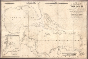
Blachfords, New General Chart of the West Indies, Including the Caribee and Virgin Islands, Porto Rico, St. Domingo, Jamaica and Cuba. The Windward Passages gulfs of Florida and Mexico, Bay of Honduras, And Coast of Colombia Compiled from the best Authorities, Including the surveys of Mr. A. de Mayne R.N., Mr. Lockwood etc.
sold
- Digital Map Information
- Suitable for large format printing
- File Size: 113.86 MB
- File Type: ZIP / TIFF
- ICC color profile embedded
- Delivered instantly via download link
A spectacular 1838 / 1843 Blachford blueback nautical map of the West Indies, including Florida, the Gulf of Mexico, the Caribbean, and Central America. This beautiful map features pencil manuscript annotations in the Gulf of Mexico that strongly suggest whaling. (more details)
The first official map of Guatemala! A cornoerstone piece for Central American 'Decolonization'!
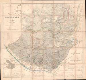
Mapa General de la Republic de Guatemala.
sold
- Digital Map Information
- Suitable for large format printing
- File Size: 79.73 MB
- File Type: ZIP / TIFF
- ICC color profile embedded
- Delivered instantly via download link
A seminal production, this 1959 map by Maximilian von Sonnenstern and August van de Gehüchte is the first official map of Guatemala and a key document associated with Guatemalan independence. The map was commissioned by first president of Guatemala, Rafael Carrera Turcios (1814 - 1865), and is the first broadly accurate meticulously detailed map of that country. The enduring legacy of this map includes its role in establishing and legitimizing Guatemala, as well as its significant evidentiary rule in subsequent Guatemalan boundary disputes and negotiations. In addition, this is the first to accurately map Guatemala's many important Mayan ruins. (more details)
One of the most influential maps in the history of North America.
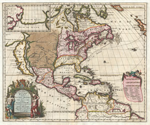
Amerique Septentrionalis Carte d'un tres grand Pays entre le Nouveau Mexique et la Mer Glaciace Dediee a Guilliaume IIIe. Roy de La Grand Bretagne Par le R. P. Louis de Hennepin Mission: Recol: et Not: Apost: Chez c. Specht a Utreght 1698.
sold
- Digital Map Information
- Suitable for large format printing
- DPI: 300
- File Size: 13.5 MB
- File Type: ZIP / TIFF
- ICC color profile embedded
- Delivered instantly via download link
A map that fundamentally impacted the cartographic history of America, this is the 1698 Friar Hennepin map of North America. Covering all of North America from the Equator to the Arctic, this map is remarkable on a number of levels including its ... (more details)
Rare map of Texas issued just before the Treaty of Guadeloupe Hidalgo.
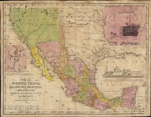
Map of Mexico, Texas, Old and New California, and Yucatan. Showing the principal Cities and Towns, Travelling Routes and c.
sold
- Digital Map Information
- Suitable for large format printing
- Full resolution TIFF file
- ICC color profile embedded
- Delivered instantly via download link
The only known example of the 1848 edition of House and Brown's broadside map of Texas, Mexico, and Upper California, issued at the end of the Mexican-American War (1846 - 1848). The map is centered on Texas, which is presented at its largest, with its western border embracing Albuquerque and Santa Fe, and the stovepipe configuration extending its northern border to 42° N latitude. The map is elaborated by inset maps of Monterey illustrating the Battle of Monterrey (September 21 - 24, 1846) and Veracruz, Mexico. In addition, the Gulf of Mexico is occupied by a large vignette view of the fortress of San Juan de Ulúa, Veracruz. In this edition, Texas is uncolored, emphasizing that it is part of the United States, but Upper California and New Mexico are colored as Mexican intendencias, suggesting this map predates the Treaty of Guadalupe Hidalgo and must therefore have been sent to the presses sometime before February 28, 1848. (more details)
Earliest Acquirable Accurate Map of the Southwest?
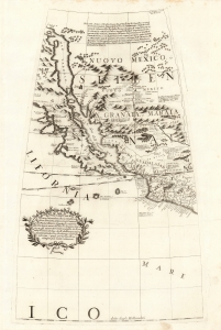
[Untitled Globe Gore of Western North America from the Equator to approximately 50º north].
sold
- Digital Map Information
- Suitable for large format printing
- Full resolution TIFF file
- ICC color profile embedded
- Delivered instantly via download link
This is the globe gore focusing on the American southwest, engraved in 1688 for Vincenzo Coronelli's 42-inch (3 1/2 foot) terrestrial globe, reprinted in 1697 for inclusion in his Libro dei Globi and Isolario. This beautiful engraving is striking in its presentation of the insular California, but this is not its most important feature. Rather it represents the earliest correct depiction of the Rio Grande generally acquirable to the collector. (more details)
The Caribbean and American East Coast from the Finest Printed Globe of the 17th Century.
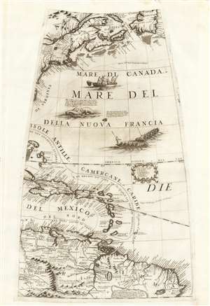
[Untitled Globe Gore of Eastern North and South America from the Equator to approximately 50º north].
sold
- Digital Map Information
- Suitable for large format printing
- Full resolution TIFF file
- ICC color profile embedded
- Delivered instantly via download link
This scarce, beautiful engraving is the globe gore presenting a map of the American northeast, the West Indies, and Terra Firma in South America, engraved in 1688 for Vincenzo Coronelli's 42-inch (3 1/2 foot) terrestrial globe, reprinted in 1697 for inclusion in his Libro dei Globi and Isolario. The map spans from the Equator in the south to Newfoundland in the north, centered on the Tropic of Cancer. It includes Canada in the vicinity of the Saint Lawrence River and Acadia, New England and New York, and part of the coastline around the Chesapeake Bay. The West Indies are shown from the Bahamas to Trinidad, stretching from the eastern part of Cuba to Barbados, including the imaginary island of Fonseca. The gore's southern extents show the northern parts of South America, from modern day Venezuela to the Orinoco Delta and the Guianas, and the fabled city of El Dorado. (more details)
Most Important Early Map of the New Mexico Territory.
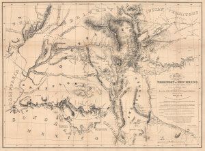
Map of the Territory of New Mexico...
sold
- Digital Map Information
- Suitable for large format printing
- Full resolution TIFF file
- ICC color profile embedded
- Delivered instantly via download link
This is the extremely rare, unpublished 1851 map of the Territory of New Mexico produced by John G. Parke and Richard Kern. Known as the Parke-Kern Map, it was printed within the War Department and separately issued on an individual basis but never included in a Congressional Report, as were other key early maps of the American West. The map was then reprinted several times in the late 19th and early 20th century with no obvious changes, but which can be distinguished from the original plate by very close examination. The present example is one of these later, c. 1900, reissues, which in themselves are still very rare. (more details)
Seminal Map of the American Southwest by 'World's Greatest Living Man'.

Carte Du Mexique et des Pays Limitrophes Situes Au Nord et a l'est Dressee d'apres la Grande Carte de la Nouvelle Espagne De Mr. A. De Humboldt et d'autres Materiaux par J.B. Poirson.
sold
- Digital Map Information
- Suitable for large format printing
- DPI: 300
- File Size: 15.17 MB
- File Type: ZIP / TIFF
- ICC color profile embedded
- Delivered instantly via download link
A seminal 1811 map of Mexico and the American West by Alexander von Humboldt. Humboldt, who during his lifetime was considered the 'world's greatest living man,' composed this map during his 1803 sojourn in Mexico. Though often playing second ... (more details)
An early unrecorded variant of Senex's large map of North America.
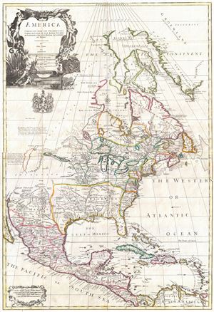
North America corrected from the observations communicated to the Royal Society at London, and the Royal Academy at Paris.
sold
- Digital Map Information
- Suitable for large format printing
- Full resolution TIFF file
- ICC color profile embedded
- Delivered instantly via download link
An exceptional and influential 1710 British map of North America by John Senex. Hands down the most ambitions British mapping of North America produced thus far, Senex's large format map covers all of North America from the unexplored high ... (more details)
A c. 1720 map guide to English piracy and privateering in the West Indies.
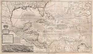
A Map of the West-Indies or the Islands of America in the North Sea; with ye adjacent Countries; explaining what belongs to Spain, England, France, Holland &c. also ye Trade Winds, and ye several Tracts made by ye Galeons and Flota from place to place. According to ye newest and most exact observations, by Herman Moll, Geographer.
sold
- Digital Map Information
- Suitable for large format printing
- DPI: 300
- File Size: 39.29 MB
- File Type: ZIP / TIFF
- ICC color profile embedded
- Delivered instantly via download link
One of the most remarkable and intriguing maps of the West Indies to appear in the 18th century. This is Herman Moll's superb circa 1720 mapping of the West Indies, Caribbean, Gulf of Mexico, Mexico, and the Spanish Main. Monumental in ... (more details)
An unrecorded variant of Senex's large map of North America.

North America corrected from the observations communicated to the Royal Society at London, and the Royal Academy at Paris.
sold
- Digital Map Information
- Suitable for large format printing
- DPI: 300
- File Size: 21.34 MB
- File Type: ZIP / TIFF
- ICC color profile embedded
- Delivered instantly via download link
An exceptional and influential 1710 British map of North America by John Senex. Hands down the most ambitions British mapping of North America produced thus far, Senex's large format map covers all of North America from the unexplored ... (more details)
First edition of a foundational chart.
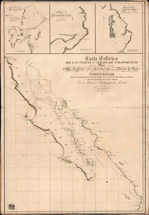
Carta Esferica de las Costas y Golfo de Californias llamado Mar de Cortes Que Comprende desde el Cabo Corrientes hasta el Puerto de S. Diego.
sold
- Digital Map Information
- Suitable for large format printing
- File Size: 26.15 MB
- File Type: ZIP / TIFF
- ICC color profile embedded
- Delivered instantly via download link
A spectacular 1825 1st edition of the Felipe Cardano y Bauzá / Dirección Hidrográfico foundational nautical chart or maritime map of Baja California and the Gulf of California. This important chart is the basis for much of the subsequent mapping of this region and is reflected in subsequent French and English charts. Coverage extends along the west coast of Mexico from San Diego, California, to Cabo Corrientes, Jalisco, Mexico, including all of modern-day Baja, the Gulf of California, and the Sonora and Sinaloa coasts. (more details)
Best map of the West Indies of the late 18th century.
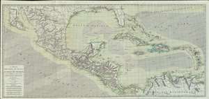
Carte des Isles Antilles et du Golfe du Méxique; avec la Majeure partie de la Nouvelle Espagne.
sold
- Digital Map Information
- Suitable for large format printing
- Full resolution TIFF file
- ICC color profile embedded
- Delivered instantly via download link
A spectacular large-scale 1786 Rigobert Bonne map of Florida, the West Indies, the Gulf of Mexico, and the Caribbean. This finely engraved and enormous map represents the best and most detailed general map of the West Indies to appear during and shortly after the American Revolutionary War (1775 - 1783). Coverage extends from Baja California and the Pacific to Barbados, and from northern Florida to the Gulf of Panama, including all of Central America, Mexico, parts of the Spanish Main, and the Greater and Lesser Antilles. The map includes a finely engraved illustration of the prevailing winds - important information for regional maritime commerce. Tiny anchors mark safe anchorages. Colonial claims are color coded, with the British represented in red, The Spanish in yellow, and the French in blue. (more details)
Exceedingly rare first edition of De Wit's masterful sea chart of the West Indies during the Golden Age of Caribbean Piracy.
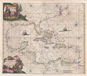
Indiarum Occidentalium Tractus Littorales cum Insulis Caribicis. / Pascaert van Westindien ende Caribise Eylanden.
sold
- Digital Map Information
- Suitable for large format printing
- DPI: 300
- File Size: 15.36 MB
- File Type: ZIP / TIFF
- ICC color profile embedded
- Delivered instantly via download link
A fine and rare old color example of the first edition of Frederick de Wit's 1675 nautical chart or maritime map of the West Indies, Central America, Gulf of Mexico, and Florida. Printed during the Golden Age of Caribbean Piracy, this ... (more details)
One of the most beautifully engraved maps of the West Indies.
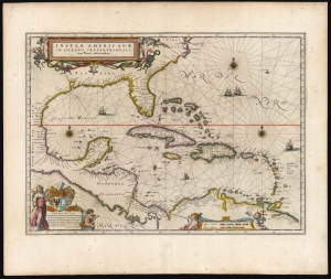
Insulae Americanae in Oceano Septentrionali cum Terris adiacentibus.
sold
- Digital Map Information
- Suitable for large format printing
- Full resolution TIFF file
- ICC color profile embedded
- Delivered instantly via download link
This is a superb 1643 example of Willem Blaeu's 1634 map of the Caribbean Islands in gorgeous original color. Both geographically and aesthetically, this map set the standard for the mapping of this region: more than a dozen maps produced later in the 17th century derived form this map, some to the extent of reproducing the title. Blaeu based this work both on his own West Indische Paskaert and Hessel Gerritsz' unacquirably rare and unassailably authoritative 1631 De Eylanden Ende Vastelanden Van Westindien op de Noordzee. The map thus reflects those geographers' commanding knowledge of the Caribbean and the Gulf Coast. (more details)
First Latin edition of a classic map.
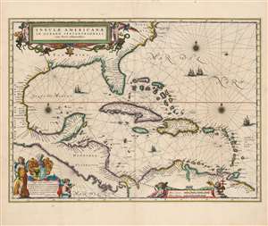
Insulae Americanae in Oceano Septentrionali cum Terris adiacentibus.
sold
- Digital Map Information
- Suitable for large format printing
- Full resolution TIFF file
- ICC color profile embedded
- Delivered instantly via download link
This is a beautiful 1635 example of Willem Blaeu's 1634 map of the Caribbean Islands and the adjacent coastlines of North and South America: this was the first Latin edition of the map to appear in the Blaeu atlas. Both geographically and aesthetically, this map set the standard for the mapping of this region: more than a dozen maps of the region produced later in the 17th century would copy this map, some to the extent of reproducing the title. Blaeu based this work both on his own West Indische Paskaert and Hessel Gerritsz' unacquirably rare and unassailably authoritative De Eylanden Ende Vastelanden Van Westindien op de Noordzee of 1631. The map thus reflects those geographers' commanding knowledge of the Caribbean and the Gulf Coast. (more details)
Remarkable first editon of Jaillot's important map of America showing California as an Island.
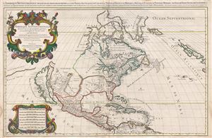
Amerique septentrionale divisee en ses principales parties, ou sont distingues les vns des autres les estats suivant qu'ils appartiennent presentemet aux Francois, Castillans, Anglois, Suedois, Danois, Hollandois, tiree des relations de toutes ces nations par le S. Sanson, geographe ordinaire du roy. 1674.
sold
- Digital Map Information
- Suitable for large format printing
- Full resolution TIFF file
- ICC color profile embedded
- Delivered instantly via download link
A large, impressive, and scarce 1674 map of North America issued by Alexis-Hubert Jaillot offered here in its first edition. The map covers all of North America and Central America from Baffin Bay to the Spanish Main. The map extends ... (more details)
Running the Union Blockade during the Civil War.
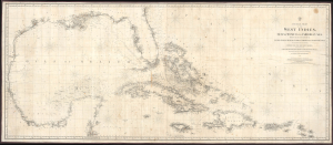
A General Chart of the West Indies, Gulf of Mexico and Caribbean Sea, showing the adjacent Coasts of the United States, Mexico, Central America, and the Spanish Main, to the Mouths of the Orinoco...
sold
- Digital Map Information
- Suitable for large format printing
- File Size: 79.4 MB
- File Type: ZIP / TIFF
- ICC color profile embedded
- Delivered instantly via download link
This is Charles Copley and Sons' huge Civil War 1863 nautical map of the West Indies or Caribbean. Although printed in New York, Copley's charts were the best available privately published nautical charts of these waters. As such, they were coveted by Confederate Blockade Runners, who acquired them through the lucrative trade of intermediary sellers in Bermuda or the West Indies. This map was likely used by Confederate blockade runners in navigating between the Confederacy and the West Indies. (more details)