
Mexico - Central America
Cornerstone American Cartography.
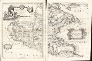
America Settentrionale Colle Cuoue Scoperte fin all' Anno 1688.
$16,000.00
Acquire
- Digital Map Information
- Suitable for large format printing
- File Size: 46.86 MB
- File Type: ZIP / TIFF
- ICC color profile embedded
- Delivered instantly via download link
This is Vincenzo Coronelli's striking 1688 two-sheet map of North America - one of the largest and most influential atlas maps to appear in the late 17th century. It emerged as much of North America had yet to be penetrated or was in the earliest stages of exploration and colonization - a true golden land of possibility. There is much of interest, including being among the first maps to embrace the cartography of Don Diego Peñalosa in New Mexico, a bold embrace of the Insular California trope, recognition of the Danish explorations of Jens Munk, an early usage of the term Chicago (Chekagou), and an interesting mapping of the apocryphal Lake May, the great inland sea of the southeast. (more details)
'... most momentous map of the American south-west published ...' - Burden
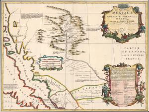
Le Nouveau Mexique appelé aussi Nouvelle Grenade et Marata Avec Partie de Californie, Selon les Memoires les plus Nouveaux.
$14,500.00
Acquire
- Digital Map Information
- Suitable for large format printing
- File Size: 17.16 MB
- File Type: ZIP / TIFF
- ICC color profile embedded
- Delivered instantly via download link
A seminally important map, this is the 1687-88 Coronelli-Nolin separately-published map of the North American Southwest, in its first edition. This map is a cornerstone for any collection dedicated to the southwest: it is the first published map to introduce the cartography of Don Diego Peñalosa with regard to the Rio Grande valley as far north as Santa Fe. Peñalosa's cartography not only has a swashbucklingly enigmatic history, but it is also foundational for most subsequent maps of the region for the next century. This is also one of the earliest maps, following the 1660 Nicolosi map, to correctly map the Rio Grande emptying into the Gulf of Mexico as opposed to the Sea of California. (more details)
Earliest published sea chart focusing on the California coast!
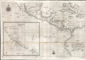
Carta prima generale d'America dell'India Occidentale e Mare del Zur.
$7,000.00
Acquire
- Digital Map Information
- Suitable for large format printing
- File Size: 26.19 MB
- File Type: ZIP / TIFF
- ICC color profile embedded
- Delivered instantly via download link
This is the 1646 first state of Robert Dudley's chart of the middle part of the Americas, illustrating the proximity of the Caribbean Sea and the Pacific Ocean and emphasizing the narrow parts of Central America dividing the two bodies of water. The chart features the western part of the Caribbean, but it is particularly noted for being the first printed sea chart to focus on the Pacific coast, including California. It is, along with Dudley's more narrowly focused charts, the first printed chart of the West Indies and South Florida to employ the Mercator Projection. An inset chart in the lower left focuses specifically on the coast of California, from Baja to Cap Mendocino. (more details)
French recognition of the Republic of Texas.
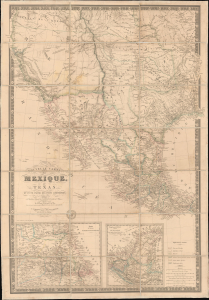
Nouvelle Carte du Mexique, du Texas et d'une partie des états limitrophes...
$6,000.00
Acquire
- Digital Map Information
- Suitable for large format printing
- Full resolution TIFF file
- ICC color profile embedded
- Delivered instantly via download link
This is the 1845 edition of Adrien-Hubert Brué's seminal map of Mexico and the Republic of Texas - issued at the peak of the Mexican-American War (1846 - 1848). Wheat rightly hails this as a 'most important map.' Its significance is as expansive as its coverage, ranging from up-to-date cartography regarding the Republic of Texas (and the French recognition thereof), to some of the first printed mappings of the cartography of Jedediah Smith, to one of the earliest uses of the term 'Arizona' on a printed map. (more details)
Enflaming the British against French encroachments.
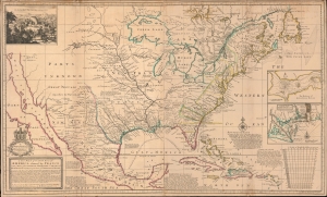
A New Map of the North Parts of America claimed by France under ye Names of Louisiana, Mississippi, Canada and New France with ye Adjoyning Territories of England and Spain.
$6,000.00
Acquire
- Digital Map Information
- Suitable for large format printing
- File Size: 50.08 MB
- File Type: ZIP / TIFF
- ICC color profile embedded
- Delivered instantly via download link
This is Herman Moll's 1720 map of North America, with original color. It was issued as part of an ongoing cartographic debate between French and British mapmakers regarding claims in the little-understood interior. The map is Moll's attempt to enflame outrage against Guillaume Delisle's 1718 pro-French map of the same. In addition, the map features several interesting cartographic elements, including a significant correction to the Great Lakes, the ephemeral Margravate of Azilia (Georgia), and a representation of California as an Island. (more details)
First official map of Nicaragua in its first edition.
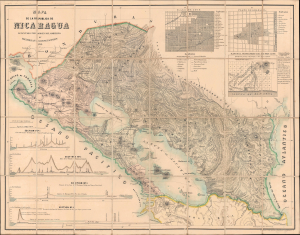
Mapa de la Republica de Nicaragua.
$5,000.00
Acquire
- Digital Map Information
- Suitable for large format printing
- Full resolution TIFF file
- ICC color profile embedded
- Delivered instantly via download link
This is Maximilian Sonnenstern's 1858 map of Nicaragua, the first official map of that state, here in its first edition. The map represents the first scientific survey of Nicaragua during a period when that nation held center stage as the most likely route for an interoceanic canal. It, moreover, is the earliest of Sonnenstern's seminal maps of the newly independent Central American republics. This map was followed by similarly significant maps of Guatemala and El Salvador. (more details)
Battle of Puebla and the Second French Intervention in Mexico.
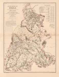
Der Mexicanische Stat Puebla.
$4,500.00
Acquire
- Digital Map Information
- Suitable for large format printing
- File Size: 22.32 MB
- File Type: ZIP / TIFF
- ICC color profile embedded
- Delivered instantly via download link
This is a scarce 1862 H. Kiepert map of Puebla, Mexico, issued in Germany in the wake of the Battle of Puebla, in which Mexican forces repulsed a French invasion, placing Mexico and Puebla on the global stage. In 1863, one year after this map was issued, French interventionists established the Second Mexican Empire, placing the Austrian Archduke Maximilian I on the throne and creating widespread interest in Mexico throughout the German-speaking world. (more details)
'An essential element in any serious southwest collection' - Streeter.
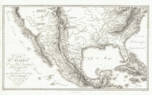
Carte Du Mexique et des Pays Limitrophes Situes Au Nord et a l'est Dressee d'apres la Grande Carte de la Nouvelle Espagne De Mr. A. De Humboldt et d'autres Materiaux par J.B. Poirson.
$4,500.00
Acquire
- Digital Map Information
- Suitable for large format printing
- File Size: 28.69 MB
- File Type: ZIP / TIFF
- ICC color profile embedded
- Delivered instantly via download link
A seminal 1811 map of Mexico and the American West by Alexander von Humboldt. Humboldt, who during his lifetime was considered the 'world's greatest living man,' composed this map during his 1803 sojourn in Mexico. Though sometimes overshadowed by Humboldt's more regional Carte Generale du Royaume de la Nouvelle Espagne, published in the same volume, this map is a cartographic achievement that Wheat noted as 'An Important Map.' Streeter considered this map an essential element in any Southwest-focused collection. (more details)
Parisificaiton of Mexico City during the Porfiriato.
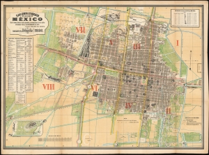
Plano general de indicacion de la Ciudad de Mexico : con la nueva division de los cuarteles y nomenclatura de los calles aprobado por el H. Ayuntamiento de 1885 y por el gobierno del distrito.Publicado por Debray Sucs. 1886.
$4,000.00
Acquire
- Digital Map Information
- Suitable for large format printing
- File Size: 111.59 MB
- File Type: ZIP / TIFF
- ICC color profile embedded
- Delivered instantly via download link
This is a rare, colorful plan of Mexico City, published in 1886 by the lithographers DeBray Sucesores based on official data from the Mexico City government. It reflects the efforts the early ambitions of the Porfiriato, wherein Porfiro Díaz (1830 - 1915), influenced by Paris' transformation under Haussmann, sought to modernize and embellish Mexico City to equal the great capitals of Europe. (more details)
'This was probably the best chart of the West Coast available in 1849' -Heckrotte
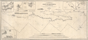
Chart of the Coast of California form San Blas to San Francisco.
$3,900.00
Acquire
- Digital Map Information
- Suitable for large format printing
- DPI: 600
- File Size: 1825.23 MB
- File Type: ZIP / TIFF
- ICC color profile embedded
- Delivered instantly via download link
The 1849 first edition, published for the California Gold Rush, of the James Imray blueback nautical map of the coast of California. This map, by Imray, predates any American charts of the California coast and, when it was issued, was the best obtainable chart for ambitious 49ers en route to the gold regions. (more details)
By the greatest German cartographer of the 19th century.
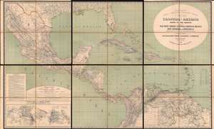
H. Kiepert's Karte des Nördlichen Tropischen America. A New Map of Tropical - America North of the Equator Comprising the West - Indies, Central - America, Mexico, New Cranada and Venezuela.
$3,500.00
Acquire
- Digital Map Information
- Suitable for large format printing
- Full resolution TIFF file
- ICC color profile embedded
- Delivered instantly via download link
This is a large and impressive 1858 map of Florida, the Gulf of Mexico, Central America, the West Indies, and northern South America, compiled by Heinrich Kiepert, the greatest German cartographer of the 19th century. The map presents the region in detail, with color coding to differentiate between countries and a key situated in the lower left. (more details)
Ephemeral Territories in the American West.
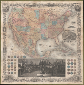
Phelps and Watson's New Map of the United States.
$3,000.00
Acquire
- Digital Map Information
- Suitable for large format printing
- Full resolution TIFF file
- ICC color profile embedded
- Delivered instantly via download link
This is a rare 1860 wall map of the United States published by Phelps and Watson. It presents the territorial configuration of U.S. states and territories on the eve of the U.S. Civil War (1861 - 1865), which would drastically reshape the map. (more details)
Classic Dutch Map of the Caribbean.
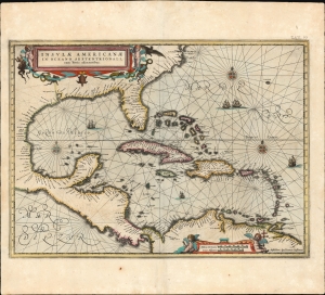
Insulae Americanae in Oceano Septentrionali cum Terris adiacentibus.
$3,000.00
Acquire
- Digital Map Information
- Suitable for large format printing
- Full resolution TIFF file
- ICC color profile embedded
- Delivered instantly via download link
This is a beautiful 1637 example of Jan Jansson's 1636 map of the Caribbean Islands and the adjacent coastlines of North and South America. It is among the most beautiful maps of the region produced in the first half of the 17th century. Moreover, the present example is in superb condition with gorgeous, bright original color. (more details)
A fine decorative map depicting colonial America during the Spanish War of Succession.
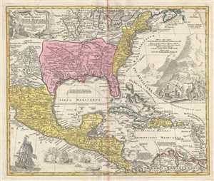
Regni Mexicani seu Novae Hispaniae, Floridae, Novae Angliae, Carolinae, Virginiae et Pensylvaniae, nec non Insularum, Archipelagi Mexicani in America Septentrionali.
$2,400.00
Acquire
- Digital Map Information
- Suitable for large format printing
- Full resolution TIFF file
- ICC color profile embedded
- Delivered instantly via download link
This is a 1715 J. B. Homann's decorative map of Mexico, Florida, New England, the West Indies, and the Mississippi Valley (Louisiana). Centered on the Mississippi River Valley, Homann's map depicts from Sinaloa (Mexico) eastwards to the Atlantic Coast and from the ... (more details)
Golden Age of Caribbean piracy.
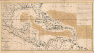
Carte du Golphe du Mexique et des Isles Antilles.
$2,000.00
Acquire
- Digital Map Information
- Suitable for large format printing
- Full resolution TIFF file
- ICC color profile embedded
- Delivered instantly via download link
A fine example of the 1780 Dezauche edition of Buache's important nautical map of the Caribbean, Gulf of Mexico, Florida, and West Indies at the end of the Golden Age of Caribbean Piracy. (more details)
First Atlas Map of the Caribbean in its First Printing
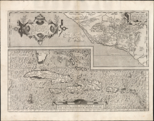
Culiacanae, America Regionis Descriptio./ Hispaniolae, Cubae, Aliarumque Insularum Circumiacentium, Delineatio./ Cum Imp. et Regio./ privilegio decennali 1579.
$2,000.00
Acquire
- Digital Map Information
- Suitable for large format printing
- Full resolution TIFF file
- ICC color profile embedded
- Delivered instantly via download link
This is a superb, first-edition example of Ortelius' 1579 map of Cuba and the Caribbean, combined with his map of the Viceroyalty of Culiacan in Northwestern Mexico. While Ortelius' Theatrum had been in print since 1570, it was not until 1579 that this map was added to the book. This example exhibits a bold, sharp strike resulting from the youth of its plate; it is consequently very desirable. (more details)
Updating the map of the West Coast.
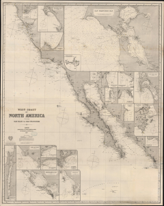
West Coast of North America from San Blas to San Francisco.
$1,900.00
Acquire
- Digital Map Information
- Suitable for large format printing
- File Size: 2178.34 MB
- File Type: ZIP / TIFF
- ICC color profile embedded
- Delivered instantly via download link
An impressive 1887 James Imray blueback nautical chart of the West Coast of America, primarily covering California from roughly San Francisco to Cabo San Lucas. (more details)
Among the last maps to use the Ottoman Perso-Arabic script.
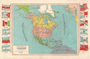
ينى امريكا / [New America].
$1,800.00
Acquire
- Digital Map Information
- Suitable for large format printing
- File Size: 34.73 MB
- File Type: ZIP / TIFF
- ICC color profile embedded
- Delivered instantly via download link
A large-format separately issued 1927 Ottoman map of North and Central America published by the Aladdin Matba-sı Printing House for the Kitabhane-yi Sudi Bookshop. Aside from its aesthetic qualities, this map is important for its role in the diffusion of knowledge about the Americas in Turkey as well as being among the last maps published in Ottoman Perso-Arabic script, before Turkey adopted a Latin-based script in 1928. (more details)
Pacific Coast of Newly Independent Countries.
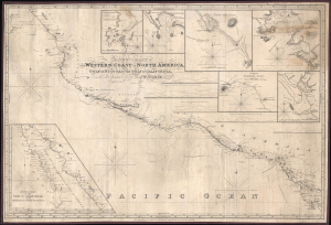
A New Chart of the Western Coast of North America from the Gulf of Nicoya to the Gulf of California, Drawn Chiefly From the late Spanish Surveys.
$1,600.00
Acquire
- Digital Map Information
- Suitable for large format printing
- File Size: 42.58 MB
- File Type: ZIP / TIFF
- ICC color profile embedded
- Delivered instantly via download link
This is J. W. Norie's 1828 large-format nautical chart of the west coast of Mexico and Central America, corrected to 1846. The map was updated and republished to capitalize on increased activity along this strategic coastline during the Mexican-American War (1846 - 1848). Being outside of U.S. waters, naval commanders resorted to existing and updated commercial charts, like this one, to control the coast. (more details)
De l'Isle's State-of-the-art cartography in a Dutch edition.
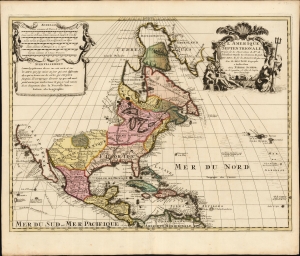
L' Amerique Septentrionale, Dressée sur les Observations de Mrs. de l'Academie Royale des Sciences, et quelques autres, et sur les Memoires les plus recens Par G. De l'Isle Geographe. a Amsterdam chez Pierre Schenk sur le vygendam, a l' Atlas de Sanson. Avec Privilege 1708.
$1,500.00
Acquire
- Digital Map Information
- Suitable for large format printing
- File Size: 22.52 MB
- File Type: ZIP / TIFF
- ICC color profile embedded
- Delivered instantly via download link
A truly beautiful original color example of Peter Schenk's 1708 edition of De L'Isle's foundational 1700 map of North America. Although derivative of De L'Isle, the map is richly decorative with a wealth of intriguing cartographic anomalies and tidbits. (more details)
Follow the route of the missionaries.
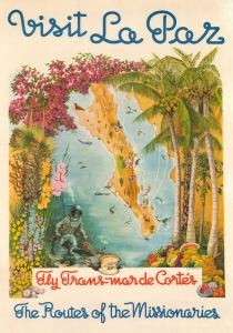
Visit La Paz, Fly Trans Mar de Cortes, The Routes of the Missionaries.
$1,500.00
Acquire
- Digital Map Information
- Suitable for large format printing
- File Size: 135.73 MB
- File Type: ZIP / TIFF
- ICC color profile embedded
- Delivered instantly via download link
This is a beautiful c. 1950 map of Baja California, Mexico, advertises Trans Mar de Cortes Airlines. It promotes the peninsula's attractions, especially the city of La Paz, and repeats the airline's slogan that passengers will follow 'the routes of the missionaries.' (more details)
Early Glimpses of Mexico, California and the Gulf Coast.
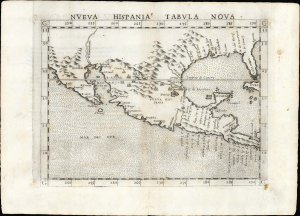
Nueva Hispania Tabula Nova.
$1,250.00
Acquire
- Digital Map Information
- Suitable for large format printing
- Full resolution TIFF file
- ICC color profile embedded
- Delivered instantly via download link
This is Girolamo Ruscelli's 1561 Nueva Hispania Tabula Nova, an early and influential map of what would become Mexico, California, Texas, and Florida. Ruscelli's work is an enlarged and improved version of the 1548 map of the same region by fellow Venetian Giacomo Gastaldi. Apart from the Gastaldi, Ruscelli's map is the earliest to focus so closely on the southern parts of what would become the United States and is one of the earliest acquirable maps to reflect Spanish exploration and colonization in the Americas. Overall, along with the map covering the East Coast north of Florida, this is among the earliest maps to focus on North America. (more details)
First Specific Printed Maps of Florida and Peru.
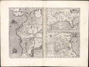
Peruviae Auriferae Regionis Typus./ La Florida./ Guastecan.
$1,250.00
Acquire
- Digital Map Information
- Suitable for large format printing
- Full resolution TIFF file
- ICC color profile embedded
- Delivered instantly via download link
This is an elegant example of Ortelius' 1584 engraving that includes the first specific map of Florida, the earliest specific map of Peru, and the first map focusing on the Guastecan province of Mexico. The map is a prime example of Ortelius' strength, not only as a mapmaker, but also as a compiler. All these maps combined here are relevant to each other in that they all derive from Spanish sources and reveal parts of the Spanish Empire in America, despite Spain forbidding the production and dissemination of such maps. Two of these maps credit specific Spanish sources, reflecting Ortelius' position as geographer to the king of Spain. Antwerp was part of the Spanish Empire at the time, and it is a testimony to Ortelius's far-reaching network of contacts throughout Europe that he was able to obtain maps such as these for publication. (more details)
Earliest Acquirable Dutch Chart of the Yucatan Peninsula.
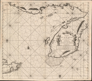
Pas-kaart van de Golff de Guanaios met 't Canaal Tusschen Yucatan en I. Cuba.
$1,200.00
Acquire
- Digital Map Information
- Suitable for large format printing
- DPI: 600
- File Size: 30.61 MB
- File Type: ZIP / TIFF
- ICC color profile embedded
- Delivered instantly via download link
A boldly engraved 1684 nautical chart or maritime map of the coasts of Honduras, Belize, Mexico and Cuba: it is one of the first, if not the first printed chart to focus on the Yucatan Peninsula. (more details)
Revealing Mexico's Fabled Silver Mines.
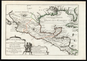
Le Vieux Mexique ou Nouvelle Espagne avec les costes de la Floride.
$1,000.00
Acquire
- Digital Map Information
- Suitable for large format printing
- File Size: 7.82 MB
- File Type: ZIP / TIFF
- ICC color profile embedded
- Delivered instantly via download link
This is Nicolas De Fer's 1705 map of Mexico, the Gulf Coast, and Florida. It illustrates French ambitions in the New World, particularly hopes to size and control the rich Mines of Santa Barbara. This map, and others like it, were subsequently influential in the inflation of the Mississippi Company - one of the world's first bubble economies. (more details)
The Yucatan Peninsula and Coast of Honduras.
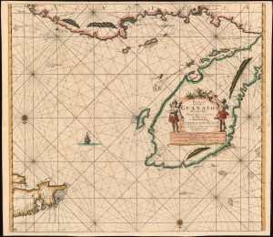
Pas-kaart van de Golff de Guanaios met 't Canaal Tusschen Yucatan en I. Cuba.
$1,000.00
Acquire
- Digital Map Information
- Suitable for large format printing
- DPI: 600
- File Size: 30.67 MB
- File Type: ZIP / TIFF
- ICC color profile embedded
- Delivered instantly via download link
A superb 1687 Johannes van Keulen nautical chart or maritime map of the coasts of Honduras, Belize, Mexico, and Cuba. It is one of the first, if not the first printed chart to focus on the Yucatan Peninsula. (more details)
German Forty-Eighters and the California Gold Rush.
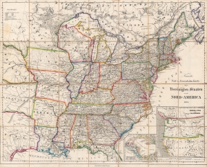
Neueste Post-u. Eisenbahn Karte der Vereinigten Staaten von Nord-America.
$1,000.00
Acquire
- Digital Map Information
- Suitable for large format printing
- Full resolution TIFF file
- ICC color profile embedded
- Delivered instantly via download link
A finely colored and engraved 1854 German-language folding map of the United States, based on maps by Calvin Smith, Henry Tanner, and others, published in Nuremberg by Sigmund Beyerlein. It reflects interest in the U.S. at a time when German Forty-Eighter immigration surged, driven by the California Gold Rush and the failure of the Springtime of the Peoples Revolutions of 1848. (more details)
War and Privateering in the West Indies.
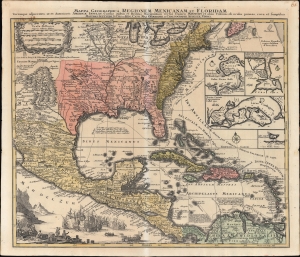
Mappa Geographica Regionem Mexicanam et Floridam Terrasque adjacentes, ut et Anteriores Americae Insulas, Cursus itidem et Reditus Navigantium versus flumem Missisipi et alias Colonias ob oculos ponens cura et sumtibus.
$1,000.00
Acquire
- Digital Map Information
- Suitable for large format printing
- File Size: 28.51 MB
- File Type: ZIP / TIFF
- ICC color profile embedded
- Delivered instantly via download link
An old-color example of Mattheus Seutter's c. 1740 map of North America below the Great Lakes, including Mexico and the Caribbean. It reflects improvements in European cartography of the New World in the late 17th and early 18th centuries, as well as the ongoing competition between colonial empires, namely the contemporaneous War of Jenkins' Ear (1739-1748). (more details)
One of the Earliest Specific Maps of Mexico.
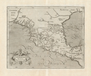
Hispania Nova.
$1,000.00
Acquire
- Digital Map Information
- Suitable for large format printing
- DPI: 600
- File Size: 19.23 MB
- File Type: ZIP / TIFF
- ICC color profile embedded
- Delivered instantly via download link
This is Cornelis Wytfliet's 1597 map of Mexico, one of the first maps of the region overall and the first to appear in an atlas dedicated to the Americas. (more details)
Direct Steam Service from France to America!

Compagnie Générale Transatlantique.
$950.00
Acquire
- Digital Map Information
- Suitable for large format printing
- Full resolution TIFF file
- ICC color profile embedded
- Delivered instantly via download link
This is an 1882 Jules Sédille map of the Atlantic Ocean highlighting the transatlantic routes between France and the Americas, primarily issued to promote the Compagnie Générale Transatlantique's service between Le Havre and New York, as well as the routes to the Caribbean and Mexico. (more details)
Guide for German emigrants to the U.S.
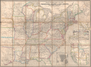
Neueste Eisenbahn-, Post- und Kanal- Karte für Reisende in den Vereinigten Staaten von Nord-Amerika, Canada, Texas, sowie Californien und den westlichen Staaten u. Gebieten.
$950.00
Acquire
- Digital Map Information
- Suitable for large format printing
- Full resolution TIFF file
- ICC color profile embedded
- Delivered instantly via download link
This is an 1866 German-language map of the United States, based on the work of Calvin Smith and Henry Tanner, published in Traugott Bromme's Hand- und Reisebuch für Auswanderer und Reisende nach Nord-, Mittel- und Süd-Amerika. It reflects continued German interest in emigrating to the U.S., well after the surge of migration caused by the California Gold Rush and Revolutions of 1848 tapered off. (more details)
Increasing French interest in Mexico.
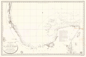
Carte Réduite de la Partie Méridionale du Golfe du Mexique Depuis le Cap Catoche jusqu'à Laguna Madre.
$950.00
Acquire
- Digital Map Information
- Suitable for large format printing
- Full resolution TIFF file
- ICC color profile embedded
- Delivered instantly via download link
This is an 1826 Dépôt de la Marine nautical map of the Gulf Coast of Mexico. The publication of this map in France reflects renewed and growing imperial interest in the New World, which culminated in the French Intervention in Mexico (1838 - 1839). This coast, and the Yucatan specifically, was the most important and wealthiest part of Mexico. The Yucatan was the only place in the world where sisal could be farmed from Henequen agave - the source of most of the world's nautical rope until the invention of synthetics. (more details)