
Nautical Maps & Charts (sold)
The first English Trade Atlas.
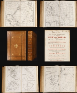
Atlas Maritimus et Commercialis or, A General View of the World, so far as relates to trade and navigation.
sold
This 1728 nautical atlas is the first openly published commercial geography produced for a general audience. 'No previous work in English had offered a survey of the world's trading sites on this scale' (Rogers, 2023). It was an ambitious project brought to completion by a consortium of mapmakers, printers, and writers. While it is conventionally credited to Nathaniel Cutler and the illustrious Edmond Halley, these supplied only portions of the monumental work. The maps can be assigned to John Senex, drawing extensively on a new projection provided by Henry Wilson; much of the descriptive content of the first part of the work has been attributed to the prolific Daniel Defoe, while the second portion - A General Coasting Pilot; Containing Directions for Sailing - is attributed to Cutler. (more details)
First printed nautical chart of the Gulf of Mexico and Florida.
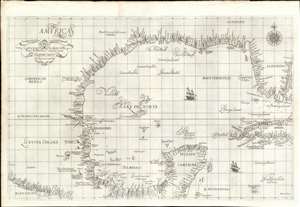
Carta particolare della Baia di Messico con la Costa.
sold
- Digital Map Information
- Suitable for large format printing
- Full resolution TIFF file
- ICC color profile embedded
- Delivered instantly via download link
A seminal production, this is a fine first-edition, first-state example of Sir Robert Dudley's 1645 - 47 maritime map of the Gulf of Mexico, the first printed nautical chart of that region. It is also the first to be printed using Mercator's Projection - thus making it the first to be practical for actual navigation. Likewise it is also the first to accurately indicate prevailing winds and ocean currents in the Gulf. Coverage extends from the Pacific Coast of Mexico to eastern Florida, and from Galveston Bay (Texas) to modern day Belize and the Bay of Honduras), inclusive of the Yucatan Peninsula and western Cuba. The whole is stunningly engraved in Antonio Francesco Lucini's masterful Italian baroque hand, complete with fine calligraphy and idiosyncratic styling. (more details)
First printed nautical chart of Virginia and North Carolina.
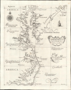
Carta particolare della Virginia Vecchia e Nuoua : la longitune comica da l'Isola di Pico di Asores : d'America carta, III.
sold
- Digital Map Information
- Suitable for large format printing
- File Size: 13.05 MB
- File Type: ZIP / TIFF
- ICC color profile embedded
- Delivered instantly via download link
A seminal chart, this is a superb 1661 example of Sir Robert Dudley's 1647 maritime map of the mouth of the Chesapeake Bay and the Carolina Sounds. In its first edition, this was the first printed nautical chart of that region. As per the title, the chart depicts the coasts of 'Old and New Virginia,' meaning the colonial efforts of Sir Walter Raleigh and the Jamestown Colony, respectively. Due to the Virginia Colony's importance to the English, Dudley's chart focuses more sharply on the region than on his other North American charts. (more details)
The VOC's Secret Map of the South China Sea.
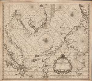
Nieuwe Caart strekkende van Banca, langs de kusten van Malacca, Siam, Cambodia, Cochinchina, als meede een gedeelte van de Eylanden Luçon, Borneo, et c. met alle dresslss Havens, Dieptens en Ankergronden.
sold
- Digital Map Information
- Suitable for large format printing
- DPI: 600
- File Size: 580.26 MB
- File Type: ZIP / TIFF
- ICC color profile embedded
- Delivered instantly via download link
The rare 1753 Johannes II van Keulen / Jan de Marre nautical map of the South China Sea compiled for the sixth volume of the Zee-Fakkel - the legendary Dutch East India Company (VOC - Vereenigde Oostindische Compagnie) 'Secret Atlas.' The map covers the South China Sea and Gulf of Thailand - thus embracing Singapore, Malaya, southern Thailand (Siam), Cambodia, southern Vietnam, most of Borneo, and parts of the Philippines. The map illustrates the most important waters and most dangerous sea passages in the East Indies. It was an essential navigational reference for VOC ships sailing from Malacca, through the Straits of Singapore, or north from Batavia for Siam (Bangkok), Laauwec (Cambodia), Nagasaki, Canton (Guangzhou), Macao, or Manila. (more details)
First printed English Nautical Chart of the East Coast
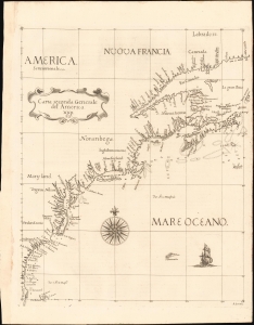
Carta Seconda Generale del' America. XXII.
sold
- Digital Map Information
- Suitable for large format printing
- File Size: 10.87 MB
- File Type: ZIP / TIFF
- ICC color profile embedded
- Delivered instantly via download link
This is the 1661 edition of Robert Dudley's general map of the east coast of North America. According to Burden, this is the 'first printed sea chart of North America by an Englishman and the first to record soundings.' It is a great rarity on the market and a keystone map for any collection of early American cartography. (more details)
Premier general chart of New England at the outbreak of the Revolutionary War.
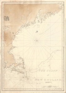
The Coast of New England.
sold
- Digital Map Information
- Suitable for large format printing
- File Size: 47.49 MB
- File Type: ZIP / TIFF
- ICC color profile embedded
- Delivered instantly via download link
This is J. F. W. Des Barres' 1776 nautical map of New England. This was the best and most accurate general chart of New England issued at the outbreak of the American Revolutionary War (1775 - 1783). (more details)
Belcher's influential chart is considered the first British Map of Hong Kong.
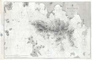
China Hong Kong Surveyed by Captn. Sir Edward Belcher in H.M.S. Sulphur 1841.
sold
- Digital Map Information
- Suitable for large format printing
- File Size: 25.14 MB
- File Type: ZIP / TIFF
- ICC color profile embedded
- Delivered instantly via download link
An iconic map of the utmost importance and rarity, this is the 1864 issue of Edward Belcher's 1843 nautical map of Hong Kong (香港) and vicinity. Belcher's 1841 study is the first detailed British survey of Hong Kong and played a significant role in the British ... (more details)
A hand drawn manuscript map - most likely the first accurate nautical chart of west Sumatra's Pepper Coast.
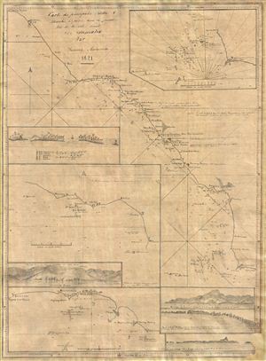
Cartes de principales Rades and Marchés à poivre dans la partie Nord de la Cote Ouest De Sumatra Par Samuel Ashmore.
sold
- Digital Map Information
- Suitable for large format printing
- DPI: 300
- File Size: 10.71 MB
- File Type: ZIP / TIFF
- ICC color profile embedded
- Delivered instantly via download link
Drawn by Australian-Irish sea captain Samuel Ashmore, this important and one of a kind 1821 manuscript (hand drawn) nautical chart or maritime map is the first accurate depiction of the pepper ports of northwestern Sumatra, modern day Aceh. The map covers the ... (more details)
'The first large-scale printed chart of the Texas coast based on actual soundings and explorations.' - Martin and Martin
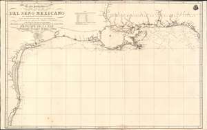
Carta Particular de las Costas Setentrionales del Seno Mexicano que comprende las de Florída Ocidental Las Margenes de la Luisiana y toda la rivera que sigue por la Bahia de S. Bernardo y el Rio Bravo del Norte hasta la Laguna Madre.
sold
- Digital Map Information
- Suitable for large format printing
- Full resolution TIFF file
- ICC color profile embedded
- Delivered instantly via download link
One of the most important maps of Texas, considered 'the first large-scale printed chart of the Texas coast based on actual soundings and explorations' (Martin and Martin). This is the 1807 Spanish Direccion Hidrografica map of the Gulf Coast in the vicinity of Texas and Louisiana. The chart follows directly on the seminal Jose Antonio de Evia (1740 - 18??) survey of the Gulf Coast, conducted between 1785 and 1786. This was the first scientific mapping of this region, resulting in, among other things, the naming of Galveston Bay. The Evia survey resulted in two subsequent maps, the 1799 Carta Esferica que Comprehende las Costas del Seno Mexicano - essentially a general chart of the Gulf of Mexico, and this more specific 1807 map offering considerably more detail to the costliness of Texas and Louisiana. (more details)
One of the rarest and finest Revolutionary War era maps of Charleston, South Carolina.
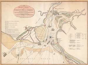
An Exact Plan of Charleston Bar and Harbour From an Actual Survey.
sold
- Digital Map Information
- Suitable for large format printing
- Full resolution TIFF file
- ICC color profile embedded
- Delivered instantly via download link
This is the 1791 Robert Sayer map of Charleston, South Carolina, one of the rarest and best Revolutionary War maps of that city. The map was issued to illustrate the 1776 Battle of Sullivan's Island, the first decisive American victory over the seemingly invincible British Royal Navy - the achievement shocked the world and protected Charleston during a critical early stage of the American Revolution (1775 - 1783). The British did not again attempt to retake the southern colonies until 1778. Moreover, unlike smaller plans by Faden which illustrate only the Attack on Fort Sullivan, this plan provides a detailed account of the British movements throughout the battle and captures significantly more information. (more details)
The finest British chart of Hong Kong available during the first Opium War.
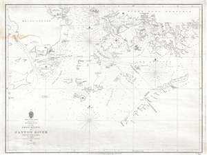
Entrance to the Chou-Kiang or Canton River from the Ouer Islands to Linten.
sold
- Digital Map Information
- Suitable for large format printing
- DPI: 300
- File Size: 6.55 MB
- File Type: ZIP / TIFF
- ICC color profile embedded
- Delivered instantly via download link
A rare and remarkable nautical chart of the utmost significance. This 1840 maritime map of Hong Kong and vicinity is attributed to Captain Daniel Ross, Bombay Marine. During the first Opium War (1839 – 1842), this was the finest and most detailed chart of ... (more details)

A New Chart of the Straits of Malacca and Sincapore Drawn from the Latest Surveys, with Additions and Improvemetns, by J. W. Norie.
sold
- Digital Map Information
- Suitable for large format printing
- DPI: 300
- File Size: 37.68 MB
- File Type: ZIP / TIFF
- ICC color profile embedded
- Delivered instantly via download link
An extremely scarce 1815 map of the Strait of Malacca and Singapore (Sincapore) by John William Norie. This map covers from Aceh in northwestern Sumatra (Acheen) to Singapore Island and Pulu Bintang. This map first appeared in 1803 when it was issued by ... (more details)
Belcher's influential chart is considered the first British Map of Hong Kong.
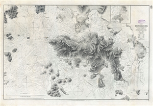
China Hong Kong Surveyed by Captn. Sir Edward Belcher in H.M.S. Sulphur 1841.
sold
- Digital Map Information
- Suitable for large format printing
- File Size: 31.4 MB
- File Type: ZIP / TIFF
- ICC color profile embedded
- Delivered instantly via download link
An iconic map of the utmost importance and rarity, this is the 1890 issue of Edward Belcher's nautical map of Hong Kong (香港) and vicinity. Belcher's 1841 study is considered to be the first British survey of Hong Kong and played a significant role in ... (more details)
By far the rarest of the great early maps of Hawaii.
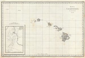
КАРТА САНДВЙЧЕВЫХЪ ОСТРВОВЪ 1826 [Map Sandvychevyh Ostrovov 1828] (Map of the Sandwich Islands 1826)
sold
- Digital Map Information
- Suitable for large format printing
- Full resolution TIFF file
- ICC color profile embedded
- Delivered instantly via download link
Perhaps the rarest of all the great early maps of the Hawaiian Islands, this is the Russian language first edition of Admiral Adam Johann von Krusenstern's important map of the Sandwich Islands or Hawaii. The map covers the Hawaiian archipelago in full ... (more details)
Singapore and the disputed Spratly Islands.
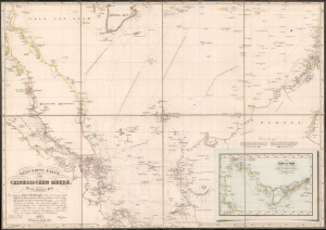
Reduzirte Karte vom Chinesischen Meere; 1stes oder Sudliches Blatt.
sold
- Digital Map Information
- Suitable for large format printing
- Full resolution TIFF file
- ICC color profile embedded
- Delivered instantly via download link
This is a striking 1835 Heinrich Burghaus nautical map of the South China Sea, Malay Archipelago, Singapore, and the Gulf of Siam. Significantly, it is among the finest mappings of the now disputed Spratly Archipelago. It was issued for Berghaus' looseleaf Atlas von Asien, the best informed general cartographic work on Asia to appear in the mid-19th century. (more details)
Spain recognizes the Republic of Texas?
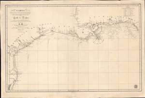
Carta de Las Costas de la Escambia, Alabama y Bocas del rio Misisipi, La Luisiana, tejas, Con la Provincia del Nuevo Santander en el Golfo de Mejico.
sold
- Digital Map Information
- Suitable for large format printing
- DPI: 600
- File Size: 1349.98 MB
- File Type: ZIP / TIFF
- ICC color profile embedded
- Delivered instantly via download link
An unusual 1846 Spanish Direccion Hidrografía nautical chart of the Gulf of Mexico recognizing the Republic of Texas. It is one of very few official Spanish publications to name the Republic of Texas, which Spain never formally recognized. The map emerged during a time of strife, both for Texas, which was involved in its own Texan Revolution (1835 - 1836) followed by the Mexican American War (1846 - 1848), but also in Spain, which was devolving into the Second Carlist War (1846 - 1849). Nonetheless, its production points to the complexity of Spanish-Texan relations during the Revolutionary years, when Texas was blockading Mexican trade and the Spanish West Indies in dire need of fresh trading partners. (more details)
The third episode in the 18th century British mapping of Bombay!
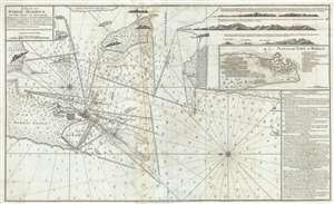
A Plan of Bombay-Harbour on th Coast of Malabar.
sold
- Digital Map Information
- Suitable for large format printing
- Full resolution TIFF file
- ICC color profile embedded
- Delivered instantly via download link
This is a fine example of Laurie and Whittle's 1794 nautical chart or maritime map of Bombay (Mumbai) Island, city, and harbor, India. This map is significant as the third major episode in the mapping of Bombay. The map covers from Salsette Island to ... (more details)
The only significant map of the Chesapeake Bay to be issued between the early 19th century Admiralty Charts and the Coast Survey Charts of the 1860s.
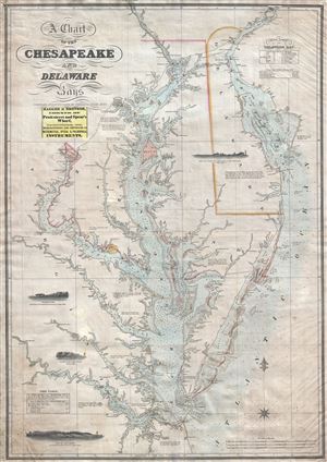
A Chart of the Chesapeake and Delaware Bays.
sold
- Digital Map Information
- Suitable for large format printing
- DPI: 300
- File Size: 40.07 MB
- File Type: ZIP / TIFF
- ICC color profile embedded
- Delivered instantly via download link
A scarce, important, and highly desirable 1852 nautical chart or maritime map of the Chesapeake and Delaware Bays by Fielding Lucas Jr. This chart covers the entirety of the Chesapeake Bay from Wrightsville (on the Susquehanna River) and ... (more details)
A hand drawn manuscript map - most likely the first accurate nautical chart of west Sumatra's Pepper Coast.
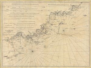
A Survey of the West Coast of Sumatra From Padang head to batang Capay Bay.
sold
- Digital Map Information
- Suitable for large format printing
- DPI: 300
- File Size: 13.45 MB
- File Type: ZIP / TIFF
- ICC color profile embedded
- Delivered instantly via download link
A remarkable discovery, this is a c. 1820 manuscript map of the western coasts of Sumatra (Indonesia) around the city of Pedang by Scottish sea captain John MacDonald. The map covers the west central Sumatra coastline from, roughly, Pedang ... (more details)
The largest and most detailed map of Bombay (Mumbai) to appear in the 18th century.
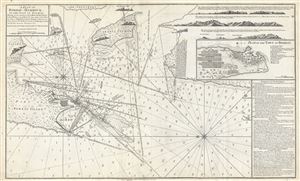
A Plan of Bombay-Harbour on th Coast of Malabar.
sold
- Digital Map Information
- Suitable for large format printing
- DPI: 300
- File Size: 20.38 MB
- File Type: ZIP / TIFF
- ICC color profile embedded
- Delivered instantly via download link
This is a fine example of Laurie and Whittle's 1794 nautical chart or maritime map of Bombay (Mumbai) Island, city, and harbor, India. The map covers from Salsette Island to the continent south to Hunary Island. There is a detailed plan ... (more details)
The earliest recognizable printed map of Bombay, India.
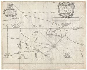
A New Mapp of the Island of Bombay and Sallset.
sold
- Digital Map Information
- Suitable for large format printing
- DPI: 300
- File Size: 12.17 MB
- File Type: ZIP / TIFF
- ICC color profile embedded
- Delivered instantly via download link
An extremely scarce map, this is John Thornton's 1711 map of Bombay Harbor, India. First drawn in 1685 for the Atlas Maritimus , this map is the first printed map to offer any real detail of Bombay harbor. Following in the style of the ... (more details)
Scoping out the Taipa for the EIC during the Napoleonic Wars.
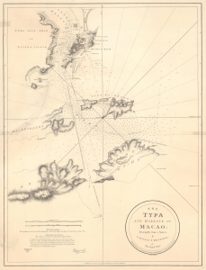
The Typa and Harbour of Macao; Principally from a Survey by Captain P. Heywood, of The Royal Navy.
sold
- Digital Map Information
- Suitable for large format printing
- File Size: 20.15 MB
- File Type: ZIP / TIFF
- ICC color profile embedded
- Delivered instantly via download link
This is the only known example of the 1809 Laurie and Whittle first edition of Peter Heywood's seminal survey of Macau (Macao) and nearby Taipa. This survey, conducted independently while Heywood's ship, the La Dedaigneuse, was being refitted in Macau, is the most important mapping of Macau since the 1778-79 survey of Heywood's erstwhile hydrography instructor, captain, and lifelong nemesis, Captain William Bligh of Bounty infamy. The survey appeared in the context of the Napoleonic Wars, when Franco-Spanish fleets were plaguing East India Company (EIC) fleets, and the British were keen to establish a foothold in the Pearl River Delta. Taipa, being a long-established EIC mooring point, was the prime target. (more details)
VOC's Secret Map of the critical passage around Madagascar to the Indies.
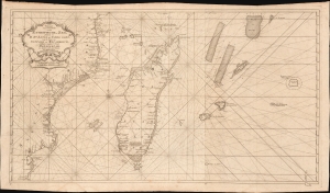
Paskaart van een Gedeelte van de Aethiopische-Zee, Strekkende van R. Sta. Lucia tot C. del Gado, Langs de Kusten van Suffalo en Mocambique, Bevattende Insgelyks 't Eiland Madagascar met Desselfs Onderhorige Eilanden.
sold
- Digital Map Information
- Suitable for large format printing
- File Size: 45.51 MB
- File Type: ZIP / TIFF
- ICC color profile embedded
- Delivered instantly via download link
This is an extremely rare 1753 Johannes II van Keulen / Jan de Marre nautical map of Madagascar, Mauritius, and the adjacent coast of Africa compiled for the sixth volume of the Zee-Fakkel - the Dutch East India Company's legendary 'Secret Atlas.' The map reveals tightly controlled navigational secrets when Madagascar was a haven not only for the world's most notorious pirates (including Captain Kidd) but also a source for the Atlantic Slave Trade. (more details)
One of the Finest Northeast Charts of the Dutch Period.
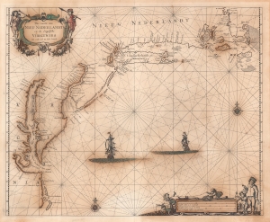
Pas Caerte van Nieu Nederlandt en de Engelsche Virginies van Capo Cod to Cabo Canrick.
sold
- Digital Map Information
- Suitable for large format printing
- Full resolution TIFF file
- ICC color profile embedded
- Delivered instantly via download link
A striking original color 1666 Pieter Goos nautical chart or maritime map of New England, New York, New Jersey, and Virginia. Coverage follows the coast of North America from Boston Harbor to Cape Hatteras, thus embracing one of the more active mid-17th century maritime corridors in North America. At the center of the map, two Dutch ships ply the seas. Finely engraved decorative cartouche work in the upper left and lower right emphasizes the region's rich fur trade and abundant fisheries. (more details)
Unrecorded chart of Florida and the Greater Antilles.
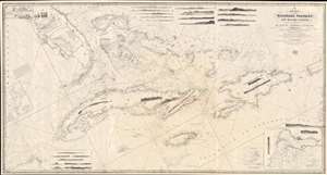
A New Chart of the Windward Passages and Bahama Islands, With the Islands of Hayti, Jamaica, Cuba, etc.
sold
- Digital Map Information
- Suitable for large format printing
- DPI: 600
- File Size: 81.76 MB
- File Type: ZIP / TIFF
- ICC color profile embedded
- Delivered instantly via download link
A rare and unusual 1848 John Purdy / Richard Holmes Laurie Blueback nautical chart or maritime map of Florida, the Bahamas, and the Greater Antilles - here in its only known surviving example. Oriented sharply to the northeast, the chart offers expansive coverage, embracing all of peninsular Florida, Cuba, the Bahamas, Hispaniola (Santo Domingo / Haiti), Jamaica, and Puerto Rico. The map exhibits some manuscript nautical annotations regarding lighthouses in the Bahamas and Cuba, but it is faded and unreadable. Insets detail important ports, including Havana, New Providence (Nassau), Matanzas, Guantanamo, the Morant Kays, and Kingston (Jamaica). (more details)
Beautiful and rare, an essential lighthouse guide for the British mariner.
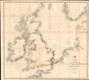
A Chart Exhibiting the Lighthouses and Light Vessels on the Coasts of Great Britain and Ireland and also those on the N.W. Coasts of Europe between Ushant and Bergen. Published by order of the Honble the Corporation of Trinity House, constructed by A. G Findlay.
sold
- Digital Map Information
- Suitable for large format printing
- Full resolution TIFF file
- ICC color profile embedded
- Delivered instantly via download link
An extraordinary 1863 chart and map exhibiting in great detail the lighthouses of Great Britain, including England, Ireland, Wales, and Scotland, and around the North Sea as far as Norway, Holland, France, and Denmark. The chart provides essential information for the mariner with regard to understanding and identifying the region's many lighthouses and what they communicate. In addition, the map illustrates the major regional railroads and their connections to major ports. The whole is impressively presented in a handsome presentation case with gilt stamped cover and brass closures. (more details)
Logwood and the cusp of change.
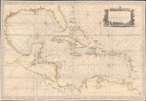
A New General Chart of the West Indies From the latest Marine Journals and Surveys, Regulated and Ascertained by Astronomical Observations.
sold
- Digital Map Information
- Suitable for large format printing
- File Size: 46.27 MB
- File Type: ZIP / TIFF
- ICC color profile embedded
- Delivered instantly via download link
This is Robert Sayer's exceptional 1790 nautical map of the West Indies and Gulf of Mexico. This map emerged, much updated, on the cusp of significant regional upheaval, including conflicts related to the French Revolutionary Wars (1792 - 1802) and the Haitian Revolution (1791 - 1804), events that disrupted shipping, provoked privateering and blockades, and reshaped the patterns of trade. (more details)
Rare mid-19th century Nautical Chart of Hong Kong.
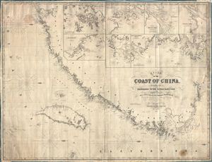
Chart of the Coast of China, Extending from Hong Kong to the River Yang-Tse, with Plans on a Large Scale of the Principal Harbours & C.
sold
- Digital Map Information
- Suitable for large format printing
- File Size: 65.86 MB
- File Type: ZIP / TIFF
- ICC color profile embedded
- Delivered instantly via download link
An impressive large 1855 format nautical chart or maritime map detailing the coast of China from the Yangtze River to Hong Kong and Macao. Map incudes Taiwan or Formosa in full. Drawn by the nautical chart maker James Imray, this is one of the rarest 19th century maps of Hong Kong and Taiwan. It includes insets of Hong Kong, the River Min, Amoy Harbor (Xiamen), Tongsang harbor, Hoo-e-Two and Chimmo Bays, the mouth of the Yangtze, and the Chusan Archipelago (Zhoushan). Dated 1855. (more details)
Earliest published sea chart focusing on the California coast!
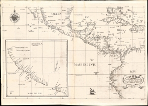
Carta prima generale d'America dell'India Occidentale e Mare del Zur.
sold
- Digital Map Information
- Suitable for large format printing
- File Size: 22.42 MB
- File Type: ZIP / TIFF
- ICC color profile embedded
- Delivered instantly via download link
This is the 1646 first state of Robert Dudley's chart of the middle part of the Americas, illustrating the proximity of the Caribbean Sea and the Pacific Ocean and emphasizing the narrow parts of Central America dividing the two bodies of water. The chart features the western part of the Caribbean, but it is particularly noted for being the first printed sea chart to focus on the Pacific coast, including California. It is, along with Dudley's more narrowly focused charts, the first printed chart of the West Indies and South Florida to employ the Mercator Projection. An inset chart in the lower left focuses specifically on the coast of California, from Baja to Cap Mendocino. (more details)
Extremely scarce nautical chart of Singapore and Malacca - the most desirable of Horsburgh's influential nautical charts.

To the Honourable The Court of Directors of the United East India Company This Chart of Malacca Strait Singapore Strait and the Southernmost Promontory of Asia Is Inscribed by Their Faithful and Obedient Servant James Horsburgh.
sold
- Digital Map Information
- Suitable for large format printing
- DPI: 300
- File Size: 31.46 MB
- File Type: ZIP / TIFF
- ICC color profile embedded
- Delivered instantly via download link
An extremely scarce 1844 James Horsburgh nautical chart of southern Malaysia, Singapore, and the straits of Malacca and ... (more details)
The Earliest Printed Chart of South Africa.
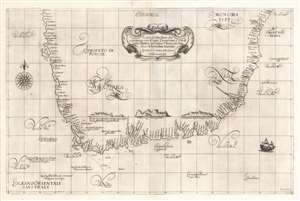
Carta particolare che comincia con il capo Degortam e con il capo Buona Speranza e finisce in gradi 27 di latitudine Australe.
sold
- Digital Map Information
- Suitable for large format printing
- Full resolution TIFF file
- ICC color profile embedded
- Delivered instantly via download link
This is a superb example of Robert Dudley's 1647 coastal chart of South Africa. It was included in Dudley's Arcano del Mare, hailed by Tooley as
The inclusion of coastal recognition views of the Cape of Good Hope, Cape Hangklip and Cape Agulhas on this particular chart suggests that Dudley, or his source for this chart, had benefited from actually having seen these shores. All of these views were landmarks of note for mariners rounding the Cape. (more details)
the first sea atlas in which every chart was based on Mercator’s projection, the first to show prevailing winds and currents in the main harbours and anchorages, the first to give magnetic declination, and the first sea atlas by an Englishman.At least in principle, these navigational notes and the adherence to the Mercator projection would make Dudley's charts the first to be of any use at sea. The present chart exhibits all of these qualities.
The inclusion of coastal recognition views of the Cape of Good Hope, Cape Hangklip and Cape Agulhas on this particular chart suggests that Dudley, or his source for this chart, had benefited from actually having seen these shores. All of these views were landmarks of note for mariners rounding the Cape. (more details)
The finest 19th century chart of Cape Fear and Bald Head Island!
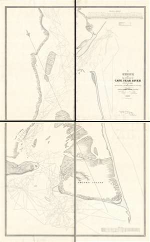
A Chart of the Entrance of Cape Fear River.
sold
- Digital Map Information
- Suitable for large format printing
- DPI: 300
- File Size: 52.16 MB
- File Type: ZIP / TIFF
- ICC color profile embedded
- Delivered instantly via download link
Without a doubt, this 1839 wall-map sized chart by James Glynn is the finest map of Cape Fear and vicinity to appear in the 19th century. Although much changed from repeat storms, this 1839 chart covers roughly from Kure Beach and Fort Fish Historic Site to the southern part of Bald Head Island (Smith Island) and from Southport (Smithville) to the Atlantic. The map exhibits a wealth of detailed soundings as well as some landside information including the course of rivers and streams, the positions of the Federal Point and Cape Fear lighthouse, and the street grid of Smithville / Southport. (more details)