
Nautical Maps & Charts
First printed English Nautical Chart of New York and New England. / First use of the name 'Connecticut' in any form.
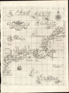
Carta particolare della nuova Belgia è parte della nuova Anglia La longitudiné Cominca da l'Isola di Pico d'Asores. D'America Carta II.
$40,000.00
Acquire
- Digital Map Information
- Suitable for large format printing
- File Size: 14.46 MB
- File Type: ZIP / TIFF
- ICC color profile embedded
- Delivered instantly via download link
This is a superb example of Robert Dudley's 1647 / 1661 nautical map of the coast of New York and New England - according to Burden, the 'first printed sea chart of New England and the New Netherlands.' Moreover, it is the first chart of New England to be produced by an Englishman. The chart's portolan-like lines and exquisite Florentine calligraphy distinguish it as one of the most beautiful works dedicated to the region. It is a rarity on the market, and a prize map for collectors of New York and New England. (more details)
Beginnings of American commercial chart publishing.

General Chart of the West Indies from the latest Marine Journals and Surveys.
$30,000.00
Acquire
- Digital Map Information
- Suitable for large format printing
- DPI: 600
- File Size: 50.2 MB
- File Type: ZIP / TIFF
- ICC color profile embedded
- Delivered instantly via download link
An important c. 1789 - 1794 nautical map of the West Indies, Florida, the Bahamas, and the Gulf of Mexico littoral by Osgood Carleton and John Norman. This is the second edition of John Norman's first published nautical chart, representing one of the first instances of post-Revolutionary American commercial chart making, predating the publication of the Clark Pilot by several months. (more details)
The first English Printed Nautical Chart to the Indies.
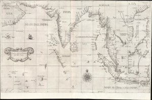
Carta prima Generale dell' Asia.
$25,000.00
Acquire
- Digital Map Information
- Suitable for large format printing
- File Size: 28.34 MB
- File Type: ZIP / TIFF
- ICC color profile embedded
- Delivered instantly via download link
This is a superb, first-state example of Robert Dudley's 1646 general nautical map of South Asia, from the Arabian Peninsula to the Philippines, including the coastlines of India, the Malay Peninsula, Cochinchina, and southern China. Countless islands of the Indian Ocean are charted, as are the western parts of the East Indies. It is the first printed chart of the route to the Spice Islands produced by an Englishman; it is the first to utilize the Mercator Projection, and the first to show prevailing winds, currents, and magnetic variation. The chart's portolan-like lines suggest its origin in the manuscript charts that informed it. Aesthetically, they distinguish this chart as one of the most elegant works dedicated to the region. It is a rarity on the market and a prize map for collectors. (more details)
First published nautical chart of Bermuda.
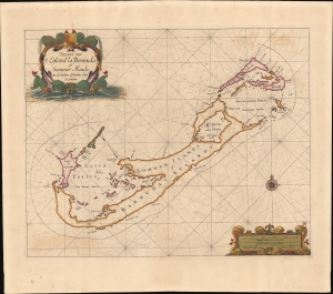
Pascaert van 't Eÿland la Bermuda of Sommer Ilands en de andere Eÿlanden daer bÿ geleeghen.
$25,000.00
Acquire
- Digital Map Information
- Suitable for large format printing
- File Size: 19.23 MB
- File Type: ZIP / TIFF
- ICC color profile embedded
- Delivered instantly via download link
This is a stunning old-color example of Arent Roggeveen's 1675 map of Bermuda, considered to be the first sea chart of the solitary archipelago. (more details)
First scientific hydrographic survey of Bermuda.

To his Excellency Alured Popple Esq. Governour of Bermuda, or the Summer Islands This Map From a new Survey, Correcting ye Dangerous Errors in all ye Charts of that Place hitherto Published is Humbly Dedicated by C. Lempriere, and W. H. Toms, 1738.
$22,500.00
Acquire
- Digital Map Information
- Suitable for large format printing
- File Size: 20.39 MB
- File Type: ZIP / TIFF
- ICC color profile embedded
- Delivered instantly via download link
A holy grail of Bermuda map collecting, this is the 1738 first-edition first-state of Clement Lemprière's separately and independently published map of Bermuda. It is considered the first scientifically verified hydrographic survey of Bermuda and the first published map to correctly identify the archipelago's longitude. It surpassed and superseded the 17th-century Arent Roggeveen survey, thus becoming the basis for most subsequent maps of the archipelago until the Hurd surveys (1783-97). (more details)
The French set their eyes on Singapore.
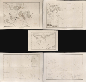
Carte des Atterrages de Singapore. / Carte Particulière des détroits de Singapore, Durian et Rhio. / Carte des Détroits de Singapore, Durian et Rhio et des Parages Environnants. / Carte du Détroit del Malacca Partie Septentrionale. / Carte du Détroit de Malacca Partie Méridionale.
$22,000.00
Acquire
- Digital Map Information
- Suitable for large format printing
- Full resolution TIFF file
- ICC color profile embedded
- Delivered instantly via download link
An exceptional set of five rare 1840s nautical maps/charts detailing Singapore, Malaya, and the Straits of Malacca and Singapore compiled by Urban Dortet de Tessan for the French Dépôt-Général de la Marine. The charts correspond to the Lagrené Mission, a French attempt to establish a colonial presence in East and Southeast Asia that challenged British regional hegemony. (more details)
First printed map to show Hong Kong in any form.
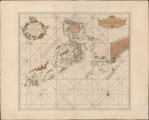
Pas-Kaart van het in en opkomen van de Rivier van Quantong aan de Zuid Kust van China strekkende van het eiland S. Joan, tot aan de Noorder Lemes, met alle tot hiertoe bekende ankerplaatzen, dieptens en droogtens.
$18,000.00
Acquire
- Digital Map Information
- Suitable for large format printing
- DPI: 600
- File Size: 828.08 MB
- File Type: ZIP / TIFF
- ICC color profile embedded
- Delivered instantly via download link
The rare 1753 Johannes II van Keulen / Jan de Marre nautical map of the Pearl River Delta (廣東河口海圖), including Macau (Macao), Lantao (Lantoan), Guangzhou (Quantong), and the first printed mapping of Hong Kong (Lantaon Falso). This rare map in fine original color was compiled for the sixth volume of the Zee-Fakkel - the legendary Dutch East India Company (VOC / Vereenigde Oostindische Compagnie) 'Secret Atlas.' (more details)
Earliest detailed mapping of western Martha's Vineyard.
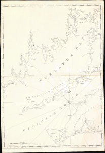
[Buzzard's Bay and Vineyard Sound.]
$17,000.00
Acquire
- Digital Map Information
- Suitable for large format printing
- Full resolution TIFF file
- ICC color profile embedded
- Delivered instantly via download link
This beautifully engraved map is the earliest acquirable issue of J. F. W. Des Barres' 1776 map of Buzzard's Bay and Vineyard Sound, capturing western Martha's Vineyard and the southern harbors of the Massachusetts mainland at the outbreak of the American Revolutionary War (1775 - 1783). It contains the first detailed mapping of the western part of Martha's Vineyard and the most accurate chart of the waters of Buzzard's Bay and Vineyard Sound. It remained authoritative for nearly 50 years. (more details)
Second earliest, and earliest obtainable scientific map of the Galapagos.
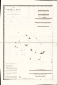
Carte d'une Partie de L'Archipel des Galapagos Levée et dressée en 1838 à bord de la Vénus...
$7,500.00
Acquire
- Digital Map Information
- Suitable for large format printing
- File Size: 2032.23 MB
- File Type: ZIP / TIFF
- ICC color profile embedded
- Delivered instantly via download link
An extraordinary discovery, this is Urbain Dortet de Tessan's 1842 nautical map of the Galapagos Islands, considered the second scientific map of the Galapagos. The map is the result of survey work performed in July of 1836 on the westward circumnavigation of the Vénus under Admiral Abel Aubert Dupetit-Thouars. The Vénus's visit to the Galapagos followed Darwin by just one year, and thus Beagle hydrographer Robert Fitzroy's contemporaneous mapping of the archipelago. This chart, published in 1842, and Fitzroy's chart, published in 1841, constitute the first comprehensive nautical overview of the islands and are comparable in both rarity and significance. (more details)
EIC China Trade: Charting a new course.
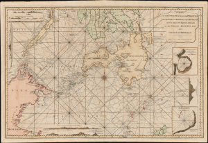
A Chart of the Passages Between the Philippine and The Isles Of Borneo And Mindanao With those to the Southward of the Sooloo Archipelago and the Isle of Mindanao.
$7,000.00
Acquire
- Digital Map Information
- Suitable for large format printing
- Full resolution TIFF file
- ICC color profile embedded
- Delivered instantly via download link
This large, rare nautical chart is Laurie and Whittle's 1794 maritime map of the southern Philippines, particularly Mindanao, Palawan, and the Sulu Sea. It presents improvements resulting from more than three decades of British East India Company voyages through these passages, and is certainly informed by, and possibly the work of, one of the EIC's most successful captains and ship owners, John Pascall Larkins. (more details)
Earliest published sea chart focusing on the California coast!
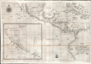
Carta prima generale d'America dell'India Occidentale e Mare del Zur.
$7,000.00
Acquire
- Digital Map Information
- Suitable for large format printing
- File Size: 26.19 MB
- File Type: ZIP / TIFF
- ICC color profile embedded
- Delivered instantly via download link
This is the 1646 first state of Robert Dudley's chart of the middle part of the Americas, illustrating the proximity of the Caribbean Sea and the Pacific Ocean and emphasizing the narrow parts of Central America dividing the two bodies of water. The chart features the western part of the Caribbean, but it is particularly noted for being the first printed sea chart to focus on the Pacific coast, including California. It is, along with Dudley's more narrowly focused charts, the first printed chart of the West Indies and South Florida to employ the Mercator Projection. An inset chart in the lower left focuses specifically on the coast of California, from Baja to Cap Mendocino. (more details)
First and largest chart of Karachi as an EIC Port.
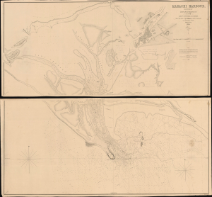
Karachi Harbour, surveyed by Lieut. A. M. Grieve, I.N. Assisted by Lieuts. Constable and Barker.
$6,000.00
Acquire
- Digital Map Information
- Suitable for large format printing
- DPI: 600
- File Size: 112.65 MB
- File Type: ZIP / TIFF
- ICC color profile embedded
- Delivered instantly via download link
A seminal 1854 large-scale Indian Navy Albany M. Grieve nautical map of Karachi Harbor, in the Sindh region of what is today Pakistan. This is the second and certainly the largest map of Karachi, and the first as an East India Company port. It was issued in the same year that marked Karachi Harbor's opening to EIC traders and the completion of the connecting Napier Mole causeway - illustrated here. (more details)
Suppressed and groundbreaking first edition!
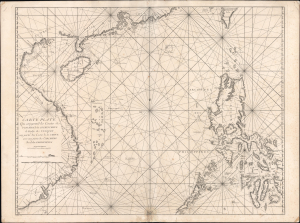
Carte Plate Qui comprend les Coste de Tsiompa, de la Cochinchine, le Golfe de Tunquin, une partie des Costes de la Chine aves une partie de l'Archipel des Isles Philippines.
$5,500.00
Acquire
- Digital Map Information
- Suitable for large format printing
- File Size: 47.63 MB
- File Type: ZIP / TIFF
- ICC color profile embedded
- Delivered instantly via download link
This is the exceedingly rare 1745 nautical map of the South China Sea and the Philippines, which appeared in Mannevillette's banned first edition of his groundbreaking nautical atlas, the Neptune Oriental. When published, this chart represented the finest available cartography of the South China Sea, Southeast China Coast, and the Philippines - thus defining the Canton-Macao-Manila triangle. It was so accurate that French authorities, fearing for the security of their colonial empire, ordered all examples banned and destroyed. The map is additionally notable for its early and idiosyncratic inclusion of various islands, banks, and atolls in the area, many of which have become hotly disputed in recent decades. (more details)
Early Spanish nautical mapping of Florida.
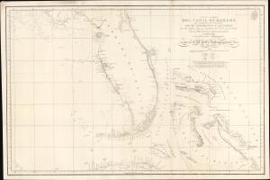
Nueva Carta del Canal de Bahama que comprehende tambien Los de Providencia y Santaren con los bajos, islas, y sondas al Este y al Oeste de la Peninsula de la Florida...
$5,000.00
Acquire
- Digital Map Information
- Suitable for large format printing
- DPI: 600
- File Size: 814.37 MB
- File Type: ZIP / TIFF
- ICC color profile embedded
- Delivered instantly via download link
A strikingly engraved 1807 Spanish nautical map of Florida and the Bahamas (Lucayas) published in Madrid by the Spanish Dirección Hidrografía. It is among the earliest modern nautical charts to focus specifically on Florida and was based on the 1799 observations of Dionisio Alcalá Galiano (1760 - 1805) aboard the ship San Fulgencio. (more details)
Largest, most beautiful, and most important early map of Hawaii.

Carte des Iles Sandwich d'apres la reconnoissance qui en a ete faite dans les differentes relaches de la corvette La Decouverte et de sa conserve Le Chatham commandes par le Capt. Vancouver en 1792, 1793 et 1794.
$5,000.00
Acquire
- Digital Map Information
- Suitable for large format printing
- Full resolution TIFF file
- ICC color profile embedded
- Delivered instantly via download link
This is a beautiful example of George Vancouver's seminal 1799 map of the Hawaiian Islands, considered the largest, most important, and most beautiful map of Hawaii to appear in the 18th century. (more details)
In Scarce Original Color.
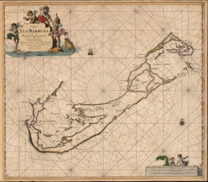
Pas Kaart van I. La Barmuda Anders Somer Islands int Groot Door Vooght Geometra.
$5,000.00
Acquire
- Digital Map Information
- Suitable for large format printing
- File Size: 24.21 MB
- File Type: ZIP / TIFF
- ICC color profile embedded
- Delivered instantly via download link
This is Johannes van Keulen's beautiful 1684 chart of Bermuda. This grand, desirable work is one of the earliest acquirable nautical charts of Bermuda; the present example is embellished with beautiful original color. (more details)
'Towards thee I roll, thou all-destroying but unconquering whale...' -Melville
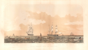
Sperm Whaling with Its Varieties.
$5,000.00
Acquire
- Digital Map Information
- Suitable for large format printing
- File Size: 21.24 MB
- File Type: ZIP / TIFF
- ICC color profile embedded
- Delivered instantly via download link
This is Benjamin Russell's stunning 1870 chromolithograph view of the American sperm whaling industry, printed by John Henry Bufford. (more details)
French colonial interest in the Philippines. Also, rectification of charts.
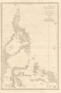
Carte des Iles Philippines, Célèbes et Moluques.
$4,500.00
Acquire
- Digital Map Information
- Suitable for large format printing
- Full resolution TIFF file
- ICC color profile embedded
- Delivered instantly via download link
A spectacular 1840 / 1852 map of the Philippines by Pierre Daussy and the French Dépot-général de la Marine. This map is significant as it reflects growing French interest in the Far East and coincides with the first French attempt to seize the Philippine island of Basilan as a base to counterbalance British power in Hong Kong. It is also part of the French Bureau des Longitudes' ongoing effort to revise its Table des Positions Géographiques des Principaux Lieux du Globe to conform to the most up-to-date measurements made possible by advances in hydrography, including widespread early 19th century adoption in the marine chronometer. Daussy published dozens of new charts, including this one, to reflect the significant corrections. (more details)
Among the Earliest Obtainable Maps of the Chesapeake.
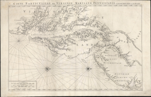
Carte Particuliere de Virginie, Maryland, Pennsilvanie, La Nouvelle Jarsey. Orient et Occidentale.
$4,500.00
Acquire
- Digital Map Information
- Suitable for large format printing
- Full resolution TIFF file
- ICC color profile embedded
- Delivered instantly via download link
This is Pierre Mortier and Alexis-Hubert Jaillot's c. 1700 large-format nautical chart of the Mid-Atlantic coast, including Chesapeake Bay and the Delaware River Estuary. One of the most important early modern maps of this region, it is significant for its early inclusion of Philadelphia and prodigious hydrographic information. (more details)
Rare working blueback nautical chart of Cuba!
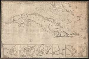
[Cuba]
$4,500.00
Acquire
- Digital Map Information
- Suitable for large format printing
- File Size: 26.33 MB
- File Type: ZIP / TIFF
- ICC color profile embedded
- Delivered instantly via download link
This stunning blueback nautical chart or map of Cuba, issued by James Imray in 1854, has all of the hallmarks of a working shipboard chart and a life at sea. Centered on Cuba, the map covers from Key West (Florida) to Grand Cayman, and from Cape Antonio (Cuba) to the Inagua Islands (Bahamas), coving all of Cuba, and parts of the southern Bahama Islands. Along the bottom of the map there are eight detail sub-maps, including, from left: Havana Harbor, Bahia Honda, Port Mariel, Port Guantanamo (Guantanamo Bay), Santiago de Cuba, Matanzas, Juaga or Zagua, and the Entrance of Puerto de la Nuevias. Some marks in pencil in the Old Bahama Channel or Santaren Channel (Bahamas) indicate navigation use. Soundings, particularly on the south coast of Cuba and throughout the Great Bahama Bank are in fathoms. (more details)
Main Trade Route of the Caribbean.
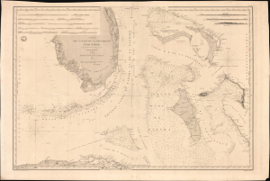
Carte des Canaux de la Providence et de Bahama. D'après la Carte en deux feuilles de E. Blunt de 1847.
$4,000.00
Acquire
- Digital Map Information
- Suitable for large format printing
- Full resolution TIFF file
- ICC color profile embedded
- Delivered instantly via download link
This is a large-format 1851 nautical chart or map of southern Florida and the Bahamas, focusing on the Bahama Banks, produced by the French Dépôt de la Marine. Based on a 1847 chart by American hydrographer Edmund Blunt, the chart represents the most detailed hydrographic information on these notoriously tricky waters available at the time. The map marks a point of rising French trade and activity in the Gulf under the Second Empire. (more details)
Dubai - Origins of an Economic Miracle.
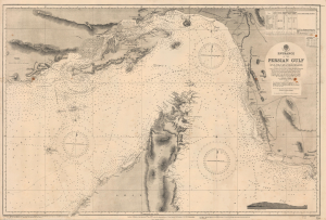
Entrance of the Persian Gulf.
$4,000.00
Acquire
- Digital Map Information
- Suitable for large format printing
- File Size: 50.69 MB
- File Type: ZIP / TIFF
- ICC color profile embedded
- Delivered instantly via download link
This is a 1945 British Admiralty large-format nautical chart of the Strait of Hormuz encompassing the Entrance to the Persian Gulf, one of the most strategically important locations in the world. The chart is notable for its inclusion of Dubai, at this time still a small fishing and pearling port but poised to become an economic powerhouse following the discovery of oil in the 1960s. (more details)
Used by Henry David Thoreau when writing 'Cape Cod.'
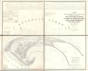
A Map of the Extremity of Cape Cod Including the Townships of Provincetown and Truro: A Chart of Their Sea Coast and of Cape Cod Harbour, State of Massachusetts.
$4,000.00
Acquire
- Digital Map Information
- Suitable for large format printing
- Full resolution TIFF file
- ICC color profile embedded
- Delivered instantly via download link
An exceptional discovery, this is James Duncan Graham's wall map of Provincetown at the tip of Cape Cod. At the time of issue, and for a long time afterward, this was the definitive map of the Provincetown area and the surrounding waters, said to have been used by, among many others, Henry David Thoreau when writing Cape Cod. The map was produced to
aid in the projection of the works for the military defenses of the important harbor formed by the peculiar spiral termination of [Cape Cod], and also to aid our ships of war and other vessels in entering it with safety after making this prominent headland. (Congressional Report, 25th Congress, Second Session, p. 3).(more details)
At the height of the Haitian Revolution, when a former slave's rise to power that undermined the foundations of the plantation system.
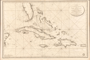
Carte de la Partie Occidentale des Îles Antilles Comprenant St. Domingue, La Jamaique, Cuba et Îles et Bancs de Bahama avec les Débouqumens de toutes ces Îles Dressée d'apres les nouvelles Observations des Espagnols et Publiée Par Ordre du Xontre-Amiral Decrès Ministre de la Marine et des Colonies au Dépôt général de la Marine, en 1801.
$4,000.00
Acquire
- Digital Map Information
- Suitable for large format printing
- Full resolution TIFF file
- ICC color profile embedded
- Delivered instantly via download link
A striking 1801 French Dépôt de la Marine nautical chart of Florida and the Greater Antilles, encompassing Cuba, the Bahamas, Hispaniola, Puerto Rico, and Jamaica. Issued at the height of the Haitian Revolution, the map coincides with the rise of the former slave and revolutionary Toussaint Louverture, who had just unified Hispaniola under his authority, sending shockwaves through the slaveholding societies of the Atlantic world. Published as Napoleon Bonaparte prepared his massive Saint-Domingue Expedition to reclaim France's richest colony, this chart reflects the sudden strategic importance of the Caribbean's sea lanes, making it an artifact of one of history's most transformative revolutions. (more details)
Important State of the dominant chart of Colonial Virginia.
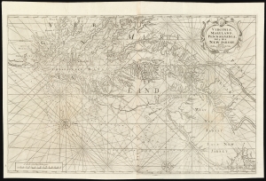
Virginia, Maryland, Pennsilvania, East and West New Jarsey...
$4,000.00
Acquire
- Digital Map Information
- Suitable for large format printing
- DPI: 600
- File Size: 89.65 MB
- File Type: ZIP / TIFF
- ICC color profile embedded
- Delivered instantly via download link
This is a superb example of William Mount and Thomas Page's large nautical map of the Chesapeake Bay and Delaware Bay in the 1742 first state. It represents the dominant English depiction of the water approaches to Virginia, Maryland, Delaware, and New Jersey for most of the Colonial Period. (more details)
'This was probably the best chart of the West Coast available in 1849' -Heckrotte
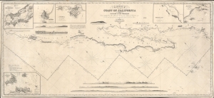
Chart of the Coast of California form San Blas to San Francisco.
$3,900.00
Acquire
- Digital Map Information
- Suitable for large format printing
- DPI: 600
- File Size: 1825.23 MB
- File Type: ZIP / TIFF
- ICC color profile embedded
- Delivered instantly via download link
The 1849 first edition, published for the California Gold Rush, of the James Imray blueback nautical map of the coast of California. This map, by Imray, predates any American charts of the California coast and, when it was issued, was the best obtainable chart for ambitious 49ers en route to the gold regions. (more details)
Earliest Detailed Chart of the Cape Verde Islands, Senegal, and the lower Gambia River.
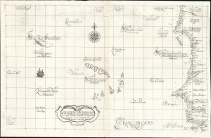
Carta particolare della Barberia Australe che comincia con il capo Matas è Finiscie con il C. Himilas con l'Isole di capo Verde.
$3,000.00
Acquire
- Digital Map Information
- Suitable for large format printing
- Full resolution TIFF file
- ICC color profile embedded
- Delivered instantly via download link
This is a superb example of Robert Dudley's rare 1647 nautical chart or map of the coast of Africa, focusing on the Cape Verde Islands and the mainland from the Western Sahara to the northern part of Guinea. It is both beautifully engraved and an important, early work. It is the earliest accurate printed chart of the Cabo Verde Islands and the coastlines of Senegal, The Gambia, and Guinea. (more details)
Waning Days of Antigua's Plantation Economy.
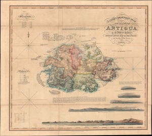
A New and Improved Map of the Island of Antigua, in the West Indies.
$3,000.00
Acquire
- Digital Map Information
- Suitable for large format printing
- Full resolution TIFF file
- ICC color profile embedded
- Delivered instantly via download link
This is J. Johnson's rare 1829 folding map of Antigua, published by Smtih, Elder, and Co. It holds both cartographic and historical significance, being the only major map of Antigua produced between 1793 and 1852, and, having been issued on the eve of the abolition of slavery, capturing the island in the late stages of the plantation slavery economy. (more details)
West-oriented chart of the Middle and North Atlantic Coastline.
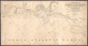
A New Chart of the Coast of America from Halifax in Nova-Scotia to the Chesapeak including Boston, New York, Philadelphia, Baltimore and Washington.
$3,000.00
Acquire
- Digital Map Information
- Suitable for large format printing
- File Size: 87.36 MB
- File Type: ZIP / TIFF
- ICC color profile embedded
- Delivered instantly via download link
This is James Imray's 1852 blueblack nautical map of the Middle-Atlantic and North Atlantic coast of North America, from the Bay of Fundy to the Chesapeake Bay. (more details)
Shows urban development in Hong Kong Victoria, Central, and Kowloon. Extensive manuscript updates!
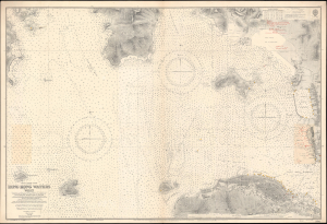
China-South Coast. Hong Kong Waters West.
$3,000.00
Acquire
- Digital Map Information
- Suitable for large format printing
- File Size: 66.09 MB
- File Type: ZIP / TIFF
- ICC color profile embedded
- Delivered instantly via download link
A detailed 1929 British Admiralty nautical chart or maritime map of Hong Kong Harbor and Kowloon. The map covers from eastern Lan Tau Island to Kowloon and from Tsing Yi (青衣, Chung Hue) to Victoria (Hong Kong Central, Sai Wan, Sai Ying Pun, and Sheung Wan. It exhibits copious c. 1930 manuscript updates in the vicinity of Kowloon, including a heavily annotated pastedown. (more details)
Modernizing Ottoman maritime data.
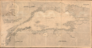
مارمارا ضنيزي / [Sea of Marmara].
$2,800.00
Acquire
- Digital Map Information
- Suitable for large format printing
- File Size: 1762.71 MB
- File Type: ZIP / TIFF
- ICC color profile embedded
- Delivered instantly via download link
A fascinating 1896 nautical chart or map of the Sea of Marmara, including the Bosphorus Straits, published by the Ottoman Matbaa-i Bahriye (Printing House of the Naval Forces). It is based on a British Admiralty chart of the same, reflecting both the advanced state of British hydrography at the time and the efforts of the late Ottoman state to close the gap with Western empires. (more details)
Rare chart of the Singapore Strait.
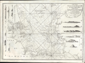
A New Chart Containing the Southwest Part of the China Sea, comprised between The Malaya Peninsula, Straits of Sincapore andc, The Straits of Banca, Gaspar and Billiton, and The Isle of Borneo.
$2,800.00
Acquire
- Digital Map Information
- Suitable for large format printing
- Full resolution TIFF file
- ICC color profile embedded
- Delivered instantly via download link
A scarce 1794 Laurie and Whittle nautical chart or maritime map of the southern tip of the Malay Peninsula, including the island of Singapore (the city had not yet been founded), the Straits of Malacca, and adjacent parts of Sumatra and Borneo. Cartographically, this chart is a vastly updated variant of Jean-Baptiste d'Après de Mannevillette's earlier chart issued in the Neptune Oriental. (more details)