
Utah - Nevada - Colorado (sold)
The final state of the landmark Ebert-Gilpin map of Colorado.
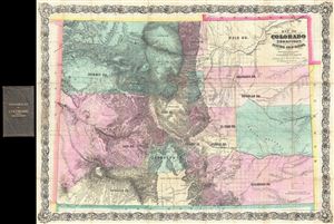
Map of Colorado Territory, Embracing the Central Gold Region.
sold
- Digital Map Information
- Suitable for large format printing
- File Size: 37.2 MB
- File Type: ZIP / TIFF
- ICC color profile embedded
- Delivered instantly via download link
An exceptional discovery, this is the 1870 Colton issue of the famous Ebert-Gilpin plan of Colorado. The Ebert-Gilpin Map, as it is commonly known, was first issued in 1862 and is considered to be the first commercially published map of Colorado Territory, a map ... (more details)
The final state of the landmark Ebert-Gilpin map of Colorado and the only example to show the apocryphal Sahwatch Lake. The first to show the Kansas Pacific Railroad.
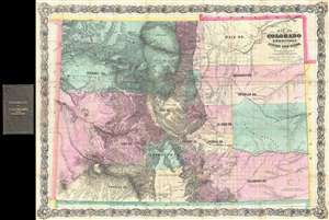
Map of Colorado Territory, Embracing the Central Gold Region.
sold
- Digital Map Information
- Suitable for large format printing
- Full resolution TIFF file
- ICC color profile embedded
- Delivered instantly via download link
An exceptional discovery, this is the 1870 Colton issue of the famous Ebert-Gilpin plan of Colorado. The Ebert-Gilpin Map, as it is commonly known, was first issued in 1862 and is considered to be the first commercially published map of Colorado Territory, a map ... (more details)
Unrecorded first state of a foundational map with extensive manuscript additions relating to American Indian Reservations established in 1867-8.
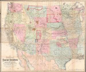
National Map of the Territory of the United States From The Mississippi River To The Pacific Ocean.
sold
- Digital Map Information
- Suitable for large format printing
- Full resolution TIFF file
- ICC color profile embedded
- Delivered instantly via download link
An extraordinary first-edition first-state example of William J. Keeler’s 1867 map of the Trans-Mississippi West - considered the finest post-Civil War railroad era map of the west - with unique manuscript annotations and additions relating to the American Indian Reservation System. This one of a kind historic document was likely the official example retained by the Indian Bureau, and possibly by Keeler himself, to administer and document the development of the American Indian Reservation system through the late 1860s. (more details)
The most detailed general map of Colorado's central mining regions published in the 1870s.
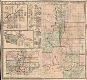
Map of Colorado with Plans of its Principal Towns.
sold
- Digital Map Information
- Suitable for large format printing
- File Size: 95.31 MB
- File Type: ZIP / TIFF
- ICC color profile embedded
- Delivered instantly via download link
A dramatic large-scale 1872 Joseph Hartshorne Bonsall and Edwin Hosmer Kellogg folding wall map of Colorado, issued during the heady days between the Colorado Gold Rush (1859) and the Colorado Silver Boom (1878). This piece is highly significant both for its extreme rarity and for the fact it offers unprecedented detail. Surpassing the Gilpen-Ebert series, the map illustrates maintained trails, and identifies ranches, springs, military reservations, post offices, and more. We are aware of no earlier map, nor any other map issued in the subsequent 10 years, that offers greater detail. (more details)
The essential covered wagon trail map of the American west.
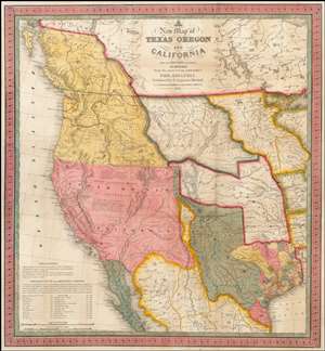
A New Map of Texas, Oregon and California with the Regions Adjoining.
sold
- Digital Map Information
- Suitable for large format printing
- Full resolution TIFF file
- ICC color profile embedded
- Delivered instantly via download link
A stunning example of Mitchell's seminal 1846 pocket map of Texas, Oregon, Upper California, Missouri Territory, the Indian Territory (Oklahoma, though in this example including most of Kansas and Colorado). This important map of Texas is one of the first ... (more details)
Important early view of Salt Lake City, Utah.
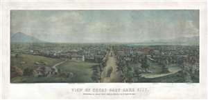
View of Great Salt Lake City.
sold
- Digital Map Information
- Suitable for large format printing
- File Size: 54.36 MB
- File Type: ZIP / TIFF
- ICC color profile embedded
- Delivered instantly via download link
This is a very rare 1867 Christian Inger view of Salt Lake City, Utah. The view illustrates Salt Lake City looking down Main Street as it appeared roughly 20 years following the arrival of the Mormons. The development, in such a short period of time, is ... (more details)
The essential trail map of the American west.
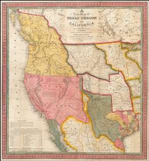
A New Map of Texas, Oregon and California with the Regions Adjoining.
sold
- Digital Map Information
- Suitable for large format printing
- DPI: 300
- File Size: 11.05 MB
- File Type: ZIP / TIFF
- ICC color profile embedded
- Delivered instantly via download link
A stunning example of Mitchell's seminal 1846 pocket map of Texas, Oregon, Upper California, Missouri Territory, the Indian Territory (Oklahoma, though in this example including most of Kansas and Colorado). This important map of Texas is one of the ... (more details)
The quintessential trail map of the American west.
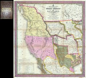
A New Map of Texas Oregon and California with the Regions Adjoining.
sold
- Digital Map Information
- Suitable for large format printing
- Full resolution TIFF file
- ICC color profile embedded
- Delivered instantly via download link
Considered 'the quintessential trail map of the American West' Samuel Augustus Mitchell's 'New Map of Texas Oregon and California' is one of the most important 19th century pocket maps ever issued. In Mitchell's own words This map comprises all that ... (more details)
An exceptionally scarce variant of a cornerstone map of the American west and the finest of its era.
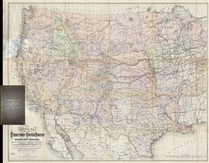
National Map of the Territory of the United States From The Mississippi River To The Pacific Ocean. Madeby the authority of the Hon. O. H. Browning Secretary of the Interior. In the Office of the Indian Bureau Chiefly For Government Purposes under the direction of the Hon. N.G. Taylor, Commisr. of Indian Affairsa and Hon. Chas E. Mix Chief Clerk of the Indian Bureau.
sold
- Digital Map Information
- Suitable for large format printing
- File Size: 46.46 MB
- File Type: ZIP / TIFF
- ICC color profile embedded
- Delivered instantly via download link
A map of the utmost importance and scarcity, this is William J. Keeler's 1868 pocket map of the American west, considered the 'the largest, finest and most detailed map of the West as it was then known.' The map covers from Detroit and Cincinnati ... (more details)
Celebrating the completion of the Central Pacific Railroad!
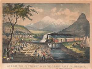
Across the Continent. Passing the Humboldt River. Pacific Bahn Nach Californien. Den Humboldt Fluss Passirend.
sold
- Digital Map Information
- Suitable for large format printing
- File Size: 49.93 MB
- File Type: ZIP / TIFF
- ICC color profile embedded
- Delivered instantly via download link
A rare iconic 1870 H. J. Schile lithograph view illustrating the Central Pacific Railroad crossing the Humboldt River, likely near Wells, Nevada. The view celebrates the exoticism and wonder of the American West, capitalizing on general enthusiasm for the Pacific Railroad and the potential of the West in general. Shortly before this view was issued, in 1869, the Central Pacific Railroad reached Humboldt Wells (modern day Wells), which was established as a division point and terminal and quickly took on iconic stats as a major transition point to the greater west. (more details)
Rare map of Texas issued just before the Treaty of Guadeloupe Hidalgo.
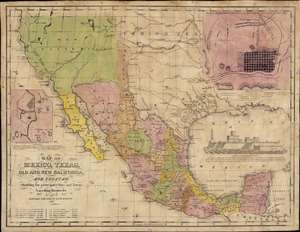
Map of Mexico, Texas, Old and New California, and Yucatan. Showing the principal Cities and Towns, Travelling Routes and c.
sold
- Digital Map Information
- Suitable for large format printing
- Full resolution TIFF file
- ICC color profile embedded
- Delivered instantly via download link
The only known example of the 1848 edition of House and Brown's broadside map of Texas, Mexico, and Upper California, issued at the end of the Mexican-American War (1846 - 1848). The map is centered on Texas, which is presented at its largest, with its western border embracing Albuquerque and Santa Fe, and the stovepipe configuration extending its northern border to 42° N latitude. The map is elaborated by inset maps of Monterey illustrating the Battle of Monterrey (September 21 - 24, 1846) and Veracruz, Mexico. In addition, the Gulf of Mexico is occupied by a large vignette view of the fortress of San Juan de Ulúa, Veracruz. In this edition, Texas is uncolored, emphasizing that it is part of the United States, but Upper California and New Mexico are colored as Mexican intendencias, suggesting this map predates the Treaty of Guadalupe Hidalgo and must therefore have been sent to the presses sometime before February 28, 1848. (more details)
A German 49er maps California.
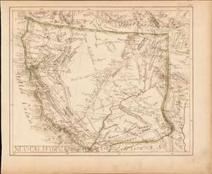
Neu-California.
sold
- Digital Map Information
- Suitable for large format printing
- DPI: 600
- File Size: 6.66 MB
- File Type: ZIP / TIFF
- ICC color profile embedded
- Delivered instantly via download link
A most intriguing German-language c. 1849 California Gold Rush era manuscript map of Upper California. Although drawn by an unknown hand, the map offers a wealth of unique information ranging from early gold discoveries, mines, and indigenous settlements to the very unusual inclusion of the explorer's route of Jedediah Smith. While mysterious, the work suggests it was drawn by a potential German 49er for personal use. (more details)
Most Important Early Map of the New Mexico Territory.
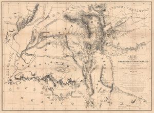
Map of the Territory of New Mexico...
sold
- Digital Map Information
- Suitable for large format printing
- Full resolution TIFF file
- ICC color profile embedded
- Delivered instantly via download link
This is the extremely rare, unpublished 1851 map of the Territory of New Mexico produced by John G. Parke and Richard Kern. Known as the Parke-Kern Map, it was printed within the War Department and separately issued on an individual basis but never included in a Congressional Report, as were other key early maps of the American West. The map was then reprinted several times in the late 19th and early 20th century with no obvious changes, but which can be distinguished from the original plate by very close examination. The present example is one of these later, c. 1900, reissues, which in themselves are still very rare. (more details)
The best early map of Salt Lake City.
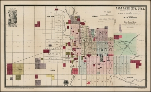
Salt Lake City, Utah.
sold
- Digital Map Information
- Suitable for large format printing
- Full resolution TIFF file
- ICC color profile embedded
- Delivered instantly via download link
This is the rare 1889 W. H. Whitney and Simon F. Mackie map of Salt Lake City, Utah. The map illustrates the early days of Salt Lake City as a stop on the Rio Grande Western Railway. This is one of Whitney's earliest maps of western cities, predating his contract with the Union Pacific. It combines the functions of a real estate map and a railroad map. An inset in the upper left offers an overview of the general area. (more details)
Seminal Map of the American Southwest by 'World's Greatest Living Man'.

Carte Du Mexique et des Pays Limitrophes Situes Au Nord et a l'est Dressee d'apres la Grande Carte de la Nouvelle Espagne De Mr. A. De Humboldt et d'autres Materiaux par J.B. Poirson.
sold
- Digital Map Information
- Suitable for large format printing
- DPI: 300
- File Size: 15.17 MB
- File Type: ZIP / TIFF
- ICC color profile embedded
- Delivered instantly via download link
A seminal 1811 map of Mexico and the American West by Alexander von Humboldt. Humboldt, who during his lifetime was considered the 'world's greatest living man,' composed this map during his 1803 sojourn in Mexico. Though often playing second ... (more details)
Super rare Comstock Lode Broadsheet!
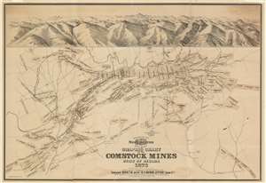
Graphic Chart of the Comstock Mines State of Nevada 1876.
sold
- Digital Map Information
- Suitable for large format printing
- Full resolution TIFF file
- ICC color profile embedded
- Delivered instantly via download link
A scarce 1876 broadsheet map and view of the Comstock Mines in Nevada by the mining engineer John B. Treadwell. Treadwell at the time was manager of the Comstock Mine. Oriented to the west and roughly centered on Virginia City, the map details the heart of the Comstock Strike, what is generally known as the Mother Lode. It identifies claims in and around Virginia City, Gold Hill, and Silver City. Surmounting the map there is a view of the silver region centered on Mount Davidson and Virginia City. At the base of the view is Dayton, Nevada, and the outlet of the Sutro Tunnel. (more details)
Engraver's Proof map of the epicenter of the Nevada Silver Boom.
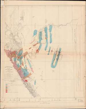
Itineraire aux Mines de La Nevada.
sold
- Digital Map Information
- Suitable for large format printing
- File Size: 20.13 MB
- File Type: ZIP / TIFF
- ICC color profile embedded
- Delivered instantly via download link
An exceptional, likely unique discovery, this is a c. 1868 proof of the French geologist's Edmond Guillemin-Tarayre meticulous survey map of the Sierra Nevada Mountains at the height of the Nevada Silver Boom. The map focuses on epicenter of the silver boom around the Comstock Lode, Virginia City, Carson, and Dayton. It is a product of the Second French Intervention in Mexico and the accompanying Commission Scientifique. (more details)
Mining claims of the Comstock Lode.
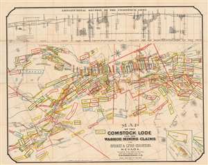
Map of the Comstock Lode and the Washoe Mining Claims in Storey and Lyon Counties, Nevada.
sold
- Digital Map Information
- Suitable for large format printing
- Full resolution TIFF file
- ICC color profile embedded
- Delivered instantly via download link
This is an 1875 T.D. Parkinson and Grafton Tyler Brown map of the Comstock Lode in Nevada. Boxes outlined in several different colors highlight individual mining claims from Silver City north to the North Virginia Townsite and Flowery Ridge. The Virginia and Truckee Railroad winds its way toward Virginia City and the Silver City Branch connects that railroad with Silver City. Streets are illustrated in Virginia City, although none are named. Numerous mills, mine shafts, toll houses, and other sites are identified, including the graveyard and county hospital. The Sutro Tunnel is prominently labeled to the right of center. A longitudinal view of the Comstock Lode appears above the map and illustrates where the silver strikes were located, the depth of many of the mine shafts, and the depth of the Sutro Tunnel. (more details)
The must unusual of Whitney's railroad maps.
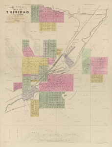
Whitney's Map of Trinidad, Colorado.
sold
- Digital Map Information
- Suitable for large format printing
- File Size: 11.76 MB
- File Type: ZIP / TIFF
- ICC color profile embedded
- Delivered instantly via download link
An extremely rare 1888 map of Trinidad, Colorado, issued by W. H. Whitney. The map was issued at a heady time in Trinidad's development. The railroads reached Trinidad in the late 1870s, ushering in a boom that lasted until the turn of the century. As a railroad nexus connecting three major lines, Trinidad prospered as a cattle town. Towards the end of the 19th century, massive coal deposits were discovered that further fueled growth. When this map was issued, legendary lawman Bat Masterson was the town marshal, and other colorful characters associated with the old west visited, including Doc Holliday and Wyatt Earp. (more details)
First edition of Nell's important large format map of Colorado.
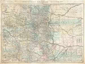
Nell's Topographical Map of the State of Colorado.
sold
- Digital Map Information
- Suitable for large format printing
- File Size: 87.77 MB
- File Type: ZIP / TIFF
- ICC color profile embedded
- Delivered instantly via download link
This is the very rare 1887 first edition of Louis Nell's separate-issue map of Colorado. It is hands down the largest and most detailed map of Colorado to appear after the 1876 statehood. The map painstakingly illustrates topography, names rivers and streams, shows railroads, identifies footpaths, and more. The map is further broken down into counties and Land Office districts. Native American reservations, military reservations, and mining territories are also named. Mountain peaks, many of which have today become popular ski resorts, are named throughout. (more details)
Extraordinary Panorama showing the Route of the Mormon Pioneers and the Westward Expansion.
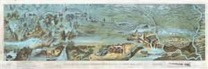
Route of the Mormon Pioneers from Nauvoo to Great Salt Lake.
sold
- Digital Map Information
- Suitable for large format printing
- File Size: 23.46 MB
- File Type: ZIP / TIFF
- ICC color profile embedded
- Delivered instantly via download link
This is an extraordinary and striking 1899 chromolithograph panoramic bird-eye view and map of the 1,300 mile Mormon Trail. This view, by Millroy and Hayes, covers the region between the Mississippi River and Great Salt Lake and chronicles the ... (more details)
Important map illustrating Mexico and Texas just before the 1848 Treaty of Guadeloupe-Hidalgo. Texas at its fullest with stovepipe configuration.
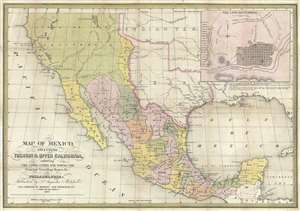
Map of Mexico, including Yucatan and Upper California, exhibiting the Chief Cities and Towns, The Principal Travelling Routes and c.
sold
- Digital Map Information
- Suitable for large format printing
- DPI: 300
- File Size: 13.99 MB
- File Type: ZIP / TIFF
- ICC color profile embedded
- Delivered instantly via download link
This is Samuel Augustus Mitchell's important 1847 map of Texas at its fullest, Mexico, and Upper California. This is one of the most important and striking maps issued to illustrate the Mexican American War. Centered on Texas, Mitchell's map ... (more details)
A definitive map of the Pacific Northwest, considered by Wheat, 'really quite extraordinary.'
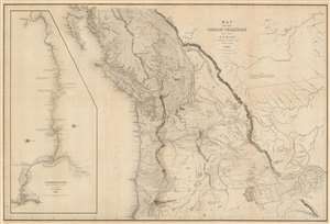
Map of the Oregon Territory by the U.S. Ex. Ex.
sold
- Digital Map Information
- Suitable for large format printing
- DPI: 600
- File Size: 59.51 MB
- File Type: ZIP / TIFF
- ICC color profile embedded
- Delivered instantly via download link
This important and extraordinary production is Commodore Wilkes' 1841 U.S. exploring expedition map of Oregon Territory, the finest and most important map of Oregon of the 19th century. The map covers roughly from the 50th parallel to Mount Shasta, the upper Sacramento River, and Great Salt Lake (Youta Lake) and from the Pacific to the Black Hills. It includes, either in part or full, modern day Washington, Oregon, British Columbia, Vancouver, Idaho, Utah, Nevada, Montana, Wyoming, and California. A large inset occupying the left quadrants focuses on the Columbia River where the United States exploring expedition lost one of its ships, the Peacock, on the infamous Columbia Bar. Topography is rendered by hachure and the engravers even made some attempt to illustrate the vast pine forests of the Pacific Northwest. (more details)
Financing the Cripple Creek Gold Rush.
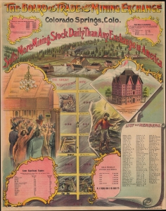
The Board of Trade and Mining Exchange Colorado Springs, Colo.
sold
- Digital Map Information
- Suitable for large format printing
- File Size: 36.86 MB
- File Type: ZIP / TIFF
- ICC color profile embedded
- Delivered instantly via download link
This is a spectacular c. 1896 Western Lithographic and Denver Times chromolithograph broadside celebrating the Cripple Creek Gold Rush and the Board of Trade and Mining Exchange in Colorado Springs, Colorado. The Cripple Creek Gold Rush was one of the last great American gold rushes, marked by its innovative use of stock exchanges to finance rapid development and large-scale mining operations. (more details)
Early surveying expedition to the American West.
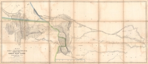
Map of a Reconnaissance between Fort Leavenworth and the Missouri River, and the Great Salt Lake in the Territory of Utah, made in 1849 and 1850…
sold
- Digital Map Information
- Suitable for large format printing
- Full resolution TIFF file
- ICC color profile embedded
- Delivered instantly via download link
A monumental map, matching the landscape it depicts, this is Howard Stansbury's seminal map of the lands between Fort Leavenworth, Kansas, and Pilot Peak (now Nevada), west of the Great Salt Lake. Originally published in 1852 as part of the Stansbury Report presented to the U.S. Congress that year, the present example is mounted on linen and folds into a case, as it was intended for a member of Congress. This is hand-down the finest example we've seen of this map, and if you are considering it for your collection, this is the one you want. (more details)
On the Mormon Trail.
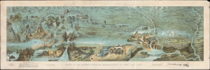
Route of the Mormon Pioneers from Nauvoo to Great Salt Lake.
sold
- Digital Map Information
- Suitable for large format printing
- File Size: 42.35 MB
- File Type: ZIP / TIFF
- ICC color profile embedded
- Delivered instantly via download link
This is a striking 1899 chromolithograph panoramic Millroy and Hayes bird's-eye view and map of the 1,300-mile Mormon Trail. The view covers the region between the Mississippi River and Great Salt Lake and chronicles the westward migration of the Mormon Pioneers from Nauvoo, Illinois, to Great Salt Lake, Utah, 1846-1847. (more details)
Foundational Map of the American West.
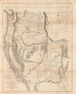
Map of Oregon and Upper California From the Surveys of John Charles Frémont.
sold
- Digital Map Information
- Suitable for large format printing
- DPI: 600
- File Size: 128 MB
- File Type: ZIP / TIFF
- ICC color profile embedded
- Delivered instantly via download link
A landmark 1848 map of the American West by John C. Frémont and Carl Preuss. In the words of Carl Wheat,
More than any other persons, John Charles Fremont and Charles Preuss dominate the cartography of the American West during the three years before the Gold Rush and brought a human tide surging into that land which had so long lain beyond the ken of most Americans. (Wheat, C. I., Mapping of the Transmississippi West, 1540 – 1861, 523).(more details)
Early view of Denver Colorado by Alfred Edward Mathews.
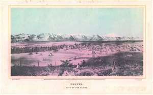
Denver, City of the Plains.
sold
- Digital Map Information
- Suitable for large format printing
- File Size: 14.28 MB
- File Type: ZIP / TIFF
- ICC color profile embedded
- Delivered instantly via download link
This is an important Alfred Edward Mathews 1866 bird's-eye view of Denver, Colorado. The view includes the then separate towns of Auraria and Denver as seen from a hill about one mile east of the South Platte River looking west towards modern-day downtown. Although the South Platte itself is not obvious, we can recognize it from the narrow band of development on both sides of the river. The tall building at center is probably the Methodist Church constructed in 1864 at 14th Street and Lawrence. A road extends from the foreground into the center of the city and is consistent with modern day 15th or 16th Street. Shooting an arrow along this road into the background leads, some 60 miles distant, directly to Longs Peak. Pikes Peak may be on the far left, but we are not 100% confident in our identification. The bluff in the foreground from which the view was drawn, is most likely somewhere in the vicinity of the modern-day capital. (more details)
Foundational Map of the American West.
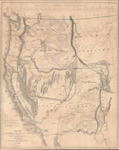
Map of Oregon and Upper California From the Surveys of John Charles Frémont.
sold
- Digital Map Information
- Suitable for large format printing
- File Size: 51.39 MB
- File Type: ZIP / TIFF
- ICC color profile embedded
- Delivered instantly via download link
A landmark 1848 map of the American West by John C. Frémont and Carl Preuss. In the words of Carl Wheat,
More than any other persons, John Charles Fremont and Charles Preuss dominate the cartography of the American West during the three years before the Gold Rush and brought a human tide surging into that land which had so long lain beyond the ken of most Americans. (Wheat, C. I., Mapping of the Transmississippi West, 1540 - 1861, 523).(more details)
Independent Mexico with the province of Texas.
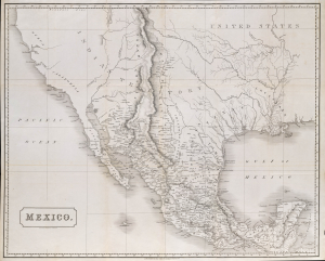
Mexico.
sold
- Digital Map Information
- Suitable for large format printing
- File Size: 2170.02 MB
- File Type: ZIP / TIFF
- ICC color profile embedded
- Delivered instantly via download link
This is an 1828 Henry Coburn map of Mexico, issued just a few years after Mexican Independence (1821) and a few years before the Texan Revolution (1835 - 1836). Published in Britain, this map highlights British interest, mostly investment-driven, in the ongoing Mexican fight for independence, as well as Austin's Town (Austin, Texas), reflecting the growing Anglo-American presence in Texas. (more details)
A definitive map of the Pacific Northwest, considered by Wheat, 'really quite extraordinary.'
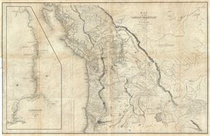
Map of the Oregon Territory by the U.S. Ex. Ex.
sold
- Digital Map Information
- Suitable for large format printing
- DPI: 300
- File Size: 29.57 MB
- File Type: ZIP / TIFF
- ICC color profile embedded
- Delivered instantly via download link
This important and extraordinary production is Commodore Wilkes' 1841 U.S. Exploring Expedition map of Oregon Territory. The map covers roughly from the 50th parallel to Mount Shasta, the upper Sacramento River, and Great Salt Lake (labeled ... (more details)
First river guide to the Grand Canyon!
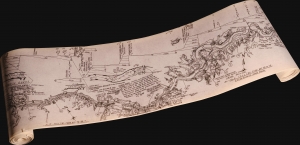
A striking 1962 river guide map of the Grand Canyon on a long scroll designed by Leslie Allen 'Buckethead' Jones. Measuring just 7.5 inches high, but roughly 45 feet long! See video below description. The map follows the Colorado River from Lee's Ferry to Lake Mead, passing fully through the Grand Canyon. This made-to-order map is the precursor to the modern riverman's guide and represents the first specific guide to the Grand Canyon intended for river-runners. (more details)