
Arkansas - Louisiana - Mississippi
'The Father of Waters again goes unvexed to the sea.'
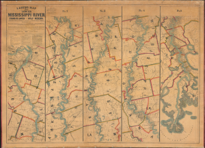
Lloyd’s Map of the Lower Mississippi River From St. Louis to the Gulf of Mexico. Compiled from Government Surveys in the Topographical Bureau...
$17,000.00
Acquire
- Digital Map Information
- Suitable for large format printing
- File Size: 104.66 MB
- File Type: ZIP / TIFF
- ICC color profile embedded
- Delivered instantly via download link
This is James T. Lloyd's engrossing 1863 large-format map of the Mississippi River, produced during the U.S. Civil War (1861 - 1865). It provides a comprehensive overview of the economically vital and strategically critical waterway, then a hotly contested theater of war vital to both the Union and the Confederacy. (more details)
Most important map in 18th century American history.
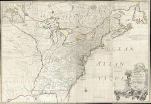
Amerique Septentrionale avec Les Routes, Distances et miles, Villages et Etablissements François et Anglois Par le Docteur Mitchel.
$12,000.00
Acquire
- Digital Map Information
- Suitable for large format printing
- Full resolution TIFF file
- ICC color profile embedded
- Delivered instantly via download link
This is the important 1777 Georges Le Rouge French edition of the seminal John Mitchell map of the eastern part of North America. The Mitchell map is considered the single most important map in 18th-century American history. It was used as a primary reference for nearly every treaty and boundary dispute in colonial North America from the French and Indian War (1754 - 1763) through the late 19th century. The map is all the more astounding because this is Mitchell's one and only map - a truly remarkable feat of virtuosity. (more details)
First published image of New Orleans.
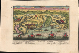
Le Mississipi ou la Louisiane dans l'Amerique Septentrionale.
$9,500.00
Acquire
- Digital Map Information
- Suitable for large format printing
- Full resolution TIFF file
- ICC color profile embedded
- Delivered instantly via download link
This is a rare c. 1720 Chéreau broadside leaflet map-view of the Gulf of Mexico littoral, just a few years after New Orleans was founded. It is likely the earliest printed view of New Orleans - though admittedly, it is not an accurate representation of the city at the time. The map was issued as a propaganda leaflet to promote New Orleans and French Louisiana, and thus coverage extends east to encompass most of the Florida Panhandle. It is among the earliest maps to include a view of New Orleans and the indigenous peoples of the Gulf. The present example is the first state, with extraordinary period color. (more details)
The rarest and most striking Temperance broadside.
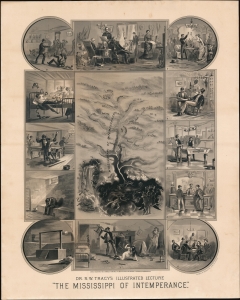
The Mississippi of Intemperance.
$9,500.00
Acquire
- Digital Map Information
- Suitable for large format printing
- File Size: 48.34 MB
- File Type: ZIP / TIFF
- ICC color profile embedded
- Delivered instantly via download link
This is perhaps the most extraordinary and certainly one of the rarest temperance broadsides to emerge out of the 19th century. Designed by 'Dr.' Nathan W. Tracy, this allegorical broadside employs the metaphor of the Mississippi River to describe the progression and dangers of alcoholism. Center to the image is a combination view and map representing the 'Mississippi of Intemperance' illustrated with a vignette of the dreaded Delirium Tremens Falls. Surrounding the main map are 12 framed vignette images detailing the decline of the drunkard. At top center, a large image reveals a happy sober man at home with his family - the Temperance ideal. Moving clockwise from this image, further illustrations depict happy toasting with a young lady, enjoying wine with a friend, playing pool at a saloon, enjoying a 'Tom and Jerry' (an early cocktail) at a bar, and a poker game. To our eye, the right side looks fun, but bottom center illustrates the turning point - an illustration that could have been taken from Tracy's own abusive life - where a drunken husband is beating his wife and children. From here, the progression is taken up at top left, where our drunkard hero gets involved in bar fights, experiences delirium tremens, commits murder in a pool hall, lands himself in prison, and ultimately meets his fate at the gallows. (more details)
Most important map of the Mississippi during the Revolutionary War.
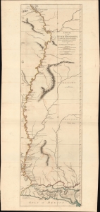
Course of the River Mississipi, from the Balise to Fort Chartres; Taken on an Expedition to the Illinois, in the latter end of the Year 1765.
$7,500.00
Acquire
- Digital Map Information
- Suitable for large format printing
- File Size: 36.6 MB
- File Type: ZIP / TIFF
- ICC color profile embedded
- Delivered instantly via download link
A scarce, important, and dramatic map of the Mississippi River Valley from the Gulf of Mexico to Fort Chartres (Illinois). This was the best map of the Mississippi to appear before the American Revolutionary War (1775 - 1783) and remained significant even after the war when it was the best demarkation of the western boundary of the United States. (more details)
Great New Orleans Fire of 1788.
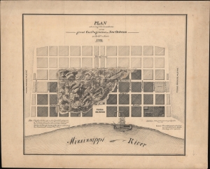
Plan showing the boundaries of the great Conflagration of New Orleans on the 21st of March 1788.
$4,500.00
Acquire
- Digital Map Information
- Suitable for large format printing
- File Size: 409.88 MB
- File Type: ZIP / TIFF
- ICC color profile embedded
- Delivered instantly via download link
This is a dramatic original c. 1880 manuscript map of 1788 Great Fire of New Orleans drafted by eccentric German-American civil engineer Baron Ludwig von Reizenstein for later publication in George E. Waring Jr.'s influential History and Present Condition of New Orleans, Louisiana, and Report on the City of Austin, Texas published in 1881. It records the 1788 Great Fire, one of the most destructive disasters to befall 18th-century New Orleans. The report, survey, and map were significant in influencing late 19th-century efforts at New Orleans fire control. (more details)
Reconstruction-era New Orleans.
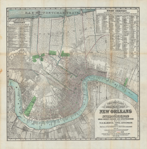
Topographical and drainage map of New Orleans and surroundings, from recent surveys and investigations.
$4,000.00
Acquire
- Digital Map Information
- Suitable for large format printing
- File Size: 36.39 MB
- File Type: ZIP / TIFF
- ICC color profile embedded
- Delivered instantly via download link
A detailed 1878 city plan or map of New Orleans and surrounding communities by civil engineer and city surveyor Thomas Sydenham Hardee. It is considered the most accurate map of the city to that date. While including comprehensive information on the city's streets, parks, railways, and more, it also focuses on the system of waterways, canals, and levees designed to prevent flooding and disease. (more details)
Racing on the Mississippi.
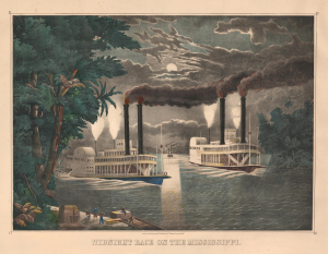
Midnight Race on the Mississippi.
$3,500.00
Acquire
- Digital Map Information
- Suitable for large format printing
- File Size: 39.32 MB
- File Type: ZIP / TIFF
- ICC color profile embedded
- Delivered instantly via download link
This is Thomas Kelly's c. 1865 large, folio hand-colored lithographic view of a nighttime steamboat race on the Mississippi River. Such races were a dangerous but popular sport in mid-19th-century America, when steamboat companies on the Mississippi and other major rivers competed for the 'fastest ride'. Some such races became famous and were recorded in many popular paintings and decorative prints by artists like Kelly, as here, and Currier and Ives. (more details)
Foundations of flood control in New Orleans - original manuscript draft.
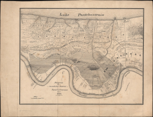
Diagram showing the inundated District Sauvé's Crevasse May 3rd 1849.
$3,000.00
Acquire
- Digital Map Information
- Suitable for large format printing
- Full resolution TIFF file
- ICC color profile embedded
- Delivered instantly via download link
This is an exceptional original c. 1880 manuscript map of New Orleans drafted by eccentric German-American civil engineer Baron Ludwig von Reizenstein for later publication in George E. Waring Jr.'s influential Report on the Social Statistics of Cities. It records the 1849 Sauvé Crevasse Flood, one of the most destructive natural disasters to befall 19th-century New Orleans. The report, survey, and map were significant in influencing late 19th-century efforts at New Orleans flood control. Unlike his other maps of New Orleans events, which were based on historical sources, Reizenstein likely witnessed this flood in person. (more details)
Providing historical context.
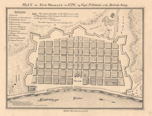
Plan of New Orleans in 1770, by Capt. Pittman of the British Army.
$3,000.00
Acquire
- Digital Map Information
- Suitable for large format printing
- File Size: 5.81 MB
- File Type: ZIP / TIFF
- ICC color profile embedded
- Delivered instantly via download link
This is an exceptional original c. 1880 manuscript draft map of New Orleans in 1770 drafted by eccentric German-American civil engineer Baron Ludwig von Reizenstein for later publication in George E. Waring Jr.'s influential 1881 History and Present Condition of New Orleans, Louisiana, and Report on the City of Austin, Texas. (more details)
...gossipy first-hand picture of life in New Orleans at the turn of the century. - Streeter
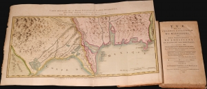
Vue de la colonie Espagnole du Mississipi, ou des provinces de Louisiane et Floride Occidentale, en l'année 1802 de Louisiane et Floride occidentale, en l'année 1802, par un observateur résidant sur les lieux.
$2,800.00
Acquire
This is Pierre-Louis Berquin Duvallon's 1803 travel narrative describing Spanish-administered Louisiana and West Florida on the cusp of the Louisiana Purchase. The work offers an entertaining and often critical account of political, economic, and social life in New Orleans between 1800 and 1802. It also includes two important maps, being among the few specific maps of Upper and Lower Louisiana and West Florida during the Spanish period. (more details)
Layers of History and Cartography.
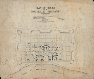
Plan et project de la Nouvelle Orleans.
$2,800.00
Acquire
- Digital Map Information
- Suitable for large format printing
- File Size: 15.18 MB
- File Type: ZIP / TIFF
- ICC color profile embedded
- Delivered instantly via download link
This is a remarkable c. 1880 manuscript map of New Orleans, drafted by eccentric German-American civil engineer Baron Ludwig von Reizenstein for later publication in George E. Waring Jr.'s influential 1881 History and Present Condition of New Orleans, Louisiana, and Report on the City of Austin, Texas. It is based on an earlier map dated 1763, though it more directly reflects the state of the city in the 1720s. (more details)
Revisiting New Orleans from 1798.
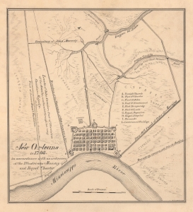
New Orleans in 1798, in accordance with an ordinance of the Illustrious Ministry and Royal Charter.
$2,800.00
Acquire
- Digital Map Information
- Suitable for large format printing
- Full resolution TIFF file
- ICC color profile embedded
- Delivered instantly via download link
This is an exceptional original c. 1880 manuscript draft map of New Orleans in 1798 drafted by eccentric German-American civil engineer Baron Ludwig von Reizenstein for later publication in George E. Waring Jr.'s influential 1881 History and Present Condition of New Orleans, Louisiana, and Report on the City of Austin, Texas. (more details)
The United States for the curious Swede.
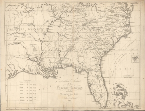
Southern Section of the United States including Florida etc. by John Melish.
$2,400.00
Acquire
- Digital Map Information
- Suitable for large format printing
- File Size: 17.01 MB
- File Type: ZIP / TIFF
- ICC color profile embedded
- Delivered instantly via download link
This is a rare 1824 Swedish map of Florida and the Southeastern United States published by Axel Leonard Klinckowström after the scarce 1816 map of John Melish. The map accompanied Klinckowström's Tocqueville-style narrative, expounding on the United States for Swedish audiences. (more details)
Harkening to the Earliest Days of New Orleans.
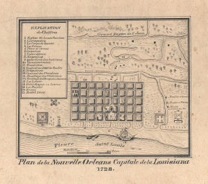
Plan de la Nouvelle Orleans Capitale de la Louisiana 1728.
$2,400.00
Acquire
- Digital Map Information
- Suitable for large format printing
- File Size: 2.04 MB
- File Type: ZIP / TIFF
- ICC color profile embedded
- Delivered instantly via download link
This is an exceptional original c. 1880 manuscript draft map of New Orleans in 1728 drafted by eccentric German-American civil engineer Baron Ludwig von Reizenstein for later publication in George E. Waring Jr.'s influential 1881 History and Present Condition of New Orleans, Louisiana, and Report on the City of Austin, Texas. (more details)
Cold War, Civil Rights, Anti-Communism.
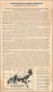
Communists Incite Racial Uprising and Bloody Revolution Among Negroes of Dixie / Seek to Establish Negro Republic In the 'Black Belt.'
$2,000.00
Acquire
- Digital Map Information
- Suitable for large format printing
- File Size: 6.35 MB
- File Type: ZIP / TIFF
- ICC color profile embedded
- Delivered instantly via download link
This is the only known example of a c. 1940 anti-Communist persuasive broadsheet and map of the U.S. South published by the organization American Women Against Communism (A.W.A.C.). The sheet details and denounces a supposed international Communist plot to create a 'Negro Republic' in the 'Black Belt' of the South. (more details)
Louisiana on the cusp of the Louisiana Purchase.
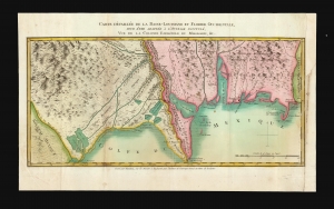
Carte Détaillée de la Basse-Louisiane et Floride Occidentale, pour étre adaptée à l'Ouvrage intitulé, Vue da la Colonie Espagnol due Mississipi, et c.
$2,000.00
Acquire
- Digital Map Information
- Suitable for large format printing
- DPI: 600
- File Size: 21.3 MB
- File Type: ZIP / TIFF
- ICC color profile embedded
- Delivered instantly via download link
This is Alexandre's Blondeau's exceptional 1803 map of Spanish-administered Louisiana and West Florida, issued for Pierre-Louis Berquin Duvallon's travel narrative, Vue de la Colonie Espagnole due Mississipi. It is one of the best maps to capture the Gulf littoral during the Post-American Revolutionary War Spanish period on the cusp of the Louisiana Purchase. (more details)
An important and often overlooked 1744 map of French, English and Spanish claims in North America.
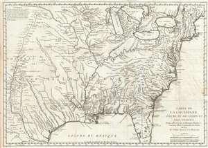
Carte de La Louisiane Cours du Mississipi et Pais Voisins.
$1,500.00
Acquire
- Digital Map Information
- Suitable for large format printing
- DPI: 300
- File Size: 9.76 MB
- File Type: ZIP / TIFF
- ICC color profile embedded
- Delivered instantly via download link
An important and influential 1744 map of the settled portions of North America by the French cartographer Jacques-Nicholas Bellin. Centered on the Mississippi Valley, Bellin's map covers from the Riviere de Nord (Rio Grande) eastward to the Atlantic seaboard and from Lake Huron to the Gulf of Mexico and south Florida. (more details)
Where the Mississippi meets the Gulf.
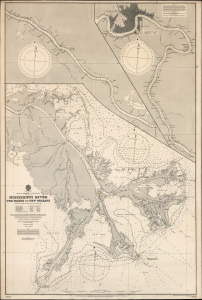
Gulf of Mexico. Louisiana. Mississippi River The Passes to New Orleans.
$1,500.00
Acquire
- Digital Map Information
- Suitable for large format printing
- File Size: 71.86 MB
- File Type: ZIP / TIFF
- ICC color profile embedded
- Delivered instantly via download link
This is a 1903 / 1908 British Admiralty nautical chart or map of the Mississippi River from New Orleans to The Passes: a richly detailed working chart for the navigation of one of the most important water routes in the United States, with all the data necessary for navigating the mouth of the great river. (more details)
Finest obtainable Colonial Era map of the Gulf Coast around the Mississippi Delta and Louisiana.
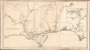
Carte de la Louisiane.
$1,400.00
Acquire
- Digital Map Information
- Suitable for large format printing
- DPI: 600
- File Size: 933.1 MB
- File Type: ZIP / TIFF
- ICC color profile embedded
- Delivered instantly via download link
A lovely example of the important 1732/52 map of the Gulf Coast and lower Mississippi River Valley by Jean Baptiste Bourguignon d'Anville. The map is significant as the largest and most comprehensive map of the Gulf littoral to appear during the French period of Louisiana. (more details)
Beautifully engraved New Orleans.
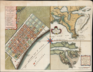
Grondvlakte van Nieuw Orleans, de hoofdstad van Louisiana. / De uitloop van de Rivier Missisippi. / De oostelyke ingang van de Missisippi, met een plan van het fort, 't welk het kanaal beheerscht.
$1,200.00
Acquire
- Digital Map Information
- Suitable for large format printing
- File Size: 15.96 MB
- File Type: ZIP / TIFF
- ICC color profile embedded
- Delivered instantly via download link
This is an attractive example of Isaak Tirion's 1769 map of New Orleans and the Mississippi River Delta: it is prized as one of the most beautiful 18th-century depictions of the city. Significantly, the map captures New Orleans as the center of Spanish Louisiana during a period of political transition. (more details)
War and Privateering in the West Indies.
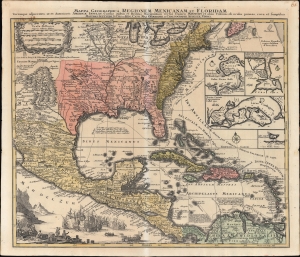
Mappa Geographica Regionem Mexicanam et Floridam Terrasque adjacentes, ut et Anteriores Americae Insulas, Cursus itidem et Reditus Navigantium versus flumem Missisipi et alias Colonias ob oculos ponens cura et sumtibus.
$1,000.00
Acquire
- Digital Map Information
- Suitable for large format printing
- File Size: 28.51 MB
- File Type: ZIP / TIFF
- ICC color profile embedded
- Delivered instantly via download link
An old-color example of Mattheus Seutter's c. 1740 map of North America below the Great Lakes, including Mexico and the Caribbean. It reflects improvements in European cartography of the New World in the late 17th and early 18th centuries, as well as the ongoing competition between colonial empires, namely the contemporaneous War of Jenkins' Ear (1739-1748). (more details)
Best obtainable Colonial Era map of the Mississippi Delta, in an English Edition.
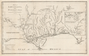
Map of Louisiana, From D'Anville's Atlas.
$950.00
Acquire
- Digital Map Information
- Suitable for large format printing
- DPI: 600
- File Size: 33.16 MB
- File Type: ZIP / TIFF
- ICC color profile embedded
- Delivered instantly via download link
This is a handsome example of the scarce 1788 English edition of Jean Baptiste Bourguignon d'Anville's map of the Gulf Coast and Lower Mississippi River Valley, engraved by Thomas Bowen for John Harrison. This is the best obtainable map of the Lower Mississippi at the time of publication - here in a rare English edition. (more details)
Stunning railroad broadside promoting emigration to Texas.
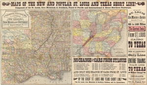
Maps of the New and Popular St. Louis and Texas Short Line!
$900.00
Acquire
- Digital Map Information
- Suitable for large format printing
- File Size: 54.88 MB
- File Type: ZIP / TIFF
- ICC color profile embedded
- Delivered instantly via download link
A striking 1878 promotional map broadsheet issued to promote travel on the St. Louis and Texas Short Line. (more details)
One of the few railroads that received a federal charter.
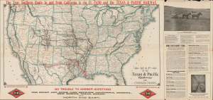
Map of the Texas and Pacific Railway and Connections. / The Texas and Pacific Railway The Short Line from Texas, Mexico and California to St. Louis, Memphis and All Points North and East. / The Texas and Pacific Railway The Direct Through Line from California, Colorado, and the West to Shreveport, New Orleans, Memphis and All Points in the Southeast.
$850.00
Acquire
- Digital Map Information
- Suitable for large format printing
- DPI: 600
- File Size: 72.4 MB
- File Type: ZIP / TIFF
- ICC color profile embedded
- Delivered instantly via download link
This is a 1911 Woodward and Tiernan railroad map of the United States illustrate the routes of the Texas and Pacific Railway, one of the few railroads established by federal charter. The Texas and Pacific Railway was a Congressional attempt at reviving a southern transcontinental railroad, only two years after the first transcontinental railroad was finished. The route of the Texas and Pacific is immediately identifiable in red, and the extensive U.S. railroad network is also illustrated. (more details)
The Mississippi Sound and Mobile Bay.
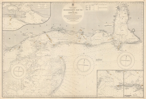
North America. East Coast. Gulf of Mexico. Mississippi Sound and Mobile Bay.
$850.00
Acquire
- Digital Map Information
- Suitable for large format printing
- File Size: 119.39 MB
- File Type: ZIP / TIFF
- ICC color profile embedded
- Delivered instantly via download link
This is a 1919 British Admiralty nautical chart or map of Mobile Bay and Mississippi Sound, part of the Gulf Littoral Intercoastal Waterway. The map provides an overview of the region while insets detail important areas. (more details)
A fantastic pictorial map of Louisiana.
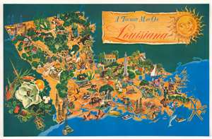
A Tourist Map of Louisiana.
$850.00
Acquire
- Digital Map Information
- Suitable for large format printing
- File Size: 43.85 MB
- File Type: ZIP / TIFF
- ICC color profile embedded
- Delivered instantly via download link
This is a fantastic c. 1948 Margaret Wendt Andry pictorial tourist map of Louisiana. Wonderful illustrations present aspects of life in Louisiana, including the oil industry, its wide agricultural base that includes growing cotton and oranges, and recreational opportunities, including hunting and fishing. Prawns appear in several places, alongside a crab and an oyster. Waterfowl, including pelicans, egrets, and ducks, appear as well. The Louisiana State Capitol building in Baton Rouge is prominently illustrated. A large magnolia (the Louisiana state flower) decorates the compass that occupies the lower left corner and an orange, a prawn, and some cotton help make up this charming illustration. (more details)
'Old Hickory' makes his mark.
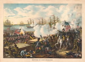
Battle of New Orleans.
$750.00
Acquire
- Digital Map Information
- Suitable for large format printing
- File Size: 104.39 MB
- File Type: ZIP / TIFF
- ICC color profile embedded
- Delivered instantly via download link
A stirring 1890 Kurz and Allison chromolithograph of the 1815 Battle of New Orleans, a major American victory in the closing days of the War of 1812 (1812 - 1815). Although in a sense futile, as a treaty had already been signed ending the war, the battle was nonetheless important for thwarting British hopes of controlling the Mississippi River and propelling Andrew Jackson to the status of national hero, facilitating his later election as president. (more details)
Treasure hidden in Louisiana?
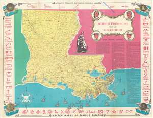
This is a 1960 Robert J. Caire and Bert Thatcher buried treasure map of Louisiana. Magenta 'X's mark the spots where fifty-six fortunes were 'partially recovered' or were supposedly buried by pirates, thieves, and the wealthy, or were lost at sea after a shipwreck. Each 'X' is numbered and corresponds with a short description of the fortune in question (ranging from $20,000 to $4,000,000). (more details)
End of the Era of Steamboat Racing.
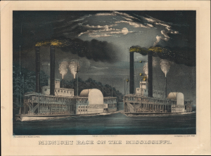
Midnight Race on the Mississippi.
$650.00
Acquire
- Digital Map Information
- Suitable for large format printing
- File Size: 11.67 MB
- File Type: ZIP / TIFF
- ICC color profile embedded
- Delivered instantly via download link
A gorgeous 1872 Currier and Ives hand-colored lithograph of steamboats racing on the Mississippi River. By the time of its publication, steamboat racing and river steamboats were becoming less popular, imbuing the piece with a touch of nostalgia. (more details)
Railroad land grants for sale in Arkansas.
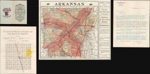
Map Showing the Land Grands of the St. Louis, Iron Mountain and Southern, and Little Rock and Fort Smith Railways in Arkansas.
$650.00
Acquire
- Digital Map Information
- Suitable for large format printing
- Full resolution TIFF file
- ICC color profile embedded
- Delivered instantly via download link
An intriguing document, with map and letter, regarding railroad grant and early town development in Arkansas. Published in 1885 by the Land Department of the Iron Mountain Railway in Little Rock, Arkansas, this map of Arkansas highlights land for sale by the Iron Mountain Railway. All rail lines are highlighted in dark red. A lighter shade of red emanates outward along both sides of most of the rail lines, illustrating where railroad land grants are located and available for purchase. (more details)
One of the South's great rail networks.
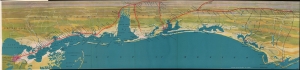
Untitled / [Gulf Coast].
$650.00
Acquire
- Digital Map Information
- Suitable for large format printing
- File Size: 19.96 MB
- File Type: ZIP / TIFF
- ICC color profile embedded
- Delivered instantly via download link
A vibrantly colored 1926 Poole Brothers bird's-eye view of the northern coast of the Gulf of Mexico, from New Orleans to Apalachicola. The view promotes the Louisville and Nashville Railroad. It appeared in the booklet New Orleans: the city of progress, beauty, charm, and romance, distributed by the railroad. (more details)