
Arkansas - Louisiana - Mississippi (sold)
'The first large-scale printed chart of the Texas coast based on actual soundings and explorations.' - Martin and Martin
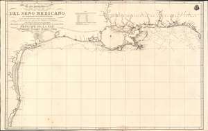
Carta Particular de las Costas Setentrionales del Seno Mexicano que comprende las de Florída Ocidental Las Margenes de la Luisiana y toda la rivera que sigue por la Bahia de S. Bernardo y el Rio Bravo del Norte hasta la Laguna Madre.
sold
- Digital Map Information
- Suitable for large format printing
- Full resolution TIFF file
- ICC color profile embedded
- Delivered instantly via download link
One of the most important maps of Texas, considered 'the first large-scale printed chart of the Texas coast based on actual soundings and explorations' (Martin and Martin). This is the 1807 Spanish Direccion Hidrografica map of the Gulf Coast in the vicinity of Texas and Louisiana. The chart follows directly on the seminal Jose Antonio de Evia (1740 - 18??) survey of the Gulf Coast, conducted between 1785 and 1786. This was the first scientific mapping of this region, resulting in, among other things, the naming of Galveston Bay. The Evia survey resulted in two subsequent maps, the 1799 Carta Esferica que Comprehende las Costas del Seno Mexicano - essentially a general chart of the Gulf of Mexico, and this more specific 1807 map offering considerably more detail to the costliness of Texas and Louisiana. (more details)
Urbanization of the Garden District!
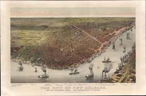
The City of New Orleans, and the Mississippi River, Lake Pontchartrain in Distance.
sold
- Digital Map Information
- Suitable for large format printing
- Full resolution TIFF file
- ICC color profile embedded
- Delivered instantly via download link
This is a rare 1885 Currier and Ives chromolithograph bird's-eye view of New Orleans. Unlike earlier views of New Orleans, this unusual view focuses attention southwest of the French Quarter towards the Garden District and extends west far enough to include Audubon Park. This is significant, as the view was issued to celebrate the 1884 - 1885 Industrial and Cotton Centennial Exposition, the campus of which appears at the far left. In the foreground the Mississippi waterfront bustles with classic paddlewheel riverboat traffic, while in the distance, Lake Pontchartrain lines the horizon. In general, the vertical perspective has been somewhat exaggerated to highlight the tallest and most impressive buildings. (more details)
Important colonial period map of the American Southeast - with seashell and coral cartouche!
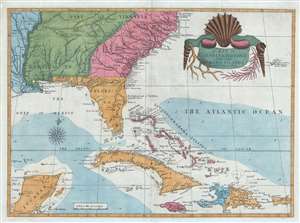
A Map of Carolina, Florida and the Bahama Islands with the Adjacent Parts.
sold
- Digital Map Information
- Suitable for large format printing
- DPI: 300
- File Size: 9.49 MB
- File Type: ZIP / TIFF
- ICC color profile embedded
- Delivered instantly via download link
A fine example of Mark Catesby’s rare 1743 / 1771 map of the southeastern parts of North America. This map is considered one of the finest maps of the colonial era American southeast. The map covers from the Mississippi River and from Cape Charles and Cape Henry to Jamaica, including all of North Carolina, South Carolina, Georgia, Florida, Louisiana, Cuba, Hispaniola, the Bahamas, Porto Rico, and parts of the Yucatan. Among other features, the map is notable for its remarkable cartouche design, which includes shells, corals, and seaweeds indigenous to the Americas. The map is furthermore an important reference for early forts, Indian tribes, English factories, and more in the southeast. The river systems of Georgia and Carolina are particularly impressive in their detail. (more details)
Spain recognizes the Republic of Texas?
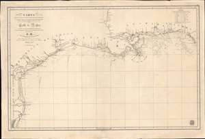
Carta de Las Costas de la Escambia, Alabama y Bocas del rio Misisipi, La Luisiana, tejas, Con la Provincia del Nuevo Santander en el Golfo de Mejico.
sold
- Digital Map Information
- Suitable for large format printing
- DPI: 600
- File Size: 1349.98 MB
- File Type: ZIP / TIFF
- ICC color profile embedded
- Delivered instantly via download link
An unusual 1846 Spanish Direccion Hidrografía nautical chart of the Gulf of Mexico recognizing the Republic of Texas. It is one of very few official Spanish publications to name the Republic of Texas, which Spain never formally recognized. The map emerged during a time of strife, both for Texas, which was involved in its own Texan Revolution (1835 - 1836) followed by the Mexican American War (1846 - 1848), but also in Spain, which was devolving into the Second Carlist War (1846 - 1849). Nonetheless, its production points to the complexity of Spanish-Texan relations during the Revolutionary years, when Texas was blockading Mexican trade and the Spanish West Indies in dire need of fresh trading partners. (more details)
Geographical Reader for Dixie Children.
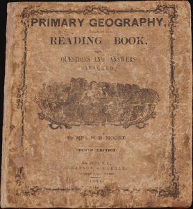
Primary Geography Arranged as a Reading Book, with Questions and Answers Attached.
sold
- Digital Map Information
- Suitable for large format printing
- Full resolution TIFF file
- ICC color profile embedded
- Delivered instantly via download link
This is a rare 1864 geographical atlas by Marinda Branson Moore prepared for Confederate children. Published during the American Civil War (1861 - 1865), the work only maps the Confederate States and contains historically relevant, if racially offensive, text critical of the Union. The work, as expressed by historians O. L. Davis, Jr. and Serena Rankin Parks, addresses the concerns of Southern schoolteachers who saw existing published textbooks as 'blighted with by Yankee biases and inaccuracies.' (more details)
The first English map of the Mississippi River.
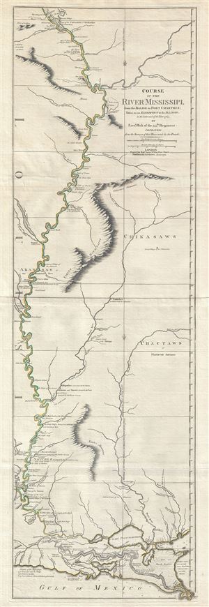
Course of the River Mississipi, from the Balise to Fort Chartres; Taken on an Expedition to the Illinois, in the latter end of the Year 1765.
sold
- Digital Map Information
- Suitable for large format printing
- DPI: 300
- File Size: 15.95 MB
- File Type: ZIP / TIFF
- ICC color profile embedded
- Delivered instantly via download link
A scarce, important, and dramatic map of the Mississippi River Valley from the Gulf of Mexico to Fort Chartres (Illinois). Set on the meridian of New Orleans, this map covers the Mississippi Valley from the Delta of the Mississippi where it joins the Gulf of ... (more details)
First view of New Orleans.
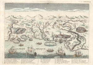
Le Mississipi ou la Louisiane dans l'Amerique Septentrionale.
sold
- Digital Map Information
- Suitable for large format printing
- File Size: 4.43 MB
- File Type: ZIP / TIFF
- ICC color profile embedded
- Delivered instantly via download link
This is a rare c. 1779 Basset / Chéreau broadside leaflet map-view of the Gulf of Mexico littoral c. 1720, just a few years after New Orleans was founded. It is likely the earliest printed view of New Orleans - though admittedly, it is not an accurate representation of the city at the time. The map was issued as a propaganda leaflet to promote New Orleans and French Louisiana. It is indeed one of the earliest maps to include a view of New Orleans and the indigenous peoples of the Gulf. The present example is the second state, issued in late 1770s by Basset to capitalize on French public interest in the American Revolutionary War (1775 - 1783). (more details)
An open invitation to Piracy?
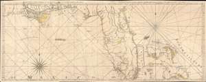
The Coast of West Florida and Louisiana. / The Peninsula and Gulf of Florida or Channel of Bahama with the Bahama Islands.
sold
- Digital Map Information
- Suitable for large format printing
- DPI: 600
- File Size: 44.18 MB
- File Type: ZIP / TIFF
- ICC color profile embedded
- Delivered instantly via download link
This is the 1775 first edition of Thomas Jeffreys' seminal map of Florida and the Gulf Coast - considered the first large-scale map to address the region in any detail. The map is significant for its accessible delineation of Florida and the Gulf, but is made more interesting through its graphic illustration of the Spanish Treasure Fleet and its route from Havana, around Florida, and then through the Bahamas - an unspoken but open invitation to pirates and privateers. (more details)
The Heart of North America from the Finest Globemaker of the 17th Century.
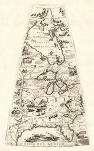
[Untitled Globe Gore of North America from the Tropic of Cancer to the Arctic Circle].
sold
- Digital Map Information
- Suitable for large format printing
- Full resolution TIFF file
- ICC color profile embedded
- Delivered instantly via download link
This is a beautiful 1688 Vincenzo Maria Coronelli globe gore focused on North America east of the Mississippi and west of the Chesapeake, engraved Coronelli's masterpiece 3 1/2 foot globe. The copperplate was adapted in 1697 for inclusion in Coronelli's bound atlases, masked off between the Tropic of Cancer and the Equator to fit book format. The gore covers most of North America east of the Mississippi, spanning from the Tropic of Cancer to the Arctic Circle. Thus, it shows the northern Gulf Coast, Florida, Chesapeake Bay, the Mississippi River (after La Salle), the Great Lakes, and Hudson's Bay. The geography is substantively the same as that on Coronelli's two-sheet America Settentrionale. Although that map bears the date 1688, it was not actually published any earlier than 1690 and it is very probable that the globes represent the earlier appearance of this geographical information. (more details)
Seminal Map of the American Southwest by 'World's Greatest Living Man'.

Carte Du Mexique et des Pays Limitrophes Situes Au Nord et a l'est Dressee d'apres la Grande Carte de la Nouvelle Espagne De Mr. A. De Humboldt et d'autres Materiaux par J.B. Poirson.
sold
- Digital Map Information
- Suitable for large format printing
- DPI: 300
- File Size: 15.17 MB
- File Type: ZIP / TIFF
- ICC color profile embedded
- Delivered instantly via download link
A seminal 1811 map of Mexico and the American West by Alexander von Humboldt. Humboldt, who during his lifetime was considered the 'world's greatest living man,' composed this map during his 1803 sojourn in Mexico. Though often playing second fiddle to ... (more details)
Scarce nautical chart of the Gulf Coast.
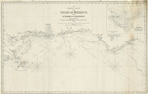
The North Coast of th Gulf of Mexico from St. Marks to Galveston.
sold
- Digital Map Information
- Suitable for large format printing
- DPI: 300
- File Size: 15.24 MB
- File Type: ZIP / TIFF
- ICC color profile embedded
- Delivered instantly via download link
An extremely scarce 1865 nautical chart or maritime map of the Gulf Coast by e and G. W. Blunt. This map, though titled ‘From St. Marks to Galveston' in fact only follows the coast from St. Marks to the Delta of the Mississippi River – suggesting ... (more details)
Includes one of the most stunning depictions of Florida as an archipelago in cartographic history.
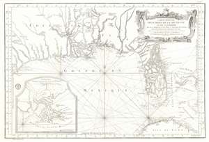
Carte Reduite des Costes de la Louisiane et de la Floride.
sold
- Digital Map Information
- Suitable for large format printing
- DPI: 600
- File Size: 32.79 MB
- File Type: ZIP / TIFF
- ICC color profile embedded
- Delivered instantly via download link
This is a 1764 Jacques-Nicolas Bellin map of the Gulf Coast of the United States featuring an exceptional depiction of Florida as an archipelago. Illustrating the Gulf region from Galveston Bay (Baye St. Louis) to the Bahamas and from the southern United States to Cuba, numerous coastal useful for navigation are incorporated. Coastal islands, capes, bays, and river mouths are all noted, including Mobile Bay, the St. John's River, and the Mississippi Delta. Depth soundings are present where they have been taken. St. Augustine and New Orleans are labeled, as are several coastal forts. Indian villages are identified in the interior, as are rivers and a lead mine in modern-day Texas. Rhumb lines appear throughout, and Dry Tortugas in the Florida Keys and individual islands in the Bahamas are notated. An inset map in the lower left corner illustrates the mouth of the Mississippi River. (more details)
Enormous unpublished draft of a Florida-Louisiana map.
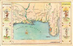
Loüissianne.
sold
- Digital Map Information
- Suitable for large format printing
- File Size: 76.81 MB
- File Type: ZIP / TIFF
- ICC color profile embedded
- Delivered instantly via download link
A striking and impressively proportioned cartographic curiosity, this is a c. 1920 manuscript map of Florida and the Gulf Littoral as far as Texas. The image is surrounded by front and back-facing images of American Indians. Most likely this is the original art for an unpublished educational poster, as it exhibits a professional level of execution. The map is drawn in ink with color added using what appears to be colored pencil or pastels. (more details)
America's first spa resort and National Park.
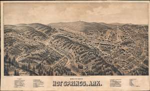
Hot Springs, Ark.
sold
- Digital Map Information
- Suitable for large format printing
- File Size: 31.72 MB
- File Type: ZIP / TIFF
- ICC color profile embedded
- Delivered instantly via download link
An exceptionally rare 1888 two-color chromolithograph bird's-eye view map of Hot Springs, Arkansas - arguably American's first national park and spa city. The view looks east on Hot Springs, possibly from a high point on nearby Sugarloaf Mountain - now part of Hot Springs National Park. Central Avenue, with its bath houses and grand hotels, cuts laterally across the page. Eleven bath houses are noted and keyed alphabetically in the lower right - curiously, they are lettered A-M, but 'I' and 'J' have been omitted. In addition, some 33 other locations, ranging from hotels to stationers and jewelers, are noted and keyed numerically. In the background, the wooden observation tower built in 1877 on top of Hot Springs Mountain by local mill owner Enoch Woolman is identifiable - this was replaced by the current metal tower in 1906. (more details)
The map and book that named Louisiana.
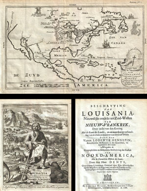
Kaart van Nieuw Vrankryk, en van Louisania Nieuwelyks Ontdekt.
sold
- Digital Map Information
- Suitable for large format printing
- DPI: 300
- File Size: 5.94 MB
- File Type: ZIP / TIFF
- ICC color profile embedded
- Delivered instantly via download link
A work that fundamentally impacted the cartographic history of America, this is the 1688 first Dutch edition of Friar Hennepin's most important work describing his explorations through the Great Lakes and the upper Mississippi valley. This book ... (more details)
First large-scale commercial map of the Confederacy.
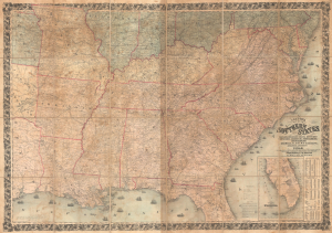
Colton's Map of the Southern States, including Maryland, Delaware, Virginia, Kentucky, Tennessee, Missouri, North Carolina, South Carolina, Georgia, Alabama, Mississippi, Arkansas, Louisiana, and Texas. Showing Also Part of Adjoining States and Territories Locating the Forts and Military Stations of the U. States and Showing all the Rail Roads, R.R. Stations, and other Internal Improvements.
sold
- Digital Map Information
- Suitable for large format printing
- File Size: 198.45 MB
- File Type: ZIP / TIFF
- ICC color profile embedded
- Delivered instantly via download link
This is an 1861 J. H. Colton map of the Confederacy published in the first year of the American Civil War (1861 - 1865). This is the first large-scale commercial map of the Confederacy, published early in 1861, in the immediate wake of the Secession. (more details)
Rare chart of the Gulf.
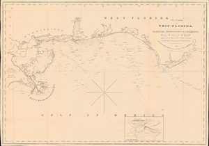
The Coasts of West Florida, Alabama, Mississippi and Louisiana; From the surveys of Gauld improved by those of the U.S. Government and the latest Astronomical Observations.
sold
- Digital Map Information
- Suitable for large format printing
- Full resolution TIFF file
- ICC color profile embedded
- Delivered instantly via download link
A rare Edmund March Blunt 1840 nautical map of West Florida, embracing the Gulf Coast from the mouths of the Mississippi to the Saint Marks River. The survey is based upon the groundbreaking work of Scottish hydrographer George Gould following the French and Indian War (1754 - 1763). Despite being nearly seventy years old by the time this chart was published, it remained the definitive mapping of the Gulf Coast until after the American Civil War (1861 - 1865). (more details)
Mostly likely the finest commercially published Civil War Era map of the Mississippi River.
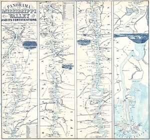
Panorama Of The Mississippi Valley And Its Fortifications.
sold
- Digital Map Information
- Suitable for large format printing
- File Size: 6.28 MB
- File Type: ZIP / TIFF
- ICC color profile embedded
- Delivered instantly via download link
An exceptionally scarce 1863 Charles Magnus Civil War era broadside map of the Mississippi River valley from St. Louis to the Delta of the Mississippi. This map, or as it is called 'panorama', is presented in strip format divided into four ... (more details)
Mostly likely the finest commercially published Civil War Era map of the Mississippi River.
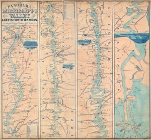
Panorama Of The Mississippi Valley And Its Fortifications.
sold
- Digital Map Information
- Suitable for large format printing
- File Size: 16.95 MB
- File Type: ZIP / TIFF
- ICC color profile embedded
- Delivered instantly via download link
An exceptionally scarce 1863 Charles Magnus Civil War era broadside map of the Mississippi River valley from St. Louis to the Delta of the Mississippi. This map, or as it is called 'panorama,' is presented in strip format divided into four ... (more details)
Mostly likely the finest commercially published Civil War Era map of the Mississippi River.
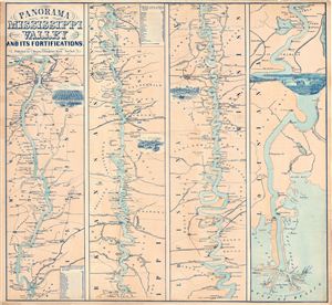
Panorama Of The Mississippi Valley And Its Fortifications.
sold
- Digital Map Information
- Suitable for large format printing
- File Size: 19.45 MB
- File Type: ZIP / TIFF
- ICC color profile embedded
- Delivered instantly via download link
An exceptionally scarce 1863 Charles Magnus Civil War era broadside map of the Mississippi River valley from St. Louis to the Delta of the Mississippi. This map, or as it is called 'panorama,' is presented in strip format divided into four ... (more details)
Shows the extent of American Indian settlement in Mississippi before the Indian Removal Act.
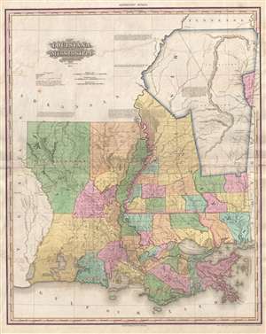
Louisiana and Mississippi by H. S. Tanner.
sold
- Digital Map Information
- Suitable for large format printing
- DPI: 300
- File Size: 15.43 MB
- File Type: ZIP / TIFF
- ICC color profile embedded
- Delivered instantly via download link
A rare and important map of Louisiana and Mississippi by H. S. Tanner. This elephant folio map covers all of Louisiana and Mississippi as well as, in less detail, adjacent parts of Texas, Arkansas, Tennessee and Alabama. The map shows ... (more details)
Best general map of the Southeast of the 18th Century.
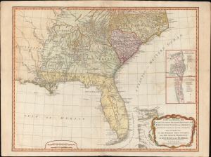
A New and General Map of the Southern Dominions Belonging to the United States of America, viz: North Carolina, South Carolina, and Georgia: with the Bordering Indian Countries and The Spanish Possessions of Louisiana and Florida.
sold
- Digital Map Information
- Suitable for large format printing
- DPI: 600
- File Size: 723.14 MB
- File Type: ZIP / TIFF
- ICC color profile embedded
- Delivered instantly via download link
A scarce 1794 Laurie and Whittle / Sayer map of the southeastern part of the United States and Florida. This is the second edition of Sayer's map of the southeast, and the first to recognize the United States as an independent nation. At the time of initial publication, it represented the finest general cartography of the southeast obtainable. (more details)
Transporting goods (including cotton) in the southern United States.
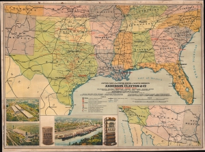
Cotton Map of the United States of North America.
sold
- Digital Map Information
- Suitable for large format printing
- Full resolution TIFF file
- ICC color profile embedded
- Delivered instantly via download link
This is a c. 1920s Anderson, Clayton and Company chromolithograph railroad wall map of the southern United States issued to celebrate the firm's rapid expansion and growth. Anderson, Clayton, and Company was an American cotton and dry goods firm that exported worldwide. This map was issued to celebrate Anderson, Clayton's growth from small town mills to a national and global logistic network. Towns identified by red text hosted either an Anderson, Clayton, and Company office or a Clayton Roundtable-Compress. An inset in the lower right details the American Southwest from Los Angeles to El Paso, noting Los Angeles was home to an Anderson, Clayton office. Three views in the lower left illustrate cotton processing centers in Houston (which had two centers) and New Orleans, noting bale capacity for each. (more details)
One of the earliest obtainable specific maps of the Gulf Coast.
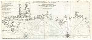
Carte de la Coste de la Louisiane depuis l'embouchure de la Riviere de Micissipi jusques à la Riviere de S. Martin.
sold
- Digital Map Information
- Suitable for large format printing
- Full resolution TIFF file
- ICC color profile embedded
- Delivered instantly via download link
An extremely rare and important 1728 Antoine Laval map of the Mississippi River Delta and the coast of Louisiana and Mississippi. The map covers from Lake Pontchartrain and Lake Maurepas eastward along the coast past the Delta of ... (more details)
Hennepin ... reconsidered?
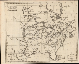
Le Cours de Fleuve Missisipi, Selon les Relations les plus modernes.
sold
- Digital Map Information
- Suitable for large format printing
- DPI: 600
- File Size: 33.38 MB
- File Type: ZIP / TIFF
- ICC color profile embedded
- Delivered instantly via download link
This is an interesting 1737 Dutch issue of Louis Hennepin's map of 1697, prepared by J. F. Bernard. It is based on the second of Hennepin's three maps, considered the map most influential in perpetrating Hennepin's fraud regarding the course of the Mississippi. The mapping of the Mississippi here, which meets the Gulf of Mexico far west of its actual location, was instrumental in fostering nearly 50 years of cartographic misrepresentation. (more details)
Sometimes maps lag behind contemporary events.
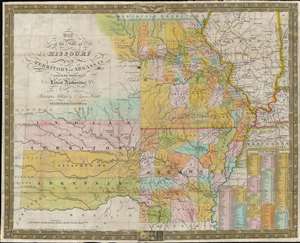
Map of the State of Missouri and Territory of Arkansas.
sold
- Digital Map Information
- Suitable for large format printing
- Full resolution TIFF file
- ICC color profile embedded
- Delivered instantly via download link
This is an 1837 Samuel Augustus Mitchell map of Missouri and Arkansas. Depicting the region from the Indian Territory to Illinois and the Mississippi River, counties, cities, and towns are illustrated and labeled. Mitchell also places an emphasis on modern transportation networks: roads crisscross the states and tables of steam boat routes occupy the lower right corner. (more details)
The finest obtainable Colonial Era map of the Gulf Coast around the Mississippi Delta and Louisiana.
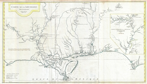
Carte de la Louisiane.
sold
- Digital Map Information
- Suitable for large format printing
- Full resolution TIFF file
- ICC color profile embedded
- Delivered instantly via download link
A fine example of an extraordinary and important 1732/52 map of the Gulf coast and lower Mississippi River Valley by Jean Baptiste Bourguignon d'Anville. D'Anville's map covers from Sabine Pass (Cabo del Norte), Texas, past the ... (more details)
The finest obtainable Colonial Era map of the Gulf Coast around the Mississippi Delta and Louisiana.
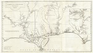
Carte de la Louisiane.
sold
- Digital Map Information
- Suitable for large format printing
- Full resolution TIFF file
- ICC color profile embedded
- Delivered instantly via download link
A flawless example of an extraordinary and important 1732/52 map of the Gulf coast and lower Mississippi River Valley by Jean Baptiste Bourguignon d'Anville. D'Anville's map covers from Sabine Pass (Cabo del Norte), Texas, ... (more details)
The finest obtainable Colonial Era map of the Gulf Coast around the Mississippi Delta and Louisiana.
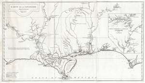
Carte de la Louisiane.
sold
- Digital Map Information
- Suitable for large format printing
- Full resolution TIFF file
- ICC color profile embedded
- Delivered instantly via download link
A lovely example of an important 1732/52 map of the Gulf coast and lower Mississippi River Valley by Jean Baptiste Bourguignon d'Anville. D'Anville's map covers from Sabine Pass (Cabo del Norte), Texas, past the Mississippi ... (more details)
Independent Mexico with the province of Texas.
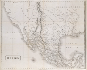
Mexico.
sold
- Digital Map Information
- Suitable for large format printing
- File Size: 2170.02 MB
- File Type: ZIP / TIFF
- ICC color profile embedded
- Delivered instantly via download link
This is an 1828 Henry Coburn map of Mexico, issued just a few years after Mexican Independence (1821) and a few years before the Texan Revolution (1835 - 1836). Published in Britain, this map highlights British interest, mostly investment-driven, in the ongoing Mexican fight for independence, as well as Austin's Town (Austin, Texas), reflecting the growing Anglo-American presence in Texas. (more details)
Louisiana on the cusp of the Louisiana Purchase.
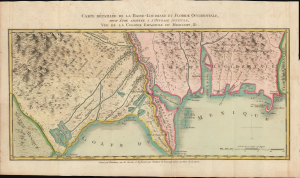
Carte Détaillée de la Basse-Louisiane et Floride Occidentale, pour étre adaptée à l'Ouvrage intitulé, Vue da la Colonie Espagnol due Mississipi, et c.
sold
- Digital Map Information
- Suitable for large format printing
- DPI: 600
- File Size: 21.22 MB
- File Type: ZIP / TIFF
- ICC color profile embedded
- Delivered instantly via download link
This is Alexandre's Blondeau's exceptional 1803 map of Spanish-administered Louisiana and West Florida, issued for Pierre-Louis Berquin Duvallon's travel narrative, Vue de la Colonie Espagnole due Mississipi. It is one of the best maps to capture the Gulf littoral during the Post-American Revolutionary War Spanish period on the cusp of the Louisiana Purchase. (more details)
Rare chart of Florida.
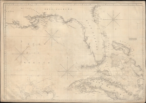
['Chart of the Gulf of Mexico, West Indies, and Spanish Main]. [Northwest Section].
sold
- Digital Map Information
- Suitable for large format printing
- DPI: 600
- File Size: 85.97 MB
- File Type: ZIP / TIFF
- ICC color profile embedded
- Delivered instantly via download link
An intriguing c. 1845 nautical map of Florida and part of the Gulf Coast by Edmund March Blunt. Following loosely on Spanish charts, this map represents the state-of-the-art Florida and Gulf Coast cartography going into the American Civil War (1861 - 1865). (more details)