
Hong Kong / Macao (sold)
Belcher's influential chart is considered the first British Map of Hong Kong.
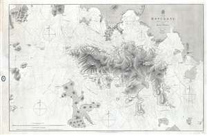
China Hong Kong Surveyed by Captn. Sir Edward Belcher in H.M.S. Sulphur 1841.
sold
- Digital Map Information
- Suitable for large format printing
- File Size: 25.14 MB
- File Type: ZIP / TIFF
- ICC color profile embedded
- Delivered instantly via download link
An iconic map of the utmost importance and rarity, this is the 1864 issue of Edward Belcher's 1843 nautical map of Hong Kong (香港) and vicinity. Belcher's 1841 study is the first detailed British survey of Hong Kong and played a significant role in the British ... (more details)
The finest British chart of Hong Kong available during the first Opium War.
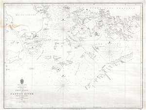
Entrance to the Chou-Kiang or Canton River from the Ouer Islands to Linten.
sold
- Digital Map Information
- Suitable for large format printing
- DPI: 300
- File Size: 6.55 MB
- File Type: ZIP / TIFF
- ICC color profile embedded
- Delivered instantly via download link
A rare and remarkable nautical chart of the utmost significance. This 1840 maritime map of Hong Kong and vicinity is attributed to Captain Daniel Ross, Bombay Marine. During the first Opium War (1839 – 1842), this was the finest and most detailed chart of Hong ... (more details)
Belcher's influential chart is considered the first British Map of Hong Kong.
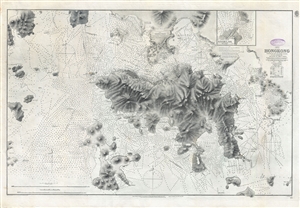
China Hong Kong Surveyed by Captn. Sir Edward Belcher in H.M.S. Sulphur 1841.
sold
- Digital Map Information
- Suitable for large format printing
- File Size: 31.4 MB
- File Type: ZIP / TIFF
- ICC color profile embedded
- Delivered instantly via download link
An iconic map of the utmost importance and rarity, this is the 1890 issue of Edward Belcher's nautical map of Hong Kong (香港) and vicinity. Belcher's 1841 study is considered to be the first British survey of Hong Kong and played a significant role in the ... (more details)
Remarkable log book of the China Station flagship during and after the Boxer Rebellion.
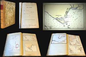
Logbook for use of Junior Officers Afloat. C. V. L. N. / Log Book. Mr. C. V. L. Norcock / H.M.S. Hannibal Glory.
sold
An exceptional and important 1900 – 1902 British naval logbook penned by Charles Vernon Lowcay Norcock (1884 - 1963), an officer in the Royal Navy, recording his experience as a Midshipman on the HMS Glory, flagship of the China Station, in the years of and immediately following the Boxer Rebellion (1899 - 1901). The full logbook covers three ships, recording the voyages of the HMS Hannibal from May to November of 1900; Norcock's subsequent service on the HMS Glory, flagship of the China Station from October of 1900 to January of 1902; and his return voyage to England on the HMS Aurora, from January to February of 1902 - thus covering Norcock's full tour of duty. The content of this volume is exceptionally rich, surpassing most other logbooks, with numerous original manuscript maps of important East Asian ports including Hong Kong, Shanghai, Singapore, Kowloon, Nagasaki, Suez, Valetta, Wusong (Shanghai), Nagasaki, and more. (more details)
The height of the China Trade on one chart! Belcher's Hong Kong! Collinson's survey!
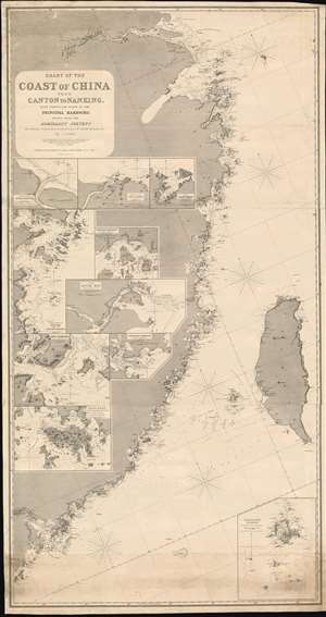
Chart of the Coast of China from Canton to Nanking, with particular plans of the principal Harbors, Drawn from the Admiralty Surveys by Captains R. Collinson, H. Kellett and Sir Edwad Belcher, R. N.
sold
- Digital Map Information
- Suitable for large format printing
- Full resolution TIFF file
- ICC color profile embedded
- Delivered instantly via download link
An exceptionally rare and important 1865 nautical chart or maritime map of the coast of China compiled by John Purdy from the surveys of Sir Edward Belcher (Hong Kong), Richard Collinson (China Coast), and Henry Kellett (China Coast) - probably the best general map of the China coast then obtainable. The map's coverage extends from mouth of the Yangtse River (Nanjing and Shanghai) south as far as Hong Kong and Macao, and east to include Taiwan (Formosa). The chart includes nine insets, among them a large representation Collinson's update of Belcher's First Opium War Hong Kong survey of 1841. This map, made after the second opium war, represents the high point of the China Trade when cities like Shanghai and Hong Kong were transforming into global centers of trade and commerce, largely at the expense of an increasing angry and frustrated Chinese populace (more details)
Scoping out the Taipa for the EIC during the Napoleonic Wars.
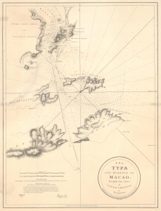
The Typa and Harbour of Macao; Principally from a Survey by Captain P. Heywood, of The Royal Navy.
sold
- Digital Map Information
- Suitable for large format printing
- File Size: 20.15 MB
- File Type: ZIP / TIFF
- ICC color profile embedded
- Delivered instantly via download link
This is the only known example of the 1809 Laurie and Whittle first edition of Peter Heywood's seminal survey of Macau (Macao) and nearby Taipa. This survey, conducted independently while Heywood's ship, the La Dedaigneuse, was being refitted in Macau, is the most important mapping of Macau since the 1778-79 survey of Heywood's erstwhile hydrography instructor, captain, and lifelong nemesis, Captain William Bligh of Bounty infamy. The survey appeared in the context of the Napoleonic Wars, when Franco-Spanish fleets were plaguing East India Company (EIC) fleets, and the British were keen to establish a foothold in the Pearl River Delta. Taipa, being a long-established EIC mooring point, was the prime target. (more details)
Rare mid-19th century Nautical Chart of Hong Kong.
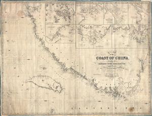
Chart of the Coast of China, Extending from Hong Kong to the River Yang-Tse, with Plans on a Large Scale of the Principal Harbours & C.
sold
- Digital Map Information
- Suitable for large format printing
- File Size: 65.86 MB
- File Type: ZIP / TIFF
- ICC color profile embedded
- Delivered instantly via download link
An impressive large 1855 format nautical chart or maritime map detailing the coast of China from the Yangtze River to Hong Kong and Macao. Map incudes Taiwan or Formosa in full. Drawn by the nautical chart maker James Imray, this is one of the rarest 19th century maps of Hong Kong and Taiwan. It includes insets of Hong Kong, the River Min, Amoy Harbor (Xiamen), Tongsang harbor, Hoo-e-Two and Chimmo Bays, the mouth of the Yangtze, and the Chusan Archipelago (Zhoushan). Dated 1855. (more details)
Rare Japanese map of China with inset of Pearl River Delta (Hong Kong).
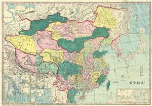
圖全那支 / Tú quán nà zhī / Whole Map of China.
sold
- Digital Map Information
- Suitable for large format printing
- File Size: 14.73 MB
- File Type: ZIP / TIFF
- ICC color profile embedded
- Delivered instantly via download link
A rare c. 1880 Japanese map of China and Korea by Kishida Ginko. The map covers all of China and Korea, extending westward to Xinjiang and the Taklimakan Desert, south to Hainan and Vietnam, and north as far as northern Sakhalin. Insets detail Hong Kong and ... (more details)
One of the earliest views of Hong Kong.
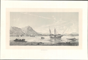
Hong Kong.
sold
- Digital Map Information
- Suitable for large format printing
- File Size: 13.12 MB
- File Type: ZIP / TIFF
- ICC color profile embedded
- Delivered instantly via download link
This rare c. 1864 lithograph of Hong Kong Harbor, printed by Wilhelm Korn in Berlin, represents one of the earliest printed views of Hong Kong. The image was drawn during the Eulenburg Expedition, a Prussian attempt to establish trading relations with Siam, China, and Japan. It is also one of the earliest examples of photolithography. (more details)
Manuscript map of Hong Kong - possibly first Japanese map of Hong Kong.
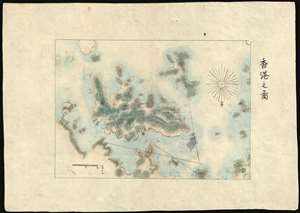
香港之圖 / Map of Hong Kong
sold
- Digital Map Information
- Suitable for large format printing
- File Size: 3.36 MB
- File Type: ZIP / TIFF
- ICC color profile embedded
- Delivered instantly via download link
A finely executed early Japanese manuscript map of Hong Kong and some of the surrounding islands prepared around 1874 - likely the earliest Japanese map to focus specifically on Hong Kong. Oriented to the south, the map covers all of Hong Kong Island, Kowloon, and some of the surrounding lands. The map includes no development, suggesting the source must be the 1841 first edition of Sir. Edward Belcher's historic plan, which it also matches in scope of coverage. (more details)
Rare early Horsburgh chart of the waters around Hong Kong issued shortly after the Crown Colony's founding.
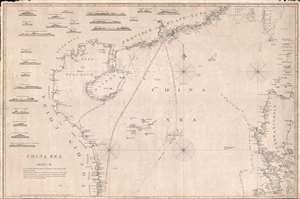
China Sea. Sheet II.
sold
- Digital Map Information
- Suitable for large format printing
- DPI: 300
- File Size: 18.5 MB
- File Type: ZIP / TIFF
- ICC color profile embedded
- Delivered instantly via download link
An attractive example of James Horsburgh's rare 1848 China Trade nautical chart or Maritime map of the South China Sea, including Hong Kong, Macao, Canton (Guangzhou), the Philippines, Hainan, the Paracel Islands, southern Taiwan (Formosa), and the ... (more details)
A British War Office map of Victoria, Singapore at the end of World War II
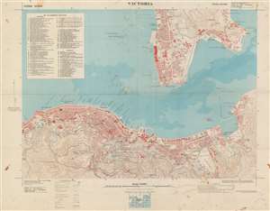
Victoria. / HING 1011. Sheet Victoria. Third Edition.
sold
- Digital Map Information
- Suitable for large format printing
- File Size: 41.53 MB
- File Type: ZIP / TIFF
- ICC color profile embedded
- Delivered instantly via download link
This is a 1945 British War Office map of Victoria, Hong Kong. The map depicts the city from North Street to Kowloon Bay and from Tai Min Tin in Kowloon to Magazine Gap in the hills south of the city. Highly detailed, many streets throughout Victoria and Kowloon are labeled. Buildings in both Victoria and Kowloon are identified, including the Kings College, the lunatic asylum, the Supreme Court, several barracks, and the Royal Naval Yard, and individual buildings are illustrated, though unlabeled. Two manuscript notations bring attention to the two typhoon anchorages in the harbor, both of which are protected by breakwaters. The topography to the south and east of the city is noted by contour lines. (more details)
Hong Kong shortly after World War II.
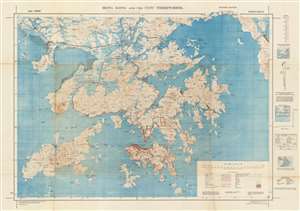
Hong Kong and the New Territories.
sold
- Digital Map Information
- Suitable for large format printing
- File Size: 87.86 MB
- File Type: ZIP / TIFF
- ICC color profile embedded
- Delivered instantly via download link
A rare 1945 map of Hong Kong and the New Territories published by the British War Office. Centered on Kowloon, coverage extends from Tai Tsan Bay to Tai Pong Bay and from Kwai Chung to the Soko Islands. This map was published shortly after the end of World War II and the British reoccupation of Hong Kong following four years of Japanese occupation. It is considered one of the finest and most detailed map of Hong Kong of this period. (more details)
Scarce nautical chart centered on Hong Kong.
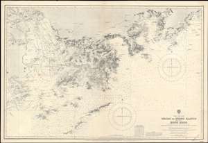
China _ S.E. Coast. Macao to Pedro Blanco including Hong Kong.
sold
- Digital Map Information
- Suitable for large format printing
- File Size: 75.95 MB
- File Type: ZIP / TIFF
- ICC color profile embedded
- Delivered instantly via download link
A rare 1929 British Admiralty nautical chart or maritime map of Hong Kong and vicinity. Centered on Hong Kong, the map includes Kowloon and the New Territories, it extends west as far as Macao, and east to Hong Hai Bay. The chart exhibits manuscript updates in a practiced hand. (more details)
First bilingual map of Hong Kong!
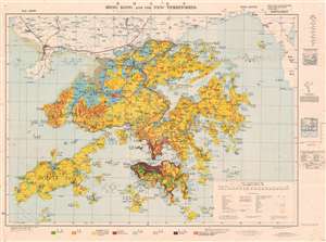
Hong Kong and the New Territories. / 香港及新界.
sold
- Digital Map Information
- Suitable for large format printing
- File Size: 92.6 MB
- File Type: ZIP / TIFF
- ICC color profile embedded
- Delivered instantly via download link
An extremely rare 1957 Geographical Section General Staff map of Hong Kong. Based upon a 1936 map published by the War Office, this is the first bilingual edition of this important. This map is further updated to represent agricultural variance, distinguishing between scrub, roughly grassland, badlands, arable lands, swamp and developed properties. (more details)
Post-War Hong Kong.
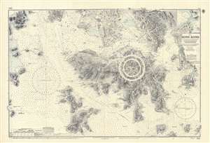
China. Hong Kong. Surveyed by Captn. Sir E. Belcher, H.M. Surveying Ship Sulphur, 1841...
sold
An iconic map of the utmost importance and rarity, this is the 1966 issue of Edward Belcher's 1843 nautical map of Hong Kong (香港) and vicinity. The map covers all of Hong Kong Island (香港島) as well as the Kowloon (九龍) Peninsula and, either in part or full, the adjacent island of Lan Tao (大嶼山), Peng Chau (坪洲), Hei Ling Chau (喜靈洲), Lamma (南丫島), Sheung Sze Mun (雙四門), Po Toi (蒲苔羣島), and Tung Lung Chau (東龍洲). Detail throughout is impressive, refined to the level of individual buildings, especially Victoria, Central, and on the Kowloon Peninsula. Belcher's work was so impressive that, although updated countless times, the base map, as here, remained unchanged for over 100 years. (more details)
Hong Kong with manuscript additions!
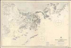
China _ S.E. Coast. Macao to Pedro Blanco including Hong Kong.
sold
- Digital Map Information
- Suitable for large format printing
- File Size: 75.95 MB
- File Type: ZIP / TIFF
- ICC color profile embedded
- Delivered instantly via download link
A rare 1929 British Admiralty nautical chart or maritime map of Hong Kong and vicinity. Centered on Hong Kong, the map includes Kowloon and the New Territories, extends west as far as Macao, and east to Hong Hai Bay. The chart exhibits manuscript updates in a practiced hand. (more details)
Chinese medicine will turn you into Charles Atlas!
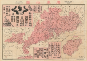
Map of Guangdong. / 廣東地圖
sold
- Digital Map Information
- Suitable for large format printing
- File Size: 39.27 MB
- File Type: ZIP / TIFF
- ICC color profile embedded
- Delivered instantly via download link
A promotional map of Canton / Guangdong (广东) / Hong Kong issued by the Leung Kai Fook Drug Store (梁介福). The map uniquely illustrates Chinese-Foreign relations through its unusual advertisements that use Western models to promote products to a primarily Chinese audience. (more details)
The War that created Hong Kong!
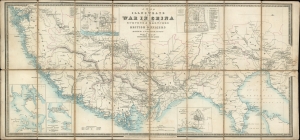
A Map to Illustrate the War in China compiled from Surveys and Sketches of British Oficers and Other Information.
sold
- Digital Map Information
- Suitable for large format printing
- DPI: 600
- File Size: 17.67 MB
- File Type: ZIP / TIFF
- ICC color profile embedded
- Delivered instantly via download link
A rare 1842 separately issued thematic map published in London by James Wyld to illustrate the primary theater of the First Opium War (1839 - 1842). It was this war that resulted in the leasing of Hong Kong to the British. With an unusual east facing orientation, the map covers the coast of China from Canton (Guangzhou) and Macao (near modern day Hong Kong) as far north as Beijing, and inland as far as Nanjing (Nanking). Chinese provinces are highlighted in pink. (more details)
Provenance to the first Governor of Hong Kong.
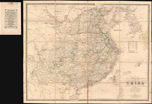
Map of China Compiled from original Surveys and Sketches.
sold
- Digital Map Information
- Suitable for large format printing
- DPI: 600
- File Size: 39.19 MB
- File Type: ZIP / TIFF
- ICC color profile embedded
- Delivered instantly via download link
A beautiful example of the scarce 1840 first edition of James Wyld's First Opium War Era map of China, with provenance to Sir Henry Pottinger, the first governor of Hong Kong, identified here as 'Heong Kong'. The map covers all of China, extending from the Tibet border to western Japan and from Manchuria to Hainan. Korea, rendered in full, is wildly malformed. Taiwan, appearing near the cartouche, is misshaped and only the western coast features any detail. There are notes in industry, transportation networks, the great wall, population, trade resources, and more. (more details)
South China Sea - then as now, an important and strategic artery.
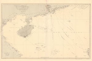
Carta de la Costa y Mar de China comprendida entre el Cabo Batangan y el Canal de Formosa con parte de la Isla de Luzon, segun los trabajos mas recientes macionales y estrangeros.
sold
- Digital Map Information
- Suitable for large format printing
- File Size: 48.36 MB
- File Type: ZIP / TIFF
- ICC color profile embedded
- Delivered instantly via download link
A rare 1869 Direccion Hidrografía nautical map detailing the China coast and the South China Sea from, roughly, Hong Kong and Macao south to Hue (Vietnam) and Luzon (the Philippines), thus embracing a highly-trafficked and critical trade and strategic channel in the 19th century (as today). The map focuses heavily on coastal maritime routes, but pushes inland along major river arteries, including a detailed mapping of the Pearl River Delta as far as Canton (Guangzhou). In Vietnam, several factorias antiguas are noted, underscoring early European trade activity. (more details)
Chinese and Portuguese Macau.
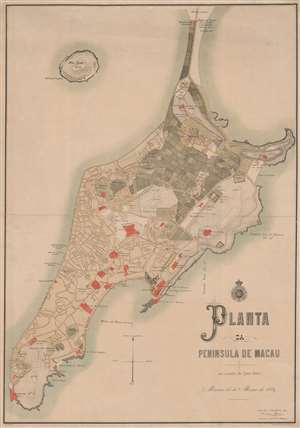
Planta de Peninsula de Macau.
sold
- Digital Map Information
- Suitable for large format printing
- File Size: 34.81 MB
- File Type: ZIP / TIFF
- ICC color profile embedded
- Delivered instantly via download link
A rare 1889 large-scale chromolithograph map of Macau, China, by António Heitor and the Sociedade de Geografia de Lisboa. This map follows the 1887 Sino-Portuguese Treaty, considered one of the Unequal Treaties following the Opium Wars, which granted the Portuguese full sovereignty over Macau. The map can be divided into two sections, the Chinese community and village in the northeastern quadrant, here colored grey and full of farm fields, and the Portuguese urbanization encroaching from the south. Episcopal buildings, fortifications, and civil institutions are highlighted in red. (more details)
Hardly Easy Sailing.
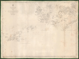
China Eastern Coast Sheet I, From Mongchow to Hong Kong. / [Admiralty Chart No.] 2212.
sold
- Digital Map Information
- Suitable for large format printing
- DPI: 600
- File Size: 575.08 MB
- File Type: ZIP / TIFF
- ICC color profile embedded
- Delivered instantly via download link
An important blueback nautical map or chart of the southern coast of China in the vicinity of Hong Kong and Macao, published in 1853 by the British Admiralty. It reflects increasing familiarity with these waters in the era immediately following the First Opium War (1839 - 1842). (more details)
A charming set of twelve pictorial postcards recording a voyage to from Euorope to Singapore, Hong Kong, Shanghai, and Yokohama.
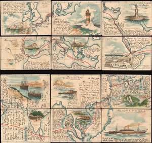
[Hamburg to Yokohama.]
sold
- Digital Map Information
- Suitable for large format printing
- File Size: 16.65 MB
- File Type: ZIP / TIFF
- ICC color profile embedded
- Delivered instantly via download link
This is a charming 1903 set of hand-colored pictorial map postcards with extensive manuscript content recording a voyage from Hamburg, Germany to Yokohama, Japan, including visits to Singapore, Hong Kong, Shanghai, Suez, and more. Divided into twelve different postcards, the cards depict the route from Hamburg through the English Channel and the Strait of Gibraltar, across the Mediterranean to the Suez Canal, then through the Red Sea to the Indian Ocean and Sri Lanka, Singapore, Hong Kong, Fuzhou, Shanghai, Nagasaki, and finally Yokohama. Beautiful views adorn each of the twelve cards, including illustrations of the Needles on the Isle of Wight, Gibraltar, the lighthouse at Genoa, the city of Aden in Yemen, the Suez Canal, Hong Kong, Colombo, and Nagasaki. (more details)
Hardly Easy Sailing.
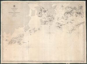
China Eastern Coast Sheet I, From Mongchow to Hong Kong. / [Admiralty Chart No.] 2212.
sold
- Digital Map Information
- Suitable for large format printing
- DPI: 600
- File Size: 620.66 MB
- File Type: ZIP / TIFF
- ICC color profile embedded
- Delivered instantly via download link
An important blueback nautical map of the southern coast of China in the vicinity of Hong Kong and Macao, published in 1853 by the British Admiralty. It reflects increasing familiarity with these waters in the era immediately following the First Opium War (1839 - 1842). (more details)
The Heart of Hong Kong.
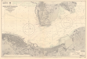
A splendid nautical map of Victoria Harbour in Hong Kong, produced by the British Admiralty's Hydrographic Office in 1966. It provides a detailed picture of the harbor, the heart of Hong Kong, and the lands to either side. (more details)
Scarce nautical chart detailing the China Coast between Taiwan, Hong Kong, and the Philippines.

East India Archipelago (Western Route to China Chart no. 6)
sold
- Digital Map Information
- Suitable for large format printing
- File Size: 44.42 MB
- File Type: ZIP / TIFF
- ICC color profile embedded
- Delivered instantly via download link
A large and impressive 1872 nautical chart by James Imray covering southeastern China in the vicinity of Hong Kong and Guangdong Province, southern Taiwan, and the northern Philippines (Luzon and Mindanao). Two trade routes are identified including the 'Usual route to and from Hong Kong in fair Monsoon' and the 'course to Hong Kong in the Northeast Monsoon.' The chart achieves its greatest detail and accuracy in the vicinity of Hong Kong and Macao as well as in the seas around the Pescadores Islands between Taiwan and the China coast. Manila Bay, in the Philippines, is also well mapped. (more details)
Nautical Chart including Hong Kong and disputed South China Sea territory near Vietnam!
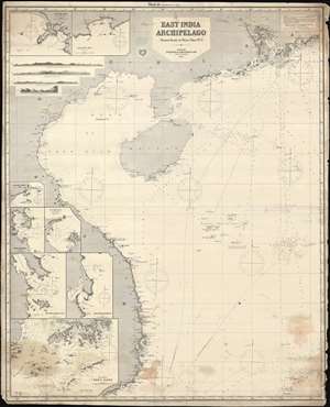
East India Archipelago. [Western Route to China. Chart No. 5.]
sold
- Digital Map Information
- Suitable for large format printing
- File Size: 116.5 MB
- File Type: ZIP / TIFF
- ICC color profile embedded
- Delivered instantly via download link
This is an uncommon 1878 James Imray map of the South China Sea region between Hong Kong, Hainan, and Vietnam. The chart covers from the Pearl River Delta, south past and including Hainan, and most of the coast of Vietnam to, roughly Saigon There are inset detail maps of Hong Kong, Nha-Trang, Cam-Ranh, Port Xuan-Dai, Touron Bay, Cape Boung-Quioua, Yu-Lin-Kan, Gaalong Bay (Yalang Wan). The map was used for actual navigation and there are pencil marks and manuscript updates associated with maritime use. It bears an 'Imray and Son 1880' stamp suggesting there may be printed updates, but his is not 100% clear as charts were not updated as frequently as one might think. (more details)
Rare and important nautical chart of the the Zhujiang River Estuary, featuring Macao, Gunagzhou, and Hong Kong.
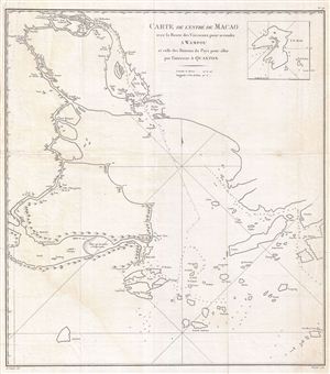
Carte de L'Entre de Macao aved la Route des Vaisseaux pour se rendre a Wampou et celle des Bateaux de Pays pour aller par l'interieur a Quanton.
sold
- Digital Map Information
- Suitable for large format printing
- DPI: 300
- File Size: 9.93 MB
- File Type: ZIP / TIFF
- ICC color profile embedded
- Delivered instantly via download link
An extremely scarce and obscure 1808 map of Macao, Canton, Lantau, and parts of Hong Kong by Chretien-Louis-Joseph de Guignes. This map is the most important of five charts prepared to illustrate de Guignes's 1808 Voyages a Peking, Manille et ... (more details)
The Changing Face of Hong Kong.
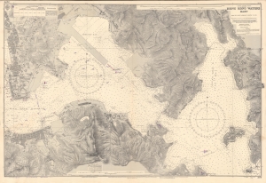
China - South Coast, Hong Kong Waters East, from the Latest Admiralty Surveys to 1959.
sold
An impressive nautical map of the waters between Hong Kong Island and Kowloon, produced in 1960 by the British Admiralty's Hydrographic Office, with minor corrections in handwriting to 1963. It reflects a city in transition, moving beyond its past as a colonial trade entrepôt dominated by wharves and warehouses and instead becoming a proper city in its own right (Hong Kong's population more than tripled between 1930 and 1960, in large part due to refugees fleeing warfare and revolution in mainland China). (more details)
Extremely rare map detailing c. 1925 residences in the Peak District.
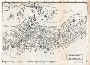
A very rare c. 1925 bi-lingual map of the Central District and Victoria Peak, Hong Kong. Oriented to the South, the map covers from Centre Street to Kennedy Street, and from Victoria Gap to Victoria Harbor. The map offers excellent street ... (more details)
Very rare map of Northern Vietnam showing the South China Sea, Hainan, and extending north roughly as far as modern Day Hong Kong.
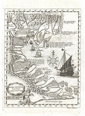
Daniel Taverniers Land-Charte des Königreichs Tunqvin.
sold
- Digital Map Information
- Suitable for large format printing
- DPI: 300
- File Size: 1.72 MB
- File Type: ZIP / TIFF
- ICC color profile embedded
- Delivered instantly via download link
A rare, important, and highly desirable 1684 map of modern day Vietnam and the South China Sea by the French Huguenot merchant adventurer, Daniel Tavernier. The map covers the coast of Vietnam from southern China to the Mekong Delta. It ... (more details)