
Kansas - Nebraska - Iowa - Missouri (sold)
Unrecorded first state of a foundational map with extensive manuscript additions relating to American Indian Reservations established in 1867-8.
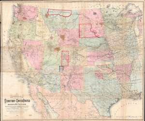
National Map of the Territory of the United States From The Mississippi River To The Pacific Ocean.
sold
- Digital Map Information
- Suitable for large format printing
- Full resolution TIFF file
- ICC color profile embedded
- Delivered instantly via download link
An extraordinary first-edition first-state example of William J. Keeler’s 1867 map of the Trans-Mississippi West - considered the finest post-Civil War railroad era map of the west - with unique manuscript annotations and additions relating to the American Indian Reservation System. This one of a kind historic document was likely the official example retained by the Indian Bureau, and possibly by Keeler himself, to administer and document the development of the American Indian Reservation system through the late 1860s. (more details)
1796 Collot Map of the Country of the Illinois (Mississippi River near Missouri, St. Louis, Illinois
The first published map of the St. Louis area.
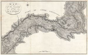
Map of the Country of the Illinois.
sold
- Digital Map Information
- Suitable for large format printing
- DPI: 300
- File Size: 13.95 MB
- File Type: ZIP / TIFF
- ICC color profile embedded
- Delivered instantly via download link
A map of 'superlative' rarity, this is Victor Collot's 1796 map of the Mississippi River in the vicinity of St. Louis, Missouri, or what at the time was known as the 'Country of the Illinois.' Focusing on the Mississippi River valley, this map covers from the ... (more details)
The quintessential trail map of the American west.
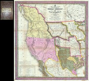
A New Map of Texas Oregon and California with the Regions Adjoining.
sold
- Digital Map Information
- Suitable for large format printing
- Full resolution TIFF file
- ICC color profile embedded
- Delivered instantly via download link
Considered 'the quintessential trail map of the American West' Samuel Augustus Mitchell's 'New Map of Texas Oregon and California' is one of the most important 19th century pocket maps ever issued. In Mitchell's own words This map comprises all that portion ... (more details)
The first English map of the Mississippi River.
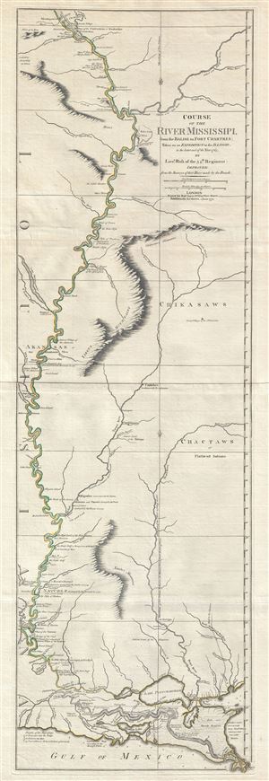
Course of the River Mississipi, from the Balise to Fort Chartres; Taken on an Expedition to the Illinois, in the latter end of the Year 1765.
sold
- Digital Map Information
- Suitable for large format printing
- DPI: 300
- File Size: 15.95 MB
- File Type: ZIP / TIFF
- ICC color profile embedded
- Delivered instantly via download link
A scarce, important, and dramatic map of the Mississippi River Valley from the Gulf of Mexico to Fort Chartres (Illinois). Set on the meridian of New Orleans, this map covers the Mississippi Valley from the Delta of the Mississippi where it joins the Gulf ... (more details)
An exceptionally scarce variant of a cornerstone map of the American west and the finest of its era.
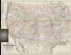
National Map of the Territory of the United States From The Mississippi River To The Pacific Ocean. Madeby the authority of the Hon. O. H. Browning Secretary of the Interior. In the Office of the Indian Bureau Chiefly For Government Purposes under the direction of the Hon. N.G. Taylor, Commisr. of Indian Affairsa and Hon. Chas E. Mix Chief Clerk of the Indian Bureau.
sold
- Digital Map Information
- Suitable for large format printing
- File Size: 46.46 MB
- File Type: ZIP / TIFF
- ICC color profile embedded
- Delivered instantly via download link
A map of the utmost importance and scarcity, this is William J. Keeler's 1868 pocket map of the American west, considered the 'the largest, finest and most detailed map of the West as it was then known.' The map covers from Detroit and Cincinnati westward ... (more details)
Foundational Map of the Transmississippi.
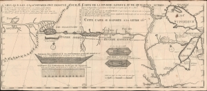
Carte que les Gnacsitares ont Dessine sur / Carte de la Riviere Longue et de quelques Autres qui se Dechargent dans le Grand Fleuve Missisipi.
sold
- Digital Map Information
- Suitable for large format printing
- File Size: 14.91 MB
- File Type: ZIP / TIFF
- ICC color profile embedded
- Delivered instantly via download link
A foundational and influential map, this is the 1703 first edition of Baron Louis-Armand de Lom d'Arce de Lahontan's seminal map of the westernmost Great Lakes, the Mississippi River, and its enigmatic tributary river, the Riviere Longue or Long River, extending westwards towards the Rocky Mountains. Although Baron de Lahontan's cartography has been severely criticized and considered apocryphal by some, it exerted a profound influence on other mapmakers of the era, including Herman Moll, John Senex, Henry Popple, and Guillaume Delisle. (more details)
Rare first edition of Lahontan's highly influential map of the supposedly apocryphal Riviere Longue (Missouri River?)
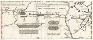
Carte que les Gnacsitares ont Dessine sur / Carte de la Riviere Longue et de quelques Autres qui se Dechargent dans le Grand Fleuve Missisipi.
sold
- Digital Map Information
- Suitable for large format printing
- DPI: 300
- File Size: 7.06 MB
- File Type: ZIP / TIFF
- ICC color profile embedded
- Delivered instantly via download link
A foundational map of extreme importance and influence, this is the rare 1703 first edition of Baron Louis-Armand de Lom d'Arce de Lahontan's, seminal map of the westernmost Great Lakes, the Mississippi River, and an enigmatic tributary river, the Riviere ... (more details)
Rare first edition of Lahontan's highly influential map of the supposedly apocryphal Riviere Longue (Missouri River?)
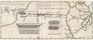
Carte que les Gnacsitares ont Dessine sur / Carte de la Riviere Longue et de quelques Autres qui se Dechargent dans le Grand Fleuve Missisipi.
sold
- Digital Map Information
- Suitable for large format printing
- DPI: 300
- File Size: 8.32 MB
- File Type: ZIP / TIFF
- ICC color profile embedded
- Delivered instantly via download link
A foundational map of extreme importance and influence, this is the rare 1703 first edition of Baron Louis-Armand de Lom d'Arce de Lahontan's, seminal map of the westernmost Great Lakes, the Mississippi River, and an enigmatic tributary river, the Riviere ... (more details)
Charting the contours of the early Civil War.
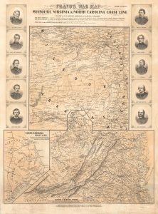
Prang's War Map Missouri, Virginia and North Carolina Coast Line.
sold
- Digital Map Information
- Suitable for large format printing
- File Size: 71.19 MB
- File Type: ZIP / TIFF
- ICC color profile embedded
- Delivered instantly via download link
A rare 1861 Louis Prang map of three theaters of the American Civil War (1861 - 1865), providing an as-it-happened snapshot of the war in its early months, when both Union and Confederate forces rushed to raise armies, produce war materiel, and grasp disputed territory. (more details)
Bleeding Kansas map issued just one month after the Sack of Lawrence.
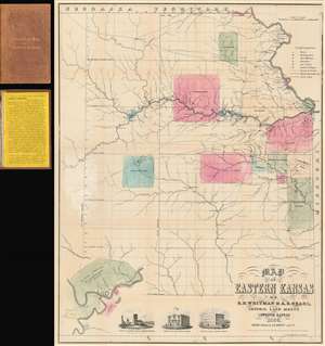
Map of Eastern Kansas.
sold
- Digital Map Information
- Suitable for large format printing
- File Size: 24.02 MB
- File Type: ZIP / TIFF
- ICC color profile embedded
- Delivered instantly via download link
An iconic and historically important map of Eastern Kansas during the 'Free Soil' and 'Bleeding Kansas' or 'Bloody Kansas' era, published just one month after the Sacking of Lawrence. This rare and important 1856 map by the prominent abolitionists Albert D. Searle, Edmund Burke Whitman, and John Punchard Jewett covers the eastern part of Kansas from the 6th Principal Meridian or 97° 22' 08'' W to the Missouri Border and the Missouri River, and from Nebraska to, roughly, the modern day northern border of Oklahoma. The map is intended to promote 'free state' emigration to Kansas as counterbalance to a similar effort by 'slave states' to move their own settlers into the territory. Zones highlighted with color reference American Indian lands - suggesting that emigrants avoid these territories and settle away from 'Indian troubles.' In the lower left there is an inset of Fort Riley on the Missouri River, identified as the 'Geographical Center of U. S. Possessions.' At the base are vignette illustrations of Constitution Hall in Topeka, and before and after images of Eldridge House, also known as the 'Free State Hotel,' which was burned to the ground by pro-slavery vigilantes. (more details)
Scarce, Superbly Detailed Map of the Northwestern Territories and States: First Detailed Map Naming the Wyoming Terrirory
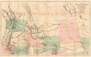
General Map of the North Pacific States and Territories Belonging to the United States and of British Columbia, Extending from Lake Superior to the Pacific Ocean and Between Latitude 39 degrees and 53 degrees North. Exhibiting Mail Routes, Gold Mines, and Including the Most Recent Surveys of the Topographical Bureau. Prepared by Captain John Mullan. ... Drawn by Edward Freyhold, T.E. Lithographed by J. Bien, 24 Vesey, St. N.Y.
sold
- Digital Map Information
- Suitable for large format printing
- File Size: 44.63 MB
- File Type: ZIP / TIFF
- ICC color profile embedded
- Delivered instantly via download link
This the 1865 Mullan - Freyhold map of the American Northwest. It shows the territories of Washington, Idaho, Montana, Wyoming, Dakota and Nebraska, and the State of Oregon in completion, and portions of California, Minnesota, Iowa, Kansas, Colorado, Utah and Nevada. The lithographed map - with hand wash color to distinguish the territories from one another - is beautifully executed and detailed. Carl Wheat esteemed this 'very fine' map so well that he chose it for the frontispiece of the fifth volume of Mapping the Transmississippi West. In discussing Freyhold, in particular, Wheat rhapsodizes:
Edwin (sic) Freyhold, who seems to have been responsible for the actual drawing of the topography, was an unrivaled expert in this type of work. His penned originals are almost unbelievably delicate, and must be examined with a powerful magnifying glass to be appreciated.Indeed, the map's details are superbly drafted and lithographed, with clear, legible typography and beautifully hachured mountains. The map, and the guide accompanying it, was intended to aid and encourage hopeful emigrants to the new territories of the northwest, particularly prospectors. The map relies heavily on data arising from Mullan's tenure as superintendent of construction for the northern military wagon road running from Walla Walla to Fort Benton on the upper Milk River, and indeed Wheat specifically praises the detail of its trails: Mullan's road is shown in its several variants, including Mullan' proposed (and rejected) route to Walla-Walla via Fort Laramie. Another route following the Yellowstone River west and crossing the mountains via Beaver Head Valley is indicated to the south of the Mullan road. Well-established U.S. Mail routes are shown in the southern part of the map. (more details)
Extraordinary Panorama showing the Route of the Mormon Pioneers and the Westward Expansion.
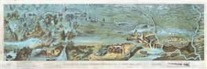
Route of the Mormon Pioneers from Nauvoo to Great Salt Lake.
sold
- Digital Map Information
- Suitable for large format printing
- File Size: 23.46 MB
- File Type: ZIP / TIFF
- ICC color profile embedded
- Delivered instantly via download link
This is an extraordinary and striking 1899 chromolithograph panoramic bird-eye view and map of the 1,300 mile Mormon Trail. This view, by Millroy and Hayes, covers the region between the Mississippi River and Great Salt Lake and chronicles the westward ... (more details)
Mostly likely the finest commercially published Civil War Era map of the Mississippi River.
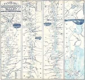
Panorama Of The Mississippi Valley And Its Fortifications.
sold
- Digital Map Information
- Suitable for large format printing
- File Size: 6.28 MB
- File Type: ZIP / TIFF
- ICC color profile embedded
- Delivered instantly via download link
An exceptionally scarce 1863 Charles Magnus Civil War era broadside map of the Mississippi River valley from St. Louis to the Delta of the Mississippi. This map, or as it is called 'panorama', is presented in strip format divided into four distinct ... (more details)
Mostly likely the finest commercially published Civil War Era map of the Mississippi River.
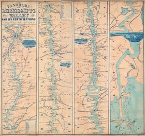
Panorama Of The Mississippi Valley And Its Fortifications.
sold
- Digital Map Information
- Suitable for large format printing
- File Size: 16.95 MB
- File Type: ZIP / TIFF
- ICC color profile embedded
- Delivered instantly via download link
An exceptionally scarce 1863 Charles Magnus Civil War era broadside map of the Mississippi River valley from St. Louis to the Delta of the Mississippi. This map, or as it is called 'panorama,' is presented in strip format divided into four distinct ... (more details)
Mostly likely the finest commercially published Civil War Era map of the Mississippi River.
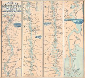
Panorama Of The Mississippi Valley And Its Fortifications.
sold
- Digital Map Information
- Suitable for large format printing
- File Size: 19.45 MB
- File Type: ZIP / TIFF
- ICC color profile embedded
- Delivered instantly via download link
An exceptionally scarce 1863 Charles Magnus Civil War era broadside map of the Mississippi River valley from St. Louis to the Delta of the Mississippi. This map, or as it is called 'panorama,' is presented in strip format divided into four distinct ... (more details)
Transporting goods (including cotton) in the southern United States.
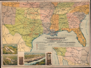
Cotton Map of the United States of North America.
sold
- Digital Map Information
- Suitable for large format printing
- Full resolution TIFF file
- ICC color profile embedded
- Delivered instantly via download link
This is a c. 1920s Anderson, Clayton and Company chromolithograph railroad wall map of the southern United States issued to celebrate the firm's rapid expansion and growth. Anderson, Clayton, and Company was an American cotton and dry goods firm that exported worldwide. This map was issued to celebrate Anderson, Clayton's growth from small town mills to a national and global logistic network. Towns identified by red text hosted either an Anderson, Clayton, and Company office or a Clayton Roundtable-Compress. An inset in the lower right details the American Southwest from Los Angeles to El Paso, noting Los Angeles was home to an Anderson, Clayton office. Three views in the lower left illustrate cotton processing centers in Houston (which had two centers) and New Orleans, noting bale capacity for each. (more details)
Sometimes maps lag behind contemporary events.
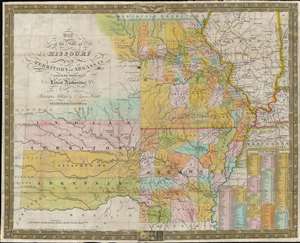
Map of the State of Missouri and Territory of Arkansas.
sold
- Digital Map Information
- Suitable for large format printing
- Full resolution TIFF file
- ICC color profile embedded
- Delivered instantly via download link
This is an 1837 Samuel Augustus Mitchell map of Missouri and Arkansas. Depicting the region from the Indian Territory to Illinois and the Mississippi River, counties, cities, and towns are illustrated and labeled. Mitchell also places an emphasis on modern transportation networks: roads crisscross the states and tables of steam boat routes occupy the lower right corner. (more details)
A Watershed in the Cartography of the Plains' - Allen
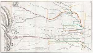
[Map of the 1835 Route of March of The Dragoons under the Command of Col. Henry Dodge from Fort Leavenworth to the Rocky Mountains and Back.]
sold
- Digital Map Information
- Suitable for large format printing
- DPI: 300
- File Size: 15.33 MB
- File Type: ZIP / TIFF
- ICC color profile embedded
- Delivered instantly via download link
A fine example of the rare 1846 Henry Dodge / Enoch Steen map of the American west covering much of the American Great Plains. The map follows the 1835 Dodge Expedition, or Second Dragoon Expedition, as they traveled from Fort Leavenworth to the Platte River, through the territories claimed by the Kickapoos and Otoes, west to Grand Island and the Pawnee Village, past the Medicine Lodge of the Rees and to the foot of the mountains, which note Snakes and Crows War Ground. From there they returned along the Arkansas River and the Santa Fe Trail to Fort Leavenworth. In modern terms, Steen's map coverage extends from Santa Fe, New Mexico, to Missouri, and from The Black Hills of South Dakota to the Red Fork River, embracing the Great Plains from the Fort Leavenworth to the Rocky Mountains, inclusive of all of modern-day Nebraska and Kansas, with parts of South Dakota, Wyoming, New Mexico, Texas, Oklahoma, and Missouri. (more details)
Schreyvogel's greatest work and the beginning a lifelong feud with Remington.
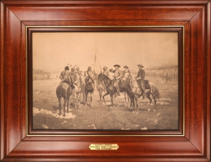
[Custer's Demand.]
sold
- Digital Map Information
- Suitable for large format printing
- File Size: 8.01 MB
- File Type: ZIP / TIFF
- ICC color profile embedded
- Delivered instantly via download link
A striking signed and inscribed example of the artist's lithograph edition Charles Schreyvogel's most famous painting Custer's Demand. This painting established Schreyvogel as one of the great artists of the American West and inspired a lifelong feud with jealous competitor and Western painting icon Frederic Remington. (more details)
Shows American Indian Lands and the Military Bounty Lands in western Illinois.
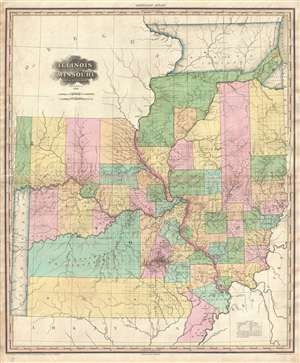
Illinois and Missouri by H. S. Tanner.
sold
- Digital Map Information
- Suitable for large format printing
- DPI: 300
- File Size: 17.22 MB
- File Type: ZIP / TIFF
- ICC color profile embedded
- Delivered instantly via download link
A rare and important map of Illinois and Missouri by H. S. Tanner. This elephant folio map covers all of Illinois and Missouri as well as, in less detail, adjacent parts of Arkansas, Kentucky, and Minnesota. The map shows rivers, topography by ... (more details)
Early real estate promotional map or Omaha, Nebraska.

Omaha and Environs.
sold
- Digital Map Information
- Suitable for large format printing
- File Size: 37.41 MB
- File Type: ZIP / TIFF
- ICC color profile embedded
- Delivered instantly via download link
This is a separately issued 1887 Adin Mann city map or plan of Omaha, Nebraska, one of the earliest obtainable maps of the city. This map depicts the booming city from Wadsworth Street to Carter Lake and the Missouri River and from just north of Fort Omaha to the Albright's Choice neighborhood (around today's Monroe Street). Myriad neighborhoods are identified, with various streets labeled as well. Certain streets will be familiar with Omaha's current residents, including Dodge Street, Farnham Street, and Leavenworth Street. Omaha's recognizable grid is present, but the north-south streets are not numbered as they are today. The Union Pacific is a major presence here, with their line and the shops both labeled. Other railroads, such as the Omaha Belt Railway, the Chicago, St. Paul, Minneapolis, and Omaha Railway, and the Burlington and Missouri River Railroad are also identified. (more details)
Premier Great Lakes Map of the Mid-18th Century.
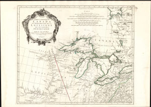
Partie Occidentale du Canada et Septentrionale de la Louisiane avec une partie de Pensilvanie.
sold
- Digital Map Information
- Suitable for large format printing
- Full resolution TIFF file
- ICC color profile embedded
- Delivered instantly via download link
This is Paolo Santini's 1775 map of the western part of Canada, the Upper Mississippi, and the Great Lakes Region. Produced to satisfy European interest in the American Revolutionary War (1775 - 1783), it drew on D'Anville's map, the best French mapping of the region produced during the French and Indian War (1754 - 1763). (more details)
'...radically and permanently altered western cartography.' - Wheat
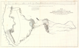
Map of an Exploring Expedition to the Rocky Mountains in the Year 1842 and to Oregon and North California in the Years 1843-44.
sold
- Digital Map Information
- Suitable for large format printing
- File Size: 56.14 MB
- File Type: ZIP / TIFF
- ICC color profile embedded
- Delivered instantly via download link
This is a seminal 1845 map of the American West by Carl Preuss and John C. Frémont charting the vast region between the Missouri River and the Pacific Ocean. Based on Frémont's 1843-44 Second Expedition, this map played a pivotal role in shaping westward expansion, guiding emigrants along the Oregon Trail and California Trail, and influencing cartography for decades. Wheat hailed this map as 'radically and permanently altering western cartography.' Featuring the first accurate mapping of the Great Salt Lake, detailed topographical features, and overland migration routes, this was the most comprehensive map of the American West. (more details)
American Indian land grants, fraud, and Half-Breed Tracts.
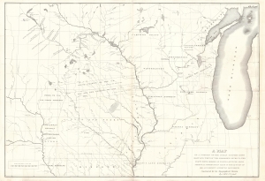
A Map of a Portion of the Indian Country Lying East and West of the Mississippi River to the Forty Sixth Degree of North Latitude from Personal Observation Made in the Autumn of 1835 and Recent Authentic Documents.
sold
- Digital Map Information
- Suitable for large format printing
- Full resolution TIFF file
- ICC color profile embedded
- Delivered instantly via download link
This is an 1836 George William Featherstonhaugh map of the American Upper Midwest. It is significant for detailing land grants given by American Indian Nations to both colonials and métis peoples - the so-called 'Half-Breed Tracts'. It also details the Carver Grant, a fraudulent land speculation scheme of the early 19th century. (more details)
Depicts both the N.U. Coliseum and Memorial Stadium and states that There Is No Place Like Nebraska.
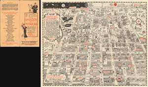
Ye Mappe of Ye Good Old University of Nebraska and Adjacent Parts Etc-Etc and Et Cetera in Dear Olde Lincoln Nebraska. / Ye Mappe of Ye Universitas Nebraskensis and Adjacent Parts.
sold
- Digital Map Information
- Suitable for large format printing
- File Size: 36.25 MB
- File Type: ZIP / TIFF
- ICC color profile embedded
- Delivered instantly via download link
This is a 1931 James H. Pickering pictorial map of the University of Nebraska in Lincoln, Nebraska. The map depicts the region from 9th Street to 17th Street and from the State Fairgrounds to M Street. Wonderfully illustrated, buildings across campus and downtown Lincoln are illustrated and labeled, including Morrill Hall, Andrews Hall, Bessey Hall, and Brace Laboratory, the four of which are still standing on campus and host classes. Others, such as the Law College, the library, and the Teacher's College have since been demolished and moved to other locations on campus. Two fixtures on campus, the N.U. Coliseum and Memorial Stadium are also illustrated, with Dana X. Bible, then the head coach of the Nebraska Cornhuskers football team, shown standing on the practice field just outside Memorial Stadium. Fraternity and sorority houses seep to be everywhere, with over a dozen located on campus along 16th Street and along R Street, while numerous others are highlighted in 'bubbles' that provide the address of the house and which fraternity or sorority lives there.
Outside campus, the offices of the Nebraska State Journal (now the Lincoln Journal-Star), the Lincoln Telephone and Telegraph Building, and the public library are among the highlighted sites. The Cornhusker Hotel is depicted in the same location as it is today, between 12th and 13th Street on M Street, and the dome of the Nebraska State Capital makes an appearance in the lower right quadrant. It is important to note that the Agriculture College, today known as East Campus, is illustrated in the upper right corner near the intersection of 33rd and Holdrege Streets.
This map is definitely not a typical city or campus map. Myriad comical illustrations and asides are included throughout, including a pair of dinosaurs 'having a go at puppy love' in the upper right corner, not far from a 'poor ol' buffalo' and some 'Cornhuskers husking corn between classes'. The 'secret societies' of the university, Mortar Board and the Innocents Society, also make an appearance, in the open space near the Administration Building and Pharmacy Hall. Students, deans, and even the campus prowler are also illustrated. Night and day both appear in the sky, with 'Old Man Moon' and 'Old Sol Himself' making an appearance. A short history of the university is situated along the left border that ends with the schools unofficial official motto, 'There Is No Place Like Nebraska'. (more details)
Outside campus, the offices of the Nebraska State Journal (now the Lincoln Journal-Star), the Lincoln Telephone and Telegraph Building, and the public library are among the highlighted sites. The Cornhusker Hotel is depicted in the same location as it is today, between 12th and 13th Street on M Street, and the dome of the Nebraska State Capital makes an appearance in the lower right quadrant. It is important to note that the Agriculture College, today known as East Campus, is illustrated in the upper right corner near the intersection of 33rd and Holdrege Streets.
This map is definitely not a typical city or campus map. Myriad comical illustrations and asides are included throughout, including a pair of dinosaurs 'having a go at puppy love' in the upper right corner, not far from a 'poor ol' buffalo' and some 'Cornhuskers husking corn between classes'. The 'secret societies' of the university, Mortar Board and the Innocents Society, also make an appearance, in the open space near the Administration Building and Pharmacy Hall. Students, deans, and even the campus prowler are also illustrated. Night and day both appear in the sky, with 'Old Man Moon' and 'Old Sol Himself' making an appearance. A short history of the university is situated along the left border that ends with the schools unofficial official motto, 'There Is No Place Like Nebraska'. (more details)
Enormous and rare map of the Confederate States at the outbreak of the American Civil War.
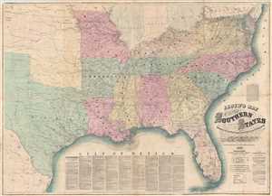
Lloyd's Map of The Southern States Showing all the Railroads, their Stations & Distances, Also The Counties, Towns, Villages, Harbors, Rivers And Forts. Compiled from the latest Government and other reliable Sources. 1861.
sold
- Digital Map Information
- Suitable for large format printing
- Full resolution TIFF file
- ICC color profile embedded
- Delivered instantly via download link
A very attractive example of J. T. Lloyd's extremely scarce railroad map of the Southern or Confederate States. Printed on a monumental scale, this map was issued in 1861 at the outset of the American Civil War and illustrates those states ... (more details)
Original mansucript trail map and journal describing the hardships of the Oregon Trail.
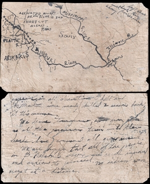
[Oregon Trail Manuscript]
sold
- Digital Map Information
- Suitable for large format printing
- DPI: 300
- File Size: 3.57 MB
- File Type: ZIP / TIFF
- ICC color profile embedded
- Delivered instantly via download link
A unique historical document, this is a c. 1848 map and journal page written by pioneers traveling on the Oregon Trail. The crudely drawn map covers from the conflux of the Missouri and Mississippi River at St. Louis to the Platte River in ... (more details)
Border confusion over new states and territories.
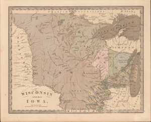
Wisconsin and Iowa.
sold
- Digital Map Information
- Suitable for large format printing
- DPI: 600
- File Size: 203.85 MB
- File Type: ZIP / TIFF
- ICC color profile embedded
- Delivered instantly via download link
This is the 1849 J. Greenleaf map of Iowa Territory (Minnesota) and Wisconsin. The map reveals early border disagreements relating to the western limits of Iowa and Wisconsin and a pre-Minnesota Territory (March 3, 1849) configuration. (more details)
A tribute to the Pacific Railroad and the conquest of the American West.
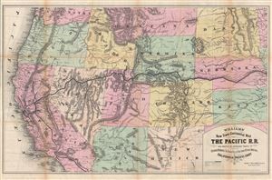
Williams' New Trans-Continental Map of The Pacific R.R. and Routes of Overland Travel to Colorado, Nebraska, The Black Hills, Utah, Idaho, Nevada, Montana, California and the Pacific Coast.
sold
- Digital Map Information
- Suitable for large format printing
- File Size: 30.27 MB
- File Type: ZIP / TIFF
- ICC color profile embedded
- Delivered instantly via download link
A scarce and exceptionally attractive first edition example of Henry Williams' 1876 map of the Pacific Railroad. Centered on the line of the Pacific Railroad as it travels westward across the continent to California, this map covers from ... (more details)
Extraordinary panorama illustrating the route of the Mormon pioneers and the westward expansion.
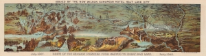
Route of the Mormon Pioneers from Nauvoo to Great Salt Lake.
sold
- Digital Map Information
- Suitable for large format printing
- Full resolution TIFF file
- ICC color profile embedded
- Delivered instantly via download link
This is a beautiful 1899 chromolithograph panoramic bird-eye view map of the 1,300-mile Mormon Trail. It is one of the finest illustrations of the Mormon migration ever published. (more details)
Free land to the 1,000,000!
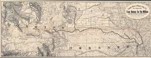
Fremont, Elkhorn and Missouri Valley R.R. and Connections, to the Free Homes for theMillion in Northwestern Nebraska and Southwestern Dakota. / The Elkhorn Valley Line to Northern Nebraska, Central Wyoming and The black Hills.
sold
- Digital Map Information
- Suitable for large format printing
- Full resolution TIFF file
- ICC color profile embedded
- Delivered instantly via download link
This is an impressive and highly detailed 1886 Rand McNally map of Wyoming, Dakota, and Nebraska issued to promoted migration to free 'government lands' in the west. It also illustrates the route of the important Fremont, Elkhorn and Missouri Valley Railroad. (more details)
Scarce Edition of a Separately Issued Folding Map of Nebraska Detailing the Union Pacific Railroad
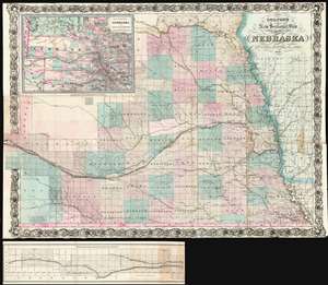
Colton's new sectional map of the state of Nebraska.
sold
- Digital Map Information
- Suitable for large format printing
- File Size: 75.22 MB
- File Type: ZIP / TIFF
- ICC color profile embedded
- Delivered instantly via download link
This is a large, scarce 1871 Colton map of Nebraska. This separately-issued, folding map details the state four years after its admission to the Union, during the population boom brought on by the opening of the prairie - both by the ongoing forcible resettlement of Native American tribes, and by the completion in 1869 of the Union Pacific Railroad. (more details)