
Kansas - Nebraska - Iowa - Missouri
'The Father of Waters again goes unvexed to the sea.'
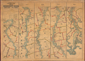
Lloyd’s Map of the Lower Mississippi River From St. Louis to the Gulf of Mexico. Compiled from Government Surveys in the Topographical Bureau...
$17,000.00
Acquire
- Digital Map Information
- Suitable for large format printing
- File Size: 104.66 MB
- File Type: ZIP / TIFF
- ICC color profile embedded
- Delivered instantly via download link
This is James T. Lloyd's engrossing 1863 large-format map of the Mississippi River, produced during the U.S. Civil War (1861 - 1865). It provides a comprehensive overview of the economically vital and strategically critical waterway, then a hotly contested theater of war vital to both the Union and the Confederacy. (more details)
Most important map of the Mississippi during the Revolutionary War.
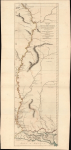
Course of the River Mississipi, from the Balise to Fort Chartres; Taken on an Expedition to the Illinois, in the latter end of the Year 1765.
$7,500.00
Acquire
- Digital Map Information
- Suitable for large format printing
- File Size: 36.6 MB
- File Type: ZIP / TIFF
- ICC color profile embedded
- Delivered instantly via download link
A scarce, important, and dramatic map of the Mississippi River Valley from the Gulf of Mexico to Fort Chartres (Illinois). This was the best map of the Mississippi to appear before the American Revolutionary War (1775 - 1783) and remained significant even after the war when it was the best demarkation of the western boundary of the United States. (more details)
Second published map of Iowa City.

Iowa City and its Environs.
$6,000.00
Acquire
- Digital Map Information
- Suitable for large format printing
- Full resolution TIFF file
- ICC color profile embedded
- Delivered instantly via download link
This rare 1854 J. H. Millar map of Iowa City - considered the second published map of the city - offers an extraordinary portrait of Iowa's first state capital during a period of rapid growth, real estate speculation, and suburban development. Twelve surrounding vignette views by celebrated Iowa artist George Henry Yewell depict churches, civic institutions, prominent residences, Clinton Street, and the State House, making this scarce map an exceptional visual record of mid-19th-century Iowa City. (more details)
Racing on the Mississippi.
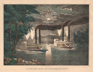
Midnight Race on the Mississippi.
$3,500.00
Acquire
- Digital Map Information
- Suitable for large format printing
- File Size: 39.32 MB
- File Type: ZIP / TIFF
- ICC color profile embedded
- Delivered instantly via download link
This is Thomas Kelly's c. 1865 large, folio hand-colored lithographic view of a nighttime steamboat race on the Mississippi River. Such races were a dangerous but popular sport in mid-19th-century America, when steamboat companies on the Mississippi and other major rivers competed for the 'fastest ride'. Some such races became famous and were recorded in many popular paintings and decorative prints by artists like Kelly, as here, and Currier and Ives. (more details)
'One of the greatest contributions ever made to American geography' - G. K. Warren
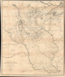
Hydrological Basin of the Upper Mississippi River From Astronomical and Barometrical Observations, Surveys, and Information.
$2,200.00
Acquire
- Digital Map Information
- Suitable for large format printing
- Full resolution TIFF file
- ICC color profile embedded
- Delivered instantly via download link
This is Joseph N. Nicollet's foundational 1843 map of the Upper Mississippi River Basin, which far surpassed all earlier maps of the area. It was the culmination of Nicollet's life's work and four surveying expeditions, which also helped launch the careers of John C. Frémont and William H. Emory, two of the greatest American explorers of the 19th century. (more details)
Grasshopper Plague of 1874.
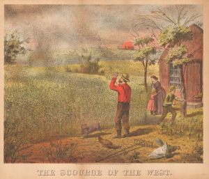
The Scourge of the West.
$1,950.00
Acquire
- Digital Map Information
- Suitable for large format printing
- DPI: 600
- File Size: 24.64 MB
- File Type: ZIP / TIFF
- ICC color profile embedded
- Delivered instantly via download link
An exceptional 1875 chromolithograph view representing one of the most horrific natural disasters in American history - the Locust Plague of 1874. This epic 1874 event, in which trillions of locusts descended from the Rocky Mountains, wiped out crops throughout the Plains States, plunging the nation into depression and leaving countless homesteaders in dire straits. (more details)
Settling the Upper Midwest.
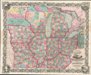
Colton's Railroad and Township Map Western States compiled from the United States Surveys. / Map of the Western States.
$1,500.00
Acquire
- Digital Map Information
- Suitable for large format printing
- File Size: 121.82 MB
- File Type: ZIP / TIFF
- ICC color profile embedded
- Delivered instantly via download link
This is a lovely, decorative, large-format 1854 pocket map of the American Midwest by Joseph H. Colton. It captures the region in the years before the U.S. Civil War and is notable for including Minnesota as a territory as well as demonstrating the rapid expansion of railroads throughout the Midwest. (more details)
Mormon Pioneers and the Westward Expansion.
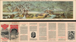
Route of the Mormon Pioneers from Nauvoo to Great Salt Lake.
$1,300.00
Acquire
- Digital Map Information
- Suitable for large format printing
- File Size: 43.98 MB
- File Type: ZIP / TIFF
- ICC color profile embedded
- Delivered instantly via download link
This is a beautiful 1899 chromolithograph panoramic bird-eye view map of the 1,300-mile Mormon Trail. It is one of the finest illustrations of the Mormon migration published - here in its smaller Wilson Hotel edition. (more details)
Early U.S. Settlement if Wisconsin Territory. Carver's Grant.
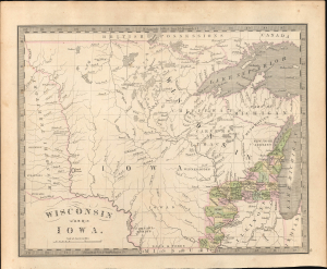
Wisconsin and Iowa.
$1,200.00
Acquire
- Digital Map Information
- Suitable for large format printing
- Full resolution TIFF file
- ICC color profile embedded
- Delivered instantly via download link
This is the rare 1842 J. Greenleaf first-state map of Wisconsin and Iowa Territories, incorporating modern-day Minnesota. It illustrates the early days of U.S. settlement in the region, which, within a few years, penetrated westward as far as the Missouri. It is also one of the few maps to illustrate Carver's Tract, a notoriously fraudulent claim used to support U.S. over American Indian claims to the region. (more details)
Among the first elevated electric trains.
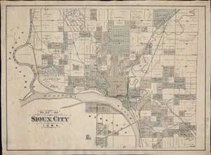
Plat of Sioux City Iowa.
$1,200.00
Acquire
- Digital Map Information
- Suitable for large format printing
- File Size: 58.22 MB
- File Type: ZIP / TIFF
- ICC color profile embedded
- Delivered instantly via download link
This is the only known example of an unrecorded c. 1893 separate-issue cadastral map of Sioux City, Iowa, capturing the city at the peak of its explosive late 19th century growth. The map illustrates both developed and undeveloped lands, as well as ambitious public works projects, including impressive parks and the Elevated Railway - one of the first such constructed. (more details)
Detailing the transportation network of the Upper Midwest.
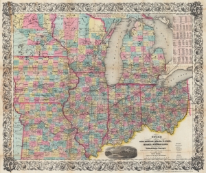
Guide Through Ohio, Michigan, Indiana, Illinois, Missouri, Wisconsin, and Iowa. Showing the Township lines of the United States Surveys, Locations of Cities, Towns, Villages, Post Hamlets, Canals, Rail and Stage Roads.
$1,200.00
Acquire
- Digital Map Information
- Suitable for large format printing
- File Size: 46.6 MB
- File Type: ZIP / TIFF
- ICC color profile embedded
- Delivered instantly via download link
This is an 1855 John Calvin Smith and John H. Colton map of Ohio, Michigan, Indiana, Illinois, Missouri, Wisconsin, and Iowa, along with part of Minnesota. The map captures a pivotal moment as mass emigration, developing industries, and displaced indigenous people transformed regional social, economic, and political spheres. (more details)
Pre-war anthill of abolitionist vs pro-slavery violence.
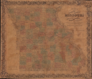
Colton's New Sectional Map of the State of Missouri. Compiled from United States Surveys and other Authentic Sources.
$1,200.00
Acquire
- Digital Map Information
- Suitable for large format printing
- File Size: 200.37 MB
- File Type: ZIP / TIFF
- ICC color profile embedded
- Delivered instantly via download link
This is an 1861 J. H. Colton map of Missouri at the beginning of the American Civil War (1861 - 1865). The map captures Missouri during a period when it was a violent microcosm of the greater abolition/pro-slavery divide. Although officially a slave state, Missouri harbored a large population of absolutists on both sides of the debate - and more from each side flooded in from 1850 on - turning it into a hotbed of violence and unrest that did not relent until long after the Civil War. (more details)
First English exploraiton fo the Upper Mississippi.
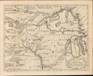
Karte von Hauptman Carvers Reise in den innern Shielen von Nord Amerika.
$1,100.00
Acquire
- Digital Map Information
- Suitable for large format printing
- File Size: 20.22 MB
- File Type: ZIP / TIFF
- ICC color profile embedded
- Delivered instantly via download link
This is the 1780 German edition of Jonathan Carver's map illustrating his pioneering travels in the Upper Mississippi Valley, including parts of modern-day Wisconsin, Minnesota, and Michigan. Carver was the first Englishman to penetrate this region and map it in any detail, making this a significant piece, replete with novel information and fascinating annotations, offering some of the earliest insights into life and travel in this, at the time, near-impenetrable frontier. (more details)
Louisiana on the cusp of the Louisiana Purchase.
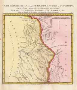
Carte Reduite de la Haute-Louisiane et Pays Circonvoisins, pour etre adaptee a l'ouvrage intitule Vue de la Colonie Espagnole du Mississipi, et c.
$1,000.00
Acquire
- Digital Map Information
- Suitable for large format printing
- DPI: 600
- File Size: 3.93 MB
- File Type: ZIP / TIFF
- ICC color profile embedded
- Delivered instantly via download link
This is Alexandre's Blondeau's exceptional 1803 map of Spanish-administered upper Louisiana, issued for Pierre-Louis Berquin Duvallon's travel narrative, Vue de la Colonie Espagnole due Mississipi. It is one of the best maps to capture the Upper Mississippi Valley on the cusp of the Louisiana Purchase. The map moreover underscores the significance of the Mississippi River as a trade artery between the Great Lakes, and hence the Atlantic, and the Gulf of Mexico. (more details)
Kansas City's moment of most expansive growth.
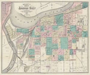
Wright's Map of Kansas City.
$950.00
Acquire
- Digital Map Information
- Suitable for large format printing
- Full resolution TIFF file
- ICC color profile embedded
- Delivered instantly via download link
This is a rare 1882 Carl Gothe de Grote and Harry T. Wright city map of Kansas City, Missouri - published in Kansas City! The map captures Kansas City in its moment of most explosive growth, illustrating the engines of said growth, including urban development plans, railroads, and the Kansas City Stockyards. (more details)
St. Louis's most attractive neighborhood.
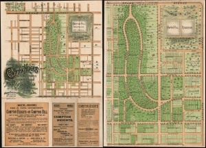
Plan of Compton Heights The Most Attractive Residence Subdivision in the City.
$900.00
Acquire
- Digital Map Information
- Suitable for large format printing
- File Size: 48.75 MB
- File Type: ZIP / TIFF
- ICC color profile embedded
- Delivered instantly via download link
A rare c. 1895 chromolithograph view promotional real estate map of Compton Heights, St. Louis, Missouri. Compton Heights is one of the first planned communities int the United States and one of the most historic and beautiful neighborhoods in St. Louis. The promotional consists of two maps, printed back-to-back on a single sheet. The title side features a smaller map of Compton Heights covering from Tower Grover Park to the Electric Railroad on California Ave, and from Halliday Ave to Layfette Ave. Below the map, there are advertising promoting the virtues of Compton Heights and the real estate agents, Boeck, Rutledge, and Horton, from whom the properties could be acquired. The verso features a much large map, identifying individual lots as well as existing properties and the property owners. (more details)
Visit the American West via Union Pacific!
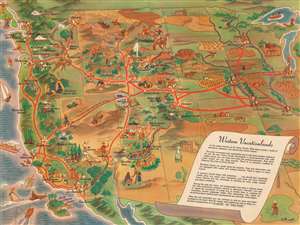
Western Vacationlands.
$750.00
Acquire
- Digital Map Information
- Suitable for large format printing
- Full resolution TIFF file
- ICC color profile embedded
- Delivered instantly via download link
This is a charming 1946 William Willmarth pictorial tourist map of the western United States promoting Union Pacific's western routes. Coverage embraces the western United States from the Mississippi River to Washington, Oregon, and California. Vignettes highlight cities, towns, landmarks, and natural sites throughout the American West. National parks benefit from this treatment, including Yellowstone, the Grand Canyon, Bryce Canyon, Rocky Mountain National Park, Sequoia, and Yosemite. Red lines trace Union Pacific's network, and major cities, including Omaha, Salt Lake City, Kansas City, San Francisco, and Los Angeles, are marked by cityscapes or other buildings. (more details)
A booming economy and an extensive railroad network.
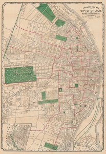
Shewey's New Map of the City of St. Louis.
$650.00
Acquire
- Digital Map Information
- Suitable for large format printing
- Full resolution TIFF file
- ICC color profile embedded
- Delivered instantly via download link
Detailing a city undergoing massive population growth, this is the 1891 Arista Shewey city plan or map of St. Louis, Missouri. By the turn of the 20th century, St. Louis emerged as the fourth-largest city in the United States with a booming economy and an extensive railroad network. (more details)
End of the Era of Steamboat Racing.
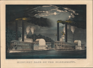
Midnight Race on the Mississippi.
$650.00
Acquire
- Digital Map Information
- Suitable for large format printing
- File Size: 11.67 MB
- File Type: ZIP / TIFF
- ICC color profile embedded
- Delivered instantly via download link
A gorgeous 1872 Currier and Ives hand-colored lithograph of steamboats racing on the Mississippi River. By the time of its publication, steamboat racing and river steamboats were becoming less popular, imbuing the piece with a touch of nostalgia. (more details)
Early settlements and Nebraska frontier landmarks.
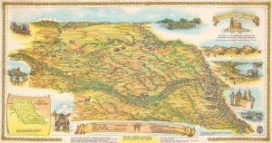
This is Walter F. Clarke's 1954 pictorial map of the Nebraska Territory created to celebrate the joint centennial of Nebraska Territory and the city of Omaha. The map illustrates Nebraska as it appeared in 1854, with coverage extending well outside modern-day Nebraska's borders. It reaches north to the Black Hills in modern-day South Dakota and west to Fort Laramie in modern-day Wyoming. (more details)
10 foot blueprint of Lincoln including the University of Nebraska campus!
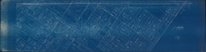
Lincoln, Nebr.
$550.00
Acquire
- Digital Map Information
- Suitable for large format printing
- File Size: 60.76 MB
- File Type: ZIP / TIFF
- ICC color profile embedded
- Delivered instantly via download link
Measuring just short of ten feet, this is an impressive 1929 Omaha, Lincoln and Beatrice Railway cyanotype or blueprint map of part of Lincoln, Nebraska, including all of the modern-day City Campus of the University of Nebraska-Lincoln. (more details)
An early, important map of the Kansas and Nebraska Territories.
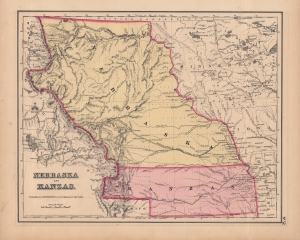
Nebraska and Kanzas.
$500.00
Acquire
- Digital Map Information
- Suitable for large format printing
- File Size: 10.27 MB
- File Type: ZIP / TIFF
- ICC color profile embedded
- Delivered instantly via download link
A beautiful example of Colton's 1857 map of Nebraska and Kansas, which appeared in the first edition of his General Atlas. This is among the rarest and most desirable Colton atlas maps. Aside from the territories named in the title, it includes portions of the future states of Colorado, Montana, Wyoming, North Dakota, and South Dakota. (more details)
Union Pacific boomtimes in Iowa.
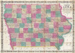
Colton's Sectional Map of the State of Iowa. Compiled from the U.S. Surveys and other Authentic Sources. Exhibiting the Sections Fractional Sections, Counties, Cities, Towns, Villages, Post Offices, Railroads and other Internal Improvements.
$500.00
Acquire
- Digital Map Information
- Suitable for large format printing
- File Size: 34.75 MB
- File Type: ZIP / TIFF
- ICC color profile embedded
- Delivered instantly via download link
This is an 1866 G. W. and C. B. Colton separate issue large format pocket map of Iowa - issued at during a period of explosive economic and population growth for Iowa. The completion of the Union Pacific Railroad, which departed from Omaha City, Nebraska, transformed Iowa into a transportation and economic hub, at the center of a trans-continental railroad network. The map depicts all of Iowa from Dakota and Nebraska to Wisconsin and Illinois and from Minnesota to Missouri. Highly detailed, myriad cities, towns, and villages are labeled throughout, including county seats and Des Moines, the state capital. Each county is labeled and shaded for easy differentiation. The map is further divided sectionally into land districts as surveyed by the United States Land Office. Numerous railroads crisscross the state, such as the Mississippi and Missouri Railroad and the Keokuk, Des Moines, and Minnesota Railroad. The Union Pacific Railroad is illustrated leaving Omaha City, Nebraska, which lies across the Missouri River from Iowa. Several roads are also depicted, such as the military road from Sioux City to St. Paul. Rivers and creeks snake their way across the state, some of which empty into the various lakes which dot the landscape (more details)
Blueprint city plan of Lincoln.
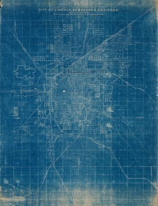
City of Lincoln, Nebraska and Environs.
$500.00
Acquire
- Digital Map Information
- Suitable for large format printing
- File Size: 83.24 MB
- File Type: ZIP / TIFF
- ICC color profile embedded
- Delivered instantly via download link
This is a 1921 Chicago, Burlington and Quincy Railroad city map of Lincoln, Nebraska. The map was issued in the heady days following World War I (1914 - 1918) and bustled with the broader currents of the Roaring Twenties. During this period Lincoln's downtown expanded with a mix of new infrastructure, businesses, and cultural institutions, reflecting a vibrant urban scene. (more details)
Early Days of Interstate 80.
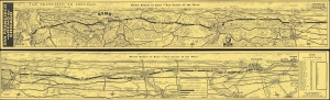
San Francisco via Reno to Chicago / Direct Routes to Reno - 'Fun Center of the West'.
$450.00
Acquire
A whimsical two-sided pictorial strip map of highway routes between San Francisco and Chicago drawn by Gerald Eddy in 1961 for Harold's Club casino in Reno. Among other features, it is notable for showcasing Interstate 80, only designated five years prior. It is part of series of similar strip map issued by Eddy for Herod's Club, but by far the rarest. (more details)
Highlights the Oregon Trail!
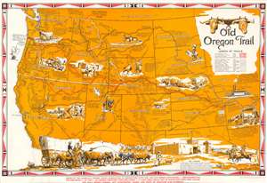
Old Oregon Trail.
$375.00
Acquire
- Digital Map Information
- Suitable for large format printing
- File Size: 22.26 MB
- File Type: ZIP / TIFF
- ICC color profile embedded
- Delivered instantly via download link
This is a 1948 Irvin Shope pictorial map of the western United States celebrating the Oregon Trail. Coverage embraces the western United States from roughly the confluence of the Missouri and Mississippi Rivers to the Pacific seaboard. The Oregon Trail, covering some 2,170 miles, was an important artery of trade and westward expansion in the mid to late 19th century - used by more than 400,000 settlers, farmers, miners, ranchers, and business owners and their families. (more details)
City Beautiful Movement meets the 'Heart of America.'
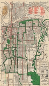
Official guide and map for greater Kansas City...
$375.00
Acquire
- Digital Map Information
- Suitable for large format printing
- Full resolution TIFF file
- ICC color profile embedded
- Delivered instantly via download link
A c. 1920 folding map of Kansas City, Missouri published by the Gallup Map and Supply Company. It shows the city near its population peak, when a series of impressive infrastructure and public works projects reshaped the city. (more details)
Contesting the Frontier during the U.S. Civil War.
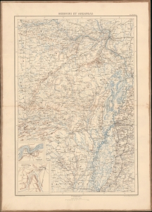
Missouri et Arkansas.
$375.00
Acquire
- Digital Map Information
- Suitable for large format printing
- File Size: 21.25 MB
- File Type: ZIP / TIFF
- ICC color profile embedded
- Delivered instantly via download link
This map of Missouri and Arkansas during the U.S. Civil War was prepared by Ernest Dumas-Vorzet for the scarce 1890 atlas volume of Philippe d'Orléans' Histoire de la Guerre Civile en Amérique. (more details)
Early Battles Point towards the Future Course of the Civil War.
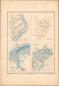
Belmont. / Pea Ridge. / Hampton Roads. / Ile No. 10 et ses abords.
$350.00
Acquire
- Digital Map Information
- Suitable for large format printing
- File Size: 9.1 MB
- File Type: ZIP / TIFF
- ICC color profile embedded
- Delivered instantly via download link
This is Ernest Dumas-Vorzet's 1890 map of the battles of Belmont, Pea Ridge, and Island No. 10, and the naval battle of Hampton Roads, prepared for his Histoire de la Guerre Civile en Amérique. (more details)
Gateway to the West at the height of the Gold Rush.
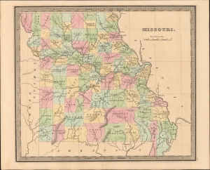
Map of the State of Missouri.
$350.00
Acquire
- Digital Map Information
- Suitable for large format printing
- DPI: 600
- File Size: 17.81 MB
- File Type: ZIP / TIFF
- ICC color profile embedded
- Delivered instantly via download link
This is Jeremiah Greenleaf's 1849 map of Missouri, illustrating the state in its heyday as the primary gateway to the west for 49ers following the California Gold Rush (more details)
'You'd Like Living in Kansas'.
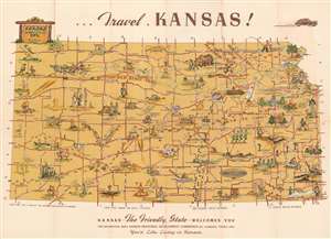
Kansas the Friendly State Welcomes You.
$350.00
Acquire
- Digital Map Information
- Suitable for large format printing
- Full resolution TIFF file
- ICC color profile embedded
- Delivered instantly via download link
This is a c. 1948 F. Richard pictorial tourist map of Kansas. Pictorial vignettes highlight sites across the state along with historic events and monuments. Footprints trace the Mormon Trail and the Santa Fe Trail, while horse hoofprints mark the Oregon Trail and steer hoofprints mark the Chisholm Trail. A stagecoach flies down the Butterfield Stage Trail chased by an angry Native American. President Eisenhower's home is illustrated and labeled, as are historic churches, universities, and several factories. Boeing's factory in Wichita is highlighted with a cartoon version of a B-29. Illustrations of graduates in their regalia mark the state's three teachers' colleges. Other comical vignettes mark the U.S. Migration Waterfowl Refuge, Leavenworth Federal Penitentiary, and the Knute Rockne Memorial. (more details)
One of the few specific maps to illustrate Wyoming as part of Idaho Territory.
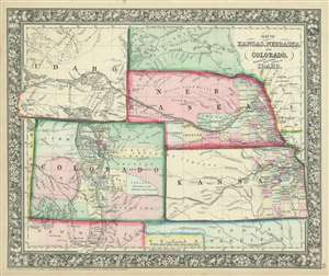
Map of Kansas, Nebraska and Colorado, Showing also the Eastern Portion of Idaho.
$350.00
Acquire
- Digital Map Information
- Suitable for large format printing
- File Size: 10.79 MB
- File Type: ZIP / TIFF
- ICC color profile embedded
- Delivered instantly via download link
A very ephemeral and surprisingly scarce 1863 Samuel Augustus Mitchell, Jr. map of Colorado, Nebraska, Kansas, and that part of Idaho Territory which is today Wyoming. The map depicts the region from the Utah-Colorado border to Iowa and Missouri and from the Big Horn Mountains to northern Texas and Santa Fe, New Mexico. This map holds the distinction of being one of the few to include Wyoming as Idaho Territory, which was formed in March 1863. The iteration of Wyoming/Idaho as seen here is exceptionally ephemeral and present only in this edition (1863), with subsequent editions (1864 - 1868) attaching Wyoming to Dakota (See below). Apart from this rare iteration of Idaho Territory / Wyoming, other intriguing aspects of this map include the fact that only about one half of Nebraska and the eastern third of Kansas are illustrated as having been divided into counties, while Colorado only has fifteen counties that vary wildly in relative size. Myriad towns and villages are labeled, along with the Pony Express route and proposed routes for the transcontinental railroad. (more details)