
Texas - Oklahoma
Progenitor of Texas Oil Boom.
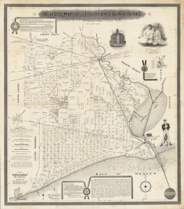
Revised map of Jefferson County, Texas. Showing Land Surveys, Railroads and Water Ways.
$7,500.00
Acquire
- Digital Map Information
- Suitable for large format printing
- File Size: 1362.75 MB
- File Type: ZIP / TIFF
- ICC color profile embedded
- Delivered instantly via download link
This is a spectacular 1898 promotional and cadastral map of Jefferson County, Texas, prepared by Pattillo Higgins, father of the Texas Oil Boom. Three years after this map's production, Higgins and his partners struck massive oil reserves at Spindletop, just outside Beaumont. But at this point, Higgins was only an ambitious self-taught geologist with an unceasing conviction in his own abilities and that of his home county, which is apparent here. (more details)
French recognition of the Republic of Texas.
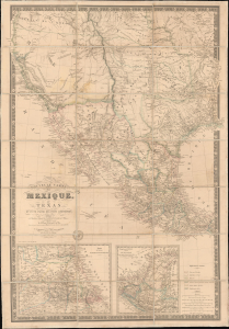
Nouvelle Carte du Mexique, du Texas et d'une partie des états limitrophes...
$6,000.00
Acquire
- Digital Map Information
- Suitable for large format printing
- Full resolution TIFF file
- ICC color profile embedded
- Delivered instantly via download link
This is the 1845 edition of Adrien-Hubert Brué's seminal map of Mexico and the Republic of Texas - issued at the peak of the Mexican-American War (1846 - 1848). Wheat rightly hails this as a 'most important map.' Its significance is as expansive as its coverage, ranging from up-to-date cartography regarding the Republic of Texas (and the French recognition thereof), to some of the first printed mappings of the cartography of Jedediah Smith, to one of the earliest uses of the term 'Arizona' on a printed map. (more details)
One of the first maps of the Republic of Texas Description of Texan Revolution.
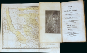
Trip to the West and Texas.
$6,000.00
Acquire
- Digital Map Information
- Suitable for large format printing
- Full resolution TIFF file
- ICC color profile embedded
- Delivered instantly via download link
A most significant book and map of Texas, being the 1836 second 'and better' edition of Amos Andrew Parker's Trip to the West and Texas.. This work is considered essential Texana, offering not only one of the earliest maps of the Republic of Texas, but also one of the first illustrations of the Lone Star flag of Texas, and one of the best early descriptions of the Texan Revolution. The map is significant, revealing early land grants throughout the new republic. It also bears an interesting manuscript dedication referencing the Mexican Revolution (1910 - 1920). (more details)
Only edition of Mitchell's Wall Map to include the Republic of Texas!
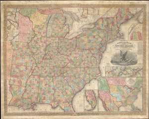
Mitchell's Reference and Distance Map of the United States.
$6,000.00
Acquire
- Digital Map Information
- Suitable for large format printing
- DPI: 600
- File Size: 308.25 MB
- File Type: ZIP / TIFF
- ICC color profile embedded
- Delivered instantly via download link
This is a rare 1844 edition of S. A. Mitchell and J. H. Young's important large-scale wall map of the United States and the only edition to include both the short-lived Republic of Texas and the even more ephemeral Florida Leigh Read County. (more details)
Unique Internal planning wall map recording the early days of the Texas Highway System.
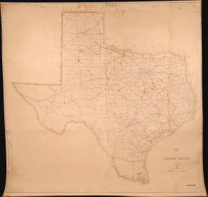
Map of the Highway System o Texas 1932.
$4,500.00
Acquire
- Digital Map Information
- Suitable for large format printing
- File Size: 5.75 MB
- File Type: ZIP / TIFF
- ICC color profile embedded
- Delivered instantly via download link
This is a massive 1932 wall map of the Texas Highway System drafted by Robert Martin Stene - featuring manuscript updates suggesting that the map was issued for internal use only. It captures a critical early phase in the development of the highway system as it transitioned old dirt and macadamized roads to concrete. It is the largest planning phase highway map of Texas known to survive. (more details)
Map of the United States just prior to the Mexican American War. Shows the Republic of Texas.
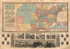
Ensign's Travellers' Guide, and Map of the United States, containing the Roads, Distances, Steam Boat and Canal Routes etc.
$4,000.00
Acquire
- Digital Map Information
- Suitable for large format printing
- Full resolution TIFF file
- ICC color profile embedded
- Delivered instantly via download link
An extremely scarce variant on Ensign and Thayer's series of highly decorative United States wall maps. This map, dated 1845, predates the annexation of Texas and the Mexican-American War by one year. It illustrates the Republic of Texas according to its early proclaimed borders, names Austin's colony, and identifies Austin as the capital. In addition, the map features a large Missouri Territory. Small mountains and rivers charts on the Bulla / Darton model appear in the upper left quadrant. The bottom of the map features a large panorama of the Signing of the Declaration of Independence as well as various scenes from American History. To either side are illustrations of Metacom, the Pokunoket Sachem called 'King Philip' and James Polk, who had just been elected 11th president of the United Sates. Portraits of other former presidents fan out on either side of the panorama. (more details)
Presaging the Republic of Texas.
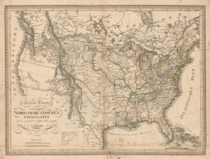
General Charte von den vereinigten Nordamericanischen Freistaaten nach den vorzüglichsten Hülfsmitteln entworfen.
$3,500.00
Acquire
- Digital Map Information
- Suitable for large format printing
- Full resolution TIFF file
- ICC color profile embedded
- Delivered instantly via download link
This is a rare 1821 C. F. Weiland map of the United States, including the ephemeral Mexican state of Texas. The map is graphically suggestive of either an independent Texas or a Texas as part of the United States, thus presaging the Texan Revolution, the borders claimed by the Republic of Texas, and the Mexican-American War. It illustrates Texas's brief period of semi-provincehood following Mexican Independence but before the 1824 ratification of the Mexican Constitution, which merged Texas with Coahuila. This is thus one of the first maps, if not the first, to present a modern, recognizable Texas. This is also one of the few maps to name the ephemeral Bonapartist colony of Champ d'Asile (Champ d'Asyle; 1818 - 1819), located in South Texas on the Trinity River. (more details)
Republic of Texas at its height.
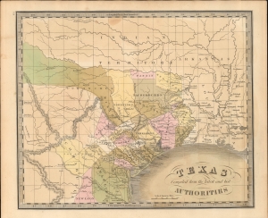
Texas Compiled from the latest and best Authorities.
$3,500.00
Acquire
- Digital Map Information
- Suitable for large format printing
- File Size: 7.52 MB
- File Type: ZIP / TIFF
- ICC color profile embedded
- Delivered instantly via download link
This is Jeremiah Greenleaf's 1842 map of the Republic of Texas. This highly sought-after map is one of the best depictions of the Republic produced during its brief existence. It is notable for incorporating both early counties and Empresario land grants. (more details)
Matched pair of beautiful, large maps of the Americas.
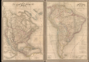
Amérique du Nord. / Amérique du Sud.
$3,500.00
Acquire
- Digital Map Information
- Suitable for large format printing
- Full resolution TIFF file
- ICC color profile embedded
- Delivered instantly via download link
This is a beautiful 1851 pair of A. H. Dufour large-format folding maps of North America and South America, presented together in an original slipcase. The North America map captures an ephemeral look at the Transmississippi in the year after the Treaty of Guadalupe Hidalgo - including a most unusual mapping of the borders of Texas.The South America map shows the political divisions just prior to the Platine War, between the Empire of Brazil and the Argentine Confederation. (more details)
Patriotic wall map of the United States illustrating the Republic of Texas.
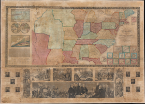
Phelps and Ensign's Travellers' Guide, and Map of the United States, containing the Roads, Distances, Steam Boat and Canal Routes etc.
$3,000.00
Acquire
- Digital Map Information
- Suitable for large format printing
- DPI: 600
- File Size: 161.68 MB
- File Type: ZIP / TIFF
- ICC color profile embedded
- Delivered instantly via download link
This is the spectacular 1841 edition of Phelps and Ensign's pictorial wall map of the United States and the Republic of Texas. The Republic of Texas appears in one of its smaller configurations, with the printed border reflecting not the vast tracts claimed by the Republic, but rather those lands it effectively controlled, with a border at the Nueces River. (more details)
Railroads in Reconstruction-Era Texas.

Colonists' and Emigrants' Route to Texas.
$3,000.00
Acquire
- Digital Map Information
- Suitable for large format printing
- Full resolution TIFF file
- ICC color profile embedded
- Delivered instantly via download link
A striking 1877 Rand McNally pictorial map of Texas issued to promote the International-Great Northern Railroad (IGNRR). The map follows in the wake of the post-Civil War Reconstruction Era (1863 - Mar 31, 1877) and illustrates Texas's efforts to promote emigration. The generally successful drive redefined Texas's cultural landscape and helped stabilize the state's foundering post-war economy. (more details)
Cold War, Civil Rights, Anti-Communism.
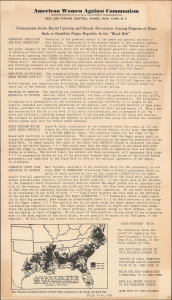
Communists Incite Racial Uprising and Bloody Revolution Among Negroes of Dixie / Seek to Establish Negro Republic In the 'Black Belt.'
$2,000.00
Acquire
- Digital Map Information
- Suitable for large format printing
- File Size: 6.35 MB
- File Type: ZIP / TIFF
- ICC color profile embedded
- Delivered instantly via download link
This is the only known example of a c. 1940 anti-Communist persuasive broadsheet and map of the U.S. South published by the organization American Women Against Communism (A.W.A.C.). The sheet details and denounces a supposed international Communist plot to create a 'Negro Republic' in the 'Black Belt' of the South. (more details)
Texas Question and the 1844 Election.
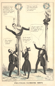
Political Climbing Boys.
$1,750.00
Acquire
- Digital Map Information
- Suitable for large format printing
- Full resolution TIFF file
- ICC color profile embedded
- Delivered instantly via download link
An extremely rare 1844 H. Bouholzer (Bucholear) editorial cartoon satirizing the fraught 1844 presidential election. It is part of a series of ephemeral political broadsides presented by Bouholzer and others over that election's central issue: the 'Texas Question,' or whether or not to support annexation. (more details)
Includes illustrations of The Alamo and San Fernando Catholic Church.
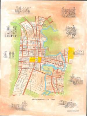
This is Jim Guimarin and Scott MacEwen's original manuscript artwork for their c. 1985 pictorial map of San Antonio, Texas. Depicting the city as it appeared in 1855, the map breaks down individual lots, labeling each with the landowner's name - evidence of the the mapmakers' meticulous scholarship. The Main Plaza, Military Plaza, and Alamo Plaza are highlighted in yellow. San Fernando Catholic Church, situated between the Military Plaza and the Main Plaza, is illustrated and labeled. The Governor's Palace, female Catholic Ursuline Convent, and the Alamo Market House are labeled as well. lustrations of The Alamo, San Fernando Catholic Church, soldiers, lawmen, and ranchers encircle the central map. (more details)
Scamming New Yorkers over land in Texas.
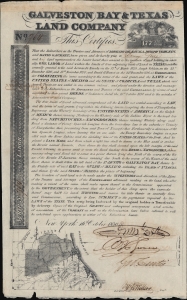
Galveston Bay and Texas Land Company.
$1,300.00
Acquire
- Digital Map Information
- Suitable for large format printing
- Full resolution TIFF file
- ICC color profile embedded
- Delivered instantly via download link
This is an 1830 'scrip' land certificate issued by the Galveston Bay and Texas Land Company, incorporating one of the earliest original regional maps of Texas. Scrip such as this, issued to New York abolitionist Barney Corse, was sold with the promise that the holder would be able to gain title to Texas land, but was in reality an elaborate fraud. The script is signed in manuscript by the company's trustees and the secretary. (more details)
Early Glimpses of Mexico, California and the Gulf Coast.
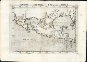
Nueva Hispania Tabula Nova.
$1,250.00
Acquire
- Digital Map Information
- Suitable for large format printing
- Full resolution TIFF file
- ICC color profile embedded
- Delivered instantly via download link
This is Girolamo Ruscelli's 1561 Nueva Hispania Tabula Nova, an early and influential map of what would become Mexico, California, Texas, and Florida. Ruscelli's work is an enlarged and improved version of the 1548 map of the same region by fellow Venetian Giacomo Gastaldi. Apart from the Gastaldi, Ruscelli's map is the earliest to focus so closely on the southern parts of what would become the United States and is one of the earliest acquirable maps to reflect Spanish exploration and colonization in the Americas. Overall, along with the map covering the East Coast north of Florida, this is among the earliest maps to focus on North America. (more details)
After Guadalupe Hidalgo, before the Compromise.
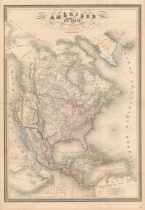
Amérique du Nord par A. H. Dufour...
$1,200.00
Acquire
- Digital Map Information
- Suitable for large format printing
- DPI: 600
- File Size: 144.18 MB
- File Type: ZIP / TIFF
- ICC color profile embedded
- Delivered instantly via download link
A fine example of A. H. Dufour's 1849 map of North America, including Texas with ambitious boundaries. The map offers an interesting and ephemeral look at the Transmississippi in the year after the Treaty of Guadalupe Hidalgo, but before the changes wrought by the Compromise of 1850, the Gold Rush, and in the same year, the statehood of California. (more details)
Dorn's first map.

A Map and History of the Military Reservation of Fort Sill Oklahoma now known as the Field Artillery School showing Topographic Features Inhabitants Surrounding Territory Flora and Fauna and Characteristics as they Truly are and should be from Ancient Times to those of Today.
$1,100.00
Acquire
- Digital Map Information
- Suitable for large format printing
- File Size: 58.03 MB
- File Type: ZIP / TIFF
- ICC color profile embedded
- Delivered instantly via download link
This 1931 pictorial map of Fort Sill, Oklahoma, is Frank Dorn's earliest known map. Embracing Fort Sill and the surrounding area, Dorn's synthesis of comic pictorial cartography, history, and vignettes of day-to-day life offer a broad picture of the military experience on base. Dorn is most famous for his Map and History of Peiping, which achieved wide acclaim and distribution. His other maps, all depicting military bases where he was stationed, including this his first map, were issued in much lower quantities and are all extremely rare. (more details)
One of the Earliest Specific Maps of Mexico.
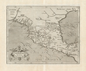
Hispania Nova.
$1,000.00
Acquire
- Digital Map Information
- Suitable for large format printing
- DPI: 600
- File Size: 19.23 MB
- File Type: ZIP / TIFF
- ICC color profile embedded
- Delivered instantly via download link
This is Cornelis Wytfliet's 1597 map of Mexico, one of the first maps of the region overall and the first to appear in an atlas dedicated to the Americas. (more details)
War and Privateering in the West Indies.
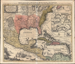
Mappa Geographica Regionem Mexicanam et Floridam Terrasque adjacentes, ut et Anteriores Americae Insulas, Cursus itidem et Reditus Navigantium versus flumem Missisipi et alias Colonias ob oculos ponens cura et sumtibus.
$1,000.00
Acquire
- Digital Map Information
- Suitable for large format printing
- File Size: 28.51 MB
- File Type: ZIP / TIFF
- ICC color profile embedded
- Delivered instantly via download link
An old-color example of Mattheus Seutter's c. 1740 map of North America below the Great Lakes, including Mexico and the Caribbean. It reflects improvements in European cartography of the New World in the late 17th and early 18th centuries, as well as the ongoing competition between colonial empires, namely the contemporaneous War of Jenkins' Ear (1739-1748). (more details)
Texas on the eve of Statehood.
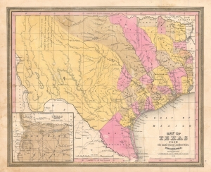
Map of Texas from the most recent authorities.
$950.00
Acquire
- Digital Map Information
- Suitable for large format printing
- DPI: 600
- File Size: 12.43 MB
- File Type: ZIP / TIFF
- ICC color profile embedded
- Delivered instantly via download link
A rare 1845 / 1846 example of the C. S. Williams / J. H. Young / S. A. Mitchell map of Texas, published in the final days of the Republic of Texas just as Texas was preparing to join the United States. Coverage includes Texas at its fullest extent, reaching from Santa Fe and the Rio Grande del Norte to the Sabin River and extending as far north as the Arkansas River (plus a stovepipe encompassing the Green Mountains not fully illustrated). Northwestern Texas is incorporated via an inset in the lower left. (more details)
Buy your books from Hemphill's!
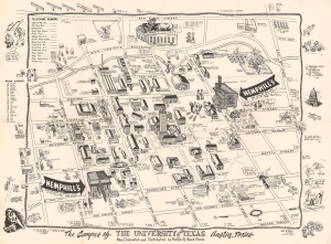
The Campus of the University of Texas.
$950.00
Acquire
- Digital Map Information
- Suitable for large format printing
- File Size: 11.26 MB
- File Type: ZIP / TIFF
- ICC color profile embedded
- Delivered instantly via download link
This is a c. 1945 Hemphill Book Stores humorous pictorial map of the University of Texas, Austin. (more details)
Stunning railroad broadside promoting emigration to Texas.
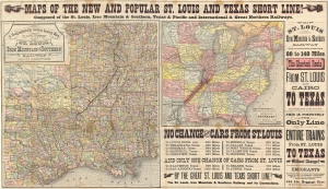
Maps of the New and Popular St. Louis and Texas Short Line!
$900.00
Acquire
- Digital Map Information
- Suitable for large format printing
- File Size: 54.88 MB
- File Type: ZIP / TIFF
- ICC color profile embedded
- Delivered instantly via download link
A striking 1878 promotional map broadsheet issued to promote travel on the St. Louis and Texas Short Line. (more details)
One of the few railroads that received a federal charter.
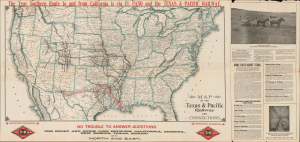
Map of the Texas and Pacific Railway and Connections. / The Texas and Pacific Railway The Short Line from Texas, Mexico and California to St. Louis, Memphis and All Points North and East. / The Texas and Pacific Railway The Direct Through Line from California, Colorado, and the West to Shreveport, New Orleans, Memphis and All Points in the Southeast.
$850.00
Acquire
- Digital Map Information
- Suitable for large format printing
- DPI: 600
- File Size: 72.4 MB
- File Type: ZIP / TIFF
- ICC color profile embedded
- Delivered instantly via download link
This is a 1911 Woodward and Tiernan railroad map of the United States illustrate the routes of the Texas and Pacific Railway, one of the few railroads established by federal charter. The Texas and Pacific Railway was a Congressional attempt at reviving a southern transcontinental railroad, only two years after the first transcontinental railroad was finished. The route of the Texas and Pacific is immediately identifiable in red, and the extensive U.S. railroad network is also illustrated. (more details)
Shifting Borders in North America.
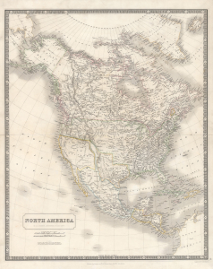
North America.
$750.00
Acquire
- Digital Map Information
- Suitable for large format printing
- DPI: 600
- File Size: 49.57 MB
- File Type: ZIP / TIFF
- ICC color profile embedded
- Delivered instantly via download link
An illuminating 1843 map of North America by Alexander Keith Johnston that was published in the first edition of his important National Atlas. The most noticeable features of the map include an enlarged Republic of Texas, a British-friendly interpretation of the Pacific Northwest, and other geographic oddities in the American West. (more details)
Texas and California before the Mexican American War.
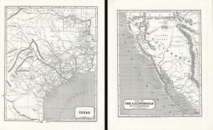
Texas. / Map of The Californias by T.J. Farnham.
$750.00
Acquire
- Digital Map Information
- Suitable for large format printing
- DPI: 600
- File Size: 51.82 MB
- File Type: ZIP / TIFF
- ICC color profile embedded
- Delivered instantly via download link
Maps of the Republic of Texas and Upper California in 1845, issued for Sidney E. Morse's Cerographic Atlas. The maps are printed back-to-back, but collectively represent the region in the year prior to the outbreak of the Mexican-American War (1846 - 1848), in the final days of the Republic of Texas (1836 - 1846) and Mexican California, considered the first atlas map of Upper California. (more details)
On the cusp of great change.
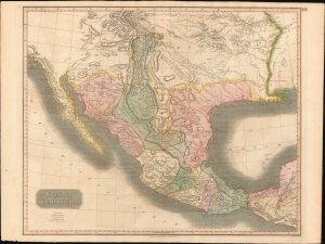
Spanish North America.
$650.00
Acquire
- Digital Map Information
- Suitable for large format printing
- Full resolution TIFF file
- ICC color profile embedded
- Delivered instantly via download link
This beautiful 1814 map is most likely the most important large format English atlas map of the American Southwest to be produced in the first quarter of the 19th century. It captures the region on the cusp of great change. At the time of issue Mexico was embroiled in the Mexican War of Independence (1810 - 1821). After the war, the newly independent Mexican Republic, eager to develop its vast northern provinces of Texas and New Mexico, initiated the 'Empressario' system, which opened Texas foreign settlement. The 'Empressario' grants gave rise to a large and industrious Anglo population in Texas and set the stage for the 1836 Texan Revolution and the subsequent Mexican-American War (1846 - 1848). (more details)
Der Freistaat.
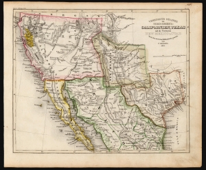
Vereinigte Staaten von Nord-America: Californien, Texas und die Territorien New Mexico u. Utah.
sold
- Digital Map Information
- Suitable for large format printing
- DPI: 600
- File Size: 15.96 MB
- File Type: ZIP / TIFF
- ICC color profile embedded
- Delivered instantly via download link
An uncommon and under-appreciated 1852 map of the American southwest and northern Mexico by Joseph Grassl and Joseph Meyer. It is most notable for its anachronistic and unusual presentation of the borders of New Mexico and Texas, and other cartographic oddities. (more details)
Before the Great Galveston Hurricane.
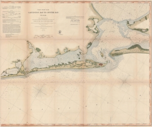
Coast Chart No. 105 Galveston Bay to Oyster Bay Texas.
$600.00
Acquire
- Digital Map Information
- Suitable for large format printing
- File Size: 138.67 MB
- File Type: ZIP / TIFF
- ICC color profile embedded
- Delivered instantly via download link
This is the 1870 edition of the U.S. Coast Survey nautical map of Galveston Bay, Texas. When this map was made Galveston was one of the most important American ports on the Gulf of Mexico. In just thirty years, it would be destroyed by the 1900 Great Galveston Hurricane, considered the deadliest natural disaster in United States history and the third-deadliest Atlantic hurricane. (more details)
Highlights the Republic of Texas and is one of the earliest non-American maps to illustrate the Republic.
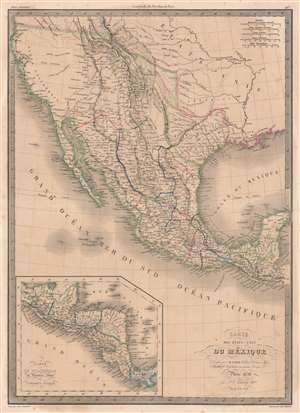
Carte des États-Unis du Méxique.
$600.00
Acquire
- Digital Map Information
- Suitable for large format printing
- DPI: 600
- File Size: 54.18 MB
- File Type: ZIP / TIFF
- ICC color profile embedded
- Delivered instantly via download link
This is an 1838 Pierre and Alexandre Lapie map of Mexico and the southwestern United States and is also one of the earliest non-American maps to include the Republic of Texas - anticipating the pending 1839 French official recognition of Texas. The Republic of Texas is bordered in yellow, highlighting its existence. Mexico is bordered in green, with its borders extending from the Yucatan to the Oregon Territory encompassing all of California and the other southwestern states. States within Mexico are labeled and bordered by thin lines of varying colors to allow for easy differentiation.
Cities and towns throughout Mexico are identified, including Mexico City, Cuernavaca, Veracruz, and Oaxaca, with Santa Fe, San Francisco, Monterey, Santa Barbara, and San Diego marked in northern Mexico, now the United States. Several Indian tribes are identified in northern Mexico, including the Apaches. A large portion of this region between the Rocky Mountains and the Pacific Coast is labeled as 'unknown'. Both the Great Salt Lake, identified as Lake Timpanogos, and Utah Lake, labeled as Lake Teguayo, are illustrated following the example of Humboldt. The apocryphal Buenaventura River is also included and is illustrated as connecting from Lake Teguayo to the Pacific Ocean, the final incarnation of the long-sought River of the West, a speculative alternative to the Northwest Passage. In the United States (as it existed in 1838) only rivers are illustrated, and a handful of Indian tribes are referenced. An inset map of Central America is situated in the lower left corner and depicts the region from the Yucatan to Chagres, Panama (labeled Colombie). (more details)
Cities and towns throughout Mexico are identified, including Mexico City, Cuernavaca, Veracruz, and Oaxaca, with Santa Fe, San Francisco, Monterey, Santa Barbara, and San Diego marked in northern Mexico, now the United States. Several Indian tribes are identified in northern Mexico, including the Apaches. A large portion of this region between the Rocky Mountains and the Pacific Coast is labeled as 'unknown'. Both the Great Salt Lake, identified as Lake Timpanogos, and Utah Lake, labeled as Lake Teguayo, are illustrated following the example of Humboldt. The apocryphal Buenaventura River is also included and is illustrated as connecting from Lake Teguayo to the Pacific Ocean, the final incarnation of the long-sought River of the West, a speculative alternative to the Northwest Passage. In the United States (as it existed in 1838) only rivers are illustrated, and a handful of Indian tribes are referenced. An inset map of Central America is situated in the lower left corner and depicts the region from the Yucatan to Chagres, Panama (labeled Colombie). (more details)
Texas, by a Californian schoolboy.
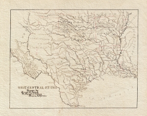
West Central States. Drawn by Ernest W. Dubois, St. Augustine College, Benicia, California.
$550.00
Acquire
- Digital Map Information
- Suitable for large format printing
- File Size: 4.79 MB
- File Type: ZIP / TIFF
- ICC color profile embedded
- Delivered instantly via download link
An attractive manuscript schoolboy / schoolgirl map of Texas by Ernest W. DuBois. Entitled the 'West Central States,' this map in fact focuses primarily on Texas with the adjacent Indian Territory (Oklahoma), Louisiana, and Arkansas also included. The map is finely drawn throughout with great attention to rivers and town placement. No counties are identified. (more details)
The German 'Fenimore Cooper'.
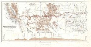
Karte zu Balduin Möllhausen's Reise vom Mississippi nach der Küste der Südsee im Jahre 1853 - 1854.
$500.00
Acquire
- Digital Map Information
- Suitable for large format printing
- File Size: 7.45 MB
- File Type: ZIP / TIFF
- ICC color profile embedded
- Delivered instantly via download link
This is Henry Lange's 1858 map of the southwestern United States illustrating the 'German Fenimore Cooper' Heinrich Balduin Möllhausen's participation in the 1853 Whipple Expedition, part of the Pacific Railroad Surveys. (more details)