
Turkey - Ottoman Empire (sold)
Here-to-fore unknown Persian variants of Serio-Comic maps by Fredric Rose and K. I. Kordig. Maps illustrate conflicting perspectives on Russian expansionism and the Balkan Crises.
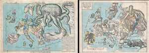
Serio-Comic Map of Europe. / Russian map of Europe.
sold
- Digital Map Information
- Suitable for large format printing
- File Size: 25.5 MB
- File Type: ZIP / TIFF
- ICC color profile embedded
- Delivered instantly via download link
An extraordinary discovery, this is a here-to-fore unknown set of Persian Serio-Comic maps issued around 1880 in Iran. These Serio-Comic maps presuppose that the reader will recognize the familiar shape of Europe and its constituent nations, which have here been ... (more details)
Manuscript of the finest map of the Bosporus in the year of the Great Istanbul Earthquake.
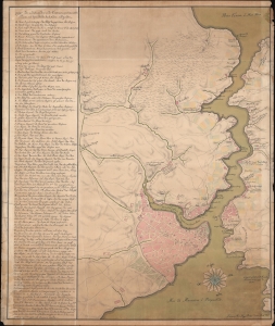
[Bosporus / Istanbul].
sold
- Digital Map Information
- Suitable for large format printing
- Full resolution TIFF file
- ICC color profile embedded
- Delivered instantly via download link
A unique 1766 manuscript map of Istanbul and the Bosporus drawn by the Slovenian surveyor and engineer Anton Mrak (1739 - 1801). This map represents the state-of-the-art mapping of the region in the year of the disastrous Great Istanbul Earthquake. The finely executed hand-drawn map is oriented loosely to the north, and covers the entirety of the Bosporus, the walled city of Istanbul, and the surrounding communities. Istanbul itself is mapped with great care, with coverage detailing the Sultanahmet, Eminoönü, Beyazit, and Fatih districts. Locations along the Bosporus are noted with detail. Curiously, the map is in Italian, but the alphanumeric key appearing along the left is in a combination of German and Ottoman Turkish. (more details)
A colossal map oof the Ottoman Europe at the moment of its collapse.
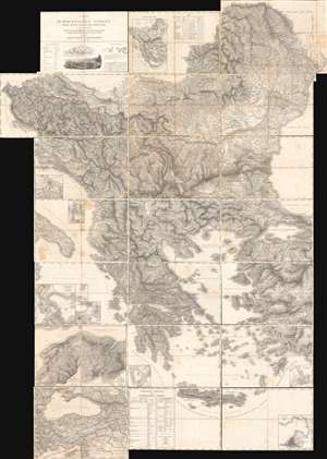
Carte der Europaeischen Tuerkey nebst einem Theile von Kleinasien in XXI. Blattern.
sold
A monumental composite map of European Turkey consisting of 21 linen-backed sheets contained within its original handsome box. This 1829 Franz von Weiss map of 'European Turkey' (Greece, the Balkans, Bulgaria), produced under the auspices of the Austrian military. It is an extraordinary work of military intelligence, made just as the Ottoman Empire's European holdings were collapsing and neighboring powers, including Austria, sought to craft a reaction. (more details)
Key Map from the Earliest Atlas in Armenian.
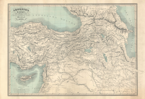
Հայաստամ Աշխարհ Ըստ նախնի աշխարհագրաց / [The Armenian World according to ancient geographers].
sold
- Digital Map Information
- Suitable for large format printing
- File Size: 47.09 MB
- File Type: ZIP / TIFF
- ICC color profile embedded
- Delivered instantly via download link
An exceptional discovery, this 1849 historical map of Armenia appeared in the Illustrated World Atlas, the first atlas published in the Armenian language. The map and atlas are a reflection of a growing Armenian national consciousness in the mid-19th century, which would eventually clash with the late Ottoman state with terrible consequences. (more details)
First modern map of Ankara.
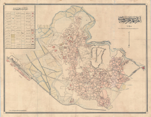
Ankara Şehir Haritası. / Ankara City Plan. / آنكارا شهير حاريتاسي.
sold
- Digital Map Information
- Suitable for large format printing
- File Size: 38.4 MB
- File Type: ZIP / TIFF
- ICC color profile embedded
- Delivered instantly via download link
This is the first accurate topographical survey of Ankara, modern-day capital of Turkey, published by the T.C. Harita Genel Müdürlüğü (Turkish Republic General Directorate of Maps) in 1924 (Şevval 1340). The map emerged from military surveys during the Turkish War of Independence (1919 - 1923), conducted between roughly 1921 - 1922. As such, it is an invaluable record of Ankara before it was developed into the national capital. (more details)
The Balkans on the cusp of their independence of the Ottoman Empire.
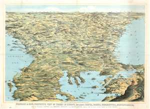
Stannard and Son's, Perspective View of Turkey in Europe, Including Servia, Bosnia, Herzegovina, Montenegro, and c, with the Adjoining Countries more Immediately Interested in the Eastern Question, Compiled from the Latest Official Sources, by Alfred Concanen.
sold
- Digital Map Information
- Suitable for large format printing
- File Size: 52.56 MB
- File Type: ZIP / TIFF
- ICC color profile embedded
- Delivered instantly via download link
An impressive 1876 William Stannard and Alfred Concanen bird's-eye perspective view of the Balkans during the Great Eastern Crises (1875 - 1878). The view centers on Sofia, Bulgaria, with coverage extending from the Adriatic to the Black Sea and from Odessa and Belgrade to Thessaly (Greece), embracing modern day Bulgaria, the Sea of Marmora, the Dardanelles, Montenegro, Bosnia, Serbia, Herzegovina, and Albania. (more details)
Strange Arabic- Boston imprint from first wave of Islamic immigration to the United States.
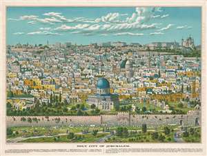
Bird's Eye View of Holy Jerusalem. / Vue Générale de la Villie de Jerusalem. / القدس الشف
sold
- Digital Map Information
- Suitable for large format printing
- File Size: 59.52 MB
- File Type: ZIP / TIFF
- ICC color profile embedded
- Delivered instantly via download link
The only known example of a magnificent and previously unknown c. 1896 Boston-Arab chromolithograph view of Jerusalem by the Palestinian / Syrian immigrant Aece Hage. This view is a veritable masterpiece of chromolithography, employing at least six separate plates, a feat even more remarkable when compounded with the knowledge that this view was produced in a flophouse under extenuating circumstances and on a low budget. The unusual view looks on Jerusalem from the Mount of Olives, east of the Old City, and centers on the Temple Mount and the Dome of the Rock (Qubbat al-Sakhrah), with other holy sites of multiple religions appearing behind it. In the foreground the Eastern Wall of Jerusalem, the walled off Golden Gate, the open Lion's Gate, and the 1400-year-old Bab-ur-Rahmah Cemetery are illustrated. The predominate colors, blue and green, are significant in Islamic tradition, representing protection, hope, and life. The view, although stylized, is mostly accurate, suggesting that Hage (or the artist) had been to or lived in Jerusalem and drew the image from life.
The view is titled in light brown lettering to either side of the view, and in the bottom right just below the view. Title text appears in English (left), French (right) and Arabic (bottom right). Text below the map identifies 15 locations, which correspond to numerical assignments appearing on the map. The cartographer identifies Christian, Muslim, and Jewish religious sites, without apparent preference. (more details)
The view is titled in light brown lettering to either side of the view, and in the bottom right just below the view. Title text appears in English (left), French (right) and Arabic (bottom right). Text below the map identifies 15 locations, which correspond to numerical assignments appearing on the map. The cartographer identifies Christian, Muslim, and Jewish religious sites, without apparent preference. (more details)
Best 19th century general map of the Ottoman Empire.
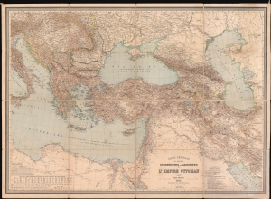
Carte Générale des Provinces Européennes et Asiatiques de l'Empire Ottoman (sans l'Arabie).
sold
- Digital Map Information
- Suitable for large format printing
- File Size: 150.63 MB
- File Type: ZIP / TIFF
- ICC color profile embedded
- Delivered instantly via download link
This is an 1892 Heinrich Kiepert wall map of the Ottoman Empire. The work of Europe's finest cartographer, this is without question the best large scale general map of the Ottoman dominions to appear in the 19th century. (more details)
Spratt's Map' that led directly to the rediscovery of the lost Homeric city of Troy!
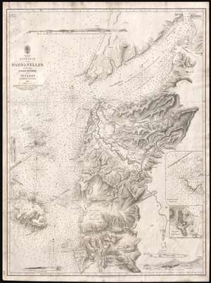
Asia Minor. Entrance of the Dardanelles, with the Plain of Troy and Tenedos.
sold
- Digital Map Information
- Suitable for large format printing
- DPI: 300
- File Size: 11.62 MB
- File Type: ZIP / TIFF
- ICC color profile embedded
- Delivered instantly via download link
Known as 'Spratt's Map', this is a most intriguing 1844 British Admiralty chart or map of the Entrance to the Dardanelles and the Troada or Plain of Troy. Compiled by Royal Navy officers Thomas Abel Brimage Spratt and Thomas Graves, this map played a significant role in the discovery of Tory. While this, like most early Admiralty charts can be admired for its supreme maritime detail and accuracy, the map's most intriguing quality is its extraordinary inland detail covering the eastern quarter of the Troada, including the Plain of Troy. Here, Graves and Spratt have left aside their usual nautical survey work to put the resources and training of the British Hydrographic Office to work on a far more important matter - the search for the ruins of lost Troy. (more details)
Centuries of War.
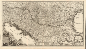
Novissima tabula regni Hungariae et regionum quondam ei unitarum ut Transilvaniae, Valachiae, Moldaviae, Serviae, Romaniae, Bulgariae, Bessarabiae, Croatiae, Bosniae, Dalmatiae, Slavoniae, Morlachiae et reipublicae Ragusanae...
sold
- Digital Map Information
- Suitable for large format printing
- File Size: 44.02 MB
- File Type: ZIP / TIFF
- ICC color profile embedded
- Delivered instantly via download link
Joachim Ottens' rare, large, and beautifully engraved c. 1700 map of the lands about the Danube captures the region in the wake of the 1699 Treaty of Karlowitz, which brought the Great Turkish War (1683 - 1699) to a close. Ottens' map encompasses the theatre of that war and records key battles in that region, stretching back to the 14th century. (more details)
Crete and Heraklion during the Longest Siege of the Great Turkish War.
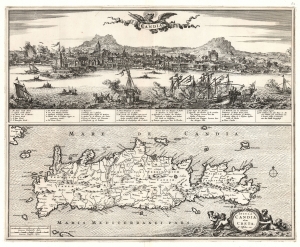
Candia. / Insula Candia olim Creta. N. Visscher exc.
sold
- Digital Map Information
- Suitable for large format printing
- File Size: 26.23 MB
- File Type: ZIP / TIFF
- ICC color profile embedded
- Delivered instantly via download link
This is Nicolas Visscher's 1670 map of Crete, accompanied by a dramatic panorama of the famous Siege of Candia (Heraklion). (more details)
A foundational map of Persia, Arabia, and India.
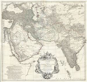
Premiere Partie de la Carte d'Asie contenant La Turquie, L'Arabie, La Perse, L'Inde en deca du Gange et de la Tartarie ce qui est limitrophe de la Perse et de l'Inde.
sold
- Digital Map Information
- Suitable for large format printing
- DPI: 300
- File Size: 36.34 MB
- File Type: ZIP / TIFF
- ICC color profile embedded
- Delivered instantly via download link
A monumental and highly detailed 1751 map of India, Persia, and Arabia by the French cartographer Jean Baptiste Bourguignon d'Anville. Centered on Persia, this map covers from Istanbul to eastern India and Tibet, and from the Black Sea to the Maldives. It offers ... (more details)
Philanthropy in the Face of Atrocity.
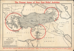
The Present Areas of Near East Relief Activities.
sold
- Digital Map Information
- Suitable for large format printing
- File Size: 25.46 MB
- File Type: ZIP / TIFF
- ICC color profile embedded
- Delivered instantly via download link
A scarce c. 1922 map of the Near East, produced by Near East Relief, an organization tasked with assisting refugees, particularly Armenians and Greeks, fleeing from Turkey. It was produced in the wake of one of the worst atrocities, the Burning of Smyrna, which destroyed the Greek and Armenian quarters. The efforts of the New East Relief saved over a million lives and are considered of the most successful humanitarian efforts of the 20th century. (more details)
A foundational map of Persia, Arabia, and India.
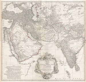
Premiere Partie de la Carte d'Asie contenant La Turquie, L'Arabie, La Perse, L'Inde en deca du Gange et de la Tartarie ce qui est limitrophe de la Perse et de l'Inde.
sold
- Digital Map Information
- Suitable for large format printing
- DPI: 300
- File Size: 34.98 MB
- File Type: ZIP / TIFF
- ICC color profile embedded
- Delivered instantly via download link
A monumental and highly detailed 1751 map of India, Persia, and Arabia by the French cartographer Jean Baptiste Bourguignon d'Anville. Centered on Persia, this map covers from Istanbul to eastern India and Tibet, and from the Black Sea to the Maldives. It offers ... (more details)
A foundational map of Persia, Arabia, and India.
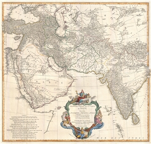
Premiere Partie de la Carte d'Asie contenant La Turquie, L'Arabie, La Perse, L'Inde en deca du Gange et de la Tartarie ce qui est limitrophe de la Perse et de l'Inde.
sold
- Digital Map Information
- Suitable for large format printing
- DPI: 300
- File Size: 25.92 MB
- File Type: ZIP / TIFF
- ICC color profile embedded
- Delivered instantly via download link
A monumental and highly detailed 1751 map of India, Persia, and Arabia by the French cartographer Jean Baptiste Bourguignon d'Anville. Centered on Persia, this map covers from Istanbul to eastern India and Tibet, and from the Black Sea to the Maldives. It offers ... (more details)
Ethnic cleansing in the Balkans.
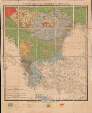
Wyld's Map of Turkey in Europe.
sold
- Digital Map Information
- Suitable for large format printing
- Full resolution TIFF file
- ICC color profile embedded
- Delivered instantly via download link
A most intriguing c. 1878 ethnographic and infographic map of Greece and the Balkans issued by James Wyld against the backdrop of the Russo-Turkish War and systematic ethnic genocide. Coverage extends from the Gulf of Venice to the Crimea and from Vienna to Crete. Overprinting illustrates the region's complex ethnic and religious mélange. The map breaks down areas according to both ethnicity and religion, also indicating those areas where different groups live side by side, and those areas occupied by the Ottomans. The region's religious diversity, as well as ancient ethnic rivalries, has led to a long history of ethnic warfare. (more details)
The world's most beautiful skyline.
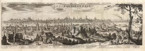
Constantinopolitanae urbis effigies ad vivum expressa, quam turcae Stampoldam vocant, Ao. MDCXXXV.
sold
- Digital Map Information
- Suitable for large format printing
- Full resolution TIFF file
- ICC color profile embedded
- Delivered instantly via download link
This is a 1638 (dated 1635) Matthäus Merian view of Constantinople, or Istanbul, Turkey. The view is oriented to the south. The Beyoğlu district - then known as 'Pera' - is in the foreground, while a panorama of Istanbul proper can be seen as a distant skyline beyond the Golden Horn. A legend at the bottom names twenty nine structures, with a key indicating the named buildings on the view - predominantly mosques. It is a beautiful example of Merian's superb engraving. The panorama is artfully framed with lifelike trees and other flora, and is filled with depictions of the city's denizens going about everyday life: walking and talking with one another, sitting and conversing, and bringing the dogs back home from the hunt. (more details)
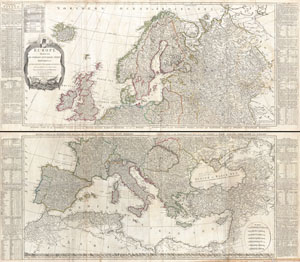
Europe Divided into its Empires, Kingdoms, States Republics, & c.
sold
- Digital Map Information
- Suitable for large format printing
- DPI: 300
- File Size: 78.51 MB
- File Type: ZIP / TIFF
- ICC color profile embedded
- Delivered instantly via download link
A large and dramatic 1794 wall map of Europe on two panels. Published by Laurie and Whittle based the work of the important cartographer J. B. B. D'Anville. Upper sheet covers from Iceland to Russia and from the Arctic to Calais and Astrakhan. The southern ... (more details)
The Balkans on the Brink.
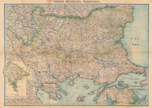
Քարտէս Պալքանէան Պետութեանց / [Map of the Balkan States].
sold
- Digital Map Information
- Suitable for large format printing
- File Size: 56.99 MB
- File Type: ZIP / TIFF
- ICC color profile embedded
- Delivered instantly via download link
This is an extremely rare c. 1898 Armenian-language map of the Balkans prepared by Stepan Agayan and published by the Iqbal Bookshop in Constantinople (Istanbul). It depicts the region at the turn of the 20th century, following the Russo-Turkish War of 1877 - 1878 but before the Balkan Wars that helped set the stage for World War I (1914 - 1918). (more details)
Most authoritative Map of Armenia, Kurdistan and Azerbaijan of the 19th Century.
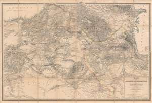
Karte von Armenien, Kurdistan und Azerbeidschan in vier blatt im Anschluss an die IV westlichen und mittleren Blätter der Karte von Klein-Asien, entworfen und bearbeitet 1852-55.
sold
- Digital Map Information
- Suitable for large format printing
- File Size: 93.53 MB
- File Type: ZIP / TIFF
- ICC color profile embedded
- Delivered instantly via download link
A seminal production, this is Heinrich Kiepert's 1858 map of Armenia, Kurdistan, and Azerbaijan, the definitive map of the region for more than 50 years. This map was used for treaty negotiation, military activity, and administration. In order to create it, Kiepert travelled the region many times - constantly sketching maps. His own observations were supplemented by diligent scholarship, resulting in a deep understanding local exploratory history and earlier survey work - note how throughout are noted, and dated, the tracks of earlier voyagers. The result is the finest area map available for most of the second half of the 19h century. The dense hachuring testifies to the areas daunting topography, underscoring the greatness of Kiepert's achievement. (more details)
A lively and detailed panorama of Istanbul, Turkey.
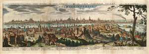
Constantinopolitanae urbis effigies ad vivum expressa, quam turcae Stampoldam vocant, Ao. MDCXXXV.
sold
- Digital Map Information
- Suitable for large format printing
- Full resolution TIFF file
- ICC color profile embedded
- Delivered instantly via download link
This is a 1638 (dated 1635) Matthaus Merian view of Constantinople, or Istanbul, Turkey. The view is oriented to the south. The Beyoğlu district - then known as 'Pera' - is in the foreground, while a panorama of Istanbul proper can be seen as a distant skyline beyond the Golden Horn. A legend at the bottom names twenty nine structures pictured in the view, with a number key indicating the named buildings on the view - predominantly mosques. It is a beautiful example of Merian's superb engraving. The panorama is artfully framed with lifelike trees and other flora, and is filled with depictions of the city's denizens going about everyday life: walking and talking with one another, sitting and conversing, and bringing the dogs back home from the hunt. (more details)
The rise of Atatürk.
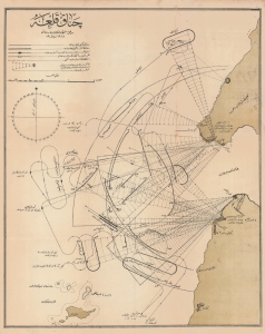
چناققلعه / [Çanakkale].
sold
- Digital Map Information
- Suitable for large format printing
- File Size: 26.52 MB
- File Type: ZIP / TIFF
- ICC color profile embedded
- Delivered instantly via download link
A remarkable 1915 Ottoman Turkish map of the Straits of Dardanelles and the tip of the Gallipoli Peninsula. It details Ottoman gun batteries protecting the opening of the Straits, which were the focal point of naval operations by the Entente Powers in February and March of that year. More specifically, it depicts the operations of February 19, when Entente ships bombarded Ottoman gun batteries to open a safe channel through the Straits. The ultimate failure of Entente ships to break through the Dardanelles led to the amphibious assault for which the Gallipoli Campaign is more famous. It also heralded the rise of Mustafa Kemal Atatürk, who founded the Republic of Turkey and remains an iconic figure. (more details)
The first map of norhtern Syria produced from actual surveys.
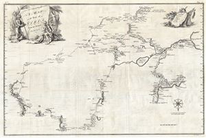
A Map of Part of Syria from an Actual Survey.
sold
- Digital Map Information
- Suitable for large format printing
- DPI: 300
- File Size: 22.03 MB
- File Type: ZIP / TIFF
- ICC color profile embedded
- Delivered instantly via download link
An extremely uncommon 1754 map of Syria by Alexander Drummond. Most likely the earliest scientifically surveyed map of the interior of northern Syria. Oriented to the south, the map is roughly centered on Aleppo, where Drummond was stationed as British ... (more details)
Ottoman Cartography.
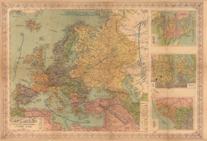
مكمل آوروپا خريطه سى / [Complete Map of Europe].
sold
- Digital Map Information
- Suitable for large format printing
- File Size: 118.12 MB
- File Type: ZIP / TIFF
- ICC color profile embedded
- Delivered instantly via download link
A scarce and engrossing large format c. 1908 Ottoman Turkish wall map of Europe, produced by geographer Mehmet Nasrullah and published by Tefeyyüz Kitaphanesi in Istanbul. It reflects improvements in both Ottoman cartography and print technology in the last years of the long-ruling dynasty. (more details)
Published the year the Republic of Turkey was founded.

Türkiye Cumhuriyeti Haritası. / [Map of the Republic of Turkey].
sold
- Digital Map Information
- Suitable for large format printing
- Full resolution TIFF file
- ICC color profile embedded
- Delivered instantly via download link
This is an enormous 1923 wall map of Turkey in Ottoman Turkish, published the year the modern Republic of Turkey was founded. The cartographer uses different colors to mark Turkey's extreme topography. Shades of brown illustrate elevation changes, while areas of green highlight river valleys and other fertile zones. (more details)
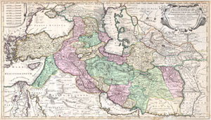
Regnum Persicum Imperium Turcicum in Asia Russorum Provinciae and Mare Caspium.
sold
- Digital Map Information
- Suitable for large format printing
- DPI: 300
- File Size: 15.73 MB
- File Type: ZIP / TIFF
- ICC color profile embedded
- Delivered instantly via download link
A scarce and altogether spectacular c. 1730 map of southwestern Asia, specifically focusing on Persia, by Reiner and Joshua Ottens. Covers from Egypt and Greece eastward to include Turkey, the northern part of the Arabian Peninsula, the Black and Caspian ... (more details)
Keeping the Ship Afloat
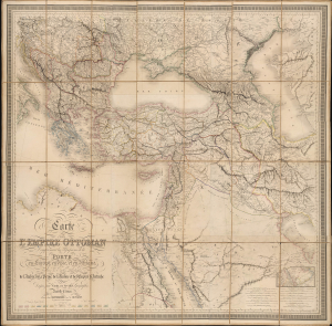
Carte de l'Empire Ottoman Comprenant les Possessions de la Porte en Europe, en Asie et en Afrique; avec les parties limitrophes de l'Arabie, de la Perse, de la Russie et de l'Empire d'Autriche.
sold
- Digital Map Information
- Suitable for large format printing
- Full resolution TIFF file
- ICC color profile embedded
- Delivered instantly via download link
This is an impressive, large-format 1864 folding map of the Ottoman Empire and environs, prepared by Louis Vivien de Saint-Martin and Joseph-Marin-Adolphe Noël des Vergers and published by J. Barthelemier. It presents the Empire in the aftermath of the Crimean War (1853 - 1856), when the Empire attempted to modernize and recover from the loss of territory earlier in the century. (more details)
Supposed Aegean Theater of the Morean War.
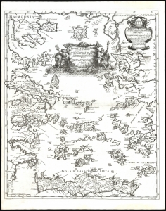
Arcipelago Mar Egeo con le Coste del Medesimo.
sold
- Digital Map Information
- Suitable for large format printing
- File Size: 21.44 MB
- File Type: ZIP / TIFF
- ICC color profile embedded
- Delivered instantly via download link
This is the beautiful 1685 Cantelli da Vignola map of the Greek Islands in the Aegean Sea. It was issued at the beginning of the 1684-1699 Morean War between Venice and the Ottoman Empire. (more details)
Southeastern Europe, Slipping Away.
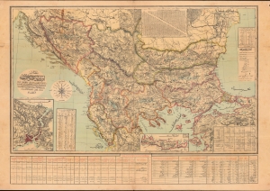
مفصل اوروبا عثمانیه / [Detailed (Map) of Ottoman Europe].
sold
- Digital Map Information
- Suitable for large format printing
- File Size: 1159.59 MB
- File Type: ZIP / TIFF
- ICC color profile embedded
- Delivered instantly via download link
A scarce map of Ottoman Europe, produced by military officer al-Hac Nasir al-Dagistani and published in 1906 by Mahmud Bey Matbaasi. It displays the remaining European portion of the Ottoman Empire, which was severely imperiled at the time, and most of which would break away in two wars in the Balkans that directly preceded World War I (1914 - 1918). (more details)
Quirky 18th century British multi-sheet wall map of the Near and Middle East.
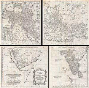
First Part of Asia, being Turkey, Arabia, Persia, most of India and Tartary.
sold
- Digital Map Information
- Suitable for large format printing
- DPI: 300
- File Size: 43.02 MB
- File Type: ZIP / TIFF
- ICC color profile embedded
- Delivered instantly via download link
A curious and uncommon four panel wall map 1786 map of India, Persia, and Arabia by the english publisher M. Postlethwayte. Published in four separate panels, this map can be either joined as a single massive map as assembled, as above, in separate ... (more details)
Depicts the entire area of conflict during The Great Game.
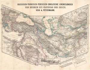
Russisch-Turkisch-Persisch-Englische Grenzländer von Bosnien vis Kaschgar und Indien.
sold
- Digital Map Information
- Suitable for large format printing
- File Size: 34.97 MB
- File Type: ZIP / TIFF
- ICC color profile embedded
- Delivered instantly via download link
This is a scarce and unusual 1877 Augustus Petermann map of the Middle East and Central Asia at the height of The Great Game, a decades-long diplomatic duel between the British and Russian Empires. Detailing the entire theater of war, the map's polyconic projection covers from the Balkans to British India; Crimea to the Persian Gulf and Indian Ocean. The Russian Empire stretches across the top of the map, an ever-expanding threat to countries to the south with deep water ports on the Mediterranean Sea and Indian Ocean. Throughout the 19th century, the Russian drive southward led to several wars with Persia and Turkey, which also embroiled British and French interests, staging Russia as 'the great enemy'. (more details)
Large 18th century map of the Mediterranean region.
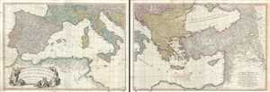
A Map of the Mediterranean Sea with the Adjacent Regions and Seas in Europe, Asia and Africa.
sold
- Digital Map Information
- Suitable for large format printing
- Full resolution TIFF file
- ICC color profile embedded
- Delivered instantly via download link
This is an appealing 1785 map of the Mediterranean region issued by William Faden. A set of two maps, the western sheet covers from Portugal, Spain, Italy, the Maghreb or the Barbary Coast of Africa and includes parts of France and the Balkans. ... (more details)