
Washington and Oregon (sold)
Unrecorded first state of a foundational map with extensive manuscript additions relating to American Indian Reservations established in 1867-8.
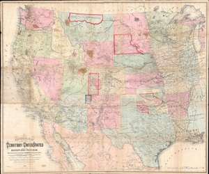
National Map of the Territory of the United States From The Mississippi River To The Pacific Ocean.
sold
- Digital Map Information
- Suitable for large format printing
- Full resolution TIFF file
- ICC color profile embedded
- Delivered instantly via download link
An extraordinary first-edition first-state example of William J. Keeler’s 1867 map of the Trans-Mississippi West - considered the finest post-Civil War railroad era map of the west - with unique manuscript annotations and additions relating to the American Indian Reservation System. This one of a kind historic document was likely the official example retained by the Indian Bureau, and possibly by Keeler himself, to administer and document the development of the American Indian Reservation system through the late 1860s. (more details)
The essential covered wagon trail map of the American west.
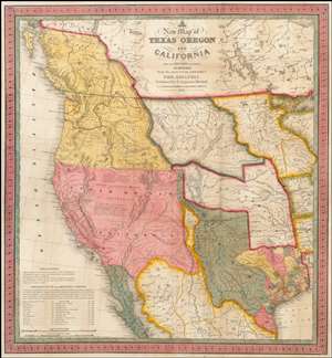
A New Map of Texas, Oregon and California with the Regions Adjoining.
sold
- Digital Map Information
- Suitable for large format printing
- Full resolution TIFF file
- ICC color profile embedded
- Delivered instantly via download link
A stunning example of Mitchell's seminal 1846 pocket map of Texas, Oregon, Upper California, Missouri Territory, the Indian Territory (Oklahoma, though in this example including most of Kansas and Colorado). This important map of Texas is one of the first ... (more details)
The essential trail map of the American west.
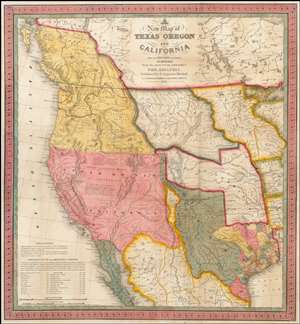
A New Map of Texas, Oregon and California with the Regions Adjoining.
sold
- Digital Map Information
- Suitable for large format printing
- DPI: 300
- File Size: 11.05 MB
- File Type: ZIP / TIFF
- ICC color profile embedded
- Delivered instantly via download link
A stunning example of Mitchell's seminal 1846 pocket map of Texas, Oregon, Upper California, Missouri Territory, the Indian Territory (Oklahoma, though in this example including most of Kansas and Colorado). This important map of Texas is one of the first ... (more details)
The first commercially produced large format map of Washington Territory.
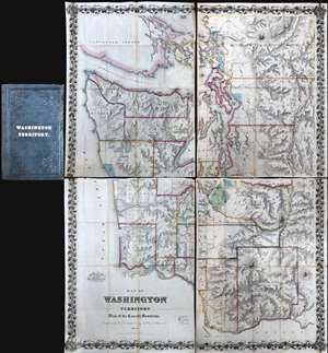
Map of Washington Territory West of the Cascade Mountains Compiled by the Government Surveys by Chas. A. White. C. E.
sold
A landmark production, this is the first large format commercially issued map of Washington Territory. It was issued by Charles A. White, woring with George Woolworth and Charles B. Colton, in 1870. The Colton brothers doubtless intended the map to capitalize on general interest in the region stemming from the imminent construction of the Northern Pacific Railroad. Although the Northern Pacific had been delayed for many years, construction finally began in 1870 and brought with it the promise of a land rush and an associated trade explosion to this previously remote and inaccessible part of the country.
Washington Territory Land Rush
The map's coverage extends from Vancouver to the Columbia River and from the Pacific to the Cascade Mountains. The region's rich topography is illustrated via shading and hachure. Cartographically, this map based upon the U.S. Government Land Surveys and the United States Coast Survey. The platting work of the U.S. Land Survey for Washington Territory is evident throughout in the form of small and large squares. Some of this land had clearly been assigned and color coding indicates Prairie Lands (Green), Government Reserves (Red), and Indian Reservations (Light Blue). Among other things, the prevalence of largely unassigned plats indicates the extraordinary wealth of excellent land available to enterprising pioneer settlers. Between 1870, when his map was issued, and 1880, the population of Washington Territory over tripped, from about 23,500 to 75,000 (more details)
Washington Territory Land Rush
The map's coverage extends from Vancouver to the Columbia River and from the Pacific to the Cascade Mountains. The region's rich topography is illustrated via shading and hachure. Cartographically, this map based upon the U.S. Government Land Surveys and the United States Coast Survey. The platting work of the U.S. Land Survey for Washington Territory is evident throughout in the form of small and large squares. Some of this land had clearly been assigned and color coding indicates Prairie Lands (Green), Government Reserves (Red), and Indian Reservations (Light Blue). Among other things, the prevalence of largely unassigned plats indicates the extraordinary wealth of excellent land available to enterprising pioneer settlers. Between 1870, when his map was issued, and 1880, the population of Washington Territory over tripped, from about 23,500 to 75,000 (more details)
The quintessential trail map of the American west.
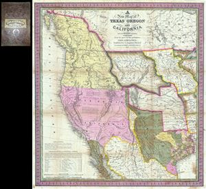
A New Map of Texas Oregon and California with the Regions Adjoining.
sold
- Digital Map Information
- Suitable for large format printing
- Full resolution TIFF file
- ICC color profile embedded
- Delivered instantly via download link
Considered 'the quintessential trail map of the American West' Samuel Augustus Mitchell's 'New Map of Texas Oregon and California' is one of the most important 19th century pocket maps ever issued. In Mitchell's own words This map comprises all that ... (more details)
Extremely rare, highly influential, and very important foundational map of the North Pacific showing Sea of the West and the apocryphal discoveries of Admiral de Fonte.
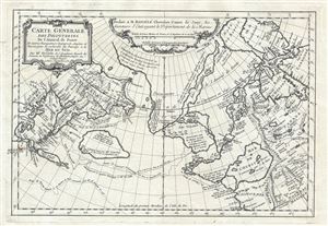
Carte General Des Decouvertes De L'Amiral de Fonte Et autres Navigateurs Espagnols, Anglois, et Russes, pour la recherche du Passage a la Mer du Sud.
sold
- Digital Map Information
- Suitable for large format printing
- DPI: 300
- File Size: 6.51 MB
- File Type: ZIP / TIFF
- ICC color profile embedded
- Delivered instantly via download link
An object of extreme historical importance and rarity, this map was the center of one of the most heated cartographic debates in history. This is an unrecorded state of Joseph-Nicolas de L'Isle's (Delisle) map of the Northern Pacific Ocean and ... (more details)
An exceptionally scarce variant of a cornerstone map of the American west and the finest of its era.
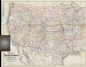
National Map of the Territory of the United States From The Mississippi River To The Pacific Ocean. Madeby the authority of the Hon. O. H. Browning Secretary of the Interior. In the Office of the Indian Bureau Chiefly For Government Purposes under the direction of the Hon. N.G. Taylor, Commisr. of Indian Affairsa and Hon. Chas E. Mix Chief Clerk of the Indian Bureau.
sold
- Digital Map Information
- Suitable for large format printing
- File Size: 46.46 MB
- File Type: ZIP / TIFF
- ICC color profile embedded
- Delivered instantly via download link
A map of the utmost importance and scarcity, this is William J. Keeler's 1868 pocket map of the American west, considered the 'the largest, finest and most detailed map of the West as it was then known.' The map covers from Detroit and ... (more details)
Outstanding 1849 broadside promoting routes the California Gold Rush.
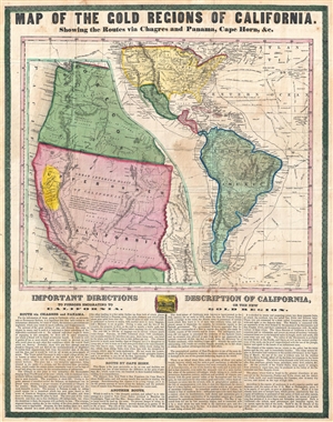
Map of the Gold Regions of California. Showing the Routes via Chagres and Panama, Cape Horn, & c.
sold
- Digital Map Information
- Suitable for large format printing
- DPI: 300
- File Size: 14.37 MB
- File Type: ZIP / TIFF
- ICC color profile embedded
- Delivered instantly via download link
A rare and remarkable example of Ensign and Thayer's 1849 promotional broadside map illustrating routes to and from the California Gold Fields. 'Forty-Niners' traveling across the continent to California faced a daunting and dangerous ... (more details)
1st to show Vancouver Island and Puget Sound.
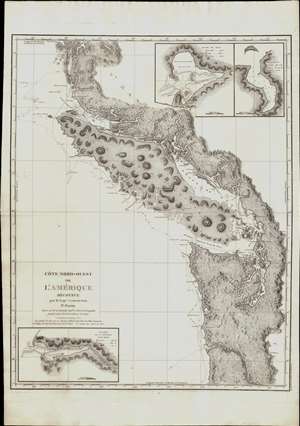
Cote Nord-Ouest de L'Amerique Reconnue par le Cape. Vanouver. 3e. Partie.
sold
- Digital Map Information
- Suitable for large format printing
- Full resolution TIFF file
- ICC color profile embedded
- Delivered instantly via download link
This is the 1799 French edition of George Vancouver's 1799 nautical map of the region around Vancouver Island, the Strait of Juan de Fuca, the mouth of the Columbia River, and Queen Charlotte Sound, extending from Cape Lookout (in modern-day Oregon) to Cape Swaine (Alaska). It is considered to be the great navigator George Vancouver's most important and influential map, among those he produced in his foundational reconnaissance of the northwest coast of America (1791 - 1795). (more details)
Seattle as a railroad town.
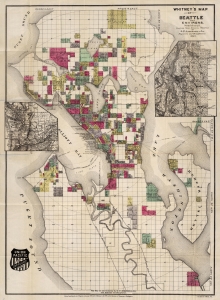
Whitney's Map Of Seattle And Environs, Washington.
sold
- Digital Map Information
- Suitable for large format printing
- Full resolution TIFF file
- ICC color profile embedded
- Delivered instantly via download link
This is the rare 1890 W. H. Whitney and Oliver Phelps Anderson map of Seattle. The map illustrates the early days of Seattle as a stop on the Union Pacific Railroad. It combines the function of a real estate map and a railroad map. (more details)
Astoria as a railroad town.
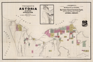
Whitney's Map of Astoria and Environs, Oregon.
sold
- Digital Map Information
- Suitable for large format printing
- Full resolution TIFF file
- ICC color profile embedded
- Delivered instantly via download link
This is the rare 1890 W. H. Whitney and Henry Jackson map of Astoria, Oregon. The map illustrates the early days of Astoria as it attempted to build railroad connections to the Northern Pacific. The route of the South Coast Railway towards Warrenton and Seaside is noted. Another line, the Albany and Astoria Railway, was a proposed route southward through the Grand Konde Indian Reservation. The line met with considerable opposition both from the tribe and from congress and was never authorized. It combines the function of a real estate map and a railroad map. (more details)
'... one of the first and best maps that show both Oregon and Washington together, in a large scale, published as a separate' - Rumsey
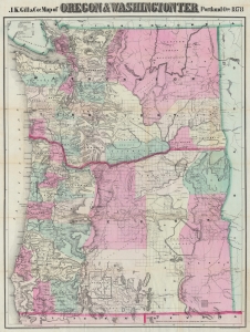
J.K. Gill and Cos. Map of Oregon and Washington Ter.
sold
- Digital Map Information
- Suitable for large format printing
- Full resolution TIFF file
- ICC color profile embedded
- Delivered instantly via download link
This is the 1878 Robert Habersham and John Gill map of Oregon and Washington Territory. It was issued during Washington's early push for statehood. According to David Rumsey, 'this is one of the first and best maps that show both Oregon and Washington together, in a large scale, published as a separate'. The present example has provenance connecting it to Jacob Kamm, co-founder of the Oregon Steam Navigation Company. (more details)
A foundational map and the single most influential map of the the Pacific Northwest issued in the middle of the 18th Century.
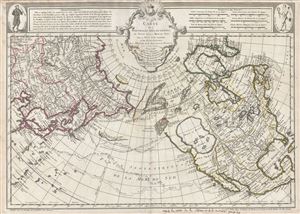
Carte Des Nouvelles Decouvertes au Nord de la Mer de Sud, tant a l'Est de la Syberie et du Kamtchatka, qu'a L'Ouest de la Nouvelle France.
sold
- Digital Map Information
- Suitable for large format printing
- DPI: 300
- File Size: 17.62 MB
- File Type: ZIP / TIFF
- ICC color profile embedded
- Delivered instantly via download link
Rare first edition of Joseph Nicolas De l'Isle's extraordinary 1752 map of North America, Siberia, the Arctic, and the North Pacific. J. N. De L'Isle and Buache drew this map to illustrate their speculations on the feasibly of a ... (more details)
Tacoma as a railroad town.
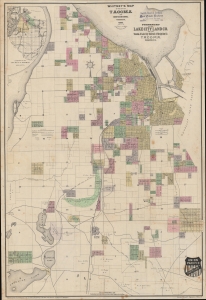
Whitney's Map of the City of Tacoma and environs, Washington.
sold
- Digital Map Information
- Suitable for large format printing
- File Size: 1186.34 MB
- File Type: ZIP / TIFF
- ICC color profile embedded
- Delivered instantly via download link
This is the rare 1889 W. H. Whitney and Frederick G. Plummer map of Tacoma, Washington. The map illustrates the early days of Tacoma as a stop on the Union Pacific's Northern Pacific Railroad. It combines the functions of a real estate map and a railroad map. An inset in the upper left offers an overview of the general area. (more details)
First map to show Vancouver Island and Puget Sound.
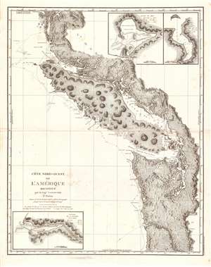
Cote Nord-Ouest de L'Amerique Reconnue par le Cape. Vanouver. 3e. Partie.
sold
- Digital Map Information
- Suitable for large format printing
- Full resolution TIFF file
- ICC color profile embedded
- Delivered instantly via download link
This is the 1799 French edition of George Vancouver's 1799 nautical map of the region around Vancouver Island, the Strait of Juan de Fuca, the mouth of the Columbia River, and Queen Charlotte Sound, extending from Cape Lookout (in modern-day Oregon) to Cape Swaine (Alaska). It is considered to be the great navigator George Vancouver's most important and influential map, among those he produced in his foundational reconnaissance of the northwest coast of America (1791 - 1795). (more details)
Tacoma as a railroad town.
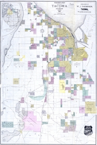
Whitney's Map of the City of Tacoma and environs, Washington.
sold
- Digital Map Information
- Suitable for large format printing
- Full resolution TIFF file
- ICC color profile embedded
- Delivered instantly via download link
This is the rare 1889 W. H. Whitney and Frederick G. Plummer map of Tacoma, Washington. The map illustrates the early days of Tacoma as a stop on the Union Pacific's Northern Pacific Railroad. It combines the functions of a real estate map and a railroad map. An inset in the upper left offers an overview of the general area. (more details)
Bellingham as a railroad town.
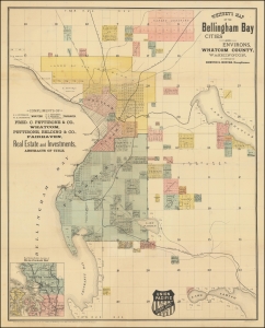
Whitney's Map of the Bellingham Bay Cities and Environs, Whatcom County, Washington.
sold
- Digital Map Information
- Suitable for large format printing
- File Size: 27.26 MB
- File Type: ZIP / TIFF
- ICC color profile embedded
- Delivered instantly via download link
This is the rare 1890 W. H. Whitney and Edmund S. Hincks map of Bellingham, Washington. The map illustrates the early attempts of Bellingham to connect to an international railroad. Although bearing the Union Pacific Railroad, that line never connected to Bellingham Bay. Instead, the services here reflect connections to the competing Canadian Pacific and Great Northern Lines. It combines the function of a real estate map and a railroad map. An inset in the upper left offers an overview of the general area. The map covers the entrance to the Straits of Juan de Fuca, highlighting the Bellingham Bay cities of Bellingham and Fairhaven as far east as Lakes Whatcom and Samish. (more details)
Awe inspiring nautical chart of th north Pacific Ocean.
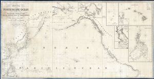
Chart of the North Pacific Ocean, Exhibiting the Eastern Shores of Asia and the Western Coast of North America from the Equator to Behring's Strait with plan, on an enlarge scale, of the Principal Island and Harbours.
sold
- Digital Map Information
- Suitable for large format printing
- DPI: 300
- File Size: 86.53 MB
- File Type: ZIP / TIFF
- ICC color profile embedded
- Delivered instantly via download link
A spectacular and massive 1849 James Imray nautical chart or maritime map of the northern Pacific. Roughly centered on Hawaii, this sprawling chart covers from Hainan and Borneo eastwards to Columbia and Panama, and from the Behring Strait to the Moluccas and the Galapagos Islands (the Equator). The chart is rendered on a Mercator Projection with latitude measured from Greenwich, England. Like most nautical charts, the cartographer offers very little inland detail, but a wealth of maritime data. This includes the identification of various ports and harbors, coastal topography, shoals and other undersea dangers, and countless depth soundings in fathoms. Additionally, the cartographer has noted aspects of various islands that may have been of importance to the mariner, for example Christmas Island has 'Plenty of Turtle, no fresh Water.'
This map is decorated with ten inset maps, from top center, Victoria Harbor (British Columbia), Awatska Bay on the east coast of Kamtschatka, the Mariana or Ladrones Islands (including Guam), the Hawaiian or Sandwich Islands (with four sub-insets: Waiakea or Byron Bay, Hanalei Bay (Kauai), Honolulu Harbor, and Kailua Bay), San Francisco Bay, the Mouth of the Columbia River (including the Fort Astoria settlement), and the Philippine Islands. (more details)
This map is decorated with ten inset maps, from top center, Victoria Harbor (British Columbia), Awatska Bay on the east coast of Kamtschatka, the Mariana or Ladrones Islands (including Guam), the Hawaiian or Sandwich Islands (with four sub-insets: Waiakea or Byron Bay, Hanalei Bay (Kauai), Honolulu Harbor, and Kailua Bay), San Francisco Bay, the Mouth of the Columbia River (including the Fort Astoria settlement), and the Philippine Islands. (more details)
Vancouver's most important map. The first map to show Vancouver Island and the Puget Sound.
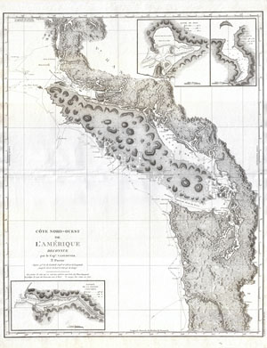
Cote Nord-Ouest de L'Amerique Reconnue par le Cape. Vancouver. 3e. Partie.
sold
- Digital Map Information
- Suitable for large format printing
- DPI: 300
- File Size: 21.35 MB
- File Type: ZIP / TIFF
- ICC color profile embedded
- Delivered instantly via download link
Considered to be the great navigator George Vancouver's most important and influential map, this is the third plate of his reconnaissance of the northwest coast of America. This 1799 map covers from Cape Lookout (modern day ... (more details)
Celebrating Seattle's success.
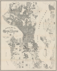
Anderson Map Co's 1909 Official map of Greater Seattle.
sold
- Digital Map Information
- Suitable for large format printing
- Full resolution TIFF file
- ICC color profile embedded
- Delivered instantly via download link
An impressive, very large, and intricately detailed map of Seattle, produced in 1909 by the Anderson Map Company to coincide with the Alaska-Yukon-Pacific Exposition. It provides a snapshot of the city in the wake of the Klondike Gold Rush, a consequent population boom, and ambitious urban planning projects. (more details)
First map to show Vancouver Island and Puget Sound.
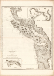
Cote Nord-Ouest de L'Amerique Reconnue par le Cape. Vancouver. 3e. Partie.
sold
- Digital Map Information
- Suitable for large format printing
- DPI: 600
- File Size: 1024.17 MB
- File Type: ZIP / TIFF
- ICC color profile embedded
- Delivered instantly via download link
This is the 1799 French edition of George Vancouver's 1799 nautical map of Vancouver Island, the Strait of Juan de Fuca, the mouth of the Columbia River, and Queen Charlotte Sound, extending from Cape Lookout (in modern-day Oregon) to Cape Swaine (Alaska). It is considered to be the great navigator George Vancouver's most important and influential map, among those he produced in his foundational reconnaissance of the northwest coast of America (1791 - 1795). (more details)
Port Townsend wants a railroad!
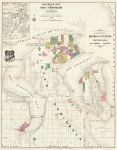
Whitney's Map of Port Townsend and Environs.
sold
- Digital Map Information
- Suitable for large format printing
- File Size: 28.42 MB
- File Type: ZIP / TIFF
- ICC color profile embedded
- Delivered instantly via download link
This is the rare 1890 W. H. Whitney and 'Miller and Going' map of Port Townsend, Washington. The map illustrates the early days of Port Townsend as it struggled to develop railroad connections. Although a prosperous port town, Port Townsend, situated on wrong side of the Puget sound, was too far and difficult to access to attract the attention of the Northern Pacific. This map instead captures grassroots efforts of Port Townsend residents to develop their own lines - the Port Townsend Southern and the Port Townsend and Southern Railroad to Quilcene. It combines the function of a real estate map and a railroad map. An inset in the upper left offers an overview of the general area. The map covers the entrance to the Straits of Juan de Fuca, Port Discovery, Port Townsend Bay, and Scow Bay (Long Harbor) to western Whidbey Island. (more details)
Scarce, Superbly Detailed Map of the Northwestern Territories and States: First Detailed Map Naming the Wyoming Terrirory
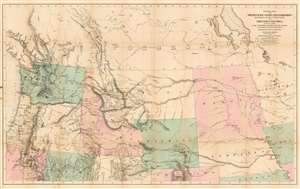
General Map of the North Pacific States and Territories Belonging to the United States and of British Columbia, Extending from Lake Superior to the Pacific Ocean and Between Latitude 39 degrees and 53 degrees North. Exhibiting Mail Routes, Gold Mines, and Including the Most Recent Surveys of the Topographical Bureau. Prepared by Captain John Mullan. ... Drawn by Edward Freyhold, T.E. Lithographed by J. Bien, 24 Vesey, St. N.Y.
sold
- Digital Map Information
- Suitable for large format printing
- File Size: 44.63 MB
- File Type: ZIP / TIFF
- ICC color profile embedded
- Delivered instantly via download link
This the 1865 Mullan - Freyhold map of the American Northwest. It shows the territories of Washington, Idaho, Montana, Wyoming, Dakota and Nebraska, and the State of Oregon in completion, and portions of California, Minnesota, Iowa, Kansas, Colorado, Utah and Nevada. The lithographed map - with hand wash color to distinguish the territories from one another - is beautifully executed and detailed. Carl Wheat esteemed this 'very fine' map so well that he chose it for the frontispiece of the fifth volume of Mapping the Transmississippi West. In discussing Freyhold, in particular, Wheat rhapsodizes:
Edwin (sic) Freyhold, who seems to have been responsible for the actual drawing of the topography, was an unrivaled expert in this type of work. His penned originals are almost unbelievably delicate, and must be examined with a powerful magnifying glass to be appreciated.Indeed, the map's details are superbly drafted and lithographed, with clear, legible typography and beautifully hachured mountains. The map, and the guide accompanying it, was intended to aid and encourage hopeful emigrants to the new territories of the northwest, particularly prospectors. The map relies heavily on data arising from Mullan's tenure as superintendent of construction for the northern military wagon road running from Walla Walla to Fort Benton on the upper Milk River, and indeed Wheat specifically praises the detail of its trails: Mullan's road is shown in its several variants, including Mullan' proposed (and rejected) route to Walla-Walla via Fort Laramie. Another route following the Yellowstone River west and crossing the mountains via Beaver Head Valley is indicated to the south of the Mullan road. Well-established U.S. Mail routes are shown in the southern part of the map. (more details)
Published just 45 years after the Seattle's founding, at the height of the Yukon Gold Rush, this is one of the earliest separately issued maps of the city to be published in that city.
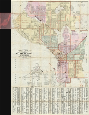
Anderson's 1896 Street and Guide Map of the City of Seattle Washington.
sold
- Digital Map Information
- Suitable for large format printing
- File Size: 35.62 MB
- File Type: ZIP / TIFF
- ICC color profile embedded
- Delivered instantly via download link
Published just 45 years after the Seattle's founding, at the height of the Yukon Gold Rush, this is one of the earliest separately issued maps of the city to be published in that city. This is a rare and impressive large ... (more details)
Details the U.S. government forced internment of over 100,000 Japanese Americans.
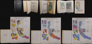
This is a 1943 U.S. government report detailing the forced internment of west-coast Japanese Americans during World War II (1939 - 1945). The reports offers disturbing insights into the racist policies and unfounded paranoia that gripped the nation in the wake of the 1941 attack on Pearl Harbor. (more details)
A Large, Superbly Detailed Map of Western Washington by its Premier Civil Engineer
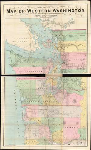
W.H. Pumphrey's map of western Washington: compiled from official records and personal reconnaissance.
sold
- Digital Map Information
- Suitable for large format printing
- File Size: 52.72 MB
- File Type: ZIP / TIFF
- ICC color profile embedded
- Delivered instantly via download link
This rare, detailed map is W. H. Pumphrey's 1892 Map of Western Washington: Compiled from Official Records and Personal Reconnaissance. Pumphrey, a respected Seattle fixture and proprietor of one of its finest stationers, sold the map: it was printed by the powerhouse Philadelphia map publisher Edward Noll and drawn by the Norwegian/ American draftsman F. M. Dehly. (more details)
A definitive map of the Pacific Northwest, considered by Wheat, 'really quite extraordinary.'
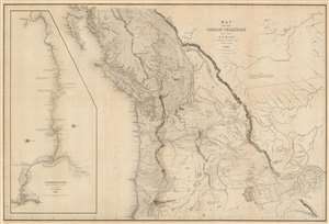
Map of the Oregon Territory by the U.S. Ex. Ex.
sold
- Digital Map Information
- Suitable for large format printing
- DPI: 600
- File Size: 59.51 MB
- File Type: ZIP / TIFF
- ICC color profile embedded
- Delivered instantly via download link
This important and extraordinary production is Commodore Wilkes' 1841 U.S. exploring expedition map of Oregon Territory, the finest and most important map of Oregon of the 19th century. The map covers roughly from the 50th parallel to Mount Shasta, the upper Sacramento River, and Great Salt Lake (Youta Lake) and from the Pacific to the Black Hills. It includes, either in part or full, modern day Washington, Oregon, British Columbia, Vancouver, Idaho, Utah, Nevada, Montana, Wyoming, and California. A large inset occupying the left quadrants focuses on the Columbia River where the United States exploring expedition lost one of its ships, the Peacock, on the infamous Columbia Bar. Topography is rendered by hachure and the engravers even made some attempt to illustrate the vast pine forests of the Pacific Northwest. (more details)
Early surveying expedition to the American West.
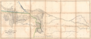
Map of a Reconnaissance between Fort Leavenworth and the Missouri River, and the Great Salt Lake in the Territory of Utah, made in 1849 and 1850…
sold
- Digital Map Information
- Suitable for large format printing
- Full resolution TIFF file
- ICC color profile embedded
- Delivered instantly via download link
A monumental map, matching the landscape it depicts, this is Howard Stansbury's seminal map of the lands between Fort Leavenworth, Kansas, and Pilot Peak (now Nevada), west of the Great Salt Lake. Originally published in 1852 as part of the Stansbury Report presented to the U.S. Congress that year, the present example is mounted on linen and folds into a case, as it was intended for a member of Congress. This is hand-down the finest example we've seen of this map, and if you are considering it for your collection, this is the one you want. (more details)
Manuscript record of an egregious (and successful) Swamp Act land grab.
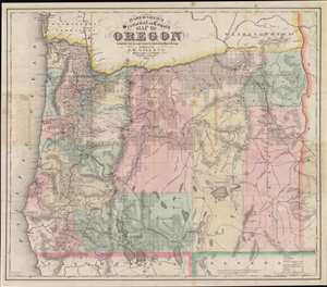
Habersham's Sectional and County Map of Oregon.
sold
- Digital Map Information
- Suitable for large format printing
- File Size: 50.36 MB
- File Type: ZIP / TIFF
- ICC color profile embedded
- Delivered instantly via download link
This 1874 Gill / Habersham map of Oregon is one of the earliest and best separate issue maps of Oregon, here amended with meticulous manuscript annotations illustrating one of the largest and most egregious land grabs in Oregon history. Moreover, the manuscript annotations also bring to light the impact of the little-known Swamp Lands Act on eastern Oregon. (more details)
Seminal Map of the Pacific Northwest.
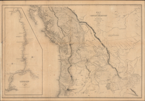
Map of the Oregon Territory by the U.S. Ex. Ex.
sold
- Digital Map Information
- Suitable for large format printing
- Full resolution TIFF file
- ICC color profile embedded
- Delivered instantly via download link
This Commodore Wilkes' rare large-format 1841 U.S. Exploring Expedition (U.S. Ex. Ex.) map of Oregon Territory, which appeared in the expedition Atlas. Wilkes' map was the finest and most detailed map of this largely unknown Oregon-Washington-Vancouver-Idaho region yet published and is considered by map historian Carl I. Wheat to be 'really quite extraordinary'. (more details)
Foundational Map of the American West.
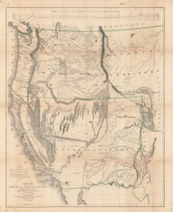
Map of Oregon and Upper California From the Surveys of John Charles Frémont.
sold
- Digital Map Information
- Suitable for large format printing
- DPI: 600
- File Size: 128 MB
- File Type: ZIP / TIFF
- ICC color profile embedded
- Delivered instantly via download link
A landmark 1848 map of the American West by John C. Frémont and Carl Preuss. In the words of Carl Wheat,
More than any other persons, John Charles Fremont and Charles Preuss dominate the cartography of the American West during the three years before the Gold Rush and brought a human tide surging into that land which had so long lain beyond the ken of most Americans. (Wheat, C. I., Mapping of the Transmississippi West, 1540 – 1861, 523).(more details)
Foundational Map of the American West.
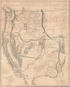
Map of Oregon and Upper California From the Surveys of John Charles Frémont.
sold
- Digital Map Information
- Suitable for large format printing
- File Size: 51.39 MB
- File Type: ZIP / TIFF
- ICC color profile embedded
- Delivered instantly via download link
A landmark 1848 map of the American West by John C. Frémont and Carl Preuss. In the words of Carl Wheat,
More than any other persons, John Charles Fremont and Charles Preuss dominate the cartography of the American West during the three years before the Gold Rush and brought a human tide surging into that land which had so long lain beyond the ken of most Americans. (Wheat, C. I., Mapping of the Transmississippi West, 1540 - 1861, 523).(more details)