
Illustrates the ephemeral period when there was an Oklahoma Territory and an Indian Territory vying for statehood.

Map Showing Indian Reservations Within the Limits of the United States. Compiled Under the Direction of the Hon. T.J. Morgan.
sold
- Digital Map Information
- Suitable for large format printing
- File Size: 37.41 MB
- File Type: ZIP / TIFF
- ICC color profile embedded
- Delivered instantly via download link
This is an 1892 Thomas Jefferson Morgan map of the United States showing Indian reservations. The map depicts the country from the Pacific Ocean to the Atlantic Ocean and from Canada to Mexico and the Gulf of Mexico. Indian reservations throughout the country are highlighted in orange and labeled in block lettering. Indian boarding schools, day schools, and contract schools throughout the U.S. are identified by different symbols which correspond to a key situated along the left border. The states are all illustrated, labeled, and shaded different colors to allow for easy differentiation. Cities and towns are labeled as well, as are railroads throughout the country. Yellowstone National Park, established in 1872, is also identified. Three insets are situated along the bottom border that illustrate Alaska, the Mission Indian Reservation in California, and the northeastern corner of the Indian Territory. (more details)
A reduction of the survey by Bjorn Gunnlaugsson - the first scientific survey of Iceland.

Map of Iceland to illustrate the Paper by Dr. K. Grossmann.
sold
- Digital Map Information
- Suitable for large format printing
- File Size: 5.08 MB
- File Type: ZIP / TIFF
- ICC color profile embedded
- Delivered instantly via download link
This is an 1894 Edward Weller map of Iceland. Created to accompany the paper given by Karl Grossmann to the Royal Geographical Society (RGS), the map depicts the entire island and is a reduction of the ground-breaking survey of Björn Gunnlaugsson. Grossmann's route is traced in red. His justification for presenting what may have appeared as 'a superfluous task' before the RGS was multiple, stating that the abundance of interesting physiographical features in Iceland is 'surprising' and that they 'are not always accessible', which led to a 'very fragmentary' understanding of Iceland. Grossmann also made a point of photographically documenting his journey, one of the first explorers to do so, stating that very few illustrations have ever been produced, with those that are most commonly reproduced in illustrated publications either being 'incorrect' or 'old time-honoured woodcuts, often copied secondhand, and mostly without acknowledgement'. (more details)
Highlights streecar lines and major thoroughfares in Portland.
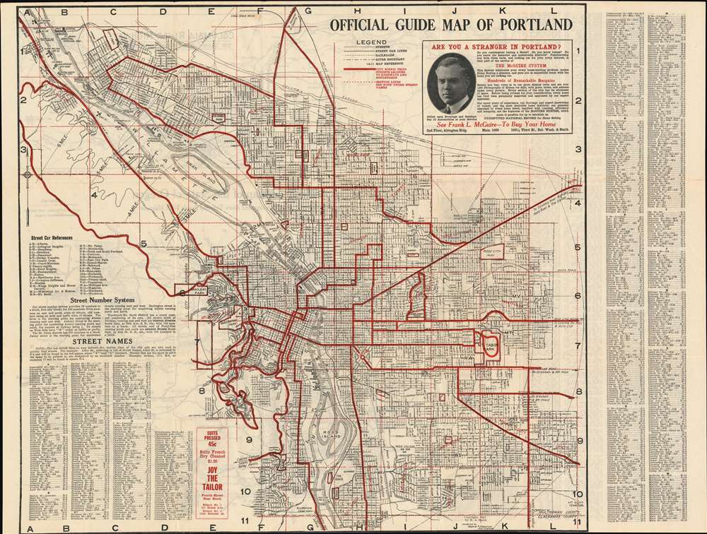
Official Guide Map of Portland.
sold
- Digital Map Information
- Suitable for large format printing
- File Size: 35.76 MB
- File Type: ZIP / TIFF
- ICC color profile embedded
- Delivered instantly via download link
This is a 1921 Radford R. Shawcross city map or plan of Portland, Oregon. The map depicts the city from the West Oregon Lumber Company on the banks of the Willamette River to Mt. Scott Cemetery and from the Union Stock Yards to Clackamas County. Highly detailed, myriad streets throughout the city are illustrated labeled and an alphabetical street index is situated in the lower left corner and along the right border which provide the grid location of each street. Streetcar lines throughout the city are highlighted by thick black lines and marked by two letter abbreviations, with the references situated on the lower left as well. The bridges across the Willamette are all labeled, as are numerous companies along the river's banks, including shipyards, shipbuilders, iron works, lumber companies, and docks. The thick red lines mark scenic trips and thoroughfares leading to major highways and boulevards. Parks and cemeteries are also labeled. An advertisement for a realtor based in Portland is situated in the upper right corner next to the legend. (more details)
A beautiful view of the old Hotel de Ville in Paris, before it was burned down at the end of the Paris Commune in 1871.

Vue de l'Hôtel de Ville Prise du Quai Pelletier.
sold
- Digital Map Information
- Suitable for large format printing
- DPI: 600
- File Size: 11.1 MB
- File Type: ZIP / TIFF
- ICC color profile embedded
- Delivered instantly via download link
This is an 1844 Jules Arnout view of the Hôtel de Ville (City Hall) in Paris, France. The view, drawn by Arnout from the quai Pelletier (today's quai de Gesvres), illustrates the hôtel de ville as it would have been seen from the Seine. The view details the building's beautiful Renaissance-style façade with Parisians milling about in the square in front going about their daily lives. (more details)
Afghanistan and Pakistan as known in the Classical Era

Tabula Asiae IX.
sold
- Digital Map Information
- Suitable for large format printing
- DPI: 600
- File Size: 8.71 MB
- File Type: ZIP / TIFF
- ICC color profile embedded
- Delivered instantly via download link
This 1552 Munster map depicts the areas west of the Indus River Delta, including present-day Pakistan, Afghanistan, and eastern Iran as they were known to the second-century geographer, Claudius Ptolemy. It appeared in the final, 1552 Munster edition of Ptolemy's Geographia. The regions of Aria, Drangiana and Arachosia refer to Afghanistan; Gedrosia is roughly equivalent to the Pakistani province of Baluchistan. The portions of Parthia and Carmania shown in the western part of the map are part of modern-day Iran. Despite being shown pictorially, the course of the Indus River and the depiction of the mountainous region bordering Persia is remarkably correct. The table at lower right indicates place names that had changed between Ptolemy’s time and that of Munster. (more details)
16th Century Woodcut Map of Kazakhstan, Tajikistan, and Uzbekistan as known to Ptolemy
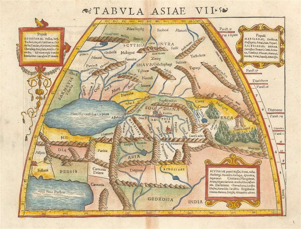
Tabula Asiae VII.
sold
- Digital Map Information
- Suitable for large format printing
- DPI: 600
- File Size: 9.61 MB
- File Type: ZIP / TIFF
- ICC color profile embedded
- Delivered instantly via download link
This is a 1552 example of Ptolemy's map of the Silk Road. The seventh Asian map from Sebastian Munster's Ptolemy, it shows the lands in Central Asia, east of the Caspian Sea. These were occupied in the 1st and 2nd centuries CE by the Sogdiqna, an ancient Iranian civilization that at different times included territory located in present-day Kazakhstan, Tajikistan, and Uzbekistan. To the north are shown the lands of the nomadic Scythians.
Centrally, the lands of the Sogdiana sit astride what we know now to be the Silk Road. At the eastern extent of the map is shown Turris Lapid, the 'Stone Tower' (λίθινος πύργος in Greek) which marked the midpoint on the ancient Silk Road – the network of overland trade routes taken by caravans between Europe and Asia. The tower was the most important landmark on this route, where caravans stopped on their difficult and dangerous journeys to allow travellers to take on provisions, rest, and trade goods before continuing on. (more details)
Centrally, the lands of the Sogdiana sit astride what we know now to be the Silk Road. At the eastern extent of the map is shown Turris Lapid, the 'Stone Tower' (λίθινος πύργος in Greek) which marked the midpoint on the ancient Silk Road – the network of overland trade routes taken by caravans between Europe and Asia. The tower was the most important landmark on this route, where caravans stopped on their difficult and dangerous journeys to allow travellers to take on provisions, rest, and trade goods before continuing on. (more details)
Sears and Roebuck Prepare Their Radio Customers for The Next War (By Preparing Them For The Previous One)
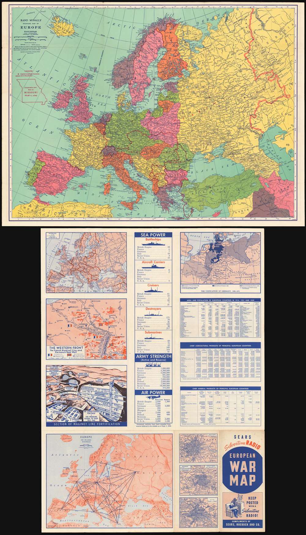
Rand McNally standard map of Europe./ Sears Silvertone radio European War Map.
sold
- Digital Map Information
- Suitable for large format printing
- File Size: 68.44 MB
- File Type: ZIP / TIFF
- ICC color profile embedded
- Delivered instantly via download link
This is a 1940 Rand McNally Map of Europe, published for Sears and Roebuck as a promotion for their Silvertone line of electronics - 'Keep Posted with a Silvertone Radio!' The recto map displays what was, for the American audience, the expected theatre of what would undoubtably be a simple re-play of the first World War: the continent of Europe. The brightly-colored map shows the 1939 national boundaries, with pre-World War borders marked in red for reference. (Thus, the borders of Austria-Hungary and the Balkans can be seen, as can the pre-Soviet Russia.) To provide a sense of scale for the American reader, an outline of the State of Missouri has been added - suggesting that any one of the players in the upcoming conflict was barely the size of just one small part of the United States. (more details)
An Attractive 19th. Century Texas, with Railroads and Ranches
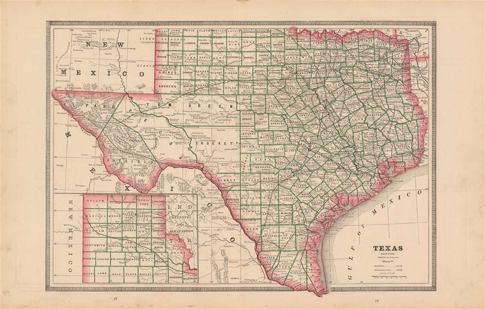
Texas.
sold
- Digital Map Information
- Suitable for large format printing
- File Size: 15.35 MB
- File Type: ZIP / TIFF
- ICC color profile embedded
- Delivered instantly via download link
This is an 1883 map of Texas, most likely from Cram's 'Unrivaled Family Atlas of the World'. The state is outlined in red: counties are bordered in green. Reeves County is not yet shown. Tom Green, Pecos, Presidio and El Paso Counties are still not subdivided. Topographical features and rivers are shown with hachure. Railroads are clearly noted. Towns, and even major ranches are also located. Interestingly, greer County is shown as part of Texas. (Even an 1896 Supreme Court ruling was insufficient in settling ownership of the land in question.) (more details)
Remarkable Temperance Broadside.

Black Valley Rail Road. Great Central Fast Route.
sold
- Digital Map Information
- Suitable for large format printing
- File Size: 24.74 MB
- File Type: ZIP / TIFF
- ICC color profile embedded
- Delivered instantly via download link
This is without a doubt the most beautiful and remarkable variants on 'Black Valley Rail Road' temperance allegory. This chromolithograph broadside was issued in 1863 on behalf of Stedman Wright Hanks, an ardent Cambridge, Massachusetts temperance advocate. Central to the image is a great demonic train, headed for the dark and dreadful Black Valley. Some escape to 'Temperance Land' on the coach while others party in the saloon car. Below the central image is an explanation of the image, with illustrations of stomachs at various stages on the allegorical voyage. (more details)
Map that led to the lifetime imprisonment of its maker.
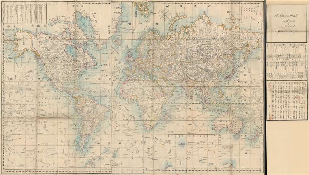
Bankoku Kōkai-zu / 萬国航海圖 / World Navigational Map.
sold
- Digital Map Information
- Suitable for large format printing
- File Size: 120.21 MB
- File Type: ZIP / TIFF
- ICC color profile embedded
- Delivered instantly via download link
An important 1862 Bunkyu 2 world map, the product of a clash of Japanese and European cultures and the end of Tokugawa isolationism that lead to the lifelong imprisonment of one of its makers. Centered on Europe, this enormous map covers the entire world on a Mercator Projection, marking it as one of the first Japanese maps to use this western projection model. The map illustrates trade routes from Japan to England, passing through the Malacca Straits and the Red Sea. Major exploratory routes followed by Cook and others, drawn from the Purdy map, are also included. The map is accompanied by its usual side panel with Schnell's manuscript 'Yokohama February 1862' imprint. (more details)
Spectacular and rare wall map of India
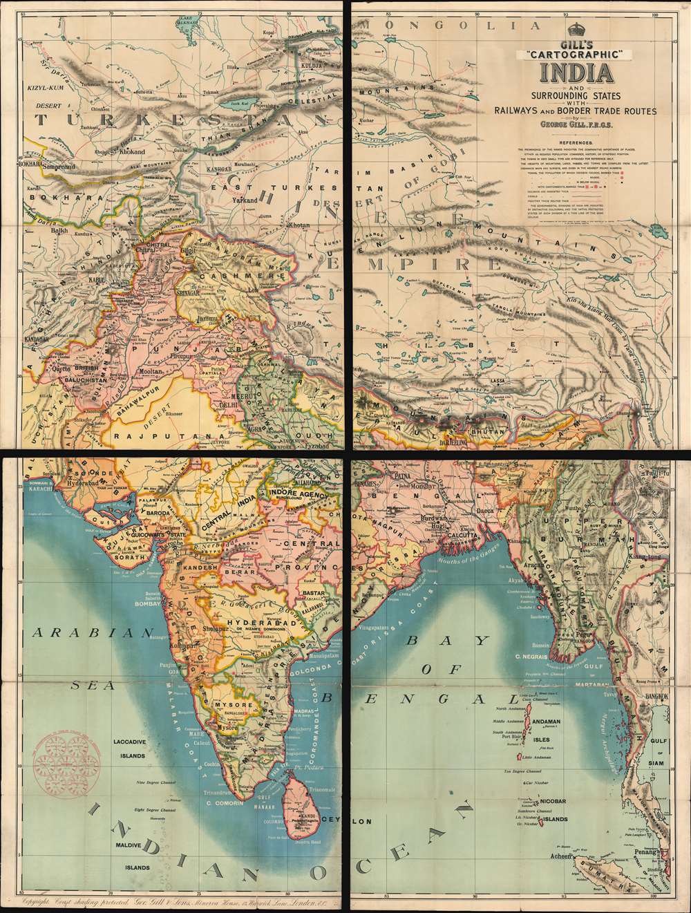
Gill's Cartographic India and Surrounding States with Railways and Border Trade Routes
sold
- Digital Map Information
- Suitable for large format printing
- Full resolution TIFF file
- ICC color profile embedded
- Delivered instantly via download link
A rare and majestically enormous c.1900 four-part map of India by George Gill and Sons. Presented in chromolithographic color and consisting of four linen back folding sections, this massive map covers from Mongolia to Sri Lanka and from Karachi to Bangkok, with the central focus being the Indian Subcontinent. The subcontinent is divided into various British run or influenced agencies and sub-agencies, ranging from British Baluchistan to the Indore Agency. As a schoolroom map, the chart is not excessively dense, has bold color, and large easy to read print. The intense blue coastal shading is apparently something the at Gill was rightfully proud of, as a note int the lower left margin, states 'Copyright coast shading protected. (more details)
Bird's Eye View of Damascus in Sumptious Contemporary Color
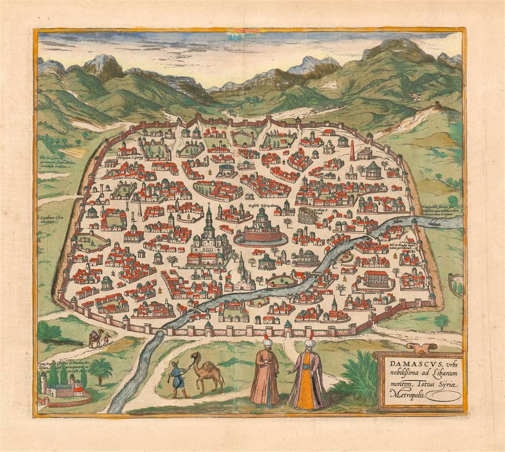
Damascus, urbs noblissima ad Libanum montem, Totius Sÿriae Metropolis
sold
- Digital Map Information
- Suitable for large format printing
- DPI: 600
- File Size: 14.78 MB
- File Type: ZIP / TIFF
- ICC color profile embedded
- Delivered instantly via download link
This is a superb example of the 1575 view of Damascus, produced by Braun and Hogenberg for inclusion in the second volume of their Civitates Orbis Terrarum, the first dedicated city book. The beautifully engraved view, illuminated with superb original color, is one of the earliest printed views of Damascus. It depicts the contemporaneous Muslim walled city; its mosques are prominently shown. Some churches illustrated as well, though one of these, The Church of Saint Paul, is in ruins. In the foreground, two noblemen in Ottoman styles converse; two footmen can be seen leading camels. (more details)
Beautiful, Original Color Example of an Early Dutch Map of Asia

Asiae Nova Descriptio Auctore Jodoco Hondio.
sold
- Digital Map Information
- Suitable for large format printing
- DPI: 600
- File Size: 22.74 MB
- File Type: ZIP / TIFF
- ICC color profile embedded
- Delivered instantly via download link
This is a 1628 Hondius map of Asia in lovely original color. The map extends across the Pacific to include New Guinea, the Philippines, and part of North America. While the interior still contains place names and geographical features that would have been familiar to Strabo, Ptolemy and Marco Polo, the coastline of Asia is filled with contemporary detail. The coastline of the subcontinent shows access to the best Dutch cartography of the late 16th century. Japan and Korea appear as they do on Ortelius' 1584 map of Japan, with Korea shown as a large island. The map shows part of North America across the mythical 'Strait of Anian*'The southeast portion of the map includes Sumatra, a recognizable Malay Peninsula, and a reasonably well-informed treatment of the Philippines and the Spice Islands. New Guinea appears with a Latin note stating 'whether it is an island or part of a southern continent is not yet evident.' In the north, the Barentz's discoveries for the Dutch in and around Nova Zemla are noted and dated. (more details)
The Earliest Scienific Charting of Okinawa and the Ryukyu Islands
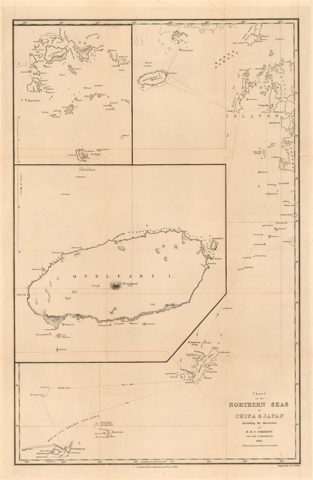
Chart of the Northern Seas of China and Japan Including the Discoveries of H. M. S. Samarang Captn, Sir E, Belcher C.B. 1845. All the shaded parts have been Surveyed.
sold
- Digital Map Information
- Suitable for large format printing
- Full resolution TIFF file
- ICC color profile embedded
- Delivered instantly via download link
This is an extremely rare 1848 Edward Belcher nautical map of the East China Sea, presenting the first scientific survey of the Ryukyu Islands and Okinawa (沖縄本島), Jeju Island (제주도) and Goheung Island (거금도). It was the result of the 1843-46 voyage of Captain Sir Edward Belcher aboard H.M.S. Samarang, which was noted and celebrated not only for thoroughly surveying the islands but also for conducting detailed socio-political and natural studies of them. Belcher was already a famous man prior to this expedition, having been knighted for his service in the First Opium War and having produced the first British survey of Hong Kong harbor. Belcher's expedition aboard the Samarang was explicitly intended to survey the approaches to the five Chinese ports that had been opened to the British in the 1842 Treaty of Nanking, which marked the end of the war. (more details)
Includes the city of Iloilo, the third most active port in the Philippines.
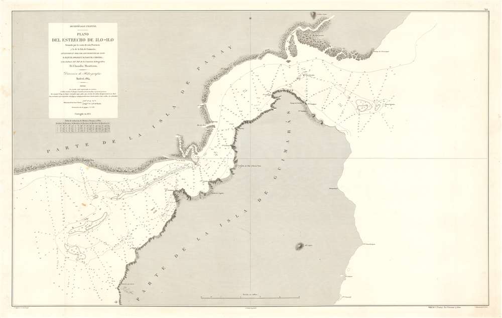
Archipiélago Filipino. Plano del Estrecho de Ilo - Ilo.
sold
- Digital Map Information
- Suitable for large format printing
- File Size: 53.29 MB
- File Type: ZIP / TIFF
- ICC color profile embedded
- Delivered instantly via download link
This is an 1875 Direccion de Hidrografia and D. Claudio Montero nautical chart or maritime map of the Iloilo Strait in the Philippines. The Iloilo Strait separates Panay Island from Guimaras Island and connects the Panay Gulf with the Guimaras Strait. Depth soundings are indicated throughout, as are banks and shoals. Points along the coast are labeled, as is the port city of Iloilo, which is today the third busiest port in the Philippines with regard to number of ships. A manuscript anchor in drawn near Iloilo, indicating the presence of a safe harbor. (more details)
A comical and incredibly charming pictorial map of Yosemite National Park.

Yosemite.
sold
This is a 1941 Jo Mora pictorial map of Yosemite National Park in California. The map centers on Yosemite Valley and identifies several of the granite peaks that surrounds the valley, including Half Dome and El Capitan. Most of these peaks are topped by comical illustrations of their names. A Spanish conquistador, for example, stands atop El Capitan, a cloud lounges in an easy chair at the summit of Clouds Rest (the highest peak around Yosemite Valley), and George Washington appears at the top of Washington Column. A bride in her wedding gown and veil peers over Bridalveil Falls, while a bishop precariously straddles Cathedral Spires. Vernal Falls, Nevada Falls, and Yosemite Falls are all illustrated and labeled.
The valley itself, as well as the granite heights surrounding it, is filled with tourists enjoying their time in the park. People are illustrated picnicking, camping, fishing, swimming in the river, feeding deer, and fleeing bears who have decided to help themselves to their picnic! Another visitor is taking a photographic portrait for a couple of bears. Still others appear on horseback or hiking the steep trails. Cars filled with awe-struck admirers of the landscape travel along the meandering roads toward campsites and lodges. A border featuring vignettes of activities at the park, including swimming, a campfire circle, horseback riding, winter sports, and fishing, is situated along the left side. A text box in the lower right corner bears a dedication to Mora's friend Stephen T. Mather, the first Director of the U.S. National Park Service. (more details)
The valley itself, as well as the granite heights surrounding it, is filled with tourists enjoying their time in the park. People are illustrated picnicking, camping, fishing, swimming in the river, feeding deer, and fleeing bears who have decided to help themselves to their picnic! Another visitor is taking a photographic portrait for a couple of bears. Still others appear on horseback or hiking the steep trails. Cars filled with awe-struck admirers of the landscape travel along the meandering roads toward campsites and lodges. A border featuring vignettes of activities at the park, including swimming, a campfire circle, horseback riding, winter sports, and fishing, is situated along the left side. A text box in the lower right corner bears a dedication to Mora's friend Stephen T. Mather, the first Director of the U.S. National Park Service. (more details)
Manila Harbor Charted in Fine Detail

Philippines, Luzon Island, Manila Bay Surveyed by the Spanish Phillipine Hydc. Commission under the direction of Captain Claudio Montero 1861 with Corrections and Additions to 1885.
sold
- Digital Map Information
- Suitable for large format printing
- File Size: 50.78 MB
- File Type: ZIP / TIFF
- ICC color profile embedded
- Delivered instantly via download link
A large, richly detailed 1886 navigational map of Manila Bay in the Philippines, one of the largest available in the English language. Published and updated by the British Admiralty, it was made in cooperation with the Spanish/ Philippine hydrographer D. Claudio Montero, who oversaw Spanish navigational charting of the Philippines directly for more than a decade. This chart shows significant updating even since its 1876 issue: topographical hachures are much more extensive and detailed; Subic Bay shows improved soundings; Manila bay's soundings have considerably multiplied. Tentative attempts to chart the river systems emptying into the north of the Bay are evident. Manila has been re-engraved, reflecting the rebuilding of the city after the 1863 earthquake. The charting of Punta de Kalumpan and Port Limbones shows significant improvement over the 1876 edition of the map as well. (more details)
One of the Earliest Contemporary Views of Jerusalem

Ierusalem civitas sancta, olim metropolis regni Iudaici, hodie vero colonia Turcae.
sold
- Digital Map Information
- Suitable for large format printing
- DPI: 600
- File Size: 11.59 MB
- File Type: ZIP / TIFF
- ICC color profile embedded
- Delivered instantly via download link
One of the earliest printed views of Jerusalem, executed in woodcut by Jacob Clauser for the Munster's Cosmographia, this example appearing in a 1559 Latin edition of the monumental work. It is one of the earliest available of the city. Unlike most early depictions, this bird’s-eye view is not intended as a purely retrospective depiction of the ancient city, but rather a modern view, showing the city at the time of publication. That said, the map is the design of a devout Christian, and so many of the features shown are those that would be of primary interest to Christian pilgrims (actual or purely armchair travelers.) Named are Mount Zion, the church of Saint Anne, and King David's tomb. The temple of the Knights of the Holy Sepulchre is shown. The court of Pilate, the palace of Herod, the Garden of Gesthemane and the Akeldama are also marked. As stated in the title, the city was at the time occupied by the Ottoman Empire. The Dome of the Rock is depicted centrally, and is clearly a mosque, but retains the name of the Temple of Solomon. The whole of the city is shown embraced by its ancient walls, with several of its famous gates named. (more details)
Employs a rainbow to trace the route of the 42nd Infantry 'Rainbow' Division through Europe during World War II.
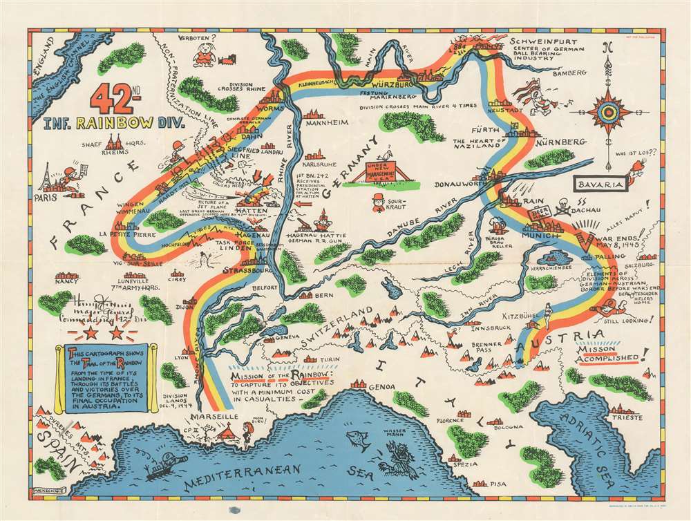
42nd Inf. Rainbow Div.
sold
- Digital Map Information
- Suitable for large format printing
- File Size: 17.05 MB
- File Type: ZIP / TIFF
- ICC color profile embedded
- Delivered instantly via download link
Created by Theodore MacKechnie, a veteran of the 42nd Infantry Division, this 1945 pictorial route map traces the path of the 42nd from its landing at Marseille on December 9th, 1944, until its arrival Austria in Austria after serving 106 days in combat. A wonderfully comic depiction of an incredibly serious subject, MacKechnie used the division's nickname, 'Rainbow', to inspire his depiction of their route across Europe. (more details)
Depicts both Hong Kong and Macao.
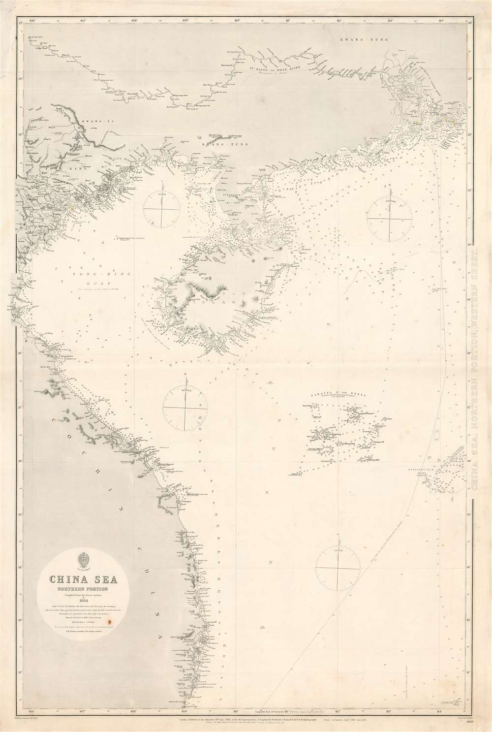
China Sea, Northern Portion, Western Sheet.
sold
- Digital Map Information
- Suitable for large format printing
- File Size: 46.76 MB
- File Type: ZIP / TIFF
- ICC color profile embedded
- Delivered instantly via download link
This is an 1886 British Admiralty nautical chart or maritime map of Vietnam, the Gulf of Tonkin, and the South China Sea. The map depicts the region from Vinh, Vietnam to Hong Kong and from Pe-sé, China to Cape Padaran, Vietnam. Incredible detail is illustrated along the entire coastline. Myriad depth soundings are indicated, with the highest concentration appearing near Hong Kong and Macau. Coastal cities and towns are labeled, along with islands, bays, and points. Little inland detail is provided, with the exception of the courses of rivers. The Paracel Islands and the Macclesfield Bank in the South China Sea are both illustrated and labeled. (more details)