
Boston (sold)

This is a rare and extraordinary powder horn dating to 1775, just prior to the Revolutionary War. Features a stunning scrimshaw map of Boston, Massachusetts, noting Bunker's Hill (Bunker Hill), Breeds Hill, Morton's Point, Charlestown, Mill Pond, Hancock's Warf, ... (more details)
The absolute best view of Boston.
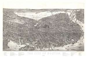
The City of Boston. 1879.
sold
- Digital Map Information
- Suitable for large format printing
- File Size: 40.5 MB
- File Type: ZIP / TIFF
- ICC color profile embedded
- Delivered instantly via download link
A magnificent 1879 bird's-eye view and map of Boston by James Compton Hazen and Oakley Hoopes Bailey, it is considered the largest and most detailed view of Boston Proper. The view presents Boston from an imaginary elevated position to the southeast of the city, looking northwest towards the Charles River with Cambridge appearing in the upper left and East Boston in the upper right. Hazen's slight and novel exaggeration of the vertical axis enhances the view with an intense three-dimensionality. This effect further highlighted by Hazen's use of a modified axonometric perspective - a technique that assumes a uniform fixed height and angle relative to all buildings, here modified only slightly to create a subtle perspective within the main Boston peninsula. The traditional view modality reasserts itself beyond the city proper where the background and outlying areas recede into the horizon. (more details)
Original planing manuscript map for The Fens.
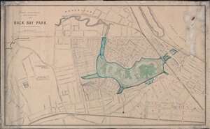
Park Department City of Boston 1877. Back Bay Park.
sold
- Digital Map Information
- Suitable for large format printing
- File Size: 82.57 MB
- File Type: ZIP / TIFF
- ICC color profile embedded
- Delivered instantly via download link
This is a unique c. 1880 urban planning map of the Back Bay Fens Park and the Fenway, Boston. The map consists of a printed map, issued in 1877 by the Park Commissioners, augmented with extensive manuscript work, including a beautiful construction-stage layout of the entire Back Bay Fens Park, as well as associated draining channels and sewers, and extensive text annotation. The layout of the park conforms to an early iteration of Frederick Law Olmsted's original plan - his updated plan was published in 1887. Centered on the park and oriented to the northwest, the map covers from Heath Street to Fairfield Street and from Brookline to the Boston and Providence Railroad. (more details)
Capital of New England - one of the earliest views of Boston based on actual observation.
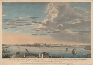
A View of the City of Boston the Capital of New England, in North America. / Vue de la Ville de Boston Capitale de la Nouvelle Angleterre, dans l'Amérique Septemtrionale.
sold
- Digital Map Information
- Suitable for large format printing
- DPI: 600
- File Size: 387.91 MB
- File Type: ZIP / TIFF
- ICC color profile embedded
- Delivered instantly via download link
This is the rare Thomas Pownall view of Boston, published in 1768. It is one of the earliest obtainable views of Boston offering a look at the city shortly after the French and Indian War (1754 - 1763). (more details)
Overlooking Boston Common to the east.
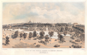
View of the Public Garden and Boston Common. From Arlington Street.
sold
- Digital Map Information
- Suitable for large format printing
- File Size: 81.98 MB
- File Type: ZIP / TIFF
- ICC color profile embedded
- Delivered instantly via download link
This is an 1866 Edwin Whitefield view of Boston Common and the Public Garden. It represents one of the finest lithograph views of the Boston Common to appear in the mid-19th century. (more details)
Unique insight into the early development of the Back Bay.
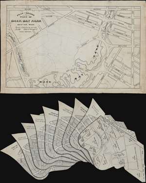
Plan of Region West of Back Bay Park Boston, Mass.
sold
- Digital Map Information
- Suitable for large format printing
- Full resolution TIFF file
- ICC color profile embedded
- Delivered instantly via download link
This is a unique 1886 Fuller and Whitney urban planning manuscript map of Boston's Back Bay immediately to the west of the Fens Park. The map consists of a manuscript masterplan, with 8 prospective overlays, each proposing a different plan for the new residential development. The plans offer slightly different street layouts, each with a different level of 'waste' by which the designer meant parks, boulevards, gardens, and other public recreation areas. The final development most resembles plans 7 or 8, representing the least 'urban waste'. In addition, there is a 9th overlay illustrating land rights and property ownership. (more details)
Manuscript planning map of the Fens.
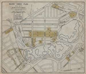
Block Index Plan Showing land of B.W.P. Co. Trustees.
sold
- Digital Map Information
- Suitable for large format printing
- File Size: 56.95 MB
- File Type: ZIP / TIFF
- ICC color profile embedded
- Delivered instantly via download link
This is a 1901 William H. Whitney manuscript map of the Back Bay Fens and the Fenway - Kenmore neighborhood in Boston, Massachusetts. Coverage extends from Brookline Avenue to Huntington Avenue, but the Fens dominate the map, with the waterways emphasized in light blue. Land owned by the Boston Water Power Company is in toned yellow or green. (more details)
Among the first printed illustrated views of the American Revolutionary War.
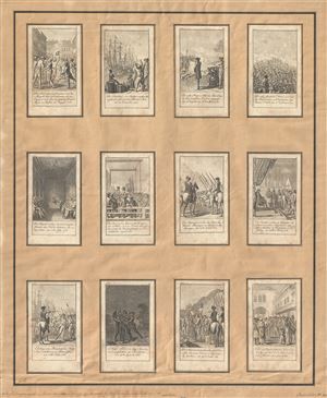
[Scenes from events and battles leading up to and during the American Revolution, 1775-1783, as depicted in 12 illustrations]
sold
- Digital Map Information
- Suitable for large format printing
- DPI: 300
- File Size: 10.62 MB
- File Type: ZIP / TIFF
- ICC color profile embedded
- Delivered instantly via download link
The full set of Chodowiecki's twelve 1784 card views illustrating the American Revolutionary War. Chodowiecki's twelve engraved images are among the first printed illustrations of the events in the colonies and were intended to capitalize on German popular ... (more details)
The first large scale trigonometric survey of the Boston vicinity since Des Barres.
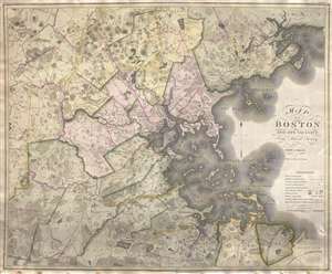
Map of Boston and its vicinity from Actual Survey.
sold
- Digital Map Information
- Suitable for large format printing
- Full resolution TIFF file
- ICC color profile embedded
- Delivered instantly via download link
An exceptional 1819 first edition wall map of Boston, Massachusetts jointly published by John Groves Hales and John Melish. Centered on Boston, Hales' map covers some 720 square miles from Acton to Scituate and from Beverly to Walpole. Hales offers ... (more details)
An extremely scarce privately issued nautical chart of Long Island, New York.
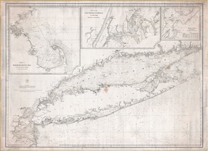
[Long Island, 1860]
sold
- Digital Map Information
- Suitable for large format printing
- File Size: 60.03 MB
- File Type: ZIP / TIFF
- ICC color profile embedded
- Delivered instantly via download link
An extremely rare 1860 blueback nautical chart or maritime map of Long Island by the Brooklyn chart publisher Charles Copley. Copley's chart covers from Staten Island to Montauk, inclusive of the Connecticut coast, Long Island Sound, Long Island itself, New York City, and parts of adjacent New Jersey and Rhode Island. Moreover, the map features three large insets detailing Cape Cod and vicinity, New York City's East River, and New York City's Hell Gate. (more details)
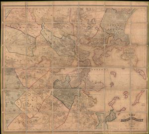
Map of Boston and its vicinity, from Actual Surveys
sold
- Digital Map Information
- Suitable for large format printing
- File Size: 29.7 MB
- File Type: ZIP / TIFF
- ICC color profile embedded
- Delivered instantly via download link
An expansive 1859 dissected case map of Boston, Massachusetts and its immediate vicinity compiled by Henry F. Walling. This enormous production is one of the large and most detailed maps of Boston to appear in the 19th century. Centered on Boston ... (more details)
19th Century reissue of the earliest Printed Map of Boston.
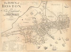
The Town of Boston in New England by Capt. John Bonner 1722.
sold
- Digital Map Information
- Suitable for large format printing
- File Size: 14.26 MB
- File Type: ZIP / TIFF
- ICC color profile embedded
- Delivered instantly via download link
This is George Girdler Smith's rare 1835 reissue of John Bonner's 1722 city map or plan of Boston. Considered the first printed map of Boston, Bonner's map covers the city's location on the Shawmut Peninsula, nearly an island, as it appeared in the early 18th century. (more details)
Stunning case map of Boston and vicinity.
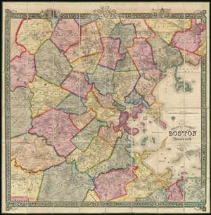
Map of the City and Vicinity of Boston, Massachusetts.
sold
- Digital Map Information
- Suitable for large format printing
- DPI: 300
- File Size: 0.65 MB
- File Type: ZIP / TIFF
- ICC color profile embedded
- Delivered instantly via download link
This is a stunning large format first edition 1852 case map of Boston, Massachusetts, and vicinity. Centered on Boston, the map covers from Danvers to Hingham, and from Weston to Massachusetts Bay. Towns are coded in bright original color. The ... (more details)
Smith edition of the first printed map of Boston!
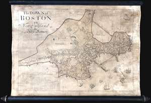
This is George Girdler Smith’s (1795-1878) rare 1835 reissue of John Bonner’s 1722 map of Boston. Considered the first printed map of Boston, Bonner’s map covers the peninsula of Boston as it appeared in the early 18th century. The map includes a wealth of fascinating information about pre-Revolutionary War Boston, including street layouts, the Boston Common, Beacon Hill, the Mill Dam, churches, public buildings, and more. Bonner also illustrates Boston's importance as a port city, detailing the location of docks, shipyards, wharves, and ropewalks. An index in the lower left helps to identify various locales on the map. The harbor around Boston is full of engraved sailing ships – evidence of Boston’s lively trade and prosperity. (more details)
Monumental map of Boston.
Map of the City of Boston and its Environs.
sold
- Digital Map Information
- Suitable for large format printing
- Full resolution TIFF file
- ICC color profile embedded
- Delivered instantly via download link
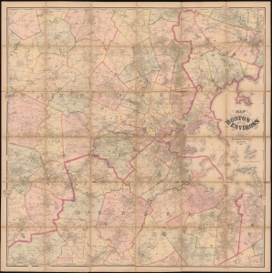
This is an 1867 Henry Francis Walling and Ormando W. Gray map of Boston, Massachusetts, and environs. Boston appears to the right of center, with East Boston and South Boston both labeled. Boston Common and the Public Garden are labeled in Boston, along with streets, wharves, railroad lines, and a handful of buildings. Outside Boston, the map depicts from Wilmington, Danvers, and North Beverly south to West Medway and Walpole Centre and from Ashland Center east to Marblehead, Salem, and Beverly. Hundreds (if not thousands) of private residences are identified by the owner's name throughout, along with banks, schools, railroad stations, churches, and cemeteries. Roads, railroads, hills, lakes, rivers, and other physical features are noted. (more details)
Rare first Harrison edition of De Berniere's map of the Battle of Bunker Hill.
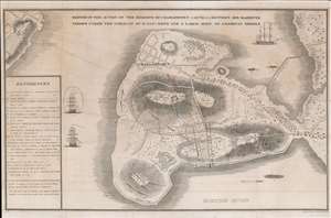
Sketch of the Action on the Heights of Charlestown 17 June 1775 Between His Majesty's Troops Under the Command of M. Genl. Howe and a Large Body of American Rebels.
sold
- Digital Map Information
- Suitable for large format printing
- DPI: 600
- File Size: 14.83 MB
- File Type: ZIP / TIFF
- ICC color profile embedded
- Delivered instantly via download link
This is a rare 1818 map of the 1775 American Revolutionary War Battle of Bunker's Hill, Boston. Cartographically, the map is derived from a sketch by Henry De Berniere, a reconnaissance Ensign (spy) under British commanding General Thomas Gage. The original manuscript, from all reports, was discovered in a trunk in the early 19th century. De Berniere witnessed Bunkers Hill first-hand and prepared the map for his report to Gage. The map is distinctive for its exacting attention to detail and topography, including the layout of Charlestown, as well as its overall fine execution, illustrating all troop movements, underscoring's De Berniere's officer's education as a military engineer and draftsman. When the map was discovered in an old trunk, it was instantly recognized as the finest record of the battle available and became the model for most subsequent illustrations of the events. (more details)

An extremely scarce and dramatic 1852 wall map of Boston, Massachusetts and vicinity. Depicts the greater Boston area from Dover in the southwest to part of Concord in the northwest to Hingham southeast and to Danvers northeast. Includes all of ... (more details)
Scarce view of the Battle of Bunker Hill.
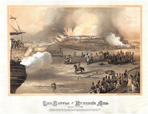
The Battle at Bunker's Hill June 17th 1775.
sold
- Digital Map Information
- Suitable for large format printing
- File Size: 12.59 MB
- File Type: ZIP / TIFF
- ICC color profile embedded
- Delivered instantly via download link
An uncommon 1875 lithograph view of the Battle of Bunker Hill drawn by Henry Atwell Thomas. The view illustrates the landing of British troops at Morton's Point and the subsequent shelling and burning of the town by the British Man-of-War ... (more details)
A view of MIT probably published to celebrate the opening of its Cambridge campus in 1916.
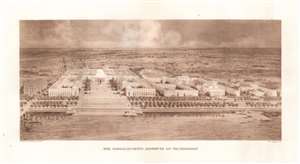
Massachusetts Institute of Technology.
sold
- Digital Map Information
- Suitable for large format printing
- File Size: 15.28 MB
- File Type: ZIP / TIFF
- ICC color profile embedded
- Delivered instantly via download link
This is an extremely rare and possibly the only obtainable example of this c. 1916 William Welles Bosworth bird's-eye view of the Massachusetts Institute of Technology (MIT) campus in Cambridge, Massachusetts. The view looks on the original main campus from across the Charles River. Buildings 1-10 (excepting 9) are illustrated to the left of center, with the Great Dome holding a prominent place. The engineering lab is illustrated on the right, with the original athletic field behind it. Large portions of the buildings shown here were never constructed, including the complex behind the main campus buildings and the complex between the engineering building and the main campus. (more details)
One of the first separately issued pictorial maps published in the United States.
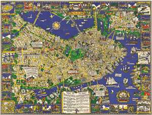
The Colour of an Old City A Map of Boston decorative and historical.
sold
- Digital Map Information
- Suitable for large format printing
- File Size: 96.22 MB
- File Type: ZIP / TIFF
- ICC color profile embedded
- Delivered instantly via download link
One of the first separately issued pictorial maps published in the United States, this is Edwin Birger Olsen and Blake Everett Clark's 1926 pictorial map of Boston. Centered on historic downtown Boston, the map depicts the city from Boylston Street to East Boston and from Cambridge to South Boston. Stunningly illustrated, Olsen and Clark blend together all the aspects that have come to be associated with pictorial cartography. Numerous sites throughout the city are drawn in profile, including the State House, the Custom House, North Station, Trinity Church, and Old North Church. Myriad streets are labeled, as are Boston Common and the Fens. Trains are busily steaming into and out of the city, while vintage sailing ships, such as the Mayflower, Captain Kidd's flagship, and the Flying Dutchman ply the waters of Boston Harbor. Airplanes, fairly modern invention that would change life in the 20th century, fly through the air over the Basin and the Charles River. The border consists of vignettes of historical sites and events around the city, including the Boston Tea Party during the American Revolution and a view of Tremont Street in 1798. Six historic maps of Boston are also reimagined along both sides. (more details)
Exceptional signed Richard Rummel view of Harvard University from above Harvard Square.

[Harvard University]
sold
- Digital Map Information
- Suitable for large format printing
- File Size: 12.48 MB
- File Type: ZIP / TIFF
- ICC color profile embedded
- Delivered instantly via download link
A scarce SIGNED 1906 Richard Rummell photogravure bird's-eye view of Harvard University in Cambridge, Massachusetts. The view embraces the entire campus as seen looking northeast from a point some 300 feet above the southwest corner of ... (more details)
Battle of Bunker's Hill.
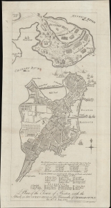
Plan of the Town of Boston with the Attack on Bunkers-Hill in the Peninsula of Charlestown, the 17th of June 1775.
sold
- Digital Map Information
- Suitable for large format printing
- File Size: 4.28 MB
- File Type: ZIP / TIFF
- ICC color profile embedded
- Delivered instantly via download link
This is a 1778 map of the American Revolutionary War Battle of Bunker's Hill, Charleston and Boston, Massachusetts, engraved by T. Robson for the British edition of James Murray's Impartial History of the Present War in America. (more details)
Before the Back Bay.
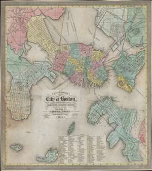
A New and Complete Map of the City of Boston, and precincts including part of Charleston, Cambridge and Roxbury.
sold
- Digital Map Information
- Suitable for large format printing
- DPI: 600
- File Size: 347.74 MB
- File Type: ZIP / TIFF
- ICC color profile embedded
- Delivered instantly via download link
This is a scarce 1848 map of pre-landfill Boston published by Nathaniel Dearborn. Presented with a westward orientation, the map reflects Boston's breakneck growth in the early 19th century. (more details)
Expansion and urbanization.
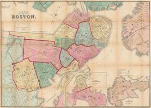
Plan of Boston Corrected under the direction of Charles W. Slack, Lewis Rice, Danl. J. Sweeney, Alderman, Com. Council, Committee on Printing, of 1867, by N. Henry Crafts, City Engineer.
sold
- Digital Map Information
- Suitable for large format printing
- Full resolution TIFF file
- ICC color profile embedded
- Delivered instantly via download link
An 1867 city map of Boston produced for the Boston City Engineer's Office. This map, updated regularly and based upon official engineering records, represents the finest mapping of Boston between 1860 and 1870 - Boston's most vibrant period of expansion, landfill development, urbanization, and modernization. (more details)
One of the earliest obtainable views of the 1775 American Revolutionary War Battle of Bunker Hill.
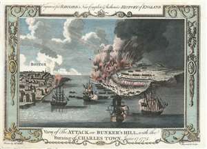
View of the Attack on Bunker's Hill, with the Burning of Charles Town, June 17, 1775.
sold
- Digital Map Information
- Suitable for large format printing
- Full resolution TIFF file
- ICC color profile embedded
- Delivered instantly via download link
One of the earliest obtainable views of the 1775 American Revolutionary War Battle of Bunker Hill. Published in 1783, this view illustrates the June 17, 1775 Battle of Bunker Hill, Boston, one of the first and most significant battles of the American Revolutionary War (1775 - 1783). The view looks east from Boston Harbor. Boston is on the left, Charlestown and Breed's Hill are afire on the right. British naval vessels fill the harbor, while long range cannons bombard Charlestown from Boston. The view is reasonably accurate, suggesting that the artist, 'Mr. Millar', probably George Henry Millar, may have witnessed the battle first hand or drew upon the experience of one who had. (more details)
Proof state of J. W. Hill's spectacular view of Boston Harbor.
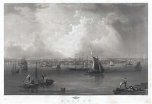
Boston.
sold
- Digital Map Information
- Suitable for large format printing
- File Size: 61.78 MB
- File Type: ZIP / TIFF
- ICC color profile embedded
- Delivered instantly via download link
This is an early proof state of an 1857 view of Boston Harbor by John William Hill. The view exhibits a sweeping majesty, is finely engraved, and impressively proportioned, and as such is one of the finest mid-19th century large-format ... (more details)
Scarce separate issue map of Boston.
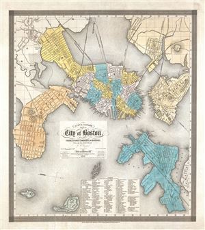
A New and Complete Map of the City of Boston, with part of Charleston, Cambridge and Roxbury.
sold
- Digital Map Information
- Suitable for large format printing
- DPI: 300
- File Size: 12.17 MB
- File Type: ZIP / TIFF
- ICC color profile embedded
- Delivered instantly via download link
A separately issued 1839 map of Boston offered in its scarce first edition. This very uncommon map was compiled by George Washington Boynton for the Boston publisher Nathaniel Dearborn. Presented with an unusual westward orientation, ... (more details)
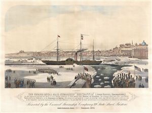
The Cunard Royal Mail Steamship 'Brittania' (John Hewitt, Commander.)
sold
- Digital Map Information
- Suitable for large format printing
- File Size: 14.51 MB
- File Type: ZIP / TIFF
- ICC color profile embedded
- Delivered instantly via download link
A fine 1876 view of Boston Harbor published by Ferdinand Meyer. This view, centered on the Royal Mail Steamship RMS Britannia , commemorates the exceptionally cold winter of 1844. By February of that year Boston Harbor was completely ... (more details)
The official map of Boston following the Annexation of Roxbury.
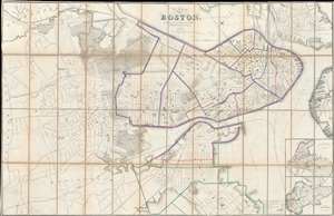
Plan of Boston.
sold
- Digital Map Information
- Suitable for large format printing
- File Size: 111.66 MB
- File Type: ZIP / TIFF
- ICC color profile embedded
- Delivered instantly via download link
The Boston City Engineer's Office produced this 1868 city plan or map of Boston. Depicting all the city of Boston, including the Roxbury, which was annexed into Boston January 5, 1868, shortly before this map went to press. Insets of South Boston and East Boston are situated on the bottom right. The color coding on the map refers to school districts with red indicating boy's schools, blue girl's schools, and green co-educational schools. As the most up to date official map of Boston, this map provided the base cartography for numerous subsequent commercial maps, including those issued by A. J. Johnson and Samuel Augustus Mitchell Jr. (more details)
Revolutionary War Era Map of Cape Cod and Boston Harbor with dramatic cartouche.
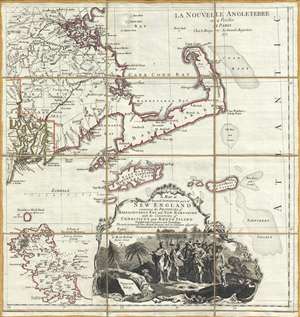
A Map of the most Inhabited part of New England containing the Provinces of Massachusets Bay and New Hampshire, with the Colonies of Connecticut and Rhode Island, divided into Counties and Townships: The whole composed form Actual Surveys and its Situation adjusted by Astronomical Observations.
sold
- Digital Map Information
- Suitable for large format printing
- Full resolution TIFF file
- ICC color profile embedded
- Delivered instantly via download link
A dramatic 1777 Braddock Mead and Le Rouge map of Cape Cod, Nantucket, Martha's Vineyard and Boston Bay. The map covers from Boston to Martha's Vineyard and from Narragansett Bay to Crab Bank and the Nantucket Shoals. This beautiful ... (more details)
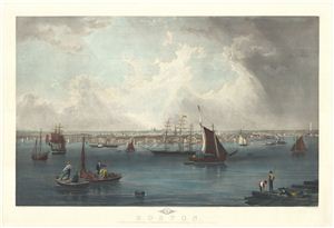
Boston.
sold
- Digital Map Information
- Suitable for large format printing
- Full resolution TIFF file
- ICC color profile embedded
- Delivered instantly via download link
An extremely attractive panoramic view of Boston Harbor by J. Hill and Charles Mottram. The view reveals a busy harbor with ships of all nations and types plying the waters. In the foreground fisherman and dockworkers ply their ... (more details)
Rare political broadsheet calling for a Boston Oil Party to impeach Nixon and Big Business!

A fascinating 1973 political broadsheet of considerable rarity calling for the impeachment of President Nixon. This poster is the rallying promotional for the December 16, 1973 Boston 'Oil Party' sponsored by the People's ... (more details)