
Broadsheets (sold)
Pony Express Broadside.
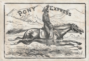
Pony Express.
sold
- Digital Map Information
- Suitable for large format printing
- File Size: 1593.38 MB
- File Type: ZIP / TIFF
- ICC color profile embedded
- Delivered instantly via download link
This is a large and dramatic c. 1860-61 xylographic broadside promoting the Pony Express - one of just two known surviving examples. Its striking size and visual grandeur are unmatched by any other Pony Express piece with which we are aware. Moreover, with a lifespan of just 18 months, and the general mystique driving interest the Pony Express, all such promotional material is of the utmost rarity and desirability. (more details)
First official large format plan of Washington D.C.
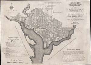
Plan of the City of Washington in the Territory of Columbia, ceded by the States of Virginia and Maryland to the United States of America, and by them established as the Seat of their Government, after the year MDCCC.
sold
- Digital Map Information
- Suitable for large format printing
- Full resolution TIFF file
- ICC color profile embedded
- Delivered instantly via download link
This is Andrew Ellicott's seminal 1792 official large format plan or map of Washington D.C., which would become, 8 years later, the capital of the United States. This is the grandest, most beautiful, and most important official founding plan of Washington D.C. The map illustrates the original urban layout of Washington D.C, then only a small part of the District of Colombia. Centered on the confluence of the Potomac and the Eastern Branch (Anacostia) Rivers, the map covers the Washington D.C. grid as far north as W Street. It also includes the older nearby city of Georgetown. (more details)
Some of the earliest surviving original illustrations associated with the King Features Mickey Mouse comic series.
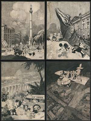
[Biedermann / King Features / Disney Original Calendar Art]
sold
- Digital Map Information
- Suitable for large format printing
- File Size: 303.48 MB
- File Type: ZIP / TIFF
- ICC color profile embedded
- Delivered instantly via download link
A one-of-a-kind set of four 30 x 40 inch original 1930 Disney / King Features manuscript pen and ink drawings of impressive size, by the master cartoonist Louis Biedermann. They are among he earliest surviving original artworks related to the Micky Mouse Comic Strip (1930 - 1995). The drawings feature Mikey Mouse (just 2 years after he was created), Felix the Cat, Bonzo the Dog, Jiggs and Maggie, Dub Dora and others. (more details)
Here-to-fore unknown Persian variants of Serio-Comic maps by Fredric Rose and K. I. Kordig. Maps illustrate conflicting perspectives on Russian expansionism and the Balkan Crises.
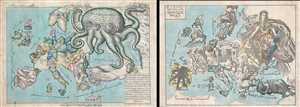
Serio-Comic Map of Europe. / Russian map of Europe.
sold
- Digital Map Information
- Suitable for large format printing
- File Size: 25.5 MB
- File Type: ZIP / TIFF
- ICC color profile embedded
- Delivered instantly via download link
An extraordinary discovery, this is a here-to-fore unknown set of Persian Serio-Comic maps issued around 1880 in Iran. These Serio-Comic maps presuppose that the reader will recognize the familiar shape of Europe and its constituent nations, which have here been ... (more details)
Exceptional early manuscript map of the Financial Center of the World - Wall Street!
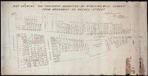
Map Shewing the Property Benefited by Widening Wall Street from Broadway to Nassau Street.
sold
- Digital Map Information
- Suitable for large format printing
- DPI: 300
- File Size: 11.96 MB
- File Type: ZIP / TIFF
- ICC color profile embedded
- Delivered instantly via download link
A unique once-in-a-lifetime discovery for the New York City collector, this is a one-of-a-kind 1851 manuscript cadastral survey map of New York City's Wall Street between Broadway and Pearl Street – including the site of the New York Stock Exchange and numerous ... (more details)
A separately-issued rarity of Biblical Cartography.
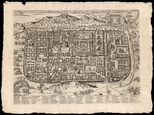
L'antichissima città di Gierusalemme come era nei tempo di N.S. Gisu Christo, con le sue dechiaratione.
sold
- Digital Map Information
- Suitable for large format printing
- Full resolution TIFF file
- ICC color profile embedded
- Delivered instantly via download link
This is a rare, separately-issued Lafreri-school broadsheet map of Jerusalem, printed c. 1595 by Matteo Florimi. It is an iteration of the influential 1584 Adrichem plan, itself an allegorical depiction of Jerusalem during Christ's lifetime, instrumental in codifying elements of Christian veneration of the Holy City, in particular the Stations of the Cross. (more details)
Technological optimism of early 20th-century.
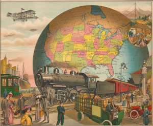
[20th Century Tranportation.]
sold
- Digital Map Information
- Suitable for large format printing
- Full resolution TIFF file
- ICC color profile embedded
- Delivered instantly via download link
A powerful 1910 Charles I. Felthousen / E. S. Yates chromolithograph broadside celebrating the technological optimism of early 20th-century America. It presents the United States as a nation dominating the globe, intoxicated by invention and increasingly convinced that technology will allow it to transcend geographic barriers. The broadside belongs to a broader tradition of aspirational progress imagery popular in the late 19th and early 20th centuries. Such works sought not simply to document technological progress, but to elevate it into a defining national identity. It is no surprise that this was published in Chicago, which, by 1910, saw itself as the embodiment of the future. (more details)
Only know example of George Thompson's 1799 broadside map of the Americas.
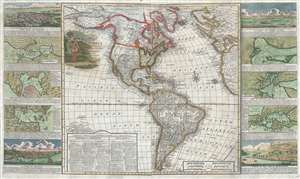
New Map of America divided into its Kingdoms, States, Governments and other Subdivisions, from the latest observations.
sold
- Digital Map Information
- Suitable for large format printing
- DPI: 300
- File Size: 24.5 MB
- File Type: ZIP / TIFF
- ICC color profile embedded
- Delivered instantly via download link
An exceptionally rare separately issued 1799 broadside map of America by the English printer and mapmaker George Thompson. Thompson's map covers the Americas from the Arctic Circle (Arctic Land) to Tierra de Fuego and Cape Horn. It extends westward into the ... (more details)
Proposed Masonic African American community near David City, Florida.
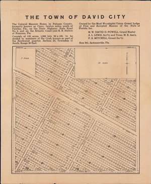
The Town of David City.
sold
- Digital Map Information
- Suitable for large format printing
- File Size: 17.6 MB
- File Type: ZIP / TIFF
- ICC color profile embedded
- Delivered instantly via download link
A unique c. 1920 broadside map promoting the development of an all-African American town, 'David City', in Putnam County, Florida. The city was planned by the African American Masonic Lodge of Jacksonville, for settlement by its members, on the abandoned site of a female-operated African American Masonic convalescent home. The map provides unique insight into the role of African American philanthropy and values in northern Florida in the early 20th century. (more details)
Unique First State.
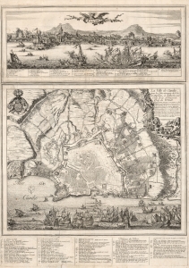
Candie/ La Ville de Candie pour la 3e. sois attaquee de L'armée Ottomane, et deffendue par Celle de la Serenissime Rep: de Venise... 1667, 68 et 69.
sold
- Digital Map Information
- Suitable for large format printing
- DPI: 600
- File Size: 109.01 MB
- File Type: ZIP / TIFF
- ICC color profile embedded
- Delivered instantly via download link
This is an extremely rare, likely unique, separately published 1668 broadsheet plan of the port of Heraklion / Candia, Crete, incorporating a striking panoramic view of the city. This broadsheet illustrates Venetian-controlled Heraklion during the final years of its 21-year-long Ottoman siege. It was privately commissioned and engraved to lionize the efforts of French nobleman Alphonse-Louis, Chevalier d’Harcourt, who perceived himself not only a defender of Crete, but as a latter-day crusader defending Christianity itself. (more details)
The only known example of Japan's second Serio-Comic map.
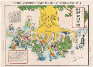
Humor Reproach Candition Map of Europa and Asia. / 滑稽諷刺歐亞形勢圖
sold
- Digital Map Information
- Suitable for large format printing
- File Size: 6.6 MB
- File Type: ZIP / TIFF
- ICC color profile embedded
- Delivered instantly via download link
A previously unknown Meiji 37 or 1904 Japanese broadsheet serio-comic map relating to the Russo-Japanese War. This map was issued in May 28 of 1904, immediately following Japan's successful siege and bombardment Russian held Port Arthur (Dalian). Of the four Japanese serio-comic maps associated with the Russo-Japanese war, this is the second, predated only by Kisaburō Ohara's April 1904 A Humorous Diplomatic Atlas of Europe and Asia. (more details)
The only known example of Japan's second Serio-Comic map.
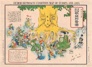
Humor Reproach Candition Map of Europa and Asia. / 滑稽諷刺歐亞形勢圖
sold
- Digital Map Information
- Suitable for large format printing
- File Size: 7.78 MB
- File Type: ZIP / TIFF
- ICC color profile embedded
- Delivered instantly via download link
A previously unknown Meiji 37 or 1904 Japanese broadsheet serio-comic map relating to the Russo-Japanese War. This map was issued in May 28 of 1904, immediately following Japan's successful siege and bombardment Russian held Port Arthur (Dalian). Of the four Japanese serio-comic maps associated with the Russo-Japanese war, this is the second, predated only by Kisaburō Ohara's April 1904 A Humorous Diplomatic Atlas of Europe and Asia. (more details)
Outstanding 1849 broadside promoting routes the California Gold Rush.
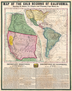
Map of the Gold Regions of California. Showing the Routes via Chagres and Panama, Cape Horn, & c.
sold
- Digital Map Information
- Suitable for large format printing
- DPI: 300
- File Size: 14.37 MB
- File Type: ZIP / TIFF
- ICC color profile embedded
- Delivered instantly via download link
A rare and remarkable example of Ensign and Thayer's 1849 promotional broadside map illustrating routes to and from the California Gold Fields. 'Forty-Niners' traveling across the continent to California faced a daunting and dangerous voyage. Moreover, ... (more details)
Contians 'On Federal Government No. 1' a pre-Federalist Papers argument for the U.S. Constitution issued during the Constitutional Convention.
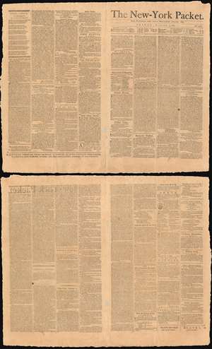
The New-York Packet. Friday, October 5, 1787.
sold
- Digital Map Information
- Suitable for large format printing
- DPI: 600
- File Size: 60.07 MB
- File Type: ZIP / TIFF
- ICC color profile embedded
- Delivered instantly via download link
A rare example of the October 5, 1787 edition of The New-York Packet containing 'On the Federal Government. No. 1,' an anonymous precursor to the Federalist Papers published during the Constitutional Convention. The subsequent Federalist Papers h would begin appearing in the The New-York Packet on October 27th, later in the same month. This essay, leading to the Federalist Papers, is considered one of the first published defenses of the proposed U. S. Constitution and as such is a cornerstone of American political thought. (more details)
One of only 2 Japanese serio-comic maps illustrating World War I.
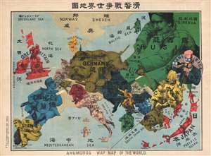
Kokkei Sensou Sekai Chizu. / Ahumoros Wap Map of the World. / 滑馨戰争世界地圖
sold
- Digital Map Information
- Suitable for large format printing
- File Size: 17.14 MB
- File Type: ZIP / TIFF
- ICC color profile embedded
- Delivered instantly via download link
A very rare Japanese broadsheet serio-comic map of Europe and Asia drawn just following the outbreak of World War I. This map was drawn by Ryōzō Tanaka and published by the Shobido Company of Tokyo. The map covers all of Europe and parts of East ... (more details)
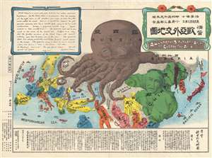
Extremely rare Japanese perspective satirical 'Octopus Map' of Asia.
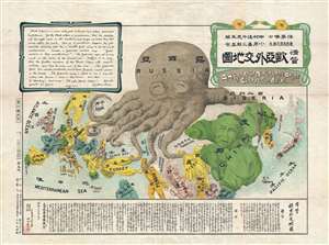
A Humorous Diplomatic Atlas of Europe and Asia. / 滑稽欧亜外交地図 / Kokkei Ō-A Gaikō Chizu.
sold
- Digital Map Information
- Suitable for large format printing
- File Size: 13.3 MB
- File Type: ZIP / TIFF
- ICC color profile embedded
- Delivered instantly via download link
A wonderful example of the rare 1904 Kisaburō Ohara / Shingo Nakamura satirical 'Octopus Map' of Europe. Composed at the outbreak of the Russo-Japanese War (1904 - 1905), Ohara here follows the conventions established by J. J. van Brederode ( Humoristische-Oorlogskaart, 1870) and Fred Rose (Serio-Comic War Map, 1877). These two maps established the convention of satirizing Russian expansionism as a menacing Kraken-like 'Black Octopus.' Whereas Brederode and Rose confine their images to Russia, Ohara has here expanded the idea to encompass all of Eurasia. Russia's eight grasping tentacles extend across Europe and Asia; on many countries they already have a firm grip. Finland, Poland, Crimea, and the Balkan nations are represented as skulls, while tentacles grasp Turkey around the foot and waist, Persia about the neck, and Tibet by the arm. The Trans-Siberian Railway and the South Manchuria Railway, represented by the rightmost tentacle, had by this time extended Russian influence into Manchuria as far as the valuable ice-free Russian stronghold of Port Arthur. As this map was issued in March of 1904, the struggle between Russian and Japan over control of Port Arthur was ongoing. Port Arthur was surrendered to the Japanese, who defeated the Russian Fleet in December of 1905, several months after this map was printed. Ohara sums up the situation in his English language descriptions of the map, printed in the upper left,
Black Octopus is a name newly given to Russia by a certain prominent Englishman. For the black octopus is so avaricious, that he stretches out his eight arms in all directions, and seizes up every thing that comes within his reach. But as it sometimes happens he gets wounded seriously even by a small fish, owing to his too much covetousness. Indeed, a Japanese proverb says: 'Great avarice is like unselfishness.' We Japanese need not to say much on the cause of the present war. Suffice it to say that the further existence of the Black Octopus will depend entirely upon how he comes out of this war. The Japanese fleet has already practically annihilated Russia's naval powers in the Orient. The Japanese army is about to win a signal victory over Russia in Corea and Manchuria. And when ... St. Petersburg? Wait and see! The ugly Black Octopus! Hurrah! Hurrah! for Japan.Certainly the map had a strong message, but who saw it? (more details)
Extremely rare Japanese perspective satirical 'Octopus Map' of Asia.
A Humorous Diplomatic Atlas of Europe and Asia. / 滑稽欧亜外交地図 / Kokkei Ō-A Gaikō Chizu.
sold
- Digital Map Information
- Suitable for large format printing
- File Size: 13.69 MB
- File Type: ZIP / TIFF
- ICC color profile embedded
- Delivered instantly via download link
A wonderful example of the rare 1904 Kisaburō Ohara / Shingo Nakamura satirical 'Octopus Map' of Europe. Composed at the outbreak of the Russo-Japanese War (1904 - 1905), Ohara here follows the conventions established by J. J. van Brederode ( Humoristische-Oorlogskaart, 1870) and Fred Rose (Serio-Comic War Map, 1877). These two maps established the convention of satirizing Russian expansionism as a menacing Kraken-like 'Black Octopus.' Whereas Brederode and Rose confine their images to Russia, Ohara has here expanded the idea to encompass all of Eurasia. Russia's eight grasping tentacles extend across Europe and Asia; on many countries they already have a firm grip. Finland, Poland, Crimea, and the Balkan nations are represented as skulls, while tentacles grasp Turkey around the foot and waist, Persia about the neck, and Tibet by the arm. The Trans-Siberian Railway and the South Manchuria Railway, represented by the rightmost tentacle, had by this time extended Russian influence into Manchuria as far as the valuable ice-free Russian stronghold of Port Arthur. As this map was issued in March of 1904, the struggle between Russian and Japan over control of Port Arthur was ongoing. Port Arthur was surrendered to the Japanese, who defeated the Russian Fleet in December of 1905, several months after this map was printed. Ohara sums up the situation in his English language descriptions of the map, printed in the upper left,
Black Octopus is a name newly given to Russia by a certain prominent Englishman. For the black octopus is so avaricious, that he stretches out his eight arms in all directions, and seizes up every thing that comes within his reach. But as it sometimes happens he gets wounded seriously even by a small fish, owing to his too much covetousness. Indeed, a Japanese proverb says: 'Great avarice is like unselfishness.' We Japanese need not to say much on the cause of the present war. Suffice it to say that the further existence of the Black Octopus will depend entirely upon how he comes out of this war. The Japanese fleet has already practically annihilated Russia's naval powers in the Orient. The Japanese army is about to win a signal victory over Russia in Corea and Manchuria. And when ... St. Petersburg? Wait and see! The ugly Black Octopus! Hurrah! Hurrah! for Japan.Certainly the map had a strong message, but who saw it? (more details)
Rare map of Texas issued just before the Treaty of Guadeloupe Hidalgo.
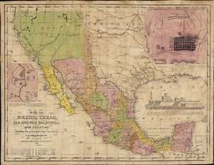
Map of Mexico, Texas, Old and New California, and Yucatan. Showing the principal Cities and Towns, Travelling Routes and c.
sold
- Digital Map Information
- Suitable for large format printing
- Full resolution TIFF file
- ICC color profile embedded
- Delivered instantly via download link
The only known example of the 1848 edition of House and Brown's broadside map of Texas, Mexico, and Upper California, issued at the end of the Mexican-American War (1846 - 1848). The map is centered on Texas, which is presented at its largest, with its western border embracing Albuquerque and Santa Fe, and the stovepipe configuration extending its northern border to 42° N latitude. The map is elaborated by inset maps of Monterey illustrating the Battle of Monterrey (September 21 - 24, 1846) and Veracruz, Mexico. In addition, the Gulf of Mexico is occupied by a large vignette view of the fortress of San Juan de Ulúa, Veracruz. In this edition, Texas is uncolored, emphasizing that it is part of the United States, but Upper California and New Mexico are colored as Mexican intendencias, suggesting this map predates the Treaty of Guadalupe Hidalgo and must therefore have been sent to the presses sometime before February 28, 1848. (more details)
Extremely rare Japanese perspective satirical 'Octopus Map' of Asia.
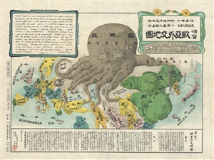
A Humorous Diplomatic Atlas of Europe and Asia. / 滑稽欧亜外交地図 / Kokkei Ō-A Gaikō Chizu.
sold
- Digital Map Information
- Suitable for large format printing
- File Size: 13 MB
- File Type: ZIP / TIFF
- ICC color profile embedded
- Delivered instantly via download link
A wonderful example of the rare 1904 Kisaburō Ohara / Shingo Nakamura satirical 'Octopus Map' of Europe. Composed at the outbreak of the Russo-Japanese War (1904 - 1905), Ohara here follows the conventions established by J. J. van Brederode ( Humoristische-Oorlogskaart, 1870) and Fred Rose (Serio-Comic War Map, 1877). These two maps established the convention of satirizing Russian expansionism as a menacing Kraken-like 'Black Octopus.' Whereas Brederode and Rose confine their images to Russia, Ohara has here expanded the idea to encompass all of Eurasia. Russia's eight grasping tentacles extend across Europe and Asia; on many countries they already have a firm grip. Finland, Poland, Crimea, and the Balkan nations are represented as skulls, while tentacles grasp Turkey around the foot and waist, Persia about the neck, and Tibet by the arm. The Trans-Siberian Railway and the South Manchuria Railway, represented by the rightmost tentacle, had by this time extended Russian influence into Manchuria as far as the valuable ice-free Russian stronghold of Port Arthur. As this map was issued in March of 1904, the struggle between Russian and Japan over control of Port Arthur was ongoing. Port Arthur was surrendered to the Japanese, who defeated the Russian Fleet in December of 1905, several months after this map was printed. Ohara sums up the situation in his English language descriptions of the map, printed in the upper left,
Black Octopus is a name newly given to Russia by a certain prominent Englishman. For the black octopus is so avaricious, that he stretches out his eight arms in all directions, and seizes up every thing that comes within his reach. But as it sometimes happens he gets wounded seriously even by a small fish, owing to his too much covetousness. Indeed, a Japanese proverb says: 'Great avarice is like unselfishness.' We Japanese need not to say much on the cause of the present war. Suffice it to say that the further existence of the Black Octopus will depend entirely upon how he comes out of this war. The Japanese fleet has already practically annihilated Russia's naval powers in the Orient. The Japanese army is about to win a signal victory over Russia in Corea and Manchuria. And when ... St. Petersburg? Wait and see! The ugly Black Octopus! Hurrah! Hurrah! for Japan.Certainly the map had a strong message, but who saw it? (more details)
A most stunning manuscript pictorial map by German female artist illustrating the cacao trade.
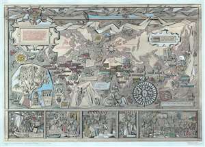
Geschichte des Kakos.
sold
- Digital Map Information
- Suitable for large format printing
- File Size: 29.43 MB
- File Type: ZIP / TIFF
- ICC color profile embedded
- Delivered instantly via download link
This is an utterly stunning c. 1955 unpublished manuscript pictorial map of the world illustrating the history of the cacao trade. The map was drawn by the female graphic designer Ingeborg Gessner (Inge Klatte) for the Stuttgart chocolate company, Eszet (1857 - 1974). It illustrates the world on a loose Mercator projection stylized to conform to German mid-century aesthetics. The map is rich with vignette images illustrating different phases in the history of cacao and phases of cacao harvesting and production. Color coding distinguishes sources of Cacao in South America, Africa, and Australasia. Vignette images along the bottom border trace the development of the cacao trade from its first Europeans exposure when Hernan Cortez arrived at the Aztec capital of Tenochtitlan, to its introduction to the Spanish court, and indigenous use. Copious annotation in German expounds on cacao throughout. (more details)
Bizarre railroad chromolithograph.
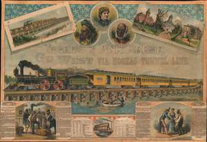
Toledo and Ann Arbor. Go West Via Hoosac Tunnel Line.
sold
- Digital Map Information
- Suitable for large format printing
- File Size: 811.06 MB
- File Type: ZIP / TIFF
- ICC color profile embedded
- Delivered instantly via download link
A striking c. 1870 - 1881 chromolithograph broadside promoting the Toledo and Ann Arbor Railroad. The route, completed in the year this broadside was issued, is promoted with connections to the Hoosac Tunnel Line, itself opened in 1875, and thus to Albany and Boston. The map further includes a lengthy and rambling story featuring 'Uncle Remus', then a popular fictional African-American folk figure. The Toledo and Ann Arbor Railroad apparently contracted the 'Uncle Remus' name for promotional purposes. (more details)
Extremely rare Japanese perspective satirical 'Octopus Map' of Asia.
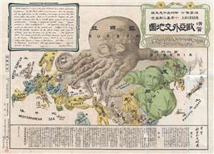
A Humorous Diplomatic Atlas of Europe and Asia. / 滑稽欧亜外交地図 / Kokkei Ō-A Gaikō Chizu.
sold
- Digital Map Information
- Suitable for large format printing
- File Size: 15.14 MB
- File Type: ZIP / TIFF
- ICC color profile embedded
- Delivered instantly via download link
A wonderful example of the rare 1904 Kisaburō Ohara / Shingo Nakamura satirical 'Octopus Map' of Europe. Composed at the outbreak of the Russo-Japanese War (1904 - 1905), Ohara here follows the conventions established by J. J. van Brederode ( Humoristische-Oorlogskaart, 1870) and Fred Rose (Serio-Comic War Map, 1877). These two maps established the convention of satirizing Russian expansionism as a menacing Kraken-like 'Black Octopus.' Whereas Brederode and Rose confine their images to Russia, Ohara has here expanded the idea to encompass all of Eurasia. Russia's eight grasping tentacles extend across Europe and Asia; on many countries they already have a firm grip. Finland, Poland, Crimea, and the Balkan nations are represented as skulls, while tentacles grasp Turkey around the foot and waist, Persia about the neck, and Tibet by the arm. The Trans-Siberian Railway and the South Manchuria Railway, represented by the rightmost tentacle, had by this time extended Russian influence into Manchuria as far as the valuable ice-free Russian stronghold of Port Arthur. As this map was issued in March of 1904, the struggle between Russian and Japan over control of Port Arthur was ongoing. Port Arthur was surrendered to the Japanese, who defeated the Russian Fleet in December of 1905, several months after this map was printed. Ohara sums up the situation in his English language descriptions of the map, printed in the upper left,
Black Octopus is a name newly given to Russia by a certain prominent Englishman. For the black octopus is so avaricious, that he stretches out his eight arms in all directions, and seizes up every thing that comes within his reach. But as it sometimes happens he gets wounded seriously even by a small fish, owing to his too much covetousness. Indeed, a Japanese proverb says: 'Great avarice is like unselfishness.' We Japanese need not to say much on the cause of the present war. Suffice it to say that the further existence of the Black Octopus will depend entirely upon how he comes out of this war. The Japanese fleet has already practically annihilated Russia's naval powers in the Orient. The Japanese army is about to win a signal victory over Russia in Corea and Manchuria. And when ... St. Petersburg? Wait and see! The ugly Black Octopus! Hurrah! Hurrah! for Japan.Certainly the map had a strong message, but who saw it? (more details)
Extremely rare Japanese perspective satirical 'Octopus Map' of Asia.
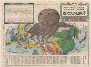
A Humorous Diplomatic Atlas of Europe and Asia. / 滑稽欧亜外交地図 / Kokkei Ō-A Gaikō Chizu.
sold
- Digital Map Information
- Suitable for large format printing
- File Size: 12.9 MB
- File Type: ZIP / TIFF
- ICC color profile embedded
- Delivered instantly via download link
A wonderful example of the rare 1904 Kisaburō Ohara / Shingo Nakamura satirical 'Octopus Map' of Europe. Composed at the outbreak of the Russo-Japanese War (1904 - 1905), Ohara here follows the conventions established by J. J. van Brederode ( Humoristische-Oorlogskaart, 1870) and Fred Rose (Serio-Comic War Map, 1877). These two maps established the convention of satirizing Russian expansionism as a menacing Kraken-like 'Black Octopus.' Whereas Brederode and Rose confine their images to Russia, Ohara has here expanded the idea to encompass all of Eurasia. Russia's eight grasping tentacles extend across Europe and Asia; on many countries they already have a firm grip. Finland, Poland, Crimea, and the Balkan nations are represented as skulls, while tentacles grasp Turkey around the foot and waist, Persia about the neck, and Tibet by the arm. The Trans-Siberian Railway and the South Manchuria Railway, represented by the rightmost tentacle, had by this time extended Russian influence into Manchuria as far as the valuable ice-free Russian stronghold of Port Arthur. As this map was issued in March of 1904, the struggle between Russian and Japan over control of Port Arthur was ongoing. Port Arthur was surrendered to the Japanese, who defeated the Russian Fleet in December of 1905, several months after this map was printed. Ohara sums up the situation in his English language descriptions of the map, printed in the upper left,
Black Octopus is a name newly given to Russia by a certain prominent Englishman. For the black octopus is so avaricious, that he stretches out his eight arms in all directions, and seizes up every thing that comes within his reach. But as it sometimes happens he gets wounded seriously even by a small fish, owing to his too much covetousness. Indeed, a Japanese proverb says: 'Great avarice is like unselfishness.' We Japanese need not to say much on the cause of the present war. Suffice it to say that the further existence of the Black Octopus will depend entirely upon how he comes out of this war. The Japanese fleet has already practically annihilated Russia's naval powers in the Orient. The Japanese army is about to win a signal victory over Russia in Corea and Manchuria. And when ... St. Petersburg? Wait and see! The ugly Black Octopus! Hurrah! Hurrah! for Japan.Certainly the map had a strong message, but who saw it? (more details)
Charting the contours of the early Civil War.
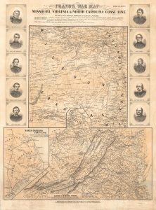
Prang's War Map Missouri, Virginia and North Carolina Coast Line.
sold
- Digital Map Information
- Suitable for large format printing
- File Size: 71.19 MB
- File Type: ZIP / TIFF
- ICC color profile embedded
- Delivered instantly via download link
A rare 1861 Louis Prang map of three theaters of the American Civil War (1861 - 1865), providing an as-it-happened snapshot of the war in its early months, when both Union and Confederate forces rushed to raise armies, produce war materiel, and grasp disputed territory. (more details)
Anti-corruption 'tear down the machine' political broadside from 1872 Presidential Election.
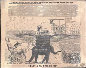
Political smash-up : War! War! War! To the Knife on Political Corruption.
sold
- Digital Map Information
- Suitable for large format printing
- File Size: 48.15 MB
- File Type: ZIP / TIFF
- ICC color profile embedded
- Delivered instantly via download link
This is a rare 1872 broadsheet that promotes an anti-corruption political message intended to bolster the presidential election prospects of retired businessman and Civil War General Thomas Alfred Davies. Davies ran in an unsuccessful 1872 bid for president on a 'tear down the machine' platform, likely a response to rampant corruption in the Republican Grant administration and the New York Boss Tweed Ring.
Davies was born in New York, attended West Point, and served in the Union Army during the Civil War. In 1865, having distinguished himself at the First Battle of Bull Run and the Siege of Corinth, he was promoted to Major General of Volunteers, and in 1866 to Brigadier General. After the war he retired from the army to devote himself to business, becoming wealthy as a realtor and author. Eventually he turned to religion, becoming a pamphleteer for Jesus, but not before his unsuccessful run for president.
Davies was frustrated with what he considered a corrupt political machine designed only to fleece the voting public. Without any formal backing or association, Davies declared himself the candidate for a new party of his own invention, the People's Party (not to be confused the more official People's Party established by William Jennings Bryant in 1892). Beyond this and two other broadsides, there is little evidence of Davies' run for office and his name did not appear on the 1872 ballot. Apparently his 'wing it solo' approach was unable to generate the necessary momentum. (more details)
Davies was born in New York, attended West Point, and served in the Union Army during the Civil War. In 1865, having distinguished himself at the First Battle of Bull Run and the Siege of Corinth, he was promoted to Major General of Volunteers, and in 1866 to Brigadier General. After the war he retired from the army to devote himself to business, becoming wealthy as a realtor and author. Eventually he turned to religion, becoming a pamphleteer for Jesus, but not before his unsuccessful run for president.
Davies was frustrated with what he considered a corrupt political machine designed only to fleece the voting public. Without any formal backing or association, Davies declared himself the candidate for a new party of his own invention, the People's Party (not to be confused the more official People's Party established by William Jennings Bryant in 1892). Beyond this and two other broadsides, there is little evidence of Davies' run for office and his name did not appear on the 1872 ballot. Apparently his 'wing it solo' approach was unable to generate the necessary momentum. (more details)
The ephemeral 'Fast Mail', America's first true 'Express Mail Service'.
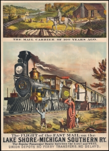
The Flight of the Fast Mail on the Lake Shore and Michigan Southern Ry. The Popular Passenger Route between East and West. Union Depots No Ferry Transfers. No Delays.
sold
- Digital Map Information
- Suitable for large format printing
- File Size: 36.99 MB
- File Type: ZIP / TIFF
- ICC color profile embedded
- Delivered instantly via download link
A spectacular 1875 5-color chromolithograph advertising broadside promoting the 'Fast Mail' route of the Lake Shore and Michigan Southern Railway - this was the first major use of railroads to institute a national 'Express Mail' service. The view contrasts the horse-based mail carrier of 1775 (or literally 1 year prior) to the steam-railroad 'Fast Mail' service. Fast Mail was an ephemeral U.S. postal initiative that utilized the New York Central and Lake Shore and Michigan Southern Railway lines to run an exclusive mail service line capable of moving tons of mail between New York and Chicago - halfway across the country - in just 24 hours. At the time, a ground-breaking achievement. Here, the 'Fast-Mail,' propelled by an impressively rendered steam locomotive, passes through town, hardly slowing as outbound mail is grabbed from a 'mail post' while inbound mail is tossed off the train to a waiting postal worker. (more details)
Rare Persian langauge variant of the Fred Rose 'Octopus Map' of Euopre. One of only 2 known examples.
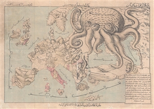
Comic Map of Europe. / نقشه طنز از اروپا
sold
- Digital Map Information
- Suitable for large format printing
- File Size: 10.45 MB
- File Type: ZIP / TIFF
- ICC color profile embedded
- Delivered instantly via download link
A very rare c. 1880 Persian version of Englishman Fred Rose's iconic 1877 Serio Comic War Map , in which expansionist Imperial Russia is analogized as a menacing grasping octopus. Iranians at this time were beset by incursions from both Western ... (more details)
Exceptional graphic large format map commemorative of New York City by master engraver Charles Magnus.
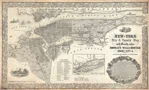
New-York City and County Map with Vicinity entire Brooklyn Williamsburgh Jersey City an c. in the 79th Year of Independence of the United States.
sold
- Digital Map Information
- Suitable for large format printing
- File Size: 30.88 MB
- File Type: ZIP / TIFF
- ICC color profile embedded
- Delivered instantly via download link
An altogether extraordinary 1855 broadside map of New York City issued by map publisher Charles Magnus in commemoration of the signing of the Declaration of Independence. Depicts the entirety of Manhattan as well as most of Brooklyn, ... (more details)
The Great Pyramid predicts the End of Days.
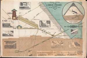
Passage System of the Great Pyramid of Giza in the Land of Egypt June - July 1909.
sold
- Digital Map Information
- Suitable for large format printing
- File Size: 109.48 MB
- File Type: ZIP / TIFF
- ICC color profile embedded
- Delivered instantly via download link
This is a c. 1910 monumental waxed linen banner illustrating the interior of the Great Pyramid of Giza, Egypt. The banner results from the 1909 studies of Morton Edgar and his brother John Edgar. Bother Edgars were dedicated pyramidologists who believed they could, through studies of the Great Pyramid, discern essential theological truths. Morton was obsessed with the theories of Jehovah's Witness founder Charles Taze Russell (1852 - 1916), who advocated the theory that the Great Pyramid was a mystical artifact deeply connected to the End of Days and the events predicted in Revelations. (more details)
Chromolithograph pre-construction view of the Statue of Liberty.
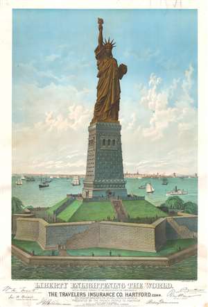
Liberty Enlightening the World. Edition Prepared Expressly for and Presented with the Compliments of Travelers Insurance Co. Hartford, this engraving represents the Clolooal Statue by Bartholdi, Presented by teh French People to America As it will appear on its pedestal on Bedloes Island in New York Harbor.
sold
- Digital Map Information
- Suitable for large format printing
- File Size: 41.4 MB
- File Type: ZIP / TIFF
- ICC color profile embedded
- Delivered instantly via download link
This exceptionally rare and stunning 4-color chromolithograph 1883 view of the Statue of Liberty is the most important pre-construction view of the statue and the first to receive official sanction. Issued 2 years prior to the Statue of Liberty's 1885 assembly and unveiling, this view illustrates the statue as seen from the south, looking north towards southern Manhattan and the Brooklyn Bridge, both of which are recognizable in the background. The image of the iconic statue here pre-dates the construction of the monument on Bedloe Island and is presented on one of Richard Morris Hunt's alternative plans rather than the base that was ultimately selected and constructed by the American Committee. (more details)
Quack science wins again!

Know Thyself! Lectures on Phrenology by Dr. J. P. M'Lean.
sold
- Digital Map Information
- Suitable for large format printing
- File Size: 121.4 MB
- File Type: ZIP / TIFF
- ICC color profile embedded
- Delivered instantly via download link
This is an uncommon c. 1865 promotional broadside advertising a lecture by the itinerant mesmerist and phrenologist J. P. M'Lean (MacLean). The broadside focuses on the 'Symbolical Head' offering the classic phrenological brain map, divided into modules representing faculties, which contain images of the postulated functions. Below the 'Symbolical Head' a framed area with red type advertises lectures by Dr. J. P. M'Lean, an associate of the Aberdeen Phrenological Society. Surrounding the advertisement are 56 illustrations of differently shaped heads, many of which are drawn from previous illustrations present in phrenological books published by Fowler and Wells. Lectures were on such subjects as 'How to Read Character Scientifically' and would be followed by 'Public Examinations,' presumably conducted by M'Lean. (more details)
Remarkable Temperance Broadside.

Black Valley Rail Road. Great Central Fast Route.
sold
- Digital Map Information
- Suitable for large format printing
- File Size: 24.74 MB
- File Type: ZIP / TIFF
- ICC color profile embedded
- Delivered instantly via download link
This is without a doubt the most beautiful and remarkable variants on 'Black Valley Rail Road' temperance allegory. This chromolithograph broadside was issued in 1863 on behalf of Stedman Wright Hanks, an ardent Cambridge, Massachusetts temperance advocate. Central to the image is a great demonic train, headed for the dark and dreadful Black Valley. Some escape to 'Temperance Land' on the coach while others party in the saloon car. Below the central image is an explanation of the image, with illustrations of stomachs at various stages on the allegorical voyage. (more details)