
Middle East (sold)
Earliest Acquirable Printed Map of Arabia.
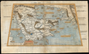
Sexta Asiae Tabula.
sold
- Digital Map Information
- Suitable for large format printing
- Full resolution TIFF file
- ICC color profile embedded
- Delivered instantly via download link
A foundational work of Renaissance cartography: this is the first acquirable printed map of the Arabian Peninsula. Appearing in the Rome edition of Ptolemy, in its 1478 printing, it is preceded only by the unacquirable 1477 Bologna Ptolemy. Ptolemy's 2nd-century innovation of representing the three-dimensional world on a grided mathematical projection provided the basis of all modern cartography. Of all the early printed versions of Ptolemy's maps, those produced for the Rome edition are considered the finest until Mercator's 1578 edition. The present example is embellished with attractive old hand color. (more details)
Here-to-fore unknown Persian variants of Serio-Comic maps by Fredric Rose and K. I. Kordig. Maps illustrate conflicting perspectives on Russian expansionism and the Balkan Crises.
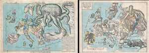
Serio-Comic Map of Europe. / Russian map of Europe.
sold
- Digital Map Information
- Suitable for large format printing
- File Size: 25.5 MB
- File Type: ZIP / TIFF
- ICC color profile embedded
- Delivered instantly via download link
An extraordinary discovery, this is a here-to-fore unknown set of Persian Serio-Comic maps issued around 1880 in Iran. These Serio-Comic maps presuppose that the reader will recognize the familiar shape of Europe and its constituent nations, which have here been ... (more details)
An Unusual Wall Map of the Gulf Region.
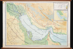
This is a rare c. 1972 wall map of the Persian / Arabian Gulf region by Ibrahim Hilmi al-Ghouri. Published by the Scientific Foundation for Educational Aids, it was likely intended for classroom use in the United Arab Emirates. (more details)
Seminal Map heralding the birth of Qatar's Petroleum Industry.
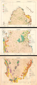
This is a remarkable, very large-format 1970 bilingual three-sheet geological map of Qatar, prepared by an international team of geologists and published by Ali Mohammed Jaidah. It represents the first comprehensive geological survey of the country and therefore played an important role in the subsequent development of Qatar's oil and gas industry. (more details)
Abu Dhabi on the Cusp of Independence and Modernization.
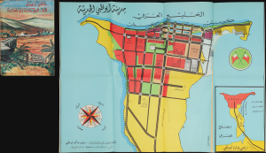
مَدِينَةُ أَبُو ظَبِي الحَدِيثَة [Modern Abu Dhabi City]. / عَامَانِ زَاهِيَان فِي تَارِيخِ إِمَارَةِ أَبُو ظَبِي [Two Glorious Years in the History of the Emirate of Abu Dhabi].
sold
This is a rare 1968 folding map of Abu Dhabi, appearing in the scarce Arabic edition of the Two Glorious Years in the History of the Emirate of Abu Dhabi. The map and book were published in a period of rapid transformation for the emirate, which was preparing for independence and implementing the early phase of a radical modern urban plan. (more details)
Birth of Qatar's Petroleum Boom, Prepared on the Eve of Independence
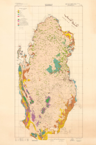
This is a stunning, large-format 1970 bilingual geological map of Qatar, prepared by an international team of geologists and published by Ali Mohammed Jaidah. It represents the first comprehensive geological survey of the country and therefore played an important role in the subsequent development of Qatar's oil and gas industry. (more details)
First 'Great Game' Map.
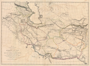
Map of the Countries lying between then Euphrates and Indus on the East and West, and the Oxus and Terek and Indian Ocean on the North and South.
sold
- Digital Map Information
- Suitable for large format printing
- File Size: 91.04 MB
- File Type: ZIP / TIFF
- ICC color profile embedded
- Delivered instantly via download link
This is John Macdonald Kinneir and Aaron Arrowsmith's 1813 large-scale map of Persia and parts of Afghanistan, Iraq, and Pakistan. This was the best obtainable map of Persia and Central Asia available in the leadup to the Great Game (1813 - 1895), and indeed, might be considered the first Great Game Map. It was issued at the end of the Russo-Persian War (1804 - 1813) and coincided with the Treaty of Gulistan, which opened up Persia for Russian invasion and set the stage for decades of Anglo-Russian conflict. (more details)
Hydrographic projects on the River Nile, and the Prospective Suez Canal.
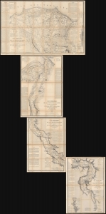
Carte Hydrographique de la Basse Égypte/ Carte Hydrographique de la Moyenne Égypte/Carte Hydrographique de la Partie Septentrionale de la Haute Egypte/ Carte Hydrographique de la Partie Méridionale de la Haute Egypte.
sold
This is a set of four large, superbly detailed maps of Egypt by Linant de Bellefonds, detailing the course of the River Nile and the prospective routes of the Suez Canal. The four maps are on a uniform scale and were sold a group by Paris mapseller Lanée, to American congregationalist preacher and professor Roswell Dwight Hitchcock, probably in 1869 in preparation for that avid traveler's 1870 visit to Egypt. These were easily the most detailed maps to cover the Egyptian Nile available at that time, and their rich detail of ancient and reference to Biblical monuments would have been compelling. Taken together, the maps illuminate the Nile continuously from the Mediterranean Sea to the cataracts upstream of Aswan. (more details)
Foundational map of the Nile Delta and the basis of all subsequent regional maps.
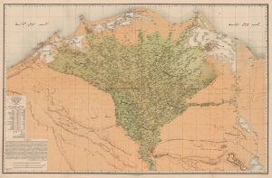
كهاريطات الءواجه الءباحاري ليلأقاليم الءميصريياه / [Map of the Egyptian Regions facing the Sea].
sold
- Digital Map Information
- Suitable for large format printing
- File Size: 168.02 MB
- File Type: ZIP / TIFF
- ICC color profile embedded
- Delivered instantly via download link
A striking, important, and rare Arabic-language chromolithographed map of the Nile Delta, prepared in 1872 by Mahmoud Bey al-Falaky. Aside from its aesthetic qualities, it also represented the most accurate map of the region when it was produced, combining the most up-to-date cartographic methods with extensive research on local placenames, terrain, and topography. As this map replaced French benchmark maps of the region from the early 19th century, it became the new gold standard and was continually used as the basis for most subsequent maps. (more details)
Key Map from the Earliest Atlas in Armenian.
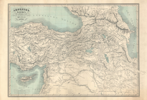
Հայաստամ Աշխարհ Ըստ նախնի աշխարհագրաց / [The Armenian World according to ancient geographers].
sold
- Digital Map Information
- Suitable for large format printing
- File Size: 47.09 MB
- File Type: ZIP / TIFF
- ICC color profile embedded
- Delivered instantly via download link
An exceptional discovery, this 1849 historical map of Armenia appeared in the Illustrated World Atlas, the first atlas published in the Armenian language. The map and atlas are a reflection of a growing Armenian national consciousness in the mid-19th century, which would eventually clash with the late Ottoman state with terrible consequences. (more details)
Only known example. Beauchamp's manuscript map of Persia/ Iran and Iraq - the first scientific map of these regions.
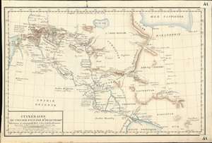
Itinéraire du Voyage Fait par Mr. Beauchamp Astronome et correspond de la cui dev. Acad. des Sciences.
sold
- Digital Map Information
- Suitable for large format printing
- DPI: 600
- File Size: 9.23 MB
- File Type: ZIP / TIFF
- ICC color profile embedded
- Delivered instantly via download link
An extraordinary discovery, this finely executed (hand-drawn) c. 1790 map of Syria, Iraq, and Iran / Persia is the only known map recording the explorations of the French astronomer and clergyman, Pierre-Joseph de Beauchamp. Comprising of the first scientific mapping of any significant part Persia/Iraq, coverage extends from the Mediterranean to the Persian Gulf and reaches as far north as Lake Van and the Caspian Sea. While we cannot definitively prove it, we believe this map to have been composed in Beauchamp's own hand for the use of Joseph Jérôme Lefrançois de Lalande (1732 - 1807), a fellow astronomer and friend. It may have been he who added additional annotations and place names to the map in light red ink. (more details)
A gorgeous pictorial map of Africa featuring illustrations of African wildlife.
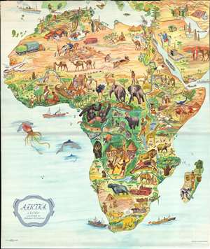
Afrika i bilder.
sold
- Digital Map Information
- Suitable for large format printing
- File Size: 48.65 MB
- File Type: ZIP / TIFF
- ICC color profile embedded
- Delivered instantly via download link
This is a stunning c. 1955 B. Lindblad pictorial map of Africa. The map depicts the region from the Atlantic Ocean to the Persian Gulf and the Indian Ocean and from Spain, Sicily, and Greece to the Cape of Good Hope. Beautifully illustrated, the incredible biodiversity of this vast continent is on full display. The relative prosperity of French Colonial Africa along the Mediterranean is highlighted by green hills, mountains, and buildings meant to denote cities. The ruins of Carthage are illustrated in Tunisia, as are the Pyramids at Giza in Egypt. The artist emphasized the life-giving power of the Nile River by making the river valley a blue and green channel through the brown wasteland of the Sahara. The nomadic lifestyle of the people living in the Sahara is shown, complete with camels and horses.
Sub-Saharan Africa is verdantly colored, with West Africa featuring a native village and locals fashioning ivory into trinkets. The wildlife of the region is, of course, the map's focus. Elephants, gazelles, gorillas, leopards, hippos, lions, and giraffes are only a few of the species illustrated. The duality of native existence up against modern technology and the constant drive to exploit Africa's seemingly infinite natural resources also take center stage, with a large tractor and a diamond mine drawn next to local villages and livestock.
The Middle East and the Arabian Peninsula are also illustrated in the upper right corner, complete with an illustration of the Great Mosque of Mecca in profile. Oil derricks are depicted along the Persian Gulf, along with a tanker plying the Gulf's waters to take the 'black gold' to market. (more details)
Sub-Saharan Africa is verdantly colored, with West Africa featuring a native village and locals fashioning ivory into trinkets. The wildlife of the region is, of course, the map's focus. Elephants, gazelles, gorillas, leopards, hippos, lions, and giraffes are only a few of the species illustrated. The duality of native existence up against modern technology and the constant drive to exploit Africa's seemingly infinite natural resources also take center stage, with a large tractor and a diamond mine drawn next to local villages and livestock.
The Middle East and the Arabian Peninsula are also illustrated in the upper right corner, complete with an illustration of the Great Mosque of Mecca in profile. Oil derricks are depicted along the Persian Gulf, along with a tanker plying the Gulf's waters to take the 'black gold' to market. (more details)
A rare, early copperplate map of India, Persia, and Arabia.
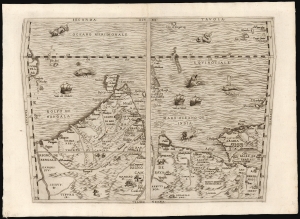
Seconda Tavola.
sold
- Digital Map Information
- Suitable for large format printing
- File Size: 10.98 MB
- File Type: ZIP / TIFF
- ICC color profile embedded
- Delivered instantly via download link
This is a scarce copperplate edition, commonly dated 1563, of the first accurate map of South Asia, including India, Arabia, and the Persian Gulf. It was drawn for Giovanni Battista Ramusio by his friend, the great cartographer Giacomo Gastaldi. The map was first published in Volume I of Ramusio's delle Navigationi et Viaggi in 1554, but this copperplate edition was engraved by Niccolo Nelli to replace the original woodblock after it was lost in a fire. (more details)
The Great Pyramid predicts the End of Days.
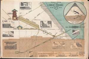
Passage System of the Great Pyramid of Giza in the Land of Egypt June - July 1909.
sold
- Digital Map Information
- Suitable for large format printing
- File Size: 109.48 MB
- File Type: ZIP / TIFF
- ICC color profile embedded
- Delivered instantly via download link
This is a c. 1910 monumental waxed linen banner illustrating the interior of the Great Pyramid of Giza, Egypt. The banner results from the 1909 studies of Morton Edgar and his brother John Edgar. Bother Edgars were dedicated pyramidologists who believed they could, through studies of the Great Pyramid, discern essential theological truths. Morton was obsessed with the theories of Jehovah's Witness founder Charles Taze Russell (1852 - 1916), who advocated the theory that the Great Pyramid was a mystical artifact deeply connected to the End of Days and the events predicted in Revelations. (more details)
Rare Peek into Daily Life in the Emirates during the 1950s.
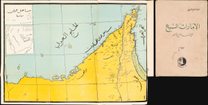
ساحل عمان [Coast of Oman]. / الإمارات السبع على الساحل الأخضر [The Seven Emirates on the Green Coast].
sold
This is a 1957 map of the Trucial States, the future United Arab Emirates, that appeared in the book The Seven Emirates on the Green Coast, written by Ahmad Qasim Al-Burini. Al-Burini's account is one of the most detailed historical accounts of the emirates in this formative period. (more details)
Strange Arabic- Boston imprint from first wave of Islamic immigration to the United States.
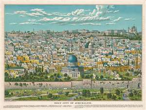
Bird's Eye View of Holy Jerusalem. / Vue Générale de la Villie de Jerusalem. / القدس الشف
sold
- Digital Map Information
- Suitable for large format printing
- File Size: 59.52 MB
- File Type: ZIP / TIFF
- ICC color profile embedded
- Delivered instantly via download link
The only known example of a magnificent and previously unknown c. 1896 Boston-Arab chromolithograph view of Jerusalem by the Palestinian / Syrian immigrant Aece Hage. This view is a veritable masterpiece of chromolithography, employing at least six separate plates, a feat even more remarkable when compounded with the knowledge that this view was produced in a flophouse under extenuating circumstances and on a low budget. The unusual view looks on Jerusalem from the Mount of Olives, east of the Old City, and centers on the Temple Mount and the Dome of the Rock (Qubbat al-Sakhrah), with other holy sites of multiple religions appearing behind it. In the foreground the Eastern Wall of Jerusalem, the walled off Golden Gate, the open Lion's Gate, and the 1400-year-old Bab-ur-Rahmah Cemetery are illustrated. The predominate colors, blue and green, are significant in Islamic tradition, representing protection, hope, and life. The view, although stylized, is mostly accurate, suggesting that Hage (or the artist) had been to or lived in Jerusalem and drew the image from life.
The view is titled in light brown lettering to either side of the view, and in the bottom right just below the view. Title text appears in English (left), French (right) and Arabic (bottom right). Text below the map identifies 15 locations, which correspond to numerical assignments appearing on the map. The cartographer identifies Christian, Muslim, and Jewish religious sites, without apparent preference. (more details)
The view is titled in light brown lettering to either side of the view, and in the bottom right just below the view. Title text appears in English (left), French (right) and Arabic (bottom right). Text below the map identifies 15 locations, which correspond to numerical assignments appearing on the map. The cartographer identifies Christian, Muslim, and Jewish religious sites, without apparent preference. (more details)
Last Days of French Rule in Lebanon.
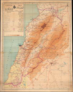
Carte générale du Liban / خريطة لبنان عامة.
sold
- Digital Map Information
- Suitable for large format printing
- File Size: 66.56 MB
- File Type: ZIP / TIFF
- ICC color profile embedded
- Delivered instantly via download link
This is a 1945 bilingual French-Arabic wall map of Lebanon, prepared by the Service Géographique des Forces Françaises Libres (Geographic Service of Free France). The map captures the final days of the French Mandate World in Lebanon at the end of World War II (1939 - 1945). (more details)
Ancient Meets Modern.
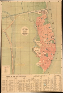
Plan de la ville de Ghizeh / خريطة مدينة الجيزة.
sold
- Digital Map Information
- Suitable for large format printing
- File Size: 55.09 MB
- File Type: ZIP / TIFF
- ICC color profile embedded
- Delivered instantly via download link
A scarce large-format bilingual (French - Arabic) city map of plan of Giza, Egypt, prepared by the Egyptian Supervision (Ministry) of Public Works and printed in 1887 by the National Printing Press of Egypt. It was produced as Giza was becoming an increasingly popular destination for European Egyptologists, a process facilitated by the completion of the railway seen here. (more details)
Red Sea and French attempts to sieze control of the India Ocean.
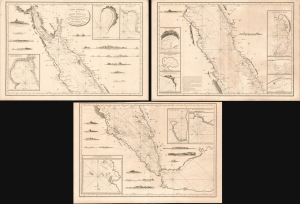
Carte Générale de la Mer Rouge...
sold
- Digital Map Information
- Suitable for large format printing
- Full resolution TIFF file
- ICC color profile embedded
- Delivered instantly via download link
This is a c. 1799 set of three nautical maps or charts covering the Red Sea, produced by the French Dépôt Général de la Marine. At the time, the Red Sea had become a key strategic waterway due to Napoleon's invasion of Egypt and the wider geopolitical struggles of the French Revolutionary Wars, prompting significant remapping. (more details)
Wartime German Military Reissue of Seminal French Map of Lebanon.
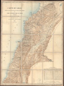
Carte du Liban d'aprés les reconaissances de la Brigade Topographique du Corps Expéditionnaire de Syrie en 1860-1861.
sold
- Digital Map Information
- Suitable for large format printing
- File Size: 54.45 MB
- File Type: ZIP / TIFF
- ICC color profile embedded
- Delivered instantly via download link
This is a 1915 WWI Era German Deputy General Staff issue of a French Dépôt de la Guerre map of Lebanon, then an Ottoman territory. It was issued in anticipation of combat action in the Lebanese Levant, an area then considered unstable due to weak Ottoman rule and ongoing sectarian violence. (more details)
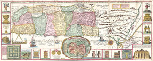
Chorographia Terrae Sanctae in Angustiorem Formam Redacta, et ex Variis Auctoribus a Multis Erroribus Expurgata
sold
- Digital Map Information
- Suitable for large format printing
- DPI: 300
- File Size: 12.36 MB
- File Type: ZIP / TIFF
- ICC color profile embedded
- Delivered instantly via download link
This is an extraordinary c. 1632 map of the Holy Land by the Jesuit monk Jacobus Tirinus. Oriented to the east, map depicts from Syria and Tyre southward as far as the Sinai, Egypt and Thebes. Ours survey of the map begins at the southern most point, in Egypt, ... (more details)
Bird's Eye View of Damascus in Sumptious Contemporary Color
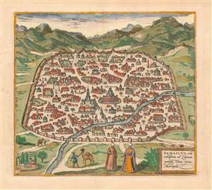
Damascus, urbs noblissima ad Libanum montem, Totius Sÿriae Metropolis
sold
- Digital Map Information
- Suitable for large format printing
- DPI: 600
- File Size: 14.78 MB
- File Type: ZIP / TIFF
- ICC color profile embedded
- Delivered instantly via download link
This is a superb example of the 1575 view of Damascus, produced by Braun and Hogenberg for inclusion in the second volume of their Civitates Orbis Terrarum, the first dedicated city book. The beautifully engraved view, illuminated with superb original color, is one of the earliest printed views of Damascus. It depicts the contemporaneous Muslim walled city; its mosques are prominently shown. Some churches illustrated as well, though one of these, The Church of Saint Paul, is in ruins. In the foreground, two noblemen in Ottoman styles converse; two footmen can be seen leading camels. (more details)
A foundational map of Persia, Arabia, and India.
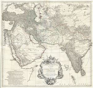
Premiere Partie de la Carte d'Asie contenant La Turquie, L'Arabie, La Perse, L'Inde en deca du Gange et de la Tartarie ce qui est limitrophe de la Perse et de l'Inde.
sold
- Digital Map Information
- Suitable for large format printing
- DPI: 300
- File Size: 36.34 MB
- File Type: ZIP / TIFF
- ICC color profile embedded
- Delivered instantly via download link
A monumental and highly detailed 1751 map of India, Persia, and Arabia by the French cartographer Jean Baptiste Bourguignon d'Anville. Centered on Persia, this map covers from Istanbul to eastern India and Tibet, and from the Black Sea to the Maldives. It ... (more details)
Rare large scale blueprint plan of Old Damascus. Unique!
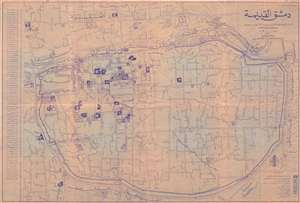
دمشق القديمةOld Damascus. /
sold
- Digital Map Information
- Suitable for large format printing
- File Size: 22.98 MB
- File Type: ZIP / TIFF
- ICC color profile embedded
- Delivered instantly via download link
An unusual c. 1920 blueprint plan or map of Old Damascus, Syria. The blueprint is centered on the Mausoleum of Saladin and the Al Azm Palace. It extends to include that areas confined to the old walled city center and the area just north of the Barada ... (more details)
A foundational map of Persia, Arabia, and India.
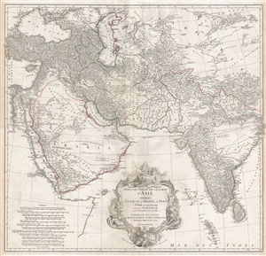
Premiere Partie de la Carte d'Asie contenant La Turquie, L'Arabie, La Perse, L'Inde en deca du Gange et de la Tartarie ce qui est limitrophe de la Perse et de l'Inde.
sold
- Digital Map Information
- Suitable for large format printing
- DPI: 300
- File Size: 34.98 MB
- File Type: ZIP / TIFF
- ICC color profile embedded
- Delivered instantly via download link
A monumental and highly detailed 1751 map of India, Persia, and Arabia by the French cartographer Jean Baptiste Bourguignon d'Anville. Centered on Persia, this map covers from Istanbul to eastern India and Tibet, and from the Black Sea to the Maldives. ... (more details)
A foundational map of Persia, Arabia, and India.
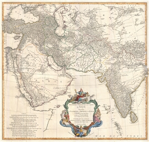
Premiere Partie de la Carte d'Asie contenant La Turquie, L'Arabie, La Perse, L'Inde en deca du Gange et de la Tartarie ce qui est limitrophe de la Perse et de l'Inde.
sold
- Digital Map Information
- Suitable for large format printing
- DPI: 300
- File Size: 25.92 MB
- File Type: ZIP / TIFF
- ICC color profile embedded
- Delivered instantly via download link
A monumental and highly detailed 1751 map of India, Persia, and Arabia by the French cartographer Jean Baptiste Bourguignon d'Anville. Centered on Persia, this map covers from Istanbul to eastern India and Tibet, and from the Black Sea to the Maldives. ... (more details)
Most finely-engraved Ptolemaic map of Arabia.
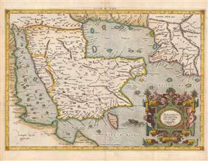
Asiae VI Tab.
sold
- Digital Map Information
- Suitable for large format printing
- Full resolution TIFF file
- ICC color profile embedded
- Delivered instantly via download link
This is Gerard Mercator's map of the Arabian Peninsula, based on the second-century mapping of Claudius Ptolemy (c. 100 - 170), the progenitor of modern geography. Mercator executed this map for his 1578 Duisberg edition of Ptolemy's Geographia, intended to be the definitive edition of that foundational work. (more details)
The Great Pyramid predicts the End of Days.
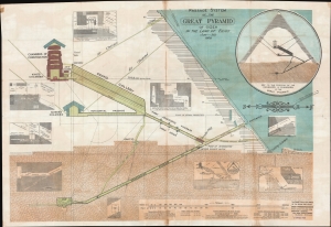
Passage System of the Great Pyramid of Giza in the Land of Egypt June - July 1909.
sold
- Digital Map Information
- Suitable for large format printing
- File Size: 321.48 MB
- File Type: ZIP / TIFF
- ICC color profile embedded
- Delivered instantly via download link
This is a c. 1910 monumental waxed linen banner illustrating the interior of the Great Pyramid of Giza, Egypt. The banner results from the 1909 studies of Morton Edgar and his brother John Edgar. Bother Edgars were dedicated pyramidologists who believed they could, through studies of the Great Pyramid, discern essential theological truths. Morton was obsessed with the theories of Jehovah's Witness founder Charles Taze Russell (1852 - 1916), who advocated the theory that the Great Pyramid was a mystical artifact deeply connected to the End of Days and the events predicted in Revelations. (more details)
Sacred places of Islam.
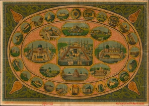
[Islamic Pilgrimage Sites].
sold
- Digital Map Information
- Suitable for large format printing
- File Size: 10.05 MB
- File Type: ZIP / TIFF
- ICC color profile embedded
- Delivered instantly via download link
This is a rare c. 1900 Raja Ravi Varma chromolithograph view of the primary Islamic pilgrimage sites: Mecca, Medina, and Jerusalem, as well as 6 secondary sites, and 24 tertiary sites. The view was printed in Lonavala, India, by a Raja Ravi Varma Press, one the first Indian owned and operated presses on the Subcontinent. (more details)
Earliest Printed Map to show the Hajj.
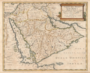
Carte des Trois Arabies Tirée en Parte de l'Arabe de Nubie, en partie de divers autres Autheurs, Par le S. N. Sanson d'Abbeville, Geographe ordinaire du Roy, A Paris.
sold
- Digital Map Information
- Suitable for large format printing
- Full resolution TIFF file
- ICC color profile embedded
- Delivered instantly via download link
This is an attractive example of Nicolas Sanson's scarce 1654 map of the Arabian Peninsula. As indicated in the title, it depicts the three Arabias: Arabie Petree, Arabie Deserte, and Arabia Heureuse; that is, Stony Arabia, Desert Arabia, and 'Happy' Arabia. The map depicts both shores of the Red Sea and the Persian Gulf, and the Indian Ocean island of Zocotora off the horn of Africa. The map includes Mecca and Medina, and the pattern of named settlements describes the Hajj routes: along the Red Sea coast, the overland routes across the peninsula from Basra, and the route to Mecca from Damascus. The Kingdom of Bahrain (Bahraim) appears as well. The largest portion of the Arabian Peninsula is here named Hyaman, ou Arabie Heureuse: 'Yemen, or Happy Arabia.' (more details)
I confess that my scheme is still a mere dream, and I do not shut my eyes to the fact that so long as I alone believe it to be possible, it is virtually impossible.' -de Lesseps
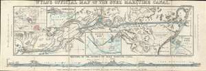
Wyld's Oficial Map of the Suez Maritime Canal.
sold
- Digital Map Information
- Suitable for large format printing
- File Size: 11.43 MB
- File Type: ZIP / TIFF
- ICC color profile embedded
- Delivered instantly via download link
An extremely rare 1869 James Wyld map of the Suez Canal issued shortly before the Canal was opened. The canal was officially opened on November 17, 1869, and Wyld copyrighted this map on November 12, 1869, just in time to capitalize and general enthusiasm over canal's completion. The map covers the full extent of the Canal form the Mediterranean to the Red Sea. There are inset charts of Ismailia, Suez Bay, and Port Said. A further inset in the upper left, illustrates the canal within the context of the British Empire, whose possessions are highlighted in red. A profile section of the canal appears along the bottom border. (more details)
Previously unknown!. Earliest specific map of Kurdistan.
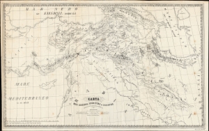
Carta dell'Armenia, Kurdistan e Lazistán della Russia meridionale e Persia occidentale ecc.
sold
- Digital Map Information
- Suitable for large format printing
- File Size: 23.93 MB
- File Type: ZIP / TIFF
- ICC color profile embedded
- Delivered instantly via download link
An unrecorded c. 1875 A. Nodari and A. de Bianchi map of the Kurdistan, Armenia, and the Caucuses. This previously unknown map may be considered the earliest known map of specifically of Kurdistan. It emerged during a period of rising ethnic and cultural division among Kurds and Armenians in the context of persistent Russian expansionism into the Caucuses and towards the Mediterranean, culminating in the Russo-Turkish War (1877 - 1878), the postwar Ottoman drive to assimilate Kurds, and events such as the Hamidian Massacres presaging the Armenian Genocide. (more details)