
Spain - Portugal (sold)
A Great Rarity of 16th Century Venetian Engraving
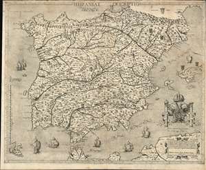
Hispania Descriptio / Hispania, quae et Iberia in ulteriore dividit ac citeriorem...
sold
- Digital Map Information
- Suitable for large format printing
- Full resolution TIFF file
- ICC color profile embedded
- Delivered instantly via download link
This is a beautiful, rare map of Spain engraved in 1560 by Domenico Zenoni (Zenoi.) It is among the earliest acquirable detailed maps of Spain based on contemporaneous knowledge. It is, moreover, a superb example of the heights the engraver's art reached in 16th century Venice. The oceans are lightly stippled, allowing for its calligraphy to be clearly legible throughout. Cities and mountain regions are shown pictorially. Each of the subordinate realms of Spain are given their respective armorial crests, and the seas are sailed by eight beautifully realized ships, and menaced by three monsters - one of which resembles nothing so much as a dog. (more details)
The only map of the Pilgrimage to Compostela.
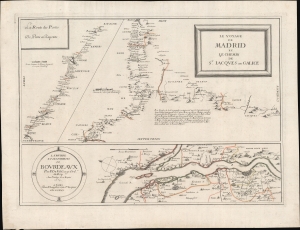
Le Voyage de Madrid et La Chemin de S. Iacques en Galice. / La Riviere et les Environs de Bovrdeavx. / La Route des Postes de Paris a Bayonne.
sold
- Digital Map Information
- Suitable for large format printing
- DPI: 600
- File Size: 486.8 MB
- File Type: ZIP / TIFF
- ICC color profile embedded
- Delivered instantly via download link
Of the utmost importance and rarity, this is the only map to illustrate the pilgrimage route to Santiago de Compostela (Chemin St. Jacques / Way of St. James) to appear during its period of greatest significance. This map was issued in 1659 by Piere Du Val and N. Langlois. It follows closely on the November 7, 1659 signing Treaty of the Pyrenees, which sealed a peace between France and Spain, ending the Franco-Spanish War (1635 - 1659) and opening the pilgrimage routes to French devotees for the first time in nearly 30 years. (more details)
The only map of the Pilgrimage of Santiago de Compostela at its height.
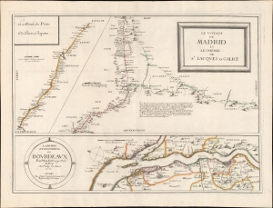
Le Voyage de Madrid et La Chemin de S. Iacques en Galice. / La Riviere et les Environs de Bovrdeavx. / La Route des Postes de Paris a Bayonne.
sold
- Digital Map Information
- Suitable for large format printing
- DPI: 600
- File Size: 440.49 MB
- File Type: ZIP / TIFF
- ICC color profile embedded
- Delivered instantly via download link
Of the utmost importance and rarity, this is the only map to illustrate the pilgrimage route to Santiago de Compostela (Chemin St. Jacques / Way of St. James) to appear during its period of greatest significance. This map was issued in 1659 by Pierre Du Val and Jacques Lagniet. It follows closely on the November 7, 1659 signing Treaty of the Pyrenees, which sealed a peace between France and Spain, ending the Franco-Spanish War (1635 - 1659) and opening the pilgrimage routes to French devotees for the first time in nearly thirty years. (more details)
Extraordinary and rare map of Mallorca with decorative borders.
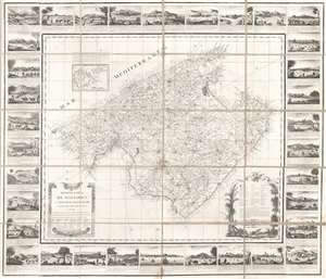
Mapa de la Isla de Mallorca sacado en escala menor del que publico el E.S. Cardenal Despuig El Año 1785.
sold
- Digital Map Information
- Suitable for large format printing
- DPI: 600
- File Size: 40.81 MB
- File Type: ZIP / TIFF
- ICC color profile embedded
- Delivered instantly via download link
An exceptionally rare 1814 / 1829 separately issued broadside map of Majorca (Mallorca), Spain, with fully illustrated surround. The map covers all of Mallorca with an inset illustrating the nearby islands of Cabrera and Conejara. It is based upon an earlier 1785 map surveyed at the order of Cardinal Antonio Despuig y Dameto. Manuel Briton, the island's Artillery Commissioner, partnered with Lorenzo María Muntaner (1782 - 1848), son of the original engraver, to revise the map for sale to tourists in 1814. The map is in Spanish, as are the caption on the surrounding views, but the imprint of Briton and Muntaner is in Catalan. The base map is quite rare and beautiful, but what makes this example special is the decorative surround featuring 34 captioned views of Majorcan towns and villages. (more details)
One of the earliest impressions of the only large-scale depiction of Martin Behaim's map.
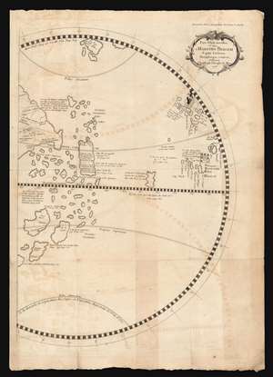
Pars Globi terrestris Ao. 1492. Martino Behaim Equite Lusitano Norimbergae confecti. Delineavit Christoph. Theoph. de Murr. 1778.
sold
- Digital Map Information
- Suitable for large format printing
- Full resolution TIFF file
- ICC color profile embedded
- Delivered instantly via download link
This fascinating and unique map, printed in 1787, is one of the earliest acquirable representations of the western hemisphere as it appeared on the oldest surviving globe - Martin Behaim's Erdapfel, a manuscript globe produced in Nuremberg in 1492. Behaim's globe was influential and fascinating, offering a glimpse on the imagined form of the world at the time of Columbus. Behaim's fame, amplified by supporters over the following centuries, led some to scholars to suppose he himself traveled across the Atlantic to America, or at least that supplied the theory to Columbus that the Atlantic route to the East Indies was navigable. The present map, copied from the western hemisphere of Behaim's globe by the historian Christoph Gottlieb von Murr, was produced as evidence that Behaim had neither stolen a march on Columbus, nor guided him. Having marshaled his evidence, von Murr says that 'history, and the globe destroy absolutely all these so - called facts, and prove (Behaim) had no knowledge of America.' (more details)
Only known example of rare Palma imprint map of Majorca with pictorial surround.
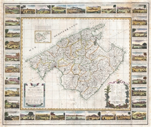
Mapa de la Isla de Mallorca sacado en escala menor del que publico el E.S. Cardenal Despuig El Año 1785.
sold
- Digital Map Information
- Suitable for large format printing
- DPI: 300
- File Size: 22.32 MB
- File Type: ZIP / TIFF
- ICC color profile embedded
- Delivered instantly via download link
An exceptionally rare 1814 separately issued boradside map of Majorca, Spain, with fully illustrated surround. The map covers all of Majorca (Mallorca) with an inset nearby islands of Cabrera and Conejara. It is based upon an earlier map surveyed at the order of ... (more details)
The first map of the Balearic Islands based on firsthand knowledge.
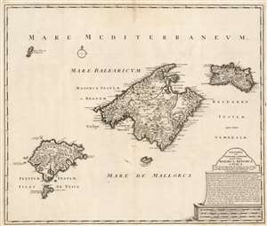
Baleares seu Gymnesiae et Pityusae insulae dictae Maiorca, Minorca et Yvica.
sold
- Digital Map Information
- Suitable for large format printing
- DPI: 600
- File Size: 55.98 MB
- File Type: ZIP / TIFF
- ICC color profile embedded
- Delivered instantly via download link
This is a superbly detailed map of the Balearic Islands by Renard and Josua Ottens, in what appears to be a scarce early state, as early as 1720. The map is oriented to the north, and includes the major islands of Mallorca, Menorca, Ibiza, and Formentera as well as the smaller Cabrera, Dragonera, and Monte Colibre. Mallorca and Menorca, in particular, are superbly detailed. All the major islands' terrain is richly and expertly engraved, illustrating topography, forests, and cultivated areas pictorially. Roads, cities, salt flats, and fortifications are depicted. Anchorages are indicated, in several cases with depth soundings. The elegant, spare cartouche features a brief history of the rulers of the islands, up to the English capture and occupation of Menorca in 1708. (more details)
First map of the Balearic Islands based on firsthand knowledge.
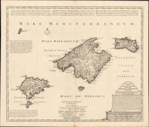
Baleares seu Gymnesiae et Pityusae insulae dictae Maiorca, Minorca et Yvica.
sold
- Digital Map Information
- Suitable for large format printing
- Full resolution TIFF file
- ICC color profile embedded
- Delivered instantly via download link
This is a superbly detailed c. 1725 map of the Balearic Islands by Renard and Josua Ottens. It draws on earlier maps by Johannes van Keulen and the local scholar Vicente Mut i Armengol, while adding notes on the islands' history and quotes from classical texts, providing a comprehensive overview. (more details)
Unrecorded, Likely Pirated Chart of the Mediterranean.
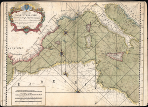
Carte de la Méditerranée dediée à Mgr le duc de Choiseul...
sold
- Digital Map Information
- Suitable for large format printing
- Full resolution TIFF file
- ICC color profile embedded
- Delivered instantly via download link
This is a rare and likely pirated nautical chart or map of the western Mediterranean Sea, based on Joseph Roux's 1764 groundbreaking 'Carte de la Mer Méditerranée en douze feuilles'. Roux's work was highly sought after and considered the gold standard for navigating the Mediterranean into the early 19th century. (more details)
Extremely rare and impressively large 18th century map of Menorca, Spain.
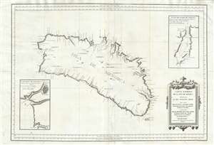
Carta Esférica de las Isla de Menorca; Presentada al Rey Nuestro Señor.
sold
- Digital Map Information
- Suitable for large format printing
- DPI: 300
- File Size: 24.51 MB
- File Type: ZIP / TIFF
- ICC color profile embedded
- Delivered instantly via download link
An extremely rare large scale 1786 Spanish nautical chart detailing the Balearic Island of Menorca (Minorca) by the famed hydrographers Vincente Tofiño de San Miguel and Antonio Valdés y Fernández Bazán. The map covers the island in full with light shoreline ... (more details)
The key Mediterranean Theatre of the War of the Spanish Succession.
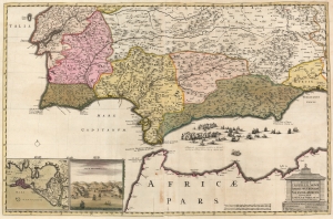
Regnorum Castellæ Novae Andalusiae Granadae Valentiae et Murciae Accurata Tabula.
sold
- Digital Map Information
- Suitable for large format printing
- DPI: 600
- File Size: 99.43 MB
- File Type: ZIP / TIFF
- ICC color profile embedded
- Delivered instantly via download link
This is a beautiful example of Nicolaes Visscher II's 1682 map of southern Spain and Portugal, and the Strait of Gibraltar. This is the c. 1710 state of the map, highlighting the crucial ports of Cadiz and Gibraltar and including a dramatically engraved portrayal of the August 24, 1704, Battle of Málaga. (more details)
Extremely rare and impressively large 18th century map of Ibiza, Spain.
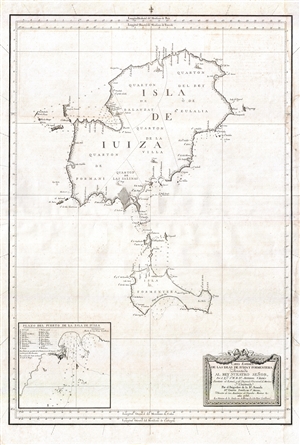
Carta Esférica de las Islas de Iuiza y Formentera;Presentada al Rey Nuestro Señor, Por el Emo. Sr. Bº. Fr. Dn. Antonio Valdés, Secretario de Estado, y del Despacho Universal de Marina;Y Construida Por el Brigadier de la Rl. Armada Dn. Vicente Tofiño de Sn. Miguel, Director de las Academias de Guardias Marinas &c.
sold
- Digital Map Information
- Suitable for large format printing
- DPI: 300
- File Size: 13.96 MB
- File Type: ZIP / TIFF
- ICC color profile embedded
- Delivered instantly via download link
An extremely rare large scale 1786 Spanish nautical chart detailing the Balearic Islands of Ibiza and Formentera by the famed hydrographers Vincente Tofiño de San Miguel and Antonio Valdés y Fernández Bazán. The map covers both islands in full with light ... (more details)
Extremely rare and impressively large 18th century map of Mallorca Spain.
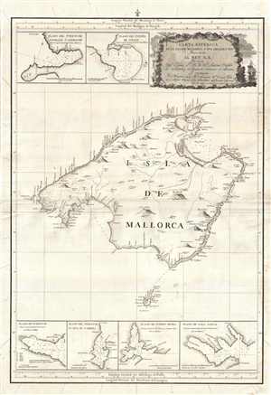
Carta Esferica de la Isla de Mallorca y sus adyacentes. Presentada al Rey N. S. por mano de... Antonio Valdés y construida por... Dn. Vicente Tofiño de S. Miguel, año 1786.
sold
- Digital Map Information
- Suitable for large format printing
- Full resolution TIFF file
- ICC color profile embedded
- Delivered instantly via download link
An extremely rare large scale 1786 Spanish nautical chart detailing the Balearic Island of Mallorca (Majorca) by the famed hydrographers Vincente Tofiño de San Miguel and Antonio Valdés y Fernández Bazán. The map covers Mallorca in full inclusive of the ... (more details)
Extremely rare and impressively large 18th century map of Mallorca Spain.
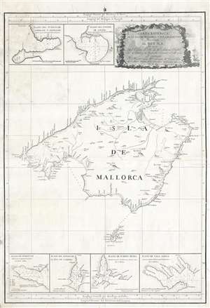
Carta Esferica de la Isla de Mallorca y sus adyacentes. Presentada al Rey N. S. por mano de... Antonio Valdés y construida por... Dn. Vicente Tofiño de S. Miguel, año 1786.
sold
- Digital Map Information
- Suitable for large format printing
- DPI: 300
- File Size: 14.54 MB
- File Type: ZIP / TIFF
- ICC color profile embedded
- Delivered instantly via download link
An extremely rare large scale 1786 Spanish nautical chart detailing the Balearic Island of Mallorca (Majorca) by the famed hydrographers Vincente Tofiño de San Miguel and Antonio Valdés y Fernández Bazán. The map covers Mallorca in full inclusive of the ... (more details)
The 1755 Great Earthquake of Lisbon.
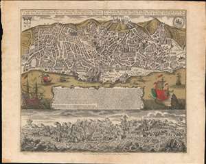
Lisabona magnificentissima Regia Sedes Portugalliae et florentissimum Emporium ad ostia Tagi situm... / Lisabon die prächtige Konigl. Residenz. Statt in Portugall ù florisanteste Handels Plaz am Ausfluss des Tagi.../ Ruinae eversae olysipponis. / Ruin der Stadt Lisabona.
sold
- Digital Map Information
- Suitable for large format printing
- Full resolution TIFF file
- ICC color profile embedded
- Delivered instantly via download link
An extraordinary 1756 Seutter / Lotter map and view of Lisbon, Portugal, in the wake of its near total destruction by the Great Lisbon Earthquake of 1755. The map is divided into two sections. The upper section features a view and map of Lisbon as it appeared in 1735, 20 years prior. The lower section, entitled 'Ruinae Eversae Olysipponis' is a dramatic bird's eye view of Lisbon being consumed by the Great Earthquake and related fires. (more details)
Definitive 18th century chart of Mallorca.
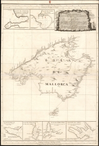
Carta Esferica de la Isla de Mallorca y sus adyacentes. Presentada al Rey N. S. por mano de... Antonio Valdés y construida por... Dn. Vicente Tofiño de S. Miguel, año 1786.
sold
- Digital Map Information
- Suitable for large format printing
- Full resolution TIFF file
- ICC color profile embedded
- Delivered instantly via download link
An extremely rare large scale 1786 Spanish nautical chart detailing the Balearic Island of Mallorca (Majorca) by the famed hydrographers Vincente Tofiño de San Miguel and Antonio Valdés y Fernández Bazán. The map covers Mallorca in full inclusive of the ... (more details)
Definitive mapping of Basque dialects.
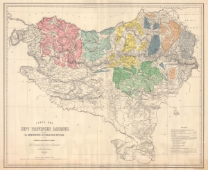
Carte des Sept Provinces Basques, montrant La Délimitation Actuelle de L'Euscara et sa division en dialectes, sous-dialects et variétés.
sold
- Digital Map Information
- Suitable for large format printing
- File Size: 81.28 MB
- File Type: ZIP / TIFF
- ICC color profile embedded
- Delivered instantly via download link
This is an impressive large-scale 1863 linguistic map of the Basque country in Spain and France showing the dialects, varieties, and sub-varieties of the Basque language, Euskara. The map illustrates the philological of Louis Lucien Bonaparte, whose classifications of Euskara remains definitive. (more details)
First Accurate Map of Galicia by Spain's 18th century greatest cartographer.
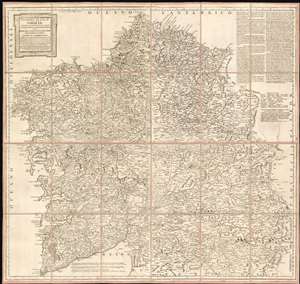
Mapa geográfico del Reyno de Galicia contiene las provincias de Santiago, Coruña, Betanzos, Lugo, Mondoñedo, Orense, y Tuy.
sold
- Digital Map Information
- Suitable for large format printing
- Full resolution TIFF file
- ICC color profile embedded
- Delivered instantly via download link
This is a 1784 map of the Kingdom of Galicia by Tomás López de Vargas Machuca, the preeminent Spanish cartographer of his generation. This is most authoritative map of Galicia ever committed to print, which López argued should be considered the first such map overall. In the text at the upper right, López wrote:
Se puede decir que este mapa es el primero impreso de Galicia... porque el del Pe. Ojea es tan diminuto, que de su lectura solo sacamos una instruccion muy limitada; el de Mr. De Fer y otros estrangeros son un monton de desalinos.López's boast is not baseless. The map of Hernando Ojea (1543 - 1615) to which he refers was first committed to print in the 1603 J.B. Vrients edition of the Ortelius atlas (he obtained a manuscript from Ojea.) This, in absolute terms, was the first printed map of Galicia, and was considered sufficiently correct that virtually every map printed of Galicia in that century was copied directly from it. Even so, in terms of detail López's criticism of the Ojea is valid: its scale limits detail. The maps of De Fer - which appear to be derived from, or from the same sources as the Cantelli and the Coronelli maps - did contain more data than their precursor, but even if they did not deserve the appellation un monton de desalinos, None approach this López map in either size or detail. Lopez credits an impressive array of sources - in sum, the map compiled a wealth of state-of-the-art data from a roster dominated by leading lights of the Spanish Enlightenment. They include the statesman Gaspar Melchor de Jovellanos (1744 - 1811); Pedro Varela y Ulloa (1737- 1797), then an official of the Secretary of State, who would eventually become Secretary of the Navy. Particular credit was given to José Andrés Cornide de Folgueira y Saavedra (D. Joseph Cornide; 1737 - 1803), a noted Galician geographer, naturalist and humanist (more details)
'It can be said that this map is the first printed of Galicia... because that of Father Ojea is so tiny, that from its reading we only get a very limited instruction; those of Mr. De Fer and other foreigners are a bunch of slops.'
Scarce map of the Balearic Islands.
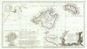
Mapa Geografico, y General de Las Islas Baleares Y Pithuyusas.
sold
- Digital Map Information
- Suitable for large format printing
- DPI: 300
- File Size: 9.9 MB
- File Type: ZIP / TIFF
- ICC color profile embedded
- Delivered instantly via download link
A scarce 1793 of the Balearic Islands of Ibiza, Majorca, and Minorca by the Spanish cartographer Tomás López de Vargas Machuca. The map has an unusual elongated format centered on Majorca (Mallorca). There are insets of the town of Ibiza (Iviza) and ... (more details)
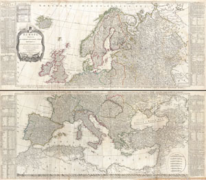
Europe Divided into its Empires, Kingdoms, States Republics, & c.
sold
- Digital Map Information
- Suitable for large format printing
- DPI: 300
- File Size: 78.51 MB
- File Type: ZIP / TIFF
- ICC color profile embedded
- Delivered instantly via download link
A large and dramatic 1794 wall map of Europe on two panels. Published by Laurie and Whittle based the work of the important cartographer J. B. B. D'Anville. Upper sheet covers from Iceland to Russia and from the Arctic to Calais and Astrakhan. The ... (more details)
Rare Spanish nautical chart of the Balearic Islands.
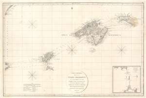
Carta Esferica de las Islas Baleares y Pithyusas, arreglada a la que se construyo en 1807 en la Dirección Hidrografica de Madrid.
sold
- Digital Map Information
- Suitable for large format printing
- Full resolution TIFF file
- ICC color profile embedded
- Delivered instantly via download link
A rare 1812 Dirección de Hidrografía nautical chart or maritime map of the Balearic Islands: Mallorca, Minorca, Ibiza and Formentera. The chart offers extraordinarily detail throughout with topography, town names rivers, roads, and depth soundings. An inset in the lower right details the channels between Ibiza and Formentera (1 : 69400). (more details)
Rare Spanish nautical chart of the Balearic Islands.
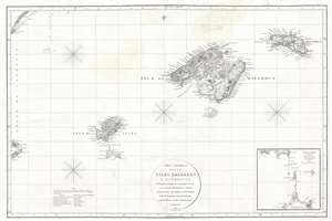
Carta Esferica de las Islas Baleares y Pithyusas, arreglada a la que se construyo en 1807 en la Dirección Hidrografica de Madrid.
sold
- Digital Map Information
- Suitable for large format printing
- DPI: 300
- File Size: 10.36 MB
- File Type: ZIP / TIFF
- ICC color profile embedded
- Delivered instantly via download link
A rare 1812 Dirección de Hidrografía nautical chart or maritime map of the Balearic Islands: Mallorca, Menorca, Ibiza and Formentera. The chart offers extraordinarily detail throughout with topography, town names rivers, roads, and depth soundings. ... (more details)
Possibly one-of-a-kind map of a Siege Campaign in the Franco-Spanish War.
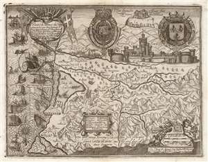
Entreé de l'Armee du Roy commandee par Monseigneur le Prince dans ala Comte de Roussllon...
sold
- Digital Map Information
- Suitable for large format printing
- DPI: 600
- File Size: 37.98 MB
- File Type: ZIP / TIFF
- ICC color profile embedded
- Delivered instantly via download link
This is a rare and highly evocative 1639 Jean-Etienne Lasne map of the region around Salses-le-Château, Roussillon, France, depicting its first siege during the Franco-Spanish War (1635 - 1659). The south-oriented map embraces the Province of Roussillon, including the Étang de Salces (Étang de Leucate), the cities of Salces, Leucate, and Perpignan, and other towns. (more details)
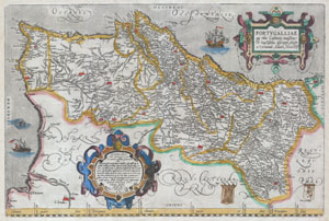
Portvgalliae que olim Lusitania, novissima & exactissima descriptio, Aucto re Vernando Aluaro Secco (A very new & exact depiction of Portugal, once called Lusitania, by Vernandus Alvarus Secco).
sold
- Digital Map Information
- Suitable for large format printing
- Full resolution TIFF file
- ICC color profile embedded
- Delivered instantly via download link
A rare and beautiful 1579 Abraham Ortelius map of the Kingdom of Portugal. Follows the extremely rare two sheet Alavaraz Secco map published by Michele Tramezzino in 1561. North oriented to the right. Sea decorated with monsters and sailing ships. ... (more details)
Original old color example of the first acquirable map of Portugal.
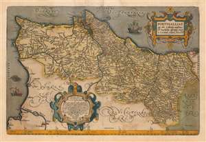
Portugalliae que olim Lusitania, novissima et exactissima descriptio.
sold
- Digital Map Information
- Suitable for large format printing
- DPI: 600
- File Size: 60.34 MB
- File Type: ZIP / TIFF
- ICC color profile embedded
- Delivered instantly via download link
This is an original old color example of Abraham Ortelius' 1570 map of the Kingdom of Portugal, in a Latin edition of 1612. In its first issue it is the earliest acquirable map of that kingdom. The map is oriented to the west, and its composition is balanced and artistic. Ships sail the stippled oceans, and a hirsute monster lurks off the southern coast. The map includes two handsome strapwork cartouches: the title cartouche in the upper right, and at the bottom just left of center, the map's effusive dedication. (more details)
Rare and striking city plan of Madrid.
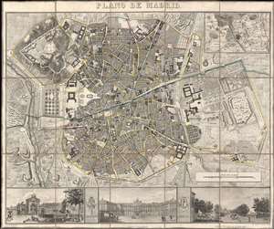
Plano de Madrid.
sold
- Digital Map Information
- Suitable for large format printing
- DPI: 600
- File Size: 44.25 MB
- File Type: ZIP / TIFF
- ICC color profile embedded
- Delivered instantly via download link
This is a beautiful 1846 Pedro Martín de López city map or plan of Madrid, Spain. The map depicts the city from the Manzanares River to Retiro Park (Parque del Buen Retiro) and from the Puerta de Bilbao to the Puerta de Toledo. Presented in exceptional detail and fine engraving, over 180 different locations are numerically identified numerically. Streets throughout the city are labeled, including the Calle Mayor. An inset of Madrid and its environs is situated in the upper right corner. Three views, illustrating the Fuente de la Cibeles, the Real Palacio, and the Puerta de San Vicente are included along the bottom border and separated by the Coat of Arms of Spain and Madrid. (more details)
An incredible large scale naval chart of Gibraltar and the Bay of Gibraltar.
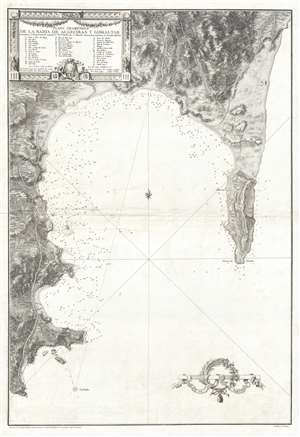
Plano Geométrico de la Bahia de Algeciras y Gibraltar.
sold
- Digital Map Information
- Suitable for large format printing
- DPI: 300
- File Size: 16.01 MB
- File Type: ZIP / TIFF
- ICC color profile embedded
- Delivered instantly via download link
An extremely rare large scale 1786 Spanish nautical chart detailing the Bay of Gibraltar and Gibraltar by the famed hydrographer Vincente Tofiño de San Miguel. The map depicts the Bay of Gibraltar from Algeciras to the Mediterranean. Depth ... (more details)
Island Paradise with some of the world's greatest fortified wines.
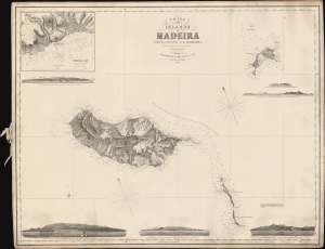
Chart of the Islands of Madeira Porto Santo and Dezerta.
sold
- Digital Map Information
- Suitable for large format printing
- File Size: 823.41 MB
- File Type: ZIP / TIFF
- ICC color profile embedded
- Delivered instantly via download link
A scarce 1863 James Imray nautical map of Madeira and nearby islands, based on a survey by Royal Navy officer Alexander Vidal. (more details)
Rare set of Spanish nautical charts.
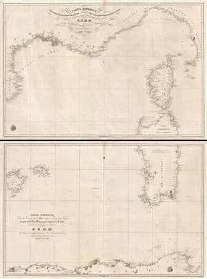
Carta esférica de las costas de Francia, Cerdeña, Luca y Toscana con las yslas de Elba, Córcega y parte septentrional de la de Cerdeña. / Carta Esférica de la Costa de Africa entre Argel y Tunez con parte de las Yslas Baleares y la meridional de Cerdeña.
sold
- Digital Map Information
- Suitable for large format printing
- DPI: 300
- File Size: 33.51 MB
- File Type: ZIP / TIFF
- ICC color profile embedded
- Delivered instantly via download link
This is a rare 1838 two-part Spanish nautical chart of the western Mediterranean in the vicinity of Corsica, Sardinia, and the Balearic Islands. The map covers from Majorca (Mallorca) and Menorca (Minorca) east to Sardinia and Corsica and ... (more details)
Large 18th century map of the Mediterranean region.
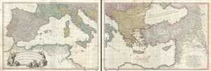
A Map of the Mediterranean Sea with the Adjacent Regions and Seas in Europe, Asia and Africa.
sold
- Digital Map Information
- Suitable for large format printing
- Full resolution TIFF file
- ICC color profile embedded
- Delivered instantly via download link
This is an appealing 1785 map of the Mediterranean region issued by William Faden. A set of two maps, the western sheet covers from Portugal, Spain, Italy, the Maghreb or the Barbary Coast of Africa and includes parts of France and the ... (more details)
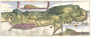
Gibraltar met alle zyne fortificatien en Verbeeteringen tot desselus Verzeekering.
sold
- Digital Map Information
- Suitable for large format printing
- Full resolution TIFF file
- ICC color profile embedded
- Delivered instantly via download link
A very scarce, c. 1720, view format map of Gibraltar most likely prepared and issued by the De La Feuille family. Depicts the peninsula and town of Gibraltar from an east facing view perspective. The town of Gibraltar is well laid ... (more details)
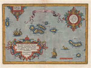
Acores Insulae.
sold
- Digital Map Information
- Suitable for large format printing
- DPI: 300
- File Size: 11.89 MB
- File Type: ZIP / TIFF
- ICC color profile embedded
- Delivered instantly via download link
A highly decorative 1603 map of the Azores by Abraham Ortelius. The map covers the Azores in considerable detail with numerous ships decorating the seas and a large sea serpent just west of St. Michael. The detail and overall ... (more details)