
U.S. Cities (sold)
Beautiful and extremely rare plan of Philadelphia while it was still the capital of the United States.
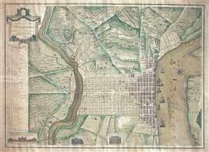
To the Citizens of Philadelphia: This Plan of the City and its Environs is respectfully dedicated by the Editor.
sold
- Digital Map Information
- Suitable for large format printing
- DPI: 300
- File Size: 18.82 MB
- File Type: ZIP / TIFF
- ICC color profile embedded
- Delivered instantly via download link
This is a 1796 Peter Charles Varlé city map or plan of Philadelphia, Pennsylvania. At this point in history, Philadelphia remained the capital of the United States, since the transfer to Washington, D.C. would not take place until 1800. The map depicts the city of ... (more details)
A most important Civil War map of Washington D.C.
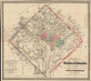
Topographical Map of the Original District of Columbia and Environs: Showing the Fortifications around the City of Washington.
sold
- Digital Map Information
- Suitable for large format printing
- File Size: 51.63 MB
- File Type: ZIP / TIFF
- ICC color profile embedded
- Delivered instantly via download link
Known as 'The Arnold Map', this is the most important Civil War era map of Washington D.C. and vicinity. This map was issued by Edward Greene 'Aloha Vivarttas' Arnold and G. W. Colton in 1862, just after the Second Battle of Bull Run. Centered on the White House, the map illustrates the 'original' ten-mile-square diamond-shaped land allocation set aside for the District of Columbia. As a cartographic piece, Arnold's map exceeded in quality all previous maps of the region, noting roads, canals, turnpikes, railroads, and mills, as well offering a meticulous presentation of topography. Significantly, it illustrates the 51 fortifications, army hospitals, and dozens of small batteries - all critical wartime reconnaissance. (more details)

This is a rare and extraordinary powder horn dating to 1775, just prior to the Revolutionary War. Features a stunning scrimshaw map of Boston, Massachusetts, noting Bunker's Hill (Bunker Hill), Breeds Hill, Morton's Point, Charlestown, Mill Pond, Hancock's Warf, ... (more details)
Gangland Style! The greatest pictorial map of all time! Addressing socially, politically, and legally volitile issues!
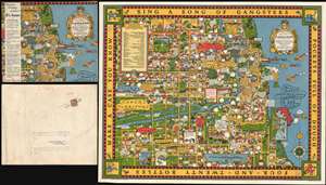
A Map of Chicago's Gangland from Authentic Sources. Designed to Inculcate the Most Important Principles of Piety and Virtue in Young Persons and Graphically Portray the Evils and Sin and Large Cities.
sold
- Digital Map Information
- Suitable for large format printing
- File Size: 52.39 MB
- File Type: ZIP / TIFF
- ICC color profile embedded
- Delivered instantly via download link
Perhaps the greatest pictorial map of all time, this is the legendary 1931 Bruce-Roberts cartoon map of Gangland Chicago, accompanied by its original mailer. Although not drawn to scale, the map covers downtown Chicago from Lincoln Park to Jackson Park and west as far as Cicero and Stickney. When this map was issued, Chicago's Prohibition Era gang wars were winding down. Al Capone, Chicago's criminal king-pin, was convicted of tax evasion and sentenced to 11 years in federal prison in October of this same year. Nonetheless, as this went to press, probably in August or September of 1931, all of Chicago was reeling from years of violent gang warfare. Unlike any previous pictorial map, the revolutionary unknown artist that drew this map is embracing politically, socially, and legally complex issues at the moment of their highest volatility. It comes thus as no surprise that the artist chose to remain anonymous. Despite its violent if cartoonish content, the map was issued with the noble intent, 'to inculcate the most important principles of Piety and virtue in young persons and graphically portray the evils and sin of large cities.' (more details)
Laredo's urbanization.
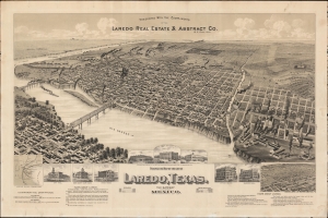
Perspective Map of the City of Laredo, Texas. The Gateway to and from Mexico.
sold
- Digital Map Information
- Suitable for large format printing
- File Size: 1068.57 MB
- File Type: ZIP / TIFF
- ICC color profile embedded
- Delivered instantly via download link
A very rare broadside bird's-eye view map of Laredo, Texas. The map was issued on Laredo's quadranscentennial, and so reflects a 25-year period of breakneck growth and prosperity, from which Laredo emerged as the most prosperous and connected border city in south Texas. (more details)
Silver boomtown by the first African American Lithographer.
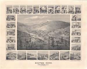
Silver City, Owyhee, I.T.
sold
- Digital Map Information
- Suitable for large format printing
- File Size: 52.62 MB
- File Type: ZIP / TIFF
- ICC color profile embedded
- Delivered instantly via download link
A remarkable 1866 bird's-eye view of Silver City, Idaho Territory, issued by Grafton Tyler Brown, America's first African American lithographer, and presenting the mining boomtown at its height of prosperity. Silver City experienced one of America's richest mineral strikes, producing gold and silver for more than 40 years. This view is one of only two known examples, significant not only for its historic illustration of a pop-up boomtown in full bloom, but also for being one of the few surviving views engraved and printed by Grafton T. Brown. Unlike many views, it has the unique distinction of being drawn from daguerreotype photographs taken by Philip Frederick Castleman, who visited with a supply caravan in 1866. (more details)
One of the most significant and desirable views of San Francisco ever published.
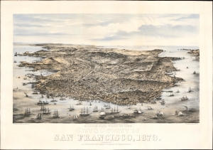
Bird's Eye View of the City and County of San Francisco, 1873.
sold
- Digital Map Information
- Suitable for large format printing
- Full resolution TIFF file
- ICC color profile embedded
- Delivered instantly via download link
This is Charles Braddock Gifford and William Vallance Gray's extraordinary 1873 three-color chromolithograph bird's-eye view of San Francisco, California - one of the most desirable and influential views of San Francisco ever produced. It captures the city in its second distinct phase, having left behind the Gold Rush era and embraced the role of financier of the Pacific Coast, particularly western Nevada's Comstock Lode. (more details)
Urbanization of the Garden District!
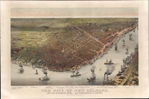
The City of New Orleans, and the Mississippi River, Lake Pontchartrain in Distance.
sold
- Digital Map Information
- Suitable for large format printing
- Full resolution TIFF file
- ICC color profile embedded
- Delivered instantly via download link
This is a rare 1885 Currier and Ives chromolithograph bird's-eye view of New Orleans. Unlike earlier views of New Orleans, this unusual view focuses attention southwest of the French Quarter towards the Garden District and extends west far enough to include Audubon Park. This is significant, as the view was issued to celebrate the 1884 - 1885 Industrial and Cotton Centennial Exposition, the campus of which appears at the far left. In the foreground the Mississippi waterfront bustles with classic paddlewheel riverboat traffic, while in the distance, Lake Pontchartrain lines the horizon. In general, the vertical perspective has been somewhat exaggerated to highlight the tallest and most impressive buildings. (more details)
Exceptional early manuscript map of the Financial Center of the World - Wall Street!
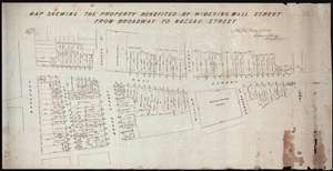
Map Shewing the Property Benefited by Widening Wall Street from Broadway to Nassau Street.
sold
- Digital Map Information
- Suitable for large format printing
- DPI: 300
- File Size: 11.96 MB
- File Type: ZIP / TIFF
- ICC color profile embedded
- Delivered instantly via download link
A unique once-in-a-lifetime discovery for the New York City collector, this is a one-of-a-kind 1851 manuscript cadastral survey map of New York City's Wall Street between Broadway and Pearl Street – including the site of the New York Stock Exchange and numerous ... (more details)
The most detailed general map of Colorado's central mining regions published in the 1870s.
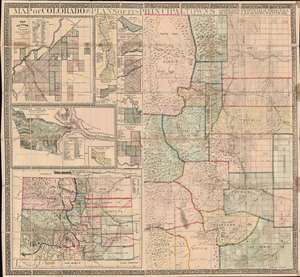
Map of Colorado with Plans of its Principal Towns.
sold
- Digital Map Information
- Suitable for large format printing
- File Size: 95.31 MB
- File Type: ZIP / TIFF
- ICC color profile embedded
- Delivered instantly via download link
A dramatic large-scale 1872 Joseph Hartshorne Bonsall and Edwin Hosmer Kellogg folding wall map of Colorado, issued during the heady days between the Colorado Gold Rush (1859) and the Colorado Silver Boom (1878). This piece is highly significant both for its extreme rarity and for the fact it offers unprecedented detail. Surpassing the Gilpen-Ebert series, the map illustrates maintained trails, and identifies ranches, springs, military reservations, post offices, and more. We are aware of no earlier map, nor any other map issued in the subsequent 10 years, that offers greater detail. (more details)
The largest-scale pioneering aerial map of New York City.
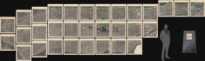
Hamilton Aerial Map Manhattan.
sold
- Digital Map Information
- Suitable for large format printing
- File Size: 164.67 MB
- File Type: ZIP / TIFF
- ICC color profile embedded
- Delivered instantly via download link
This is the rare William L. Hamilton 1927 aerial map of Manhattan, New York City. It is one of the earliest and certainly the largest aerial map of New York produced in the pioneering days of aerial cartography. The map was issued as a loose-leaf folio atlas of thirty-one sheets. (more details)
Official planning map by St. Petersburg, Florida.
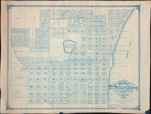
Map of the City of St. Petersburg Hillsborough Co. Florida 1906.
sold
- Digital Map Information
- Suitable for large format printing
- File Size: 2444.3 MB
- File Type: ZIP / TIFF
- ICC color profile embedded
- Delivered instantly via download link
An extraordinary 1906 wall map of St. Petersburg, Florida, issued at the height of its early 20th century development as a railroad and tourist town. The map was drawn by St. Petersburg's City Engineer, John Poore Titcomb, who took the position in 1901 and, in the year this map was issued, supervised the 1906 construction of the city's first sewer system - as identified here. (more details)
Earliest known example of the first Official Map of Miami Beach.
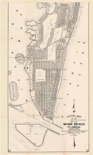
Official Map Adopted November 3, 1920 of the city of Miami Beach Florida.
sold
- Digital Map Information
- Suitable for large format printing
- File Size: 37.39 MB
- File Type: ZIP / TIFF
- ICC color profile embedded
- Delivered instantly via download link
This is Robert M. Davidson's 1925 map of Miami Beach, Florida - the earliest known example of the first official planning map of Miami Beach, drawn at the height of construction in Miami Beach and the apex of the Florida Land Boom. The map was first drawn by Davidson, Miami Beach's first City Engineer, in 1920, with the present example bearing the date of February 1925. The map covers from 42nd Street to South Point, covering modern day South Beach and parts of Mid-Beach. The map reveals the early planning and lotting of Miami Beach, noting sub-divisions, individual lots, parks, hotels, and golf clubs, and elite developments such as 'Star Island'. Although very large as is, the present map is only the 'South Half' of the full map, although no surviving examples of the 'North Half' are known, and it may not have been issued at all. (more details)
Rare Colton edition of an iconic New York City map.
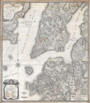
Plan of the city of New York in North America : surveyed in the years 1766 and 1767.
sold
- Digital Map Information
- Suitable for large format printing
- DPI: 300
- File Size: 61.52 MB
- File Type: ZIP / TIFF
- ICC color profile embedded
- Delivered instantly via download link
Known as the 'Ratzer Plan,' this is one of the most important, beautiful, and iconic colonial era maps of New York City, offered here in a stunning 1853 Colton restrike. This map was originally surveyed in 1767 by Bernard Ratzer, a lieutenant in the 'Royal American' regiment at the behest of Sir George Moore, governor of New York, who is sited in the cartouche. The map, which covers the southern part of Manhattan to about modern day 57th street, is a revision and expansion upon the flawed John Montresor plan of 1767. Across East River, a portion of Long Island is depicted, including most of Brooklyn and Parts of Long Island City. (more details)
Among the earliest obtainable maps of Charleston.
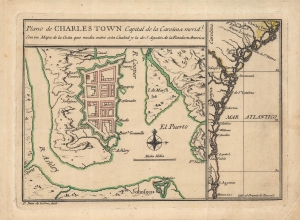
Plano de Charles Town capital de la Carolina Medl. con un mapa de la costa que media entre esta ciudad y la de S. Agustin de la Florida en America.
sold
- Digital Map Information
- Suitable for large format printing
- Full resolution TIFF file
- ICC color profile embedded
- Delivered instantly via download link
This is Juan de la Cruz's important and rare c. 1753 plan of Charleston, South Carolina. It is one of the earliest printed maps of Charleston, and perhaps the earliest specific printed map of Charleston. It updates the city plan included, via inset, on the unobtainable 1711 Edward Crisp map. As such, it reflects the precarity of the settlement just 30 years after its founding, as a distant colonial outpost, heavily fortified against anticipated attacks. (more details)
Proposed Masonic African American community near David City, Florida.
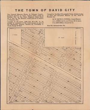
The Town of David City.
sold
- Digital Map Information
- Suitable for large format printing
- File Size: 17.6 MB
- File Type: ZIP / TIFF
- ICC color profile embedded
- Delivered instantly via download link
A unique c. 1920 broadside map promoting the development of an all-African American town, 'David City', in Putnam County, Florida. The city was planned by the African American Masonic Lodge of Jacksonville, for settlement by its members, on the abandoned site of a female-operated African American Masonic convalescent home. The map provides unique insight into the role of African American philanthropy and values in northern Florida in the early 20th century. (more details)
Important early view of Salt Lake City, Utah.
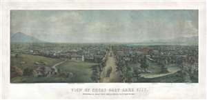
View of Great Salt Lake City.
sold
- Digital Map Information
- Suitable for large format printing
- File Size: 54.36 MB
- File Type: ZIP / TIFF
- ICC color profile embedded
- Delivered instantly via download link
This is a very rare 1867 Christian Inger view of Salt Lake City, Utah. The view illustrates Salt Lake City looking down Main Street as it appeared roughly 20 years following the arrival of the Mormons. The development, in such a short period of time, is ... (more details)
First Official Map of Miami Beach.
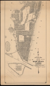
Official Map Adopted November 3, 1920 of the city of Miami Beach Florida.
sold
- Digital Map Information
- Suitable for large format printing
- File Size: 98.16 MB
- File Type: ZIP / TIFF
- ICC color profile embedded
- Delivered instantly via download link
This is Robert M. Davidson's 1929 map of Miami Beach, Florida - the first official planning map of Miami Beach, drawn at the height of construction in Miami Beach and the apex of the Florida Land Boom. The map exhibits significant advances over the 1925 first edition, including the Sunset Isles development, Peninsula Terminals lots, Flamingo Park has been redesignated as 'Flamingo Golf Course (until 1931)', and dramatic development along Alton Road near 41st Street, among many other changes. (more details)
Beers / Colton edition of the most important printed map of New York compiled during the Pre-Amercian Revolutionary War colonial period.
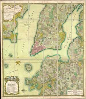
To his excellency Sr. Henry Moore, bart., captain general and governour in chief, in and over his majesty's province of New York and the territories depending thereon in America, chancellor and vice admiral of the same : This plan of the city of New York and its environs, survey'd and laid down ; is most humbly dedicated by his excellency's most obedt. humble servant B. Ratzer.
sold
- Digital Map Information
- Suitable for large format printing
- File Size: 111.61 MB
- File Type: ZIP / TIFF
- ICC color profile embedded
- Delivered instantly via download link
Known as the 'Ratzer Plan,' this is one of the most important, beautiful, and iconic colonial era maps of New York City, offered here in a stunning 1874 Colton / Beers restrike. This map was originally surveyed in 1767 by Bernard Ratzer, a lieutenant in the 'Royal American' regiment at the behest of Sir George Moore, governor of New York, who is sited in the cartouche. The map, which covers the southern part of Manhattan to about modern day 57th street, is a revision and expansion upon the flawed John Montresor plan of 1767. Across East River, a portion of Long Island is depicted, including most of Brooklyn and Parts of Long Island City. (more details)
Only the fourth known example of the very first subway map for use by the public.
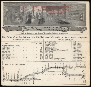
The Wanamaker Vest Pocket Subway Guide / The Wanamaker Station in the Subway at Astor Place.
sold
- Digital Map Information
- Suitable for large format printing
- Full resolution TIFF file
- ICC color profile embedded
- Delivered instantly via download link
This 1904-07 Wanamaker Vest Pocket Subway Guide is one of only four known surviving examples of the first subway map intended for public use. It was printed in 1904 on behalf of, or by, Wanamaker's department stores to promote their expanded New York City location, which featured an underground entrance to the Astor Place subway station. That busy subway platform is pictured here in an image entitled 'The Wanamaker Station in the Subway at Astor Place,' showing fashionably-dressed New Yorkers at the entrance to the Wanamaker's store (pointed out to the reader with the red, hand-stamped note, 'Direct Entrance from Subway to the Wanamaker Store Now Open.')andnbsp; A train, with its taillight shining, can be seen leaving on the uptown track. Below this vignette are a timetable and a map of the nascent subway (then extending from Brooklyn Bridge to 145th Street.) Special attention, naturally, is given on both the map and timetable to the Astor Place stop with its underground Wanamaker's storefront. Although Wanamaker's is long defunct, the same entrance is today used by the sole K-Mart in Manhattan. (more details)
Bar Harbor's Gilded Age.
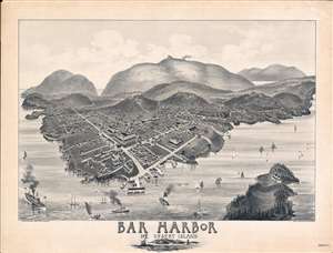
Bar Harbor Mt. Desert Island.
sold
- Digital Map Information
- Suitable for large format printing
- File Size: 60.03 MB
- File Type: ZIP / TIFF
- ICC color profile embedded
- Delivered instantly via download link
A rare and highly unusual 1886 Charles E. Jorgensen bird's-eye view of Bar Harbor, Mount Desert Island, Maine - illustrating the town at the height of Mount Desert Island's gilded age. This view was published to publicize the rebuilding of the Green Mountain Hotel (following a fire) and the inauguration of the Green Mountain Railroad - here visible at the summit of Cadillac Mountain. (more details)
The second 'official' published map of Miami.
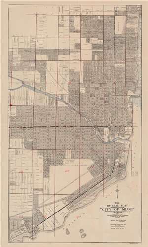
The Official Plat 'City of Miami' Florida.
sold
- Digital Map Information
- Suitable for large format printing
- File Size: 33.53 MB
- File Type: ZIP / TIFF
- ICC color profile embedded
- Delivered instantly via download link
This is the 1920 second edition of the first official plat map of Miami, published at the height of its development during the Third Florida Land Boom. The map lays out the streets and development of Miami from roughly Northeast 39th Street to Kloeber Bay Fronts and illustrates streets, parks, private property holdings, hotels, utilities and more. It exhibits additional manuscript work dividing the city into 25 zones, as well as identifying Highland Park and the home of someone named 'Mary Louise' on SW Fourth St. (more details)
A scarce proof state of the most iconic view of the Battle of Gettysburg ever published.
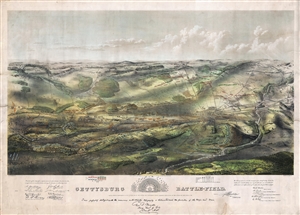
Gettysburg Battle-Field.
sold
- Digital Map Information
- Suitable for large format printing
- File Size: 37.34 MB
- File Type: ZIP / TIFF
- ICC color profile embedded
- Delivered instantly via download link
A remarkable and scarce 1863 proof state of the most iconic view of the American Civil War Battle of Gettysburg printed. This bird's eye view of the Battle of Gettysburg was issued by John Bachelder just months after the actual event. Within days of the ... (more details)
Official planning map by St. Petersburg, Florida - 2nd state.
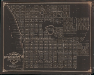
Map of the City of St. Petersburg Hillsborough Co. Florida 1906.
sold
- Digital Map Information
- Suitable for large format printing
- File Size: 90.03 MB
- File Type: ZIP / TIFF
- ICC color profile embedded
- Delivered instantly via download link
An extraordinary 1908 wall map of St. Petersburg, Florida, issued at the height of its early 20th century development as a railroad and tourist town. The only other known example of this map is a 1906 edition previously offered by Geographicus (StPetersburg-titcomb-1906). The present map features several major updates, including the additional developments of Lake Park, Lake Side, Richland Park, Glover, Plunket, and a row of commercial properties on First Street. The sewage lines, evident on the 1906 edition, are here removed to focus on other development.The map was drawn by St. Petersburg's City Engineer, John Poore Titcomb, who took the position in 1901. (more details)
Very rare Bird's-Eye View of Portland, Maine. Only 4 known examples.
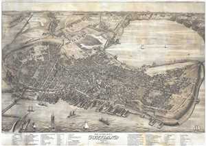
Bird's Eye View of the City of Portland Maine, 1876.
sold
- Digital Map Information
- Suitable for large format printing
- Full resolution TIFF file
- ICC color profile embedded
- Delivered instantly via download link
An exceptional 1876 Bird's-Eye View Map of Portland, Maine, by Joseph Warner. One of only three known views by Warner, this is a dramatic aerial view of Portland as seen from the east looking west. The cartographer has identified some 90 locations, ... (more details)
Mora's rarest and most desirable map.
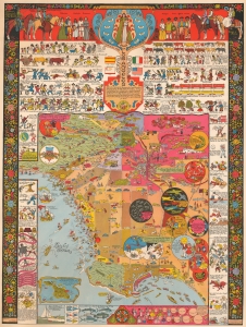
This is a 1942 Jo Mora pictorial map of Los Angeles, California. This is Mora's rarest and most sought-after pictorial map and arguably the best pictorial map of Los Angeles ever issued. It is filled with Mora's unique humor and artistry, which captures Los Angeles' culture, folklore, and history. (more details)
Original planing manuscript map for The Fens.
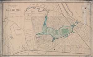
Park Department City of Boston 1877. Back Bay Park.
sold
- Digital Map Information
- Suitable for large format printing
- File Size: 82.57 MB
- File Type: ZIP / TIFF
- ICC color profile embedded
- Delivered instantly via download link
This is a unique c. 1880 urban planning map of the Back Bay Fens Park and the Fenway, Boston. The map consists of a printed map, issued in 1877 by the Park Commissioners, augmented with extensive manuscript work, including a beautiful construction-stage layout of the entire Back Bay Fens Park, as well as associated draining channels and sewers, and extensive text annotation. The layout of the park conforms to an early iteration of Frederick Law Olmsted's original plan - his updated plan was published in 1887. Centered on the park and oriented to the northwest, the map covers from Heath Street to Fairfield Street and from Brookline to the Boston and Providence Railroad. (more details)
Perhaps the Greatest Ever Map of Central Park.
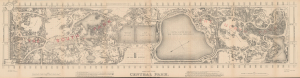
Map of the Central Park.
sold
- Digital Map Information
- Suitable for large format printing
- Full resolution TIFF file
- ICC color profile embedded
- Delivered instantly via download link
This is a rare, very large format c. 1873 administrative map of Central Park in New York City, prepared by draughtsman Otto Sibeth. The size and the level of detail allowed for by the large scale easily make it one of the finest maps of Central Park ever prepared. The map also presents the park as it neared completion (officially completed in 1876), including early renderings of the planned sites for the Metropolitan Museum of Art and the American Museum of Natural History. (more details)
Mora's rarest and most desirable map.
This is a 1942 Jo Mora pictorial map of Los Angeles, California. This is Mora's rarest and most sought-after pictorial map and arguably the best pictorial map of Los Angeles ever issued. It is filled with Mora's unique humor and artistry, which captures Los Angeles' culture, folklore, and history. (more details)
Issued to raise funds to preserve the San Antonio River as the River Walk.

Historic guide map to San Antonio de Bexar and environs.
sold
- Digital Map Information
- Suitable for large format printing
- File Size: 72.53 MB
- File Type: ZIP / TIFF
- ICC color profile embedded
- Delivered instantly via download link
This is Emily Edwards' 1926 historical pictorial map of San Antonio, Texas. This map was issued to raise funds for the preservation of the San Antonio River and the establishment of San Antonio's River Walk - today an iconic part of the city. As an American pictorial map, Edwards' map is early, predating the earliest iconic work of Jo Mora by one year. (more details)
Citrus boomtowns. Modern ghost towns.
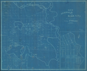
Norwalk and Kerr City Florida.
sold
- Digital Map Information
- Suitable for large format printing
- File Size: 930.67 MB
- File Type: ZIP / TIFF
- ICC color profile embedded
- Delivered instantly via download link
This is a unique c. 1886 cyanotype map of Norwalk and Kerr City, Marion County, north central Florida, by Civil Engineer John Poore Titcomb. The map provides a unique overview of the short-lived Citrus Boom communities west of the St. John's River before the disastrous freezes of 1894-95, highlighting property owners, including the mapmaker, throughout. (more details)
Washington Square Park!
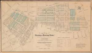
Map of the Haring or Herring Farm, showing its Original Perimeter as surveyed in 1784 by David Haring with the Streets and Avenues accurately laid down, also the Division of the Farm by Partition and c.
sold
- Digital Map Information
- Suitable for large format printing
- File Size: 29.8 MB
- File Type: ZIP / TIFF
- ICC color profile embedded
- Delivered instantly via download link
This is John Bute Holmes's rare January 1869 cadastral map of Greenwich Village, or more properly the West Village, New York City. Like Holmes' rarest and most desirable work, this is one of the earliest, if not the earliest, specific published maps of the West Village, including the area around and immediately to the south of Washington Square Park. Reference tables in the lower right and left corners reference deeds and other property documents on file with the city Clerk's office. (more details)