
Western Hemisphere (sold)
The updated world and continents maps from the dominant geographical source for its day.
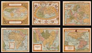
Die erst General Tafel... Ptolemeisch General Tafel... Europa... Asia... Africa... Die newen Inseln.
sold
- Digital Map Information
- Suitable for large format printing
- DPI: 600
- File Size: 76.61 MB
- File Type: ZIP / TIFF
- ICC color profile embedded
- Delivered instantly via download link
This is a beautiful, 6-map set of maps of the world and continents executed for 1588 and later editions of Sebastian Münster's magnum opus, Cosmographia Universalis, entitled in these later editions Cosmographey: das ist, Beschreibung Aller Länder, Herrschafften vnd fürnemesten Stetten des gantzen Erdbodens, sampt ihren Gelegenheiten, Eygenschafften, Religion, Gebräuchen, Geschichten vnd Handtierungen, [et]c. Beginning in 1544, this work would be the primary source of information for anyone who wished to know about the rest of the world: consequently its maps would have had a disproportionate impact, providing the first glimpse of remote and newly-discovered parts World to literate laypeople in Europe for more than half a century. (more details)
First printed map of the Western Hemisphere in one of its earliest printings.
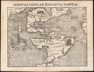
Novae Insulae XVII Nova Tabula.
sold
- Digital Map Information
- Suitable for large format printing
- Full resolution TIFF file
- ICC color profile embedded
- Delivered instantly via download link
This is a superb example of Sebastian Münster's map of America, the first printed map of the Western Hemisphere. This map appeared in the second, 1542 printing of Münster's edition of Ptolemy's Geographia, preceded only by the 1540. As is to be expected for an early printing strike, the image is bold, sharp, and clear. This attractive and evocative map was broadly influential. Münster's Geographia was one of the earliest versions of Ptolemy's work to systematically include maps showing contemporary geographical knowledge, but the map's 1544 inclusion in Münster's magnum opus, Cosmographia Universalis would insure that for more than thirty years during the age of discovery, this map would provide the first glimpse of the New World to the literate European. (more details)
A Magnificent, Boldly Decorative Wall Map of the Americas.
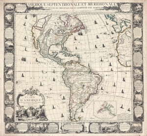
Amerique Septentrionale et Meridionale Divisée en ses Principaux Pais et Subdivisée par Audience. / Nle. Carte D'Amerique Dressée sur les Mémories le plus récens et assujetie aux derniers Observations Astronomiques.
sold
- Digital Map Information
- Suitable for large format printing
- Full resolution TIFF file
- ICC color profile embedded
- Delivered instantly via download link
A rare and highly decorative 1761 French wall map of America issued by Louis Charles Desnos. The map covers all of America, from the northern reaches of Hudson Bay to Tierro del Fuego - which just breaks the lower border. Items of note include a bold depiction of the imaginary Sea of the West (Mer d l'Ouest) and a large 'Lac des Zarayes' in South America. An inset in the lower right details the Pacific Northwest and the Bering Strait, incorporating the Sea of the West with the Apocryphal voyages of Admiral Bartholomew de Fonte and the Chinese legends of an American colony named 'Fusang'. A wealth of ships fill the seas as well as nautical routes by famous explorers. The whole is surrounded by a strikingly engraved border illustrating the indigenous peoples of the Americas - frequently in the processes of martyring missionaries and worshiping idols, but also engaging in trade, fishing, and other more mundane activities. (more details)
Early state, heightened with gold!
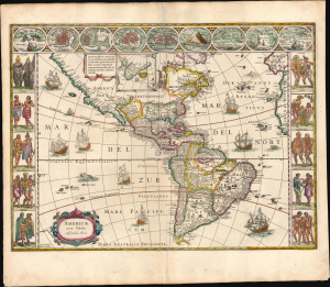
Americae Nova Tabula.
sold
- Digital Map Information
- Suitable for large format printing
- Full resolution TIFF file
- ICC color profile embedded
- Delivered instantly via download link
The essential Dutch map of America: Willem Janszoon Blaeu's carte-á-figures of the Western Hemisphere, in a third-state example with beautiful original color, heightened with gold. This is among the most desirable printed maps, encapsulating in one piece the most sought-after aesthetic qualities of the Dutch Golden Age. (more details)
Revelatory map of the Americas.
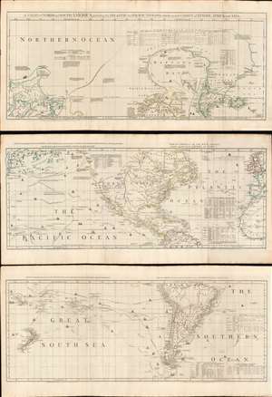
A Chart of North and South America, including the Atlantic and Pacific Oceans, with the nearest Coasts of Europe, Africa, and Asia.
sold
- Digital Map Information
- Suitable for large format printing
- Full resolution TIFF file
- ICC color profile embedded
- Delivered instantly via download link
A wonderful 1775 map of the Americas or Western Hemisphere by John Green, also known as Braddock Mead. The map in fact consists of three related maps covering, from top: Canada and the Arctic; the modern day United States, Central America, and the West Indies; and South America. The map is a masterpiece of late 18th century cartography by one of the least understood and most controversial cartographers of his age. Mead composed the map in protest to what he believed to be the flagrantly spurious and irresponsible speculative cartography of Frenchmen Joseph-Nicolas De l'Isle (1688 - 1768) and Phillipe Buache (1700 - 1773). (more details)
The Classic Map of America of the Dutch Golden Age of Cartography.
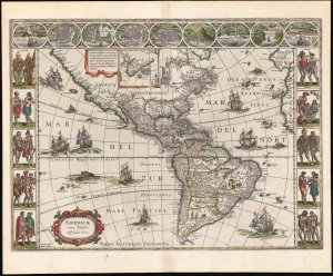
Americae Nova Tabula. Auct. Guilielmo Blaeuw.
sold
- Digital Map Information
- Suitable for large format printing
- Full resolution TIFF file
- ICC color profile embedded
- Delivered instantly via download link
The essential Dutch map of America: Willem Janszoon Blaeu's 1635 carte-á-figures of the Western Hemisphere. This is among the most desirable printed maps, encapsulating in one piece the most sought-after aesthetic qualities of the Dutch Golden Age of Cartography. (more details)
Only know example of George Thompson's 1799 broadside map of the Americas.
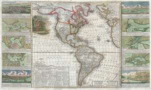
New Map of America divided into its Kingdoms, States, Governments and other Subdivisions, from the latest observations.
sold
- Digital Map Information
- Suitable for large format printing
- DPI: 300
- File Size: 24.5 MB
- File Type: ZIP / TIFF
- ICC color profile embedded
- Delivered instantly via download link
An exceptionally rare separately issued 1799 broadside map of America by the English printer and mapmaker George Thompson. Thompson's map covers the Americas from the Arctic Circle (Arctic Land) to Tierra de Fuego and Cape Horn. It extends westward into the ... (more details)
First printed map of the Western Hemisphere.
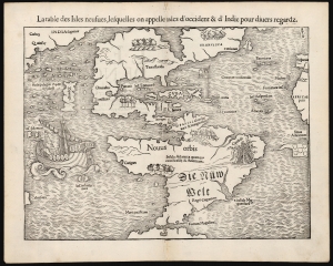
La table des Isles neufues, lesquelles on appelle isles d'occident et d Indie pour divers regardz.
sold
- Digital Map Information
- Suitable for large format printing
- Full resolution TIFF file
- ICC color profile embedded
- Delivered instantly via download link
This is an excellent 1552 French-text edition of Sebastian Münster's 1540 map of America, the first printed map of the Western Hemisphere. From 1544, this map was included in Münster's Cosmographia. The 1552 editions are the last published in Münster's lifetime - after which production quality significantly declined. Cosmographia long outlasted Münster, remaining the best source for over 40 years for anyone who wished to know about the world. Consequently, this map had a disproportionate impact, providing the first glimpse of the New World to Europeans for nearly half a century. (more details)
A Scarce, Third State Example
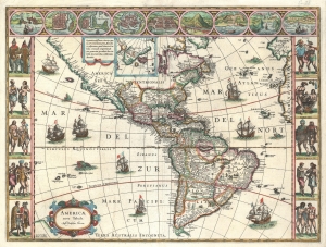
Americae Nova Tabula.
sold
- Digital Map Information
- Suitable for large format printing
- Full resolution TIFF file
- ICC color profile embedded
- Delivered instantly via download link
The essential Dutch map of America: Willem Janszoon Blaeu's 1635 carte-á-figures of the Western Hemisphere, in a scarce early printing. This is among the most desirable printed maps, encapsulating in one piece the most sought-after aesthetic qualities of the Dutch Golden Age of Cartography. (more details)
First printed map of the Western Hemisphere.
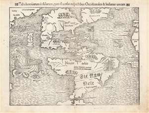
Tabula novarum insularum, quas diversis respectibus Occidentales et Indianas vocant.
sold
- Digital Map Information
- Suitable for large format printing
- Full resolution TIFF file
- ICC color profile embedded
- Delivered instantly via download link
This is an excellent 1552 Latin edition of Sebastian Münster's map of America, the first printed map of the Western Hemisphere. The map first appeared in Münster's 1540 edition of Ptolemy's Geographia, one of the earliest versions of the classical work to systematically include maps showing contemporary geographical knowledge. Beginning in 1544, it would be included in Münster's magnum opus, Cosmographia Universalis, which for over forty years was the primary source for anyone interested in world geography. Consequently, this map had a disproportionate impact, providing the first glimpse of the New World to Europeans for nearly half a century. (more details)
The First Printed Map of the Western Hemisphere, and the First America Map Naming the Strait of Magellan
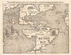
Tavola dell'isole nuoue, le quali son nominate accidentali, et indiane per diuersi rispetti.
sold
- Digital Map Information
- Suitable for large format printing
- Full resolution TIFF file
- ICC color profile embedded
- Delivered instantly via download link
This is a bold, sharp strike of an 1558 Italian edition of Sebastian Münster's map of America or the New World, the earliest printed map of the Western Hemisphere. That is to say, this is the first specific printed map to reveal all of North and South America in clear continental form. It was originally published by Münster in his 1540 Basel edition of Ptolemy's Geographia. Münster would include this map, along with the other modern maps appearing in the work, in his 1544 Cosmographia. This ambitious tome, intended to reveal to the lay reader the wonders of the whole world in one volume, proved popular, appearing in some 40 editions over the subsequent century. The popularity of Munster's Cosmographia and this map in particular made this map highly influential, naming the Straits of Magellan, the Pacific Ocean (Mare Pacificum), the presumed insular form of the Yucatan, and the speculation of Verazanno's Sea. It is one of the earliest maps to identify Japan as well, here presented according to Marco Polo as 'Zipangri'. (more details)
First printed map of the Western Hemisphere.
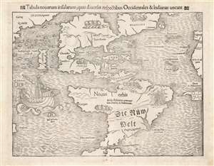
Tabula novarum insularum, quas diversis respectibus Occidentales et Indianas vocant.
sold
- Digital Map Information
- Suitable for large format printing
- Full resolution TIFF file
- ICC color profile embedded
- Delivered instantly via download link
This is an excellent 1552 Latin edition of Sebastian Münster's map of America, the first printed map of the Western Hemisphere. The map first appeared in Münster’s 1540 edition of Ptolemy's Geographia, one of the earliest versions of the classical work to systematically include maps showing contemporary geographical knowledge. Beginning in 1544 it would be included in Münster’s magnum opus, Cosmographia Universalis, which for over forty years would be the primary source of information for anyone who wished to know about the rest of the world: consequently this map would have had a disproportionate impact, providing the first glimpse of the New World to literate laypeople in Europe nearly half a century. (more details)
Iconic Map of America of the Dutch Golden Age of Cartography.
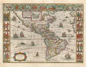
Americae Nova Tabula. Auct. Guilielmo Blaeuw.
sold
- Digital Map Information
- Suitable for large format printing
- Full resolution TIFF file
- ICC color profile embedded
- Delivered instantly via download link
The essential Dutch map of America: Willem Janszoon Blaeu's 1635 carte-á-figures map of the Western Hemisphere. This is among the most desirable printed maps, encapsulating in one piece the most sought-after aesthetic qualities of the Dutch Golden Age of Cartography. In particular, it is the prime example of the carte-á-figures, or 'figured map,' displaying in its upper border the most important cities in the mapped region, and in its left and right borders finely-engraved depictions of the peoples native to it. The cities thus depicted are (from left) Havana, Santo Domingo, Cartagena, Mexico, Cusco, Potosi, La Mocha, Rio de Janeiro, and Olinda. The denizens of the Americas here depicted include Greenlanders, Virginians, Floridians, Californians (specifically, the King and Queen of Nova Albion) Mexicans, Peruvians, Brazilians, Chileans, and the natives of Magellanica (these last, possibly intended to be the giants reported by the survivors of Magellan's voyage). The decorative elements of the map are not limited to the borders: the seas are sailed by no fewer than eight ships. (more details)
First specific map to reveal America as separate continent. First European map to show Japan. First map to identify the Pacific Ocean.

Die neuwen inseln so hinder Hispanien gegen Orient bey dem land Indie ligen.
sold
- Digital Map Information
- Suitable for large format printing
- Full resolution TIFF file
- ICC color profile embedded
- Delivered instantly via download link
A fine 1554 example of Sebastian Munster's map of America or the New World. This is one the earliest and most influential obtainable maps of the Americas. This is the first specific published map to reveal all of North and South America in clear continental ... (more details)
First specific map to reveal America as separate continent. First map to identify the Pacific Ocean.
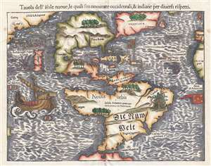
Tavola dell'isole nuove, le quali son nominate occidentali, et indiane per diversi rispetti.
sold
- Digital Map Information
- Suitable for large format printing
- DPI: 300
- File Size: 4.95 MB
- File Type: ZIP / TIFF
- ICC color profile embedded
- Delivered instantly via download link
This is a scarce 1558 Italian edition of Sebastian Münster's map of America, the first printed map of the Western Hemisphere. The map first appeared in Münster’s 1540 edition of Ptolemy's Geographia, one of the earliest versions of the classical work to systematically include maps showing contemporary geographical knowledge. Beginning in 1544 it would be included in Münster’s magnum opus, Cosmographia Universalis, which for over forty years would be the primary source of information for anyone who wished to know about the rest of the world: consequently this map would have had a disproportionate impact, providing the first glimpse of the New World to literate laypeople in Europe nearly half a century. (more details)
First Atlas Map of the Western Hemisphere.
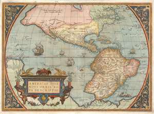
Americae Sive Novi Orbis Nova Descriptio.
sold
- Digital Map Information
- Suitable for large format printing
- Full resolution TIFF file
- ICC color profile embedded
- Delivered instantly via download link
This is Abraham Ortelius' map of the Western Hemisphere, considered to be the 'first map of the Americas to appear in a modern atlas' (Schwartz). Ortelius' success and the spread of his atlas made this fine map the standard - and best - representation of the Americas during the initial period its colonization. (more details)
The first Atlas Map of the Western Hemisphere.
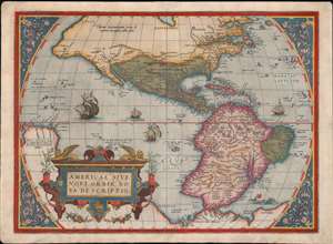
Americae Sive Novi Orbis Nova Descriptio.
sold
- Digital Map Information
- Suitable for large format printing
- Full resolution TIFF file
- ICC color profile embedded
- Delivered instantly via download link
This is Abraham Ortelius' map of the Western Hemisphere, 'first map of the Americas to appear in a modern atlas' (Schwartz). Ortelius' success and the spread of his atlas made this fine map the standard - and best - representation of the Americas during the initial period of the colonization of North America by Europeans. (more details)
Only America map of the Mercator Atlas.
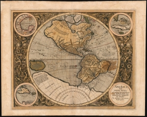
America, siue, India Nova : ad magnae Gerardi Mercatoris aui vniversalis imitationem in compendium redacta.
sold
- Digital Map Information
- Suitable for large format printing
- Full resolution TIFF file
- ICC color profile embedded
- Delivered instantly via download link
This is Mercator's 1595 America, one of the most visually arresting maps of the Western Hemisphere. It is the only map of America to appear in an atlas directly connected to the great Gerard Mercator, here in a first Atlas edition of 1595. (more details)
Dominant 16th century Map of the Western Hemisphere in Original Color.
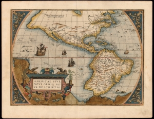
Americae Sive Novi Orbis Nova Descriptio.
sold
- Digital Map Information
- Suitable for large format printing
- Full resolution TIFF file
- ICC color profile embedded
- Delivered instantly via download link
This a striking original-color example of Abraham Ortelius' map of the Western Hemisphere, 'first map of the Americas to appear in a modern atlas' (Schwartz). Ortelius' success and the spread of his atlas made this map the standard - and best - representation of the Americas during the initial period of the European colonization. (more details)
Magnificent Original Color.
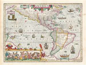
America.
sold
- Digital Map Information
- Suitable for large format printing
- Full resolution TIFF file
- ICC color profile embedded
- Delivered instantly via download link
This is a superb, original-color example of Jodocus Hondius' 1606 map of America. Presented on a stereographic projection centered on the Americas, the map extends west to include the Pacific as far as New Guinea, and east to include the Atlantic as far as the British Isles, western Spain, and western Africa. It further extends from Greenland to the speculative continent of Terra Australis just south of the Straits of Magellan. (more details)
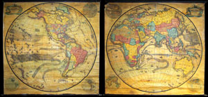
Pelton's Political & Physical Map of the Western Hemisphere. / Pelton's Political & Physical Map of the Eastern Hemisphere.
sold
A mammoth, extremely rare, and highly desirable set of hemisphere wall maps issued by C. Pelton in 1858. These spectacular wall maps rarely appear on the market and almost never as a set. Depicts the entire world on a hemisphere projection. On both maps, ... (more details)
Sunning and scarce 17th century world map in two panels.
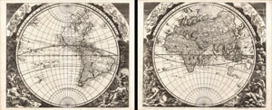
Facies una Hemi-sphaerii Terrestris. Facies Altern Hemi-sphaerii Terrestris.
sold
- Digital Map Information
- Suitable for large format printing
- DPI: 300
- File Size: 22.14 MB
- File Type: ZIP / TIFF
- ICC color profile embedded
- Delivered instantly via download link
An extremely rare discovery, this is a wonderful 1693 double hemisphere map of the world in two panels. Both of these maps were drawn and engraved by the German Enlightenment era polymath Johann Zahn for his pseudo-scientific opus Mundus Mirabili , or the ... (more details)
First printed map to illustrate the Chesapeake Bay.
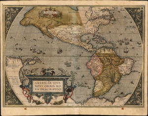
Americae Sive Novi Orbis Nova Descriptio.
sold
- Digital Map Information
- Suitable for large format printing
- Full resolution TIFF file
- ICC color profile embedded
- Delivered instantly via download link
This is Abraham Ortelius' map of the Americas in an attractive, early example of the 1587 third plate, printed in 1589. It represents the state-of-the-art mapping of the Western Hemisphere during the initial period of European Colonization. It is significant as the first printed map to illustrate the Chesapeake Bay, predating John White's 1590 map of Virginia. (more details)
'An advance of the first importance' - Wheat
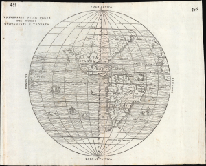
Universale Della Parte De Mondo Nuovamente Ritrovata.
sold
- Digital Map Information
- Suitable for large format printing
- File Size: 10.16 MB
- File Type: ZIP / TIFF
- ICC color profile embedded
- Delivered instantly via download link
This is Giovanni Battista Ramusio's scarce 1556 map of the Americas. It appeared in Ramusio's Navigationi et Viaggi, the first collection of explorers' first-hand accounts of their travels. It is among the earliest detailed representations of the Western Hemisphere, and was the first overall printed map of America to include placenames from Coronado's travels of 1540-1542. Wheat hailed this inclusion as an advance of the first importance, so far as the mapping of the American West is concerned. (more details)
The Second Age of Discovery summarized in a game.
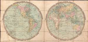
Walker's Geographical Pastime, or Tour Through the Western Hemisphere, or New World. An Amusing and Instructive Game. Walker's Geographical Pastime, or Tour Through the Eastern Hemisphere, or Old World. An Amusing and Instructive Game.
sold
- Digital Map Information
- Suitable for large format printing
- Full resolution TIFF file
- ICC color profile embedded
- Delivered instantly via download link
This is an 1816 William Darton game map of the world in two hemispheres. The map emerged early in the 19th century during a period of global optimism, curiosity, and romanticism following the well-publicized voyages of Cook, Perouse, and Vancouver. It celebrates expanded geographical curiosity, while serving as a didactic tool to educate on matters of geography, history, and culture. (more details)
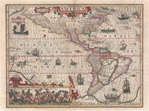
Considered among the most beautiful of the early atlas maps of the Americas and one of the first to illustrate indigenous Americans.
America.
sold
- Digital Map Information
- Suitable for large format printing
- DPI: 600
- File Size: 20.3 MB
- File Type: ZIP / TIFF
- ICC color profile embedded
- Delivered instantly via download link
A stunning full color example of Jodocus Hondius' 1606 map of America. Presented on a stereographic projection and centered on the Americas, the map extends west to include the Pacific as far as New Guinea, and east to include the Atlantic as far as the ... (more details)
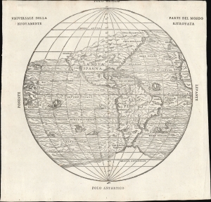
'An advance of the first importance' - Wheat
Universale Della Parte De Mondo Nuovamente Ritrovata.
sold
- Digital Map Information
- Suitable for large format printing
- File Size: 7.62 MB
- File Type: ZIP / TIFF
- ICC color profile embedded
- Delivered instantly via download link
This is Giovanni Battista Ramusio's scarce 1565 map of the Americas. It first appeared in Ramusio's 1556 Navigationi et Viaggi, the first collection of explorers' first-hand accounts of their travels. It is among the earliest detailed representations of the Western Hemisphere, predated only by the 1540 Münster and the extremely rare 1554 Bellère map. This was the first printed map of America to include placenames from Coronado's travels of 1540-1542: Wheat hailed this inclusion as 'an advance of the first importance, so far as the mapping of the American West is concerned.'
Ramusio commissioned Giacomo Gastaldi (1500 - 1566) to compose this map, along with the others appearing in the Navigationi et Viaggi; that much of its detail agrees with the western portion of Gastaldi's 1546 world map supports this. (more details)
Ramusio commissioned Giacomo Gastaldi (1500 - 1566) to compose this map, along with the others appearing in the Navigationi et Viaggi; that much of its detail agrees with the western portion of Gastaldi's 1546 world map supports this. (more details)
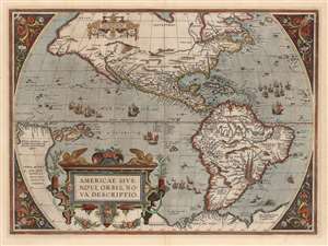
First Printed Map to show the Chesapeake Bay.
Americae Sive Novi Orbis Nova Descriptio.
sold
- Digital Map Information
- Suitable for large format printing
- DPI: 600
- File Size: 50.62 MB
- File Type: ZIP / TIFF
- ICC color profile embedded
- Delivered instantly via download link
This is Abraham Ortelius' map of the Western Hemisphere, in an attractive example of the 1587 third state. It represents the state-of-the-art mapping of the Americas during the initial period of European Colonization and the first printed map to illustrate the Chesapeake Bay. (more details)
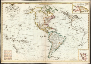
Rare First Edition of a Richly Detailed Western Hemisphere Map.
Carte de l'Amérique Septentrionale et Meridionale, ou se trouvent les Decouvertes les plus nouvelles, et les trois Voyages de Cook Dressée Par Hérisson, E lève du C.en Bonne, ancien Ingénieur Hydrographe de la Marine. A Paris, Chez Basset, rue Jacques, au coin de celle des Mathurins, No. 670.
sold
- Digital Map Information
- Suitable for large format printing
- DPI: 600
- File Size: 79.61 MB
- File Type: ZIP / TIFF
- ICC color profile embedded
- Delivered instantly via download link
This is a rare, elegant, and detailed map of America by Eustache Hérisson, in its 1795 first edition. In addition to the Western Hemisphere, Hérisson's work focuses on the three voyages of Captain James Cook - in particular, presenting the key results of his third and final journey to Hawaii, and his efforts to penetrate the Bering Straits. Cook's tracks through the Pacific and the Atlantic both are included. His journey through the South Pacific, its revelations of New Zealand, and the cipher presented by the as-yet undetected Antarctica are also made evident. (more details)
The first atlas map to show California as an Island.
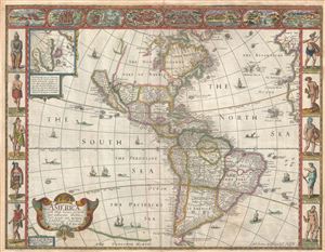
America with those known parts in that unknowne world both people and manner of buildings discribed and inlarged by I.S. Ano 1626.
sold
- Digital Map Information
- Suitable for large format printing
- DPI: 300
- File Size: 10.02 MB
- File Type: ZIP / TIFF
- ICC color profile embedded
- Delivered instantly via download link
A nice example of John Speed's 1626 map of America here in its fourth or 1676 state. One of the most iconic maps of America ever made, this map is surrounded by decorative vignettes illustrating the indigenous peoples and cities of the Americas. This map ... (more details)
The only America map of the Mercator Atlas.
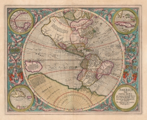
America, siue, India Nova. Ad magnae Gerardi Mercatoris aui vniversalis imitationem in compendium redacta.
sold
- Digital Map Information
- Suitable for large format printing
- DPI: 600
- File Size: 51.54 MB
- File Type: ZIP / TIFF
- ICC color profile embedded
- Delivered instantly via download link
This is a beautifully colored 1613 Hondius edition of Mercator's America, one of the most visually arresting early maps of the Western Hemisphere. (more details)
The first printed map of the Pacific Northwest.
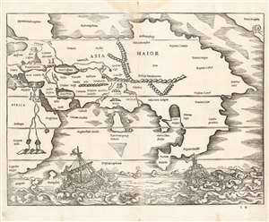
[Africa/ Asia Maior/ Terra incognita]
sold
- Digital Map Information
- Suitable for large format printing
- Full resolution TIFF file
- ICC color profile embedded
- Delivered instantly via download link
This is a rare 1538 map of Asia, executed by Sebastian Münster for inclusion in his edition of Solinus' Polyhistor. It predates by two years the map of Asia in Münster's 1540Geographia. Although it is not entirely a modern work, it is the earliest printed map focusing on the continent of Asia. It also contains the first printed representation of the Pacific Northwest, more than thirty years prior to the Ortelius map generally granted that laurel. (more details)