
Fer, Nicholas de (sold)
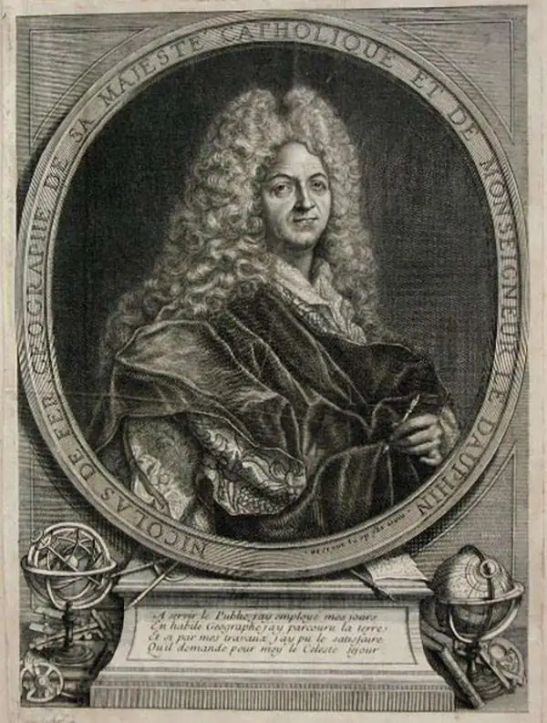
Nicholas de Fer (1646 - October 25, 1720) was a French cartographer and publisher, the son of cartographer Antoine de Fer. He apprenticed with the Paris engraver Louis Spirinx, producing his first map, of the Canal du Midi, at 23. When his father died in June of 1673 he took over the family engraving business and established himself on Quai de L'Horloge, Paris, as an engraver, cartographer, and map publisher. De Fer was a prolific cartographer with over 600 maps and atlases to his credit. De Fer's work, though replete with geographical errors, earned a large following because of its considerable decorative appeal. In the late 17th century, De Fer's fame culminated in his appointment as Geographe de le Dauphin, a position that offered him unprecedented access to the most up to date cartographic information. This was a partner position to another simultaneously held by the more scientific geographer Guillaume De L'Isle, Premier Geograph de Roi. Despite very different cartographic approaches, De L'Isle and De Fer seem to have stepped carefully around one another and were rarely publicly at odds. Upon his death of old age in 1720, Nicolas was succeeded by two of his sons-in-law, who also happened to be brothers, Guillaume Danet (who had married his daughter Marguerite-Geneviève De Fer), and Jacques-François Bénard (Besnard) Danet (husband of Marie-Anne De Fer), and their heirs, who continued to publish under the De Fer imprint until about 1760. It is of note that part of the De Fer legacy also passed to the engraver Remi Rircher, who married De Fer's third daughter, but Richer had little interest in the business and sold his share to the Danet brothers in 1721.
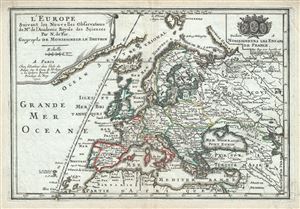
L'Europe.
sold
- Digital Map Information
- Suitable for large format printing
- Full resolution TIFF file
- ICC color profile embedded
- Delivered instantly via download link
This is a beautiful 1700 map of Europe by Nicholas De Fer. It covers the entire continent including Iceland and the northern coast of Africa, Asia Minor and parts of the Middle East. The map renders the entire region in extraordinary detail offering both ... (more details)
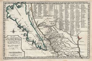
Cette Carte de Californie et du Nouveau .
sold
- Digital Map Information
- Suitable for large format printing
- Full resolution TIFF file
- ICC color profile embedded
- Delivered instantly via download link
A landmark 1700 map showing California as an island and the first published dissemination of Fr. Eusebio Frabcusci Kino's groundbreaking explorations in New Mexico and California. Drawn by Nicolas de Fer, official Geographe de Monseigneur le Dauphin , this ... (more details)
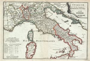
L'Italie.
sold
- Digital Map Information
- Suitable for large format printing
- Full resolution TIFF file
- ICC color profile embedded
- Delivered instantly via download link
This is an attractive 1700 map of Italy by Nicholas De Fer. It covers from Tirol in Austria south to the northern part of Sicily and includes the Islands of Sardinia and Corsica. The map renders the entire region in extraordinary detail offering both ... (more details)
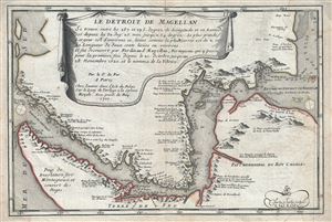
Le Detroit de Magellan.
sold
- Digital Map Information
- Suitable for large format printing
- Full resolution TIFF file
- ICC color profile embedded
- Delivered instantly via download link
This is a scarce 1700 map of the Straits of Magellan, South America by Nicholas De Fer. It covers the important strait located at the southern tip of the South American mainland, just north of Tierra del Fuego. The map renders the region in detail, ... (more details)
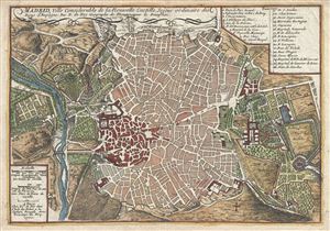
Madrid, Ville Considerable de la Nouvelle Castille.
sold
- Digital Map Information
- Suitable for large format printing
- Full resolution TIFF file
- ICC color profile embedded
- Delivered instantly via download link
This is a beautiful 1700 map or plan of the city of Madrid, Spain by Nicholas De Fer. Centered on the Puerta del Sol, this map covers the center of modern Madrid, Spain's capital city, as well as the surrounding parks, farms, and estates - most of ... (more details)
Baroque Masterpiece in the Mapping of Africa.
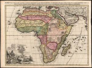
L'Afrique selon les nouvelles observations de Mssrs de l'Académie des sciences, etc., Africa in praecipuas ipsius partes distributa, ad observationes academiae regiae scientarum et exquisitissimas tabulas quae nunquam antehac lucen vederunt, Excusa A Francisco Halma, cum privilegio ordinum Hollandiae et westfrisiae.
sold
- Digital Map Information
- Suitable for large format printing
- Full resolution TIFF file
- ICC color profile embedded
- Delivered instantly via download link
This is the rare first state of François Halma's c. 1699 separately-issued map of Africa. Its unusually large folio size, bold and sophisticated engraving, and rich original color sets this map apart as one of the most beautiful obtainable late-17th century maps of the continent. (more details)
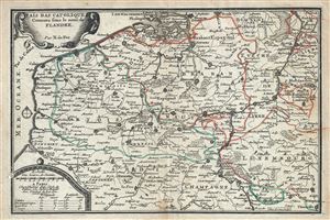
Pais Bas Catoliques Connues sous le nom de Flandre.
sold
- Digital Map Information
- Suitable for large format printing
- Full resolution TIFF file
- ICC color profile embedded
- Delivered instantly via download link
This is an attractive 1701 map of Flanders by Nicholas De Fer. The map depicts modern day Belgium and Luxemburg along with parts of Germany, France and Holland, a region commonly called Flanders at the time. It covers from Breda south as far as ... (more details)
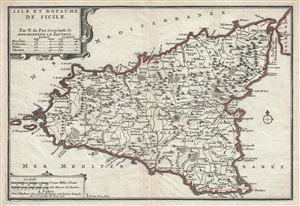
Isle et Royaume de Sicile.
sold
- Digital Map Information
- Suitable for large format printing
- Full resolution TIFF file
- ICC color profile embedded
- Delivered instantly via download link
A beautiful 1701 map of Sicily, Italy by Nicholas De Fer. It covers the Mediterranean Island in its entirety and renders the region in extraordinary detail offering both topographical and political information with mountains beautifully rendered ... (more details)
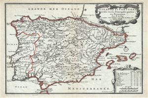
Espagne et Portugal Divises en ses Princiaples parties ou Royaumes.
sold
- Digital Map Information
- Suitable for large format printing
- Full resolution TIFF file
- ICC color profile embedded
- Delivered instantly via download link
This is a beautiful 1701 map of Spain and Portugal by Nicholas De Fer. It covers the Iberian Peninsula as well as adjacent parts of France and Africa and prominently displays the Balearic Islands of Majorca, Minorca, and Ibiza. The map renders ... (more details)
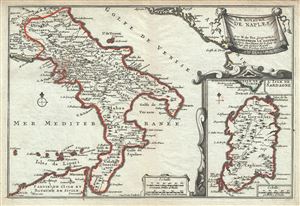
Le Royaume de Naples.
sold
- Digital Map Information
- Suitable for large format printing
- Full resolution TIFF file
- ICC color profile embedded
- Delivered instantly via download link
This is a scarce 1701 map of the Kingdom of Naples (officially the Kingdom of Sicily, although the Island of Sicily was not part of the kingdom since the 13th century), in southern Italy by Nicholas De Fer. It covers the southern part of Italy ... (more details)
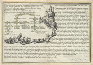
Ligne directe des branches d'Espagne et d'Allemagne depuis Philippe d'Autriche Pere de Charles Quint; Et les Alliances de la Branche d'Espagne tant avec la Maison de France qu'avec la Branche d'Autriche d'Alemagne.
sold
- Digital Map Information
- Suitable for large format printing
- Full resolution TIFF file
- ICC color profile embedded
- Delivered instantly via download link
This is a fine 1701 map of the lineage of Philip I of Castile. It notes spouses, and children, and succession as well as title and alliances mapping their rule in Spain, France and Austria. The two sons of Philip I went on to rule the Spanish ... (more details)
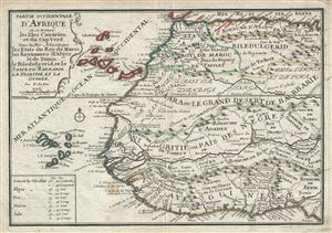
Partie Occidentale D'Afrique ou se trouve les Isles Canaries, et du Cap Ver dans la Mer Atlantique les Etats du Roy de Maroc, des Royaumes d'Alger et de Tunis, de Biledulgerid, et le Saara, en Barbarie, La Nigritie, et la Guinee.
sold
- Digital Map Information
- Suitable for large format printing
- Full resolution TIFF file
- ICC color profile embedded
- Delivered instantly via download link
This is a scarce 1701 map of western Africa by Nicholas De Fer. It covers the northwestern part of Africa from the Mediterranean Sea to the Gulf of Guinea and the Bight of Benin, and from the Cape Verde Islands eastward as far as Tunis. The ... (more details)
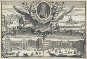
Philipe V. Roy d'Espagne. Buen-retiro. Hermitage de S. Antoine. Entree du Palais Royal a Madrid. La Place Major, de Madrid.
sold
- Digital Map Information
- Suitable for large format printing
- Full resolution TIFF file
- ICC color profile embedded
- Delivered instantly via download link
This is a fine 1701 view of the Royal Palace, Plaza Mayor and the Buen Retiro in Madrid, Spain, by Nicholas De Fer. This beautifully engraved view includes a portrait of Philip V, King of Spain, surrounded by an elaborate and beautiful ... (more details)
Asia of the 18th century.
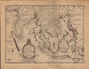
A New Map of the East Indies, Taken from Mr. de Fer's Map of Asia, Shewing their Chief Divisions, Cities, Towns, Ports, Rivers, Mountains etc.
sold
- Digital Map Information
- Suitable for large format printing
- DPI: 600
- File Size: 46.58 MB
- File Type: ZIP / TIFF
- ICC color profile embedded
- Delivered instantly via download link
This is an attractive and scarce c. 1701 map of India, Southeast Asia, and the East Indies by Edward Wells. Based on the cartography on Nicolas de Fer, it is a good representation of Europeans' perception of the geography of South and Southeast Asia at the time. (more details)
Rare maps showing the legendary Mines de St. Barbe.
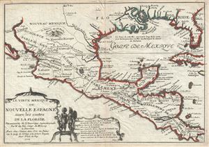
Les Vieux Mexique ou Nouvelle Espagne avec les costes de la Floride.
sold
- Digital Map Information
- Suitable for large format printing
- Full resolution TIFF file
- ICC color profile embedded
- Delivered instantly via download link
An uncommon 1702 map by Nicolas De Fer of Mexico, the Gulf Coast, and Florida. Centered on the Gulf Of Mexico, this map covers from Baja California to Florida and Cuba, covering in the process, the Gulf of Mexico, parts of New Mexico ... (more details)
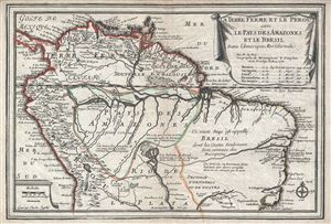
La Terre Ferme et le Perou avec le Pays des Amazones et le Bresil dans l'Amerique Meridionale.
sold
- Digital Map Information
- Suitable for large format printing
- Full resolution TIFF file
- ICC color profile embedded
- Delivered instantly via download link
This is a scarce and beautiful example of Nicholas De Fer's 1702 map of northern South America. It covers from Panama to Rio de Janeiro and renders the entire region in extraordinary detail offering both topographical and political ... (more details)
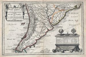
Le Chili et Les Provinces qui Composent Celles de Rio de la Plata avec les Terres Magellanique.
sold
- Digital Map Information
- Suitable for large format printing
- Full resolution TIFF file
- ICC color profile embedded
- Delivered instantly via download link
This is a beautiful 1702 map of southern South America by Nicholas De Fer. It covers from Rio de Janeiro south to the Strait of Magellan and Tierra del Fuego, and includes the modern day nations of Paraguay, Chile, Uruguay and ... (more details)
Uncommon early map of the East Indies.
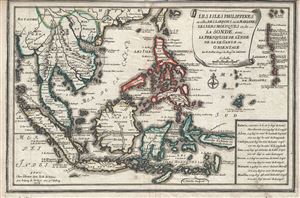
Les Isles Philippines et celles Des Larrons ou de Marianes, Les Isles Moluques et de La Sonde, avec, La Presqu'Isle de l'Inde de la le Gange ou Orientale.
sold
- Digital Map Information
- Suitable for large format printing
- Full resolution TIFF file
- ICC color profile embedded
- Delivered instantly via download link
This is a beautiful and scarce 1702 map of the East Indies by Nicholas De Fer. It covers all of Southeast Asia and the East Indies from the Andaman Islands east to New Guinea and from Taiwan or Formosa south as far as Timor. ... (more details)
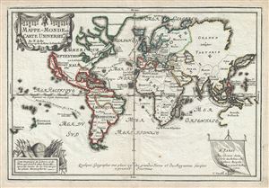
Mappe-Monde ou Carte Universelle.
sold
- Digital Map Information
- Suitable for large format printing
- Full resolution TIFF file
- ICC color profile embedded
- Delivered instantly via download link
This is a scarce and important 1702 Nicholas de Fer map of the world which depicts the entire world according to its 17th century conception. The map is adorned by a beautiful title cartouche in the upper left quadrant and another illustration depicting a globe and flags is featured in the lower left quadrant. Spanish possessions are noted with boundaries color coded in red outline. Routes around the world are illustrated, as are a host of other interesting features. (more details)
A lovely map of the world illustrating California as an island.
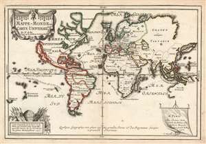
Mappe-Monde ou Carte Universelle.
sold
- Digital Map Information
- Suitable for large format printing
- DPI: 600
- File Size: 9.15 MB
- File Type: ZIP / TIFF
- ICC color profile embedded
- Delivered instantly via download link
This is a scarce and important 1702 Nicholas de Fer map of the world which depicts the entire world according to its 17th century conception. The map is adorned by a beautiful title cartouche in the upper left quadrant and another illustration depicting a globe and flags is featured in the lower left quadrant. Spanish possessions are noted with boundaries color coded in red outline. Routes around the world are illustrated, as are a host of other interesting features. (more details)
Uncommon early map of the West Indies.
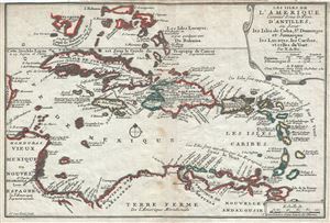
Les Isles de L'Amerique Connues sous le Nom D'Antilles, ou Sont les Isles de Cuba, St. Domingue et Jamaique les Lucayes, les Caribes, et celles du Vent.
sold
- Digital Map Information
- Suitable for large format printing
- Full resolution TIFF file
- ICC color profile embedded
- Delivered instantly via download link
This is a scarce and attractive 1702 map of the West Indies by Nicholas De Fer. It covers the Caribbean from the eastern coast of Yucatan east as far as Barbados and from the southern tip of Florida south to Trinidad and ... (more details)
Uncommon map of Asia illustrating the geographical confusions of the early 18th century.
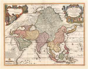
L'Asie dressée selon les dernières relations et suivant les nouvelles découvertes dont les points principaux sont placés sur les observations de Mrs. de l'Académie Royale des Sciences par N. de Fer.
sold
- Digital Map Information
- Suitable for large format printing
- Full resolution TIFF file
- ICC color profile embedded
- Delivered instantly via download link
A scarce 1705 separate issue Nicolas De Fer map of Asia dedicated to the children of France. The map features two decorative cartouches engraved by N. Guerard. Coverage on an unusual conical projection extends from the Mediterranean to the Philippine Archipelago (Archipel de St. Lazare), and from Nova Zembla to Java. The map embraces many of the confusions and misconceptions regarding the geography of Asia prevalent during the late 17th and late 18th centuries, among them a mismapping of the Caspian Sea, the apocryphal lake of Chiamay, and confusion regarding the seas north of Japan and the Siberian Arctic. (more details)
First published map to show Fra. Kino's explorations. Includes California as an Island!
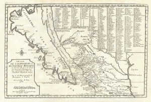
Cette Carte de Californie et du Nouveau Mexique, est tiree de celle qui a ete envoyee par un grand d'Espagne pour etre communiquee a Mrs. De L'Academie Royale des Sciences.
sold
- Digital Map Information
- Suitable for large format printing
- DPI: 300
- File Size: 4.45 MB
- File Type: ZIP / TIFF
- ICC color profile embedded
- Delivered instantly via download link
A landmark 1705 map illustrating California as an island and the first published dissemination of Fr. Eusebio Frabcusci Kino's groundbreaking explorations in New Mexico and California. Drawn by Nicolas de Fer, official Geograph de Monseigneur le Dauphin, this map covers from Cape Mendocino (California) to the Gulf of Mexico and the mouth of the Mississippi River (mis-mapped) and from Santa Fe to Mexico City. Place names are identified both textually and numerically referencing a table of 314 specific locations in the upper right quadrant. (more details)
Includes a fantastic illustration of the legendary Mines de St. Barbe / Santa Barbara silver mines.
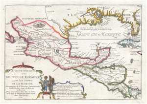
Le Vieux Mexique ou Nouvelle Espagne avec les costes de la Floride.
sold
- Digital Map Information
- Suitable for large format printing
- DPI: 300
- File Size: 3.04 MB
- File Type: ZIP / TIFF
- ICC color profile embedded
- Delivered instantly via download link
An uncommon 1705 map by Nicolas De Fer of Mexico, the Gulf Coast, and Florida. Centered on the Gulf of Mexico, this map depicts from Baja California to Florida and Cuba, covering in the process, the Gulf of Mexico, parts ... (more details)
Uncommon map illustrating nascent French colonial expansionism before the French and Indian War.
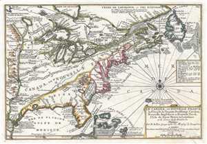
Le Canada, ou Nouvelle France La Floride, La Virginie, Pensilvanie, Caroline, Nouvelle Angleterre et Nouvelle Yorck, I'Isle de Terre Neuve, La Louisiane et le Courss de la Riviere de Misisipi.
sold
- Digital Map Information
- Suitable for large format printing
- DPI: 300
- File Size: 3.62 MB
- File Type: ZIP / TIFF
- ICC color profile embedded
- Delivered instantly via download link
This is a 1705 map of North America east of the Mississippi River by French cartographer Nicolas De Fer. Centered roughly on the Great Lakes and the Hudson Valley, this map depicts from the Mississippi River east to ... (more details)
Uncommon map illustrating nascent French colonial expansionism before the French and Indian War.
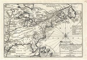
Le Canada, ou Nouvelle France La Floride, La Virginie, Pensilvanie, Caroline, Nouvelle Angleterre et Nouvelle Yorck, I'Isle de Terre Neuve, La Louisiane et le Courss de la Riviere de Misisipi.
sold
- Digital Map Information
- Suitable for large format printing
- DPI: 300
- File Size: 5.76 MB
- File Type: ZIP / TIFF
- ICC color profile embedded
- Delivered instantly via download link
This is a 1705 map of North America east of the Mississippi River by French cartographer Nicolas De Fer. Centered roughly on the Great Lakes and the Hudson Valley, this map depicts from the Mississippi River east to ... (more details)
Rare, Separately Issued.
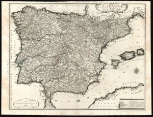
L'Espagne et le Portugal par N. De Fer Geographe de sa Majesté Catolique.
sold
- Digital Map Information
- Suitable for large format printing
- DPI: 600
- File Size: 73.85 MB
- File Type: ZIP / TIFF
- ICC color profile embedded
- Delivered instantly via download link
This is a beautiful example of Nicholas De Fer's 1705 map of Spain and Portugal, including the Balearic islands and part of the North African coast. Typical of De Fer's work, the map is superbly detailed, while remaining restrained and elegant in its decoration. (more details)
One of the earliest printed maps to offer significant detail of the Lower Mississippi Valley.
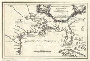
Les Costes Aus Environs de la Riviere de Misisipi.
sold
- Digital Map Information
- Suitable for large format printing
- DPI: 300
- File Size: 3.88 MB
- File Type: ZIP / TIFF
- ICC color profile embedded
- Delivered instantly via download link
An uncommon map of often neglected and misunderstood significance, this is Nicolas de Fer's 1705 map of the Gulf Coast, Florida, and Texas. This is one of the earliest published maps to show any significant detail ... (more details)
One of the earliest published maps of the lower Mississippi Valley.
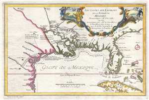
Les Costes aux Environs de la Riviere de Misisipi.
sold
- Digital Map Information
- Suitable for large format printing
- DPI: 300
- File Size: 2.79 MB
- File Type: ZIP / TIFF
- ICC color profile embedded
- Delivered instantly via download link
An uncommon map of often neglected and misunderstood significance, this is Nicolas de Fer's 1705 map of the Gulf Coast, Florida, and Texas, one of the earliest published maps to show any significant detail of the ... (more details)
One of the first maps to offer any detail of the lower Mississippi.
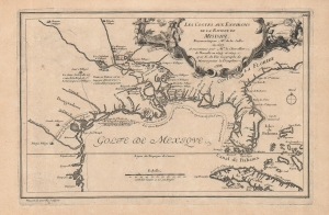
Les Costes aux Environs de la Riviere de Misisipi.
sold
- Digital Map Information
- Suitable for large format printing
- DPI: 600
- File Size: 17.92 MB
- File Type: ZIP / TIFF
- ICC color profile embedded
- Delivered instantly via download link
An uncommon map of often neglected and misunderstood significance, this is Nicolas de Fer's 1705 map of the Gulf Coast, Florida, and Texas, one of the earliest published maps to show any significant detail of the lower Mississippi Valley. It is the first widely disseminated illustration of D'Iberville's cartography along the Mississippi. Also, it dramatically illustrates La Salle's assassination at the hands of his own disgruntled men. (more details)
Southern Spain during the War of Spanish Succession.
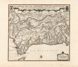
Les Royaumes de Grenade et d'Andalousie.
sold
- Digital Map Information
- Suitable for large format printing
- DPI: 600
- File Size: 56.57 MB
- File Type: ZIP / TIFF
- ICC color profile embedded
- Delivered instantly via download link
This is a large, elegant map of Grenada and Andalusia in southern Spain produced in 1707 by Nicolas De Fer, in a lovely original color example. The map was produced during the War of Spanish Succession (1701 - 1714), of which the region here depicted was one of the many theatres. Cadiz and Málaga, in particular, saw major fleet actions in 1702 and 1704, respectively.It encompasses from the Strait of Gibraltar in the south to Guadiana River in the north. Cities are marked, pictorially indicating differences in size and importance. Among its chief cities are Cadiz, Seville, Écija, Córdoba, Jaén, Grenada, and the ports of Málaga, Almeria, and Gibraltar. The title at top is set off with an elegant strapwork border and is flanked with the arms of the Kingdoms of Granada and Andalusia. (more details)
Among the first maps to detail French West Africa.
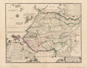
Partie Occidentale De L'Afrique ou se Trouve La Barbarie: Divisée en Royaumes de Maroc, de Fez, d'Alger de Tripoli, et de Tunis, et le Sara ou le Desert de Barbarie la Nigritie ou le Pais Des Negres et la Guinée Les Isles du Cap Verd, Les Isles Canaries et les Acores. Ses Dernieres sont Estimées de l'Amerique.
sold
- Digital Map Information
- Suitable for large format printing
- Full resolution TIFF file
- ICC color profile embedded
- Delivered instantly via download link
This beautifully engraved and rare map is Nicolas De Fer's c. 1709 map of the western part of Africa, with a specific and early focus on the region of Senegal. Senegal was the focus France's main effort at colonization in Africa. Despite those efforts having begun in the mid-seventeenth century, they were astonishingly not captured in cartographic form before 1707. No continental map of Africa prior to that point is so revealing of France's interests in Africa: her efforts to enter the international slave trade, and as well to identify and corner the world's supply of gum arabic. (more details)
Map of Mexico City before the draining of Lake Texcoco.
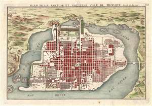
Plan de la Fameuse et Nouvelle Ville de Mexique.
sold
- Digital Map Information
- Suitable for large format printing
- DPI: 300
- File Size: 3.8 MB
- File Type: ZIP / TIFF
- ICC color profile embedded
- Delivered instantly via download link
This is a 1715 Nicolas de Fer city map or plan of Mexico City, Mexico. Although somewhat hard to correlate to the sprawling modern day Mexico City, this map illustrates Mexico shortly after being constructed ... (more details)
A Visual Pilgrimage.
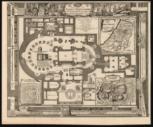
Plan du Saint Sepulchre de Notre Seigr. Jesus-Christ Situe en la Terre Sainte sur le Mont-Calvaire dans la Cite de Jerusalem from: Suite de l'Atlas Curieux.
sold
- Digital Map Information
- Suitable for large format printing
- DPI: 600
- File Size: 55.72 MB
- File Type: ZIP / TIFF
- ICC color profile embedded
- Delivered instantly via download link
This is Nicolas De Fer's scarce, richly detailed 1715 plan of the Church of Holy Sepulchre, Jerusalem. (more details)
A sarce and beautiful map of Paris, France.
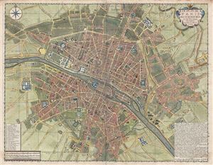
Le Plan de Paris ses Faubourgs et ses Environs.
sold
- Digital Map Information
- Suitable for large format printing
- DPI: 300
- File Size: 25.62 MB
- File Type: ZIP / TIFF
- ICC color profile embedded
- Delivered instantly via download link
A fine example of De Fer's scarce and beautiful 1717 map of Paris, France. Centered on the Seine River, the map covers from Ile aux Cygnes to Mont Louis, and from Les Porcherons to Le Gaubourg Saint-Marceau. ... (more details)
The ambition of a French Empire in America.
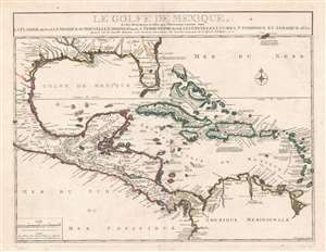
Le Golfe De Mexique, Et les Provinces et Isles qui l'Environe comme sont La Floride Au Nord Le Mexique ou Nouvelle Espagne . . . 1717
sold
- Digital Map Information
- Suitable for large format printing
- DPI: 600
- File Size: 40.96 MB
- File Type: ZIP / TIFF
- ICC color profile embedded
- Delivered instantly via download link
This is a beautiful example of Nicholas De Fer's rare 1717 map of Florida, the West Indies, the Gulf of Mexico and Central America. This region was central to French ambitions for an American empire, and follows upon the establishment of La Salle's colony on Matagorda Bay, and d'Iberville and Bienville's fortification of the Mississippi (Fort de Missisipi). Just one year after this map was issued, in 1718, Jean-Baptiste Le Moyne de Bienville founded New Orleans. Centered on Cuba, coverage extends from roughly Cape Fear to the Equator and from the Mexico City to Barbados. Bermuda, along with its surrounding shoals, breaks the border on the upper right. It is distinctive for its sophisticated mapping of the Gulf Coast and Florida, a region then little known but heavily disputed. (more details)
Highly decorative world map full of cartographic speculation.
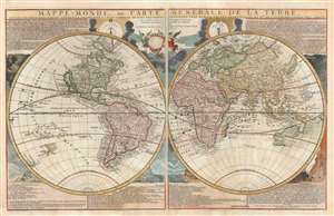
Mappe-Monde, ou Carte Generale de la Terre, divisée en deux himisphere suivant la Projection la plus commune ou tous les points principaux sont placez sur les observations de Mes. de L'Academie Royale Des Sciences.
sold
- Digital Map Information
- Suitable for large format printing
- DPI: 600
- File Size: 46.66 MB
- File Type: ZIP / TIFF
- ICC color profile embedded
- Delivered instantly via download link
An attractive example of Nicolas de Fer's c. 1718 map of the world in two hemispheres. This map is an intermediate proof state of a map first published in 1700. Note the empty cartouche at top center - representing a transitional phase between the 1708 and 1718 editions. The map features numerous interesting cartographic anomalies, among them 'California as an Island', a speculative pacific northwest and Siberian Arctic, and partial pre-Cook mappings of New Zealand, New Guinea, and Australia. The whole is surrounded by beautiful decorative engraving by Herman van Loon illustrating tides, volcanos, and extreme weather. (more details)
Map used to promote investment in John Law's Compagnie d'Occident (Mississippi Bubble) and the first map to show Le Maire's discoveries.
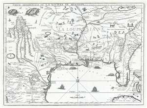
Partie Meridionale De La Riviere De Missisipi, et ses Environs dan L'Amerique Septentrionale.
sold
- Digital Map Information
- Suitable for large format printing
- DPI: 300
- File Size: 15.98 MB
- File Type: ZIP / TIFF
- ICC color profile embedded
- Delivered instantly via download link
A seminal map of the utmost importance and rarity, this is Nicolas de Fer's 1718 map of the Mississippi River Valley drawn to promote the Compagnie d'Occident . Essentially mirroring the coverage of De ... (more details)
Map used to promote investment in John Law's Compagnie d'Occident (Mississippi Bubble) and the first map to show Le Maire's discoveries.
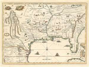
Partie Meridionale De La Riviere De Missisipi, et ses Environs dan L'Amerique Septentrionale.
sold
- Digital Map Information
- Suitable for large format printing
- DPI: 600
- File Size: 23.29 MB
- File Type: ZIP / TIFF
- ICC color profile embedded
- Delivered instantly via download link
A seminal map of the utmost importance and rarity, this is Nicolas de Fer's 1718 map of the Mississippi River Valley drawn to promote the Compagnie d'Occident. Essentially mirroring the coverage of De L'Isle's map of 1703, the map covers from just west of the Rio Grande (Rio del Norte) eastward as far as Charleston, north to include Lake Erie, and south as far as Cuba and the Gulf of Mexico. Per its title, the map is centered on the Mississippi Valley and was intended to illustrate the lush richness of this region. (more details)
The largest and best specific map of insular California.
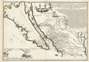
La Californie ou Nouvelle Caroline, Teatro de los Trabajos Apostolicos de la Compa. E Jesus en la America Septe. Dressée sur celle que le Viceroy de la Nouvelle Espagne envoya il y a peu d'années à Mrs. De l'Academie des Sciences.
sold
- Digital Map Information
- Suitable for large format printing
- DPI: 300
- File Size: 16.89 MB
- File Type: ZIP / TIFF
- ICC color profile embedded
- Delivered instantly via download link
A landmark 1720 map showing California as an island and the first published dissemination of Fr. Eusebio Frabcusci Kino's groundbreaking explorations in New Mexico and California. Drawn by Nicolas de ... (more details)
Stunning Malta map showing the armorial crests of the Grand Masters of the Knights Hospitallers of St. John.
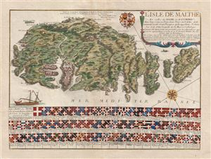
L'Isle de Malthe Et celles de Goze et de Comino, Avec leurs ou Ports, leurs Toursou Vedetes, qu'ils nomment Casati et leurs Precipices qu'ils appelant Redum . . . 1722.
sold
- Digital Map Information
- Suitable for large format printing
- DPI: 300
- File Size: 16.95 MB
- File Type: ZIP / TIFF
- ICC color profile embedded
- Delivered instantly via download link
A spectacular and scarce 1722 map of Malta by Estienne Vouillemont and Nicolas de Fer. De Fer's map covers all of Malta as well as the adjacent island of Gozo. Throughout the map offers exceptional ... (more details)
Charismatic and highly decorative map of Hispaniola or Santo Domingo.
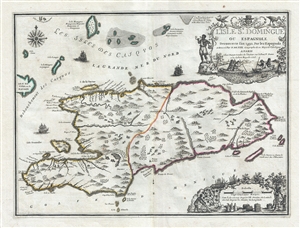
L'Isle St. Domingue ou Espagnole Decouverte l'an 1492 par les Espagnols.
sold
- Digital Map Information
- Suitable for large format printing
- DPI: 300
- File Size: 6.22 MB
- File Type: ZIP / TIFF
- ICC color profile embedded
- Delivered instantly via download link
A stunning large format example of Nicolas De Fer and Guillaume Danet's map of the island of Santo Domingo or Hispaniola. The map coves the island in full as well as parts of adjacent Cuba and Turks and Caicos. The island is shown with colored boundaries derived from the 1697 Treaty of Ryswick dividing the island into the western French portion (modern Haiti) and the larger eastern lands of Spain (Dominican Republic). Topography is drawn in profile according to De Fer's idiosyncratic style. (more details)
Charismatic and highly decorative map of Hispaniola or Santo Domingo.
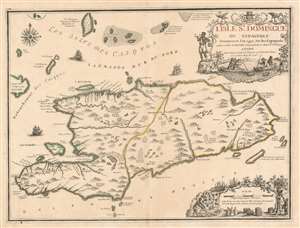
L'Isle St. Domingue ou Espagnole Decouverte l'an 1492 par les Espagnols.
sold
- Digital Map Information
- Suitable for large format printing
- DPI: 600
- File Size: 23.99 MB
- File Type: ZIP / TIFF
- ICC color profile embedded
- Delivered instantly via download link
A stunning large format example of Nicolas De Fer and Guillaume Danet's map of the island of Santo Domingo or Hispaniola. The map coves the island in full as well as parts of adjacent Cuba and Turks and Caicos. The island is shown with colored boundaries derived from the 1697 Treaty of Ryswick dividing the island into the western French portion (modern Haiti) and the larger eastern lands of Spain (Dominican Republic). Topography is drawn in profile according to De Fer's idiosyncratic style. (more details)
Defense of Malta.
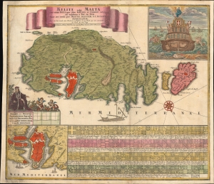
Melite, vulgo Malta cum vicinis Goza, quae olim Gaulos, et Comino insulis / uti exhibetur á Nic. de Fer, nunc aeri incisa per Matth. Seutter, S.C.M. Geogr.
sold
- Digital Map Information
- Suitable for large format printing
- File Size: 27.75 MB
- File Type: ZIP / TIFF
- ICC color profile embedded
- Delivered instantly via download link
With this dramatic 1730 map of Malta, Gozo, and Comino, Matthias Seutter celebrates the Venetian victory over the Ottoman Turks in the 1565 Siege of Malta - an event so momentous that even in the 18th century it remained a signal event in European consciousness. Along the bottom of the map are a series of armorial crests representing Grand Masters of the Order of Knights of the Hospital of Saint John of Jerusalem, commonly known as the Knights Hospitaller or the Order of Saint John, a militant monastic order dating to the Crusades. (more details)
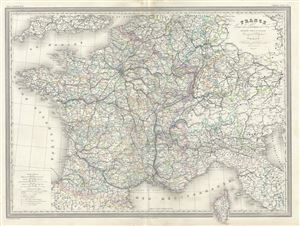
France Carte des Chemin de Fer.
sold
- Digital Map Information
- Suitable for large format printing
- Full resolution TIFF file
- ICC color profile embedded
- Delivered instantly via download link
This is an uncommon 1860 elephant folio railway map of France by A. H. Dufour. It covers the whole of France including parts of Italy, Germany and Switzerland, depicting the railway system ... (more details)
Enormous unpublished draft of a Florida-Louisiana map.
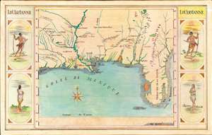
Loüissianne.
sold
- Digital Map Information
- Suitable for large format printing
- File Size: 76.81 MB
- File Type: ZIP / TIFF
- ICC color profile embedded
- Delivered instantly via download link
A striking and impressively proportioned cartographic curiosity, this is a c. 1920 manuscript map of Florida and the Gulf Littoral as far as Texas. The image is surrounded by front and back-facing images of American Indians. Most likely this is the original art for an unpublished educational poster, as it exhibits a professional level of execution. The map is drawn in ink with color added using what appears to be colored pencil or pastels. (more details)