
Australia & Polynesia
First Full Map of Australia, and the First to name Sydney.
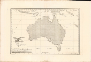
Carte Generale de la Nouvelle Hollande dressee par M L Freycinet Commandant La Goelette, Le Casuarina an 1808.
$8,500.00
Acquire
- Digital Map Information
- Suitable for large format printing
- Full resolution TIFF file
- ICC color profile embedded
- Delivered instantly via download link
This landmark 1811 map of Australia by French explorer and cartographer Louis de Freycinet is celebrated as the first published map to depict the continent's complete coastline and the first to identify Sydney by name. Based on surveys conducted during Nicolas Baudin's French expedition to Australia aboard the Géographe and Naturaliste (1801 - 1803), it presents the continent as Nouvelle Hollande and preserves the expedition's politically charged French nomenclature, including Terre Napoléon. Issued three years before Matthew Flinders' competing map, Freycinet's chart represents a defining achievement in the exploration, mapping and naming of Australia. (more details)
'...worthy of a place in any nobleman's library' - Australian Mail
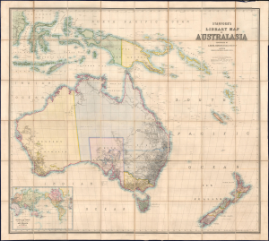
Stanford's Library Map of Australasia.
$8,500.00
Acquire
- Digital Map Information
- Suitable for large format printing
- File Size: 129.08 MB
- File Type: ZIP / TIFF
- ICC color profile embedded
- Delivered instantly via download link
The astounding 1859 first edition of A. Kieth Johnston and Edward Stanford's large-format Library Map of Australasia, comprising Australia, New Zealand, and New Guinea. This is arguably the largest and most detailed general map of Australia to appear in the 19th century, issued a month before the official establishment of Queensland in June 1859. (more details)
Defending Victoria against rival colonial powers.
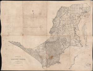
Contour Map of Mornington Peninsula.
$3,500.00
Acquire
- Digital Map Information
- Suitable for large format printing
- Full resolution TIFF file
- ICC color profile embedded
- Delivered instantly via download link
This is a rare 1891 Alexander Black map of the Mornington Peninsula near Melbourne, Australia, prepared for the use of the 'Defence Department of the Colony of Victoria'. It is primarily a topographical map but also offers comprehensive information about the peninsula and its defensive potential - increasingly significant in the face of a proactive German effort to establish a colonial presence in the Pacific. It was printed directly on waxed linen, suggesting it was meant for field use, as this material resists dampness and withstands repeated folding and unfolding. (more details)
Planning Operation Hailstone - the World War II U.S. Navy attack on Truk Atoll.
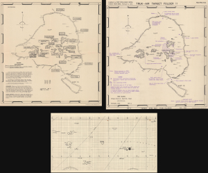
Truk Atoll. Major Fortifications. / Truk - Air Target Folder II. Truk Islands. Target Area Map - Truk Islands. / [Untitled Aviation Chart of the East Caroline Islands.]
$3,500.00
Acquire
- Digital Map Information
- Suitable for large format printing
- Full resolution TIFF file
- ICC color profile embedded
- Delivered instantly via download link
This important archive, compiled days after the World War II Battle of Kwajalein and weeks before Operation Hailstone, includes three 1944 U.S Navy maps of Truk Atoll (Chuuk Lagoon, Micronesia): two 1944 Joint Intelligence Center Pacific Ocean Areas (JICPOA) maps of Truk Atoll, and an aviation chart of the same. The map archive offers unique insights into the U.S. Navy's preparations to assault one of Japan's most formidable bases in the South Pacific. Truk Atoll was Imperial Japan's main naval base in the South Pacific, considered the 'Gibraltar of the Pacific'. (more details)
First map of South Australia: politically charged French toponymy.
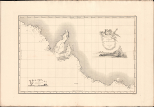
Carte Générale de al Terre Napoléon (À la Nouvelle Holland.)
$3,000.00
Acquire
- Digital Map Information
- Suitable for large format printing
- Full resolution TIFF file
- ICC color profile embedded
- Delivered instantly via download link
This landmark 1811 map of South Australia, including modern-day Adelaide and Melbourne, by French explorer and cartographer Louis de Freycinet. Based on surveys conducted during Nicolas Baudin's expedition to Australia aboard the Géographe and Naturaliste (1801 - 1803), it presents South Australia with politically charged French nomenclature, including, as here, Terre Napoléon. Issued three years before Matthew Flinders' competing map, Freycinet's chart represents a defining achievement in the exploration, mapping and naming of South Australia. (more details)
Russian Interest in the Americas.
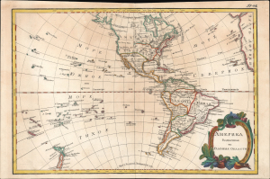
Америка раздѣленная на главныя области / [America Divided into Its Main Regions].
$2,800.00
Acquire
- Digital Map Information
- Suitable for large format printing
- File Size: 11.78 MB
- File Type: ZIP / TIFF
- ICC color profile embedded
- Delivered instantly via download link
This is a 1793 Russian-language map of the Americas produced for the 'New Atlas' (Novyy Atlas / Новый атлас), an important work that made the latest French cartography available to a Russian audience. (more details)
A glimpse into how WWII aviators were briefed before missions.
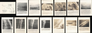
[Kwajalein Atoll Aerial Attack Archive.]
$2,500.00
Acquire
- Digital Map Information
- Suitable for large format printing
- Full resolution TIFF file
- ICC color profile embedded
- Delivered instantly via download link
This is a 1943-1944 intelligence archive prepared for the aerial campaign preceding the invasion of Kwajalein Atoll, offering unique insights into how American World War II aircrews were briefed for combat missions. Strategically located, Kwajalein was occupied and fortified by Imperial Japan early in the war and became a principal American objective in the Central Pacific. U.S. forces landed on Kwajalein and Roi-Namur on January 31, 1944, following months of reconnaissance and preparatory bombing. Comprising annotated aerial photographs, target maps, a manuscript planning overlay, and a regional aviation chart, this archive reveals how pilots moved from broad theater geography to the identification of individual airfields, warehouses, gun positions, and other tactical targets. (more details)
Rare, Early Cadastral Map of New Zealand's Largest City, w/ Manuscript Annotations.
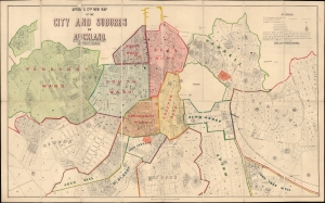
Upton and Co.'s New Map of the City and Suburbs of Auckland.
$2,400.00
Acquire
- Digital Map Information
- Suitable for large format printing
- File Size: 32.19 MB
- File Type: ZIP / TIFF
- ICC color profile embedded
- Delivered instantly via download link
This is Upton's scarce 1884 folding city plan and cadastral map of Auckland, New Zealand, printed by Wilson and Horton. It provides a fascinating glimpse into the early history and evolution of the fast-growing port city. (more details)
Geography for the Nation, in Greek!
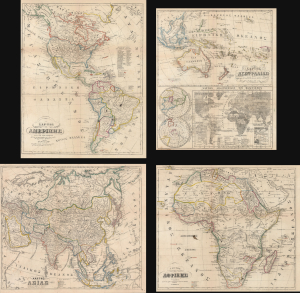
ΧAΡΤΗΣ ΤΗΣ ΑΜΕΡΙΚHΣ / ΧAΡΤΗΣ ΤΗΣ ΑΥΣΤΡΑΛIΑΣ / ΧΆΡΤΗΣ ΤΗΣ ΑΣIΑΣ / ΧAΡΤΗΣ ΤΗΣ ΑΦΡΙΚHΣ.
$2,000.00
Acquire
- Digital Map Information
- Suitable for large format printing
- File Size: 91.34 MB
- File Type: ZIP / TIFF
- ICC color profile embedded
- Delivered instantly via download link
This is an extremely rare c. 1856 set of four Greek-language educational maps published by the Athenian printer Karl Joseph Kolmann. The maps represent an early attempt by the newly independent Greece to reform and nationalize its educational system. (more details)
WWII Guadalcanal Campaign.
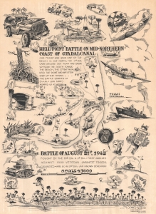
'Hell Point' Battle on Mid-Northern Coast of Guadalcanal. Battle of August 21, 1942.
$2,000.00
Acquire
- Digital Map Information
- Suitable for large format printing
- File Size: 23.62 MB
- File Type: ZIP / TIFF
- ICC color profile embedded
- Delivered instantly via download link
This is a 1943 Donald Moss pictorial map of the 1942 Battle of Hell's Point on Guadalcanal. Guadalcanal was the first American ground offensive in the Pacific and was a critical fight to stop the Japanese advance. (more details)
Gold Field map of Australia drawn for the 1851 Victoria Gold Rush.
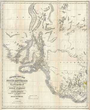
Philip's New Map of South Australia and Part of Victoria Showing the Gold Fields and other Mining Districts according to Parliamentary Returns and other Official Authorities.
$2,000.00
Acquire
- Digital Map Information
- Suitable for large format printing
- DPI: 300
- File Size: 10.28 MB
- File Type: ZIP / TIFF
- ICC color profile embedded
- Delivered instantly via download link
A remarkable and very rare 1853 map of the gold discoveries in South Australia and Victoria. The map covers from Coffin Bay to Cape Ottoway and as far north as Mount Hopeless. Major gold discoveries are highlighted in yellow, and these include discoveries near ... (more details)
The first map of New South Wales Australia!
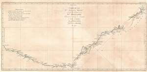
Carte de La Nle. Galles Meridle. Ou de la Cote Orientale de la Nle. Hollande Decouverte et visitee par le Lieutenant J. Cook, Commandant de L'Endeavour, vaisseau de sa Majeste en 1770.
$1,900.00
Acquire
- Digital Map Information
- Suitable for large format printing
- DPI: 600
- File Size: 21.69 MB
- File Type: ZIP / TIFF
- ICC color profile embedded
- Delivered instantly via download link
This is the 1774 first French edition of James Cook's seminal first map of New South Wales, Australia. Oriented to the West, the map extends from Cape York, Prince of Wales Island, and the Endeavour Straits to Point Hicks (Victoria). The map is a product of Cook's search for the often speculated upon southern continent or 'Terra Australis,' which scholars from the 16th century on believed, based upon ancient Greek texts, must exist at the base of the world.
After observing the Transit of Venus on June 3, 1769, Cook sailed westward, planning to return to England via the Cape of Good Hope, as he believed the Endeavour would not survive a second trip around Cape Horn. Instead he sailed west, where he hoped to discover Terra Australis. He sailed around New Zealand and headed for Tasmania, intending to follow up on Abel Tasman's work, when gales forced him northward. On April 19, 1770, his second, Zachary Hicks, signed land, what Cook immediately named Point Hicks. While Cook was most certainly aware he had not discovered 'Terra Australis', he did spend several months, from April 19 to August 22, 1770, mapping long sought east coast of New Holland (Australia), what he came to call New South Wales. He proceeded northwards, navigating the coast with great care, naming notable locations along the way.
It is of note that the coasts between Cape Flattery and Weymouth remains unmapped. This area is so full of small islands and dangerous reefs that Cook aptly named it 'The Labyrinth.' Just as he entered this area, near Cape Tribulation, the Endeavour struck a reef. On our map there is a note reading, 'On this ledge the ship laid 23 hours.' Rather than risk his ship further Cook sailed the Endeavour further out to sea, around the perilous reefs, landing at Cape York to officially name New South Wales and claim the land for England,
After observing the Transit of Venus on June 3, 1769, Cook sailed westward, planning to return to England via the Cape of Good Hope, as he believed the Endeavour would not survive a second trip around Cape Horn. Instead he sailed west, where he hoped to discover Terra Australis. He sailed around New Zealand and headed for Tasmania, intending to follow up on Abel Tasman's work, when gales forced him northward. On April 19, 1770, his second, Zachary Hicks, signed land, what Cook immediately named Point Hicks. While Cook was most certainly aware he had not discovered 'Terra Australis', he did spend several months, from April 19 to August 22, 1770, mapping long sought east coast of New Holland (Australia), what he came to call New South Wales. He proceeded northwards, navigating the coast with great care, naming notable locations along the way.
It is of note that the coasts between Cape Flattery and Weymouth remains unmapped. This area is so full of small islands and dangerous reefs that Cook aptly named it 'The Labyrinth.' Just as he entered this area, near Cape Tribulation, the Endeavour struck a reef. On our map there is a note reading, 'On this ledge the ship laid 23 hours.' Rather than risk his ship further Cook sailed the Endeavour further out to sea, around the perilous reefs, landing at Cape York to officially name New South Wales and claim the land for England,
I now once more hoisted English Coulers and in the Name of His Majesty King George the Third took possession of the whole Eastern Coast from the above Latitude [38] down to this place by the name of New South Wales, together with all the Bays, Harbors, Rivers, and Island s situate upon the said coast. (Cook, J., Journal, August 22, 1770)Until this time it was assumed that Australia, or New Holland as it was known, was a barren wasteland, as the Dutch navigators had explored only a small part of the arid western coast. Cook on the other hand, sailed up the fertile east coast, and was impressed by what he saw. It was Cook who recommended settlement and persuaded Joseph Banks to argue for using the remote continent as a penal colony. This map is significant for Australia collectors as the first definitive mapping of the coasts of New South Wales. Cook's nomenclature largely remains in use today. The map notes both Botany Bay and Port Jackson. (more details)
Visualizing the Celestial Sphere.

Situs Terrae Circulis Coelestibus Circundatae.
$1,800.00
Acquire
- Digital Map Information
- Suitable for large format printing
- DPI: 600
- File Size: 62.91 MB
- File Type: ZIP / TIFF
- ICC color profile embedded
- Delivered instantly via download link
This beautiful work is Andreas Cellarius' celestial chart, in its 1708 Valk and Schenk edition, illustrating the position of the Earth within the celestial sphere divided into its circles. Its lush, baroque presentation - filled with clouds, putti, and muses - frames a useful visual glossary illustrating terminology important both to the astronomer and to the geographer. (more details)
If all you care about is here, this is a good place to be. -Emile de Becque
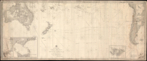
This Chart of the Indian and Pacific Oceans, compiled chiefly from Documents deposited in the Hydrographic Office of the British Admiralty is respectfully dedicated to Adm. Sir. F. Beaufort, F. R. L....
$1,800.00
Acquire
- Digital Map Information
- Suitable for large format printing
- File Size: 116.18 MB
- File Type: ZIP / TIFF
- ICC color profile embedded
- Delivered instantly via download link
An expansive and rare 1880 blueback nautical map or chart of the South Pacific by Richard Holmes Laurie. (more details)
Australia Remade by World War II.
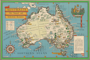
Australia Her Natural and Industrial Resources.
$1,600.00
Acquire
- Digital Map Information
- Suitable for large format printing
- File Size: 34.09 MB
- File Type: ZIP / TIFF
- ICC color profile embedded
- Delivered instantly via download link
This is a colorful 1942 pictorial map of Australia prepared by MacDonald Gill, a pioneer of the genre. Produced in the early phase of the Pacific War (1941 - 1945) against Imperial Japan, part of World War II (1939 - 1945), the map focuses on Australia's resources, which would prove critical to winning the war. (more details)
Sailing to Australia for the Victoria Gold Rush!
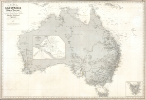
Carte de L'Australie ou Nouvelle Hollande, dressée d'aprés les derniers documents Anglais part Robiquet, Hydrographe, Paris.
$1,500.00
Acquire
- Digital Map Information
- Suitable for large format printing
- File Size: 67.19 MB
- File Type: ZIP / TIFF
- ICC color profile embedded
- Delivered instantly via download link
A handsome, exquisitely detailed 1863 first edition of Aimé Robiquet's privately published nautical chart or maritime map of Australia. Covering all of Australia, with Tasmania represented as an inset, this map was published to capitalize on navigation to Melbourne associated with the Victoria Gold Rush - hence the large inset of Port Phillip, the access point to Melbourne and the wealth lying just inland. Robiquet compiled this chart from the most up-to-date English sources, with several modifications and additions of his own to increase accuracy. (more details)
Sailing to Tasmania!
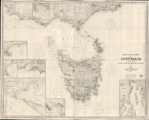
South and East Coasts of Australia [In Five Charts] Chart No. 2, Cape Northumberland to Cape Howe.
$1,500.00
Acquire
- Digital Map Information
- Suitable for large format printing
- File Size: 75.25 MB
- File Type: ZIP / TIFF
- ICC color profile embedded
- Delivered instantly via download link
A striking 1883 James Imray and Son blueback nautical chart or maritime map of Tasmania, Australia. The map captures a transition period as Tasmania emerged from its convict era to embrace mining and agriculture. (more details)
Strikingly decorative map of the East Indies, Philippines, and Australia.
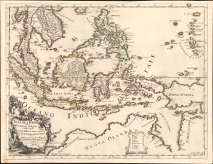
Isole dell'India cio è le Molucche, le Filippine e della Sonda, parte de paesi di nuova scoperta e l'isole de Ladri nel mare del zud / descritte da Giacomo Cantelli de Vignola ; Fran. Donia Messis sculp.
$1,500.00
Acquire
- Digital Map Information
- Suitable for large format printing
- File Size: 18.9 MB
- File Type: ZIP / TIFF
- ICC color profile embedded
- Delivered instantly via download link
A rare, highly decorative 1683 map of Southeast Asia and the East Indies by Giacomo Cantelli da Vignola and Giacomo de Rossi. (more details)
'X' marks the spot. Victoria Gold Rush.
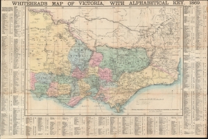
Whitehead's Map of Victoria, with Alphabetical Key, 1869.
$1,500.00
Acquire
- Digital Map Information
- Suitable for large format printing
- File Size: 36.52 MB
- File Type: ZIP / TIFF
- ICC color profile embedded
- Delivered instantly via download link
This is an 1869 Whitehead map of Victoria, Australia. The map is an early edition of one of the most successful cartographic enterprises of the Victoria Gold Rush Era. It also includes manuscript annotations marking gold diggings - 'x' marks the spot! (more details)
The first generation of Meiji Maps drawn from Western sources.
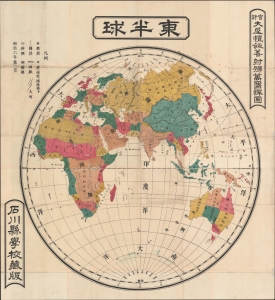
東半球 / Eastern Hemisphere.
$1,200.00
Acquire
- Digital Map Information
- Suitable for large format printing
- File Size: 74.36 MB
- File Type: ZIP / TIFF
- ICC color profile embedded
- Delivered instantly via download link
A rare 1873 or Meiji 6 wall map of the Eastern Hemisphere by the Japanese geographer Gaiko Oya (大屋 愷敆). The map follows the early Meiji Restoration convention of copying cartography from western sources. The practice was intended to modernize Japanese geographical conceptions and place Japan into a geographically accurate global reference. (more details)
French Edition of the First Map of New South Wales.
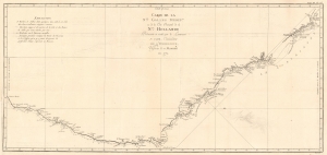
Carte de La Nle. Galles Meridle. Ou de la Cote Orientale de la Nle. Hollande Decouverte et visitee par le Lieutenant J. Cook, Commandant de L'Endeavour, vaisseau de sa Majeste en 1770.
$1,200.00
Acquire
- Digital Map Information
- Suitable for large format printing
- DPI: 600
- File Size: 13.45 MB
- File Type: ZIP / TIFF
- ICC color profile embedded
- Delivered instantly via download link
This is the 1774 first French edition of James Cook's seminal first map of New South Wales, Australia. The map is a product of Cook's search for the often speculated upon southern continent or 'Terra Australis,' which scholars from the 16th century on believed, based upon ancient Greek texts, must exist at the base of the world. This map is significant for Australia collectors as the first definitive mapping of the coasts of New South Wales. (more details)
Mash-up of indigenous and European cartography.
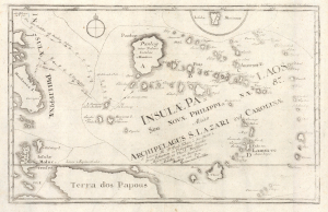
Insulae Palaos seu Novae Philippinae 87, alias Archipelagus S. Lazari vel Carolinae.
$1,200.00
Acquire
- Digital Map Information
- Suitable for large format printing
- File Size: 6.48 MB
- File Type: ZIP / TIFF
- ICC color profile embedded
- Delivered instantly via download link
This is a c. 1726 Joseph Stöcklein map of Palau and surrounding islands in the southwestern Pacific. This map is a fascinating mash-up of Europe and indigenous cartography. It is moreover an especially early presentation of these islands, based on a cartographic game of telephone from native Palauans waylaid in the Philippines through the Jesuits and then to the European public via Joseph Stöcklein. (more details)
New South Wales during the Australian Gold Rush.
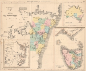
B.F. Lloyd [and] Co.'s Map of Colony of New South Wales.
$1,200.00
Acquire
- Digital Map Information
- Suitable for large format printing
- File Size: 20.08 MB
- File Type: ZIP / TIFF
- ICC color profile embedded
- Delivered instantly via download link
This is a c. 1851 Bartholomew Frederick Lloyd separately issued map of the colony of New South Wales, Australia, issued to promote further colonisation in the light of the 1851 Australian Gold Rush. (more details)
Important early Stokes nautical chart of Australia inlcuding Sydney, Port Jackson, and Botany Bay.
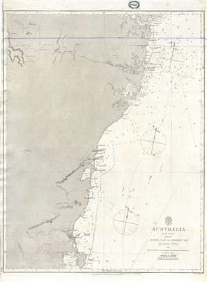
Australia East Coast Sheet III Jervis Bay to Broken Bay.
$1,200.00
Acquire
- Digital Map Information
- Suitable for large format printing
- File Size: 14.58 MB
- File Type: ZIP / TIFF
- ICC color profile embedded
- Delivered instantly via download link
This is an extremely rare 1865 map of eastern Australia covering from Broken Bay to Jervis Bay, including Sydney Port Jackson, and Botany Bay. This is one of the earliest large scale Nautical charts provide scientifically surveyed hydrographic detail for a ... (more details)
One of only 4 known examples of this rare early chart of Australia's coast.
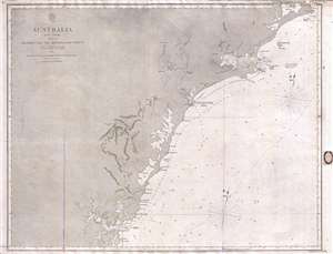
Australia East Coast Sheet IV Broken Bay to Sugarloaf Point.
$1,200.00
Acquire
- Digital Map Information
- Suitable for large format printing
- File Size: 16.08 MB
- File Type: ZIP / TIFF
- ICC color profile embedded
- Delivered instantly via download link
This is an extremely rare 1862 map of eastern Australia covering from Sugarloaf Point to Broken Bay, just north of Syndey. This is one of the earliest large scale Nautical charts provide scientifically surveyed hydrographic detail for a significant portion ... (more details)
One of an incredibly important series of maps of Australia detailing its colonization.
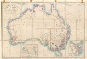
Map of Australia Compiled from the Nautical Surveys, Made by Order of The Admiralty, And other Authentic Documents, By James Wyld Geographer to the Queen.
$1,000.00
Acquire
- Digital Map Information
- Suitable for large format printing
- File Size: 29.49 MB
- File Type: ZIP / TIFF
- ICC color profile embedded
- Delivered instantly via download link
This is a c. 1858 James Wyld map of Australia during the Australian Gold Rush. Depicting the entire continent as well as Tasmania, Wyld illustrates Australia as is being transformed by aggressive colonization and mineral exploitation. (more details)
New Zealand hydrography.
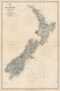
Pacific Ocean. Nea Zealand From Surveys by Captain J. L. Stokes, Commanders B. Drury and G. H. Richards...
$1,000.00
Acquire
- Digital Map Information
- Suitable for large format printing
- File Size: 55.54 MB
- File Type: ZIP / TIFF
- ICC color profile embedded
- Delivered instantly via download link
A rare 1917 British Admiralty nautical chart or maritime map of New Zealand. The map covers both North and South Islands and the surrounding waters. While depth soundings along the coastlines are extensive, soundings further out are few and far between. Lighthouses throughout are marked using the standard red and yellow convention. This map is based upon surveys completed by J. L. Stokes, one of the premier British hydrographers of his generation. Inland detail is derived from surveys completed by the Wellington Public Works Department, c. 1885. (more details)
Exceptional early nautical chart of southeastern Australia including inland topography.
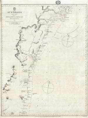
Australia East Coast Sheet II Barriga Point to Jervis Bay.
$1,000.00
Acquire
- Digital Map Information
- Suitable for large format printing
- File Size: 9.07 MB
- File Type: ZIP / TIFF
- ICC color profile embedded
- Delivered instantly via download link
This is an extremely rare 1865 map of eastern Australia covering from Jervis Bay to Barriga Point, including Ulladulla Harbor (then under construction) and Bateman Bay. It extends south as far as Mount Townsend. There are copious annotations regarding ... (more details)
Exceptional early nautical chart of southeastern Australia including inland topography.
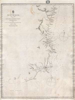
Australia East Coast Sheet I Cape Howe to Barriga Point.
$1,000.00
Acquire
- Digital Map Information
- Suitable for large format printing
- File Size: 8.96 MB
- File Type: ZIP / TIFF
- ICC color profile embedded
- Delivered instantly via download link
This is an extremely rare 1865 map of eastern Australia covering from Cape Howe to Barriga Point. It extends north as far as Mount Townsend and south to Bass Strait. Includes the popular resort of Mallacoota, Twofold Bay, Boyd, and Eden. There are ... (more details)
French mapping of a major British port during the Napoleonic Wars.
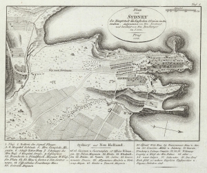
Plan von Sydney der Hauptstadt der Englischen Colonien in Australien. Aufgenommen von Hrn. Lesueur; und berichtigt von Hrn Boullanger i. J. 1802.
$950.00
Acquire
- Digital Map Information
- Suitable for large format printing
- File Size: 3.92 MB
- File Type: ZIP / TIFF
- ICC color profile embedded
- Delivered instantly via download link
One of the earliest obtainable maps of the city of Sydney, Australia, this is an 1815 German edition of an 1802 manuscript map by Charles-Alexandre Lesueur. (more details)
First specific map of the Marshall Islands.
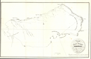
Plan der Insel-Gruppe Romanzoff...
$950.00
Acquire
- Digital Map Information
- Suitable for large format printing
- File Size: 176.25 MB
- File Type: ZIP / TIFF
- ICC color profile embedded
- Delivered instantly via download link
This is Otto von Kotzebue's 1821 map of the Marshall Islands, considered the first specific map of that archipelago. Kotzebue named them the Romanzoff Islands, but this part of the Marshalls is today known as the Ailinglaplap Atoll. The map resulted from Kotzebue's Rurik Expedition, the second Russian circumnavigation of the globe. (more details)
Tracking the Pacific War from Pearl Harbor to V-J Day.
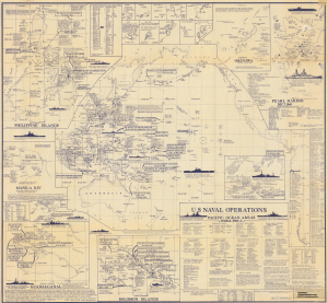
This is a rare first-edition 1966 Marvin E. Metzler infographic map of the Pacific War battles of World War II (1939 - 1945). It is a unique tribute to the Pacific War prepared by a veteran who experienced it firsthand. (more details)