
Australia & Polynesia (sold)
A Sumptuous Example of a Rare Map of the Americas and the Pacific
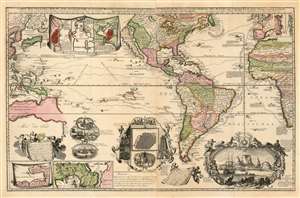
Carte Nouvelle de la Mer du Sud, dressee par Ordre des principaux Directeurs des Memoires les plus recents et des Relations des Navigateurs les plus Modernes.
sold
- Digital Map Information
- Suitable for large format printing
- Full resolution TIFF file
- ICC color profile embedded
- Delivered instantly via download link
A superb example of a rare map, by Hendrik De Leth, presenting the reader with a compendium of European exploration and discovery. Not confined to the Pacific Ocean - as suggested by the title - the map includes richly detailed mapping of the Americas and coastal Africa as well as the Pacific, Southeast Asia, and Australia. Though it is clearly based in part on de Fer's map of 1713 and the 1719 Chatelain, this finely engraved map is easily the match of its predecessors for the elegance of its decorative vignettes. These include - along the bottom center of the map - scenes depicting the manner of turtle-hunting on Pacific Islands, the operation of a sugar mill, gold mining and bird hunting in Mexico, the manner of human sacrifice in mezo America, and a depiction of Cortez destroying Mexican idols. To the lower right is a magnificent scene of the Cape Town settlement, filled with ships and surrounded by a magnificent frame decorated with lions, monkeys, and native figures. (more details)
One of the most beautiful and sumptuously illustrated maps of the 18th century.
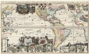
Carte très curieuse de la Mer du Sud, contenant des Remarques Nouvelles et très utiles non seulement sur des Ports et Îles de cette Mer, mais aussy sur les principaux Pays de l'Amerique tant Septentrionale que Méridionale en a été faite.
sold
- Digital Map Information
- Suitable for large format printing
- DPI: 300
- File Size: 52.8 MB
- File Type: ZIP / TIFF
- ICC color profile embedded
- Delivered instantly via download link
One of the most spectacularly decorative maps of the 18th century, this is Henri Chatelain's magnificent 1719 map of the Americas and the Pacific. This sumptuously engraved map is centered on the American continent, but extends west to include all of the pacific ... (more details)
One of the most beautiful and sumptuously illustrated maps of the 18th century.
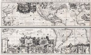
Carte très curieuse de la Mer du Sud, contenant des Remarques Nouvelles et très utiles non seulement sur des Ports et Îles de cette Mer, mais aussy sur les principaux Pays de l'Amerique tant Septentrionale que Méridionale en a été faite.
sold
- Digital Map Information
- Suitable for large format printing
- DPI: 300
- File Size: 76.5 MB
- File Type: ZIP / TIFF
- ICC color profile embedded
- Delivered instantly via download link
One of the most spectacularly decorative maps of the 18th century, this is Henri Chatelain's magnificent 1719 map of the Americas and the Pacific. This sumptuously engraved map is centered on the American continent, but extends west to include all of the pacific ... (more details)
Possibly the earliest printed world map to show Australia - well before its recorded discovery!
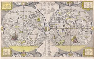
Pars Orbis.
sold
- Digital Map Information
- Suitable for large format printing
- DPI: 300
- File Size: 37.11 MB
- File Type: ZIP / TIFF
- ICC color profile embedded
- Delivered instantly via download link
This is a scarce and important 1571 map of the world by Benedict Arias Montanus. Finely engraved and prepared for the eight-volume Antwerp Poyglot Bible , this stunning map is considered to by some to be the first printed map to include Australia - well before ... (more details)
First Full Map of Australia, and the First to name Sydney
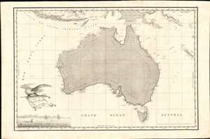
Carte Generale de la Nouvelle Hollande dressee par M L Freycinet Commandant La Goelette, Le Casuarina an 1808.
sold
- Digital Map Information
- Suitable for large format printing
- Full resolution TIFF file
- ICC color profile embedded
- Delivered instantly via download link
This is Louis de Freycinet's 1811 map of Australia, summing up French surveys of the continent undertaken between 1801 and 1808. Freycinet's mapping was executed as part of voyages under the command of Nicolas Baudin, which took place at the same time as Flinders made his surveys of the same region. (more details)
Pre-invasion manuscript planning map of Guadalcanal - a decisive WWII battle.
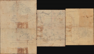
Guadalcanal Island.
sold
- Digital Map Information
- Suitable for large format printing
- Full resolution TIFF file
- ICC color profile embedded
- Delivered instantly via download link
This is a 1942 four-sheet manuscript World War II map of Guadalcanal, Solomon Islands, prepared ship-board in anticipation of the decisive August 7, 1942, landing on Guadalcanal that began the Guadalcanal Campaign. It is one of the few surviving maps from the ad hoc Marine effort to gather critical reconnaissance on Guadalcanal days before the impending invasion. It is thus unique record of one of the most decisive and pivotal battles in the World War II (1939 - 1945) Pacific Theater. (more details)
Greatest map of Tasmania - period.

This Map of Tasmania in 1859, Sir Henry Edward Fox Young Knight Companion of the Most Honorable Order of the Bath Being Governor in Chief, and teh Honble. Francis Smigh Attorney General being Premier is dedicated to his Excellency and the Parliament by James Sprent, Surveyor General.
sold
- Digital Map Information
- Suitable for large format printing
- File Size: 202.12 MB
- File Type: ZIP / TIFF
- ICC color profile embedded
- Delivered instantly via download link
The first, largest, and best colonial and settlement era map of Tasmania. This is the James Sprent / William Hogan 1859 map of Tasmania in its deluxe large-format presentation edition. It is the product of nearly 20 years of meticulous trigonometrical survey work and covers Tasmania with unprecedented precision. The map features manuscript annotation of several voyages dating to the 1920s, underscoring its enduring significance as the best reconnaissance of Tasmania more than 70 years after its issue. (more details)
Van Keulen maps Quiri Regio.
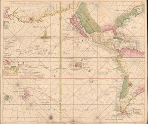
De Zuyd Zee [The South Seas].
sold
- Digital Map Information
- Suitable for large format printing
- File Size: 19.99 MB
- File Type: ZIP / TIFF
- ICC color profile embedded
- Delivered instantly via download link
A remarkable untitled c. 1720 Gerard van Keulen map of the Pacific and the Americas. The map is rich with fascinating content, reflecting the degree to which the Pacific remained a terra incognita well into the 18th century. Points of interest include California as an Island, a vast landmass named 'Terre de Compagnie' between America and Asia, and the mapping of the discoveries of Álvaro de Mendaña y Neira (Solomon Islands) and Pedro Ferdinand de Quiros (Quiri Regio). (more details)
The most striking commercial map of Australia during the Gold Rush Era.
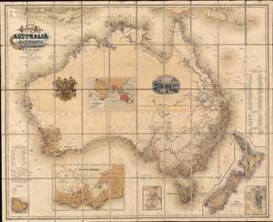
General Map of Australia and Tasmania or Van Diemen's Land shewing The British Colonies as divided into Counties.
sold
- Digital Map Information
- Suitable for large format printing
- File Size: 91.52 MB
- File Type: ZIP / TIFF
- ICC color profile embedded
- Delivered instantly via download link
A rare and striking first-edition chromolithograph gold rush era map of Australia issued by Ernst Georg Ravenstein in 1857 - without a doubt one of the largest and most decorative commercial maps of Australia to appear in the 19th century. The map covers the entire continent with insets detailing nearby New Zealand, the colony of Victory, Sydney, the Mount Alexander gold region, Norfolk Island, and commercial maritime routes to and from Australian ports. The first edition, as here, features two dramatic vignettes: the wharves at Melbourne and a curious British Royal crest modified to honor Prince Albert. The map depicts Australia in the midst of a continent-wide population explosion driven by a series of gold rushes lasting over half a century. Lest there be any doubt that this is a Gold Rush map, the map's striking chromolithograph color is awash with golden tones suggestive of prosperity and promise. (more details)
Meticulous manuscript Map of New Zealand.
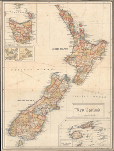
New Zealand.
sold
- Digital Map Information
- Suitable for large format printing
- File Size: 6.87 MB
- File Type: ZIP / TIFF
- ICC color profile embedded
- Delivered instantly via download link
A meticulous manuscript map of New Zealand drawn in 1909 by William Richard Colling Hockin. It was composed soon after New Zealand gained Dominion status within the British Empire, formalizing its independence, and this may have been the occasion that brought New Zealand to the attention of Hockin, then studying in Cornwall to be an electrical engineer. Since we see no other cartographic output from this artist, we must assume this work to be a unique project of leisure and enjoyment; a thoughtful young man's rumination on one of the Empire's newest and most exotic dominions. (more details)
Victoria Gold Rush!
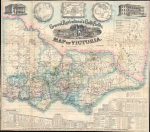
General, Agricultural, and Gold Fields Map of Victoria.
sold
- Digital Map Information
- Suitable for large format printing
- Full resolution TIFF file
- ICC color profile embedded
- Delivered instantly via download link
This is a rare 1859 Frederick Proeschel pocket map of Victoria, Australia, published to capitalize on Victoria Gold Rush emigration. Such maps were sold cheaply to hopeful prospectors who often carried them in-hand to mining and agricultural camps - the harsh conditions contributing to such maps having exceptionally low survival rate. The central cartouche engraved by D. Tulloch, illustrates Victoria's many blessings, including rich flora and fauna, excellent agricultural lands, and of course, the all-important gold mines. Herein, gold 'diggings' are highlighted throughout in brilliant yellow - offering essential data to the emigrant. In addition, the map names settlements, offers commentary on terrain, and highlights both planned and active transportation networks. For those disinclined to rough gold camp life, It also notes 'good sheep pastures'. A view of the Geelong town hall occupies the upper left, and a view of the Melbourne 'Gold Office' the upper right. Three inset maps illustrate, from left to right, the southern hemisphere, the world on a Mercator projection (with Australia at the center) and Australasia. Statistics are included along the bottom border, with particular attention to 'principal gold field townships or diggings', the values of gold extracted from specific fields, Victoria's exports, and Great Britain's exports. (more details)
The steam age.
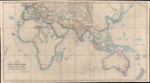
Map Showing the Steam Communication and Overland Routes between England, India, China and Australia.
sold
- Digital Map Information
- Suitable for large format printing
- Full resolution TIFF file
- ICC color profile embedded
- Delivered instantly via download link
A striking 1853 large-scale map by W. H. Allen detailing both overland and steamship routes between England, India, Australia, and East Asia. It illustrates the height of the steamship trade between far-flung British colonies in the decades before the construction of the Suez Canal. The present example features numerous manuscript updates, some in pencil, tracing additional steamship lines run by Oriental-Lloyds-Shanghai and Eastern Atlantic. In addition, further highlighting in red illustrates telegraph lines. (more details)
'The Fifth Part of the World'.
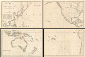
Océanie ou Cinquième Partie du Monde Comprenant L'Archipel d'Asie, L'Australasie et la Polynésie (ou le Continent de la Nouvelle-Hollande et les Îles du Grand Ocean.) en outre Une Grande Partie de L'Amérique et des Còtes de L'Asie.
sold
- Digital Map Information
- Suitable for large format printing
- Full resolution TIFF file
- ICC color profile embedded
- Delivered instantly via download link
A striking large scale 1814 map of the Pacific by Adrian-Hubert Brué. This is one of the earliest general maps of the Pacific to be offered commercially - partially responsible for introducing the vastness of Oceania to the general European public. It is moreover the first map to coin the term Océanie for the Pacific Islands - previously it was known as Océanique. (more details)
Giant blueback working nautical chart of the Indian Ocean with in manuscript navigational notes.
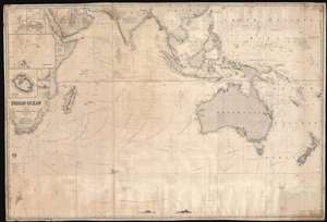
Indian Ocean.
sold
- Digital Map Information
- Suitable for large format printing
- Full resolution TIFF file
- ICC color profile embedded
- Delivered instantly via download link
This is a gigantic 1874 James Imray and Son blueback working nautical chart or maritime map of the Indian Ocean covered in manuscript notations. The map depicts the world from East Africa to Fiji and from Taiwan and the Persian Gulf to 60 degrees south latitude. Manuscript pencil notations trace at least three, possibly four, voyages across the Indian Ocean. These notations mark the vessel's location on its trip across the ocean and notes what is most likely the day of the expedition. Apart from these four voyages, numerous routes between various points throughout the region are also illustrated, with a particular concentration running from the Gulf of Aden to the East Indies, frequented trade routes between England and the Netherlands and these colonies rich in natural resources. Myriad locations are identified throughout, particularly along the coastlines and small islands making up parts of archipelagos situated throughout the Pacific Ocean and the China Sea. Eight inset maps are situated on the map's left side and illustrate Cargados Carajos, Coetivy, Rodrigues, Wood Island, Farquhar Passage, Tromelin, Réunion, and the cities of Saint Paul and Saint Denis on Réunion. (more details)
Fearmongering Japanese Propaganda suggesting an American Surprise attack on Japan - 7 years before WWII!

太平洋攻防戰略圖 / [Sketch Map of Pacific Warfare].
sold
- Digital Map Information
- Suitable for large format printing
- Full resolution TIFF file
- ICC color profile embedded
- Delivered instantly via download link
An astonishing 1935 Kagaku no Nihon Japanese propaganda map of the Pacific demonizing the United States and predicting an American attack on Japan. The map was part of internal Japanese pre-war propaganda efforts intended to establish a clear line of threat and thus promote Imperial Japanese expansionist goals as essential to national security - particularly Hawaii, which is central to this piece and, as the map suggests, key to controlling the Pacific. The cartographer assiduously documents the relative strength of the various powers in the region and their overlapping spheres of influence, presaging the Pacific War that would come seven years later. (more details)
Possibly the first ship-to-shore diagram?
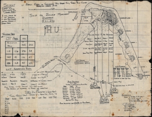
Annex Easy to Commander Task Group Fifty Three Point Eleven Operation Order 3-44. Ship to Shore Diagram D + 1 Day. / Appendix One to Annex Easy to Commander Task Group Fifty Three Point Eleven Operation Order No 3-44. Detailed Diagram of Typical Assault Boat Group.
sold
- Digital Map Information
- Suitable for large format printing
- Full resolution TIFF file
- ICC color profile embedded
- Delivered instantly via download link
An exceptional discovery, this is a 1944 Ship-to-Shore diagram map of the landings on Roi and Namur in Kwajalein Atoll in the Marshall Islands. It is possibly the first printed ship-to-shore diagram issued by the U.S. military - and is certainly the earliest known. Such diagrams were introduced during World War II when amphibious assault doctrine was initially developed. The only other known World War II ship-to-shore diagrams relate to subsequent operations, among them the June 6, 1944, D-Day landings and the invasion of Iwo Jima. (more details)
Extremely rare, separately issued.
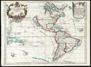
Les Deus Ameriques Divisées en leurs principales Parties, et tirees de toutes les Relations qui ont Par Louis de Lepine Presentee A Monsieur de Chevalier Mari.
sold
- Digital Map Information
- Suitable for large format printing
- File Size: 50.18 MB
- File Type: ZIP / TIFF
- ICC color profile embedded
- Delivered instantly via download link
This is an extremely rare, separately published c. 1695 map of the Western Hemisphere by Louis de Lépine, featuring California as an island. The map also presents the limits of the Pacific Ocean, showing parts of Tasmania, the west coast of New Zealand, part of Japan, and the coastline of the conjectural Terra de Iesso. (more details)
The quest for Terre Australis.
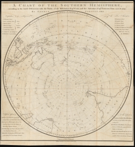
A Chart of the Southern Hemisphere according to the latest Discoveries with the Tracks of the Resolution, Cap.n Cook; and the Adventure, Cap.n Furneaux; from 1772, to 1775.
sold
- Digital Map Information
- Suitable for large format printing
- DPI: 600
- File Size: 68.68 MB
- File Type: ZIP / TIFF
- ICC color profile embedded
- Delivered instantly via download link
A rare 1777 George Forster map of James Cook's second voyage of exploration to the South Pole, from 1772 to 1775. (more details)
A unique and special broadsheet propaganda piece relating to the early colonization of Queensland, Australia.
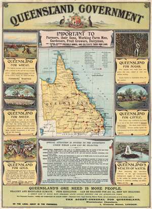
Queensland Government : important to farmers, their sons, working farm men, gardeners, fruit growers, dairymen, and others wishing to obtain freehold homes, and cultivate their own land.
sold
- Digital Map Information
- Suitable for large format printing
- File Size: 10.12 MB
- File Type: ZIP / TIFF
- ICC color profile embedded
- Delivered instantly via download link
An extraordinary rare government-issued 1898 broadsheet chromolithograph poster promoting immigration to Queensland, Australia. Surrounding a map of Queensland highlighting regional Land Offices, this broadsheet boasts of Queensland's incredible wheat and ... (more details)
WWII in the Pacific: drafted to discharged.
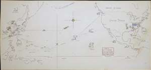
[Untitled Manuscript Pacific War Route Map].
sold
- Digital Map Information
- Suitable for large format printing
- File Size: 2.77 MB
- File Type: ZIP / TIFF
- ICC color profile embedded
- Delivered instantly via download link
A remarkable survival, this is a c. 1947 manuscript pictorial route map of the Pacific War following the World War II service of a U.S. Navy man. Pictorial vignettes highlight the sailor's wartime experience: swearing in, working at the Charleston Navy Yard, surveying the Pacific, weathering typhoons, mine sweeping, good times in Shanghai, and the voyage home. Dated lines trace his travels, with red dates marking wartime movements and yellow dates identifying his return. (more details)
South Sea whaling.
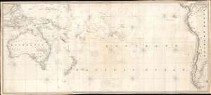
[South Pacific]
sold
- Digital Map Information
- Suitable for large format printing
- Full resolution TIFF file
- ICC color profile embedded
- Delivered instantly via download link
A rare 1825 James Norie blueback nautical chart or maritime map of the South Pacific with notations from a whaling voyage undertaken between 1855 and 1856. The chart, a composite of three charts joined by the original owner, covers from Borneo and Australia to South America and The Falkland Islands. (more details)
The earliest obtainable map of Wellington, capital of New Zealand. Shows Maori land grants.
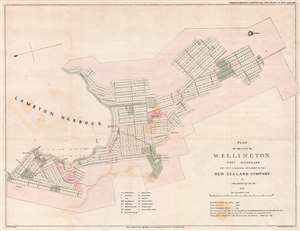
Plan of the City of Wellington Port Nicholson the First and Principal Settlement of the New Zealand Company.
sold
- Digital Map Information
- Suitable for large format printing
- DPI: 300
- File Size: 9.17 MB
- File Type: ZIP / TIFF
- ICC color profile embedded
- Delivered instantly via download link
This rare 1841 map of Wellington is one of the earliest obtainable plans of the modern-day capital of New Zealand. The map was surveyed on behalf of the New Zealand Land Company in 1840 by the first Surveyor-General of New Zealand, Felton Mathew. Mathew laid out the new city's road and grid system in precise detail. The street grid shown here is still reflected in the modern city. This map was issued in 1842 for the House of Commons, probably in conjunction with the Spain Commission, and based upon Mathew's 1840 manuscript survey. (more details)
Quite simply the largest, most beautiful, and most important early map of Hawaii ever published.
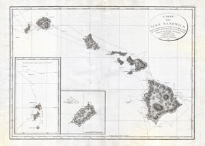
Carte des Iles Sandwich d'apres la reconnoissance qui en a ete faite dans les differentes relaches de la corvette La Decouverte et de sa conserve Le Chatham commandes par le Capt. Vancouver en 1792, 1793 et 1794.
sold
- Digital Map Information
- Suitable for large format printing
- DPI: 300
- File Size: 16.94 MB
- File Type: ZIP / TIFF
- ICC color profile embedded
- Delivered instantly via download link
A seminal map. This is a fine example of George Vancouver's 1799 map of the Hawaiian Islands, considered the largest, most important, and most beautiful map of Hawaii to appear in the 18th century. George Vancouver first sighted Hawaii on January 18, ... (more details)
Rare state of one of the most important 19th century map of New Zealand.
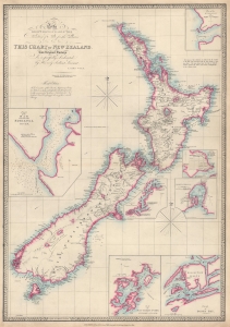
To the Right Honourable the Secretary of State for the Colonies etc. etc. etc. This Chart of New Zealand from Original Surveys is Respectfully Dedicated by His very obedient Servant James Wyld.
sold
- Digital Map Information
- Suitable for large format printing
- File Size: 29.62 MB
- File Type: ZIP / TIFF
- ICC color profile embedded
- Delivered instantly via download link
This is an 1853 James Wyld map of New Zealand - the present example being a rare state of one of the most important 19th-century maps of New Zealand. It does not appear in OCLC and is not cataloged in Tooley's The Mapping of Australia and Antarctica. (more details)
Visualizing the Celestial Sphere.
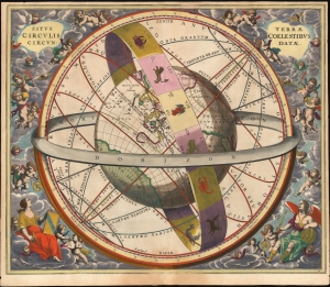
Situs Terrae Circulis Coelestibus Circundatae.
sold
- Digital Map Information
- Suitable for large format printing
- File Size: 24.78 MB
- File Type: ZIP / TIFF
- ICC color profile embedded
- Delivered instantly via download link
This beautiful work is Andreas Cellarius' celestial chart, in its 1661 second state with sumptuous original color, illustrating the position of the Earth within the celestial sphere divided into its circles. Its lush, baroque presentation - filled with clouds, putti, and muses - frames a useful visual glossary illustrating terminology important to the astronomer and the geographer. (more details)
Cornerstone map of Australian discovery and colonization.
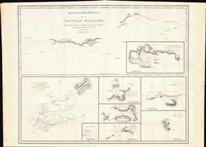
Partie de la Cote Sud-Ouest de la Nouvelle Hollande avec les Routes de la Corvette la Decouverte et sa conserve le Chatham commandes par Georges Vancouver en l'Annee 1791.
sold
- Digital Map Information
- Suitable for large format printing
- DPI: 600
- File Size: 29.25 MB
- File Type: ZIP / TIFF
- ICC color profile embedded
- Delivered instantly via download link
One of the great navigator George Vancouver's most important and influential maps, this is Vancouver's 1799 mapping of southwestern Australia and New Zealand. Though less well known than his historic mapping of the Pacific Northwest, Vancouver's work in Australia and New Zealand is no less significant. (more details)
Sailing to Australia for the Victoria Gold Rush!
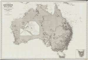
Carte de L'Australie ou Nouvelle Hollande, dressée d'aprés les derniers documents Anglais part Robiquet, Hydrographe, Paris.
sold
- Digital Map Information
- Suitable for large format printing
- File Size: 88.54 MB
- File Type: ZIP / TIFF
- ICC color profile embedded
- Delivered instantly via download link
A fine and exquisitely detailed 1863 first edition of Aimé Robiquet's privately published nautical chart or maritime map of Australia. Covering all of Australia, with Tasmania represented as an inset, this map was published to capitalize on navigation to Melbourne associated with the Victoria Gold Rush - hence the large inset of Port Phillip, the access point to Melbourne and the wealth lying just inland. Robiquet compiled this chart from the most up-to-date English sources, with several modifications and additions of his own to increase accuracy. (more details)
Japan's vision for the Pacific during World War II.
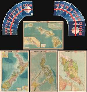
This is an important and rare full set of 20 maps from the 1943 Showa 18 World War II (WWII) Greater East Asian Co-Prosperity Sphere series. The series of maps covers from India to Hawaii and from Japan to Australia. Those areas of particular ... (more details)
A cornerstone map of Australian discovery and colonization.
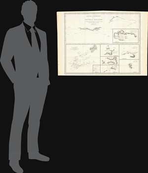
Partie de la Cote Sud-Ouest de la Nouvelle Hollande avec les Routes de la Corvette la Decouverte et sa conserve le Chatham commandes par Georges Vancouver en l'Annee 1791.
sold
- Digital Map Information
- Suitable for large format printing
- DPI: 300
- File Size: 13.52 MB
- File Type: ZIP / TIFF
- ICC color profile embedded
- Delivered instantly via download link
One of the great navigator George Vancouver's most important and influential maps, this is Vancouver's 1799 mapping of southwestern Australia and New Zealand. Though less well known than his historic mapping of the Pacific Northwest, Vancouver's ... (more details)
Failed Development Scheme in Sydney's Natural Wonderland.
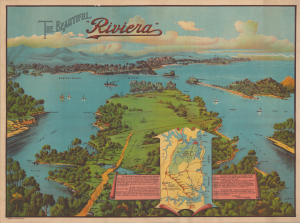
The Beautiful 'Riviera'
sold
- Digital Map Information
- Suitable for large format printing
- Full resolution TIFF file
- ICC color profile embedded
- Delivered instantly via download link
This is a stunning c. 1929 promotional bird's-eye view of the Ku-ring-gai Chase National Park, just south of Sydney, Australia, drawn by artist Victor Henry and printed by the lithographer Simmons, Ltd. The 'Riviera' resort proposed here, itself a compromise after an earlier planned housing development was scrapped, was never constructed due to opposition, leaving the parklands and their remarkable views open to the public for posterity. (more details)
One of the first maps to depict Tasmania as an island following the circumnavigation of Tasmania by this map's creator.
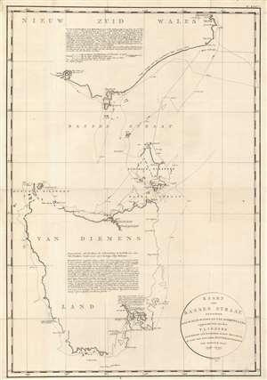
Kaart van Basses Straat Tusschen Nieuw Zuid Wales en Van Diemens-Land.
sold
- Digital Map Information
- Suitable for large format printing
- DPI: 600
- File Size: 31.3 MB
- File Type: ZIP / TIFF
- ICC color profile embedded
- Delivered instantly via download link
Created by Captain Matthew Flinders during his circumnavigation of Tasmania or Van Diemens Land, this c. 1800 map is one of the first to depict Tasmania as a separate island. Resulting from the first circumnavigation of the island, Tasmania is illustrated in some detail, but it is also evident that Flinders was not exceptionally confident about his reconnaissance of the entire coastline. He uses gaps and ghosting to mark uncertainties, particularly along the northwest coast. The eastern coast is much more tenuously sketched, probably due to the distance from shore Flinders maintained. Two large block texts, one situated in New South Wales and the other in the interior of Tasmania, furnish more information, with all text in Dutch. (more details)
The first map of New South Wales Australia!
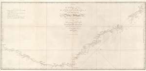
A Chart of New South Wales, or the East Coast of New-Holland. Discovered and explored by Lieutenant J. Cook, Commander of His Majesty's Bark Endeavour, in the year MDCCLXX.
sold
- Digital Map Information
- Suitable for large format printing
- DPI: 600
- File Size: 17.29 MB
- File Type: ZIP / TIFF
- ICC color profile embedded
- Delivered instantly via download link
This seminal 1773 first edition map by James Cook is the first map of New South Wales, Australia. Oriented to the West, the map extends from Cape York, Prince of Wales Island, and the Endeavour Straits to Point Hicks (Victoria). The map is a product of Cook's search for the often speculated upon southern continent or 'Terra Australis,' which scholars from the 16th century on believed, based upon ancient Greek texts, must exist at the base of the world.
After observing the Transit of Venus on June 3, 1769, Cook sailed westward, planning to return to England via the Cape of Good Hope, as he believed the Endeavour would not survive a second trip around Cape Horn. Instead he sailed west, where he hoped to discover Terra Australis. He sailed around New Zealand and headed for Tasmania, intending to follow up on Abel Tasman's work, when gales forced him northward. On April 19, 1770, his second, Zachary Hicks, signed land, what Cook immediately named Point Hicks. While Cook was most certainly aware he had not discovered 'Terra Australis', he did spend several months, from April 19 to August 22, 1770, mapping long sought east coast of New Holland (Australia), what he came to call New South Wales. He proceeded northwards, navigating the coast with great care, naming notable locations along the way.
It is of note that the coasts between Cape Flattery and Weymouth remains unmapped. This area is so full of small islands and dangerous reefs that Cook aptly named it 'The Labyrinth.' Just as he entered this area, near Cape Tribulation, the Endeavour struck a reef. On our map there is a note reading, 'On this ledge the ship laid 23 hours.' Rather than risk his ship further Cook sailed the Endeavour further out to sea, around the perilous reefs, landing at Cape York to officially name New South Wales and claim the land for England,
After observing the Transit of Venus on June 3, 1769, Cook sailed westward, planning to return to England via the Cape of Good Hope, as he believed the Endeavour would not survive a second trip around Cape Horn. Instead he sailed west, where he hoped to discover Terra Australis. He sailed around New Zealand and headed for Tasmania, intending to follow up on Abel Tasman's work, when gales forced him northward. On April 19, 1770, his second, Zachary Hicks, signed land, what Cook immediately named Point Hicks. While Cook was most certainly aware he had not discovered 'Terra Australis', he did spend several months, from April 19 to August 22, 1770, mapping long sought east coast of New Holland (Australia), what he came to call New South Wales. He proceeded northwards, navigating the coast with great care, naming notable locations along the way.
It is of note that the coasts between Cape Flattery and Weymouth remains unmapped. This area is so full of small islands and dangerous reefs that Cook aptly named it 'The Labyrinth.' Just as he entered this area, near Cape Tribulation, the Endeavour struck a reef. On our map there is a note reading, 'On this ledge the ship laid 23 hours.' Rather than risk his ship further Cook sailed the Endeavour further out to sea, around the perilous reefs, landing at Cape York to officially name New South Wales and claim the land for England,
I now once more hoisted English Coulers and in the Name of His Majesty King George the Third took possession of the whole Eastern Coast from the above Latitude [38] down to this place by the name of New South Wales, together with all the Bays, Harbors, Rivers, and Island s situate upon the said coast. (Cook, J., Journal, August 22, 1770)Until this time it was assumed that Australia, or New Holland as it was known, was a barren wasteland, as the Dutch navigators had explored only a small part of the arid western coast. Cook on the other hand, sailed up the fertile east coast, and was impressed by what he saw. It was Cook who recommended settlement and persuaded Joseph Banks to argue for using the remote continent as a penal colony. This map is significant for Australia collectors as the first definitive mapping of the coasts of New South Wales. Cook's nomenclature largely remains in use today. The map notes both Botany Bay and Port Jackson. (more details)