
Central Asia - Tibet (sold)
First Japanese Printed Map to show European geographical information with Buddhist world-view.
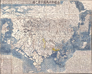
Nansenbushu Bankoku Shoka No Zu (Outline Map of All Countries of the Universe)
sold
- Digital Map Information
- Suitable for large format printing
- Full resolution TIFF file
- ICC color profile embedded
- Delivered instantly via download link
A seminal map. This is the first Japanese printed map to depict the world, including Europe and America, from a Buddhist cosmographical perspective. Printed by woodblock in 1710 (Hoei 7), this map was composed by the Buddhist monk Rokashi Hotan. Inspired by ... (more details)
The first Japanese map of the world from a Buddhist cosmographical perspective - a seminal map.
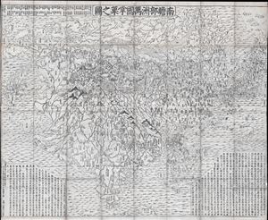
Nansenbushu Bankoku Shoka No Zu (Outline Map of All Countries of the Universe)
sold
- Digital Map Information
- Suitable for large format printing
- DPI: 300
- File Size: 91.94 MB
- File Type: ZIP / TIFF
- ICC color profile embedded
- Delivered instantly via download link
A seminal map of extreme significance. This is the first Japanese printed map to depict the world, including Europe and America, from a Buddhist cosmographical perspective. Printed by woodblock in 1710 (Hoei 7), this map was composed by the Buddhist monk ... (more details)
Nansenbushu: First Japanese Printed Map to show European geographical information with Buddhist world-view.
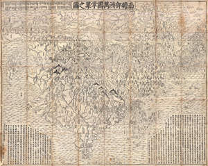
Nansenbushu Bankoku Shoka No Zu (Outline Map of All Countries of the Universe)
sold
- Digital Map Information
- Suitable for large format printing
- DPI: 300
- File Size: 330.31 MB
- File Type: ZIP / TIFF
- ICC color profile embedded
- Delivered instantly via download link
A seminal map of extreme significance. This is the first Japanese printed map to depict the world, including Europe and America, from a Buddhist cosmographical perspective. Printed by woodblock in 1710 (Hoei 7), this map was composed by the Buddhist monk ... (more details)
Rare map illustrating Japanese concerns over Russian and American expansionism.
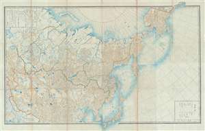
[Russia, China, Japan, Korea, Alaska]
sold
- Digital Map Information
- Suitable for large format printing
- File Size: 50.29 MB
- File Type: ZIP / TIFF
- ICC color profile embedded
- Delivered instantly via download link
This is a highly unusual 1867 or Keiō 3 Japanese lithograph map of Asia and Alaska. The map covers from the Caspian Sea and Nova Zembla to Alaska as far as Prince of Wales Island and Sitka. It embraces most of the Russian Empire in Asia including ... (more details)
The first surveyed map of Karachi, Pakistan, issued by the East India Company exploratory mission to Sinde in preparation for the February 1839 occupation.
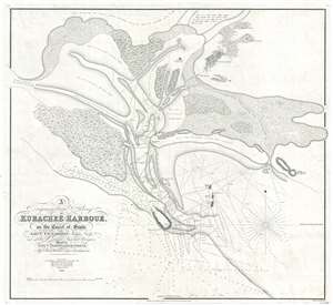
A Trigonometrical Survey of Kurachee Harbour, on the Coast of Sinde.
sold
- Digital Map Information
- Suitable for large format printing
- DPI: 300
- File Size: 12.67 MB
- File Type: ZIP / TIFF
- ICC color profile embedded
- Delivered instantly via download link
This is the first map of Karachi city and harbor, modern day Pakistan, drawn from Thomas Greer Carless' exploratory surveys of 1838. Carless, along with fellow India Navy Officers W. Jardine, Sheppard, and Grieve, was sent to survey the coast of ... (more details)
The steam age.
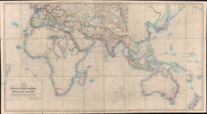
Map Showing the Steam Communication and Overland Routes between England, India, China and Australia.
sold
- Digital Map Information
- Suitable for large format printing
- Full resolution TIFF file
- ICC color profile embedded
- Delivered instantly via download link
A striking 1853 large-scale map by W. H. Allen detailing both overland and steamship routes between England, India, Australia, and East Asia. It illustrates the height of the steamship trade between far-flung British colonies in the decades before the construction of the Suez Canal. The present example features numerous manuscript updates, some in pencil, tracing additional steamship lines run by Oriental-Lloyds-Shanghai and Eastern Atlantic. In addition, further highlighting in red illustrates telegraph lines. (more details)
Up-to-Date, if fictitious.
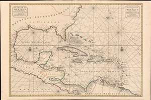
Le Golfe de Mexique et les Isles Voisine Dressé sr les Relations les plus Nouvelles. / Archipelague du Mexique, ou sont les Isles de Cuba, Espagnola, Jamaica, et c. Dressé sur les relations les plus Nouvelles.
sold
- Digital Map Information
- Suitable for large format printing
- DPI: 600
- File Size: 46.72 MB
- File Type: ZIP / TIFF
- ICC color profile embedded
- Delivered instantly via download link
A scarce and striking 1700 Pierre Mortier nautical map embracing Florida, the Gulf of Mexico, Central America, the West Indies, and the Caribbean. Presented on two sheets, joined at center by the publisher, it is centered on Cuba, but extends broadly from Cape Lookout to the Gulf of Darien and from Mexico to Bermuda, Surinam, and Barbados. (more details)
A masterpiece by an mysterious unknown cartographer.
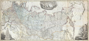
Nova Tabula Geographica Imperii Russici in Gubernia Divisi Edita 1787
sold
- Digital Map Information
- Suitable for large format printing
- DPI: 300
- File Size: 129.69 MB
- File Type: ZIP / TIFF
- ICC color profile embedded
- Delivered instantly via download link
A scarce and spectacular monumentally proportioned 1787 Map of Russia by an unknown yet masterful cartographer. Renders the full sprawling extant of the Russian Empire from the Black Sea to the northwestern parts of the American Continent ... (more details)
Includes the earliest acquirable European mapping of Korea based on firsthand report.
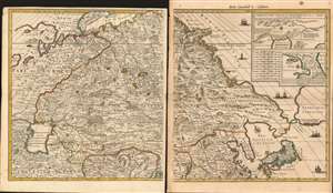
[Carte Nouvelle de la Grande Tartarie].
sold
- Digital Map Information
- Suitable for large format printing
- Full resolution TIFF file
- ICC color profile embedded
- Delivered instantly via download link
This is Pierre Mortier's 1696 two-sheet map of northern Asia, Siberia and Tartary. It is drawn primarily from two sources: Hubert Jaillot's 1695 six-sheet wall map of Asia, and Nicolaes Witsen's 1687 map of Tartary. As a result, this map represents the most up-to-date cartography of central and northeastern Asia of the seventeenth century, which would not be significantly improved upon until the maps of Strahlenberg. (more details)
Modernizing Public Transit in Tashkent.
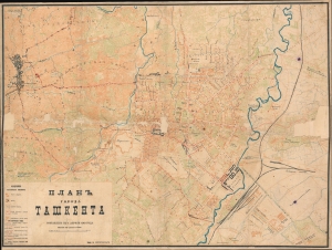
[Map of the City of Tashkent] / ПЛАНЪ ГОРОДА ТАШКЕНТА.
sold
- Digital Map Information
- Suitable for large format printing
- File Size: 52.29 MB
- File Type: ZIP / TIFF
- ICC color profile embedded
- Delivered instantly via download link
This is a rare 1913 map of Tashkent (Toshkent), the capital of today's Uzbekistan and a former Silk Road city, then the capital of Russian Turkestan and a major hub on the Trans-Caspian Railway. The map, likely administrative, was issued to illustrate Tashkent's electric tram system, launched in 1913. (more details)
The Trans-Siberian Railway paving the way for resettlement in Siberia.
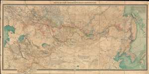
КАРТА ПУТЕЙ СООБЩЕНИЯ АЗІАТСКОЙ РОССIЙ. / Map of Routes of Communication of Asian Russia.
sold
- Digital Map Information
- Suitable for large format printing
- Full resolution TIFF file
- ICC color profile embedded
- Delivered instantly via download link
A rare large-scale 1911 Alexei Ilyin map of the Russian Empire in Asia and the Trans-Siberian Railway issued for the Imperial Russian Ministry of Railways. The map catalogs not only the near complexation of the Trans-Siberian Railway, a major development in Russian infrastructure, but also the extensive Siberian resettlement projects instigated under Tsar Nicholas II and Pyotr N. Stolypin. This expansive maps coves from the Caspian Sea to Japan and Korea, and from Yakutsk to northern China. In addition to railroad routes, the map shows communication networks, mines, ironworks, forests, and resettlement areas up to 1910, inclusive. (more details)
'The trouble in Afghanistan...'
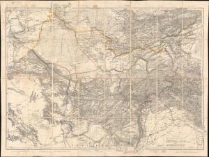
Wyld's Military Staff Map of Central Asia and Afghanistan.
sold
- Digital Map Information
- Suitable for large format printing
- Full resolution TIFF file
- ICC color profile embedded
- Delivered instantly via download link
This is James Wyld II's exceptional 1879 large-scale Military Staff Map of Afghanistan, issued for government and military planning at the height of the Second Anglo-Afghan War (1878 - 1880), part of the Great Game. Like Wyld's other 'military staff maps', this map was not part of his prolific commercial output, but rather made directly from the best government and private sources for the use of military commanders and strategists in the field. (more details)
Best 19th century general map of the Ottoman Empire.
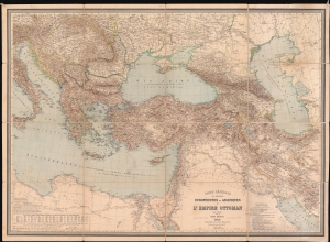
Carte Générale des Provinces Européennes et Asiatiques de l'Empire Ottoman (sans l'Arabie).
sold
- Digital Map Information
- Suitable for large format printing
- File Size: 150.63 MB
- File Type: ZIP / TIFF
- ICC color profile embedded
- Delivered instantly via download link
This is an 1892 Heinrich Kiepert wall map of the Ottoman Empire. The work of Europe's finest cartographer, this is without question the best large scale general map of the Ottoman dominions to appear in the 19th century. (more details)
Scarce and Elegantly-Engraved Map of the Far East.
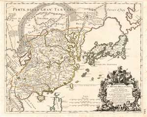
Il Regno Della China detto presentemente Catay e Mangin diviso sopra le Carte piú esatte sue Principali Provincie.
sold
- Digital Map Information
- Suitable for large format printing
- Full resolution TIFF file
- ICC color profile embedded
- Delivered instantly via download link
This is a rare 1682 Cantelli da Vignola map of China, Japan and Korea, presenting a striking and up-to-date view of the Far East benefitting from Jesuit and Dutch reports. Its framework and outline are derived from the 1552 Martino Martini map produced by Blaeu, but this map is significantly updated, at least in part, from the reports of the Jesuits Bento de Góis and Johann Grueber. (more details)
A forgotten milestone in the 18th century mapping of Tibet!
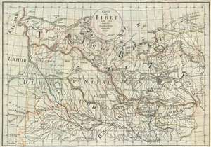
Carte von Tibet nach den neuesten Nachrichten entworfen.
sold
- Digital Map Information
- Suitable for large format printing
- DPI: 300
- File Size: 5.68 MB
- File Type: ZIP / TIFF
- ICC color profile embedded
- Delivered instantly via download link
This is a remarkable and rare 1790 map of Tibet, a milestone in the mapping of that region, and one of the first maps of Tibet, Nepal, and Bhutan with any pretense at accuracy. The map was prepared by Paul Gotthelf Kummer to illustrate ... (more details)
Issued as Tibet was being invaded by the PRC.
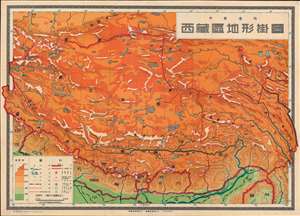
西藏區地形掛圖 / Topographic Wall Map of Tibet.
sold
- Digital Map Information
- Suitable for large format printing
- File Size: 106.69 MB
- File Type: ZIP / TIFF
- ICC color profile embedded
- Delivered instantly via download link
This is a scarce 1950 Chinese wall map of Tibet issued by the Communist Party to propagandize the October 1950 invasion of Tibet by the People's Liberation Army. The large-scale map covers all of Tibet showing terrain, cities, and major transportation networks. It was ostensibly drawn for use in classrooms, but the map is part of a broad effort to generate support for Chinese sovereignty over Tibet as well as to legitimize their claims. (more details)
A foundational map of Persia, Arabia, and India.
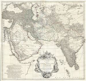
Premiere Partie de la Carte d'Asie contenant La Turquie, L'Arabie, La Perse, L'Inde en deca du Gange et de la Tartarie ce qui est limitrophe de la Perse et de l'Inde.
sold
- Digital Map Information
- Suitable for large format printing
- DPI: 300
- File Size: 36.34 MB
- File Type: ZIP / TIFF
- ICC color profile embedded
- Delivered instantly via download link
A monumental and highly detailed 1751 map of India, Persia, and Arabia by the French cartographer Jean Baptiste Bourguignon d'Anville. Centered on Persia, this map covers from Istanbul to eastern India and Tibet, and from the Black Sea ... (more details)
The first scientific geological survey of Iran - and an all around stunning map.
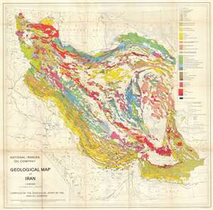
National Iranian Oil Company Geological Map of Iran.
sold
- Digital Map Information
- Suitable for large format printing
- File Size: 34.93 MB
- File Type: ZIP / TIFF
- ICC color profile embedded
- Delivered instantly via download link
An extremely rare, beautiful and important production, this is the 1959 geological map of Iran issued from original surveys by the National Iranian Oil Company (Shirkat-i Millī-i Naft-i Īrān) completed in 1957. This is the first ... (more details)
A foundational map of Persia, Arabia, and India.
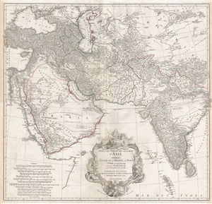
Premiere Partie de la Carte d'Asie contenant La Turquie, L'Arabie, La Perse, L'Inde en deca du Gange et de la Tartarie ce qui est limitrophe de la Perse et de l'Inde.
sold
- Digital Map Information
- Suitable for large format printing
- DPI: 300
- File Size: 34.98 MB
- File Type: ZIP / TIFF
- ICC color profile embedded
- Delivered instantly via download link
A monumental and highly detailed 1751 map of India, Persia, and Arabia by the French cartographer Jean Baptiste Bourguignon d'Anville. Centered on Persia, this map covers from Istanbul to eastern India and Tibet, and from the Black ... (more details)
A foundational map of Persia, Arabia, and India.
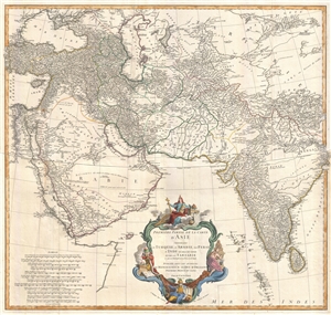
Premiere Partie de la Carte d'Asie contenant La Turquie, L'Arabie, La Perse, L'Inde en deca du Gange et de la Tartarie ce qui est limitrophe de la Perse et de l'Inde.
sold
- Digital Map Information
- Suitable for large format printing
- DPI: 300
- File Size: 25.92 MB
- File Type: ZIP / TIFF
- ICC color profile embedded
- Delivered instantly via download link
A monumental and highly detailed 1751 map of India, Persia, and Arabia by the French cartographer Jean Baptiste Bourguignon d'Anville. Centered on Persia, this map covers from Istanbul to eastern India and Tibet, and from the Black ... (more details)
Unrecorded Proof State: Revealing Uzbek geography and toponymy.
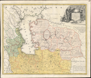
Nova Maris Caspii et Regionis Usbeck cum Provincijs adjacentibus vera Delineatio.
sold
- Digital Map Information
- Suitable for large format printing
- File Size: 26.38 MB
- File Type: ZIP / TIFF
- ICC color profile embedded
- Delivered instantly via download link
This is an unrecorded proof state of Abraham Maas' 1735 map of Uzbekistan and the Caspian Region, edited by Johann Peter von Ghelen and published by Homann Heirs. It is the first map to show the results of Peter the Great's initiatives to chart the ill-understood frontier of the Russian Empire, and it is the first printed map specifically of the Uzbek region. Moreover, it incorporates the first published records of the indigenous toponymy east of the Caspian. (more details)
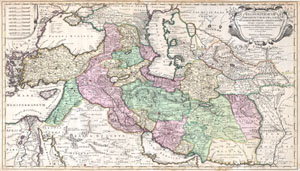
Regnum Persicum Imperium Turcicum in Asia Russorum Provinciae and Mare Caspium.
sold
- Digital Map Information
- Suitable for large format printing
- DPI: 300
- File Size: 15.73 MB
- File Type: ZIP / TIFF
- ICC color profile embedded
- Delivered instantly via download link
A scarce and altogether spectacular c. 1730 map of southwestern Asia, specifically focusing on Persia, by Reiner and Joshua Ottens. Covers from Egypt and Greece eastward to include Turkey, the northern part of the Arabian Peninsula, ... (more details)
Revealing Uzbek geography and toponymy.
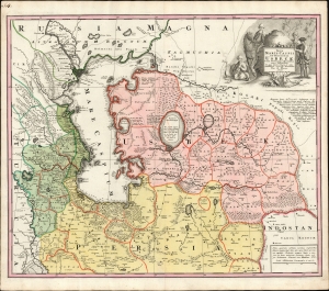
Nova Maris Caspii et Regionis Usbeck cum Provincijs adjacentibus vera Delineatio.
sold
- Digital Map Information
- Suitable for large format printing
- File Size: 26.43 MB
- File Type: ZIP / TIFF
- ICC color profile embedded
- Delivered instantly via download link
This is Abraham Maas' map of Uzbekistan and the Caspian Region, edited by Johann Peter von Ghelen and published by Homann Heirs in 1735. It was the first map to show the results of Peter the Great's initiatives to chart this ill-understood frontier of the Russian Empire, and it is the first printed map specifically of the Uzbek region. Moreover, it incorporates the first published records of the indigenous toponymy east of the Caspian. (more details)
Revealing Uzbek geography
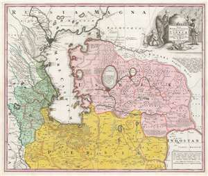
Nova Maris Caspii et Regionis Usbeck cum Provincijs adjacentibus vera Delineatio.
sold
- Digital Map Information
- Suitable for large format printing
- DPI: 600
- File Size: 69.16 MB
- File Type: ZIP / TIFF
- ICC color profile embedded
- Delivered instantly via download link
This is Abraham Maas' map of Uzbekistan and the Caspian Region, edited by Johann Peter von Ghelen and published by Homann Heirs in 1735. It was the first map to show the results of Peter the Great's initiatives to chart this ill-understood frontier of the Russian Empire, and it is the first printed map specifically of the Uzbek region. The map shows the area around the Caspian Sea and northern Iran. A broad area running eastwards from the Caspian is marked 'Uzbek;' this encompasses Turkmenistan, Uzbekistan, Kyrgyzstan, Tajikistan and part of Kazakhstan. (more details)
The earliest Western city plan of Lhasa.
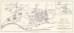
Plan of Lhasa.
sold
- Digital Map Information
- Suitable for large format printing
- Full resolution TIFF file
- ICC color profile embedded
- Delivered instantly via download link
This is a 1904 Laurence Austine Waddell city map or plan of Lhasa, Tibet, created during the 1903 - 1904 British Expedition to Tibet. Likely the earliest detailed plan of the city available outside of Tibet, numerous locations are identified, including bridges, walls, cathedrals, restaurants, and theaters. Markets, including the mule market, the horse market, and the meat market, are noted. Waddell differentiates between Nepalese, Bhutanese, and Chinese shops, and also includes two 'pleasure gardens', and even specifies the Lama's pleasure garden. Another note describes the cemetery as 'infested by dogs.' Ninety locations are numerically identified, but unfortunately, the index has been lost. We have included a screenshot of the index that we located online, but this is not included with the map. An inset map situated in the upper right corner the environs of Lhasa and identifies monasteries, cathedrals, and parade grounds. (more details)
First Accurate English Map of Tibet.
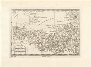
A Map of Great Tibet, drawn from that made by Lama Mathematicians in 1717.
sold
- Digital Map Information
- Suitable for large format printing
- Full resolution TIFF file
- ICC color profile embedded
- Delivered instantly via download link
This is the earliest English map of Tibet, engraved for Braddock Mead's A New General Collection of Voyages and Travels, published under his pseudonym 'John Green' by Thomas Astley in 1747. It is one of the few maps of the region to rely (ultimately) on local sources - although the mapmaker's claim that the map was 'drawn from that made by Lama Mathematicians' does not include the chain of Jesuit missionaries and French cartographers linking the 'Lama Mathematicians' to the 'English engraver'. The map covers an area from northern India (Delhi is shown) to encompass the Gobi Desert and as far as Kashgar. The map includes Lake Kokonor in the Qinghai Province of China, and embraces what is now the Xinjiang Uyghur Autonomous Region. The Himalaya Mountains of Tibet appear pictorially, but the map is rich in place names and rivers, including several rivers disappearing into the endoheiric basins of the Gobi. (more details)
A seminal production - the first accurate map of the Caspian Sea.
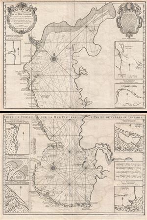
Carte Marine de la Mer Caspiene.
sold
- Digital Map Information
- Suitable for large format printing
- DPI: 300
- File Size: 34.76 MB
- File Type: ZIP / TIFF
- ICC color profile embedded
- Delivered instantly via download link
A seminal production, this is Guillaume Delisle's 1721 map of the Caspian Sea according to the surveys of Van Verden and S. I Soimonov. It is the first printed map of the Caspian Sea based upon actual survey work. Although other ... (more details)
Depicts the entire area of conflict during The Great Game.
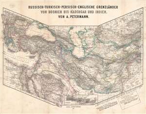
Russisch-Turkisch-Persisch-Englische Grenzländer von Bosnien vis Kaschgar und Indien.
sold
- Digital Map Information
- Suitable for large format printing
- File Size: 34.97 MB
- File Type: ZIP / TIFF
- ICC color profile embedded
- Delivered instantly via download link
This is a scarce and unusual 1877 Augustus Petermann map of the Middle East and Central Asia at the height of The Great Game, a decades-long diplomatic duel between the British and Russian Empires. Detailing the entire theater of war, the map's polyconic projection covers from the Balkans to British India; Crimea to the Persian Gulf and Indian Ocean. The Russian Empire stretches across the top of the map, an ever-expanding threat to countries to the south with deep water ports on the Mediterranean Sea and Indian Ocean. Throughout the 19th century, the Russian drive southward led to several wars with Persia and Turkey, which also embroiled British and French interests, staging Russia as 'the great enemy'. (more details)
Monumental map of Arabia, Persia and India based on D'Anville.
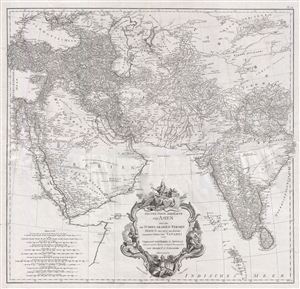
Erster Theil der Karte von Asien welche die Türkei, Arabien, Persien Indien diesseits des Ganges und einen Theil der Tatarei enthält.
sold
- Digital Map Information
- Suitable for large format printing
- DPI: 300
- File Size: 37.9 MB
- File Type: ZIP / TIFF
- ICC color profile embedded
- Delivered instantly via download link
A monumental and highly detailed 1786 map of India, Persia, and Arabia by the Austrian cartographer F. A. Scharembl. Centered on Persia, this map covers from Istanbul to eastern India and Tibet, and from the Black Sea to the ... (more details)
Tajikistan, published in Tashkent, first official map of the Tajik S.S.R.
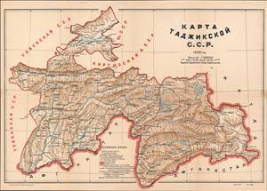
Карта Таджикской С.С.Р. / [Map of the Tajik Soviet Socialist Republic].
sold
- Digital Map Information
- Suitable for large format printing
- File Size: 31.99 MB
- File Type: ZIP / TIFF
- ICC color profile embedded
- Delivered instantly via download link
This is a unique 1932 map of Tajikistan made by Geokartprom and published by the Tajik State Publishing House - the first official map of the Tajik S.S.R. It shows the recently-formed Soviet Socialist Republic (SSR) and reflects the efforts of the Soviet Union to build political and economic infrastructure in Central Asia while also 'delimiting' the complex ethnic groups of the region. (more details)
Graphically stunning Dutch map of the Bible Lands.
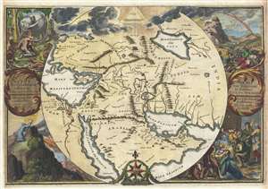
Orbis Per Creationem Institutus. / Orbis Per Diluvium De Stitutus. /Per Legem Constitutus. / Per Christum Restitutus.
sold
- Digital Map Information
- Suitable for large format printing
- DPI: 300
- File Size: 30.02 MB
- File Type: ZIP / TIFF
- ICC color profile embedded
- Delivered instantly via download link
A remarkable 1705 map of the Biblical lands by Romeyln de Hooghe. Centered on Babylon, then thought to be the center of creation, the map extends from the Bosporus to the Arabian Sea and from the Nile valley to the Caspian ... (more details)
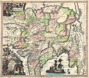
Imperii Magni Mogolis sive Indici Padschach, juxta recentiissimas Navigationes accurata delineato Geographica studio et sumtibus.
sold
- Digital Map Information
- Suitable for large format printing
- DPI: 300
- File Size: 23.09 MB
- File Type: ZIP / TIFF
- ICC color profile embedded
- Delivered instantly via download link
Representing 18th century Germany cartography at its finest; this is an absolutely spectacular c. 1740 map of northern India by Matthias Seutter. Showing the extent of the powerful Mughal Empire in the late 17th century, ... (more details)