
Central Asia - Tibet
Calling for an Armenian State during the Armenian Genocide.
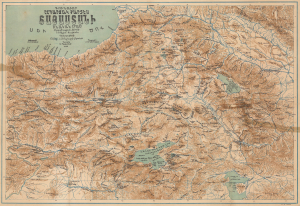
Գունավոր ընդարձակ քարտէս Հայաստանի բնական մաս. / [Colored Expanded Physical Map of Armenia.]
$5,000.00
Acquire
- Digital Map Information
- Suitable for large format printing
- File Size: 16.73 MB
- File Type: ZIP / TIFF
- ICC color profile embedded
- Delivered instantly via download link
Published in Istanbul in 1923, at the tail end of the Armenian Genocide, this remarkable chromolithograph persuasive map in the Armenian language calls for an expansive independent Armenian state. Known as 'Wilsonian Armenia', the lands mapped here roughly conform to the 1920 Treaty of Sèvres, which called for an Armenian homeland. The 'Armenian' stipulations within the treaty were never actualized. The map is almost certainly a response to the Treaty of Lausanne (1923), which effectively erased Wilsonian Armenia from the diplomatic record. Considering the context of the Armenian Genocide and open anti-Armenian sentiment in Istanbul, it is a remarkable achievement that this map was even published. (more details)
Spectacularly presented.
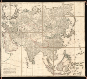
L'Asie divisée en ses Empires et Royaumes.
$3,500.00
Acquire
- Digital Map Information
- Suitable for large format printing
- Full resolution TIFF file
- ICC color profile embedded
- Delivered instantly via download link
A spectacularly presented c. 1787 Charles-François Delamarche / Robert de Vaugondy map of Asia. The beautifully presented map is laid down on unusual patterned linen and set into a fine royal blue slipcase with gold gilt tooling. (more details)
The earliest acquirable European mapping of Korea based on firsthand report.
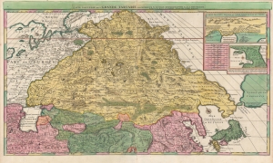
Carte Nouvelle de la Grande Tartarie.
$3,500.00
Acquire
- Digital Map Information
- Suitable for large format printing
- DPI: 600
- File Size: 123.4 MB
- File Type: ZIP / TIFF
- ICC color profile embedded
- Delivered instantly via download link
This is a stunning, original-color example of Pierre Mortier's 1696 two-sheet map of northern Asia, Siberia, and Tartary. It is drawn primarily from two sources: Hubert Jaillot's 1695 six-sheet wall map of Asia and Nicolaes Witsen's 1687 map of Tartary. As a result, this map represents the most up-to-date cartography of central and northeastern Asia of the seventeenth century, which would not be significantly improved upon until the maps of Strahlenberg thirty years later. (more details)
A Remarkable Survival: an in-house Indian Survey map compiling manuscript results from contemporaneous exploration.
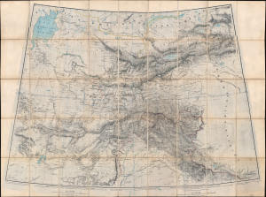
[Turkestan with the adjoining portions of the British and Russian territories.]
$3,500.00
Acquire
- Digital Map Information
- Suitable for large format printing
- File Size: 115.78 MB
- File Type: ZIP / TIFF
- ICC color profile embedded
- Delivered instantly via download link
This monumental c. 1869 British intelligence map from the height of the Great Game details the southern frontier of the Russian Empire in Asia, extending southwards to the British sphere of influence in Afghanistan, the Punjab, and Kashmir. This represented the primary theatre of the Great Game - the struggle for control in Central Asia between Russia and the British Empire. The map includes numerous manuscript annotations and updates, including records of George Hayward's ill-fated reconnaissance (spy) mission into the Pamirs. (more details)
Rare Glimpse of the Efforts to Comprehend Northeastern Asia.
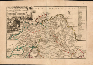
Les etats du Czar ou Empereur des Russes en Europe et en Asie...
$3,000.00
Acquire
- Digital Map Information
- Suitable for large format printing
- File Size: 38.72 MB
- File Type: ZIP / TIFF
- ICC color profile embedded
- Delivered instantly via download link
This large, beautiful, and rare map of the Russian Empire, engraved by Nicolas de Fer and published in 1722, is a fascinating revision of Nicolas Witsen's 1687 map of the Tatar Empire and Siberia. It incorporates the novel reports of Evert Ysbrandzoon Ides - derived from his journeys between Moscow and China - as well as the Central Asian voyage of Philippe Avril. (more details)
Tibet between Independence and Incorporation.
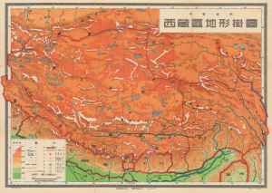
This is a scarce c. 1955 Chinese wall map of Tibet printed by the Chunghwa (or Zhonghua) Book Company in Shanghai and published by the China Cartographic Publishing House in the wake of the October 1950 invasion of Tibet by the People's Liberation Army. It was ostensibly drawn for classroom use in middle schools (中學適用), but the map is part of a broader effort to generate support for Chinese sovereignty over Tibet and legitimize their claims. (more details)
Scarce and Elegantly-Engraved Map of the Far East.

Il Regno Della China detto presentemente Catay e Mangin diviso sopra le Carte piú esatte sue Principali Provincie.
$2,200.00
Acquire
- Digital Map Information
- Suitable for large format printing
- DPI: 600
- File Size: 48.62 MB
- File Type: ZIP / TIFF
- ICC color profile embedded
- Delivered instantly via download link
This is a scarce 1682 Cantelli da Vignola map of China, Japan, and Korea, presenting a striking and up-to-date view of the Far East benefitting from Jesuit and Dutch reports. Its framework is derived from the 1552 Martino Martini map by Blaeu, but this map is significantly updated after the reports of the Jesuits Bento de Góis and Johann Grueber. (more details)
On the brink of war in Central Asia.
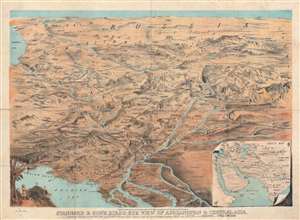
Stannard and Son's Bird's-Eye View of Afghanistan and Central Asia.
$2,200.00
Acquire
- Digital Map Information
- Suitable for large format printing
- File Size: 39.76 MB
- File Type: ZIP / TIFF
- ICC color profile embedded
- Delivered instantly via download link
This is a rare 1885 Alfred Concanen bird's-eye view map of Central Asia. Karachi, the Indus River Delta, and the Persian Gulf occupy the foreground and India, Iran, Afghanistan, reach toward the horizon, with Russia in the background. The Caspian Sea appears along the left border. Numerous important cities, including Kabul (Cabul), Samarkand, Bukhara, Tehran, Isfahan, Kandahar, Srinagar, and Hyderabad are all labeled, along with many others. Mountain ranges and mountain passes are identified. (more details)
Richly-Decorative, Separately-Issued Map of Asia.
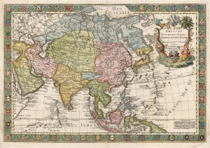
L'Asie Dressée sur de Nouveaux Mémoires Assujettis aux Observations Astronomique.
$2,000.00
Acquire
- Digital Map Information
- Suitable for large format printing
- DPI: 600
- File Size: 95.23 MB
- File Type: ZIP / TIFF
- ICC color profile embedded
- Delivered instantly via download link
This is a separately-issued 1732 Guillaume Danet map of Asia. It is a synthesis of the most advanced cartographic ideas of the age, including from piracies of Strahlenberg's stolen cartography. (more details)
Eastern reaches of the Silk Road.
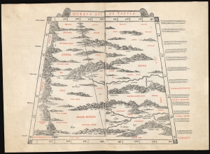
Octava Asia Tabula.
$2,000.00
Acquire
- Digital Map Information
- Suitable for large format printing
- File Size: 18.22 MB
- File Type: ZIP / TIFF
- ICC color profile embedded
- Delivered instantly via download link
This is a rare example of Bernard Sylvanus' 1511 Ptolemaic map of the eastern reaches of the Silk Road. Printed in a single edition, it is one of the most visually distinctive early woodcut maps to detail parts of modern-day Kazakhstan, Kyrgyzstan, and Tajikistan, the northeastern part of Mongolia, and the Xinjiang province of China. For Ancient Romans, this was the most remote part of the known world: Serica, named after the precious silk understood to originate there. (more details)
First map of Russia based on actual exploration.
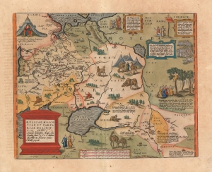
Russiae, Moscoviae et Tartariae Descriptio. Auctore Antonio Ienkensono Anglo, edita Londini Anno. 1562 et dedicata illustriss: D. Henrico Sÿdneo Wallie presidi.
$2,000.00
Acquire
- Digital Map Information
- Suitable for large format printing
- Full resolution TIFF file
- ICC color profile embedded
- Delivered instantly via download link
This is a 1601 example of Abraham Ortelius' 'Russia, Moscoviae et Tartariae', the first atlas map of Russia, and the first to be produced based on actual exploration. Its content is based on the travels of English merchant and diplomat Anthony Jenkinson, who visited Russia four times between 1557 and 1571. The map details the lands revealed by Jenkinson's first voyage which lasted from 1557 to 1560. His map, which was provided to Ortelius, was completed after that voyage, in 1562. (more details)
The Great Game: Competition and Cooperation.
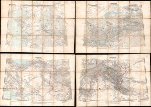
Turkestan and the countries between the British and the Russian Dominions in Asia.
$1,800.00
Acquire
- Digital Map Information
- Suitable for large format printing
- Full resolution TIFF file
- ICC color profile embedded
- Delivered instantly via download link
This is a fascinating 1879 map of Central Asia, divided into four large folding sheets, produced by G.W.E. Atkinson, a British Survey of India expert on Tibet, the Himalayas, and Central Asia. It was produced at the height of the 'Great Game' and intended for use by the government and military of British India. This map provides unique insight into the collaborative process of Russian and British surveyors operating in Central Asia despite ongoing political conflict. (more details)
Magnificent Seventeenth-Century Asia.
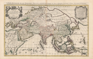
L'Asie diviseé en ses Principales Regions, et ou se peut voir l'estendue Des Empires, Monarchies, Royaumes et Estats qui partagent présentement L'Asie.
$1,500.00
Acquire
- Digital Map Information
- Suitable for large format printing
- DPI: 600
- File Size: 112.68 MB
- File Type: ZIP / TIFF
- ICC color profile embedded
- Delivered instantly via download link
This is a beautiful example of Hubert Jaillot's two-sheet map of Asia in its 1696 Mortier issue. While fundamentally based on Nicolas Sanson's mapping of the continent, the map has been updated to reflect advances in European knowledge of the Far East. Moreover, Jaillot's background as a sculptor has resulted in the artfully engraved cartouches which grace this work. (more details)
Afridi revolt in the Kyber.
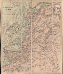
Stanford's Sketch Map of The North-Western Frontier of India.
$1,200.00
Acquire
- Digital Map Information
- Suitable for large format printing
- File Size: 41.73 MB
- File Type: ZIP / TIFF
- ICC color profile embedded
- Delivered instantly via download link
A remarkable 1887 map of northwestern Pakistan and northeastern Afghanistan produced at the height of the Great Game to satisfy British interest in the Tirah Campaign. Centered on Peshawar, the map covers modern-day Khyber Pakhtunkhwa (Khyber Pass), from Fayzabad (Faizabad), Afghanistan, to Jhelum, Pakistan, and parts of Punjab. (more details)
First accurate map of the Caspian Sea.
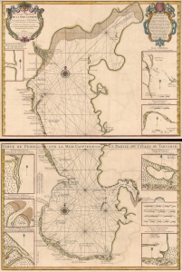
Carte Marine de la Mer Caspiene.
$900.00
Acquire
- Digital Map Information
- Suitable for large format printing
- Full resolution TIFF file
- ICC color profile embedded
- Delivered instantly via download link
A seminal production, this is Guillaume Delisle's 1721 map of the Caspian Sea according to the surveys of Van Verden and S. I Soimonov. It is the first printed map of the Caspian Sea based upon actual survey work. Although other cartographers also copied the work of Van Verden and Soimonov, Delisle was the first, and his mapping is the finest and truest to the original manuscript. (more details)
A 'Great Game' reconnaissance expedition from Beijing across the Gobi.
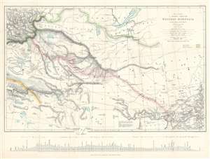
Map to illustrate A Journey Through Western Mongolia.
$800.00
Acquire
- Digital Map Information
- Suitable for large format printing
- File Size: 20.33 MB
- File Type: ZIP / TIFF
- ICC color profile embedded
- Delivered instantly via download link
This is an 1873 Ney Elias map of western Mongolia. Although not specifically described as such, this map and the Elias expedition were most likely British reconnaissance related to 'The Great Game'. This map was drawn by Elias after his 1872 expedition through the region. A thin red line follows his progress from Beijing (Peking), China, across the Gobi Desert to Bisk in Russia, where he arrived on January 4th, 1873. Elias marks each day's progress along his route and labels Uliassutai, the largest settlement he encountered. The pink shading around Elias's route highlights the limits of the surveys conducted by Elias during the expedition. Karakorum, which Elias refers to as the 'ancient Tartar capital', is marked in two places, suggesting ambugity over its actual location. The map traces the Great Wall along the bottom border, with the wall and the rivers leading from Lake Alak, Lake Tsui-yan, and Lake Sobi breaking the map's bottom border. Numerous lakes of varying sizes appear throughout. (more details)
A little known region mapped.
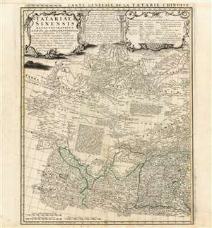
Tartariae Sinensis mappa Geographica...
$750.00
Acquire
- Digital Map Information
- Suitable for large format printing
- Full resolution TIFF file
- ICC color profile embedded
- Delivered instantly via download link
This is a handsome 1749 Homann Heirs map of western China, Mongolia and the extreme southeastern border with Russia. It was produced in order to accompany a German translation of P. Du Halde's 1732 Description de la Chine. As such, it is a faithful copy of J. B. D'Anville's Carte Generale de la Tartarie Chinoise which accompanied Du Halde's original text and the definitive mapping of this little-known and ill-mapped region. D'Anville's map - and Du Halde's data - were derived from Jesuit sources. Jesuits, with the blessing of the Qing Emperor Kangxi, produced at a map of the Chinese Empire's frontiers between 1708 and 1717. (more details)
Includes an intriguing depiction of the Philippines with exaggerated mapping of the Cagayan River!
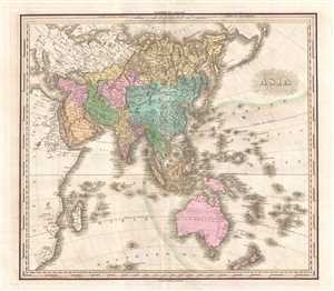
Asia.
$750.00
Acquire
- Digital Map Information
- Suitable for large format printing
- DPI: 300
- File Size: 11.18 MB
- File Type: ZIP / TIFF
- ICC color profile embedded
- Delivered instantly via download link
This is an 1825 Henry Shenk Tanner map of Asia. The map depicts from continental Europe and Africa (though both are uncolored) to Alaska and from the Arctic Ocean to Australia, South Africa, and the Southern Ocean. A few intriguing details are present here, ... (more details)
Armenian Kingdom of Urartu.
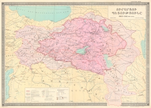
This is a rare separately issued Armenian-language 1980 Suren Yeremian map of the historical Kingdom of Urartu - an Armenian civilization that existed between 860 and 590 BCE. The Urartu period is considered a golden age in the ancient history of the Armenian people. (more details)
Compiling European Explorations of the Altai.
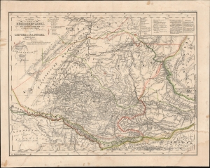
Karte vom Russischen Altai.
$750.00
Acquire
- Digital Map Information
- Suitable for large format printing
- File Size: 18.69 MB
- File Type: ZIP / TIFF
- ICC color profile embedded
- Delivered instantly via download link
This is Carl Ritter and Heinrich Mahlmann's 1839 map of the Altay region of central Asia. This map was compiled at a time when Europeans knew little of this region, but compiles the tracks of European explorers who, between 1771 and 1829, explored the mountainous region. It represents a revolutionary amalgam of explorers' accounts and speculation expounded through the lens of Ritter's German Romantic theories of the Earth as a 'cosmic individual'. (more details)
Empires of the East.
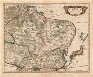
Tabula Tartariae et majoris partis Regni Chinae edita a F. de Wit.
$750.00
Acquire
- Digital Map Information
- Suitable for large format printing
- DPI: 600
- File Size: 51.08 MB
- File Type: ZIP / TIFF
- ICC color profile embedded
- Delivered instantly via download link
This beautifully engraved and colored map is Frederick de Wit's 1680 map of Central Asia and the Far East, including Persia, China, Japan and Siberia. It reaches from the eastern Caspian Sea to the Pacific, and from the mouth of the Ganges in the south to the mouth of the Ob in Siberia. This represented the state of the art of Dutch cartography of northeastern Asia prior to the groundbreaking map of Nicolaas Witsen. The treatment of Japan and Yedso reflects the journey of Maarten Gerritsz Vries and the northeastern bulge evident on the maps of Blaeu and Jansson has been truncated here. The regions of central Asia are replete with descriptive texts, some of which were retained from the 15th century maps of Fra Mauro, and even from the narrative of Marco Polo. These focus particularly on the empire of the Grand Khan, and on various putative Christian kingdoms. The Great Wall of China is depicted. (more details)
Revealing Central Asia.
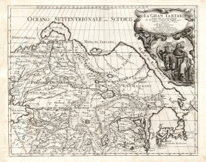
La Gran Tartaria.
$650.00
Acquire
- Digital Map Information
- Suitable for large format printing
- DPI: 600
- File Size: 55.88 MB
- File Type: ZIP / TIFF
- ICC color profile embedded
- Delivered instantly via download link
This is Cantelli da Vignola's 1693 map of Central and northeastern Asia, focusing on 'Tartar lands', an expansive territory spanning from the Russian steppe to the Great Wall of China. (more details)
First Accurate English Map of Tibet.
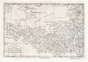
A Map of Great Tibet, drawn from that made by Lama Mathematicians in 1717.
$650.00
Acquire
- Digital Map Information
- Suitable for large format printing
- DPI: 600
- File Size: 9.69 MB
- File Type: ZIP / TIFF
- ICC color profile embedded
- Delivered instantly via download link
This is the earliest English map of Tibet, engraved for Braddock Mead's 1747 A New General Collection of Voyages and Travels, published under his pseudonym 'John Green' by Thomas Astley. It is one of the few maps of the region to rely (ultimately) on local sources - although the mapmaker's claim that the map was 'drawn from that made by Lama Mathematicians' does not include the chain of Jesuit missionaries and French cartographers linking the 'Lama Mathematicians' to the 'English engraver'. (more details)
Russian mapping of their southeastern frontier.
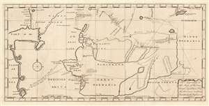
The Appendage to the Maps of the Orenburg Expedition, No. 1. and the Provinces in Siberia, No. 2. As taken by the Russians in 1747.
$650.00
Acquire
- Digital Map Information
- Suitable for large format printing
- Full resolution TIFF file
- ICC color profile embedded
- Delivered instantly via download link
This fascinating map of modern-day Turkmenistan, Uzbekistan and Tajikistan, engraved by John Gibson in 1753, was based on Russian maps Jonas Hanway included in his An Historical Account of the British Trade Over the Caspian Sea. Hanway supplemented the results of his own travels to the Caspian with a multiplicity of travelers' journals and the maps of other explorers, compiling an exhaustive collection of the most up to date geographical sources for this area, which remained one of the most obscure regions in the world. The map is centered on the Silk Route capitals of Samarkand and Bukhara, east of the Aral Sea. The cities of Tashkent and Badakshan are shown; the northeastern Caspian Sea and the lower part of the Ural River appears at the west; the eastern shore of the endoheiric Aral Sea is shown as well, but the western shore and indeed all the land between the Caspian and the Aral Sea is obscure. (The nomadic Tatars occupying that region were notoriously ill disposed towards travelers.) The map excels in detailing the regions south and east of the Aral, which include cities having 'plantations of trees' and 'mountains on which the Persians say is Gold and Silver and Lapis Lazuli.' (more details)
The most detailed chart of the Caspian Sea of the mid-18th century.
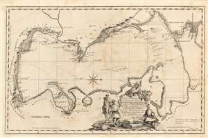
A Plain Chart of the Caspian-Sea, According to the Observations of Capt. John Elton, Author of Elton's Quadrant, and Thomas Woodroofe, Master of the British Ship Empress of Russia, Who navigated this Sea three years; Presented to Mr. Jonas Hanway of St. Petersburgh in 1745 by his most Obedient Servant Thomas Woodroofe.
$650.00
Acquire
- Digital Map Information
- Suitable for large format printing
- Full resolution TIFF file
- ICC color profile embedded
- Delivered instantly via download link
This superbly detailed chart of the Caspian Sea, engraved by John Gibson in 1753, was the first detailed charting of that sea following the work of Carl Van Verden, and arguably the better chart. It was produced for inclusion in Jonas Hanway's An Historical Account of the British Trade Over the Caspian Sea and relies on details provided Hanway by captains John Elton and Thomas Woodroofe, whose accounts have been preserved nowhere but in Hanway's work. (more details)
The first European expedition into the Tian Shan Mountains.
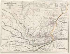
Map of Russian and Chinese Frontier Illustrating the Journey of Semenof to the Tian-Shan Mounts. and R. Jaxartes and Golubof's Issyk-kul Expedition.
$575.00
Acquire
- Digital Map Information
- Suitable for large format printing
- File Size: 12.88 MB
- File Type: ZIP / TIFF
- ICC color profile embedded
- Delivered instantly via download link
This is an 1861 John Murray map of Central Asia tracing Pyotr Semyonov's (1827 - 1914) first European ascent into the Tian Shan Mountains. The map depicts the region from Lake Balkash south to the Tian Shan Mountains, encompassing modern-day Kyrgyzstan, Kazakhstan, and western China - at the time considered one of the most remote and inaccessible parts of the world. (more details)
Russian mapping of their southeastern frontier.
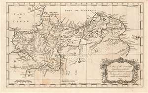
A Map of the Orenburgh Expedition, with the Russian Frontiers towards Independent Tartary, made in Orenburgh in 1747.
$550.00
Acquire
- Digital Map Information
- Suitable for large format printing
- Full resolution TIFF file
- ICC color profile embedded
- Delivered instantly via download link
This fascinating map, engraved by John Gibson in 1753, depicts modern-day southern Russia, along the empire's contentious frontier with the lands of the Kazakh and Oirat tribes. These and other tribes from what the map terms 'Independent Tartary' made regular incursions into Russian territory, and the first part of the 18th century was characterized by Russia's efforts to stem those incursions. Among these efforts was the construction of the Irtysh line, a series of fortifications clearly shown on this map spanning the Volga and the Irtysh Rivers, for much of the distance following the north bank of the Ural, or Yaik river. The map distinguishes between those fortifications already constructed, and those which were yet intended to be built. (more details)
Jesuit Conception of the Mogul Empire.
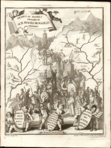
Genius ac Mores Indorum Sub Magni Mogolis Imperio.
$500.00
Acquire
- Digital Map Information
- Suitable for large format printing
- File Size: 5.52 MB
- File Type: ZIP / TIFF
- ICC color profile embedded
- Delivered instantly via download link
This is a fascinating allegorical engraving representing the Mogul Empire was composed by the German religious painter Johann Degler. It was issued in Heinrich Scherer's 1702 Atlas Novus. (more details)
After the conquest of Khiva.
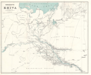
Khanate of Khiva after Russian sources.
$500.00
Acquire
- Digital Map Information
- Suitable for large format printing
- File Size: 24.08 MB
- File Type: ZIP / TIFF
- ICC color profile embedded
- Delivered instantly via download link
This is an 1875 Herbert William Wood map of the Khanate of Khiva in modern-day Uzbekistan - issued shortly after the 1873 Russian conquest of Khiva, a defining moment in the Great Game. (more details)
Detailing the Empires of the East.
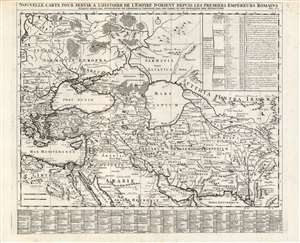
Nouvelle carte pour servir a l'Histoire de l'Empire d'Orient Depuis les Premiers Empereurs Romains.
$500.00
Acquire
- Digital Map Information
- Suitable for large format printing
- DPI: 600
- File Size: 66.62 MB
- File Type: ZIP / TIFF
- ICC color profile embedded
- Delivered instantly via download link
A superbly engraved 1719 Chatelain map of the Middle and Near East, presenting the ancient cities and kingdoms of those regions in the time of the Persian Empire and early Roman Empire. It spans from the eastern Mediterranean to the mouth of the Indus River. It centers on the Black and Caspian Seas, and embraces from the Persian Gulf to the full course of the Volga River. The map applies what was state-of-the-art geographical information to the place names of antiquity, thus placing the ancient eastern world in a more understandable context. The map shows ancient administrative divisions, regional names, major cities, towns and forts. Mountains and forests are shown pictorially. Extensive tables - one listing cities and towns, the other listing the prefectures and Dioceses at that time under the dominion of the Ottoman Empire - use a coordinate system to aid in finding the listed places on the map itself. The map was included in Chatelain's seven-volume historical atlas of the world, one of the largest and broadest Dutch encyclopedias of the early eighteenth century. In addition to its geographical information, it was a treasure trove of historical, political and even genealogical information. Chatelain's maps drew on the work of his day's finest geographers, including De l'Isle and De Fer. (more details)
First lithograph map of Xinjiang, China.
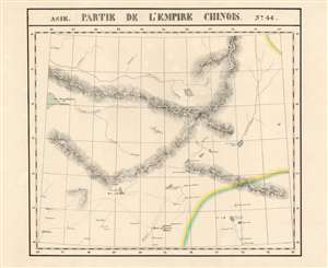
Partie de L'Empire Chinois. Asie no. 44.
$400.00
Acquire
- Digital Map Information
- Suitable for large format printing
- Full resolution TIFF file
- ICC color profile embedded
- Delivered instantly via download link
This is Vandermaelen's 1827 map of Xinjiang Province, northwestern China, and south-central Mongolia. It is the first map of the region produced by lithography. Xinjiang, even in the 19th century, remained for Europeans one of the least-understood parts of the world. (more details)
Botanical excursion through Central Asia.
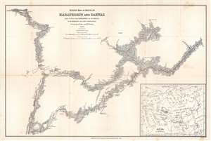
Survey Map of Route in Karateghin and Darwaz Made During the Expedition of Dr. Regel.
$375.00
Acquire
- Digital Map Information
- Suitable for large format printing
- File Size: 17.72 MB
- File Type: ZIP / TIFF
- ICC color profile embedded
- Delivered instantly via download link
This is an 1886 M. Kossiakof map of Turkestan in Central Asia. Red lines trace Kossiakof's route through the Rasht Valley (Karateghin) and Darvaz (Darwaz) regions with the 1881 Regel Expedition. The primarily botanically focused 1881 expedition was led by Johann Albert von Regel (1845 - 1909), a Swiss-Russian physician and botanist. Nonetheless, the Regel Expedition was one of the first European penetrations into the area. Kossiakof was a military topographer attached to the mission. He mapped the region, labeling cities, towns, and villages through which the group passed. Rivers are illustrated. In the lower right corner, an inset map of Asia and eastern Europe situates the depicted area in a continental manner. The map covers only the actual path followed, along with the observable surrounds, underscoring Kossiakof's integrity in illustrating only scientifically confirmed geography. (more details)