
Kentucky - Tennessee
'The Father of Waters again goes unvexed to the sea.'
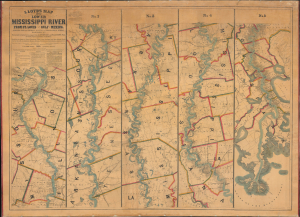
Lloyd’s Map of the Lower Mississippi River From St. Louis to the Gulf of Mexico. Compiled from Government Surveys in the Topographical Bureau...
$17,000.00
Acquire
- Digital Map Information
- Suitable for large format printing
- File Size: 104.66 MB
- File Type: ZIP / TIFF
- ICC color profile embedded
- Delivered instantly via download link
This is James T. Lloyd's engrossing 1863 large-format map of the Mississippi River, produced during the U.S. Civil War (1861 - 1865). It provides a comprehensive overview of the economically vital and strategically critical waterway, then a hotly contested theater of war vital to both the Union and the Confederacy. (more details)
Racing on the Mississippi.
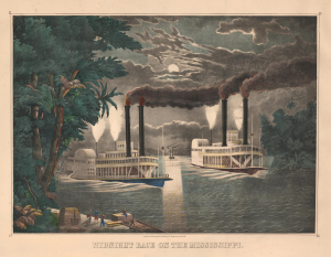
Midnight Race on the Mississippi.
$3,500.00
Acquire
- Digital Map Information
- Suitable for large format printing
- File Size: 39.32 MB
- File Type: ZIP / TIFF
- ICC color profile embedded
- Delivered instantly via download link
This is Thomas Kelly's c. 1865 large, folio hand-colored lithographic view of a nighttime steamboat race on the Mississippi River. Such races were a dangerous but popular sport in mid-19th-century America, when steamboat companies on the Mississippi and other major rivers competed for the 'fastest ride'. Some such races became famous and were recorded in many popular paintings and decorative prints by artists like Kelly, as here, and Currier and Ives. (more details)
The United States for the curious Swede.
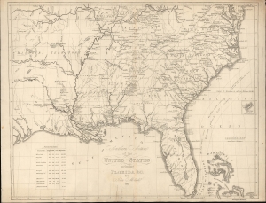
Southern Section of the United States including Florida etc. by John Melish.
$2,400.00
Acquire
- Digital Map Information
- Suitable for large format printing
- File Size: 17.01 MB
- File Type: ZIP / TIFF
- ICC color profile embedded
- Delivered instantly via download link
This is a rare 1824 Swedish map of Florida and the Southeastern United States published by Axel Leonard Klinckowström after the scarce 1816 map of John Melish. The map accompanied Klinckowström's Tocqueville-style narrative, expounding on the United States for Swedish audiences. (more details)
Updating the Evans Map: First Map with Louisville
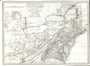
Carte Generale des Etats de Virginie, Maryland, Delaware, Pensilvanie, Nouveau-Jersey, New-York, Connecticut et Isle de Rhodes Ainsi que des Lacs Erie, Ontario, et Champlain. D'Apres la Carte Ameriquaine de Louis Evans et la Carte Anglaise de Thomas-Jefferys, pour les Lettres d'un Cultivateur Amériquain.
$1,950.00
Acquire
- Digital Map Information
- Suitable for large format printing
- DPI: 600
- File Size: 68.46 MB
- File Type: ZIP / TIFF
- ICC color profile embedded
- Delivered instantly via download link
An elegant 1787 French edition of Louis Evans' seminal and influential map of the Middle British Colonies, one of the most important maps of the British colonies and the best colonial mapping of the Ohio River Valley. It was issued for Michel Guillaume St. Jean de Crevecoeur's 1787 Lettres d'un Cultivateur Ameriquain, one of the most influential works on colonial America. (more details)
Settling the Upper Midwest.
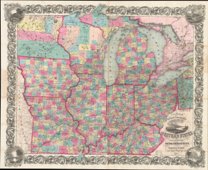
Colton's Railroad and Township Map Western States compiled from the United States Surveys. / Map of the Western States.
$1,500.00
Acquire
- Digital Map Information
- Suitable for large format printing
- File Size: 121.82 MB
- File Type: ZIP / TIFF
- ICC color profile embedded
- Delivered instantly via download link
This is a lovely, decorative, large-format 1854 pocket map of the American Midwest by Joseph H. Colton. It captures the region in the years before the U.S. Civil War and is notable for including Minnesota as a territory as well as demonstrating the rapid expansion of railroads throughout the Midwest. (more details)
Transitional state of H.S. Tanner's Kentucky and Tennessee.
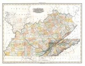
Kentucky and Tennessee by H. S. Tanner.
$1,500.00
Acquire
- Digital Map Information
- Suitable for large format printing
- DPI: 600
- File Size: 28.2 MB
- File Type: ZIP / TIFF
- ICC color profile embedded
- Delivered instantly via download link
This is a rare transitional state of Henry S. Tanner's 1823 map of Kentucky and Tennessee. The map captures the creation of Wood Lake following the New Madrid Earthquakes. (more details)
Benchmark Map of the Northwest Territory.
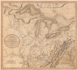
A New Map of Part of the United States of North America, exhibiting The Western Territory, Kentucky, Pennsylvania, Maryland, Virginia and C. Also, the Lakes Superior, Michigan, Huron, Ontario and Erie; with Upper and Lower Canada and C. From the Latest Authorities.
$1,200.00
Acquire
- Digital Map Information
- Suitable for large format printing
- File Size: 22.49 MB
- File Type: ZIP / TIFF
- ICC color profile embedded
- Delivered instantly via download link
Prepared by John Cary in 1805, this is one of the most interesting and attractive maps of the American Frontier and the Great Lakes to emerge in the first years of the 19th century. It provides a detailed snapshot of the western United States in the early years of the republic. (more details)
Louisiana on the cusp of the Louisiana Purchase.
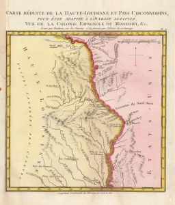
Carte Reduite de la Haute-Louisiane et Pays Circonvoisins, pour etre adaptee a l'ouvrage intitule Vue de la Colonie Espagnole du Mississipi, et c.
$1,000.00
Acquire
- Digital Map Information
- Suitable for large format printing
- DPI: 600
- File Size: 3.93 MB
- File Type: ZIP / TIFF
- ICC color profile embedded
- Delivered instantly via download link
This is Alexandre's Blondeau's exceptional 1803 map of Spanish-administered upper Louisiana, issued for Pierre-Louis Berquin Duvallon's travel narrative, Vue de la Colonie Espagnole due Mississipi. It is one of the best maps to capture the Upper Mississippi Valley on the cusp of the Louisiana Purchase. The map moreover underscores the significance of the Mississippi River as a trade artery between the Great Lakes, and hence the Atlantic, and the Gulf of Mexico. (more details)
Presentation issue of foundational Kentuky Geolgical Map.
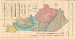
Geologic Map of Kentucky.
$950.00
Acquire
- Digital Map Information
- Suitable for large format printing
- Full resolution TIFF file
- ICC color profile embedded
- Delivered instantly via download link
An exceptional presentation issue of Willard Rouse Jillson's 1929 geological map of Kentucky, compiled from the landmark Sixth Kentucky Geological Survey (1925 - 1928). The map provides an extraordinary record of the state's geology and mineral wealth during a formative period of industrial and natural resource development. This presentation example is inscribed to Major Maurice Kirby Gordon (1878 - 1974), an important Madisonville attorney, Kentucky historian, World War I officer, and founding figure of the American Legion whose research focused extensively on western Kentucky coal mining and regional development. (more details)
Hail Kentucky, Alma Mater!
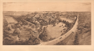
State University of Kentucky.
$950.00
Acquire
- Digital Map Information
- Suitable for large format printing
- File Size: 19.56 MB
- File Type: ZIP / TIFF
- ICC color profile embedded
- Delivered instantly via download link
A rare 1911 Arthur J. Elder / Littig bird's-eye view map of the University of Kentucky - here in its first edition. This view is in the style of the more famous contemporaneous university viewmaker Richard Rummell and was published by Littig, also Rummell's publisher. It is one of only 4 known university views drawn by Elder. (more details)
1817 Thomson Map of the Southeastern United States: Georgia, Carolina, Virginia, Tennessee, Kentucky
A young nation looking west.
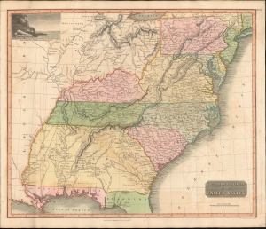
Southern Provinces of the United States.
$950.00
Acquire
- Digital Map Information
- Suitable for large format printing
- DPI: 600
- File Size: 633.59 MB
- File Type: ZIP / TIFF
- ICC color profile embedded
- Delivered instantly via download link
A scarce first edition of John Thomson's 1817 map of the southeastern part of the United States. Thomson prepared this map during a transitional period of expansion shortly following the American Revolutionary War and is among most thorough treatments of this region prior to the U.S. Government Surveys. It records early U.S. efforts to acquire and assimilate American Indian territories west of the Appalachian Mountains. (more details)
Confederate Civil War Map.
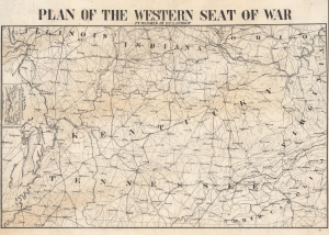
Plan of the Western Seat of War.
$850.00
Acquire
- Digital Map Information
- Suitable for large format printing
- File Size: 18.78 MB
- File Type: ZIP / TIFF
- ICC color profile embedded
- Delivered instantly via download link
This is a c. 1862 Confederate-printed map of the Western Theater of War during the American Civil War (1861 - 1865) created in New Orleans by Henry P. Lathrop. The Western Theater saw some of the war's most brutal fighting, and the Union's first major victories occurred in this theater. Confederate maps of any kind are exceedingly rare as most southern cities lacked supplies or a printing infrastructure capable of supporting map production. (more details)
Early map of the Bluegrass State.
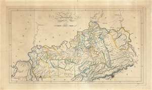
Kentucky.
$800.00
Acquire
- Digital Map Information
- Suitable for large format printing
- DPI: 600
- File Size: 28.74 MB
- File Type: ZIP / TIFF
- ICC color profile embedded
- Delivered instantly via download link
An 1814 map of the state of Kentucky by Matthew Carey and engraved by Enoch Gridley for the 1814 edition of Carey's General Atlas. Produced roughly twenty years after Kentucky gained statehood, it gives a sense of the rapid development of the state. (more details)
The United States Colored Troops.
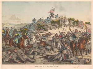
Battle of Nashville.
$750.00
Acquire
- Digital Map Information
- Suitable for large format printing
- File Size: 41.56 MB
- File Type: ZIP / TIFF
- ICC color profile embedded
- Delivered instantly via download link
This is an 1891 Kurz and Allison chromolithograph American Civil War (1861 - 1865) view of the Battle of Nashville, Tennessee. Union troops are illustrated on the left storming Confederate redoubts. United States Colored Troops are prominently featured courageously advancing in the face of point-blank musket fire. The bulk of the illustrated Confederate soldiers appear in the lower right retreating from determined Federal soldiers. (more details)
End of the Era of Steamboat Racing.
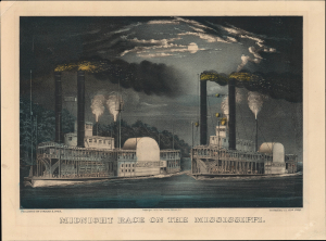
Midnight Race on the Mississippi.
$650.00
Acquire
- Digital Map Information
- Suitable for large format printing
- File Size: 11.67 MB
- File Type: ZIP / TIFF
- ICC color profile embedded
- Delivered instantly via download link
A gorgeous 1872 Currier and Ives hand-colored lithograph of steamboats racing on the Mississippi River. By the time of its publication, steamboat racing and river steamboats were becoming less popular, imbuing the piece with a touch of nostalgia. (more details)
Naval Battle at Fort Pillow, Tennessee.
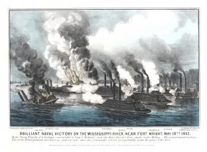
Brilliant Naval Victory on the Mississippi River, near Fort Wright, May 10, 1862.
$600.00
Acquire
- Digital Map Information
- Suitable for large format printing
- File Size: 9.35 MB
- File Type: ZIP / TIFF
- ICC color profile embedded
- Delivered instantly via download link
A rare American Civil War naval combat scene. This is an 1862 Currier and Ives view of the American Civil War naval battle of Plum Point Bend (also known as Battle of Fort Pillow), fought on the Mississippi River in Tennessee. The view illustrates the close-quarters fighting between Confederate and Federal ironclads. The Federal ironclads Cincinnati, Cairo, Benton, St. Louis, and Carondelet occupy the foreground. Multiple vessels are sinking or on fire such that the chaos of battle is almost palpable. (more details)
One of Ulysses S. Grant's first victories in the Civil War.
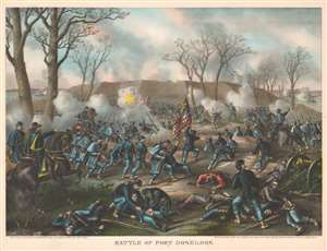
Battle of Fort Donelson.
$600.00
Acquire
- Digital Map Information
- Suitable for large format printing
- File Size: 52.07 MB
- File Type: ZIP / TIFF
- ICC color profile embedded
- Delivered instantly via download link
This is an 1887 Kurz and Allison view of the American Civil War (1861 - 1865) Battle of Fort Donelson, Tennessee. The view illustrates the Union Army of the Tennessee commanded by Brigadier General Ulysses S. Grant (depicted on the left astride a horse) assaulting the Confederate stronghold at Fort Donelson. (more details)
Land of Lincoln.
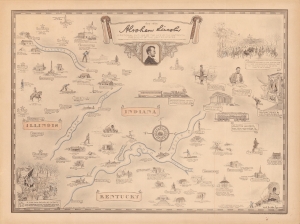
Abraham Lincoln, a pictorial outline of the life of the sixteenth president of the United States.
$500.00
Acquire
- Digital Map Information
- Suitable for large format printing
- File Size: 52.94 MB
- File Type: ZIP / TIFF
- ICC color profile embedded
- Delivered instantly via download link
A curious historical 1934 Karl Smith pictorial map of portions of Kentucky, Illinois, and Indiana, along with Washington, D.C. It traces the momentous life of Abraham Lincoln, from his childhood, to his presidency, through the Civil War, to his final resting place in Springfield, Illinois. (more details)
First Battle of Corinth.
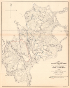
Map of the Country Between Monterey, Tenn. And Corinth,Miss. Showing the Lines of Entrenchments Made and the Routes Followed by the U.S. Forces under the Command of Maj. Gen'l. Halleck, U.S. Army, in Their Advance Upon Corinth, in May 1862.
$500.00
Acquire
- Digital Map Information
- Suitable for large format printing
- File Size: 78.4 MB
- File Type: ZIP / TIFF
- ICC color profile embedded
- Delivered instantly via download link
This is a separate issue 1862 Otto H. Matz map of American Civil War troop movements leading to the capture of Corinth, Mississippi, in May 1862. The map depicts from Cane Creek and the Tuscumbia River to Springer, Tennessee and Johnston, Mississippi and from Monterey, Tennessee to the George homestead in Mississippi. (more details)
Illustrates the original nine counties established before Kentucky's admission into the Union.
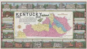
Sesquicentennial of Kentucky 1792 1942 Map Showing the nine Counties formed by Virginia before Kentucky was admitted to the Union June 1, 1792 with their County Seats and present Counties with dates of formation and early stations.
$450.00
Acquire
- Digital Map Information
- Suitable for large format printing
- File Size: 20.59 MB
- File Type: ZIP / TIFF
- ICC color profile embedded
- Delivered instantly via download link
This is a 1942 Bayless Hardin map of Kentucky to celebrate the state's sesquicentennial, or the 150th anniversary of Kentucky's admission into the Union. The map depicts the state from Missouri to Virginia and West Virginia and from the Ohio River to Tennessee. An unconventional illustration of the state, the nine differently colored counties are those established by Virginia before Kentucky was admitted to the Union. Each of these nine counties is labeled, and the present counties are all illustrated and labeled as well, along with their date of formation. Numerous cities and towns are labeled throughout, including Frankfort, Louisville, and Lexington. Several rivers, streams, and creeks are labeled, as well as forts from the state's frontier days. Two vignettes are included just above the map of Kentucky, one illustrating Fort Boonesboro and the other Constitution Square in Danville. Below the map, an illustration of the 'Kentucky' rifle is included as well. (more details)
Burr's first edition map of Kentucky and Tennessee.
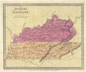
Kentucky and Tennessee.
$450.00
Acquire
- Digital Map Information
- Suitable for large format printing
- DPI: 300
- File Size: 5.32 MB
- File Type: ZIP / TIFF
- ICC color profile embedded
- Delivered instantly via download link
This is an 1834 first edition map of Kentucky and Tennessee issued by David. H. Burr. It depicts the two states in detail noting rivers, cities, towns, roads and elevation rendered in profile. According to Ristow, although Burr is credited on the title page, he ... (more details)
The first significant Union victory during the U.S. Civil War.
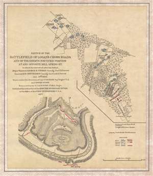
Sketch of the Battlefield of Logan's Cross Roads and of the Enemy's Fortified Position at and opposite Mill Spring, KY.
$375.00
Acquire
- Digital Map Information
- Suitable for large format printing
- File Size: 3.21 MB
- File Type: ZIP / TIFF
- ICC color profile embedded
- Delivered instantly via download link
This is an 1877 separate issue Edmund Ruger and Nathaniel Michler map of the American Civil War Battlefield of Logan's Cross Roads / Mill Springs. Located near present-day Nancy, Kentucky, the map depicts the region in two sections: one from the intersection of the Jamestown Road and the Somerset Road to a Confederate Field Hospital along the Mill Spring Road, and then from approximately 1.25 miles from Mill Spring across the Cumberland River to Mill Spring. By separating the map, the cartographer was able to illustrate two separate actions (the Battle of Logan's Cross Roads and the Confederate entrenchment at Mill Spring) on the same sheet. In depicting the Battle of Logan's Cross Roads, numerous Union encampments are illustrated and labeled, as are positions occupied by both Union and Confederate troops. The course of the battle is also included by using shading to illustrate how the Union and Confederate positions changed throughout the battle; Union forces are marked with blue and Confederate positions are noted in red. (more details)
Turning the Tide in the West.
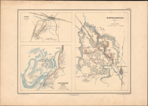
Murfreesborough (Tennessee). / Iuka (Mississippi). / Chickasaw Bayou (Mississippi).
$350.00
Acquire
- Digital Map Information
- Suitable for large format printing
- File Size: 9.65 MB
- File Type: ZIP / TIFF
- ICC color profile embedded
- Delivered instantly via download link
This is Ernest Dumas-Vorzet's 1890 map of Murfreesboro, Tennessee, and Iuka and Chickasaw Bayou in Mississippi, prepared for the 1890 book Histoire de la Guerre Civile en Amérique. (more details)
A Crushing Defeat for the Confederacy at Nashville.
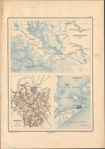
Brashear City (Louisianie) / Nashville (Tennessee) / Galveston (Texas).
$350.00
Acquire
- Digital Map Information
- Suitable for large format printing
- File Size: 10.28 MB
- File Type: ZIP / TIFF
- ICC color profile embedded
- Delivered instantly via download link
This sheet, including three detailed maps, was prepared by Ernest Dumas-Vorzet for the 1890 work Histoire de la Guerre Civile en Amérique. It maps battles at Nashville, Galveston, and Brashear City, three important battles in the Western and Trans-Mississippi Theaters of the U.S. Civil War. (more details)
One of the First Union Victories of the Civil War.
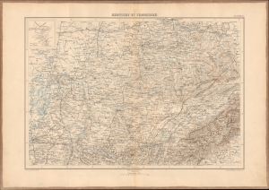
Kentucky et Tennessee.
$350.00
Acquire
- Digital Map Information
- Suitable for large format printing
- File Size: 23.03 MB
- File Type: ZIP / TIFF
- ICC color profile embedded
- Delivered instantly via download link
This impressive 1890 map of Kentucky, Tennessee, and portions of neighboring states was prepared by Ernest Dumas-Vorzet for his Histoire de la Guerre Civile en Amérique. Among the larger maps in the atlas volume of the work, it highlights a large portion of the Western Theater, a bright spot for the Union early in the war. (more details)
The Western Theater - a Bright Spot for the Union.
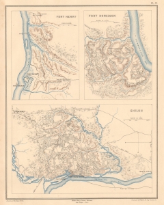
Fort Henry Fort Donelson Shiloh.
$350.00
Acquire
- Digital Map Information
- Suitable for large format printing
- File Size: 6.43 MB
- File Type: ZIP / TIFF
- ICC color profile embedded
- Delivered instantly via download link
This sheet includes three highly detailed 1890 Dumas Vorzet maps of Fort Henry, Fort Donelson, and Shiloh, Tennessee, sites of early battles in the Western Theater of the American Civil War. It was issued to illustrate the scarce atlas volume of the French edition of Philippe d'Orléans' Histoire de la Guerre Civile en Amérique. (more details)
Early Battles Point towards the Future Course of the Civil War.
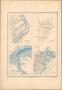
Belmont. / Pea Ridge. / Hampton Roads. / Ile No. 10 et ses abords.
$350.00
Acquire
- Digital Map Information
- Suitable for large format printing
- File Size: 9.1 MB
- File Type: ZIP / TIFF
- ICC color profile embedded
- Delivered instantly via download link
This is Ernest Dumas-Vorzet's 1890 map of the battles of Belmont, Pea Ridge, and Island No. 10, and the naval battle of Hampton Roads, prepared for his Histoire de la Guerre Civile en Amérique. (more details)
Proposed early Tennessee Railroads.
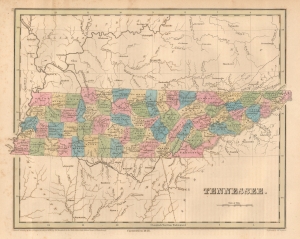
Tennessee.
$300.00
Acquire
- Digital Map Information
- Suitable for large format printing
- File Size: 7.37 MB
- File Type: ZIP / TIFF
- ICC color profile embedded
- Delivered instantly via download link
This is an 1846 Thomas G. Bradford map of Tennessee. Coverage embraces Tennessee in full, with significant parts of adjacent Kentucky, Georgia, Alabama, and Mississippi. (more details)
From Chickasaw Territory to Cotton Belt.
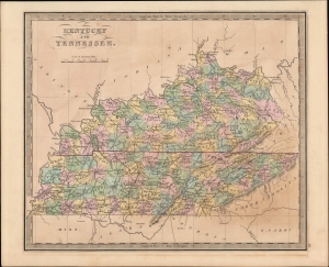
Kentucky and Tennessee.
$300.00
Acquire
- Digital Map Information
- Suitable for large format printing
- Full resolution TIFF file
- ICC color profile embedded
- Delivered instantly via download link
A hand-colored 1849 map of Kentucky and Tennessee by Jeremiah Greenleaf which appeared in his New Universal Atlas. (more details)
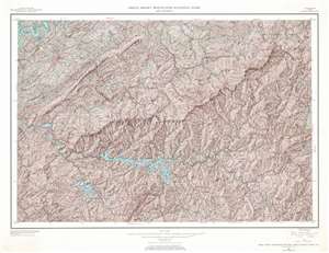
Great Smoky Mountains National Park and Vicinity.
$300.00
Acquire
- Digital Map Information
- Suitable for large format printing
- File Size: 96.45 MB
- File Type: ZIP / TIFF
- ICC color profile embedded
- Delivered instantly via download link
This is a 1968 U.S. Geological Survey topographical map of Great Smoky Mountains National Park and its vicinity. The map depicts the region from the Cherokee National Forest and the Tennessee River to the Pisgah National Forest and from the Bays Mountains and the Tennessee River to the Nantahala National Forest. Highly detailed, innumerable locations throughout the park and its vicinity are identified. Ridges, peaks, gaps, knobs, and tops are all labeled. The Appalachian Trail winds its way across the map, as do numerous other trails (both maintained and not) and roads of varying degree of improvement. Blue colored creeks, rivers, and lakes stand out against the brown terrain of the surrounding mountains. Towns are noted throughout the vicinity of the park, such as Sevierville and Maryville, Tennessee and Robbinsville, North Carolina. Counties are also noted. (more details)
From Harper Lee to Mark Twain.
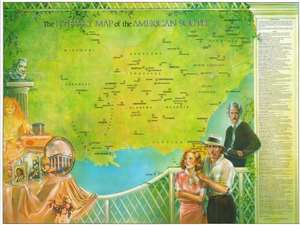
This is a 1988 Linda Ayriss and Brian Ladner literary map of the American Southeast. Coverage extends from Harper's Ferry, West Virginia, south as far as central Florida. Eighty locations associated with regional literature are numerically labeled. Among these are the homes of authors and where works were set. The index along the right border lists authors alphabetically, including Truman Capote, Hellen Keller, Flannery O'Connor, Mark Twain, Harriet Beecher Stowe, and others. (more details)
Charming view of the city of Louisville, Kentucky.
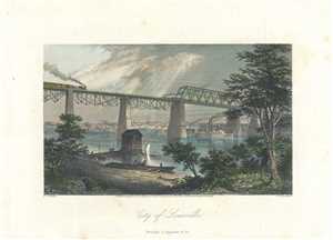
City of Louisville.
$275.00
Acquire
- Digital Map Information
- Suitable for large format printing
- Full resolution TIFF file
- ICC color profile embedded
- Delivered instantly via download link
This is a charming view of the city of Louisville, Kentucky issued by Appleton in 1872. It features a view of the Ohio River with bridge with the buildings of Louisville in background. The foreground shows the riverbank and pier with fishermen and boats. The ... (more details)