
Kentucky - Tennessee (sold)
Important colonial period map of the American Southeast - with seashell and coral cartouche!
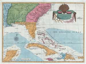
A Map of Carolina, Florida and the Bahama Islands with the Adjacent Parts.
sold
- Digital Map Information
- Suitable for large format printing
- DPI: 300
- File Size: 9.49 MB
- File Type: ZIP / TIFF
- ICC color profile embedded
- Delivered instantly via download link
A fine example of Mark Catesby’s rare 1743 / 1771 map of the southeastern parts of North America. This map is considered one of the finest maps of the colonial era American southeast. The map covers from the Mississippi River and from Cape Charles and Cape Henry to Jamaica, including all of North Carolina, South Carolina, Georgia, Florida, Louisiana, Cuba, Hispaniola, the Bahamas, Porto Rico, and parts of the Yucatan. Among other features, the map is notable for its remarkable cartouche design, which includes shells, corals, and seaweeds indigenous to the Americas. The map is furthermore an important reference for early forts, Indian tribes, English factories, and more in the southeast. The river systems of Georgia and Carolina are particularly impressive in their detail. (more details)
Geographical Reader for Dixie Children.
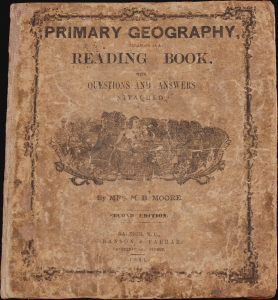
Primary Geography Arranged as a Reading Book, with Questions and Answers Attached.
sold
- Digital Map Information
- Suitable for large format printing
- Full resolution TIFF file
- ICC color profile embedded
- Delivered instantly via download link
This is a rare 1864 geographical atlas by Marinda Branson Moore prepared for Confederate children. Published during the American Civil War (1861 - 1865), the work only maps the Confederate States and contains historically relevant, if racially offensive, text critical of the Union. The work, as expressed by historians O. L. Davis, Jr. and Serena Rankin Parks, addresses the concerns of Southern schoolteachers who saw existing published textbooks as 'blighted with by Yankee biases and inaccuracies.' (more details)
An Essential American Revolutonary War map rvised to reflect the independence of the United States.
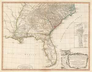
A New and General Map of the Southern Dominions Belonging to The United States of America, viz: North Carolina, South Carolina, and Georgia: with the Bordering Indian Countries, and The Spanish Possessions of Louisiana and Florida.
sold
- Digital Map Information
- Suitable for large format printing
- DPI: 600
- File Size: 24.8 MB
- File Type: ZIP / TIFF
- ICC color profile embedded
- Delivered instantly via download link
A scarce 1794 map of the southeastern part of the United States and Florida issued by the London firm of Laurie and Whittle. The coverage extends from North Carolina to the Florida Keys and from just beyond the Mississippi River to the Atlantic seaboard and the Bahamas. It encompasses the modern-day states of North Carolina, South Carolina, Georgia, Kentucky, Tennessee, Alabama, Mississippi, Louisiana (very little detail), and Florida. At right, there are inset detail maps of Charleston and St. Augustine. (more details)
Nautical map by the French during the American Revolutionary War.
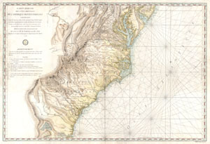
Carte Reduite Des Cotes Orientales De L'amerique Septentrionale Contenant Partie du Nouveau Jersey, la Pen-sylvanie, le Mary-land, la Virginie, la Caroline Septentrionale, la Caroline Meridionale et la Georgie, Assujettie aux Observations les plus recentes et aux Cartes de detail les plus estimées. Dressée au Dépôt Général des Cartes, Plans et Journaux de la Marine. Pour le Service des Vaisseaux Français Par Ordre de M. de Sartine, Conseiller d'Etat, Ministre et Secretaire d'Etat, ayant le Département de la Marine. 1778.
sold
- Digital Map Information
- Suitable for large format printing
- Full resolution TIFF file
- ICC color profile embedded
- Delivered instantly via download link
A rare and extraordinary map of considerable historic importance. This map, which covers from New Jersey and Pennsylvania southward through Maryland and Virginia, then along the Carolina coast to Georgia and Florida, was issued by the French 'Depot General de la ... (more details)
Manuscript Map of the Battle of Shiloh. - drawn by a participant.
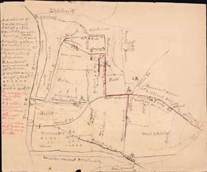
[Battle of Shiloh].
sold
- Digital Map Information
- Suitable for large format printing
- File Size: 39.14 MB
- File Type: ZIP / TIFF
- ICC color profile embedded
- Delivered instantly via download link
This is a c. 1865 manuscript map of the American Civil War Battle of Shiloh (April 6 - 7, 1862) drawn by Jehiel D. Lyon, a solider who participated in the battle with the 1st Ohio Infantry Regiment. (more details)
An exceptionally beautiful early map of Kentucky and Tennessee.
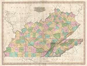
Kentucky and Tennessee by H. S. Tanner.
sold
- Digital Map Information
- Suitable for large format printing
- DPI: 300
- File Size: 15.45 MB
- File Type: ZIP / TIFF
- ICC color profile embedded
- Delivered instantly via download link
A rare and important map of Kentucky and Tennessee by H. S. Tanner. This elephant folio map covers both states in full as well as, in less detail, parts of adjacent states. The map shows rivers, topography by hachure, cities, towns and roadways. Tanner first ... (more details)
First large-scale commercial map of the Confederacy.
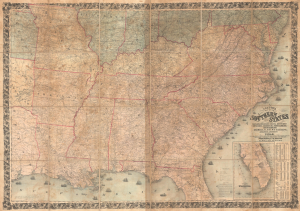
Colton's Map of the Southern States, including Maryland, Delaware, Virginia, Kentucky, Tennessee, Missouri, North Carolina, South Carolina, Georgia, Alabama, Mississippi, Arkansas, Louisiana, and Texas. Showing Also Part of Adjoining States and Territories Locating the Forts and Military Stations of the U. States and Showing all the Rail Roads, R.R. Stations, and other Internal Improvements.
sold
- Digital Map Information
- Suitable for large format printing
- File Size: 198.45 MB
- File Type: ZIP / TIFF
- ICC color profile embedded
- Delivered instantly via download link
This is an 1861 J. H. Colton map of the Confederacy published in the first year of the American Civil War (1861 - 1865). This is the first large-scale commercial map of the Confederacy, published early in 1861, in the immediate wake of the Secession. (more details)
An unusual treasure of American Folk Art.

For Gun and Women, and Horse and Flask, These are Our Law, Let Any Ask.
sold
- Digital Map Information
- Suitable for large format printing
- File Size: 3.74 MB
- File Type: ZIP / TIFF
- ICC color profile embedded
- Delivered instantly via download link
An extraordinary bit of Americana. This Folk Art manuscript (hand drawn) map of Kentucky was produced by an unknown artist in 1929. The map, though somewhat difficult to interpret, covers Kentucky from Reelfoot Lake on the Tennessee-Missouri-Kentucky border ... (more details)
Best general map of the Southeast of the 18th Century.
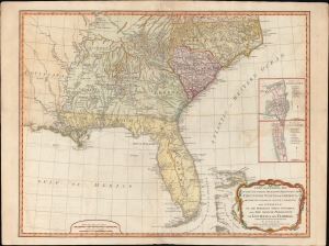
A New and General Map of the Southern Dominions Belonging to the United States of America, viz: North Carolina, South Carolina, and Georgia: with the Bordering Indian Countries and The Spanish Possessions of Louisiana and Florida.
sold
- Digital Map Information
- Suitable for large format printing
- DPI: 600
- File Size: 723.14 MB
- File Type: ZIP / TIFF
- ICC color profile embedded
- Delivered instantly via download link
A scarce 1794 Laurie and Whittle / Sayer map of the southeastern part of the United States and Florida. This is the second edition of Sayer's map of the southeast, and the first to recognize the United States as an independent nation. At the time of initial publication, it represented the finest general cartography of the southeast obtainable. (more details)
Later edition of Lewis Evans' map, considered a milestone both for its political significance and expansion of cartographic knowledge.

Carte Generale des Etats de Virginie, Maryland, Delaware, Pensilvanie, Nouveau-Jersey, New-York, Connecticut et Isle de Rhodes Ainsi que des Lacs Erie, Ontario, et Champlain. D'Apres la Carte Ameriquaine de Louis Evans et la Carte Anglaise de Thomas-Jefferys.
sold
- Digital Map Information
- Suitable for large format printing
- DPI: 300
- File Size: 17.66 MB
- File Type: ZIP / TIFF
- ICC color profile embedded
- Delivered instantly via download link
A fine and scarce French edition of Louis Evans' highly influential map of the Middle British Colonies, one of the most important maps of the British Colonies to appear in the 18th century. The map covers Louisville on the Ohio River eastward as far as ... (more details)
Later edition of Lewis Evans' map, considered a milestone both for its political significance and expansion of cartographic knowledge.
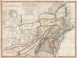
Carte Generale des Etats de Virginie, Maryland, Delaware, Pensilvanie, Nouveau-Jersey, New-York, Connecticut et Isle de Rhodes Ainsi que des Lacs Erie, Ontario, et Champlain. D'Apres la Carte Ameriquaine de Louis Evans et la Carte Anglaise de Thomas-Jefferys.
sold
- Digital Map Information
- Suitable for large format printing
- DPI: 300
- File Size: 16.54 MB
- File Type: ZIP / TIFF
- ICC color profile embedded
- Delivered instantly via download link
A scarce French edition of Louis Evans' highly influential map of the Middle British Colonies, one of the most important maps of the British Colonies to appear in the 18th century. The map covers Louisville on the Ohio River eastward as far as ... (more details)
A fine example of one of the second earliest obtainable map of Tennessee, issued 1796, the first year of Tennessee's statehood.
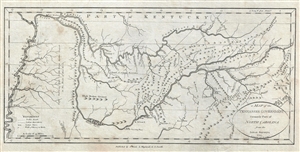
A Map of the Tennassee Government formerly Part of North Carolina from the latest Surveys. 1795.
sold
- Digital Map Information
- Suitable for large format printing
- DPI: 300
- File Size: 3.78 MB
- File Type: ZIP / TIFF
- ICC color profile embedded
- Delivered instantly via download link
A fine example of one of the second earliest obtainable map of Tennessee, issued 1796, the first year of Tennessee's statehood. This is the rare first state of John Reid's 1796 Map of the Tennassee Government . Cartographically derived from ... (more details)
The Southern Railway and the Florida Central and Peninsular Railroad.
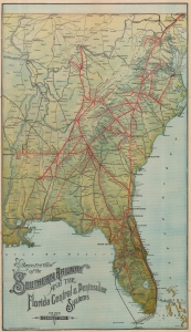
Birds Eye View of the Southern Railway and the Florida Central and Peninsula Systems and Their Connections.
sold
- Digital Map Information
- Suitable for large format printing
- Full resolution TIFF file
- ICC color profile embedded
- Delivered instantly via download link
A rare find, this is the c. 1894 American Bank Note bird's-eye view railroad map of the eastern United States published by the Southern Railway. It cleverly employs the view perspective to focus on the Southern States, particularly Florida, while still showing connections to networks to the north. (more details)
The state of Franklinia. The first map of the United States by a Southerner.
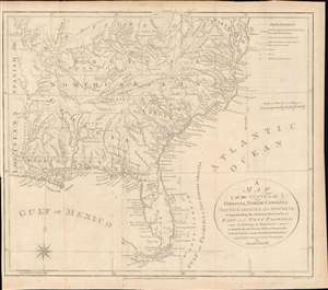
A Map of the States of Virginia, North Carolina, South Carolina and Georgia; Comprehending the Spanish Provinces of East and West Florida: Exhibiting the Boundaries as fixed by the late Treaty of Peace between the United States and the Spanish Dominions.
sold
- Digital Map Information
- Suitable for large format printing
- DPI: 600
- File Size: 242.41 MB
- File Type: ZIP / TIFF
- ICC color profile embedded
- Delivered instantly via download link
This 1792 Joseph Purcell map of the United States recording post-Revolutionary War westward expansion. This is one of the earliest maps to identify the ephemeral pseudo-state of Franklinia, the claims of the Ohio Company of Associates, the lands of the New Jersey and Wabash Companies, the Cumberland Settlement, and the Moravian Settlement. It is moreover, one of the best maps of the American Indian nations in the southeast - benefiting from Purcell's firsthand reconnaissance. Significantly, this is also the first maps of the United States by a southern cartographer. (more details)
An important and fascinating mapping of the American Southeast just prior to the French and Indian War.
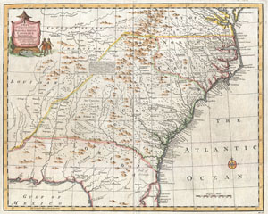
A New and Accurate Map of the Provinces of North and South Carolina etc.
sold
- Digital Map Information
- Suitable for large format printing
- DPI: 300
- File Size: 7.67 MB
- File Type: ZIP / TIFF
- ICC color profile embedded
- Delivered instantly via download link
This is Emmanuel Bowen's remarkable 1747 chart of the southeastern parts of North America. Covers from the mouth of the Chesapeake Bay to St. Augustine, FL, and from Louisiana to the Atlantic. Introduced in the second edition of Bowen's ... (more details)
One of the Earliest Detailed Maps of the American Southeast
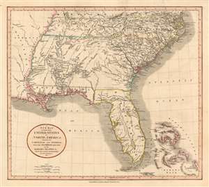
A New Map of Part of the United States of North America, Containing the Carolinas and Georgia, also the Floridas and Part of the Bahama Islands etc.
sold
- Digital Map Information
- Suitable for large format printing
- DPI: 600
- File Size: 22.69 MB
- File Type: ZIP / TIFF
- ICC color profile embedded
- Delivered instantly via download link
Executed by John Cary in 1806, this is one of the most interesting and attractive maps of the American southeast to appear in the first years of the 19th century. The map extends from Kentucky and Virginia in the north to include all of modern day North Carolina, South Carolina, Tennessee, Georgia, Alabama, Mississippi and Florida. Georgia is shown extending westward as far as the Mississippi River, despite the Mississippi Territory having been created in 1798. Florida is divided at the Appalachicola River into eastern and western sections. West Florida, ostensibly part of the Louisiana Purchase, was claimed by the Spanish and remained under their control until 1812. (more details)
Enormous and rare map of the Confederate States at the outbreak of the American Civil War.
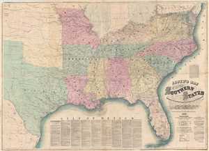
Lloyd's Map of The Southern States Showing all the Railroads, their Stations & Distances, Also The Counties, Towns, Villages, Harbors, Rivers And Forts. Compiled from the latest Government and other reliable Sources. 1861.
sold
- Digital Map Information
- Suitable for large format printing
- Full resolution TIFF file
- ICC color profile embedded
- Delivered instantly via download link
A very attractive example of J. T. Lloyd's extremely scarce railroad map of the Southern or Confederate States. Printed on a monumental scale, this map was issued in 1861 at the outset of the American Civil War and illustrates those ... (more details)
The state of Franklinia. The first map of the United States by a Southerner.

A Map of the States of Virginia, North Carolina, South Carolina and Georgia; Comprehending the Spanish Provinces of East and West Florida: Exhibiting the Boundaries as fixed by the late Treaty of Peace between the United States and the Spanish Dominions.
sold
- Digital Map Information
- Suitable for large format printing
- DPI: 600
- File Size: 16.43 MB
- File Type: ZIP / TIFF
- ICC color profile embedded
- Delivered instantly via download link
This 1800 Vint and Anderson issue of the Joseph Purcell map of the United States recording post-Revolutionary War westward expansion. This is one of the earliest maps to identify the ephemeral pseudo-state of Franklinia, the claims of the Ohio Company of Associates, the lands of the New Jersey and Wabash Companies, the Cumberland Settlement, and the Moravian Settlement. It is moreover, one of the best maps of the American Indian nations in the southeast - benefiting from Purcell's firsthand reconnaissance. Significantly, this is also the first maps of the United States by a southern cartographer. (more details)
Tennessee just after the Creek War (1813 - 1814) and the War of 1812 (1812 - 1815).
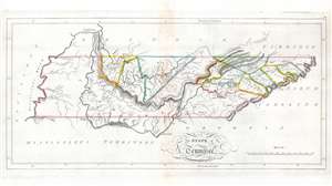
The State of Tennessee.
sold
- Digital Map Information
- Suitable for large format printing
- Full resolution TIFF file
- ICC color profile embedded
- Delivered instantly via download link
This is an 1814 Mathew Carey map of Tennessee issued at the height of the Creek Wars. This is one of the earliest maps of Tennessee to include an embryonic county structure - fine original outline color defines a handful of emerging counties. Nashville and Knoxville are both labeled. A handful of smaller towns are identified on the skeleton road network. Cherokee territory occupies all of western Tennessee and extends east along the southern border to Tennessee's border with North Carolina. (more details)
Fascinating map. One of the earliest obtainable maps of Kentucky and Tennessee.
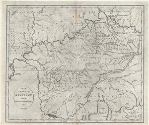
Map of the State of Kentucky; with the Adjoining Territories. 1795.
sold
- Digital Map Information
- Suitable for large format printing
- DPI: 300
- File Size: 8.93 MB
- File Type: ZIP / TIFF
- ICC color profile embedded
- Delivered instantly via download link
This 1795 map by John Reid is one of the earliest obtainable maps of Kentucky and Tennessee. Centered on the Cumberland River, the map covers from New Madrid on the Mississippi River to, roughly, the Cumberland Gap, and from the ... (more details)
Early Italian map of the southern United States.
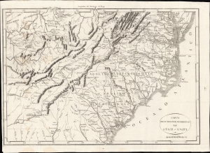
Carta Delle Provincie Meridionali degli Stati-Uniti.
sold
- Digital Map Information
- Suitable for large format printing
- Full resolution TIFF file
- ICC color profile embedded
- Delivered instantly via download link
An Italian-language map of the southern United States, very likely based on P. F. Tardieu's map of the same title in French, first published in 1801. It features rich idiosyncratic typography. The map depicts the years just after independence, when the borders of the former colonies, now states, were still forming and the white population of the area gradually moved inland. (more details)
Exceptional post-Revolutionary map of the America Southest.
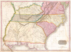
United States of America Southern Part.
sold
- Digital Map Information
- Suitable for large format printing
- DPI: 300
- File Size: 20.46 MB
- File Type: ZIP / TIFF
- ICC color profile embedded
- Delivered instantly via download link
A rare and important 1818 map of the southeastern part of the United States. Depicts from the Mississippi River eastward to the Pacific, extends north as far as Delaware and south as far as Florida and the Mississippi Delta. ... (more details)
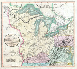
A New Map of Part of the United States of North America, exhibiting The Western Territory, Kentucky, Pennsylvania, Maryland, Virginia & C. Also, the Lakes Superior, Michigan, Huron, Ontario & Erie; with Upper and Lower Canada & C. From the Latest Authorities.
sold
- Digital Map Information
- Suitable for large format printing
- DPI: 300
- File Size: 16.69 MB
- File Type: ZIP / TIFF
- ICC color profile embedded
- Delivered instantly via download link
Published by John Cary in 1805, this is one of the most interesting and attractive maps of the American Frontier and the Great Lakes to emerge in the first years of the 19th century. Covers from Lakes Superior south along the ... (more details)
One of the earliest specific maps of Tennessee.
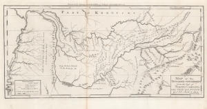
A Map of The Tennassee Government formerly Part of North Carolina taken Chiefly from Surveys by Genl. D. Smith and others.
sold
- Digital Map Information
- Suitable for large format printing
- Full resolution TIFF file
- ICC color profile embedded
- Delivered instantly via download link
This is a c. 1796 Mathew Carey map of the 'Tennessee Government', considered one of the earliest specific maps of Tennessee. (more details)
Appalachian Space Age BioDome?
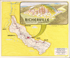
Tug Fork Valley Mountaintop Development Plan L, Part 27.5. / Bicherville Mountaintop Development.
sold
This is a highly unusual c. 1980 manuscript pictorial view of an imagined mountaintop community of 'Bicherville' in the Tug Fork Valley, along the border of West Virginia and Kentucky. Although resembling a space colony or experimental biodome, the conceived project was instead motivated by concerns about flooding and hoped to revive the mining industry in the area. (more details)
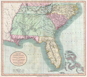
A New Map of Part of the United States of North America, Containing the Carolinas and Georgia, also the Floridas and Part of the Bahama Islands etc.
sold
- Digital Map Information
- Suitable for large format printing
- DPI: 300
- File Size: 17.51 MB
- File Type: ZIP / TIFF
- ICC color profile embedded
- Delivered instantly via download link
Published by John Cary in 1805, this is one of the most interesting and attractive maps of the American southeast to appear in the first years of the 19th century. Covers from Kentucky and Virginia South include all of modern ... (more details)
1817 Thomson Map of the Southeastern United States: Georgia, Carolina, Virginia, Tennessee, Kentucky
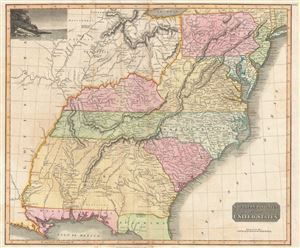
Southern Provinces of the United States.
sold
- Digital Map Information
- Suitable for large format printing
- DPI: 300
- File Size: 18.64 MB
- File Type: ZIP / TIFF
- ICC color profile embedded
- Delivered instantly via download link
A scarce first edition of John Thomson's 1817 map of the southeastern part of the United States. Thomson prepared this map during a transitional period of expansion shortly following the American Revolutionary War and is among most thorough treatments of this region prior to the U.S. Government Surveys. It records early U.S. efforts to acquire and assimilate American Indian territories west of the Appalachian Mountains. (more details)
One of the Earliest Detailed Maps of the American Southeast
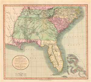
A New Map of Part of the United States of North America, Containing the Carolinas and Georgia, also the Floridas and Part of the Bahama Islands etc.
sold
- Digital Map Information
- Suitable for large format printing
- DPI: 600
- File Size: 21.11 MB
- File Type: ZIP / TIFF
- ICC color profile embedded
- Delivered instantly via download link
Executed by John Cary in 1806, this is one of the most interesting and attractive maps of the American southeast to appear in the first years of the 19th century. The map extends from Kentucky and Virginia in the north to include all of modern day North Carolina, South Carolina, Tennessee, Georgia, Alabama, Mississippi and Florida. Georgia is shown extending westward as far as the Mississippi River, despite the Mississippi Territory having been created in 1798. Florida is divided at the Appalachicola River into eastern and western sections. West Florida, ostensibly part of the Louisiana Purchase, was claimed by the Spanish and remained under their control until 1812. (more details)
Louisiana on the cusp of the Louisiana Purchase.
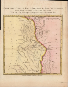
Carte Reduite de la Haute-Louisiane et Pays Circonvoisins, pour etre adaptee a l'ouvrage intitule Vue de la Colonie Espagnole du Mississipi, et c.
sold
- Digital Map Information
- Suitable for large format printing
- DPI: 300
- File Size: 3.12 MB
- File Type: ZIP / TIFF
- ICC color profile embedded
- Delivered instantly via download link
This is Alexandre's Blondeau's exceptional 1803 map of Spanish-administered upper Louisiana, issued for Pierre-Louis Berquin Duvallon's travel narrative, Vue de la Colonie Espagnole due Mississipi. It is one of the best maps to capture the Upper Mississippi Valley on the cusp of the Louisiana Purchase. The map moreover underscores the significance of the Mississippi River as a trade artery between the Great Lakes, and hence the Atlantic, and the Gulf of Mexico. (more details)
Sherman's March to the Sea.
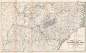
Military Map Showing the Marches of the United States Forces Under Command of Maj. Gen. W. T. Sherman. U.S.A. During the Years 1863, 1864, 1865.
sold
- Digital Map Information
- Suitable for large format printing
- File Size: 83.33 MB
- File Type: ZIP / TIFF
- ICC color profile embedded
- Delivered instantly via download link
This is an 1865 William Kossak map of the southeastern United States tracing the movements of Union Army forces under the command of Major General William Tecumseh Sherman in 1863, 1864, and 1865. Coverage extends from Missouri, Arkansas, and Louisiana to North Carolina and the Atlantic Ocean, and from Missouri, Illinois, Indiana, Kentucky, Ohio, and Virginia to Mobile Bay. Throughout Kossak, and John B. Muller, a draughtsman, achieve astounding detail. The routes followed by General Sherman's units, which include the 4th, 14th, 15th, 16th, 17th, and 20th Army Corps are illustrated. Sherman's movement on Atlanta (a massive operation during which he orchestrated the movements of three separate armies) and Sherman's pursuit of Confederate General John Bell Hood both appear as well. The movements of General J. H. Wilson's Cavalry Corps and those of General G. Stoneman's Cavalry Corps are also depicted, along with Union and Rebel fortifications. (more details)
Superbly Detailed Map of Louisville, Kentucky
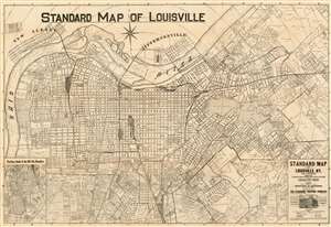
Standard Map of Louisville, Ky. And Environs Originally Compiled from Sureveys and Official Records by the Louisville Title Company.
sold
- Digital Map Information
- Suitable for large format printing
- File Size: 42.45 MB
- File Type: ZIP / TIFF
- ICC color profile embedded
- Delivered instantly via download link
This is the 1921 edition of William Bridges Hunter’s map of Louisville, Kentucky. This plan, printed in Louisville by the Standard Printing Company, is one of the most detailed early maps of the city we have encountered, far outstripping the atlas maps available from the 19th century and rivaled only by the Mendenhall map of 1906. (more details)
The Yazoo and Mississippi Valley Railroad are featured in several songs by legendary blues masters.
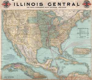
Illinois Central and Yazoo and Mississippi Valley Railroads. 4,824 miles.
sold
- Digital Map Information
- Suitable for large format printing
- File Size: 33.22 MB
- File Type: ZIP / TIFF
- ICC color profile embedded
- Delivered instantly via download link
This is an 1897 Poole Brothers railroad map of the Illinois Central and Yazoo and Mississippi Valley railroads. The map depicts the continental United States from the Pacific Ocean to the Atlantic Ocean and from the Canada to ... (more details)