
Minnesota - North Dakota - South Dakota (sold)
Auchagah Map, a unique synthesis of American Indian and European cartography.
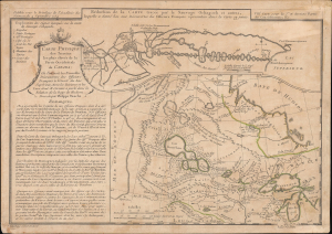
Réduction de la Carte tracée par le Sauvage Ochagach et autres. / Carte Physique des Terreins les plus eleves de la Partie Occidentale du Canada.
sold
- Digital Map Information
- Suitable for large format printing
- Full resolution TIFF file
- ICC color profile embedded
- Delivered instantly via download link
This is Philipe Buache's c. 1754 dual map of inland water routes west of Lake Superior extending, ostensibly, to the Pacific. It is an important and intellectually complex juxtaposition of two radically divergent cartographic conceptions of the North American interior: American Indian (Cree) geographic knowledge (known as the Auchagah Map) and Philippe Buache's speculative synthesis of French exploration, hydrographic theory, and the elusive dream of a navigable route to the Pacific. Within a decade of this map's issue, the route revealed here between Lake Superior and Winnipeg became the primary artery of the Canadian fur trade. (more details)
Unrecorded first state of a foundational map with extensive manuscript additions relating to American Indian Reservations established in 1867-8.
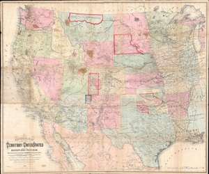
National Map of the Territory of the United States From The Mississippi River To The Pacific Ocean.
sold
- Digital Map Information
- Suitable for large format printing
- Full resolution TIFF file
- ICC color profile embedded
- Delivered instantly via download link
An extraordinary first-edition first-state example of William J. Keeler’s 1867 map of the Trans-Mississippi West - considered the finest post-Civil War railroad era map of the west - with unique manuscript annotations and additions relating to the American Indian Reservation System. This one of a kind historic document was likely the official example retained by the Indian Bureau, and possibly by Keeler himself, to administer and document the development of the American Indian Reservation system through the late 1860s. (more details)
The quintessential trail map of the American west.
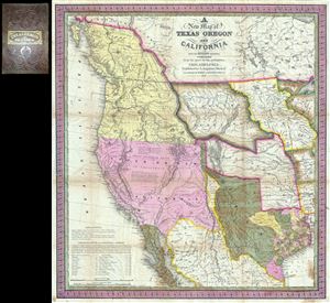
A New Map of Texas Oregon and California with the Regions Adjoining.
sold
- Digital Map Information
- Suitable for large format printing
- Full resolution TIFF file
- ICC color profile embedded
- Delivered instantly via download link
Considered 'the quintessential trail map of the American West' Samuel Augustus Mitchell's 'New Map of Texas Oregon and California' is one of the most important 19th century pocket maps ever issued. In Mitchell's own words This map comprises all that portion of ... (more details)
The eariest known map of St. Paul, Minnesota.
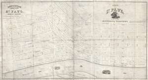
City of Saint Paul, Capital of Minnesota Territory. / Rice and Irvine's addition to St. Paul, Minnesota Territory.
sold
- Digital Map Information
- Suitable for large format printing
- Full resolution TIFF file
- ICC color profile embedded
- Delivered instantly via download link
A rarity of extreme historical importance, this 1849 map by Benjamin Brunson is the earliest printed map of Saint Paul, Minnesota, and the original plat of the city. Centered on Seven Corners and Rice Park, this map covers the original 280 acres of Saint Paul, ... (more details)
An exceptionally scarce variant of a cornerstone map of the American west and the finest of its era.
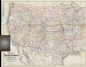
National Map of the Territory of the United States From The Mississippi River To The Pacific Ocean. Madeby the authority of the Hon. O. H. Browning Secretary of the Interior. In the Office of the Indian Bureau Chiefly For Government Purposes under the direction of the Hon. N.G. Taylor, Commisr. of Indian Affairsa and Hon. Chas E. Mix Chief Clerk of the Indian Bureau.
sold
- Digital Map Information
- Suitable for large format printing
- File Size: 46.46 MB
- File Type: ZIP / TIFF
- ICC color profile embedded
- Delivered instantly via download link
A map of the utmost importance and scarcity, this is William J. Keeler's 1868 pocket map of the American west, considered the 'the largest, finest and most detailed map of the West as it was then known.' The map covers from Detroit and Cincinnati westward to ... (more details)
Gold, geology, and the Great Sioux War.
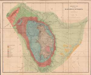
This is an 1879 Henry Newton geological atlas of the Black Hills, Dakota Territory (now South Dakota) published during the height of the Black Hills Gold Rush. Consisting of two maps and one view, the atlas provides some of the earliest detailed surveys of the region and particularly its geology, a matter of critical importance to miners. The present example, unlike any other we've seen, is handsomely dissected, laid on linen, and accompanies a custom original slipcase. (more details)
Best early map of the Great Lakes.
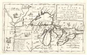
La Louisiana, Parte Settentrionalle, Scoperta sotto la Protettione di Luigi XIV, Re di Francia et Descritta, e Dedicata Dal P. Cosmografo Coronelli, All'Illustriss, et Eccellentiss, S. Zaccaria Bernardi su dell Ecc. S. Francesco.
sold
- Digital Map Information
- Suitable for large format printing
- Full resolution TIFF file
- ICC color profile embedded
- Delivered instantly via download link
This rare 1694 production by Venetian cartographer Vincenzo Coronelli is the earliest and most important obtainable map of the Great Lakes and the headwaters of the Mississippi. Coronelli's map centers on Lake Superior, but covers all five Great Lakes and extends westward as far as the Upper Mississippi River Valley. Cartographically this map is essentially an elaboration upon the 1688 Nolin/Coronelli map, Partie Occidentale du Canada ou de la Nouvelle France. Coronelli was particularly fascinated with the Great Lakes region and this map includes numerous updates and elaborations. (more details)
Foundational Map of the Transmississippi.
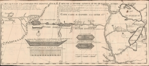
Carte que les Gnacsitares ont Dessine sur / Carte de la Riviere Longue et de quelques Autres qui se Dechargent dans le Grand Fleuve Missisipi.
sold
- Digital Map Information
- Suitable for large format printing
- File Size: 14.91 MB
- File Type: ZIP / TIFF
- ICC color profile embedded
- Delivered instantly via download link
A foundational and influential map, this is the 1703 first edition of Baron Louis-Armand de Lom d'Arce de Lahontan's seminal map of the westernmost Great Lakes, the Mississippi River, and its enigmatic tributary river, the Riviere Longue or Long River, extending westwards towards the Rocky Mountains. Although Baron de Lahontan's cartography has been severely criticized and considered apocryphal by some, it exerted a profound influence on other mapmakers of the era, including Herman Moll, John Senex, Henry Popple, and Guillaume Delisle. (more details)
The Heart of North America from the Finest Globemaker of the 17th Century.
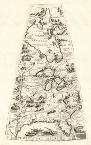
[Untitled Globe Gore of North America from the Tropic of Cancer to the Arctic Circle].
sold
- Digital Map Information
- Suitable for large format printing
- Full resolution TIFF file
- ICC color profile embedded
- Delivered instantly via download link
This is a beautiful 1688 Vincenzo Maria Coronelli globe gore focused on North America east of the Mississippi and west of the Chesapeake, engraved Coronelli's masterpiece 3 1/2 foot globe. The copperplate was adapted in 1697 for inclusion in Coronelli's bound atlases, masked off between the Tropic of Cancer and the Equator to fit book format. The gore covers most of North America east of the Mississippi, spanning from the Tropic of Cancer to the Arctic Circle. Thus, it shows the northern Gulf Coast, Florida, Chesapeake Bay, the Mississippi River (after La Salle), the Great Lakes, and Hudson's Bay. The geography is substantively the same as that on Coronelli's two-sheet America Settentrionale. Although that map bears the date 1688, it was not actually published any earlier than 1690 and it is very probable that the globes represent the earlier appearance of this geographical information. (more details)
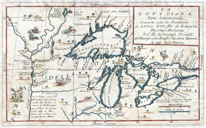
La Louisiana, Parte Settentrionalle, Scoperta sotto la Protettione di Luigi XIV, Re di Francia et Descritta, e Dedicata Dal P. Cosmografo Coronelli, All'Illustriss, et Eccellentiss, S. Zaccaria Bernardi su dell Ecc. S. Francesco.
sold
- Digital Map Information
- Suitable for large format printing
- DPI: 300
- File Size: 6.87 MB
- File Type: ZIP / TIFF
- ICC color profile embedded
- Delivered instantly via download link
This exceedingly rare 1694 map by Vincenzo Coronelli is the most important depiction of the Great Lakes and the headwaters of the Mississippi River to appear in the late 17th century. Covers all five Great Lakes and extends westward as far as the Mississippi ... (more details)
One of the most influential maps of the Great Lakes to appear in the 18th century.
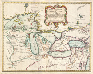
Partie Occidentale de la Nouvelle France ou du Canada.
sold
- Digital Map Information
- Suitable for large format printing
- DPI: 300
- File Size: 13.4 MB
- File Type: ZIP / TIFF
- ICC color profile embedded
- Delivered instantly via download link
A rare and extremely influential 1755 map of the Great Lakes drawn by Jacques Nicholas Bellin. This map, which appeared in the 1755 issue of the Homann Heirs Atlas Major , covers all five of the Great Lakes as well as the adjacent Indian lands and the ... (more details)
Scarce, Superbly Detailed Map of the Northwestern Territories and States: First Detailed Map Naming the Wyoming Terrirory
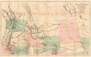
General Map of the North Pacific States and Territories Belonging to the United States and of British Columbia, Extending from Lake Superior to the Pacific Ocean and Between Latitude 39 degrees and 53 degrees North. Exhibiting Mail Routes, Gold Mines, and Including the Most Recent Surveys of the Topographical Bureau. Prepared by Captain John Mullan. ... Drawn by Edward Freyhold, T.E. Lithographed by J. Bien, 24 Vesey, St. N.Y.
sold
- Digital Map Information
- Suitable for large format printing
- File Size: 44.63 MB
- File Type: ZIP / TIFF
- ICC color profile embedded
- Delivered instantly via download link
This the 1865 Mullan - Freyhold map of the American Northwest. It shows the territories of Washington, Idaho, Montana, Wyoming, Dakota and Nebraska, and the State of Oregon in completion, and portions of California, Minnesota, Iowa, Kansas, Colorado, Utah and Nevada. The lithographed map - with hand wash color to distinguish the territories from one another - is beautifully executed and detailed. Carl Wheat esteemed this 'very fine' map so well that he chose it for the frontispiece of the fifth volume of Mapping the Transmississippi West. In discussing Freyhold, in particular, Wheat rhapsodizes:
Edwin (sic) Freyhold, who seems to have been responsible for the actual drawing of the topography, was an unrivaled expert in this type of work. His penned originals are almost unbelievably delicate, and must be examined with a powerful magnifying glass to be appreciated.Indeed, the map's details are superbly drafted and lithographed, with clear, legible typography and beautifully hachured mountains. The map, and the guide accompanying it, was intended to aid and encourage hopeful emigrants to the new territories of the northwest, particularly prospectors. The map relies heavily on data arising from Mullan's tenure as superintendent of construction for the northern military wagon road running from Walla Walla to Fort Benton on the upper Milk River, and indeed Wheat specifically praises the detail of its trails: Mullan's road is shown in its several variants, including Mullan' proposed (and rejected) route to Walla-Walla via Fort Laramie. Another route following the Yellowstone River west and crossing the mountains via Beaver Head Valley is indicated to the south of the Mullan road. Well-established U.S. Mail routes are shown in the southern part of the map. (more details)
The second earliest view of Minneapolis.
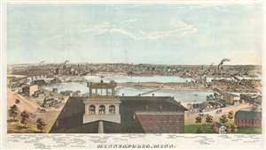
Minneapolis, Minn.
sold
- Digital Map Information
- Suitable for large format printing
- File Size: 29.99 MB
- File Type: ZIP / TIFF
- ICC color profile embedded
- Delivered instantly via download link
A stunning 1874 chromolithograph view of Minneapolis by George H. Ellsbury and Vernon Green. This image is the second earliest specific printed view of Minneapolis, following only the Hageboeck view of 1872. The view looks westwards over the Mississippi River towards Minneapolis. The large building in the foreground sporting an angelic wind vane is the observation tower of the Winslow House Hotel, which in the year this view was issued became the founding structure of Macalester College. The original span of Hennepin Avenue Bridge, the first permanent bridge over the Mississippi River, can be seen crossing the river from Nicollet Island. Eighty-five additional structures are noted beneath the view, including churches, mills, factories, municipal buildings, and hotels. (more details)
The early days of Minnesota Territory.
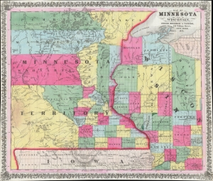
Map of Minnesota and Part of Wisconsin.
sold
- Digital Map Information
- Suitable for large format printing
- Full resolution TIFF file
- ICC color profile embedded
- Delivered instantly via download link
A stunning 1856 Ensign, Bridgman, and Fanning map of Minnesota Territory representing the early settlement of Minnesota. This map illustrates the beginning of the settlement plan for Minnesota proposed by Jonathan Carver in his 1778 Travels. When this map was issued, life in Minnesota was characterized by harsh living conditions and frontier lawlessness dominated by American Indian relations and the fur trade. (more details)
Premier Great Lakes Map of the Mid-18th Century.
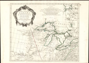
Partie Occidentale du Canada et Septentrionale de la Louisiane avec une partie de Pensilvanie.
sold
- Digital Map Information
- Suitable for large format printing
- Full resolution TIFF file
- ICC color profile embedded
- Delivered instantly via download link
This is Paolo Santini's 1775 map of the western part of Canada, the Upper Mississippi, and the Great Lakes Region. Produced to satisfy European interest in the American Revolutionary War (1775 - 1783), it drew on D'Anville's map, the best French mapping of the region produced during the French and Indian War (1754 - 1763). (more details)
American Indian land grants, fraud, and Half-Breed Tracts.
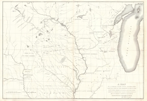
A Map of a Portion of the Indian Country Lying East and West of the Mississippi River to the Forty Sixth Degree of North Latitude from Personal Observation Made in the Autumn of 1835 and Recent Authentic Documents.
sold
- Digital Map Information
- Suitable for large format printing
- Full resolution TIFF file
- ICC color profile embedded
- Delivered instantly via download link
This is an 1836 George William Featherstonhaugh map of the American Upper Midwest. It is significant for detailing land grants given by American Indian Nations to both colonials and métis peoples - the so-called 'Half-Breed Tracts'. It also details the Carver Grant, a fraudulent land speculation scheme of the early 19th century. (more details)
A tribute to the Pacific Railroad and the conquest of the American West.
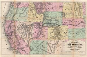
Williams' New Trans-Continental Map of The Pacific R.R. and Routes of Overland Travel to Colorado, Nebraska, The Black Hills, Utah, Idaho, Nevada, Montana, California and the Pacific Coast.
sold
- Digital Map Information
- Suitable for large format printing
- File Size: 30.27 MB
- File Type: ZIP / TIFF
- ICC color profile embedded
- Delivered instantly via download link
A scarce and exceptionally attractive first edition example of Henry Williams' 1876 map of the Pacific Railroad. Centered on the line of the Pacific Railroad as it travels westward across the continent to California, this map covers from Omaha, to San ... (more details)
One of the earliest obtainable separate issue maps of Duluth, Minnesota.
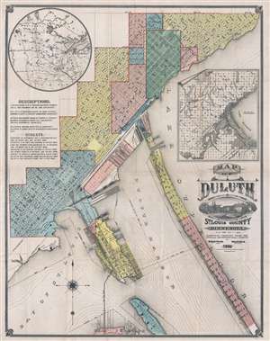
Map of Duluth St. Louis County Minnesota.
sold
- Digital Map Information
- Suitable for large format printing
- File Size: 24.4 MB
- File Type: ZIP / TIFF
- ICC color profile embedded
- Delivered instantly via download link
An exceptionally rare 1886 Map of Duluth, Minnesota by William Baird Paton and Charles H. Drew. This is one of the earliest obtainable separate issue maps of Duluth, Minnesota. The map covers roughly from Forest Hill Cemetery to Connors Point and ... (more details)
Free land to the 1,000,000!
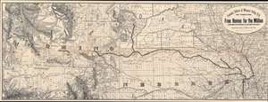
Fremont, Elkhorn and Missouri Valley R.R. and Connections, to the Free Homes for theMillion in Northwestern Nebraska and Southwestern Dakota. / The Elkhorn Valley Line to Northern Nebraska, Central Wyoming and The black Hills.
sold
- Digital Map Information
- Suitable for large format printing
- Full resolution TIFF file
- ICC color profile embedded
- Delivered instantly via download link
This is an impressive and highly detailed 1886 Rand McNally map of Wyoming, Dakota, and Nebraska issued to promoted migration to free 'government lands' in the west. It also illustrates the route of the important Fremont, Elkhorn and Missouri Valley Railroad. (more details)
Rare separate issue map of the capital of Minnesota.
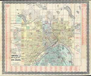
Rice's Map of the City of St. Paul.
sold
- Digital Map Information
- Suitable for large format printing
- File Size: 39.8 MB
- File Type: ZIP / TIFF
- ICC color profile embedded
- Delivered instantly via download link
An uncommon 1883 map of Saint Paul, Minnesota by G. Jay Rice. The map covers all of Saint Paul on both sides of the Mississippi River, as it appeared at the time of publishing. The map has here been lithographed in two passes, one for the black ink, one for the red overprinting. All other color is hand applied. (more details)
Comprehensive proposal for justice for Native peoples.
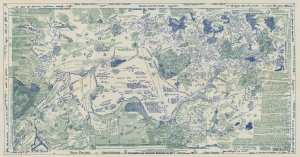
Lilawaste Lake Country refuge-to-be.
sold
- Digital Map Information
- Suitable for large format printing
- File Size: 33.22 MB
- File Type: ZIP / TIFF
- ICC color profile embedded
- Delivered instantly via download link
An engrossing and poignant map that merits hours of close study, this is a highly detailed and acerbic proposal for a 'Lilawaste Lake Country Refuge' drawn by the pseudonymous Iktomi. It appeared in the 1937 book America Needs Indians!, by the same author, a creative and combative work that sharply criticizes White society's destruction of indigenous cultures and proposes measures for maintaining and even reviving the latter. (more details)
A comprehensive proposal for justice towards Native peoples.
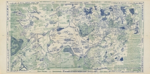
Lilawaste Lake Country refuge-to-be.
sold
- Digital Map Information
- Suitable for large format printing
- File Size: 28.41 MB
- File Type: ZIP / TIFF
- ICC color profile embedded
- Delivered instantly via download link
An engrossing map that merits hours of close study, this is a highly detailed and acerbic proposal for a 'Lilawaste Lake Country Refuge' drawn by the pseudonymous Iktomi. It appeared in the 1937 book America Needs Indians!, by the same author, a creative and combative work that sharply criticizes White society's destruction of indigenous cultures and proposes measures for maintaining and even reviving the latter. (more details)
Grisly end to the Dakota War.
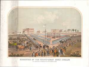
Execution of the thirty-eight Sioux Indians, at Mankato, Minnesota, December, 26, 1862.
sold
- Digital Map Information
- Suitable for large format printing
- File Size: 47.36 MB
- File Type: ZIP / TIFF
- ICC color profile embedded
- Delivered instantly via download link
This 1883 lithograph depicts the mass execution of thirty-eight Dakota in Mankato, Minnesota that took place twenty years earlier during the Dakota War (August 18, 1862 - September 26, 1862). It is a disturbing reminder of atrocities committed during the westward expansion of the United States. The event remains the largest mass execution carried out in U.S. history. (more details)
A highly detailed city plan of Minneapolis including the various railroads that traveled through the city.
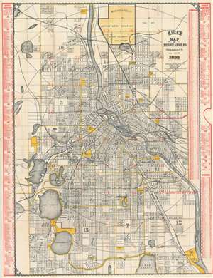
Rice's Map of Minneapolis Minnesota.
sold
- Digital Map Information
- Suitable for large format printing
- File Size: 66.47 MB
- File Type: ZIP / TIFF
- ICC color profile embedded
- Delivered instantly via download link
This is an 1899 G. Jay Rice city map or plan of Minneapolis, Minnesota. The map depicts the region from Sweeney Lake and Bass Lake to the eastern city limits of Minneapolis and from the northern city limits of Minneapolis to Lake Amelia and the southern city limits. Highly detailed, myriad streets are illustrated and labeled throughout the city. Buildings all across the city are identified by numbers, although it is unclear whether or not these numbers are their street addresses. Railroads, such as the Minneapolis and Pacific, the Chicago, St. Paul, and Minneapolis, and the Great Northern Railway wind their way across the city in several different directions. Parks are labeled and shaded yellow, as are major avenues, streets, and the city limits. Neighborhoods are identified but not rigidly defined. Concentric circles placed one mile apart illustrate the distance from Courthouse Square. A street directory, situated along both the left and right borders, lists the city's streets in alphabetical order and gives each street's location on the grid that is superimposed over the city on the map. (more details)
First English exploraiton fo the Upper Mississippi.
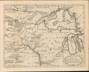
Karte von Hauptman Carvers Reise in den innern Shielen von Nord Amerika.
sold
- Digital Map Information
- Suitable for large format printing
- File Size: 20.22 MB
- File Type: ZIP / TIFF
- ICC color profile embedded
- Delivered instantly via download link
This is the 1780 German edition of Jonathan Carver's map illustrating his pioneering travels in the Upper Mississippi Valley, including parts of modern-day Wisconsin, Minnesota, and Michigan. Carver was the first Englishman to penetrate this region and map it in any detail, making this a significant piece, replete with novel information and fascinating annotations, offering some of the earliest insights into life and travel in this, at the time, near-impenetrable frontier. (more details)
The only commercial atlas map to specifically illustrate Nebraska territory at its ephemeral fullest.
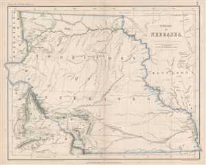
Territory of Nebraska.
sold
- Digital Map Information
- Suitable for large format printing
- File Size: 4.79 MB
- File Type: ZIP / TIFF
- ICC color profile embedded
- Delivered instantly via download link
This is a rare 1857 Henry Darwin Rogers map of the ephemeral Nebraska Territory at its fullest, extending from Kansas to the Canadian border. Few maps illustrate Nebraska in this form, and most of those only as part of a larger map. The ... (more details)
Railroad hub to the nation.
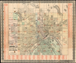
Rice's Map of the City of St. Paul.
sold
- Digital Map Information
- Suitable for large format printing
- Full resolution TIFF file
- ICC color profile embedded
- Delivered instantly via download link
A scarce 1885 map of Saint Paul, Minnesota by Gilbert Jay Rice. The map covers all of Saint Paul on both sides of the Mississippi River. The map has here been lithographed in two passes, once with black ink, and again with red overprinting - a feature along with the wash color that appeared only on deluxe issues of the map. (more details)
The Yazoo and Mississippi Valley Railroad are featured in several songs by legendary blues masters.
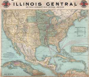
Illinois Central and Yazoo and Mississippi Valley Railroads. 4,824 miles.
sold
- Digital Map Information
- Suitable for large format printing
- File Size: 33.22 MB
- File Type: ZIP / TIFF
- ICC color profile embedded
- Delivered instantly via download link
This is an 1897 Poole Brothers railroad map of the Illinois Central and Yazoo and Mississippi Valley railroads. The map depicts the continental United States from the Pacific Ocean to the Atlantic Ocean and from the Canada to Mexico, the ... (more details)
Colorful Geological survey view of the Black Hills height of the Black Hills Gold Rush!
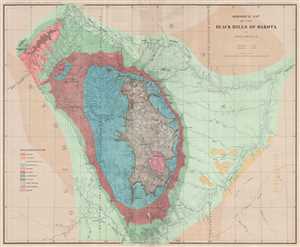
Geological Map of the Black Hills of Dakota.
sold
- Digital Map Information
- Suitable for large format printing
- File Size: 19.2 MB
- File Type: ZIP / TIFF
- ICC color profile embedded
- Delivered instantly via download link
This is an 1879 Henry Newton geological map of the Black Hills during the height of the Black Hills Gold Rush. The Black Hills are a spectacular mountain range in the northern plains states of South Dakota and Wyoming. Per Carl Wheat, ... (more details)
A Futruristic Vision of Ecologically Friendly Living in a Cold World

Ice City Jan. 10-25 Fargo, N.D. Joint Workshop
sold
- Digital Map Information
- Suitable for large format printing
- File Size: 45.99 MB
- File Type: ZIP / TIFF
- ICC color profile embedded
- Delivered instantly via download link
A unique survival: a fantastic 1972 broadside poster promoting and memorializing the construction and habitation of an ice village, an architectural research project intended to explore the use of ecologically low-impact building systems, primarily ice. The event was a joint workshop held by the architecture departments of North Dakota State University, Carnegie-Mellon University, and the University of Texas at Austin. It appears to have been the brainchild of then - CMU assistant professor of architecture Volker Hartkopf, who accompanied his students to the event. Of it, he said:
We want to stimulate the scientific community to launch extensive research toward development of flexible new building systems... we hope to provide the first full scale realization of responsive environments in architecture... Utilizing (ice) at the workshop we expect to develop and demonstrate processes, forms and techniques which could be used with yet-to-be-developed building materials with similar potential.Between one hundred and two hundred students from the three sponsoring institutions and an international array of others were to spend two weeks in January of 1973 building - and then living in - a village made of ice. Living units, sleeping quarters, entertainment, and study spaces were all to be constructed according to the architectural concepts of UT professor Wolf H. Hilbertz, using water ice chosen for it inexpensiveness, availability, ease of disposal, and minimal environmental impact. (January temperatures in Fargo ranged from 15 to 30 degrees below zero in the 1970s.) (more details)
The map that precipitated the slaughter of Col. Custer at Little Big Horn.
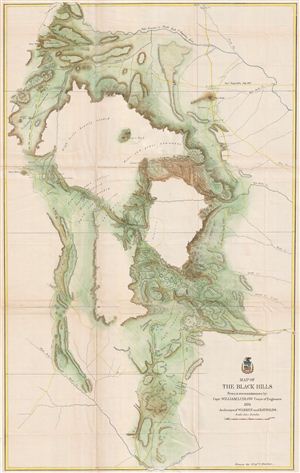
Map of the Black Hills From a reconnaissance by Capt. William Ludlow Corps of Engineers, 1874 And maps of Warren and Raynolds.
sold
- Digital Map Information
- Suitable for large format printing
- File Size: 28.49 MB
- File Type: ZIP / TIFF
- ICC color profile embedded
- Delivered instantly via download link
George Armstrong Custer and William Ludlow's seminal 1874 map of the Black Hills, Dakota Territory, covering from the Missouri to the Powder River and from the 47th to the 43rd parallel. In 1874 one thousand cavalrymen under the command ... (more details)
The map that precipitated the slaughter of Col. Custer at Little Big Horn. 'A most interesting map' - Wheat
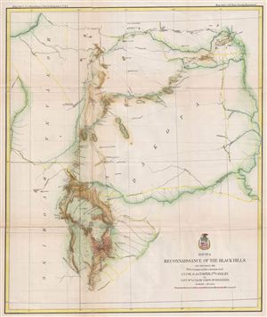
Map of a Reconnaissance of the Black Hills, July and August, 1874, with troops under the command of Lt. Col. G. A. Custer, 7th Cavalry.
sold
- Digital Map Information
- Suitable for large format printing
- File Size: 13.36 MB
- File Type: ZIP / TIFF
- ICC color profile embedded
- Delivered instantly via download link
George Armstrong Custer and William Ludlow's seminal 1874 map of the Black Hills, Dakota Territory, covering from the Missouri to the Powder River and from the 47th to the 43rd parallel. In 1874 one thousand cavalrymen under the command ... (more details)