
Miscellaneous (sold)
Early Texas scene on Fan depicting the Las Salle Expedition w/map.
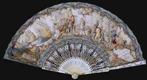
A remarkable c. 1750 Texas cartifact, this is a French hand-held fan, printed and hand colored on both sides, with one side bearing a map of Texas and illustrations celebrating the La Salle Expedition. The fan is a highly decorative and stylized chronology of the René Robert Cavalier, Sieur de La Salle (1643 - 1687) led French attempt to colonize Texas. It is a striking example of the fanciful representation that went into many depictions of European colonial enterprises, regardless of the facts. (more details)
Pony Express Broadside.
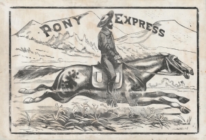
Pony Express.
sold
- Digital Map Information
- Suitable for large format printing
- File Size: 1593.38 MB
- File Type: ZIP / TIFF
- ICC color profile embedded
- Delivered instantly via download link
This is a large and dramatic c. 1860-61 xylographic broadside promoting the Pony Express - one of just two known surviving examples. Its striking size and visual grandeur are unmatched by any other Pony Express piece with which we are aware. Moreover, with a lifespan of just 18 months, and the general mystique driving interest the Pony Express, all such promotional material is of the utmost rarity and desirability. (more details)
Rare painting by one of the greatest mid-19th century British maritime artists.
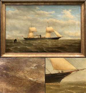
[Bonita]
sold
- Digital Map Information
- Suitable for large format printing
- File Size: 2.49 MB
- File Type: ZIP / TIFF
- ICC color profile embedded
- Delivered instantly via download link
A signed and dated nautical oil on canvas painting of a steamboat by Thomas Goldsworth Dutton, considered the greatest English painter of mid-19th century sail/steam powered merchant ships. The painting illustrating the 1,886 ton 300 horsepower British Mail ... (more details)
One of the most richly informative cartographic productions ever created.
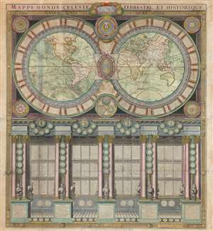
Mappe-Monde Celeste Terrestre et Historique.
sold
- Digital Map Information
- Suitable for large format printing
- DPI: 600
- File Size: 132.49 MB
- File Type: ZIP / TIFF
- ICC color profile embedded
- Delivered instantly via download link
A stunning large format wall map of the world in six panels issued in 1786 by Charles Desnos and Nicolas Jaugeon. Described by map historian Rodney W. Shirley as 'a veritable compendium of a map,' this is one of the most richly informative cartographic productions ever issued. The map consists of a double hemisphere map projection surrounded by no less than 60 Aeoli windheads, astronomical data on constellations, cosmic systems, and other charts - intentionally placing the world in the context of the greater cosmos. Its elegant presentation conveys confidence in the human capacity to describe not only the Earth, but the cosmos itself. The double hemisphere map rests upon Corinthian columns, underscoring the classical foundations of western scientific thought, here augmented by new discovery. The unique, neo-classical motif is carried through to the bottom half of the engraving, where panels of text are set within a portico supported by Corinthian columns. Completing the illusion are a coffered roof and a patterned tile floor. At the base of the columns there busts and accounts of the great explorers, among them Columbus, Magellan, and Vasco de Gama. (more details)
Unique first person espionage archive of the Great Game.
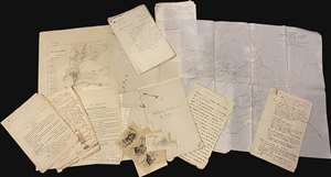
This is a fascinating, unrecorded archive of secret British Indian Army espionage documentation, dating from first decade of the 20th century, providing the modern reader a unique fly-on-the-wall view of the geopolitical, military, and social history of the frontiers of British India as the Great Game came to a close and as the Great War loomed. The documents predominantly date from 1906 to 1910, contain privileged information intended for an audience of prospective intelligence officers in the British Indian Army, and were mainly produced in Peshawar, headquarters of the British Indian army on the frontier with Afghanistan. Peshawar was an espionage hub, crucial to British efforts to counter threats by Russia and China to destabilize India, the Jewel in the Crown of the British Empire. (more details)
Some of the earliest surviving original illustrations associated with the King Features Mickey Mouse comic series.
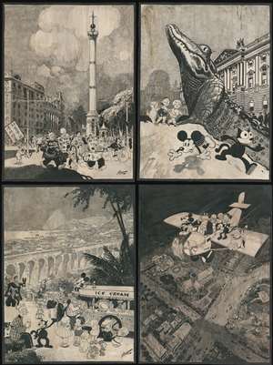
[Biedermann / King Features / Disney Original Calendar Art]
sold
- Digital Map Information
- Suitable for large format printing
- File Size: 303.48 MB
- File Type: ZIP / TIFF
- ICC color profile embedded
- Delivered instantly via download link
A one-of-a-kind set of four 30 x 40 inch original 1930 Disney / King Features manuscript pen and ink drawings of impressive size, by the master cartoonist Louis Biedermann. They are among he earliest surviving original artworks related to the Micky Mouse Comic Strip (1930 - 1995). The drawings feature Mikey Mouse (just 2 years after he was created), Felix the Cat, Bonzo the Dog, Jiggs and Maggie, Dub Dora and others. (more details)
Visual cognitive map of Renaissance Humanism.
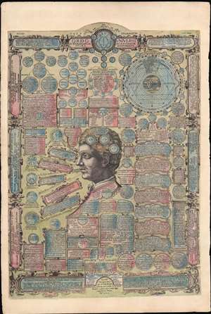
Ordo Universi et humanarum scientiarum prima monumenta.
sold
- Digital Map Information
- Suitable for large format printing
- DPI: 600
- File Size: 78.99 MB
- File Type: ZIP / TIFF
- ICC color profile embedded
- Delivered instantly via download link
The essence of the Renaissance Humanism distilled into a single 1585 broadsheet publication. This is an extremely rare, separately-issued educational broadside printed in 1585 by Gerard De Jode, based on the Papal physician Andrea Bacci’s conception of mankind’s place within the Cosmos - Bacci's proposition is noted centrally: 'Homo qui ad universi ordinem conformatus dicitur Μικροκοσμος' [The man, who is configured by the order of the universe, is a Microcosmos.] (more details)
Spectacular 15 inch Celestial Globe.

Cary's New Celestial Globe, on which are carefully laid down the whole of the Stars and Nebulae contained in the Catalogues of Wollaston, Herschel, Bode, Piazzi, Zach and c. calculated to the year 1820.
sold
A fine 15-inch example of Cary's New Celestial Globe . The stars and constellations depicted are derived from the astronomical catalogues of Wollaston, Herschel, Bode, Piazzi, Zach and others, calculated to the Year 1820. This globe was made and sold by ... (more details)
Columbia - a life-sized chromolithograph.
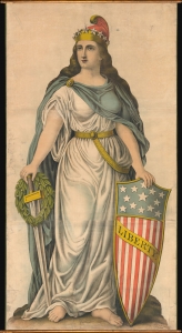
Liberty.
sold
- Digital Map Information
- Suitable for large format printing
- File Size: 188.09 MB
- File Type: ZIP / TIFF
- ICC color profile embedded
- Delivered instantly via download link
A spectacular full-height chromolithograph illustration of Columbia issued c. 1893 by Kurz and Allison, likely for the 1893 Chicago World's Fair or Columbia Exposition. Liberty appears here in full patriotic regalia, with a toga, blue cape, American flag shield, sword, laurel wreath, and Phrygian cap. (more details)
Here-to-fore unknown Persian variants of Serio-Comic maps by Fredric Rose and K. I. Kordig. Maps illustrate conflicting perspectives on Russian expansionism and the Balkan Crises.
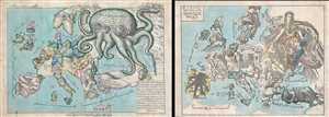
Serio-Comic Map of Europe. / Russian map of Europe.
sold
- Digital Map Information
- Suitable for large format printing
- File Size: 25.5 MB
- File Type: ZIP / TIFF
- ICC color profile embedded
- Delivered instantly via download link
An extraordinary discovery, this is a here-to-fore unknown set of Persian Serio-Comic maps issued around 1880 in Iran. These Serio-Comic maps presuppose that the reader will recognize the familiar shape of Europe and its constituent nations, which have ... (more details)
Remarkable photographic archive illustrating Pre-War China from the perspective of an American navy man. Includes historically unknown images of graphic war events, General Chiang Kai-shek, and Chinese life.
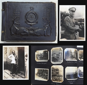
A unique photographic archive covering China and the Philippines in the years of 1927 – 1931, just prior to World War II. The photo archive contains hundreds of photos, loosely arranged thematically and chronologically, following the oriental tour ... (more details)
John Jeffries' own copy of his historic narrative recording the first international aerial voyage across the English Channel.
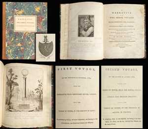
A Narrative of the Two Aerial Voyages of Doctor Jeffries with Mons. Blanchard; with Meteorological Observations and remarks. / First Voyage, on the Thirtieth of November, 1784, from the Rhedarium, near Grosvenor Square, London, into the Paris of Stone, in the Country of Kent; in performing which, we were suspended, and floating in the Atmosphere, on Hour and twenty-one Minutes. / Second Voyage, on the Seventh of January, 1785, from the Cliffs of Dover, Near the Royal Castle, across the British Channel, into the Forest of Guines, in the Province of Artois, in France: In completing which, we were suspended, and floating in the Atmosphere, Two Hours over the Sea; and forty-seven minutes of the Land of France.
sold
- Digital Map Information
- Suitable for large format printing
- Full resolution TIFF file
- ICC color profile embedded
- Delivered instantly via download link
One of the most important books ever published with regard to the history of aviation, this is the American physician John Jeffries' (February 5, 1744 - September 16, 1819) personal copy of his narratives of two balloon voyages personally undertaken ... (more details)
Stunning and complex geographical game.
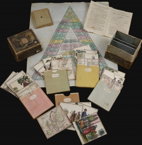
Voyage dans les Cinq Parties du Monde. ou representations de 32 Nations avec VI cartes geographiques 1805.
sold
A stunning 1807 geographical game by Johann Georg Klinger and Johann Wolfgang Müller. It is among the most interesting and complex geographical games we have encountered. The beautifully produced game features 37 (35 present) cards, a game board, and instructions detailing how it can be played in three increasingly complex modes. The most advanced involved strategic planning of global commerce. As such, it could appeal to and delight children of all ages. (more details)
Eccentric genius cryptanalysist L. D. Callimahos' pedagogical puzzle, 'The Zendian Problem,' representing a 'Top Secret' proxy war game anticipating the invasion of Cuba.
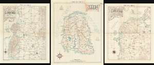
Zendia Respubliko (ASAS 60-2 MAP A)/ Norda Parto de la Provinco Loreno (ASAS 60-2 MAP B)/ Centra Parto de la Provinco Loreno (ASAS 60-2 MAP C).
sold
These three maps are extraordinary relics of a top-secret (now declassified) U.S. Army Cold War program to train code-breakers and invade Cuba, devised by the flamboyant maverick genius cryptanalyst Lambros D. Callimahos. Here in the only known surviving examples, this is a set of three, undated maps of the fantasy nemesis Republic of Zendia, with the northern part, and the central part of the Zendian province of Loreno. It has been argued, by Charles Varga and others, that Zendia is a proxy of the Isle of Pines (Cuba), and that the 'Zendian Problem', as it was known, was a training exercise for the 1961 Cold War invasion of Cuba (see below). (more details)
The Apocalypse in 1843?
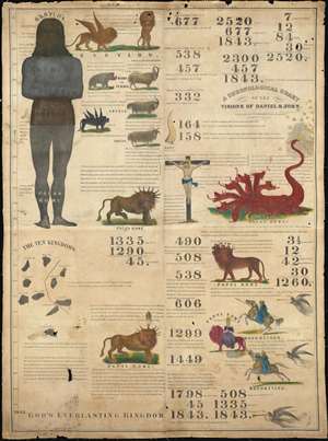
A Chronological Chart of the Visions of Daniel and John.
sold
- Digital Map Information
- Suitable for large format printing
- Full resolution TIFF file
- ICC color profile embedded
- Delivered instantly via download link
Known as the '1843 Chart', this rare Millerite chronological chart predicts the end-of-days in 1843. Printed on cloth by Benjamin Thayer, this chart is a didactic tool illustrating the predictions of William Miller. The chronology records world history from roughly 700 BC to 1843, when Miller, based upon Biblical calculus and prophetic interpretation, predicted Christ would come again heralding Armageddon. The allegorical 'beasts' of Armageddon are illustrated, among them various goats, a 7 headed dragon, a lion-bull creature, and more. The chart was published by Joshua Vaughan Himes, who served as Miller's publicist and pamphleteer after 1840. he publicaion of htis chart was significant as it was meant both to fulfill prophecy and for use at 'big tent' evangelical gatherings. (more details)
The only known example of Japan's second Serio-Comic map.
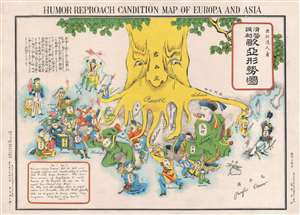
Humor Reproach Candition Map of Europa and Asia. / 滑稽諷刺歐亞形勢圖
sold
- Digital Map Information
- Suitable for large format printing
- File Size: 6.6 MB
- File Type: ZIP / TIFF
- ICC color profile embedded
- Delivered instantly via download link
A previously unknown Meiji 37 or 1904 Japanese broadsheet serio-comic map relating to the Russo-Japanese War. This map was issued in May 28 of 1904, immediately following Japan's successful siege and bombardment Russian held Port Arthur (Dalian). Of the four Japanese serio-comic maps associated with the Russo-Japanese war, this is the second, predated only by Kisaburō Ohara's April 1904 A Humorous Diplomatic Atlas of Europe and Asia. (more details)
The only known example of Japan's second Serio-Comic map.
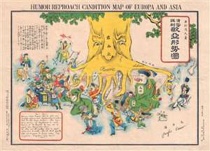
Humor Reproach Candition Map of Europa and Asia. / 滑稽諷刺歐亞形勢圖
sold
- Digital Map Information
- Suitable for large format printing
- File Size: 7.78 MB
- File Type: ZIP / TIFF
- ICC color profile embedded
- Delivered instantly via download link
A previously unknown Meiji 37 or 1904 Japanese broadsheet serio-comic map relating to the Russo-Japanese War. This map was issued in May 28 of 1904, immediately following Japan's successful siege and bombardment Russian held Port Arthur (Dalian). Of the four Japanese serio-comic maps associated with the Russo-Japanese war, this is the second, predated only by Kisaburō Ohara's April 1904 A Humorous Diplomatic Atlas of Europe and Asia. (more details)
Outstanding 1849 broadside promoting routes the California Gold Rush.
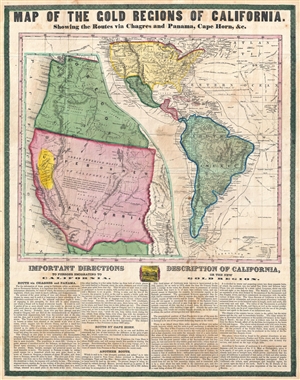
Map of the Gold Regions of California. Showing the Routes via Chagres and Panama, Cape Horn, & c.
sold
- Digital Map Information
- Suitable for large format printing
- DPI: 300
- File Size: 14.37 MB
- File Type: ZIP / TIFF
- ICC color profile embedded
- Delivered instantly via download link
A rare and remarkable example of Ensign and Thayer's 1849 promotional broadside map illustrating routes to and from the California Gold Fields. 'Forty-Niners' traveling across the continent to California faced a daunting and dangerous voyage. ... (more details)
Contians 'On Federal Government No. 1' a pre-Federalist Papers argument for the U.S. Constitution issued during the Constitutional Convention.
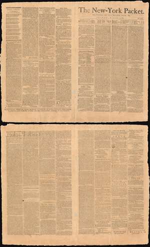
The New-York Packet. Friday, October 5, 1787.
sold
- Digital Map Information
- Suitable for large format printing
- DPI: 600
- File Size: 60.07 MB
- File Type: ZIP / TIFF
- ICC color profile embedded
- Delivered instantly via download link
A rare example of the October 5, 1787 edition of The New-York Packet containing 'On the Federal Government. No. 1,' an anonymous precursor to the Federalist Papers published during the Constitutional Convention. The subsequent Federalist Papers h would begin appearing in the The New-York Packet on October 27th, later in the same month. This essay, leading to the Federalist Papers, is considered one of the first published defenses of the proposed U. S. Constitution and as such is a cornerstone of American political thought. (more details)
One of only 2 Japanese serio-comic maps illustrating World War I.
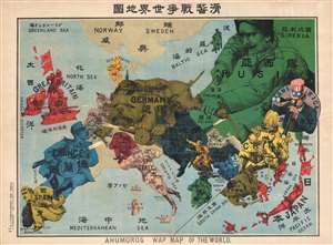
Kokkei Sensou Sekai Chizu. / Ahumoros Wap Map of the World. / 滑馨戰争世界地圖
sold
- Digital Map Information
- Suitable for large format printing
- File Size: 17.14 MB
- File Type: ZIP / TIFF
- ICC color profile embedded
- Delivered instantly via download link
A very rare Japanese broadsheet serio-comic map of Europe and Asia drawn just following the outbreak of World War I. This map was drawn by Ryōzō Tanaka and published by the Shobido Company of Tokyo. The map covers all of Europe and parts of ... (more details)
Measuring the land.

[Waywizer].
sold
- Digital Map Information
- Suitable for large format printing
- Full resolution TIFF file
- ICC color profile embedded
- Delivered instantly via download link
A striking early to mid-19th century British brass and mahogany waywiser, perambulator, or surveyor's wheel. The brass wheel connects to a dial that measures distances in miles, furlongs, poles, and yards. The brass apparatus is mounted on a polished mahogany wand with a finely engraved heart-shaped handle. (more details)
Pedagogical tool - The Empire of Things.
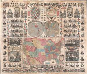
The Cottage Ornament.
sold
- Digital Map Information
- Suitable for large format printing
- File Size: 145.31 MB
- File Type: ZIP / TIFF
- ICC color profile embedded
- Delivered instantly via download link
An impressive pedagogical tool, this is Ensign, Bridgman and Fanning's 1857 wall map of the United States with a densely informative surround. The complex and dense wall map was designed to address pedagogical issues of the mid-19th century, when the westward expansion and homesteading led to increased rural populations without access to educational infrastructure. It is intended to be a textbook at-a-glance, able teach American history, science, and geography, as well as inspire patriotic optimism. The overall organization and pictorial richness mean the reader need not even be literate to absorb the map's messages. (more details)
Exceptionally large map of the world on waxed cloth illustrating Protestant Missions c. 1878.
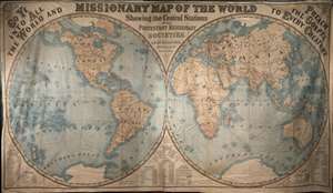
Missionary map of the world showing the central stations of all Protestant missionary societies.
sold
One of the largest and most unusual maps we have dealt with, this is an enormous 1878 double hemisphere map of the world illustrating missionary activity. Published by G. W. and C. B. Colton, this map is printed on waxed linen cloth, several ... (more details)
Journalistic logbook offering unique insight to the shipboard life of a turn-of-the-century midshipman.
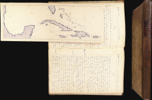
This is a 1900 logbook and journal kept by Quintin Bernard Preston-Thomas. As a midshipman, keeping a logbook was part of the required training - this example, however, is most unusual in that, in addition to recording routine shipboard matters, it also serves as a journal with rich personal and topical content. It offers unique insight into the life of a midshipman at the turn of the century. (more details)
Cowboy Culture, by a cowboy.
![1933 Jo Mora Evolution of the Cowboy Life Rodeo Poster [First Edition]](/mm5/graphics/00000001/M/Cowboys-mora-1933-2-M.jpg "1933 Jo Mora Evolution of the Cowboy Life Rodeo Poster [First Edition]")
The legendarily rare 1933 first edition of Jo Mora's 'Evolution of the Cowboy' is considered his most iconic and influential work. The image celebrates all things cowboy, from the rodeo to saddles, steers, and chuckwagons. It is worth noting that Mora became a cowboy himself, and his depictions of cowboy life, the Salinas Rodeo, and the surrounding culture exhibit realism grounded in experience. (more details)
An idyllic land created at the end of the Great War. A sharp juxtaposition to bomb-blasted Europe.
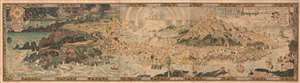
An Anciente Mappe of Fairy Land newly discovered and set forth.
sold
- Digital Map Information
- Suitable for large format printing
- Full resolution TIFF file
- ICC color profile embedded
- Delivered instantly via download link
An extraordinary 6-foot-long masterpiece, this is Bernard Sleigh's 1918 fantastical map of Fairy Land - in tis deluxe first edition. This wonderful map offers a wide birds-eye view panorama of the island of 'Fairy Land' which it describes as 'newly discovered and set forth'. Fairy Land is a wonderful juxtaposition of European fairy tales, literature, and Greek mythology. One can travel from King Arthur's Tomb to Peter Pan's House to the 'Bay of Moaning,' or the visit the roost of Dragons, watch Perseus save Andromeda, chat with Hercules, or visit the 'Harbour of Dreamland.' A red line indicates the route of passage 'From the World' to 'a place that never was and always will be.'
As pointed out by map historian Tim Bryars, this map was printed in 1918, the final year of World War I. Bryars astutely asks,
As pointed out by map historian Tim Bryars, this map was printed in 1918, the final year of World War I. Bryars astutely asks,
Could the map constitute a yearning for a return to pre-1914 Edwardian innocence? Compared with the devastated, bomb-blasted landscape of northern France, this vision of a make-believe land may have seemed a seductive escape for a European society bearing the psychological and physical scars of mass conflict.Another approach to this map is to study it within the context of the Arts and Crafts Movement. Sleigh was a close associate of Robert Morris and this map clearly follows Arts and Crafts Movement ideology. The typeface and decoration are very much in the style of Morris's Kelmscott Press and its embrace of traditional pre-industrial era production techniques. (more details)
An idylic fantastical land created by Bernard Sleigh at the end of the Great War and which then stood in sharp justaposition to bomb-blasted Europe.
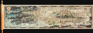
An Anciente Mappe of Fairy Land newly discovered and set forth.
sold
- Digital Map Information
- Suitable for large format printing
- Full resolution TIFF file
- ICC color profile embedded
- Delivered instantly via download link
An extraordinary 6 foot long presentation edition of Bernard Sleigh's 1918 fantastical map of Fairy Land. This wonderful map offers a wide birds-eye view style panorama of the island of 'Fairy Land' which it describes as 'newly discovered ... (more details)
Quite simply the largest, most beautiful, and most important early map of Hawaii ever published.
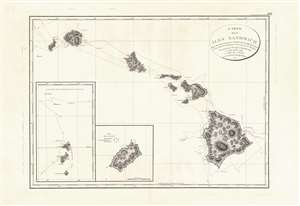
Carte des Iles Sandwich d'apres la reconnoissance qui en a ete faite dans les differentes relaches de la corvette La Decouverte et de sa conserve Le Chatham commandes par le Capt. Vancouver en 1792, 1793 et 1794.
sold
- Digital Map Information
- Suitable for large format printing
- Full resolution TIFF file
- ICC color profile embedded
- Delivered instantly via download link
This is a beautiful example of George Vancouver's seminal 1799 map of the Hawaiian Islands, considered the largest, most important, and most beautiful map of Hawaii to appear in the 18th century. George Vancouver first sighted Hawaii on January 18, 1778, as a midshipman on the HMS Discovery, consort ship to Captain James Cook's HMS Resolution, becoming one of the first Europeans to see the idyllic island group. Despite Cook's having been killed by angry Hawaiian natives, Vancouver formed a good opinion of the both the archipelago and the Hawaiian people. Fourteen years later and captain of his own ship, George Vancouver chose the Hawaiian Islands as a winter base while exploring the Northwest Coast of America in search of the elusive Northwest Passage. During his three seasonal visits to the Hawaiian Islands, Vancouver and his Lieutenant Joseph Baker completed this, the first complete map of the archipelago. His route, which zigzags around and between the islands, is carefully noted and includes visits in 1792, 1793, and 1794. (more details)
Extremely rare and early oversized double hemisphere constellation map, or celestial, by Frederik de Wit.
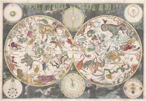
Planisphaerium Coeleste.
sold
- Digital Map Information
- Suitable for large format printing
- DPI: 300
- File Size: 18.1 MB
- File Type: ZIP / TIFF
- ICC color profile embedded
- Delivered instantly via download link
A remarkable and very rare example of Frederic de Wit's c. 1680 oversized and beautifully engraved double hemisphere celestial map. The map consists of two hemispheres surrounded by six supplementary diagrams. These illustrated the ... (more details)
Extremely rare and early oversized double hemisphere constellation map, or celestial, by Frederik de Wit.
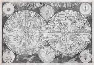
Planisphaerium Coeleste.
sold
- Digital Map Information
- Suitable for large format printing
- DPI: 300
- File Size: 84.78 MB
- File Type: ZIP / TIFF
- ICC color profile embedded
- Delivered instantly via download link
A remarkable and very rare example of Frederic de Wit's c. 1680 oversized and beautifully engraved double hemisphere celestial map. The map consists of two hemispheres surrounded by six supplementary diagrams. These illustrated the ... (more details)
The first, largest, and finest star maps of the 19th century.
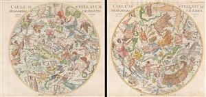
Coelum Stellatum Hemisphaerium Librae / Coelum Stellatum Hemisphaerium Arietis.
sold
- Digital Map Information
- Suitable for large format printing
- DPI: 300
- File Size: 51.59 MB
- File Type: ZIP / TIFF
- ICC color profile embedded
- Delivered instantly via download link
A rare and extraordinary pair of elephant folio celestial hemisphere charts or star maps issued in 1801 by Johann Elert Bode. Considered the largest and most dramatic celestial map of its era, possibly ever published, these gigantic ... (more details)
Rosicrucian Vision of Knowledge, God, and the Universe.
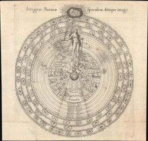
Integrae Naturae Speculum, Artisque Imago.
sold
- Digital Map Information
- Suitable for large format printing
- Full resolution TIFF file
- ICC color profile embedded
- Delivered instantly via download link
This is a rare 1617 Rosicrucian hierarchical diagram organizing the divine, cosmic, natural, and human experience into a structured, symbolic system. It was designed by the English Rosicrucian and alchemist Robert Fludd, who sought to condense the hermetic, Neoplatonic, and alchemical worldviews into a coherent vision of reality. Although rooted in Rennaissance thought, this image offers an enduring visual metaphor for the search for meaning, reflecting the impulse to systematically rationalize human experience. (more details)