
Ohio - Indiana
Most important map in 18th century American history.
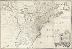
Amerique Septentrionale avec Les Routes, Distances et miles, Villages et Etablissements François et Anglois Par le Docteur Mitchel.
$12,000.00
Acquire
- Digital Map Information
- Suitable for large format printing
- Full resolution TIFF file
- ICC color profile embedded
- Delivered instantly via download link
This is the important 1777 Georges Le Rouge French edition of the seminal John Mitchell map of the eastern part of North America. The Mitchell map is considered the single most important map in 18th-century American history. It was used as a primary reference for nearly every treaty and boundary dispute in colonial North America from the French and Indian War (1754 - 1763) through the late 19th century. The map is all the more astounding because this is Mitchell's one and only map - a truly remarkable feat of virtuosity. (more details)
Piracy of a seminal map detailing Trans-Appalachia.
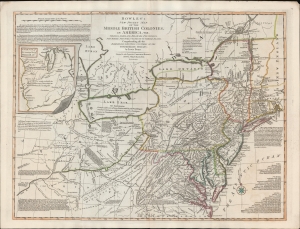
Bowles's New Pocket Map of the Middle British Colonies, in America, Vis. Virginia, Maryland, Delaware, Pensylvaia, New Jersey, New York, Connecticut and RHode Island. Comprending also the Habitations and Hunting Countries of the Confederate Indians: by Lewis Evans.
$6,500.00
Acquire
- Digital Map Information
- Suitable for large format printing
- DPI: 600
- File Size: 659.83 MB
- File Type: ZIP / TIFF
- ICC color profile embedded
- Delivered instantly via download link
A fine example of the 1780 Carington Bowles edition of the Lewis Evans map of the Middle British Colonies - one of the most important maps to emerge out of the French and Indian War (1754 - 1763). Essentially a piracy of a piracy, this is the Carington Bowles 1780 piracy of the 1771 Kitchen/Jefferys piracy of the 1755 Lewis Evans map - here given new relevance in the context of the American Revolutionary War (1775 - 1783). There are numerous subtle changes over earlier editions although the essential Lewis Evans chart - the finest and most comprehensive treatment of the Trans-Appalachia and the Ohio Valley from the French and Indian War through the Revolutionary period - remains the core. Pre-release editions of this map were circulated among British officers, including Major-General Edward Braddock (1695 - 1755), who consulted them during his disastrous 1755 expedition against the French-occupied Ohio River Valley (he was killed in the effort - but not for lack of cartographic reconnaissance). (more details)
Superior Street Viaduct - transforming Cleveland.
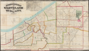
Stringer's Map of Cleveland and Suburbs.
$2,800.00
Acquire
- Digital Map Information
- Suitable for large format printing
- File Size: 2069.47 MB
- File Type: ZIP / TIFF
- ICC color profile embedded
- Delivered instantly via download link
This is an impressive 1873 William Stringer and Otto Dercum large-scale map of Cleveland, Ohio. The map was drawn to illustrate the Super Street Viaduct, a transformative infrastructure project that prompted a wave of urban expansion in the late 19th century. (more details)
Rare Transitional State Chronicling the Aftermath of the 1818 Delaware's Cession.
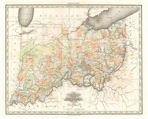
Ohio and Indiana By H.S. Tanner.
$2,000.00
Acquire
- Digital Map Information
- Suitable for large format printing
- DPI: 600
- File Size: 30.04 MB
- File Type: ZIP / TIFF
- ICC color profile embedded
- Delivered instantly via download link
A rare and important map of Ohio and Indiana by Henry S. Tanner, in a transitional state between the 1823 and 1825 editions of his New American Atlas. This elephant folio map covers all of Ohio and Indiana in detail, as well as sketching in adjacent parts of Michigan, Illinois, Kentucky, Virginia and Pennsylvania. The map is a strong example of Tanner's superb engraving, showing rivers, topography by hachure, cities, towns and roadways. (more details)
Updating the Evans Map: First Map with Louisville
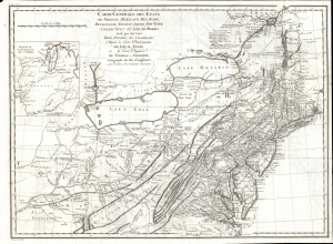
Carte Generale des Etats de Virginie, Maryland, Delaware, Pensilvanie, Nouveau-Jersey, New-York, Connecticut et Isle de Rhodes Ainsi que des Lacs Erie, Ontario, et Champlain. D'Apres la Carte Ameriquaine de Louis Evans et la Carte Anglaise de Thomas-Jefferys, pour les Lettres d'un Cultivateur Amériquain.
$1,950.00
Acquire
- Digital Map Information
- Suitable for large format printing
- DPI: 600
- File Size: 68.46 MB
- File Type: ZIP / TIFF
- ICC color profile embedded
- Delivered instantly via download link
An elegant 1787 French edition of Louis Evans' seminal and influential map of the Middle British Colonies, one of the most important maps of the British colonies and the best colonial mapping of the Ohio River Valley. It was issued for Michel Guillaume St. Jean de Crevecoeur's 1787 Lettres d'un Cultivateur Ameriquain, one of the most influential works on colonial America. (more details)
Best 18th century map of the Ohio River Valley.
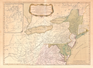
A New and General Map of the Middle Dominions Belonging to the United States of America, viz. Virginia, Maryland, the Delaware-Counties, Pennsylvania, New Jersey etc…
$1,850.00
Acquire
- Digital Map Information
- Suitable for large format printing
- DPI: 600
- File Size: 27.56 MB
- File Type: ZIP / TIFF
- ICC color profile embedded
- Delivered instantly via download link
This is the Laurie and Whittle 1794 updated edition of Lewis Evans' foundational 1755 map of the middle part of the British Colonies in North America. Evans' map was the earliest to accurately detail the American frontier at the time of its original publication. It exhibits superb detail in the northern Appalachian Mountains and the Ohio River Valley, providing information about Native American tribes and transport, French and English forts, and other details pertinent to the frontiersman, including sources of salt, roads, and trails. It was hailed by Schwartz and Ehrenberg as 'the most ambitious performance of its kind undertaken in America up to that time.' So widely was the excellence of Evans' map recognized that he was unable to make any money on it at all, as it was promptly pirated by Jefferys, Sayer, Kitchen, Bowles, Crevecoeur, and, as here, Laurie and Whittle. This 1794 edition, at least, updates the map to indicate the outcome of the American Revolution - it names the United States and includes the boundary line between the United States and Canada as determined by the 1783 Treaty of Paris. This is also the first edition of the Evans map to include the new state of Kentucky - although erroneously positioned north of the Ohio River. (more details)
Settling the Upper Midwest.
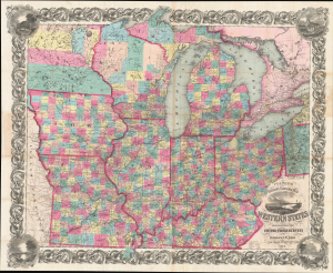
Colton's Railroad and Township Map Western States compiled from the United States Surveys. / Map of the Western States.
$1,500.00
Acquire
- Digital Map Information
- Suitable for large format printing
- File Size: 121.82 MB
- File Type: ZIP / TIFF
- ICC color profile embedded
- Delivered instantly via download link
This is a lovely, decorative, large-format 1854 pocket map of the American Midwest by Joseph H. Colton. It captures the region in the years before the U.S. Civil War and is notable for including Minnesota as a territory as well as demonstrating the rapid expansion of railroads throughout the Midwest. (more details)
Civil War Veterans - a home.
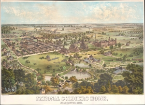
National Soldiers Home, Near Dayton, Ohio.
$1,500.00
Acquire
- Digital Map Information
- Suitable for large format printing
- File Size: 24.92 MB
- File Type: ZIP / TIFF
- ICC color profile embedded
- Delivered instantly via download link
A rare 1878 Adolph Krebs chromolithograph view of the National Soldier's Home (National Asylum for Disabled Volunteer Soldiers) near Dayton, Ohio. The view looks west and slightly north on the campus from a high point to the west of the home, a region today called Highview Hills. (more details)
An important perspective on American Indian territory in Ohio and Indiana before the Treaty of Mississinewas forced the Miami off their traditional lands.
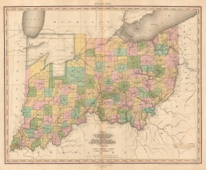
Ohio and Indiana By H.S. Tanner.
$1,250.00
Acquire
- Digital Map Information
- Suitable for large format printing
- Full resolution TIFF file
- ICC color profile embedded
- Delivered instantly via download link
A rare and important map of Ohio and Indiana by H. S. Tanner. American Indian lands constitute most of modern-day northern Indiana, which would change only a year later with the signing of the Treaty of Mississinewas. (more details)
Benchmark Map of the Northwest Territory.
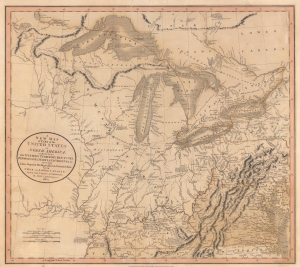
A New Map of Part of the United States of North America, exhibiting The Western Territory, Kentucky, Pennsylvania, Maryland, Virginia and C. Also, the Lakes Superior, Michigan, Huron, Ontario and Erie; with Upper and Lower Canada and C. From the Latest Authorities.
$1,200.00
Acquire
- Digital Map Information
- Suitable for large format printing
- File Size: 22.49 MB
- File Type: ZIP / TIFF
- ICC color profile embedded
- Delivered instantly via download link
Prepared by John Cary in 1805, this is one of the most interesting and attractive maps of the American Frontier and the Great Lakes to emerge in the first years of the 19th century. It provides a detailed snapshot of the western United States in the early years of the republic. (more details)
Early Appearance of the Wabash and Erie Canal.
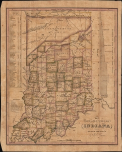
The Travellers Pocket Map of Indiana with its roads and distances. / Indiana Traveller.
$1,200.00
Acquire
- Digital Map Information
- Suitable for large format printing
- File Size: 8.78 MB
- File Type: ZIP / TIFF
- ICC color profile embedded
- Delivered instantly via download link
This is a scarce 1831 pocket map of Indiana prepared by Henry Schenck Tanner and engraved by John Knight. It presents the state as its population was growing rapidly in the wake of statehood and several wars against Native Americans, particularly Tecumseh's Confederacy, which opened most of the state's territory up to settlement. (more details)
A Pacified Frontier.
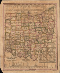
The Travellers Pocket Map of Ohio with its canals, roads and distances. / Ohio Traveller.
$1,200.00
Acquire
- Digital Map Information
- Suitable for large format printing
- File Size: 10 MB
- File Type: ZIP / TIFF
- ICC color profile embedded
- Delivered instantly via download link
This is a scarce 1830 pocket map of Ohio by Henry Schenck Tanner and engraved by Edward B. Dawson. It presents the state during a period of rapid growth after the War of 1812, as settlers arrived in large numbers to settle the pacified frontier. (more details)
Detailing the transportation network of the Upper Midwest.
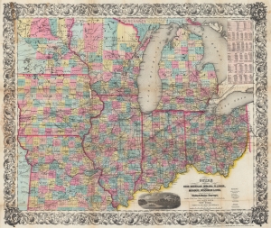
Guide Through Ohio, Michigan, Indiana, Illinois, Missouri, Wisconsin, and Iowa. Showing the Township lines of the United States Surveys, Locations of Cities, Towns, Villages, Post Hamlets, Canals, Rail and Stage Roads.
$1,200.00
Acquire
- Digital Map Information
- Suitable for large format printing
- File Size: 46.6 MB
- File Type: ZIP / TIFF
- ICC color profile embedded
- Delivered instantly via download link
This is an 1855 John Calvin Smith and John H. Colton map of Ohio, Michigan, Indiana, Illinois, Missouri, Wisconsin, and Iowa, along with part of Minnesota. The map captures a pivotal moment as mass emigration, developing industries, and displaced indigenous people transformed regional social, economic, and political spheres. (more details)
Detailed mapping of American Indian lands between the Mississippi River and the Appalachian Mountains following the American Revolutionary War.
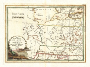
Gli Stati uniti dell' America delineati sulle ultime Osservazioni. Terzo foglio che comprende parte della Virginia.
$1,000.00
Acquire
- Digital Map Information
- Suitable for large format printing
- DPI: 300
- File Size: 9.22 MB
- File Type: ZIP / TIFF
- ICC color profile embedded
- Delivered instantly via download link
A very nice example of Cassini's stunning 1797 map of the eastern Mississippi watershed. The map covers from Lake Michigan to the modern day southern Tennessee border and from central Illinois to the Monongahela River. The focus of the map are the western claims, ... (more details)
By Cleveland's hometown cartographer.
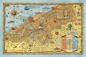
The Heart of Cleveland Ohio Forest City.
$950.00
Acquire
- Digital Map Information
- Suitable for large format printing
- File Size: 114.09 MB
- File Type: ZIP / TIFF
- ICC color profile embedded
- Delivered instantly via download link
This is a striking example of Arthur Suchy's 1928 pictorial map of Cleveland, Ohio - Suchy's hometown - accompanied by its original mailer envelope. The map covers from Cleveland's waterfront on Lake Erie south to the Cuyahoga River, beyond which, space is dedicated to historical vignettes and illustrations of local landmarks. Much emphasis is given to Cleveland's 'Forest City' qualities, with tree-filled residential blocks and parks noted. At the same time, skyscrapers and smoking factories underscore Cleveland's industrial might. Among the vignettes is an illustration of Moses Cleveland, the city's founder. (more details)
Cincinnati's first suburb.
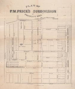
Plat of P. M. Price's Subdivision of Prospect Hill.
$950.00
Acquire
- Digital Map Information
- Suitable for large format printing
- File Size: 52.93 MB
- File Type: ZIP / TIFF
- ICC color profile embedded
- Delivered instantly via download link
This is a c. 1867 Phillips and Hickenlooper plat map of the Prospect Hill district in Cincinnati, Ohio. Today Prospect Hill is part of the Mount Auburn neighborhood and is just outside downtown Cincinnati. (more details)
Electric railways in Ohio and parts of Indiana and Pennsylvania.
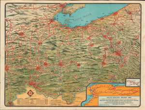
Dell's Electric Railway Map Showing the Various Electric Systems in Operation and Under Construction in Western New York and Pennsylvania, Northern West Virginia, Ohio, Eastern Indiana, and Southern Michigan.
$950.00
Acquire
- Digital Map Information
- Suitable for large format printing
- File Size: 40.77 MB
- File Type: ZIP / TIFF
- ICC color profile embedded
- Delivered instantly via download link
This is a 1907 Dell's Electric Railway chromolithograph map of Ohio, Indiana, and Pennsylvania. Depicting from Indianapolis to Pittsburgh and from Detroit to Louisville, solid red lines trace electric railways currently in operation and dashed red lines mark those under construction. Cities and towns with stations are labeled along the routes, many of which are illustrated with electric train cars. Some networks, particularly around major cities, are extensive and can stretch hundreds of miles, while other rural systems only connect a handful of small towns. Two insets are included in the lower right corner. One illustrates the electric rail network between Syracuse, Buffalo, and Niagara Falls, while the smaller inset focuses on the small network between Shingle House and Salamanca in New York. Stylistically this map is similar to other semi-view style maps issued to promote New England electric railways. (more details)
Pivotal War of 1812 naval battle.
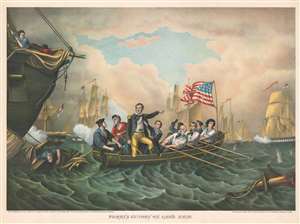
Perry's Victory on Lake Erie.
$600.00
Acquire
- Digital Map Information
- Suitable for large format printing
- File Size: 41.24 MB
- File Type: ZIP / TIFF
- ICC color profile embedded
- Delivered instantly via download link
This is a c. 1889 Kurz and Allison chromolithograph view of the Battle of Lake Erie during the War of 1812. The view captures the moment when Master Commandant Oliver Hazard Perry (1785 - 1819) transfers his flag from the stricken USS Lawrence to the USS Niagara to continue the battle. Perry is illustrated standing, while members of his crew row the small boat across the lake to the Niagara. Among these men is one black man. He is Cyrus Tiffany, Perry's personal servant, who is said to have accompanied Perry during the transfer to Niagara. The stricken Lawrence appears along the left border, while both American and British ships fire at each other in the background. (more details)
Land of Lincoln.
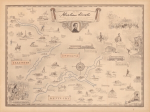
Abraham Lincoln, a pictorial outline of the life of the sixteenth president of the United States.
$500.00
Acquire
- Digital Map Information
- Suitable for large format printing
- File Size: 52.94 MB
- File Type: ZIP / TIFF
- ICC color profile embedded
- Delivered instantly via download link
A curious historical 1934 Karl Smith pictorial map of portions of Kentucky, Illinois, and Indiana, along with Washington, D.C. It traces the momentous life of Abraham Lincoln, from his childhood, to his presidency, through the Civil War, to his final resting place in Springfield, Illinois. (more details)
Commemorating service during the American Civil War.
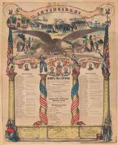
Invincibles. Company C. 32d Regiment, Ohio Infantry.
$450.00
Acquire
- Digital Map Information
- Suitable for large format printing
- File Size: 23.19 MB
- File Type: ZIP / TIFF
- ICC color profile embedded
- Delivered instantly via download link
This is a c. 1862 American Civil War broadside roster for Company C, 32nd Regiment, Ohio Infantry. It is a scarce memorial of the company's service published as a memento for surviving soldiers. Few such records for any unit survive. (more details)
In lumine tuo videbimus lumen.
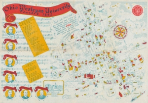
Ohio Wesleyan University Founded 1842.
$450.00
Acquire
- Digital Map Information
- Suitable for large format printing
- File Size: 35 MB
- File Type: ZIP / TIFF
- ICC color profile embedded
- Delivered instantly via download link
A scarce c. 1936 pictorial view of Wesleyan University, likely by alum and Good Housekeeping editor William Frederick Bigelow. Located in Delaware, Ohio, 27 miles north of Columbus, the university is among the oldest in the state. (more details)
Ohio's extensive railroad network.
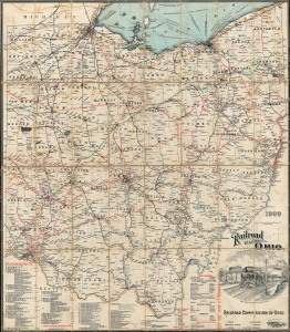
Railroad Map of Ohio.
$450.00
Acquire
- Digital Map Information
- Suitable for large format printing
- File Size: 57.8 MB
- File Type: ZIP / TIFF
- ICC color profile embedded
- Delivered instantly via download link
This is a 1909 Columbus Lithograph Company railroad map of Ohio. (more details)
How Harrison became 'Tippecanoe'.
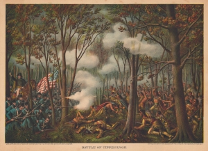
Battle of Tippecanoe.
$400.00
Acquire
- Digital Map Information
- Suitable for large format printing
- File Size: 99.59 MB
- File Type: ZIP / TIFF
- ICC color profile embedded
- Delivered instantly via download link
This is an 1889 Kurz and Allison view of the 1811 Battle of Tippecanoe, Indiana, fought between Native American tribes led by Tecumseh and the U.S. army led by future president William Henry Harrison. Harrison appears on the left mounted on horseback with his saber raised while his men fire into the charging Native Americans. (more details)
Home to the University of Notre Dame.
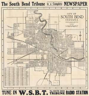
City of South Bend, Indiana.
$400.00
Acquire
- Digital Map Information
- Suitable for large format printing
- Full resolution TIFF file
- ICC color profile embedded
- Delivered instantly via download link
This is a 1931 Louis V. Bruggner city plan or map of South Bend, Indiana. The University of Notre Dame's campus appears in the upper right near the title and St. Mary's Academy. Streets are labeled throughout, along with schools, parks, and cemeteries. Black and white dashed lines trace railroads, including the Lake Shore and Michigan Central Railroad, the Grand Trunk and Western Railroad, and the South Bend, St. Joseph, and Southern Railroad. A street index occupies the lower left corner. (more details)
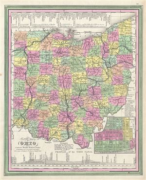
A New Map Of Ohio with its Canals Roads And Distances.
$360.00
Acquire
- Digital Map Information
- Suitable for large format printing
- DPI: 300
- File Size: 10.24 MB
- File Type: ZIP / TIFF
- ICC color profile embedded
- Delivered instantly via download link
This scarce hand colored map is a lithographic engraving of Ohio dating to 1846 by the legendary American Mapmaker S.A. Mitchell, the elder. Includes a detailed inset map of Cincinnati. Along the bottom there is a profile of the Ohio Canal with navigational ... (more details)
The Northern Borderlands of the U.S. in the Era of Revolution.
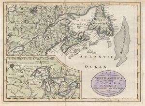
Part of North America, containing Canada, the north parts of New England and New York ; with Nova Scotia and Newfoundland.
$350.00
Acquire
- Digital Map Information
- Suitable for large format printing
- Full resolution TIFF file
- ICC color profile embedded
- Delivered instantly via download link
This is John Cary's c. 1781 map of the borderlands between the American colonies / United States of America and British dominions in North America. It is remarkable for reflecting geographical knowledge and territorial claims in the era of the American Revolutionary War. (more details)
Detailed maps of America's New Frontier.
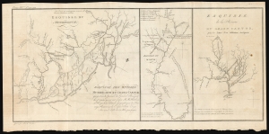
Esquisse des rivieres Muskinghum et Grand Castor que j'ai tiree du Journal du General Bouquet.
$350.00
Acquire
- Digital Map Information
- Suitable for large format printing
- DPI: 600
- File Size: 25.11 MB
- File Type: ZIP / TIFF
- ICC color profile embedded
- Delivered instantly via download link
This is a scarce 1787 Pierre Tardieu map of the Ohio River and its tributaries. (more details)
The Last Indians in Indiana.
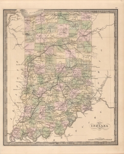
Indiana.
$350.00
Acquire
- Digital Map Information
- Suitable for large format printing
- Full resolution TIFF file
- ICC color profile embedded
- Delivered instantly via download link
This is Jeremiah Greenleaf's 1849 map of Indiana. It presents the state on the tail end of a process of the removal of native peoples and their replacement with White settlers. (more details)
Comic Ohio by a Ohioan.

Claude Shafer's Cartoon Map of Ohio.
$350.00
Acquire
- Digital Map Information
- Suitable for large format printing
- File Size: 17.15 MB
- File Type: ZIP / TIFF
- ICC color profile embedded
- Delivered instantly via download link
This is a 1939 Claude Shafer pictorial map of Ohio. Shafer, a cartoonist celebrated in Ohio for his wit, combines historical events with pictorial depictions of important sites. A stork carries a Wright Flyer in a sling, much as it might a baby, near Dayton, labeled as the 'birthplace of the airplane'. Ohio's famous mounds are illustrated, along with Fort Ancient, and the Serpent Mound. The Johnny Appleseed Memorial is referenced, as are McGuffey Readers in Oxford and Collier's Weekly in Springfield. The state's many resources are illustrated, including salt and coal mines, oil wells, the rubber plant in Akron, and the Youngstown steel district. Shafer's wit shines in several places, including the illustration of a man 'looking for Helen of Troy' in Troy, Ohio and a bear scaring the daylights out of a man in the Roosevelt Game Preserve. (more details)
Pictorial map promoting Ohio!
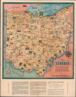
Being a Cartograph of Ohio.
$275.00
Acquire
- Digital Map Information
- Suitable for large format printing
- File Size: 57.61 MB
- File Type: ZIP / TIFF
- ICC color profile embedded
- Delivered instantly via download link
This is a beautiful 1933 Sewah Studios pictorial map of Ohio published by the Ohio Commission to A Century of Progress International Exposition at the Columbian Exposition or The Chicago World’s Fair. Numerous illustrations populate the state, referencing history, topography, fun facts about Ohio, points of interest, and animals. Some of these include ‘The only Y bridge in the United States’, Natural Bridge, ‘Throughout Ohio are many interesting caves and caverns. In this locality are some of the most extensive’, ‘birthplace of Senator Grant’, etc. (more details)
Fighting Gilded Age Machine Politics.
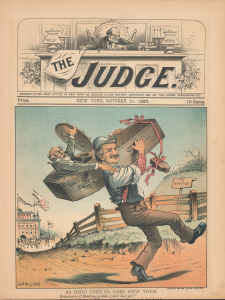
As Ohio Goes So Goes New York.
$250.00
Acquire
- Digital Map Information
- Suitable for large format printing
- Full resolution TIFF file
- ICC color profile embedded
- Delivered instantly via download link
This is an October 1885 Grant Hamilton satirical political cartoon that appeared in The Judge. It refers to the Ohio and New York Gubernatorial elections that year, in which The Judge supported Republican candidates and bitterly opposed a frequent target of their attacks, New York Democratic Governor David Hill. (more details)
Promoting the 'push-button' war of Tomorrow!
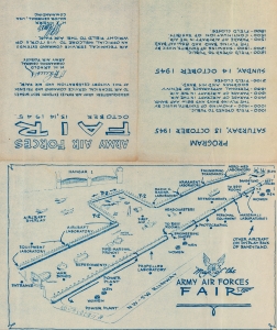
Map of the Army Air Forces Fair.
$250.00
Acquire
- Digital Map Information
- Suitable for large format printing
- Full resolution TIFF file
- ICC color profile embedded
- Delivered instantly via download link
This is a 1945 United States Army Air Forces map of the Army Air Forces Fair at Wright Field in Dayton, Ohio, today's Wright-Patterson Air Force Base. Army officials called the fair 'the largest spectacle of its kind ever staged anywhere,' where many previously classified aircraft and other projects were presented. (more details)