
Ohio - Indiana (sold)
Best colonial map of Virginia and Maryland.
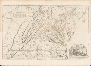
A Map of the most Inhabited part of Virginia containing the whole Province of Maryland with Part of Pensilvania, New Jersey and North Carolina drawn by Joshua Fry and Peter Jefferson in 1775.
sold
- Digital Map Information
- Suitable for large format printing
- Full resolution TIFF file
- ICC color profile embedded
- Delivered instantly via download link
This is the monumental 1775 Fry/Jefferson map of Virginia and Maryland, the most important colonial map of Virginia, in its original four-sheet English version. Drawn by Joshua Fry and Peter Jefferson in 1751 and first printed in 1753, this was the first accurate survey of the interior of Virginia. It was the first printed map to approximate the parallel ridges and valleys of the Appalachian Mountains, and the first to accurately depict the Blue Ridge Mountains. Following the revision of the map in 1755, this was the first map to include Virginia's road system, also marking routes used by frontier traders and Native Americans. Following that revision, it contained the best mapping of the Upper Ohio Valley and the Virginia frontier produced during the French and Indian War (1754 - 1763) and remained the prototype for all subsequent maps of Virginia until the 19th century. As both Fry and Jefferson were denizens of the colony, this further represents the first map of Virginia produced by Virginians. (more details)
A most important map of eastern Canada detailing British settlement and colonization in the early 19th century.
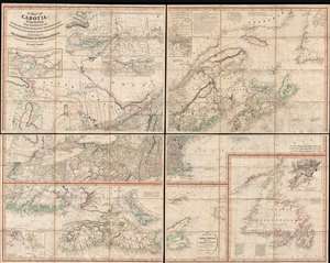
A Map of Cabotia; Comprehending The Provinces of Upper and Lower Canada, New-Brunswick And Nova-Scotia, with Breton Island, Newfoundland, &c. And Including also, The Adjacent Parts of the United States. Compiled from a great Variety of Original Documents. By John Purdy.
sold
- Digital Map Information
- Suitable for large format printing
- DPI: 300
- File Size: 72.87 MB
- File Type: ZIP / TIFF
- ICC color profile embedded
- Delivered instantly via download link
A fine example of Purdy's important 1821 map of Cabotia or Canada and New England – at the time the largest and finest map of that region. Cabotia is Purdy's manufactured term for eastern Canada or those lands discovered by John Cabot in 1497. The map covers from Lake Michigan to Newfoundland and from Labrador to New York City. Within Canada, it includes all of Ontario, Quebec, Nova Scotia, New Brunswick and Nova Scotia, and Newfoundland. In the United States, it includes all of New England, Michigan, and New York, as well as parts of Ohio and Pennsylvania. There are no fewer than 10 inset detail maps including a map of the Great lakes, the environs of Quebec, the St. Lawrence River, Niagara and vicinity, Newfoundland, Nova Scotia, Halifax, St. John, and New York Harbor. (more details)
The Heart of North America from the Finest Globemaker of the 17th Century.
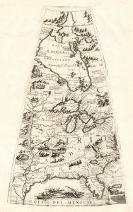
[Untitled Globe Gore of North America from the Tropic of Cancer to the Arctic Circle].
sold
- Digital Map Information
- Suitable for large format printing
- Full resolution TIFF file
- ICC color profile embedded
- Delivered instantly via download link
This is a beautiful 1688 Vincenzo Maria Coronelli globe gore focused on North America east of the Mississippi and west of the Chesapeake, engraved Coronelli's masterpiece 3 1/2 foot globe. The copperplate was adapted in 1697 for inclusion in Coronelli's bound atlases, masked off between the Tropic of Cancer and the Equator to fit book format. The gore covers most of North America east of the Mississippi, spanning from the Tropic of Cancer to the Arctic Circle. Thus, it shows the northern Gulf Coast, Florida, Chesapeake Bay, the Mississippi River (after La Salle), the Great Lakes, and Hudson's Bay. The geography is substantively the same as that on Coronelli's two-sheet America Settentrionale. Although that map bears the date 1688, it was not actually published any earlier than 1690 and it is very probable that the globes represent the earlier appearance of this geographical information. (more details)
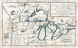
La Louisiana, Parte Settentrionalle, Scoperta sotto la Protettione di Luigi XIV, Re di Francia et Descritta, e Dedicata Dal P. Cosmografo Coronelli, All'Illustriss, et Eccellentiss, S. Zaccaria Bernardi su dell Ecc. S. Francesco.
sold
- Digital Map Information
- Suitable for large format printing
- DPI: 300
- File Size: 6.87 MB
- File Type: ZIP / TIFF
- ICC color profile embedded
- Delivered instantly via download link
This exceedingly rare 1694 map by Vincenzo Coronelli is the most important depiction of the Great Lakes and the headwaters of the Mississippi River to appear in the late 17th century. Covers all five Great Lakes and extends westward as far as the Mississippi River ... (more details)
An extremely rare, previously uncatalogued Ohio wall map.
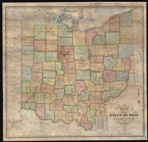
Map of the State of Ohio from the latest and best Authorities.
sold
- Digital Map Information
- Suitable for large format printing
- DPI: 600
- File Size: 165.32 MB
- File Type: ZIP / TIFF
- ICC color profile embedded
- Delivered instantly via download link
This is an impressively elusive 1831 William Chapin wall map of Ohio - one of the earliest large format wall maps of the state to exhibit a complete county structure. The state's interconnected network of roads and canals is illustrated in detail, including the National Road (then under construction), the Ohio and Erie Canal, and the Miami and Erie Canal. This map supersedes the 1825 John Kilbourne map of Ohio, expanding upon it in terms of completeness, detail, and proportion. (more details)
Later edition of Lewis Evans' map, considered a milestone both for its political significance and expansion of cartographic knowledge.

Carte Generale des Etats de Virginie, Maryland, Delaware, Pensilvanie, Nouveau-Jersey, New-York, Connecticut et Isle de Rhodes Ainsi que des Lacs Erie, Ontario, et Champlain. D'Apres la Carte Ameriquaine de Louis Evans et la Carte Anglaise de Thomas-Jefferys.
sold
- Digital Map Information
- Suitable for large format printing
- DPI: 300
- File Size: 17.66 MB
- File Type: ZIP / TIFF
- ICC color profile embedded
- Delivered instantly via download link
A fine and scarce French edition of Louis Evans' highly influential map of the Middle British Colonies, one of the most important maps of the British Colonies to appear in the 18th century. The map covers Louisville on the Ohio River eastward as far as ... (more details)
Later edition of Lewis Evans' map, considered a milestone both for its political significance and expansion of cartographic knowledge.
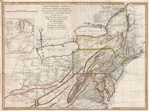
Carte Generale des Etats de Virginie, Maryland, Delaware, Pensilvanie, Nouveau-Jersey, New-York, Connecticut et Isle de Rhodes Ainsi que des Lacs Erie, Ontario, et Champlain. D'Apres la Carte Ameriquaine de Louis Evans et la Carte Anglaise de Thomas-Jefferys.
sold
- Digital Map Information
- Suitable for large format printing
- DPI: 300
- File Size: 16.54 MB
- File Type: ZIP / TIFF
- ICC color profile embedded
- Delivered instantly via download link
A scarce French edition of Louis Evans' highly influential map of the Middle British Colonies, one of the most important maps of the British Colonies to appear in the 18th century. The map covers Louisville on the Ohio River eastward as far as ... (more details)
Engraved in prison by America's greatest bank note counterfeiter!
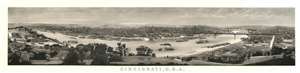
Cincinnati, U.S.A.
sold
- Digital Map Information
- Suitable for large format printing
- File Size: 40.1 MB
- File Type: ZIP / TIFF
- ICC color profile embedded
- Delivered instantly via download link
A production of extraordinary virtuosity, this is the outstanding masterpiece of the notorious bank note counterfeiter Charles F. Ulrich: a c. 1900 view of Cincinnati, Ohio. Ulrich engraved the view while in prison for counterfeiting. It is nonetheless a masterwork of engraving. (more details)
The central office of the National Asylum for Disabled Volunteer Soldiers, now the Dayton Veterans Affairs Medical Center.
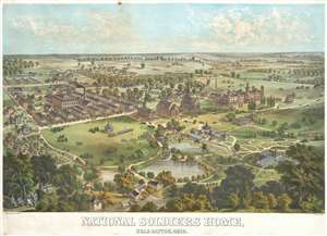
National Soldiers Home, Near Dayton, Ohio.
sold
- Digital Map Information
- Suitable for large format printing
- Full resolution TIFF file
- ICC color profile embedded
- Delivered instantly via download link
A rare 1878 Adolph Krebs chromolithograph view of the National Soldier's Home (National Asylum for Disabled Volunteer Soldiers) near Dayton, Ohio. The view looks west and slightly north on the campus of the National Soldier's Home from a high ... (more details)
The iconic Bufflao Map.
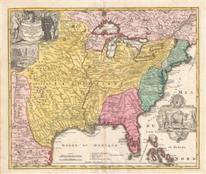
Amplissimae Regionis Mississipi seu Provinciae Ludovicianae a R.P. Ludovico Hennepin Francisc Miss in America Septentrionali Anno 1687. Detectae, Nunc Gallorum Coloniis et Actionum Negotiis Toto Orbe Celeberrimae.
sold
- Digital Map Information
- Suitable for large format printing
- DPI: 300
- File Size: 17.79 MB
- File Type: ZIP / TIFF
- ICC color profile embedded
- Delivered instantly via download link
An iconic c. 1720 map of the Mississippi River Valley by Johann Baptiste Homan. Commonly called the 'Buffalo Map' for its distinctive decorative elements depicting a stylized buffalo, this map is derived from an earlier 1718 map of the same ... (more details)
The earliest sepcific map of Ohio. Depicts the Connecticut Western Reserve, Virginia Military District, and lands of the Ohio Company.
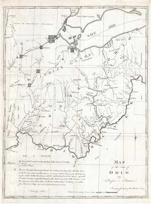
Map of the State of Ohio.
sold
- Digital Map Information
- Suitable for large format printing
- DPI: 300
- File Size: 6.29 MB
- File Type: ZIP / TIFF
- ICC color profile embedded
- Delivered instantly via download link
This is an 1804 Rufus Putnam map of Ohio –the earliest specific map of the fledgling state. The map depicts the Ohio only a year after its statehood, covering from the Detroit District and Lake Erie to Kentucky and Virginia and from the ... (more details)
An ephemeral railroad.
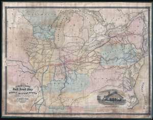
A Section of J. Sage and Sons New and Reliable Rail Road Map comprising all the Rail Roads in operation in the Middle and Western States with their stations and distances.
sold
- Digital Map Information
- Suitable for large format printing
- File Size: 30.49 MB
- File Type: ZIP / TIFF
- ICC color profile embedded
- Delivered instantly via download link
A rare 1858 wall format railroad map issued by J. Sage and Sons. The map's coverage extends from the Mid-Atlantic seaboard west to Missouri and Iowa, inclusive of all of the Great Lakes. It extends south as far as Tennessee and the Outer Banks. A high level of detail is present with regard to rail lines, including many stopping points throughout. Otherwise, the cartographers took a minimalist approach and areas underserved by the railroad networks are generally left blank. Red overprinting emphasizes the Bellefontaine, Terre Haute, and St. Louis Railroad, an extensive network with coverage from New York City to St. Louis. An inset featuring an engraving of the Indianapolis Central Terminal occupies the lower right. (more details)
Premier Great Lakes Map of the Mid-18th Century.
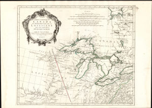
Partie Occidentale du Canada et Septentrionale de la Louisiane avec une partie de Pensilvanie.
sold
- Digital Map Information
- Suitable for large format printing
- Full resolution TIFF file
- ICC color profile embedded
- Delivered instantly via download link
This is Paolo Santini's 1775 map of the western part of Canada, the Upper Mississippi, and the Great Lakes Region. Produced to satisfy European interest in the American Revolutionary War (1775 - 1783), it drew on D'Anville's map, the best French mapping of the region produced during the French and Indian War (1754 - 1763). (more details)
One of the earliest works of a seminal American mapmaker.
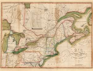
Map of the Seat of War in North America.
sold
- Digital Map Information
- Suitable for large format printing
- Full resolution TIFF file
- ICC color profile embedded
- Delivered instantly via download link
This John Melish's 1815 map of the northeastern United States and Canada, one of the earliest works by the first American publisher to concentrate specifically on maps. It is moreover one of the earliest maps specifically relating to the War of 1812 (1812 - 1815), and is one of the few maps pertinent to the war that was printed while it was still underway. It is, moreover, one of the best Federal Period maps available to the collector. Melish drew the map prior to the declaration of the war, and published it in conjunction with his 1812 A description of the British possessions in North America. So successful was that work that the plate swiftly wore out. This second edition of the map - 'with additions and improvements' - was engraved to accompany Melish's 1813 Military and Topographical Atlas of the United States. The identical second edition appeared in the 1815 second edition of the work. Both editions were engraved by Henry Schenck Tanner, and in this respect the map represents the work of two definitive figures in American map publishing. (more details)
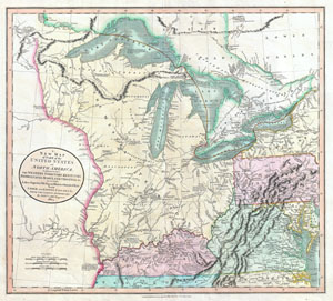
A New Map of Part of the United States of North America, exhibiting The Western Territory, Kentucky, Pennsylvania, Maryland, Virginia & C. Also, the Lakes Superior, Michigan, Huron, Ontario & Erie; with Upper and Lower Canada & C. From the Latest Authorities.
sold
- Digital Map Information
- Suitable for large format printing
- DPI: 300
- File Size: 16.69 MB
- File Type: ZIP / TIFF
- ICC color profile embedded
- Delivered instantly via download link
Published by John Cary in 1805, this is one of the most interesting and attractive maps of the American Frontier and the Great Lakes to emerge in the first years of the 19th century. Covers from Lakes Superior south along the Mississippi ... (more details)
Cincinnati's German heritage.

Map of Cincinnati and Suburbs and Covington and Newport. Bellevue, Dayton, Ludow, and Bromley, [KY]
sold
- Digital Map Information
- Suitable for large format printing
- File Size: 15.66 MB
- File Type: ZIP / TIFF
- ICC color profile embedded
- Delivered instantly via download link
This is a stunning, large format 1888 Max Burgheim map of Cincinnati, Ohio, one of the finest of the 19th century. It reflects the significant influence of German immigration in the mid to late 19th century. (more details)
Dramatic view of one of America's greatest natural disasters - drawn and printed in Dayton!
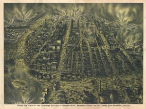
Birds-Eye View of the business Section of Dayton, Ohio. Sketched March 26, 1913. Looking East from Williams St.
sold
- Digital Map Information
- Suitable for large format printing
- File Size: 52.09 MB
- File Type: ZIP / TIFF
- ICC color profile embedded
- Delivered instantly via download link
This is a dramatic 1913 George Ring chromolithographic view of Dayton, Ohio, in the midst of the Great Dayton Flood of 1913 - one of the worst natural disasters in United States history. As a product of lithography, this is a rare example of a lithographic city view printed outside one of the great centers of American lithography by otherwise little-known makers. (more details)
Rare second state!
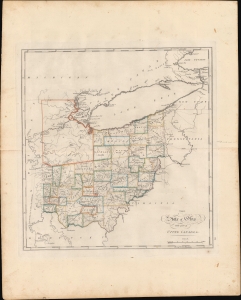
The State of Ohio with part of Upper Canada, etc.
sold
- Digital Map Information
- Suitable for large format printing
- DPI: 600
- File Size: 423.89 MB
- File Type: ZIP / TIFF
- ICC color profile embedded
- Delivered instantly via download link
This is the rare 1818 edition of Carey's map of Ohio. This second state is considerably rarer than the 1814 first state and notable for its significant updates, reflecting both corrections and Ohio's high-paced settlement. (more details)
One of the finest large format American maps of Ohio obtainable.
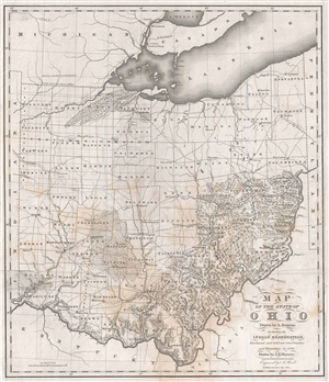
Map of the State of Ohio Drawn by A. Bourne. Including the Indian Reservation, Purchased and laid out Counties and Townships in 1820.
sold
- Digital Map Information
- Suitable for large format printing
- Full resolution TIFF file
- ICC color profile embedded
- Delivered instantly via download link
One of the earliest obtainable specific large format maps of Ohio from the early part of the 19th century. This 1820 map of Ohio was engraved by Abner Reed and published by Caleb Atwater in his Description of the Antiquities discovered in ... (more details)
One of the finest large format American maps of Ohio obtainable.
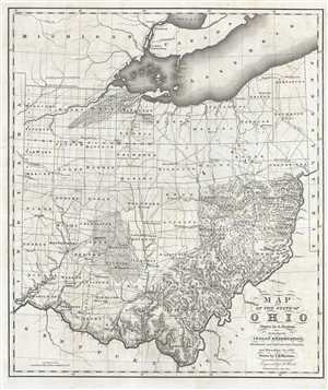
Map of the State of Ohio Drawn by A. Bourne. Including the Indian Reservation, Purchased and laid out Counties and Townships in 1820.
sold
- Digital Map Information
- Suitable for large format printing
- Full resolution TIFF file
- ICC color profile embedded
- Delivered instantly via download link
A rare 1820 American map of Ohio drawn for Caleb Atwater's Description of Antiquities Discovered in the State of Ohio . This map covers all of modern day Ohio as well as some of the surrounding states from Lake Eire to Kentucky and from ... (more details)
The Bufflao Map.

Amplissimae Regionis Mississipi seu Provinciae Ludovicianae a R.P. Ludovico Hennepin Francisc Miss in America Septentrionali Anno 1687. Detectae, Nunc Gallorum Coloniis et Actionum Negotiis Toto Orbe Celeberrimae.
sold
- Digital Map Information
- Suitable for large format printing
- DPI: 300
- File Size: 20.99 MB
- File Type: ZIP / TIFF
- ICC color profile embedded
- Delivered instantly via download link
An iconic c. 1720 map of the Mississippi River Valley by Johann Baptiste Homann. Commonly called the 'Buffalo Map' for its distinctive decorative elements depicting a stylized buffalo, this map is derived from an earlier 1718 map of the same region by G. De L'Isle, although it has been enlarged to include New England. (more details)
The Yazoo and Mississippi Valley Railroad are featured in several songs by legendary blues masters.
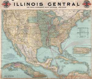
Illinois Central and Yazoo and Mississippi Valley Railroads. 4,824 miles.
sold
- Digital Map Information
- Suitable for large format printing
- File Size: 33.22 MB
- File Type: ZIP / TIFF
- ICC color profile embedded
- Delivered instantly via download link
This is an 1897 Poole Brothers railroad map of the Illinois Central and Yazoo and Mississippi Valley railroads. The map depicts the continental United States from the Pacific Ocean to the Atlantic Ocean and from the Canada to Mexico, the ... (more details)
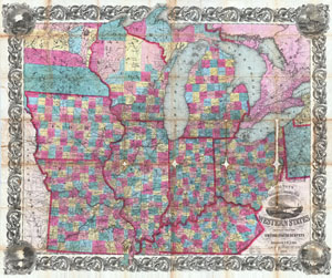
Colton's Railroad & Township Map of the Western States compiled from the United States Surveys.
sold
- Digital Map Information
- Suitable for large format printing
- Full resolution TIFF file
- ICC color profile embedded
- Delivered instantly via download link
An extremely attractive example of Colton's 1854 pocket map format railroad and township map of the Western States. Covers the states of Ohio, Kentucky, Illinois, Indiana, Missouri Iowa Michigan and Wisconsin with parts of Minnesota and ... (more details)
Important map issued at the outset of the French and Indian War.
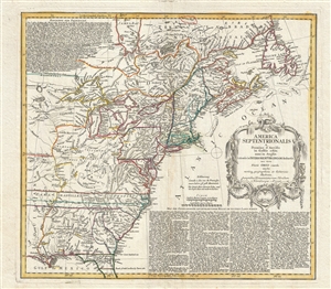
America Septentrionalis a domino d'Anville in Galiis edita nunc in Anglia coloniis in interiorem Virginiam deductis nec non fluvii Ohio cursu aucta notisq geographicis et historicis illustrata.
sold
- Digital Map Information
- Suitable for large format printing
- DPI: 300
- File Size: 14.65 MB
- File Type: ZIP / TIFF
- ICC color profile embedded
- Delivered instantly via download link
A fine example of the 1756 first edition of the Homann Heirs map of the English Colonies in North America near the outset of the French and Indian War. The map covers much of the eastern part of the modern day United States from just ... (more details)
One of the best maps of the Mississippi and Ohio River Valleys issued after the Revolutionary War.
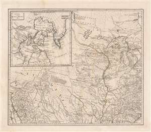
[Mississippi Valley].
sold
- Digital Map Information
- Suitable for large format printing
- DPI: 600
- File Size: 39.05 MB
- File Type: ZIP / TIFF
- ICC color profile embedded
- Delivered instantly via download link
This is the northwestern sheet from Franz Anton Schraembl's 1788 edition of Generalkarte von Nord America samt den Westindischen inseln depicting the central part of North America. Although derived from a larger wall map, the present map is a stand-alone piece and one of the first detailed maps of this region to appear after the American Revolutionary War (1775 - 1783). Concentrating on the Mississippi Valley, the map extends from the Gulf of California to the Pacific near Savannah, Georgia, and from Lake Winnipeg (Ouinpigon) to Mobile Bay. (more details)
Map that reveals the lost Indiana-Michigan border!
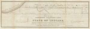
Plat of the northern boundary line of the state of Indiana : surveyed in conformity to the Act of Contress, 'To authorize the President of the United States to ascertain and designate the northern boundary of the state of Indiana: passed March 2nd, 1827.
sold
- Digital Map Information
- Suitable for large format printing
- DPI: 300
- File Size: 9.59 MB
- File Type: ZIP / TIFF
- ICC color profile embedded
- Delivered instantly via download link
This is a scarce 1827 Eleazer P. Kendrick map drawn to determine the Indiana-Michigan border. The map extends from Lake Michigan to Ohio and covers territory approximately 20 miles from north to south. When Michigan territory was ... (more details)
Very few printed pieces are of more importance in the history of Ohio than this survey of a part of the future state. – 'Fifty Ohio Rarities,' Clements Library.
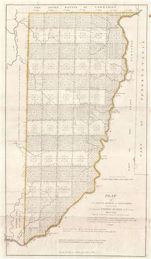
Plat of The Seven Ranges of Townships being Part of the Territory of the United States N.W. of the River Ohio Which by a late act of Congress are directed to be sold.
sold
- Digital Map Information
- Suitable for large format printing
- DPI: 300
- File Size: 6.19 MB
- File Type: ZIP / TIFF
- ICC color profile embedded
- Delivered instantly via download link
This is considered by some to be the map that began the opening of the American west and established the groundwork for the American westward expansion. It was initially published on September 30 of 1786 and is the first map ... (more details)
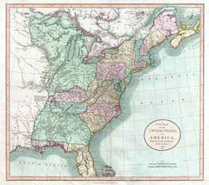
A New Map of the United States of America, from the latest authorities.
sold
- Digital Map Information
- Suitable for large format printing
- DPI: 300
- File Size: 18.12 MB
- File Type: ZIP / TIFF
- ICC color profile embedded
- Delivered instantly via download link
Published by John Cary in 1806, this is one of the most interesting atlas maps of the United States to appear in the early 19th century. Covers the entire United States east of the Mississippi River as well as parts of the ... (more details)
Courting industrial development along the Erie Railroad trunk line.
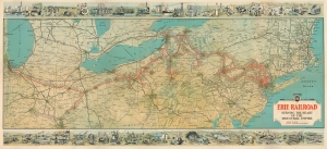
Erie Railroad Serving the Heart of the Industrial Empire.
sold
- Digital Map Information
- Suitable for large format printing
- Full resolution TIFF file
- ICC color profile embedded
- Delivered instantly via download link
This is a highly graphic 1930 Whitney-Graham railroad map of the northeastern United States issued to promote industrial development along the Erie Railroad. (more details)
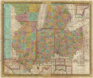
Map of the States of Ohio, Indiana, and Illinois with the settled par of Michigan.
sold
- Digital Map Information
- Suitable for large format printing
- DPI: 300
- File Size: 17.67 MB
- File Type: ZIP / TIFF
- ICC color profile embedded
- Delivered instantly via download link
A scarce 1839 S. A. Mitchell pocket map depicting the states of Ohio, Indiana, Illinois, and Michigan. Insets include, 'Vicinity of Detroit,' 'Vicinity of Cincinnati,' 'Falls of Ohio,' 'Lead Region East of the ... (more details)
Go West!
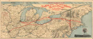
The Popular Through Car Line Between the East and West. New York, Boston, Chicago, and St. Louis. The Niagara Falls Route.
sold
- Digital Map Information
- Suitable for large format printing
- Full resolution TIFF file
- ICC color profile embedded
- Delivered instantly via download link
A 1898 Wynkoop Hallenbeck railroad map of the northeastern United States promoting the West Shore Railroad and its connections between Boston, New York, Chicago, and St. Louis. (more details)
Land used by Virginia to pay its American Revolutionary War veterans.
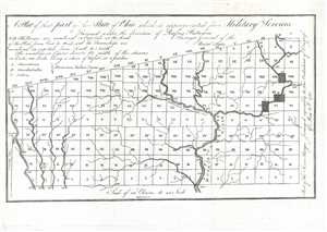
A Plat of theat part of the State of Ohio which is appropriated for Military Services.
sold
- Digital Map Information
- Suitable for large format printing
- DPI: 300
- File Size: 1.48 MB
- File Type: ZIP / TIFF
- ICC color profile embedded
- Delivered instantly via download link
This is an 1805 Rufus Putnam map of the Virginia Military District in present-day Ohio. The map depicts the District from Range I to Range XX and from Township I to Township X within the Plat. Rivers and ... (more details)