
Russia - Eastern Europe (sold)
Thorough, early defense of the Sea of the West and the Northwest Passage.
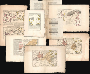
Exposé des Découvertes au Nord de la Grande Mer...
sold
- Digital Map Information
- Suitable for large format printing
- Full resolution TIFF file
- ICC color profile embedded
- Delivered instantly via download link
This is an extremely rare example of Philippe Buache's 1753 Exposé des Découvertes au Nord de la Grande Mer, the essential maps published to support the astonishing geographical theories of Philippe Buache and Joseph Nicolas De l'Isle, presented in August 1752 to the Paris Academie des Sciences. It was then the most complete cartographical defense of Nicolas De l'Isle's 'exposé' of Russian cartographic advances, along with Buache's synthesis of several mappings of the Pacific Northwest, revealing compelling (if ultimately false) evidence of a viable Northwest Passage. These maps were later included in the 1753-1755 Considérations Géographiques, 'the magnum opus of the Delisle-Buache theory of the layout of lands in the North Pacific space,' (Lada-Mocarski, 1969) appearing there in their second states. These six sheets are all first state examples, indicating that the Exposé enjoyed an earlier publication, spurred perhaps by the novelty of Buache and De l'Isle's arguments and the urgency with which the two geographers wished to assuage and rebut critics of their presentation to the Academie. (more details)
Nazi General's presentation atlas of Operation Barbarossa - before it all went to hell.
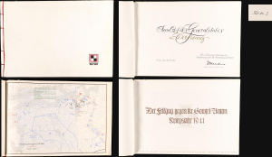
Der Feldzug gegen die Sowiet-Union / Kriegsjahr 1941 / Bearbeitet in der Führungsabteilung des Oberkommandos der Heeresgruppe Nord.
sold
A proof-state white-kid-bound 1941 World War II German general's presentation atlas, here in its only known example, chronicling the first 6 months of Operation Barbarossa. It was lavishly published on Christmas Eve 1941 by the General Staff of Army Group North as a gift to members of Army Group North's General Staff participating in the invasion. This atlas appeared at a high point in the Nazi campaign to conquer the Soviet Union, and the bravado that accompanied their early successes is evident. The present example, 'proof no. 2', is the only known surviving copy. (more details)
1st map to show the results of the Bering Expedition; 1st map to show any part of Alaska, 1st map of the Russian Empire printed in Russia.
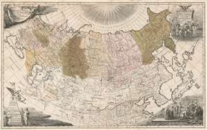
Imperii Russici tabula generalis quo ad fieri potuit accuratissime descripta opera et studio Ioannis Kyrilow.
sold
- Digital Map Information
- Suitable for large format printing
- DPI: 600
- File Size: 70.85 MB
- File Type: ZIP / TIFF
- ICC color profile embedded
- Delivered instantly via download link
An incredibly rare and important map, this is Ivan Kirilov's 1734 large format map of the Russian Empire. Printed in Petropoli, Russia, this is the first scientifically accurate map of the Russian Empire printed in Russia. It is also the first printed map to show the cartographic results if Vutys Bering's First Kamchatka Expedition (1727 - 1730) AND the first appearance of any part of Alaska (St. Lawrence Island) on a printed map. The map's coverage extends from the Black Sea to the Bering Strait, and from the north pole to the Persia, Korea, Japan, and the Yangze River. Decorative cartouche work adorns all four comers and underscores the Tzardom's wealth and power. (more details)
A previously undiscovered Japanese Serio-Comic Map! Possibly the first!
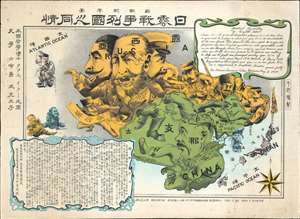
New Commemorative Print of Various Countries Sympathies in the Russo Japanese War. / 崭新纪念画 日露戰爭列國义同情
sold
- Digital Map Information
- Suitable for large format printing
- Full resolution TIFF file
- ICC color profile embedded
- Delivered instantly via download link
The only known example of a 1904 (Meiji 37) Japanese serio-comic style map of Asia illustrating foreign perspectives on the Russo-Japanese War (1904 - 1905). Although previously unknown, if the May 3rd 1904 date is to be believed, this is the second Japanese serio-comic map in the Russo-Japanese War series. The map covers all of Asia and although it does not include Europe, illustrates several western European powers, including France, England, and Germany. (more details)
The most important map of the Northeast Passage and pre-Behring map of the NE Asian Arctic.
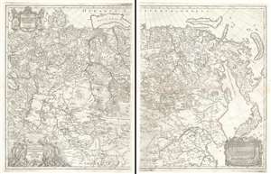
Nova Descriptio Geographica Tattariae Magnae Tam Orientalis Quam Occidentalis In Particularibus Et Generalibus Territoriis Una Cum Delineatione Totius Imperii Russici Imprimis Siberiae Accurate Ostensa.
sold
- Digital Map Information
- Suitable for large format printing
- DPI: 600
- File Size: 71.2 MB
- File Type: ZIP / TIFF
- ICC color profile embedded
- Delivered instantly via download link
A cartographic masterpiece defined by imprisonment, war, and obsession. This is the first edition of Philipp Johann von Strahlenberg's 1730 map of Russia and Siberia. Strahlenberg's expansive map is considered one of the largest, most groundbreaking, and unique maps of Russia to appear in the first half of the 18th century. It is of particular importance to the mapping of Siberia and the Russian Arctic, to establishing expectations for the viability of a Northeast Passage, and to the pre-Bering mapping of the Bering Strait. (more details)
Previously unknown Japanese serio-comic map.
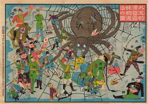
外交的滑稽露蜘蛛退治の圖 / [Image of the Diplomatic Hilarity of Exterminating the Spider].
sold
- Digital Map Information
- Suitable for large format printing
- File Size: 125.97 MB
- File Type: ZIP / TIFF
- ICC color profile embedded
- Delivered instantly via download link
This is a 1904 serio-comic tour de force, with vivid colors and rich symbolism, made by Enomoto Matsunosuke, satirizing the geopolitics of the day in the opening phase of the Russo-Japanese War. While cheering on Japan in the conflict, Enomoto is also having a laugh at the alliances and efforts required to exterminate the 'spider' of Tsarist Russia. This comic was part of an outpouring of popular patriotic images, poetry, songs, and other cultural production in Japan after the start of the war. Enomoto was prescient in his portrayal of the Russian Empire as tottering, beset by domestic unrest and surrounded by unfriendly powers. (more details)
First Edition, First State of a later censured Map of Hungary.
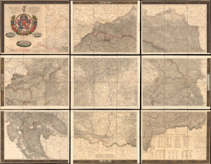
Magyar Ország, Horvát, Tót, Dalmát, és Erdély Országok, a tenger mellék és a végőri videkék kőzonséges pśták és útak főldabrosza... / Vollstaendige General Posten- und Strassen-Karte des Königreichs Ungran, der Königreiche Croatien, Slavonien, Dalmatien, des Grossfürstenth. Siebenbürgen, des Küstenlandes und der Militair-Grenze...
sold
- Digital Map Information
- Suitable for large format printing
- File Size: 591.44 MB
- File Type: ZIP / TIFF
- ICC color profile embedded
- Delivered instantly via download link
This is Blaschnék Sámuel and Schedius Lajos' lavish, very large-format bilingual (Hungarian-German) c. 1836 folding map of the Kingdom of Hungary, here in its first-edition first-state. It depicts the kingdom in the wake of the Napoleonic Wars, when it was in the midst of a reform movement, and represents the most detailed and up-to-date mapping of the kingdom in the first half of the 19th century. (more details)
Published in only one edition.
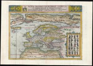
Nova Totius Europae Tabula.
sold
- Digital Map Information
- Suitable for large format printing
- Full resolution TIFF file
- ICC color profile embedded
- Delivered instantly via download link
This is Cornelis De Jode's rare map of Europe, printed in a single edition of 1593. It was among the updated maps added to the De Jode atlas specifically to compete with Ortelius' powerhouse Theatrum Orbis Terrarum. To this end, it combined cartographic information from the most current sources with a level of decorative flourish that had not yet appeared in any atlas. It also presented its subject with a broader focus to incorporate newer information about the northern parts of the world not present on the elder De Jode's map. (more details)
Meticulous day-to-day diary of war.
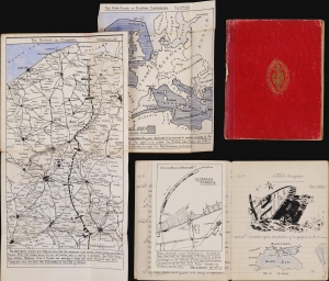
[Western Campaign. Eastern Campaign.].
sold
- Digital Map Information
- Suitable for large format printing
- File Size: 907.88 MB
- File Type: ZIP / TIFF
- ICC color profile embedded
- Delivered instantly via download link
An extraordinary discovery, this is a handwritten schoolgirl diary chronicling World War I from April 15, 1918, to just after June 23, 1919. The 124-page diary features meticulously executed hand-drawn maps covering battle fronts from France and Belgium to the Middle East, Ukraine (Crimea), the Caucasus, and Siberia, all of which are referenced in the text. A map near the end highlights the final Allied offensive and victories from August through November 1918. Photographs, airplane silhouettes, and newspaper clippings are pasted in as well, and the writer includes striking drawings of airplanes, tanks, airships, bombs, and manuscript copies of political cartoons. (more details)
The earliest acquirable modern printed map of Eastern Europe.
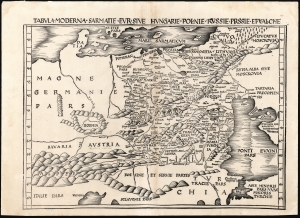
Tabula Moderna Sarmatie Eur. Sive Hungarie Polonie Russie Prussie Et Walachie.
sold
- Digital Map Information
- Suitable for large format printing
- DPI: 600
- File Size: 53.73 MB
- File Type: ZIP / TIFF
- ICC color profile embedded
- Delivered instantly via download link
This is Martin Waldseemüller's 1513 map of Eastern Europe, covering from the Elbe River to the Dnipro River and the Black Sea - roughly Poland, Hungary, Prussia, Lithuania, Russia, Transylvania, and Bulgaria, and some of the earliest obtainable mappings of the Ukraine. (more details)
An original manuscript map detailing events during the first year of the Russo-Turkish War of 1735-1739 - most likely the template for several reduced atlas maps.
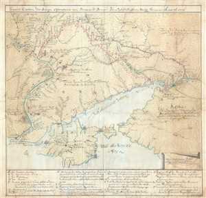
General-Carten der Kriegs Operationen am Donn und Dnieper, Irho Rußish Kayßerl: Merijl: Glorieusen Armée Ao. 1736.
sold
- Digital Map Information
- Suitable for large format printing
- DPI: 300
- File Size: 20.4 MB
- File Type: ZIP / TIFF
- ICC color profile embedded
- Delivered instantly via download link
This is the original 1736 manuscript map of Ukraine and the Crimean Peninsula that inspired reduced atlas editions by Joseph Nicolas de L'Isle and Matthäus Seutter, among others, and illustrates the events of the first year of the Russo-Turkish War of 1735-1739. ... (more details)
Rare map illustrating Japanese concerns over Russian and American expansionism.
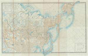
[Russia, China, Japan, Korea, Alaska]
sold
- Digital Map Information
- Suitable for large format printing
- File Size: 50.29 MB
- File Type: ZIP / TIFF
- ICC color profile embedded
- Delivered instantly via download link
This is a highly unusual 1867 or Keiō 3 Japanese lithograph map of Asia and Alaska. The map covers from the Caspian Sea and Nova Zembla to Alaska as far as Prince of Wales Island and Sitka. It embraces most of the Russian Empire in Asia including Alaska, which ... (more details)
One of the most important maps of Siberia made in Tsarist times.
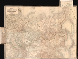
Карта Азіятской Россіи с прилегающими к ней владѣниями / [Map of Asian Russia, with Adjacent Possessions].
sold
- Digital Map Information
- Suitable for large format printing
- Full resolution TIFF file
- ICC color profile embedded
- Delivered instantly via download link
This is an rare and important 1884 Russian-language map of the Russian Empire, focusing on Siberia and the Russian Far East, produced by the Military Topographic Department of the Imperial Army's General Staff. It represents a major advance in detailed geographical and cartographic knowledge of Siberia at a time, when the Tsarist government was increasingly interested in settling colonists and exploiting the resources of the vast region. (more details)
Russian and Japanese conflict over railway rights in Manchuria.
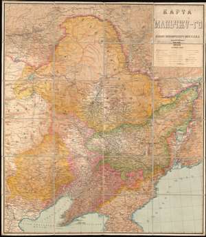
КАРТА МАНЬЧЖУ-ГО. / Manchu-Go Map.
sold
- Digital Map Information
- Suitable for large format printing
- Full resolution TIFF file
- ICC color profile embedded
- Delivered instantly via download link
This is a 1932 wall map of Manchuria or Manchukuo published by the Economic Bureau of the Chinese Eastern Railway (abbreviated K.V.Zh.D. in Russian). Entirely in Russian, the map depicts Manchukuo, the name giving to the Japanese puppet state established after the 1932 Japanese invasion of Manchuria. This railroad map was published by the Soviet division of the Chinese Eastern Railway, a vital transport artery critical to Soviet ambitions in East Asia. These railways, the Trans-Siberian Railway and the Chinese Eastern Railway (also known as the Trans-Manchurian Railway), played a pivotal role in the geopolitical upheavals in East Asia during the early 20th century. The publication of this piece by the Soviets, the year Manchukuo was established, underscores the significance control of the railroads had on Soviet psyche and perhaps their premonitions of what was to come. (more details)
The Russian Empire at its height of expansion just before the Napoleonic Invasion.
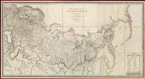
ГЕНЕРАЛЬНАЯ КАРТА РОССIЙСКОЙ ИМПЕРIИ HA ПЯТДЕСЯТЪ ГУБЕРНIЙ РАЗДЂЛЕННОЙ, съ ПОКАЗАНIЕМЪ СОСЕДСТВЕННЫХЪ ВЛАДЂНІЙ и большихъ дорогъ. / A General Map of the Russian Empire Divided into the Fifty Provinces, Showing Neighboring Domains and Highways.
sold
- Digital Map Information
- Suitable for large format printing
- DPI: 600
- File Size: 112.48 MB
- File Type: ZIP / TIFF
- ICC color profile embedded
- Delivered instantly via download link
An exceptionally rare 1809 large-format map of the Russian Empire by Alexsandr Dmitrievich Savinkov. This is the largest and most important map published during Savinkov's tenure at the Saint Petersburg Imperial Map Depot. Presented on a conic equidistant projection, Savinkov's map covers the Russian Empire in all of its expansiveness, from Finland, annexed into Russia in the year this map was made, to Russian Alaska, and from the Arctic to Mongolia. It is dedicated to Savinkov's patron, Tsar Alexander I or Alexander Pavlovich (1777 - 1825), who ruled from 1801 to 1825. The whole exhibits Savinkov's distinctive and exceptional fine engraving style. (more details)
Stalin's plan for continental-level terraforming.
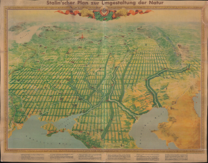
Stalin'scher Plan zur Umgestaltung der Natur. [Stalin's Plan for the Reorganization of Nature.]
sold
- Digital Map Information
- Suitable for large format printing
- Full resolution TIFF file
- ICC color profile embedded
- Delivered instantly via download link
An extraordinary discovery, this is the only known surviving example of a 1949 bird's-eye view of the Ukraine, Russia, and the Caucasus, published to illustrate Stalin's grandiose plan to terraform the Soviet steppe. This view is a cartographic amalgam of Cold War environmentalism, propaganda, scientific ambition, Soviet dogma, and large-scale terraforming. (more details)
Among the earliest maps of the Dnipro River.
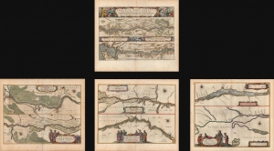
Tractus Borysthenis, Vulgo Dniepr er Niepr dicti.
sold
- Digital Map Information
- Suitable for large format printing
- Full resolution TIFF file
- ICC color profile embedded
- Delivered instantly via download link
A beautiful 1662 original-color set of Joan Blaeu maps of the Dnipro (Dnieper) River, the Ukrainian frontier of the Polish-Lithuanian Commonwealth. At the time, the region was undergoing a radical rearrangement, with Poland-Lithuania ejected as the major outside power and replaced by Tsarist Russia. (more details)
Key Map from the Earliest Atlas in Armenian.
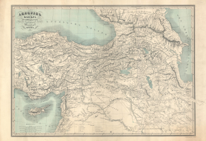
Հայաստամ Աշխարհ Ըստ նախնի աշխարհագրաց / [The Armenian World according to ancient geographers].
sold
- Digital Map Information
- Suitable for large format printing
- File Size: 47.09 MB
- File Type: ZIP / TIFF
- ICC color profile embedded
- Delivered instantly via download link
An exceptional discovery, this 1849 historical map of Armenia appeared in the Illustrated World Atlas, the first atlas published in the Armenian language. The map and atlas are a reflection of a growing Armenian national consciousness in the mid-19th century, which would eventually clash with the late Ottoman state with terrible consequences. (more details)
Map prepared for Napoleon's catastrophic invasion of Russia.
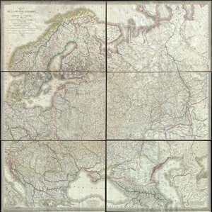
Carte de la Russie d'Europe, avec l'Empire d'Autriche, la Suede, le Danemark et la Norwege, la Prusse, le Grand Duche de Varsovie, les provinces Illyriennes, et une partie de la Confederation du Rhin et de la Turquie d'Europe.
sold
- Digital Map Information
- Suitable for large format printing
- DPI: 300
- File Size: 135.89 MB
- File Type: ZIP / TIFF
- ICC color profile embedded
- Delivered instantly via download link
This extraordinary six-sheet 1812 wall map of Russia was prepared by Pierre M. Lapie and Pierre Antoine-François Tardieu in anticipation of Napoleon's catastrophic 1812 French Invasion of Russia. Centered on Moscow (Moscau), the map depicts European Russia and ... (more details)
The most beautiful example of Blaeu's city map of Moscow.
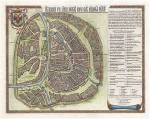
Царствающои град Москва началнои город всех московских государствах. / Carstvajuščoi grad Moskva načalo I gorod všeh Moskovech I carstvach. Urbis Moskvae.
sold
- Digital Map Information
- Suitable for large format printing
- DPI: 300
- File Size: 10.89 MB
- File Type: ZIP / TIFF
- ICC color profile embedded
- Delivered instantly via download link
This is a 1642 Hessel Gerritsz city map or plan of Moscow, Russia. With the Kremlin at its center, the map depicts the city from the city from the Moscow River to Zemlyanoy Gorod, which is surrounded by ramparts and a moat. This historical district in Moscow ... (more details)
A beautiful example of a plan of Moscow's 'fortress'.
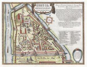
КРЕМЛЁН ГРАД. / Kremlenagrad, Castellum Urbis Moskvæ.
sold
- Digital Map Information
- Suitable for large format printing
- DPI: 300
- File Size: 11.39 MB
- File Type: ZIP / TIFF
- ICC color profile embedded
- Delivered instantly via download link
This is a 1642 Hessel Gerritsz map of the Kremlin, Moscow, Russia. (more details)
A masterpiece by an mysterious unknown cartographer.
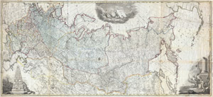
Nova Tabula Geographica Imperii Russici in Gubernia Divisi Edita 1787
sold
- Digital Map Information
- Suitable for large format printing
- DPI: 300
- File Size: 129.69 MB
- File Type: ZIP / TIFF
- ICC color profile embedded
- Delivered instantly via download link
A scarce and spectacular monumentally proportioned 1787 Map of Russia by an unknown yet masterful cartographer. Renders the full sprawling extant of the Russian Empire from the Black Sea to the northwestern parts of the American Continent (Alaska) in ... (more details)
Strahlenberg's stolen 1715 map of Asiatic Russia and the Tatar Empire.
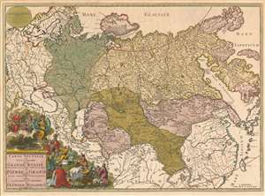
Carte nouvelle de tout l'Empire de la Grande Russie dans l'estat ou il s'est trouvé à la mort de Pierre le Grand. Dressée sur des observations toutes nouvelles et dedoée à l'immortelle memoire de ce Grand Monarque Avec Privilege à Amsterdam.
sold
- Digital Map Information
- Suitable for large format printing
- Full resolution TIFF file
- ICC color profile embedded
- Delivered instantly via download link
This rare, separately issued map of the Russian Empire was printed by Renier and Josua Ottens c. 1730, but the map is based on the work of Philipp Johann von Strahlenberg. It is that mapmaker's first map of Russia and Siberia, stolen from him in 1715. Strahlenberg (1677 - 1747) would rebound to produce his superb 1730 Tattariae Magnae, one of the largest, most groundbreaking, and unique maps of Russia to appear in the first half of the 18th century. This beautiful engraving represents the first complete expression of Strahlenberg's efforts at his seminal mapping of Siberia and the Russian Arctic. (more details)
The greatest map of Hungary ever made.
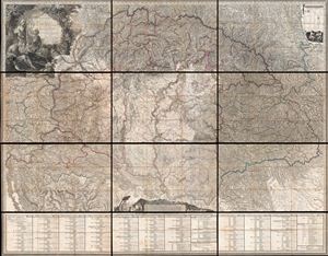
Mappa Generalis Regni Hungariae, partiumque adnexarum Croatiae, Slavoniae et Confiniorum Militarium. Magni item Principatus Transylvaniae geometricis partium dimensionibus, recentissimisque astronomicis observationibus superstructa, adjectis finibus Provinciarum Bukovinae, Galliciae, Silesiae, Austriae, Styriae, Carinthiae, Carnioliae, Dalmatiae, Bosniae, Serviae, Valachae, et Moldaviae.
sold
- Digital Map Information
- Suitable for large format printing
- DPI: 300
- File Size: 211.09 MB
- File Type: ZIP / TIFF
- ICC color profile embedded
- Delivered instantly via download link
Possibly the finest engraved map of Hungary ever produced, and certainly the most detailed, this is Janos's Lipszky's seminal 1806 wall map of Hungary. The map covers Hungary at the height of its territorial claims in the early 19th century, covering ... (more details)
The Balkans on the cusp of their independence of the Ottoman Empire.
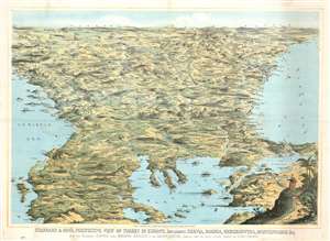
Stannard and Son's, Perspective View of Turkey in Europe, Including Servia, Bosnia, Herzegovina, Montenegro, and c, with the Adjoining Countries more Immediately Interested in the Eastern Question, Compiled from the Latest Official Sources, by Alfred Concanen.
sold
- Digital Map Information
- Suitable for large format printing
- File Size: 52.56 MB
- File Type: ZIP / TIFF
- ICC color profile embedded
- Delivered instantly via download link
An impressive 1876 William Stannard and Alfred Concanen bird's-eye perspective view of the Balkans during the Great Eastern Crises (1875 - 1878). The view centers on Sofia, Bulgaria, with coverage extending from the Adriatic to the Black Sea and from Odessa and Belgrade to Thessaly (Greece), embracing modern day Bulgaria, the Sea of Marmora, the Dardanelles, Montenegro, Bosnia, Serbia, Herzegovina, and Albania. (more details)
Includes the earliest acquirable European mapping of Korea based on firsthand report.
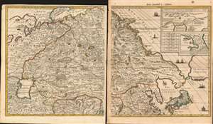
[Carte Nouvelle de la Grande Tartarie].
sold
- Digital Map Information
- Suitable for large format printing
- Full resolution TIFF file
- ICC color profile embedded
- Delivered instantly via download link
This is Pierre Mortier's 1696 two-sheet map of northern Asia, Siberia and Tartary. It is drawn primarily from two sources: Hubert Jaillot's 1695 six-sheet wall map of Asia, and Nicolaes Witsen's 1687 map of Tartary. As a result, this map represents the most up-to-date cartography of central and northeastern Asia of the seventeenth century, which would not be significantly improved upon until the maps of Strahlenberg. (more details)
Scarce map of Russia reflecting the work of the short lived but promising Tzar and boy genius, Fyodor II Borisovich Godunov.
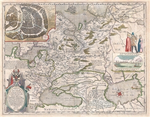
Tabula Russiae ex autographo, quod delineandum curavit Foedor filius Tzaris Boris desumta ... Magno domino, Tzari et magno duci Michäeli Foedrowits omnium Russorum, autocratori ... dedicata ab Hesselo Gerardo.
sold
- Digital Map Information
- Suitable for large format printing
- DPI: 300
- File Size: 14.17 MB
- File Type: ZIP / TIFF
- ICC color profile embedded
- Delivered instantly via download link
A very attractive 1632 old color example of Hessel Gerritsz's important map of Russia. Centered on Moscow, the map covers from the North Sea to the Caspian Sea and from Nova Zembla to Trabzon (Black Sea south coast). There is a large and ... (more details)
Early detailed Russian map of Asia, including Maritime Southeast Asia.
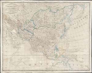
генеральная карта Азіи : изданная По новейшим известиям / [General Map of Asia: Published according to the Latest News].
sold
- Digital Map Information
- Suitable for large format printing
- DPI: 600
- File Size: 115.83 MB
- File Type: ZIP / TIFF
- ICC color profile embedded
- Delivered instantly via download link
This is a unique 1833 Russian-language map of Asia, most likely produced by the Russian Military Topographic Depot (Военно-топографическом депо). It represents an important advance in Russian geographic knowledge, particularly of Maritime Southeast Asia and Australia. (more details)
Stalin's Genocide against the Ukrainian Kulak.
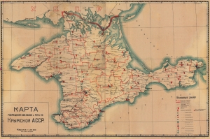
КАРТА РАЗМЕЩЕНИЯ СОВХОЗОВ И М.Т.С. ПО КРЫМСКОЙ АССР. / LOCATION MAP OF STATE FARMS AND M.T.S. ACCORDING TO THE CRIMEA ASSR.
sold
- Digital Map Information
- Suitable for large format printing
- File Size: 40.83 MB
- File Type: ZIP / TIFF
- ICC color profile embedded
- Delivered instantly via download link
This is a c. 1936 Tipo-Lithografia map of Crimea, Ukraine, highlighting collective farms and machine tractor stations - a key element of Stalin's 'Dekulakization', Stalin's 'genocide' against the Ukrainian Kulak (prosperous farmer) class. (more details)
The Trans-Siberian Railway paving the way for resettlement in Siberia.
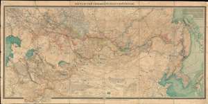
КАРТА ПУТЕЙ СООБЩЕНИЯ АЗІАТСКОЙ РОССIЙ. / Map of Routes of Communication of Asian Russia.
sold
- Digital Map Information
- Suitable for large format printing
- Full resolution TIFF file
- ICC color profile embedded
- Delivered instantly via download link
A rare large-scale 1911 Alexei Ilyin map of the Russian Empire in Asia and the Trans-Siberian Railway issued for the Imperial Russian Ministry of Railways. The map catalogs not only the near complexation of the Trans-Siberian Railway, a major development in Russian infrastructure, but also the extensive Siberian resettlement projects instigated under Tsar Nicholas II and Pyotr N. Stolypin. This expansive maps coves from the Caspian Sea to Japan and Korea, and from Yakutsk to northern China. In addition to railroad routes, the map shows communication networks, mines, ironworks, forests, and resettlement areas up to 1910, inclusive. (more details)
Most Visually Engaging Seventeenth Century Map of Russia.
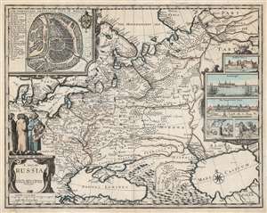
A Map of Russia.
sold
- Digital Map Information
- Suitable for large format printing
- DPI: 600
- File Size: 65.3 MB
- File Type: ZIP / TIFF
- ICC color profile embedded
- Delivered instantly via download link
This is John Speed's scarce 1676 map of Russia, one of the first English maps of Russia and certainly the most decorative. The map is scarce, having appeared only in the latter, Basset and Chiswell edition of the Speed atlas. Centered on Moscow, the map covers from the North Sea to the Caspian Sea and from Nova Zembla to Trabzon (Black Sea south coast). There is a large and impressive inset map of Moscow: this is centered on the Kremlin, Belygorod, and the Kityagorod. Five inset views depict the Emperor's Court in the Kremlin, the vital port of Archangel, the Russian fort at Narva (in modern Estonia and a crucial stronghold on Russia’s western border), bathhouses and a mill. Above the cartouche are figures dressed in 'The Habit of Russians,' one of whom carries the Russian coat of arms. (more details)
An enormous geological map of the former Soviet Union that was internationally renowned when it was first issued.
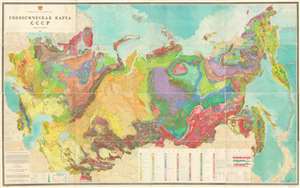
Geological Map of the U.S.S.R. / ГЕОЛОГИЧЕСКАЯ КАРТА CCCP.
sold
- Digital Map Information
- Suitable for large format printing
- Full resolution TIFF file
- ICC color profile embedded
- Delivered instantly via download link
This is a 1968 Dimitri Vasilievich Nalivkin geological map of the Union of Soviet Socialist Republics (U.S.S.R). The map depicts the region from Poland to the Pacific Ocean and from the Arctic Ocean to Iran, China, and Japan. Strikingly ... (more details)