
Russia - Eastern Europe
Imperial Struggle for the Manchu Homeland
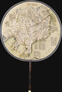
東三省俄部邊防全省圖說 / [Illustrated Description of the Russian Section of the Three Eastern Provinces for Border Defense].
$11,000.00
Acquire
- Digital Map Information
- Suitable for large format printing
- Full resolution TIFF file
- ICC color profile embedded
- Delivered instantly via download link
This is a stunning c. 1900 manuscript fan map of Manchuria prepared by a group of Qing military officers led by one surnamed Ren. Demonstrating astonishingly fine and meticulous workmanship, it covers the border region of Manchuria at a time when Qing rule of their Manchu homeland was greatly imperiled by both the Russian Empire and Imperial Japan. (more details)
Cold War Era Soviet Plan to Repel an American Arctic Invasion.

Организация и ведение противодесантной операции на морском побережье во взаимодействии с военно-морским флотом / [Organization and Conduct of an Anti-Amphibious Operation on the Seacoast in Coordination with the Navy].
$7,500.00
Acquire
This is a one-of-a-kind 1952 Cold War Era top-secret report with maps, prepared for the Operations Directorate of the Northern Military District of the Armed Forces of the Soviet Union. The booklet discusses detailed plans to repel a much-feared 'Anglo-American imperialist' invasion of the Soviet Union from the Arctic. It offers unique insight into the Soviet perspective and defensive planning at the height of the Cold War (1947 - 1991). (more details)
Most Important Map of of the Polish-Ukraine Border Kingdom.
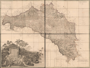
Regna Galicia, et Lodomeriae Josephi II et M. Theresiae Augg. iussu methodo astronomico-trigonometrica, nec non Bukovina geometrice dimensa...
$6,500.00
Acquire
- Digital Map Information
- Suitable for large format printing
- Full resolution TIFF file
- ICC color profile embedded
- Delivered instantly via download link
This is the 1790 first edition of Joseph Liesganig's seminal and massive map of Galicia, a territory roughly conforming to the modern border between Poland and Ukraine. The region, which had been granted to the Habsburgs in the First Partition of Poland, was virtually unmapped using modern methods before Liesganig and his team spent months preparing the present work, making it one of the most important maps of Eastern Europe of the era. (more details)
Most Detailed Ottoman Map of Montenegro Ever Produced.
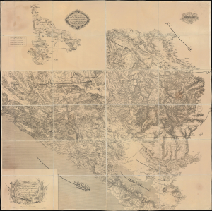
... ١٨٦٩ سنه سی اوستريا دولتی جغرافيا جمعيت عسكريه سی واسطه سيله تنظيم قلنان قره طاغ وجوارينك خريطه سی اولوب / [This is a map of Montenegro and its Surroundings, prepared by means of the Austrian Militärgeographisches Institut in the year 1869...].
$6,000.00
Acquire
- Digital Map Information
- Suitable for large format printing
- Full resolution TIFF file
- ICC color profile embedded
- Delivered instantly via download link
This is a rare 1875 Ottoman Turkish large-format folding map of Montenegro produced by the Erkân-ı Harbiye Dairesi, the General Staff Department of the Ottoman military, based on an earlier 1869 Austrian map prepared by the Militärgeographisches Institut. Combining Austrian and Ottoman cartographic knowledge, largely gained during the Ottoman-Montenegrin War (1861 - 1862), it is the most detailed Ottoman map of Montenegro produced before the kingdom's independence. (more details)
Landmark of Cyrillic calligraphic printing.
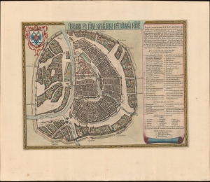
Царствающои град Москва началнои город всех московских государствах. / Carstvajuščoi grad Moskva načalo I gorod všeh Moskovech I carstvach. Urbis Moskvae.
$4,400.00
Acquire
- Digital Map Information
- Suitable for large format printing
- Full resolution TIFF file
- ICC color profile embedded
- Delivered instantly via download link
This is the 1662 Hessel Gerritsz and Willem Janszoon Blaeu city map or plan of Moscow, Russia. The map is significant as the dominant plan of Moscow in the 17th century. It is also significant for its innovative use of Cyrillic calligraphy to name both the city gates and in the map's titling - a first for non-Russian publishers. The Cyrillic calligraphy of the title is especially innovative, revealing the designer as a master of the style. (more details)
The earliest acquirable European mapping of Korea based on firsthand report.
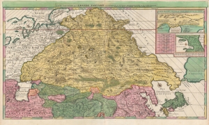
Carte Nouvelle de la Grande Tartarie.
$3,500.00
Acquire
- Digital Map Information
- Suitable for large format printing
- DPI: 600
- File Size: 123.4 MB
- File Type: ZIP / TIFF
- ICC color profile embedded
- Delivered instantly via download link
This is a stunning, original-color example of Pierre Mortier's 1696 two-sheet map of northern Asia, Siberia, and Tartary. It is drawn primarily from two sources: Hubert Jaillot's 1695 six-sheet wall map of Asia and Nicolaes Witsen's 1687 map of Tartary. As a result, this map represents the most up-to-date cartography of central and northeastern Asia of the seventeenth century, which would not be significantly improved upon until the maps of Strahlenberg thirty years later. (more details)
Pioneering Jewish Social Welfare in Interwar Poland.
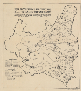
פארבאנד פון געזעלשאפט פאר יתומים־פארזאר גונג אױף אין פּוילן / Union of Societies For Jewish Orphan Welfare Work In Poland / Związek Towarzystw Opieki Nad Sierotami Żydowskiemi w Polsce.
$3,500.00
Acquire
- Digital Map Information
- Suitable for large format printing
- File Size: 11.89 MB
- File Type: ZIP / TIFF
- ICC color profile embedded
- Delivered instantly via download link
This is a very scarce 1928 trilingual (Yiddish-Polish-English) map of the Second Polish Republic prepared by B. Horowitz for CENTOS, the largest Jewish charitable organization in Poland caring for orphans. It highlights the locations of Jewish social welfare organizations throughout the country, working with orphans. Despite harrowing difficulties, CENTOS pioneered modern social welfare in the tumultuous Interwar Period (1919 - 1939), when the Polish Jewish community faced not only an orphan crisis, the result of pogroms perpetrated during World War I, but also increased isolation and discrimination. (more details)
Strahlenberg's stolen 1715 map of Asiatic Russia and the Tatar Empire.
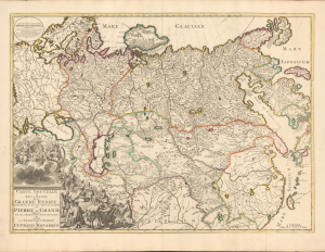
Carte nouvelle de tout l'Empire de la Grande Russie dans l'estat ou il s'est trouvé à la mort de Pierre le Grand. Dressée sur des observations toutes nouvelles et dedoée à l'immortelle memoire de ce Grand Monarque Avec Privilege à Amsterdam.
$3,500.00
Acquire
- Digital Map Information
- Suitable for large format printing
- DPI: 600
- File Size: 29.44 MB
- File Type: ZIP / TIFF
- ICC color profile embedded
- Delivered instantly via download link
This rare, separately issued map of the Russian Empire was printed by Renier and Josua Ottens c. 1730, but the map is based on the work of Philipp Johann von Strahlenberg. It is that mapmaker's first map of Russia and Siberia, stolen from him in 1715. Strahlenberg (1677 - 1747) would rebound to produce his superb 1730 Tattariae Magnae, one of the largest, most groundbreaking, and unique maps of Russia to appear in the first half of the 18th century. This beautiful engraving represents the first complete expression of Strahlenberg's efforts at his seminal mapping of Siberia and the Russian Arctic. (more details)
First scientific charting of the River Don, by Peter The Great's Handpicked Admiral.
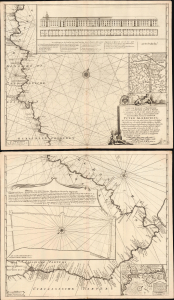
Nieuwe zeer Accurate, en Naauwkeurige Caart vande Rivierde Don of Tanais, Met aanwijzinge van alle des Selfs Dieptens, Droogtens etc. afgemeeten in 't Iaar 1699.
$3,250.00
Acquire
- Digital Map Information
- Suitable for large format printing
- Full resolution TIFF file
- ICC color profile embedded
- Delivered instantly via download link
This is Cornelis Cruys' rare, two-sheet chart of the Don River, the first modern astronomical survey of that waterway, based on his 1699 observations made while accompanying Peter the Great and the new Russian Black Sea Fleet from Voronezh to Azov. The plates were engraved by Hendrick Doncker for inclusion in Cruys' 1704 atlas of the Don; the present example is of the c. 1729 state, updated and printed by the Ottens firm for inclusion in their atlases. All states of the chart are rare, with the Doncker all but unacquirable. (more details)
Rare Glimpse of the Efforts to Comprehend Northeastern Asia.
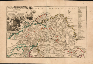
Les etats du Czar ou Empereur des Russes en Europe et en Asie...
$3,000.00
Acquire
- Digital Map Information
- Suitable for large format printing
- File Size: 38.72 MB
- File Type: ZIP / TIFF
- ICC color profile embedded
- Delivered instantly via download link
This large, beautiful, and rare map of the Russian Empire, engraved by Nicolas de Fer and published in 1722, is a fascinating revision of Nicolas Witsen's 1687 map of the Tatar Empire and Siberia. It incorporates the novel reports of Evert Ysbrandzoon Ides - derived from his journeys between Moscow and China - as well as the Central Asian voyage of Philippe Avril. (more details)
Modernizing Ottoman maritime data.
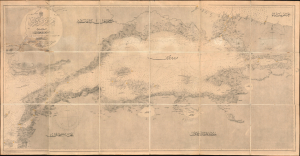
مارمارا ضنيزي / [Sea of Marmara].
$2,800.00
Acquire
- Digital Map Information
- Suitable for large format printing
- File Size: 1762.71 MB
- File Type: ZIP / TIFF
- ICC color profile embedded
- Delivered instantly via download link
A fascinating 1896 nautical chart or map of the Sea of Marmara, including the Bosphorus Straits, published by the Ottoman Matbaa-i Bahriye (Printing House of the Naval Forces). It is based on a British Admiralty chart of the same, reflecting both the advanced state of British hydrography at the time and the efforts of the late Ottoman state to close the gap with Western empires. (more details)
Defending the borders in the wake of Commodore Perry.
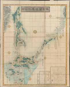
蝦夷闔境輿地全圖 / [Complete Map of All Lands within the Borders of Ezo].
$2,750.00
Acquire
- Digital Map Information
- Suitable for large format printing
- Full resolution TIFF file
- ICC color profile embedded
- Delivered instantly via download link
This is an important 1854 (Kaei 7) Japanese Edo period Fujita Ryou chromoxylographic map illustrating Hokkaido, Sakhalin, and the Kuril Islands. It was issued following the 1853 arrival of Commodore Matthew Perry, anticipating the opening of Hakodate as one of the five Japanese treaty ports. (more details)
From lost Russian sources.
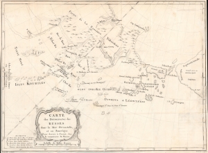
Carte des Découvertes des Russes dans la Mer Orientale, et en Amerique Pour Servir à L'essai, Sur le commerce de Russie.
$2,000.00
Acquire
- Digital Map Information
- Suitable for large format printing
- File Size: 378.74 MB
- File Type: ZIP / TIFF
- ICC color profile embedded
- Delivered instantly via download link
This is a rare and unusual 1777 map of the North Pacific in the vicinity of Alaska, the Bering Strait, and northeastern Siberia based upon Russian Promyshlenniki (trader) exploration. It appeared accompanying one of the earliest works on Russian commerce, the M. de Marbault's Essai sur le Commerce de Russie, avec l'Histoire de ses Decouvertes. (more details)
First map of Russia based on actual exploration.
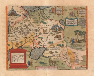
Russiae, Moscoviae et Tartariae Descriptio. Auctore Antonio Ienkensono Anglo, edita Londini Anno. 1562 et dedicata illustriss: D. Henrico Sÿdneo Wallie presidi.
$2,000.00
Acquire
- Digital Map Information
- Suitable for large format printing
- Full resolution TIFF file
- ICC color profile embedded
- Delivered instantly via download link
This is a 1601 example of Abraham Ortelius' 'Russia, Moscoviae et Tartariae', the first atlas map of Russia, and the first to be produced based on actual exploration. Its content is based on the travels of English merchant and diplomat Anthony Jenkinson, who visited Russia four times between 1557 and 1571. The map details the lands revealed by Jenkinson's first voyage which lasted from 1557 to 1560. His map, which was provided to Ortelius, was completed after that voyage, in 1562. (more details)
Reflecting historical tensions between Kiev and Russia.
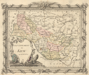
Gouvernement de Kiew.
$2,000.00
Acquire
- Digital Map Information
- Suitable for large format printing
- File Size: 8.46 MB
- File Type: ZIP / TIFF
- ICC color profile embedded
- Delivered instantly via download link
This is a previously unrecorded c. 1790 map of the Kiev Viceroyalty, today the heart of Ukraine, then a province of the Russian Empire. When this map was issued, the region was an ethnically diverse community of Ukrainians, Russians, Poles, Jews, and a small number of Greeks and Armenians, with Russian imperial culture slowly displacing the city’s older Polish-Lithuanian influences. These influences persist as an undercurrent in the current Russo-Ukrainian War. (more details)
Kyiv after Beauplan's Firsthand Survey. During the Russo-Polish War (1654 - 1667).
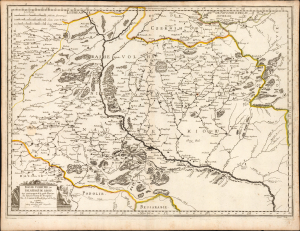
Basse Volhynie, ou Palatinate de Kiow.
$2,000.00
Acquire
- Digital Map Information
- Suitable for large format printing
- Full resolution TIFF file
- ICC color profile embedded
- Delivered instantly via download link
This is a beautifully engraved 1665 map of central Ukraine by Nicolas Sanson. Published during the Russo-Polish War (1654 - 1667), it is the earliest French iteration of the geography of Franco-Polish cartographer, engineer, and architect Guillaume Levasseur de Beauplan. Beauplan produced the best 17th-century survey of the Dniepr and laid the foundation for the modern mapping of Ukraine. (more details)
Odessa at its cultural and economic zenith.
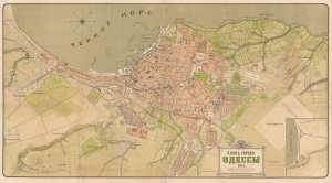
ПЛАНЪ ГОРОДА ОДЕССЫ. / Plan of the City of Odessa.
$2,000.00
Acquire
- Digital Map Information
- Suitable for large format printing
- File Size: 36.07 MB
- File Type: ZIP / TIFF
- ICC color profile embedded
- Delivered instantly via download link
This is a 1912 chromolithograph map of Odessa, Ukraine, capturing the city at its economic and cultural zenith. It was produced for the Imperial Society of Agriculture of Southern Russia (Императорское Общество Сельского Хозяйства Южной России) by the Odessa lithographer A. Til and Company. At the time, Odessa was one of the largest cities in the Russian Empire, often called the 'Southern Capital of Russia' for its economic, military, and cultural significance. The map records the breakneck pace of development Odessa underwent in the early 20th century, when it was Russia's largest port and home to its most active stock exchange. It was also, as this map reflects, an extremely diverse city, home to large Russian, Jewish, Ukrainian, Greek, and Armenian communities. (more details)
English language 1930s tourist map of the Caucasus that begs the question - why?
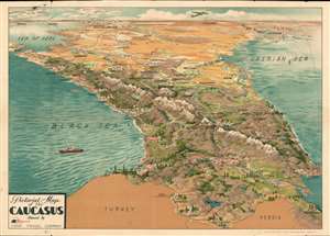
Pictorial Map of the Caucasus.
$2,000.00
Acquire
- Digital Map Information
- Suitable for large format printing
- Full resolution TIFF file
- ICC color profile embedded
- Delivered instantly via download link
This is a beautiful c. 1930 Intourist U.S.S.R. Travel Company pictorial map of the Caucasus. The map is most intriguing as while clearly a tourist-focused piece, the English-speaking audiences for whom it was intended are mysteriously absent. The English only established normalized relation with the USSR a year before, and the Americans had not. Moreover, this map appeared at the height of the Great Depression, when global travel dropped to a trickle. (more details)
Pre-Смутное время plan of Moscow.
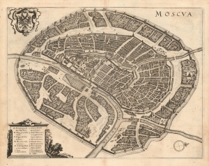
Moscva.
$1,900.00
Acquire
- Digital Map Information
- Suitable for large format printing
- DPI: 600
- File Size: 12.97 MB
- File Type: ZIP / TIFF
- ICC color profile embedded
- Delivered instantly via download link
This is a scarce 1638 Matthais Merian city plan or map of Moscow. Apart from the Braun and Hogenberg, this is the earliest full-sheet edition of the plan, which pre-dates by more than 20 years the version included by Joan Blaeu in his Atlas Maior. (more details)
Muller's important map postulating a large peninsula in the North Atlantic.
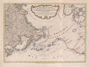
Nouvelle Carte des decouvertes Faites Par Des Vaisseaux Russiens Aux Côtes Inconnues de L'Amerique Septentrionale Avec Les Pais Adiacents.
$1,900.00
Acquire
- Digital Map Information
- Suitable for large format printing
- Full resolution TIFF file
- ICC color profile embedded
- Delivered instantly via download link
A beautiful example of Gerhard Friedrich Müller's important 1766 map of the Pacific Northwest, Alaska, the Bering Strait and Siberia, here in its rare Dutch second edition. Issued after the seminal explorations of Vitus Bering (1733 - 1743) on the Asia side of his namesake strait, but before the voyages of Captain James Cook similarly mapped the American side of the Bering Strait, this map is a smorgasbord of cartographic speculation – such as the exceptionally fine delineation of Friedrich Müller's Peninsula (Alaska / Aleutians). Centered on the Bering Strait, the map covers from Chinese Tartary to the Hudson Bay, and from the high Arctic, south as far as New Mexico, and Honshu (Japan). There is a striking contrast between the well explored Asiatic regions and the starkly bare and highly speculative mapping of America. (more details)
The early days of St. Petersburg.
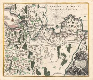
Ладожское озеро [Lake Ladoga], Conspectus recens et accuratus magnae partis Lacus Ladogae et Sinus Finnici.
$1,800.00
Acquire
- Digital Map Information
- Suitable for large format printing
- Full resolution TIFF file
- ICC color profile embedded
- Delivered instantly via download link
A scarce c. 1760 Russian-language map of Lake Ladoga, St. Petersburg, and environs, produced by Johann Elias Grimmel, based on an original published by Matthäus Seutter. It depicts the region as St. Petersburg was growing considerably and attracting intellectuals from throughout Europe, including Grimmel. (more details)
One of the largest printed views of Ljubljana.
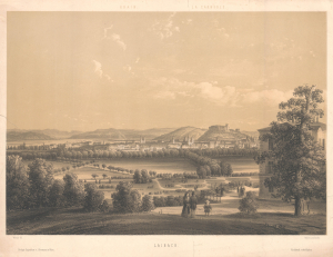
Laibach.
$1,800.00
Acquire
- Digital Map Information
- Suitable for large format printing
- File Size: 20.14 MB
- File Type: ZIP / TIFF
- ICC color profile embedded
- Delivered instantly via download link
This is a scarce 1850 two-color chromolithograph view of Ljubljana (Laibach), Slovenia, by the Austrian artist Karl Waage. It is one of the largest printed views of Ljubljana of the 19th century. (more details)
Powerful Anti-Communist Cold War Propaganda.
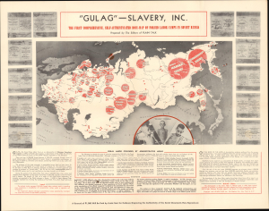
'Gulag' - Slavery, Inc. The First Comprehensive, self-Authenticated Docu-Map of Forced Labor Camps in Soviet Russia.
$1,750.00
Acquire
- Digital Map Information
- Suitable for large format printing
- File Size: 25.9 MB
- File Type: ZIP / TIFF
- ICC color profile embedded
- Delivered instantly via download link
This is a 1947 Plain Talk propaganda poster of the Gulag labor and prison camp network in the Soviet Union. Maps depicting the Soviet Union’s network of forced labor camps, known as the Gulag, became iconic symbols of Cold War propaganda, serving as some of the most widely distributed and influential pieces of anti-Communist media in the West. (more details)
Transylvania after the Great Turkish War.
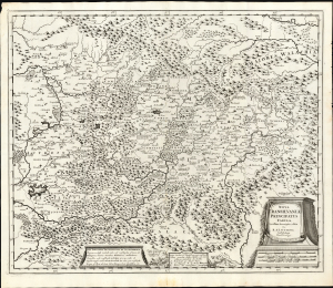
Nova Transilvaniae Principatus Tabula. Novissima descriptia editia Per R. et I. Ottens. Amstelodami Cum Priviligeo.
$1,600.00
Acquire
- Digital Map Information
- Suitable for large format printing
- File Size: 26.04 MB
- File Type: ZIP / TIFF
- ICC color profile embedded
- Delivered instantly via download link
This is Josue and Renier Ottens / Danckerts c. 1725 map of Transylvania. The map was published in the wake of the Great Turkish War (1683 - 1699) during a period of German migration into Transylvania and the Banat. (more details)
An unforgettable wall map of Russia and Eastern Europe.
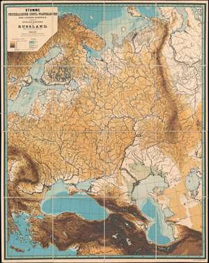
Stumme Physikalische Schul-Wandkarten der Länder Europas. Russland.
$1,500.00
Acquire
- Digital Map Information
- Suitable for large format printing
- File Size: 158.37 MB
- File Type: ZIP / TIFF
- ICC color profile embedded
- Delivered instantly via download link
This is an unforgettable 1888 Richard Kiepert topographic map of Russia and Eastern Europe. The map depicts the region from Sweden and the Balkans to the Ob River and from the Arctic Ocean to the Middle East. Kiepert employs eight different colors to illustrate the region's topography and three shades of blue for ocean depth. He details the region's river systems and coastlines, along with both the Aral Sea and Caspian Sea. Green appears along the shores of the Caspian Sea and denotes areas below sea level. Although without identifying any by name, many of the region's cities and towns are marked as well. (more details)
Catch up and overtake America!
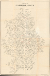
A remarkable find, this is an unrecorded 1958 very large-format (5' x 3') map of Stalino Oblast (Donetsk Oblast) of Soviet Ukraine, produced by the Soviet Ministry of Agriculture. It presents the region during the height of Nikita Khruschev's agricultural modernization and production drive of the late 1950s. Today, this region is contested in an ongoing Russo-Ukrainian War (2014 - present). (more details)
Beautifully executed map of the Russian Frontier with Sweden.
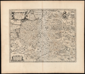
Russiae, vulgo Moscovia dictae, Para Occidentalis. Auctore Isaaco Massa.
$1,500.00
Acquire
- Digital Map Information
- Suitable for large format printing
- DPI: 600
- File Size: 56.46 MB
- File Type: ZIP / TIFF
- ICC color profile embedded
- Delivered instantly via download link
This is a handsome, first edition example of Blaeu's 1662 map covering from Moscow to Estonia, and part of Lithuania, including the frontier with the Swedish Empire. This is among the rarest Blaeu atlas maps of Russia, being one of those first appearing in Joan Blaeu's 1662 Atlas Maior. The map would only appear in the five editions of that atlas before the Blaeu warehouse burned in 1672. (more details)
Venice of the North.
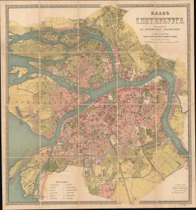
Планъ С. Петербурга составленный по новѣйшимъ свѣденіямъ [План С. Петербурга составленный по новейшим сведениям] / [Plan of St. Petersburg, Compiled Based on the Latest Information].
sold
- Digital Map Information
- Suitable for large format printing
- Full resolution TIFF file
- ICC color profile embedded
- Delivered instantly via download link
This is a c. 1885 chromolithographed folding Russian-language city plan of St. Petersburg, Russia, published by the prolific cartographic establishment of Alexey Ilyin. It captures the imperial capital as it underwent a rebirth, growing into the fifth-largest city in Europe, with modern infrastructure, amenities, and industries. (more details)
Between Bucharest and Brașov.
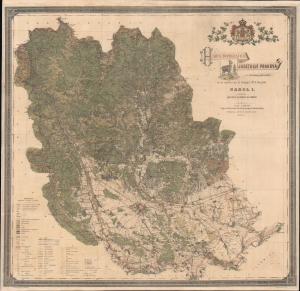
Harta Topografica Judetului Prahova.
$1,500.00
Acquire
- Digital Map Information
- Suitable for large format printing
- File Size: 232.7 MB
- File Type: ZIP / TIFF
- ICC color profile embedded
- Delivered instantly via download link
A rare 1904 chromolithograph wall map of Prahova and Transylvania, Romania issued by the Romanian Army Geographic Institute (Institutul Geografic al Armatei). Coverage embraces from just south of Brașov, Transylvania to the Ialomița River, just north of Bucharest. This includes the stunning Parcut Natural Bucegi (Bucegi Natural Park), with its rugged mountain scenery, unusual rock formations, and famous wild Black Goats - one of which is pictured in the title of this map. At a scale of 1:100000, the detail is stupendous, with individual properties, roads, and buildings noted. An extensive scale in the lower left details the elaborate coding through the map, where everything from factories, to mines, cemeteries, ruins, telegraph lines, and much more are identified. (more details)
Largest Soviet-era map of Kiev.
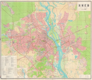
This is an enormous, classified, and scarce four-sheet map of Kiev (Kyiv), standing more than six feet tall, produced in 1989 by the Soviet Military Topographic Directorate of the General Staff. It depicts the city near the end of the Soviet Era, holding high the flag of socialism and Russian-Ukrainian unity, but also reflecting some cracks in the edifice of state power. (more details)
Primary artery of the Russian Civil War.
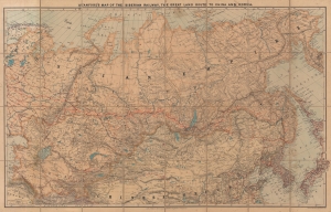
Stanford's Map of the Siberian Railway, the Great Land Route to China and Korea.
$1,200.00
Acquire
- Digital Map Information
- Suitable for large format printing
- Full resolution TIFF file
- ICC color profile embedded
- Delivered instantly via download link
This is a 1919 Edward Stanford map of Russia and the Trans-Siberian Railway - issued at the height of the Russian Civil War. Red lines, with major stops noted, highlight the extraordinary achievement of Russian railway engineers. The completion of a railway network across the world's largest continent opened Siberia to settlement, brought Russian influence to China, led to the Russo-Japanese War (1904 - 1905), and influenced the outcome of the Russian Civil War (1917 - 1920). (more details)
Crimea and Caucasus of the 17th century.
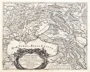
Tartaria d'Europa o vero Piccola Tartaria divisa da Giacomo Cantelli da Vignola ne Tartari Nogai e del Crim, o di Precop Soggetti al proprio Kam ne Tartari di Budziack, d'Oczackow, e di Dobruss, soggetti al Turco, ne Tartari Circassi, e di Mordua Soggetti al Gran Duca di Moscovia e nelle Due Uckraine...
$1,200.00
Acquire
- Digital Map Information
- Suitable for large format printing
- DPI: 600
- File Size: 68.61 MB
- File Type: ZIP / TIFF
- ICC color profile embedded
- Delivered instantly via download link
This is a 1684 Cantelli da Vignola map of the Caucasus, the lands of the Circassian and Crimean Tartars, Georgia, and Ukraine. The region - peopled by an array of Tatar and Cossack tribes - was largely under the domination of the Crimean Khanate and the Nogai Horde, but represented a borderland contested by the Grand Duchy of Muscovy and the Turkish Empire. (more details)