
The Blue Map of China - one of the most important and beautiful maps ever made.
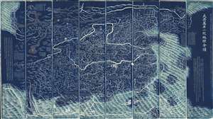
DaQing Wannian Yitong Tianxia Quantu / 大清万年一统天下全图 / All-Under-Heaven Complete Map of the Everlasting Unified Qing Empire
sold
- Digital Map Information
- Suitable for large format printing
- Full resolution TIFF file
- ICC color profile embedded
- Delivered instantly via download link
The legendary Blue Map of China under the Great Qing, one of the rarest, largest, and most aesthetically magnificent Chinese maps ever made. Published in 1811 (Jiaqing 16) in the Qing Dynasty, this Chinese map by Huang Qianren (黃千人, 1694–1771) is of utmost significance. Although ostensibly a map of China, the coverage of this map in fact extends to all lands touched by the influence Qing Empire, including England, Holland, Southeast Asia, Arabia, and Africa. As such it can be considered a political manifesto lionizing the unity and majesty of Qing China as well as a functional administrative document. (more details)
The Most Beautiful 15th Century Map of the World.
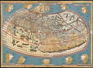
[Untitled map of the World].
sold
- Digital Map Information
- Suitable for large format printing
- DPI: 600
- File Size: 18.86 MB
- File Type: ZIP / TIFF
- ICC color profile embedded
- Delivered instantly via download link
This is a beautiful example, in rich original color, of the world map of the 1486 Ulm Ptolemy: regarded as the most beautiful, printed world map of the 15th century. The present example is one of the finest to appear on the market in recent years. It appeared in the first edition of Ptolemy printed north of the Alps, and as such it provided the foundation for the revolution in geographical knowledge that occurred in the opening years of the 16th century. The 'world' as depicted here is mainly the Oikumene, the inhabited world as it was known to 2nd century Romans. It covers the 'Old World' from the islands of the Atlantic Ocean (both real and legendary) to Indochina, and from the Arctic to the Tropic of Capricorn. But this was also the first printed world map to depart from a purely Ptolemaic model, offering more contemporaneous knowledge: the early depiction of Scandinavia and Iceland. (more details)
Exceptional complete example of the First American Road Atlas!
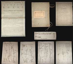
A superb example, entirely complete, of Christopher Colles' 1789 - 1790 A Survey of the Roads of the United States of America. This is the First American Road atlas, wherein at least some of the plates represent the first American maps engraved by a female - Colles' 13-year-old daughter Eliza. Covering depictions from Albany, New York to Williamsburg, Virginia, Colles' atlas consists of a prospectus, a title page, and 83 separate strip maps, each covering some 12 miles of roads and offering invaluable detail about the natural and human landscape of late 18th-century America, and was published in commemoration of the founding of the new republic in 1789. (more details)
The only indigenous Siamese map outside of Siam.
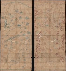
[Siam, Cambodia.]
sold
- Digital Map Information
- Suitable for large format printing
- Full resolution TIFF file
- ICC color profile embedded
- Delivered instantly via download link
Two c. 1800 Siamese / Thai manuscript maps, drawn back-to-back on hand loomed cotton. The significance of these maps cannot be understated. They are likely working drafts for parts of a series of maps compiled for and presented to the Siamese kings sometime between 1783 and 1825. Collectively, they represent the only examples of indigenous Siamese non-religious cartographic visualization outside 17 Royal Maps (really just 11, see below). As working draft, these maps may predate the Royal Siamese Maps, possibly making them the earliest known Thai maps. (more details)
Rare, Distinctive World Map with a Unique Projection.
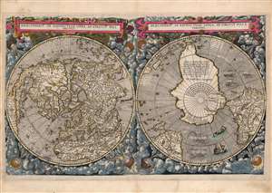
Hemispheriū Ab Aequinoctli Linea, Ad Circulū Poli Arctici / Hemispheriū Ad Circulū Poli Ātarctici.
sold
- Digital Map Information
- Suitable for large format printing
- Full resolution TIFF file
- ICC color profile embedded
- Delivered instantly via download link
This is a beautiful example of Cornelis De Jode's 1593 double-polar projection map of the world. It is among the most striking early world maps, and among the earliest to introduce the double hemispheric polar projection. Moreover, as a competitor to Ortelius' cartography, it is the sole obtainable map to preserve the innovative Guillaume Postel / Antwerp Unicum cartography. The map is moreover exceedingly rare, having been published in only a single edition. (more details)
Unique manuscript record of the War of the Quadruple Alliance. Author's own copy.
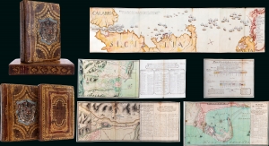
Guerra De Cerdeña Ysicilia, En Los Años De 1717, 18, 19, Y 1720. Con Reflexiones Militares Del Marquèsde La Mina Conde De Pezuela.
sold
This is an extraordinary 2-volume 1755-57 manuscript account of the War of the Quadruple Alliance, fought over Sicily, drafted by a participant, the II Marques de la Mina, Jaime Miguel de Guzmán Davalos y Spinola. It is Mina's personal copy, emblazoned with his arms, rich with masterfully executed foldout manuscript maps and tables, and features exceptional provenance. At the time of writing, this work was suppressed in Spain, as the loss of the Spanish fleet at the Battle of Cape Passaro was a royal embarrassment, leading to it remaining unpublished for more than 140 years. The War of the Quadruple Alliance here represented, while not well known, had global ramifications, as it significantly diminished the Spanish navy, giving the British largely unopposed free reign on the colonial stage, particularly in the Americas. (more details)
First Islamic Wall Map of the Arabian Peninsula.
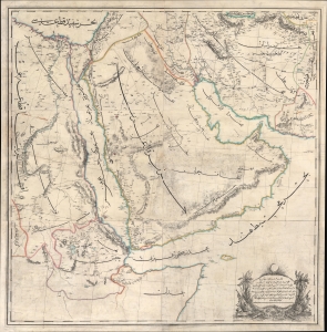
...مملك محروسهء شاهانه دن آسيا / [The Royal Palace of Asia...].
sold
- Digital Map Information
- Suitable for large format printing
- File Size: 172.65 MB
- File Type: ZIP / TIFF
- ICC color profile embedded
- Delivered instantly via download link
A rare large-format 1871 Ottoman wall map of Arabia by military officer Yusbasi Husni (Hüsnü) Efendi. This is the earliest known large-scale Islamic wall map of Arabia. It was produced amid major administrative changes and cartographic developments, when the Ottoman Empire was securing its tenuous control of Mecca, Medina, and Yemen against both internal and external pressure. (more details)
The most important map of the Philippines, in the reduced 'B' variant. Engraved by a Philippine and printed in the Manila.
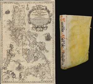
Mapa de Las Yslas Philipinas Hecho Por el Pe. Pedro Murillo Velarde de Compa. de Jesus.
sold
The first edition of Pedro Murillo Velarde's seminal 1749 history of the Philippines, complete with the desirable 1744 Bagay reduction of the 1734 Murillo-Bagay wall map of the Philippines. As a whole, the work is considered one of the most important productions in the history of Philippine printing and a unique Spanish-Philippine collaboration. The map is of particular significance, being the second major map of the Philippines published in the Philippines, engraved by the same hand that engraved the 1734 wall map, but with updates and revisions reflecting 10 years of discovery and development. (more details)
Stunning Atlas, Old Color, Distinguished Provenance.

Fasciculus geographicus complectens praecipuarum totius orbis regionum tabulas circiter centum, unà cum earundem enarrationibus.
sold
This is Matthias Quad's geographical atlas in its expanded 1608 edition, with 87 maps in superb original color and a distinguished provenance connecting it to the Lord Wardington Collection. Quad's atlas provided, in a small folio, a compilation of the most state-of-the-art maps of his era - some engraved by Quad himself, the bulk having been engraved by publisher Johan Bussemacher. The richly-colored atlas is beautifully bound in contemporary vellum and is the finest example of this work known. (more details)
Earliest Acquirable Printed Map of Arabia.
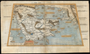
Sexta Asiae Tabula.
sold
- Digital Map Information
- Suitable for large format printing
- Full resolution TIFF file
- ICC color profile embedded
- Delivered instantly via download link
A foundational work of Renaissance cartography: this is the first acquirable printed map of the Arabian Peninsula. Appearing in the Rome edition of Ptolemy, in its 1478 printing, it is preceded only by the unacquirable 1477 Bologna Ptolemy. Ptolemy's 2nd-century innovation of representing the three-dimensional world on a grided mathematical projection provided the basis of all modern cartography. Of all the early printed versions of Ptolemy's maps, those produced for the Rome edition are considered the finest until Mercator's 1578 edition. The present example is embellished with attractive old hand color. (more details)
The Finest Dutch World Map Venice Could Offer.
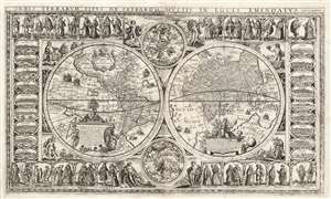
Orbis Terrarum Tipus de Integro Multis in Locis Emendatus.
sold
- Digital Map Information
- Suitable for large format printing
- Full resolution TIFF file
- ICC color profile embedded
- Delivered instantly via download link
This beautiful, extremely rare, separately-issued, double hemisphere carte á figures world map captures the most desirable elements of 17th century Dutch decorative cartography in one composition - including an Amsterdam imprint and the prominently displayed patronym of 'Willem Blaeu'. Both the imprint and the professed authorship were deliberately misleading: the map was engraved in Venice, not Amsterdam, and it has been attributed to the illustrator and printer Stefano Mozzi Scolari. The map is dated 1655. It is perhaps ironic that of the Dutch mapmakers from whom Scolari sourced this map, not one element appears to have been drawn from Blaeu, apart from his name. The engraver was not fully committed to deception: faintly in the lower right border is an additional, more honest imprint, 'in Venetia à S. Fosca'. Bifolco identifies this location as an engravers' shop associated with Scolari. (more details)
One of the Finest and Most Detailed Woodcut World Maps.
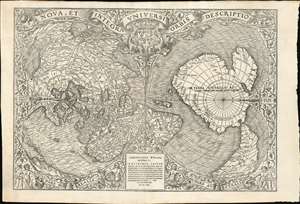
Nova, et Integra Universi Orbis Descriptio.
sold
- Digital Map Information
- Suitable for large format printing
- Full resolution TIFF file
- ICC color profile embedded
- Delivered instantly via download link
This the rare and influential 1531 Oronce Fine map of the world, portrayed using a double cordiform polar projection. This intricate woodcut map was both influential and - especially compared to other printed maps of its era - remarkably reflective of state-of-the-art cartographic detail. Rodney Shirley proclaimed it 'a rendering considerably in advance of any others printed earlier.' Many areas of significant interest are addressed in detail for the first time. The peninsular shape of Florida is clearly presented for the first time, and both Pineda and Cortez' mapping of the Gulf of Mexico are recorded here. This is the first printed map to refer to Magellan's voyage, naming a 'Mare Magellanicum' west of South America. The map breaks from Martin Waldseemüller's convention of presenting North America as separate from Asia: Fine's map incontrovertibly presents Labrador, Florida and the Gulf Coast as part of the Asian mainland; South America itself is depicted as taking the place of the Ptolemaic Great Promontory, or 'Dragon's Tail' that appeared on earlier maps like the 1507 Waldseemüller and the 1490 Martellus. Although including (but not naming) Magellan's strait, the map fails to account for the size of the ocean that circumnavigator revealed (despite naming that ocean - Mare Magellanicum.) (more details)
Extraordinary manuscript map collection of Taiwan and Fujian relating to the 1874 Punitive Expedition and the cartography of Le Gendre.
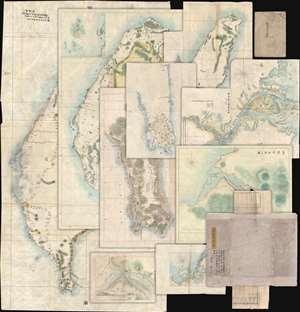
[Taiwan Manuscript Map Collection relating to 1874 Taiwan Punitive Expedition.]
sold
- Digital Map Information
- Suitable for large format printing
- Full resolution TIFF file
- ICC color profile embedded
- Delivered instantly via download link
An extraordinary collection of nine 1874 manuscript maps detailing Taiwan and part of Fujian province, China. The maps were compiled and drafted by one, Sudo Katsuzō (湏藤 or 湏藤勝三) of Tochigi Prefecture, Japan, on an official or semi-official 1874 mission to Taiwan and thence to mainland China. Most of the maps in this set were compiled between March of and June of 1874 and are related to the 1871 Mundan Incident and the subsequent 1874 Taiwan Punitive Expedition. The Taiwan maps are primarily derived from maps drawn by the American Consul to Qing Taiwan Charles William (Guillaum) Joseph Émile Le Gendre's (August 26, 1830 - September 1, 1899) between 1867 and 1873. Others, particularly those of mainland china and Tamsui, are derived from British Admiralty Hydrographic Charts. In addition to the manuscript maps, the collection also contains its original binder and Sudo's application booklet requesting permission to travel from Taiwan to Fujian and Shanghai. (more details)
Ceremonial and Administrative Embodiment of the Qing.
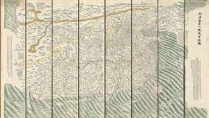
DaQing Wannian Yitong Tianxia Quantu / 大清万年一统天下全图 / All-Under-Heaven Complete Map of the Everlasting Unified Qing Empire
sold
- Digital Map Information
- Suitable for large format printing
- Full resolution TIFF file
- ICC color profile embedded
- Delivered instantly via download link
A seminal 1821 (Daoguang 1) Qing Dynasty Chinese map of utmost importance and rarity, this is Huang Qianren's (黃千人, 1694–1771) grand and spacious map of the Great Qing Empire of China. Although ostensibly a map of China, the coverage of this map in fact extends to all lands touched by the influence Qing Empire, including England, Holland, Southeast Asia, and Africa. As such it can be considered a political manifesto lionizing the unity and majesty of Qing China as well as a functional administrative document. This edition of the map, 1821, was issued to memorialize the reign of the Jiaqing Emperor and celebrate the coming Daoguang reign. (more details)
Unobtainable first state of one of the most influential maps of New England ever made.
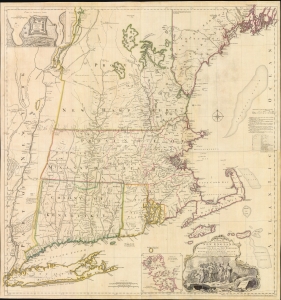
A MAP of the most INHABITED part of NEW ENGLAND, containing the PROVINCES of MASSACHUSETS BAY and NEW HAMPSHIRE, with the COLONIES of KONEKTIKUT AND RHODE ISLAND. Divided into Counties and Townships: The whole composed of Actual Surveys and its situation adjusted by ASTRONOMICAL OBSERVATIONS.
$55,000.00
Acquire
- Digital Map Information
- Suitable for large format printing
- File Size: 35.46 MB
- File Type: ZIP / TIFF
- ICC color profile embedded
- Delivered instantly via download link
This is the rare 1755 first state of Braddock Mead's French and Indian War Era map of New England - one of the most significant and iconic American maps ever produced. It is one of the first large-format regional maps of any part of North America and was the most comprehensively researched and detailed map of contemporary New England. (more details)
The last great cartographic masterpiece of Ming China.
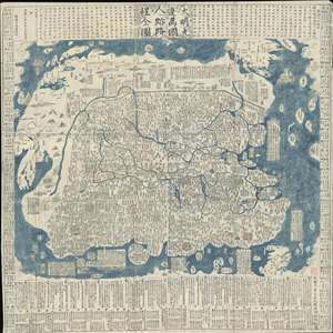
Complete Map of the Nine Border Towns of the Great Ming and of the Human Presence and Travel Routes of the Ten Thousand Countries. / 大明九邊萬國人跡路程全圖 / Dàmíng jiǔ biān wànguó rén jì lùchéng quán tú.
sold
- Digital Map Information
- Suitable for large format printing
- Full resolution TIFF file
- ICC color profile embedded
- Delivered instantly via download link
A rare and extraordinary 1663 (Kangxi 2) xylographic map of Ming China, and indeed the entire world, by Wáng Jūnfǔ (王君甫) issued during the reign of the Kangxi Emperor (1661 – 1722). This massively proportioned map focuses on China, which, bounded on the ... (more details)
The last great cartographic masterpiece of Ming China.
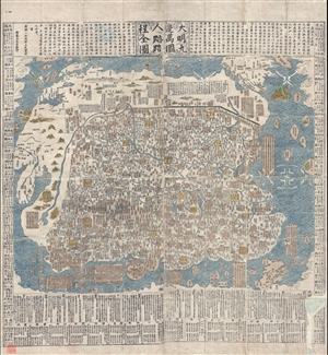
Complete Map of the Nine Border Towns of the Great Ming and of the Human Presence and Travel Routes of the Ten Thousand Countries. / 大明九邊萬國人跡路程全圖 / Dàmíng jiǔ biān wànguó rén jì lùchéng quán tú.
sold
- Digital Map Information
- Suitable for large format printing
- DPI: 300
- File Size: 70.8 MB
- File Type: ZIP / TIFF
- ICC color profile embedded
- Delivered instantly via download link
A rare and extraordinary 1663 (Kangxi 2) xylographic map of Ming China, and indeed the entire world, by Wáng Jūnfǔ (王君甫) issued during the reign of the Kangxi Emperor (1661 – 1722). This massively proportioned map focuses on China, which, bounded on the ... (more details)
With the only pre-1500 map reflecting the Age of Discovery.
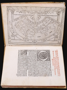
This is a rare, important 1482 incunable edition of Pomponius Mela's Cosmographi Geographica or De situ orbis, the only full Latin text on geography to have survived the classical era. This 1482 edition is doubly important as the first geographical text to include a map, as opposed to an atlas. Moreover, it is the only map of the pre-1500 era to show evidence of the Portuguese voyages of discovery. (more details)
The largest and most decorative map of Shanghai!
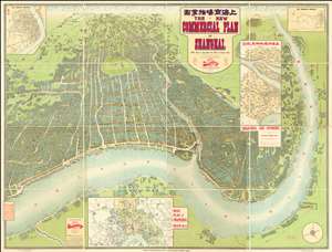
The New Commercial Plan of Shanghai (with which is incorporated the Wharf and Godown Plan). Surveyed, constructed and designed by the Far Eastern Geographical Establishment 6 Kiukiang Road Shanghai.
sold
- Digital Map Information
- Suitable for large format printing
- File Size: 300.62 MB
- File Type: ZIP / TIFF
- ICC color profile embedded
- Delivered instantly via download link
The greatest and most impressive map of Shanghai we have yet seen. Issued in 1915, this is the Far Eastern Geographical Establishment / Edwin John Dingle / H. J. Fruin pictorial view and map of Shanghai. The map is a staggering 83 x 63 inches. The view looks on Shanghai from the east, at a high point across the Huangpu River in what is today the hip Pudong district. In includes the Bund, the Shanghai International Settlement, and the British and French Concessions, as well as the old Chinese City at left. It was issued shortly after the shortly after the 1911 Xinhai Revolution. One can follow Wusong Creek westward into the Horizon, which is illustrated with clouds. Inset maps detail Shanghai and Environs, Road Plan of Shanghai, The Nantao District, and The Rubicon District. (more details)
Largest map of the Philippines Printed in the Philippines w/ Distinguished Provenance.
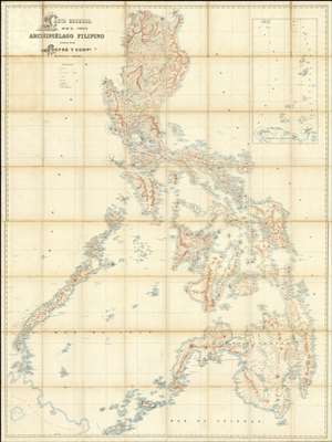
Carta General del Archipiélago Filipino.
sold
- Digital Map Information
- Suitable for large format printing
- File Size: 2002.83 MB
- File Type: ZIP / TIFF
- ICC color profile embedded
- Delivered instantly via download link
This is the only known example of Salvador Chofré's spectacular 1897 map of the Philippines - what must be considered the largest and most detailed Spanish map of the Philippines issued in the 19th century. The map was produced by Salvador Chofré, Manila's first lithographer at the height of his career, likely by government request in the face of the Philippine Revolution (1896 - 1898). The present example is likely a proof, as no other example or publishing history is known. What is known is that this example was acquired by American naval officer Henry Glass in 1898, when he participated in the invasion and surrender of Manila. The U.S. Navy reportedly reproduced it, very likely from this example, at a 50% reduced scale, although we have found no trace of said reproduction. The present map accompanied Glass when he returned to the United States, serving in San Francisco and attaining the rank of Rear Admiral, and was subsequently passed down through his family until we acquired it. (more details)
Early Texas scene on Fan depicting the Las Salle Expedition w/map.
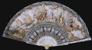
A remarkable c. 1750 Texas cartifact, this is a French hand-held fan, printed and hand colored on both sides, with one side bearing a map of Texas and illustrations celebrating the La Salle Expedition. The fan is a highly decorative and stylized chronology of the René Robert Cavalier, Sieur de La Salle (1643 - 1687) led French attempt to colonize Texas. It is a striking example of the fanciful representation that went into many depictions of European colonial enterprises, regardless of the facts. (more details)
The last edition of Melish's iconic 'Manifest Destiny' map of the United State to be published in his lifetime.
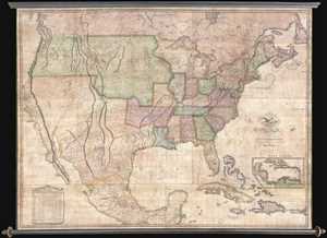
Map of the United States with the Contiguous British & Spanish Possessions Compiled from the latest & best authorities by John Melish . . . Improved to 1822.
sold
- Digital Map Information
- Suitable for large format printing
- DPI: 300
- File Size: 92.78 MB
- File Type: ZIP / TIFF
- ICC color profile embedded
- Delivered instantly via download link
An example of John Melish's important 1822 map of the United States. Melish's map is considered the most influential map of American published in the 19th century and is rivaled only by John Mitchell's 1755 map of North America as the single most influential map ... (more details)
First Japanese Printed Map to show European geographical information with Buddhist world-view.
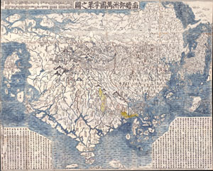
Nansenbushu Bankoku Shoka No Zu (Outline Map of All Countries of the Universe)
sold
- Digital Map Information
- Suitable for large format printing
- Full resolution TIFF file
- ICC color profile embedded
- Delivered instantly via download link
A seminal map. This is the first Japanese printed map to depict the world, including Europe and America, from a Buddhist cosmographical perspective. Printed by woodblock in 1710 (Hoei 7), this map was composed by the Buddhist monk Rokashi Hotan. Inspired by ... (more details)
First full-size folio map of North America.
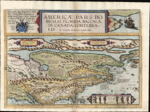
Americae Pars Borealis, Florida, Baccalaos, Canada, Corterealis.
$37,500.00
Acquire
- Digital Map Information
- Suitable for large format printing
- Full resolution TIFF file
- ICC color profile embedded
- Delivered instantly via download link
This is Cornelis De Jode's rare map of North America, printed in a single edition of 1593. The first full-size folio map specifically of North America, it was among the updated maps added to the De Jode atlas specifically to compete with Ortelius' Theatrum Orbis Terrarum. To this end, it combined cartographic information from current sources with a level of decorative flourish that had not yet appeared in any atlas. In the case of this map, Cornelis focused on a part of the world omitted from the elder De Jode's 1578 atlas. (more details)
The first Japanese map of the world from a Buddhist cosmographical perspective - a seminal map.
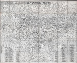
Nansenbushu Bankoku Shoka No Zu (Outline Map of All Countries of the Universe)
sold
- Digital Map Information
- Suitable for large format printing
- DPI: 300
- File Size: 91.94 MB
- File Type: ZIP / TIFF
- ICC color profile embedded
- Delivered instantly via download link
A seminal map of extreme significance. This is the first Japanese printed map to depict the world, including Europe and America, from a Buddhist cosmographical perspective. Printed by woodblock in 1710 (Hoei 7), this map was composed by the Buddhist monk ... (more details)
State-of-the-Art British Sea Atlas for the Caribbean.
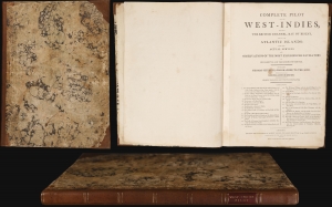
A Complete Pilot for the West-Indies, including the British Channel, Bay of Biscay, and all the Atlantic Islands: done from Actual Surveys.
sold
This is Robert Sayer's nautical atlas of the West Indies, A Complete Pilot for the West Indies, in its 1795 Laurie and Whittle edition. The Pilot showcases Thomas Jefferys' state-of-the-art British chartmaking during the American Revolutionary War (1775 - 1783). The present edition reflects Sayer's revisions following the Revolution, presenting the West Indies and the surrounding region as the changing political climate impacted the British sugar trade and its part in the infamous Triangle Trade, the systematic shipment of enslaved Africans to the West Indies and North America to facilitate the cultivation and processing of sugar. (more details)
First printed nautical chart of Virginia and North Carolina.
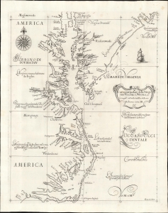
Carta particolare della Virginia Vecchia e Nuoua : la longitune comica da l'Isola di Pico di Asores : d'America carta, III.
sold
- Digital Map Information
- Suitable for large format printing
- File Size: 13.05 MB
- File Type: ZIP / TIFF
- ICC color profile embedded
- Delivered instantly via download link
A seminal chart, this is a superb 1661 example of Sir Robert Dudley's 1647 maritime map of the mouth of the Chesapeake Bay and the Carolina Sounds. In its first edition, this was the first printed nautical chart of that region. As per the title, the chart depicts the coasts of 'Old and New Virginia,' meaning the colonial efforts of Sir Walter Raleigh and the Jamestown Colony, respectively. Due to the Virginia Colony's importance to the English, Dudley's chart focuses more sharply on the region than on his other North American charts. (more details)
Remarkable example, exhibiting Catholic censorship.
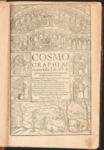
A superb, fascinating example of Sebastian Münster's masterpiece: his Cosmographia, in its much-expanded, first, Latin edition of 1550. Münster's work had between 1544 and 1548 been only published in German. With this edition, opening the work to an international audience, Münster added a wealth of larger and more elaborate images that would seal its popularity. This compendium would for more than half a century provide the European literate layperson their best source of information about the world, via its lively descriptions, engaging woodcut illustrations, and its array of maps. It was also one of the most copiously illustrated, early books, containing nearly 1000 woodcuts as well as the first separate maps of America and Asia, and the first detailed contemporaneous maps of Europe and Africa. Its regional maps present their respective areas in what were often the earliest modern depictions available to the reader.
That the book retained an audience long after its publication is attested to by the present example: almost two hundred and fifty years after its publication, it fell under the scrutiny of a Catholic censor, expurgating passages deemed harmful to the Church, the Papacy, and the modesty of the presumably Catholic reader. (more details)
That the book retained an audience long after its publication is attested to by the present example: almost two hundred and fifty years after its publication, it fell under the scrutiny of a Catholic censor, expurgating passages deemed harmful to the Church, the Papacy, and the modesty of the presumably Catholic reader. (more details)
Pony Express Broadside.
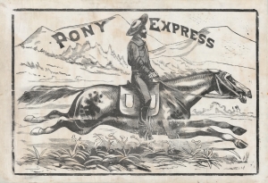
Pony Express.
sold
- Digital Map Information
- Suitable for large format printing
- File Size: 1593.38 MB
- File Type: ZIP / TIFF
- ICC color profile embedded
- Delivered instantly via download link
This is a large and dramatic c. 1860-61 xylographic broadside promoting the Pony Express - one of just two known surviving examples. Its striking size and visual grandeur are unmatched by any other Pony Express piece with which we are aware. Moreover, with a lifespan of just 18 months, and the general mystique driving interest the Pony Express, all such promotional material is of the utmost rarity and desirability. (more details)
A stunning late 19th century Vietnamese manuscript map.
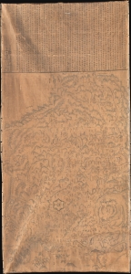
清化省圖本 / [Map of Thanh Hóa Province].
sold
- Digital Map Information
- Suitable for large format printing
- Full resolution TIFF file
- ICC color profile embedded
- Delivered instantly via download link
An incredible, one-of-a-kind large-format 1878 manuscript map depicting Thanh Hóa Province (清化省) in north-central Vietnam by Trần Lưu Huệ, an official at the court of the Nguyễn Dynasty. It is one of only a few examples of traditional Chinese-influenced Vietnamese cartography in private hands and outside of Vietnam. The area here covered was significant for the Nguyễn emperors, who had risen to prominence from Thanh Hóa in the early Lê Dynasty (r. 1428 - 1789). This, nonetheless, captures the Nguyễn Empire in decline as French Indochina began its push into the region. (more details)
Unique espionage portrait Paraguay under the Lopez dictatorship.
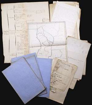
This is an incomparable find: an unpublished manuscript set, dated approximately 1860, consisting of maps, surveys, charts, and research notes pertaining to Paraguay, written by French naval officer and hydrographer Ernest Amédée Barthélemy Mouchez (1821 - 1892). It describes in detail Paraguay's volatile situation under dictator Carlos Antonio López Ynsfrán (née 1792, ruled 1841 - 1862,) whose autocracy set the stage for the disastrous reign of his son, Francisco Solano López Carrillo. (1827 - 1870) (more details)
Beautiful and extremely rare plan of Philadelphia while it was still the capital of the United States.
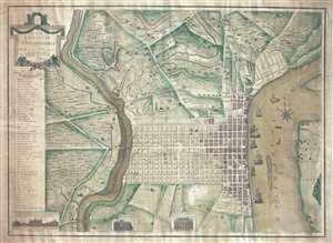
To the Citizens of Philadelphia: This Plan of the City and its Environs is respectfully dedicated by the Editor.
sold
- Digital Map Information
- Suitable for large format printing
- DPI: 300
- File Size: 18.82 MB
- File Type: ZIP / TIFF
- ICC color profile embedded
- Delivered instantly via download link
This is a 1796 Peter Charles Varlé city map or plan of Philadelphia, Pennsylvania. At this point in history, Philadelphia remained the capital of the United States, since the transfer to Washington, D.C. would not take place until 1800. The map depicts ... (more details)