
Bellin, Jacques-Nicolas

Jacques-Nicolas Bellin (1703 - March 21, 1772) was one of the most important cartographers of the 18th century. With a career spanning some 50 years, Bellin is best understood as geographe de cabinet and transitional mapmaker spanning the gap between 18th and early-19th century cartographic styles. His long career as Hydrographer and Ingénieur Hydrographe at the French Dépôt des cartes et plans de la Marine resulted in hundreds of high quality nautical charts of practically everywhere in the world. A true child of the Enlightenment Era, Bellin's work focuses on function and accuracy tending in the process to be less decorative than the earlier 17th and 18th century cartographic work. Unlike many of his contemporaries, Bellin was always careful to cite his references and his scholarly corpus consists of over 1400 articles on geography prepared for Diderot's Encyclopedie. Bellin, despite his extraordinary success, may not have enjoyed his work, which is described as "long, unpleasant, and hard." In addition to numerous maps and charts published during his lifetime, many of Bellin's maps were updated (or not) and published posthumously. He was succeeded as Ingénieur Hydrographe by his student, also a prolific and influential cartographer, Rigobert Bonne.
An important and often overlooked 1744 map of French, English and Spanish claims in North America.
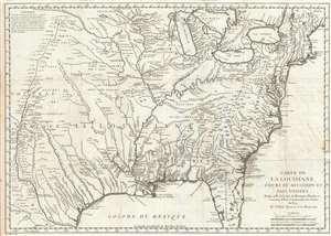
Carte de La Louisiane Cours du Mississipi et Pais Voisins.
$1,500.00
Acquire
- Digital Map Information
- Suitable for large format printing
- DPI: 300
- File Size: 9.76 MB
- File Type: ZIP / TIFF
- ICC color profile embedded
- Delivered instantly via download link
An important and influential 1744 map of the settled portions of North America by the French cartographer Jacques-Nicholas Bellin. Centered on the Mississippi Valley, Bellin's map covers from the Riviere de Nord (Rio Grande) eastward to the Atlantic seaboard and from Lake Huron to the Gulf of Mexico and south Florida. (more details)
First issue of an early depiction of Quebec.
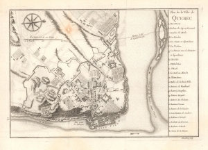
Plan de la Ville de Quebec.
$350.00
Acquire
- Digital Map Information
- Suitable for large format printing
- File Size: 5.39 MB
- File Type: ZIP / TIFF
- ICC color profile embedded
- Delivered instantly via download link
A scarce 1744 first state first issue of Bellin's important map of Quebec City, Canada. When this map was issued, Quebec dominated the French fur trade with its strategic position on a vital St. Lawrence artery. (more details)
Pensacola Bay and its Anchorages.
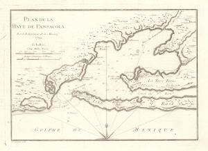
Plan de la Baye de Pensacola.
$450.00
Acquire
- Digital Map Information
- Suitable for large format printing
- File Size: 3.54 MB
- File Type: ZIP / TIFF
- ICC color profile embedded
- Delivered instantly via download link
This is an elegant 1744 chart of Pensacola Harbor in Florida by Jacques-Nicolas Bellin. It is among the earliest available charts of the bay and harbor and identifies the locations of Fort St. Charles and Fort St. Rose. Bellin also notes important coastal features, including reefs, soundings, and anchorages.
Bellin originally prepared this map to illustrate Pierre François Xavier de Charlevoix's Histoire et description generale de la Nouvelle France. It was engraved by Guillaume Dheulland. Charlevoix's history and this map, in particular, thus proved exceptionally influential as one of the most comprehensive works on North America predating the French and Indian War. Copies of the Histoire et description generale were found in the libraries of many 18th-century luminaries, including Voltaire, Franklin, and Jefferson. Jefferson especially admired Charlevoix's work, calling it 'a particularly useful species of reading' and no doubt influenced his decision to pursue the historic 1802 Louisiana Purchase, possibly the most significant event in the post-colonial history of North America. (more details)
Bellin originally prepared this map to illustrate Pierre François Xavier de Charlevoix's Histoire et description generale de la Nouvelle France. It was engraved by Guillaume Dheulland. Charlevoix's history and this map, in particular, thus proved exceptionally influential as one of the most comprehensive works on North America predating the French and Indian War. Copies of the Histoire et description generale were found in the libraries of many 18th-century luminaries, including Voltaire, Franklin, and Jefferson. Jefferson especially admired Charlevoix's work, calling it 'a particularly useful species of reading' and no doubt influenced his decision to pursue the historic 1802 Louisiana Purchase, possibly the most significant event in the post-colonial history of North America. (more details)
First issue of an early depiction of Quebec.
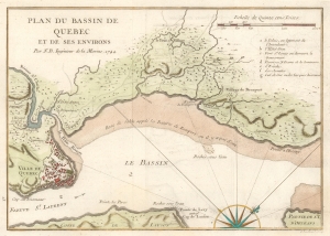
Plan du Bassin de Quebec et de ses Environs.
$200.00
Acquire
- Digital Map Information
- Suitable for large format printing
- File Size: 3.91 MB
- File Type: ZIP / TIFF
- ICC color profile embedded
- Delivered instantly via download link
A scarce 1744 first state first issue of Bellin's map of the vicinity of Quebec City, Canada, illustrating the shallows of the St. Lawrence River. When this map was issued, Quebec dominated the French fur trade with its strategic position on a vital St. Lawrence artery. (more details)
'The cartographic model for the next thirty years' -Kershaw
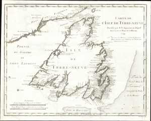
Carte De L'Isle de Terre-Neuve Dressée-par N. B. Ingenieur au Dépost des Cartes et Plans de la Marine 1744.
$750.00
Acquire
- Digital Map Information
- Suitable for large format printing
- File Size: 7.81 MB
- File Type: ZIP / TIFF
- ICC color profile embedded
- Delivered instantly via download link
This is the 1744 Bellin map of Newfoundland, a keystone map that set the standard for the mapping of the island for the third quarter of the 18th century. Newfoundland commanded a strategic position at the mouth of the St. Lawrence River, but its importance as a fishery would resonate throughout the century. The map's scope encompasses not only the island but also its position relative to the Labrador coast and the codfish-rich Grand Banks, emphasizing those important points. (more details)
Greatest map from Prevost's Voyages.
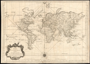
Essay d'une Carte Reduite, Contenant Les Parties Connuees du Globe Terrestre Dedié a M le Comte de Maurepas Commandeur des Ordres du Roy Ministre et Secretaire d'Etat.
$875.00
Acquire
- Digital Map Information
- Suitable for large format printing
- DPI: 600
- File Size: 75.08 MB
- File Type: ZIP / TIFF
- ICC color profile embedded
- Delivered instantly via download link
An attractive first edition, first plate example of J. N. Bellin's 1748 nautical chart of the world. Presents the entire world on a Mercator Projection based on a Paris (L'Isle de Fer) meridian. This is the first iteration of this important map, exhibiting a pre-Cook geography throughout, but most specifically in the Pacific and along the northwest coast of America.
North America to the west of the Mississippi is vaguely rendered according to 16th century expeditions into the region by Coronado, La Salle, De Soto, and others. Bellin identifies the semi-mythical civilizations of Quivira and Teguayo, both associated with legends of the Seven Cities of Gold, in what is modern day Utah, California, and Nevada. Along the western coast the strait discovered by the 17th-century explorer Martin Aguilar is noted. In a grand, optimistic vein, a great the River of the West (Fl. de l'Ouest) is shown extending from the Lake of the Woods (Lac de Bois) nearly to the Pacific. Via additional waterways, this river would have provided an easy link between the Pacific and the Great Lakes, and the Atlantic. The River of the West appeared in many 18th-century maps of the Americas and is reflective of French hopes for a water route from their colonies in Canada and Louisiana to the Pacific. Beyond here becomes extremely vague, with the notation in French 'Probably America extends as far as here.' The Aleutians are vaguely rendered according to various sightings by Vitus Jonassen Bering and Aleksei Chirikov: a note indicates that 'The Muscovites came here in 1743 but were stranded and drowned,' probably a reference to Bering and Chirikov's second Kamchatka expedition.
In the Pacific, various Polynesian Island groups are noted though many are slightly or significantly misplaced. The Solomon Islands are vastly oversized referencing the early 17th claims of Quiros. The other lands discovered and erroneously mapped by Quiros in 1606 and Davis in 1686 during their search of the Great Southern Continent are also noted. Hawaii, as yet undiscovered, is absent. New Zealand and Australia, (here labeled 'Nouvelle Holland,') are depicted mainly as per Abel Tasman's mid-16th century model, albeit the latter has part of its southern coastline ghosted and Van Diemen's Land (Tasmania) is attached to the mainland. New Guinea is connected to northeastern Australia. (more details)
North America to the west of the Mississippi is vaguely rendered according to 16th century expeditions into the region by Coronado, La Salle, De Soto, and others. Bellin identifies the semi-mythical civilizations of Quivira and Teguayo, both associated with legends of the Seven Cities of Gold, in what is modern day Utah, California, and Nevada. Along the western coast the strait discovered by the 17th-century explorer Martin Aguilar is noted. In a grand, optimistic vein, a great the River of the West (Fl. de l'Ouest) is shown extending from the Lake of the Woods (Lac de Bois) nearly to the Pacific. Via additional waterways, this river would have provided an easy link between the Pacific and the Great Lakes, and the Atlantic. The River of the West appeared in many 18th-century maps of the Americas and is reflective of French hopes for a water route from their colonies in Canada and Louisiana to the Pacific. Beyond here becomes extremely vague, with the notation in French 'Probably America extends as far as here.' The Aleutians are vaguely rendered according to various sightings by Vitus Jonassen Bering and Aleksei Chirikov: a note indicates that 'The Muscovites came here in 1743 but were stranded and drowned,' probably a reference to Bering and Chirikov's second Kamchatka expedition.
In the Pacific, various Polynesian Island groups are noted though many are slightly or significantly misplaced. The Solomon Islands are vastly oversized referencing the early 17th claims of Quiros. The other lands discovered and erroneously mapped by Quiros in 1606 and Davis in 1686 during their search of the Great Southern Continent are also noted. Hawaii, as yet undiscovered, is absent. New Zealand and Australia, (here labeled 'Nouvelle Holland,') are depicted mainly as per Abel Tasman's mid-16th century model, albeit the latter has part of its southern coastline ghosted and Van Diemen's Land (Tasmania) is attached to the mainland. New Guinea is connected to northeastern Australia. (more details)
Attractive French Map of the Northern Extremities of Russia.
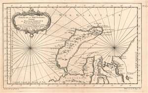
Partie de la Mer Glaciale, Contenant La Nouvelle Zemble et le Pais de Samoiedes suivant les Découvertes des Hollandois et les Cartes des Russes Pour servir à l'Histoire Générale des Voyages Par M. Bellin Ing. de la Marine 1758.
$250.00
Acquire
- Digital Map Information
- Suitable for large format printing
- Full resolution TIFF file
- ICC color profile embedded
- Delivered instantly via download link
This is a 1758 Bellin map of the northwestern coast of Russia, focusing on the island of Nova Zembla, the mouth of the River Ob, and the limits of European efforts to achieve a northeast passage. The eastern shore of Nova Zembla is sketched in and noted to be entirely unknown; The Kara sea is not named, but it is accurately described as a gulf 'nearly always full of ice.' The site of Barentz's famous refuge in the north of Nova Zembla is marked Ici les Hollandois basserent l'hiver en 1596. The Ob and the Yenisea rivers are shown with reasonable accuracy, but beyond the mouth of the unnamed Pyasina River, the coastline is conjectural and, again, n'est pas connue.
Despite its appearance in Prévost's Histoire générale des voyages - a work perhaps better known for its imaginative flourish than its factuality - Bellin drew on state-of-the-art knowledge for the maps he contributed. Though the map was intended to contextualize Prévost's discussion of Russia's indigenous tributaries to the Tsars, Bellin's map presents a reasonably accurate depiction of what western Europeans understood of the geography of this remote region. (more details)
Despite its appearance in Prévost's Histoire générale des voyages - a work perhaps better known for its imaginative flourish than its factuality - Bellin drew on state-of-the-art knowledge for the maps he contributed. Though the map was intended to contextualize Prévost's discussion of Russia's indigenous tributaries to the Tsars, Bellin's map presents a reasonably accurate depiction of what western Europeans understood of the geography of this remote region. (more details)
Attractive French Map of the Northern Extremities of Russia.
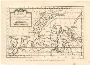
Carte Des Pais Habités par Les Samojedes et Ostiacs Pour l'Histoire Générale des Voyages.
$175.00
Acquire
- Digital Map Information
- Suitable for large format printing
- DPI: 600
- File Size: 4.32 MB
- File Type: ZIP / TIFF
- ICC color profile embedded
- Delivered instantly via download link
This is a 1749 Bellin map of the northwestern coast of Russia, focusing on the island of Nova Zembla, the mouth of the River Ob, and the limits of European efforts to achieve a northeast passage. The eastern shore of Nova Zembla is sketched in and noted to be entirely unknown; The Kara sea is not named, but it is described as a gulf 'nearly always full of ice.' The Ob and the Yenisea rivers are shown with reasonable accuracy, but beyond the mouth of the unnamed Pyasina River, the coastline is conjectural and, again, n'est pas connue.
Despite its appearance in Prévost's Histoire générale des voyages - a work perhaps better known for its imaginative flourish than for its factuality - Bellin drew on state-of-the-art knowledge for the maps he contributed. Though the map was intended to contextualize Prévost's discussion of Russias indigenous tributaries to the Tsars, Bellin's map presents a reasonably accurate depiction of what Europeans understood of the geography of this remote region. (more details)
Despite its appearance in Prévost's Histoire générale des voyages - a work perhaps better known for its imaginative flourish than for its factuality - Bellin drew on state-of-the-art knowledge for the maps he contributed. Though the map was intended to contextualize Prévost's discussion of Russias indigenous tributaries to the Tsars, Bellin's map presents a reasonably accurate depiction of what Europeans understood of the geography of this remote region. (more details)
Beautiful map of the East Indies.
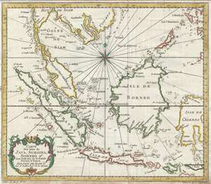
Carte des Isles de Java, Sumatra, Borneo & les détroits de la Sonde Malaca et Banca Golphe de Siam.
$275.00
Acquire
- Digital Map Information
- Suitable for large format printing
- Full resolution TIFF file
- ICC color profile embedded
- Delivered instantly via download link
This is an attractive c.1750 map of the East Indies by Jacques Nicholas Bellin. The map covers from Siam (Thailand) and Tsiompa (modern day Vietnam) south to include the Sumatra, Java, and Borneo. The Malay (Malacca), Singapore, Borneo, Sumatra, Java, and part of ... (more details)
Beautiful map of the East Indies.
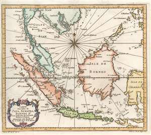
Carte des Isles de Java, Sumatra, Borneo et les détroits de la Sonde Malaca et Banca Golphe de Siam.
$275.00
Acquire
- Digital Map Information
- Suitable for large format printing
- Full resolution TIFF file
- ICC color profile embedded
- Delivered instantly via download link
This is an attractive c.1780 Jacques Nicholas Bellin map of the East Indies. The map depicts from Siam (Thailand) and Tsiompa (modern day Vietnam) south to include the Sumatra, Java, and Borneo. The Malay Peninsula (Malacca), Singapore, Borneo, Sumatra, Java, and part of Celebes (Sulawesi), are included. Impressive detail appears along all the coastlines, however little inland information is present, as is common for Bellin's nautical charts. Singapore remains unidentified, but several other lesser islands are noted including Tioman Island (Poulo ou I. Timon) and Penang. A beautifully engraved rocco title cartouche adorns the lower left corner of the map. (more details)
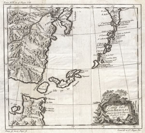
Carte des Isles Kouriles d'apres la Carte Russe Dressee et Gravee par Laurent.
$150.00
Acquire
- Digital Map Information
- Suitable for large format printing
- Full resolution TIFF file
- ICC color profile embedded
- Delivered instantly via download link
A beautiful example of Bellin's c. 1750 map of the Kuril Islands. The Kuril Islands or Kurile Islands are a volcanic archipelago that stretches approximately 1,300 km (810 mi) northeast from Hokkaido, Japan, to Kamchatka, Russia, separating the Sea of Okhotsk ... (more details)
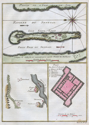
Riviere du Senegal / Isle Saint Louis / Petit Bras du Senegal / Plan du Fort St. Joseph.
$175.00
Acquire
- Digital Map Information
- Suitable for large format printing
- Full resolution TIFF file
- ICC color profile embedded
- Delivered instantly via download link
This stunning 1747 nautical chart by French mapmaker J. C. Bellin, the Elder depicts the Senegal River and the area surrounding Fort St. Joseph & Fort St. Louis. This region was part of the Senegambia & the Company of the Indies Senegal Concession. It ... (more details)
Home to one of the southernmost breeding colonies of Magellanic penguins.
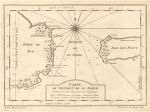
Carte du Détroit de Le Maire, Dressée sur les Journaux des Navigateurs.
$125.00
Acquire
- Digital Map Information
- Suitable for large format printing
- DPI: 600
- File Size: 4.86 MB
- File Type: ZIP / TIFF
- ICC color profile embedded
- Delivered instantly via download link
This is a 1753 Jacques-Nicolas Bellin map of the Le Maire Strait in Argentina. Situated between the Isla de los Estados (Staten Island in English, and not the one that is a borough in New York City) and Tierra del Fuego, the strait was first discovered by European explorers Jacob Le Maire and Willem Schouten in 1616 while they were attempting to find a navigable route between the Atlantic and Pacific Oceans. Their discovery of the strait only shortly preceded their discovery of Cape Horn. The strait is named after Le Maire, and, due to the bad weather and strong currents that the region is famous for, vessels tend to favor going around the east side of Isla de los Estados instead of through the Le Maire Strait. On an ecological note, the Isla de los Estados is home to one of the southernmost breeding colony of Magellanic penguins in the Atlantic. (more details)
Legendary dangerous passage between Atlantic and Pacific.
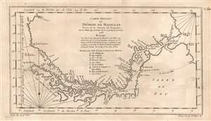
Carte Reduite du Detroit de Magellan Dressee sur les Journaux des Navigateurs.
$195.00
Acquire
- Digital Map Information
- Suitable for large format printing
- Full resolution TIFF file
- ICC color profile embedded
- Delivered instantly via download link
This is a beautiful 1753 Bellin map of the Straits of Magellan, South America. It covers the crucial strait located at the southern tip of the South American mainland, just north of Tierra del Fuego. The map extends from Cap des Vierges to Cap de la Victoire, rendering the region in detail, noting the coastlines, capes, harbors, islands and other important topographical features. Since its discovery by the Portuguese circumnavigator Ferdinand Magellin in 1520, this natural channel linked the Atlantic and Pacific Oceans despite the challenge in negotiating its unpredictable winds and currents. Until the construction of the Panama Canal it remained the fastest connection between the two oceans.
The map is simply but elegantly engraved, with rhumb lines in the ocean areas; the one indicating north is marked with a fleur de lis.. Below the title, is a notation crediting the details of the map to a Mr. Labat, engineer accompanying Jacques Gouin de Beauchesne's 1699 voyage to the Pacific (the first French trading expedition to that ocean.) A key is included, identifying nine locations marked on the map. (more details)
The map is simply but elegantly engraved, with rhumb lines in the ocean areas; the one indicating north is marked with a fleur de lis.. Below the title, is a notation crediting the details of the map to a Mr. Labat, engineer accompanying Jacques Gouin de Beauchesne's 1699 voyage to the Pacific (the first French trading expedition to that ocean.) A key is included, identifying nine locations marked on the map. (more details)
Mapping the Transatlantic Slave Trade.
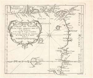
Carte du golfe de Guinée et les costes comprises entre le cap Formosa et le cap de Lopes Goncalvo.
$200.00
Acquire
- Digital Map Information
- Suitable for large format printing
- DPI: 600
- File Size: 17.75 MB
- File Type: ZIP / TIFF
- ICC color profile embedded
- Delivered instantly via download link
This is a c. 1754 map and chart of the Gulf of Guinea by Jacques-Nicolas Bellin that appeared in the Abbé Prévost's Histoire Generale Des Voyages. It notes a range of maritime and terrestrial features, especially rivers flowing from the African interior into the gulf. (more details)
Fantastic vexillology chart.
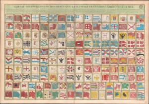
Tableau des Pavillons ou Bannieres Que La Pluspart des Nations Arborent a la Mer.
$1,800.00
Acquire
- Digital Map Information
- Suitable for large format printing
- DPI: 600
- File Size: 60.94 MB
- File Type: ZIP / TIFF
- ICC color profile embedded
- Delivered instantly via download link
This is an exceptional 1756 J. N. Bellin / Dépôt de la Marine vexillology or flag chart illustrating worldwide maritime ensigns. It illustrates a total of 160 flags, most representing European powers, but some representing religious societies, Asian and African nations, and trading companies. (more details)
Early 18th century map or plan of Boston, Massachusetts.
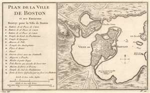
Plan de la Ville de Boston et ses Environs.
$500.00
Acquire
- Digital Map Information
- Suitable for large format printing
- DPI: 600
- File Size: 9.06 MB
- File Type: ZIP / TIFF
- ICC color profile embedded
- Delivered instantly via download link
This is a striking 1757 Jacques-Nicolas Bellin map of Boston, Massachusetts. Coverage embraces the Shawmut Peninsula of Boston with nearby Charestown across the harbor. The isle ronde is situated along the right side with a windmill (moulin) labeled. An artillery battery protects the road into Charles Town. Sixteen locations around Boston are marked alphabetically and correspond with an index to the left. Among the locations notes are churches, three artillery batteries, and the powder magazine. Just three depth soundings are noted in Boston Harbor. (more details)
One of the Earliest Obtainable Maps of Taiwan.
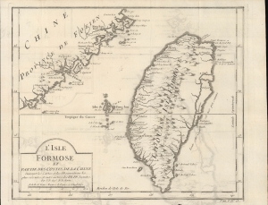
L'Isle Formose et Partie des Costes de la Chine.
$500.00
Acquire
- Digital Map Information
- Suitable for large format printing
- DPI: 600
- File Size: 13.93 MB
- File Type: ZIP / TIFF
- ICC color profile embedded
- Delivered instantly via download link
An important early (c. 1756) European map of Taiwan by Jacques-Nicolas Bellin, which appeared in l'Abbé Prévost's Histoire générale des voyages. Drawing on information from Jesuit missionaries, Bellin's map was among the earliest European maps to focus on the island and the first to employ its contemporary official Chinese name (Taiwan, here as 'Taiouan or Taivan'). (more details)
One of the Earliest Obtainable Maps of Taiwan.
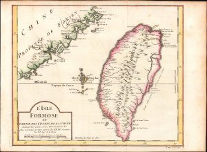
L'Isle Formose et Partie des Costes de la Chine.
$1,200.00
Acquire
- Digital Map Information
- Suitable for large format printing
- File Size: 5.22 MB
- File Type: ZIP / TIFF
- ICC color profile embedded
- Delivered instantly via download link
This is Jacques-Nicolas Bellin's important c. 1756 map of Taiwan, which appeared in l'Abbé Prévost's Histoire Générale des Voyages, here with hand-coloring. Drawing on information from Jesuit missionaries, Bellin's map was among the earliest European maps to focus on the island and the first to employ its contemporary official Chinese name (Taiwan, here as 'Taiouan or Taivan'). (more details)
Includes the Paraguay, Parana, and Uruguay Rivers, the Rio de la Plata, and the mythical Laguna de Xarayes.
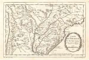
Carte du Paraguay et des pays voisins.
$150.00
Acquire
- Digital Map Information
- Suitable for large format printing
- DPI: 600
- File Size: 7.1 MB
- File Type: ZIP / TIFF
- ICC color profile embedded
- Delivered instantly via download link
This is a 1756 Jacques-Nicolas Bellin map of southern South America. The map depicts the region from the Pacific Ocean to the Atlantic Ocean and Rio de Janeiro and from La Paz and the mythical Laguna de Xarayes to the Rio de la Plata and Buenos Aires. Highly detailed, numerous colonial cities, towns, and villages are identified, including Asuncion (Assomption), Buenos Aires, Rio de Janeiro, La Paz, and Montevideo. The Paraguay, Parana, and Uruguay Rivers are all illustrated in detail, with myriad tributaries branching off from each one. (more details)
An 18th century French map of Sulawesi, Indonesia.
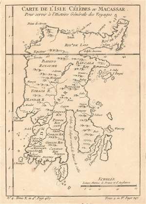
Carte De L'Isle Célèbes ou Macassar : Pour servir à l'Histoire Générale des Voyages.
$175.00
Acquire
- Digital Map Information
- Suitable for large format printing
- DPI: 600
- File Size: 2.78 MB
- File Type: ZIP / TIFF
- ICC color profile embedded
- Delivered instantly via download link
This is a 1757 Jacques-Nicolas Bellin map of Celebes (Sulawesi), Indonesia. The map depicts the entire island and labels villages, rivers, and mountain ranges. The island is divided into several kingdoms (royaumes), each of which is labeled. Gulfs along the coastline are also labeled, as are smaller islands. One safe harbor is also noted next to the Dutch fort (Fort Hollandois) in the southwest part of the island. (more details)
References native tribes while at the same time making it clear how little was known about the interior of the region.
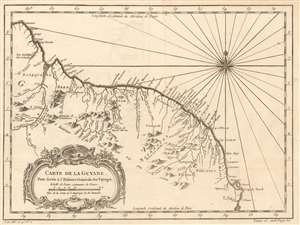
Carte de la Guyane. Pour servir á l'Histoire General des Voyages.
$175.00
Acquire
- Digital Map Information
- Suitable for large format printing
- DPI: 600
- File Size: 6.56 MB
- File Type: ZIP / TIFF
- ICC color profile embedded
- Delivered instantly via download link
This is a 1757 Jacques-Nicolas Bellin map of northeastern South America. The map depicts the region from the Essequibo River in Guyana through Suriname and French Guiana to the Araguari River in Brazil. Myriad locations are labeled along the Atlantic coast, including Paramaribo, Suriname. The vast majority of these locations are rivers, while others are towns along the coast. Some native villages are also identified, but the nations of the native peoples are at least referenced. Notes about the region are also included, stating, for example, that 'the interior of this country is not well known', or that 'the source of this river is unknown'. A note next to the Essequibo River states that 'in this region there are 39 waterfalls'. (more details)
Labels both Buenos Aires and Montevideo.
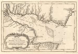
Carte De La Riviere De La Plata : Pour servir à l'Histoire Générale des Voyages.
$175.00
Acquire
- Digital Map Information
- Suitable for large format printing
- DPI: 600
- File Size: 5.1 MB
- File Type: ZIP / TIFF
- ICC color profile embedded
- Delivered instantly via download link
This is a 1757 Jacques-Nicolas Bellin map of the Canary Islands. The map depicts the Rio de la Plata as it empties into the Atlantic Ocean, with modern-day Uruguay on the top and Argentina on the bottom. Today, the Rio de la Plata forms part of the border between Argentina and Uruguay, with both Buenos Aires and Montevideo situated along its banks. Both Buenos Aires (Buenos Ayres) and Montevideo are labeled here, along with the Baye van Montvidio, which is noted as a safe harbor. Small villages and other settlements are also labeled. Numerous smaller rivers are illustrated emptying into the Rio de la Plata from both banks and many of them are identified. Depth soundings are included along both banks and within the Rio de la Plata, along with two banks. (more details)
Bellin's seminal Great Lakes cartography.
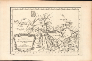
Carte des Lacs du Canada.
$950.00
Acquire
- Digital Map Information
- Suitable for large format printing
- File Size: 6.22 MB
- File Type: ZIP / TIFF
- ICC color profile embedded
- Delivered instantly via download link
This elegant map of the Great Lakes, printed in 1757 for Abbe Provost's L'Histoire Generale des Voyages, was drawn by French cartographer Jacques-Nicholas Bellin. It is also notable for being among the earliest maps to identify Detroit and the Port of Chicago (Checagou). Significantly, Bellin's cartography was one of the first to depict the four phantom islands in Lake Superior (Philippeux, Pontchartrain, Maurepas, and St. Anne) - islands that, despite their nonexistence, influenced the structuring of post-Revolutionary War borders between British Canada and the fledgling United States. (more details)
An incredibly detailed 18th century map of the Kamchatka Peninsula.
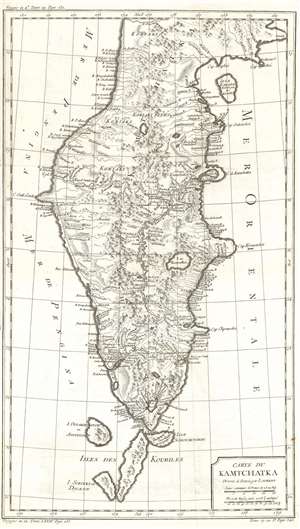
Carte du Kamchatka.
$250.00
Acquire
- Digital Map Information
- Suitable for large format printing
- DPI: 600
- File Size: 13.51 MB
- File Type: ZIP / TIFF
- ICC color profile embedded
- Delivered instantly via download link
This is a 1757 Jacques-Nicolas Bellin map of the Kamchatka Peninsula. The map depicts the entire peninsula and parts of the Sea of Okhotsk and the Bering Sea. Based on the work of Stepan Petrovich Krasheninnikov, an incredibly detailed illustration of the peninsula's interior is presented. Myriad rivers are illustrated and labeled, as is a chain of mountains running up the peninsula's center. A handful of lakes are also identified. The northernmost Kuril Islands are illustrated and labeled as Isle Schoumctchou, I. Oulakousatch ou Anfinogen, Isle Poromoustr, and I. Sirinki ou Dilkon. (more details)
An important map illustrating the Mississippi Valley during the French and Indian War.
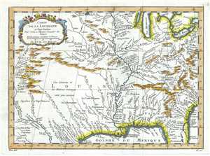
Carte de la Louisiane et Pays Voisins.
$650.00
Acquire
- Digital Map Information
- Suitable for large format printing
- DPI: 300
- File Size: 4.44 MB
- File Type: ZIP / TIFF
- ICC color profile embedded
- Delivered instantly via download link
This is an important 1757 map of the United States by the French cartographer Jacques-Nicholas Bellin. Centered on the Mississippi Valley, Bellin's map covers from the Riviere de Nord (Rio Grande) eastward to Lake Ontario and from Lake Huron to the Gulf of ... (more details)
Barbados at the height of the plantation economy.
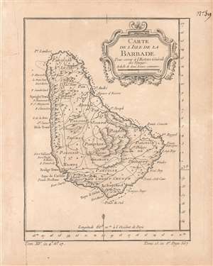
Carte de l'isle de la Barbade pour servir à l'Histoire Générale des Voyages.
$400.00
Acquire
- Digital Map Information
- Suitable for large format printing
- DPI: 600
- File Size: 3.09 MB
- File Type: ZIP / TIFF
- ICC color profile embedded
- Delivered instantly via download link
This is a rare c. 1758 map of Barbados by the French cartographer and hydrographer Jacques-Nicolas Bellin. It was prepared for the Abbé Antoine François Prévost's Histoire générale des voyages. The map shows the island in the heyday of English colonialism, when it was one of the main sources of sugar, produced through a system of brutal plantation slavery. (more details)
Stuning map illustrating the island paradise of Saint Lucia.
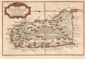
Carte de l'Isle de Sainte Lucie. Pour servir à l'Histoire Générale des Voyages.
$300.00
Acquire
- Digital Map Information
- Suitable for large format printing
- DPI: 300
- File Size: 3.18 MB
- File Type: ZIP / TIFF
- ICC color profile embedded
- Delivered instantly via download link
An extremely attractive example of Jacques-Nicolas Bellin's 1758 map of Saint Lucia (St. Lucia) or Sainte Lucie in the West Indies. St. Lucia is considered among the most beautiful of the Windward Isles. This map covers this spectacular Caribbean island in ... (more details)
A Bellin map of a strait off the northern coast of Siberia.
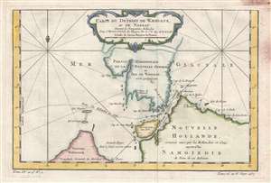
Carte du Detroit de Waeigats, ou de Nassau.
$150.00
Acquire
- Digital Map Information
- Suitable for large format printing
- Full resolution TIFF file
- ICC color profile embedded
- Delivered instantly via download link
This is a 1758 Jacques-Nicolas Bellin map of the Kara Strait in the Novaya Zemlya archipelago in the Arctic Ocean. The map depicts the southern portion of Yuzhny Island, the Strait, and an extreme northern part of Siberia. Several places within the region ... (more details)
Sugar Empires and the Seven Years' War.
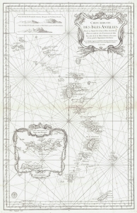
Carte Reduite des Isles Antilles.
$1,100.00
Acquire
- Digital Map Information
- Suitable for large format printing
- File Size: 24.15 MB
- File Type: ZIP / TIFF
- ICC color profile embedded
- Delivered instantly via download link
This is a 1758 Jacques-Nicolas Bellin nautical chart or map of the Lesser Antilles. Published two years into the Seven Years' War (1756 - 1763), this map highlights the rich sugar-producing French, British, and Dutch colonies in the Antilles - all up for grabs in the conflict. (more details)
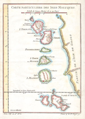
Carte Particuliere Des Isles Moluques.
$180.00
Acquire
- Digital Map Information
- Suitable for large format printing
- Full resolution TIFF file
- ICC color profile embedded
- Delivered instantly via download link
This beautiful hand colored map of the Moluques (also known as the Moluccas, Moluccan Islands or simply Maluku) was produced by the French Cartographer Jacques-Nicolas Bellin in 1760. Depicts the islands of Herij, Ternate, Tidor, Pottebackers, Timor, ... (more details)
One of Italy's most celebrated cities.
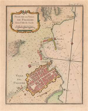
Plan de la Ville de Palerme dans l'isle de Sicile.
$250.00
Acquire
- Digital Map Information
- Suitable for large format printing
- Full resolution TIFF file
- ICC color profile embedded
- Delivered instantly via download link
This is a beautiful 1764 Jacques-Nicolas Bellin city plan or map of Palermo, Italy. The city occupies the bottom portion of the map, with its citadel and shore battery both labeled. its city walls are clearly illustrated. The Chemin de Montreal (the road to Monreale) is labeled to the left of the city and heads west.The Oreto River appears south of Palermo, while the city's port is to its north. A small fort and storage facilities near the port are both illustrated and labeled, along with a signal lantern. An aqueduct brings water from the nearby mountains to a site labeled 'Aqua Santa', which would translate to 'Holy Water'. Today, Palermo is the economic and tourist capital of Sicily and draws people because of its history, art, culture, music, and food. Its Mediterranean climate, incredible architecture, and nightlife all appeal to tourists. The city is also home to eight UNESCO World Heritage sites dating from the era of the Norman Kingdom of Sicily (1130 - 1194): three cathedrals, two palaces, and a bridge. Two other cathedrals, in Cefalù and Monreale, are also part of the UNESCO World Heritage Site designation. (more details)
Bellin puts it all together...
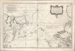
Remarques sur la Carte reduite de l'océan septentrional, compris entre l'Asie et l'Amérique, suivant les découvertes qui ont été faites par les Russes; dressée au Dépôt des cartes et plans de la Marine, pour le service des vaisseaux du roi, par ordre de M. le duc de Praslin, ministre d'etat, ayant le département de la Marine.
$2,750.00
Acquire
- Digital Map Information
- Suitable for large format printing
- File Size: 39.82 MB
- File Type: ZIP / TIFF
- ICC color profile embedded
- Delivered instantly via download link
A beautiful example of Bellin's splendidly engraved 1766 map of the Pacific Northwest, Alaska, the Bering Strait, and Siberia. This map is significant as a reactionary piece to the waves of cartographic speculation about the American Pacific Northwest that defined the first half of the 18th century. Bellin, the premier hydrographer of his generation, here attempts to make sense of it all, bringing together the speculations of the previous generation, his own geographical expertise, and issuing, for the first time on a French map, Frederick Müller's revolutionary cartography relating to the discoveries of Vitus Bering and Aleksei Chirikov. (more details)
Edition of the first map of Iceland based on Trigonometric Survey.
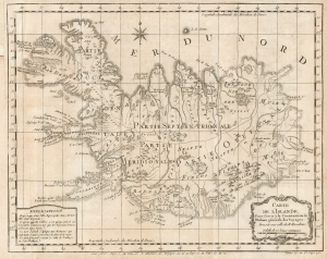
Carte de l'Islande, Pour servir a la Continuation de l'Histoire générale des Voyages.
$250.00
Acquire
- Digital Map Information
- Suitable for large format printing
- Full resolution TIFF file
- ICC color profile embedded
- Delivered instantly via download link
This is J. N. Bellin's 1768 edition of Niels Horrebow's map of Iceland, based on the first trigonometrical survey of the country. (more details)
Mysterious, opaque Interior of Brazil.
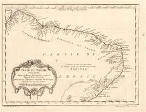
Carte du Bresil, Prem. Partie Depuis la Riviere des Amazones jusquà la Baye de Tous es Saints, Pour Servir à l'Histoire Générale des Voyages.
$250.00
Acquire
- Digital Map Information
- Suitable for large format printing
- Full resolution TIFF file
- ICC color profile embedded
- Delivered instantly via download link
This is a beautifully engraved 1780 map of the coast of Brazil, extending from the mouth of the Amazon River to the Baía de Todos los Santos. It names and marks the coastal borders of the Portuguese colonial Captaincies of Maranhão, Ceará, Rio Grande do Norte, Paraiba, Olinda (actually Pernambuco, of which Olinda was the capital), and Sergipe. Coastal settlements and the mouths of rivers are named, and prominent mountain ranges near coastal areas are shown pictorially. While most rivers are not shown at length, the Rio São Francisco does appear, and its sharp turn to the southwest is suggestive of the actual course of that river. Waterfalls are marked in the vicinity of the Paulo Afonso Falls, and settlements are named along the lower course of the river. (more details)
Coastal Brazil.
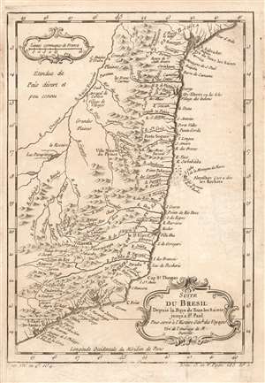
Suite du Bresil Depuis la Baye de Tous les Saints jusqu' a St. Paul. Pour servir à l'Histoire Génle. des Voyages Tiré de l'Amerique de M. Danville.
$150.00
Acquire
- Digital Map Information
- Suitable for large format printing
- Full resolution TIFF file
- ICC color profile embedded
- Delivered instantly via download link
This is a 1780 map of coastal Brazil, showing the Captaincies of Bahia, Ilheús, Porto Seguro, Espirito Santo, Rio de Janeiro and part of Sao Paolo. These were coastal colonies, and the map's detail does not extend beyond the Rio São Francisco, apart from the descriptive text Étendue de País désert et peu connu (This extent of the country is deserted and little known.) Although composed and engraved by Nicolas Bellin, the cartography is drawn from D'Anville's 1748 Amerique Meridionale, which still represented the most up-to-date cartography in 1753, when this map was engraved. (more details)
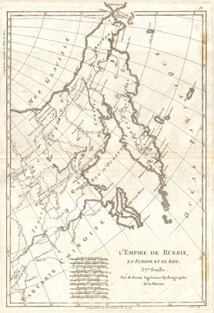
L'Emire deRussie, en Europe et en Asie. 3eme Fuille.
$175.00
Acquire
- Digital Map Information
- Suitable for large format printing
- DPI: 300
- File Size: 4.32 MB
- File Type: ZIP / TIFF
- ICC color profile embedded
- Delivered instantly via download link
An attractive example of R. Bonne's c. 1780 map of Eastern Russia, Tartary, and Siberia. Covers from Nerczinsk and Chinese Tartary north to the Arctic and eastward as far as Alaska. Focuses on Siberia showing various villages, fortifications, ... (more details)
Treasures of India.
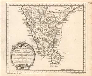
Suite de la carte de l'Inde en deçà du Gange IIe. feuille, comprenant la Presqu' Isle de l'Ind pour servir à l'Histoire générale des voyages.
$200.00
Acquire
- Digital Map Information
- Suitable for large format printing
- Full resolution TIFF file
- ICC color profile embedded
- Delivered instantly via download link
This is a 1780 Bellin map of India and Sri Lanka. Unlike many of Bellin's smaller works, this is strictly a map, as opposed to a nautical chart: the focus of the map is on the interior, particularly between areas of French influence on the Coromandel Coast such as Pondicheri, and the old Mogul Empire to the northwest. (more details)
A time of increasing tensions between expansionist Russia and Qing China.
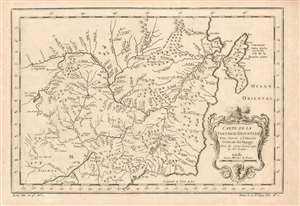
Carte de la Tartarie Orientale Pour Servir a l'Histoire Générale des Voyages Tirée des Cartes Levees par les P.P. Jesuites.
$225.00
Acquire
- Digital Map Information
- Suitable for large format printing
- Full resolution TIFF file
- ICC color profile embedded
- Delivered instantly via download link
This is a 1749 Bellin map of the frontier between Russia and China, during a period of increasing pressure between the expanding Russian Empire and the Qing dynasty. The map covers the Chinese provinces of Jilin and Heilongjiang, and the Russian Amur Oblast, Khabarovsk Krai, Primorsky Krai and Sakhalin Island. (more details)
Archetypical Desert Island.
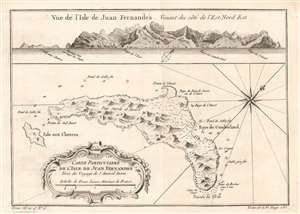
Carte Particulière de l'isle de Juan Fn.ernandés Tirée du voyage de l'Amiral Anson.
$250.00
Acquire
- Digital Map Information
- Suitable for large format printing
- Full resolution TIFF file
- ICC color profile embedded
- Delivered instantly via download link
This is a beautifully engraved 1780 map of Juan Fernández island, now officially known as Robinson Crusoe Island, formerly Más a Tierra. It is the second largest of the Juan Fernández Islands. The island was, from 1704 to 1709, home to the marooned sailor Alexander Selkirk, the inspiration for Defoe's Robinson Crusoe (despite the novel's Caribbean setting.) The island was originally named after Juan Fernández, the explorer who first landed there in 1574. The name 'Robinson Crusoe Island' was officially adopted by the Chilean government in the 1960s. Bellin's source for this map postdates Selkirk's ordeal: George Anson's 1740 expedition stopped at the island, resulting in a chart and view. (more details)
Traces part of Gmelin's expedition across Siberia to join Vitus Bering.
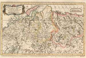
Carte de la Siberie et des Pays voisins.
$200.00
Acquire
- Digital Map Information
- Suitable for large format printing
- DPI: 600
- File Size: 12.08 MB
- File Type: ZIP / TIFF
- ICC color profile embedded
- Delivered instantly via download link
This is a 1780 Jacques-Nicolas Bellin map of Siberia. Depicting the region from Moscow and St. Petersburg to central Asia, numerous cities, towns, and villages are labeled. The region's rivers are illustrated in detail, along with its many mountain ranges. (more details)
The African Coast from the Cape of Good Hope to Madagascar.
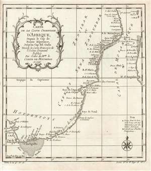
Carte de la coste orientale d'Afrique depuis le Cap de Bonne Esperance jusqu'au Cap del Gada : tireéde la carte francoise de l'ocean oriental publieé par ordre de mgr. le comte de Maurepas en 1740.
$450.00
Acquire
- Digital Map Information
- Suitable for large format printing
- DPI: 600
- File Size: 4.48 MB
- File Type: ZIP / TIFF
- ICC color profile embedded
- Delivered instantly via download link
This is a 1780 Bellin map of the southeastern coast of Africa, starting at the Cape of Good Hope and continuing around to the island of Comoroa (Comore ou Angasi on the map) and part of Madagascar. Bellin drew the information for this chart from his own superb 1740 chart of the Indian Ocean, Carte Reduite de l'Ocean Oriental ou Mer des Indes Contenant Les Costes d'Afrique. It was this grand chart, and not the present lovely if narrowly-focused engraving, that was produced 'Par Ordre' of the Count de Maurepas. It seems slightly misleading that Bellin should here invoke this famous French statesman, naval strategist and spymaster, given that the present map was to appear in Harpe's 1780 Abrégé de l'histoire générale des voyages, which epitomized Prévost's Histoire générale des voyages - a work perhaps better known for its imaginative flourish than for its factuality. This map is notable, however, for its focus on the indigenous African national names that appear on it. (more details)
Depicts a great African kingdom that was slowly dismantled by civil war and Portuguese colonial interests.
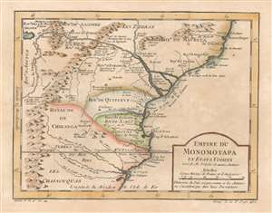
Empire du Monomotapa et Etats Voisins.
$250.00
Acquire
- Digital Map Information
- Suitable for large format printing
- DPI: 600
- File Size: 4.88 MB
- File Type: ZIP / TIFF
- ICC color profile embedded
- Delivered instantly via download link
This is a 1780 Jacques-Nicolas Bellin map of southeastern Africa. Centered on modern-day Mozambique, the map depicts part of the Kingdom of Mutapa, a vast empire that dominated parts of southern Africa from 1430 - 1760. Smaller kingdoms, the Kingdom of Quiterve, the Kingdom of Sabia, and the Kingdom of Chikanga, are also identified. The Zambezi River and its delta, also labeled here as the Cuama River, dominates the upper portion of the map. Short comments provide some context and label certain peoples as being 'friends of the Portuguese,' the region's gold mines, and a castle built by the Portuguese at Tete. (more details)
Attractively Engraved Map of St. Christopher.
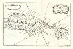
Carte De De l'Isle St. Christophe Pour servir á l'Histoire Genle. des Voyages Par M. B. Ingr. de la Marine.
$350.00
Acquire
- Digital Map Information
- Suitable for large format printing
- DPI: 600
- File Size: 4.82 MB
- File Type: ZIP / TIFF
- ICC color profile embedded
- Delivered instantly via download link
This is an attractive 1780 Bellin map of the Caribbean island of St. Christopher/ St. Kitts. The map is based on the surveys of Andrew Norwood, who died nearly a century prior in 1685. Norwood's survey also served as source material the maps of Moll, Bowen, and Mount and Page. During the course of the 17th century, the island saw the establishment of colonies by the English (1623) and the French (1625). The two colonial powers vied for dominance, cooperating only in the massacre of the indigenous Kalinago population, and interrupted only for a year by the 1629 Spanish occupation. Thereafter, the English and French partitioned the island, and it changed hands several times by both military action and treaty. By the time this map was printed, rule of the island passed to the British according to the terms of the Peace of Utrecht - although the place names reflect the French tenure on the eastern part of the island. (more details)
Comparing two groundbreaking maps of the Amazon on one sheet.
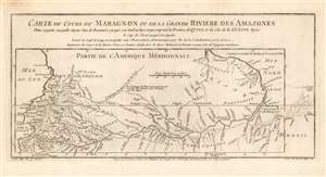
Carte du Cours du Maragnon ou de la Grande Riviere des Amazones Dans sa partie navigable depuis Jaen de Bracamoros jusqu'a son Embouchure et qui comprend la Province de Quito, et la Côte de la Guïane depuis le Cap de Nord jusqu'à Esséquebè.
$300.00
Acquire
- Digital Map Information
- Suitable for large format printing
- DPI: 600
- File Size: 5.94 MB
- File Type: ZIP / TIFF
- ICC color profile embedded
- Delivered instantly via download link
This is a fascinating 1780 map of the Amazon river basin, spanning the breadth of the South American continent, embracing Peru, Ecuador, Colombia, Venezuela, Brazil, Guyana, Suriname, and French Guiana. It displays the mapping of the great river produced in 1743 by the French Geodesic Mission under Charles Marie de La Condamine, which still represented the state of the art. This exhaustive mapping of the Amazon and its tributaries is shown overlaying another map of the Amazon, this one executed in 1707 by the Jesuit Father Samuel Fritz. His mapping of the Amazon had been the first accurate one to be produced, and so to have it compare so poorly to Condamine's was to present a flourish on behalf of modern, French scientific geography. (more details)
Embarkation Point of the Atlantic Slave Trade.
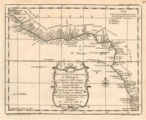
Carte De La Coste Occidentale D'Afrique, Depuis le XII.e Dégré de Latitude Septentrionale, Jusqu'au XI.e Dégré de Latitude Méridionale. Tirée de la Carte Francoise de l'Océan Occidental. Augmenteé sur les Observations particulieres de Barbot Smith Marchaise etc. Publiee Par Ordre de MGR. le Comte De Maurepas en 1738.
$450.00
Acquire
- Digital Map Information
- Suitable for large format printing
- DPI: 600
- File Size: 4.42 MB
- File Type: ZIP / TIFF
- ICC color profile embedded
- Delivered instantly via download link
This is a 1780 Bellin map of the Guinea Coast of west Africa, from what is now Guinea-Bissau as far south as the northern coast of Angola. The map therefore includes, and indeed labels, the regions by resources extracted during the age of discovery and exploration. Revealed on the map are the Coste de Grain, the Coste d'Ivoire, the Coste d'Or, and the Coste des Esclaves. The map includes notations indicating places whose latitudes had been observed by 'skilled navigators,' and includes a letter-key showing trade forts - including the infamous Castel de la Mina - belonging respectively to the English, the Dutch, and the French. (more details)
Newfoundland and the Gulf of St. Lawrence attractively engraved
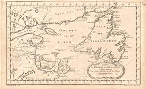
Carte Du Golphe De St. Laurent et Pays Voisins : Pour servir a l'Histoire Generale des Voyage
$175.00
Acquire
- Digital Map Information
- Suitable for large format printing
- DPI: 600
- File Size: 6.38 MB
- File Type: ZIP / TIFF
- ICC color profile embedded
- Delivered instantly via download link
This is an attractive 1780 Bellin map of Acadia, the mouth of the Saint Lawrence River, and Newfoundland. It includes Anticosti island, Prince Edward Island (here named I. St. Jean) and Isle Royale (Cape Breton Island.) While a number of rivers are shown, the focus overall is on the coastlines and interior detail is sparse. (more details)
The coveted Spice Islands
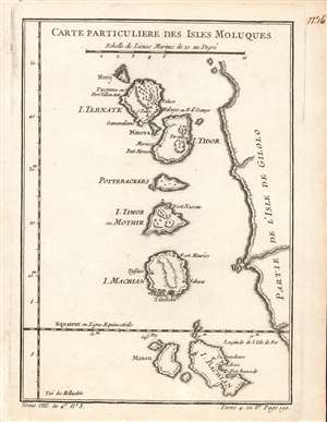
Carte Particuliere Des Isles Moluques.
$250.00
Acquire
- Digital Map Information
- Suitable for large format printing
- Full resolution TIFF file
- ICC color profile embedded
- Delivered instantly via download link
This is a beautifully engraved 1780 map of the Malaku Islands, or the Moluccas - also known as The Spice Islands. The string of islands, now part of eastern Indonesia, are shown along the west coast of the island of Halmahera, previously known as Gilolo (and so marked on the map.) Hiri Island, Ternate, Maitara, Tidore, Mare Island (Pottebackers) Moti Island (I. Timor, or Mothir) and Makian Island, are somewhat accurately delineated. Forts and settlements are noted on each island. At the southern extremity of the map, Kasiruta Island (Manen) and Bacan Island are recognizable. It is puzzling that between Makian and Bacan, the islands of Kaioa and Laluin have been omitted - but indeed, this is the case on maps of the Moluccas going back to the Age of Discovery. European explorers, arriving from a trans-Pacific voyage, seem to have coasted Halmahera/Gilolo exclusively from the north, having reached the islands north of New Guinea; this was the case with Magellan's survivors, Drake, and Le Maire. Hence Antonio Pigafetta's (c. 1491 - 1531) 1525 depiction of the Moluccas began with Ternate and ended with Machian; the 1630 Willem Blaeu (1571 - 1638) would do the same, adding Bachian as an inset. Hondius' 1633 map of the Moluccas added Bachian - in very schematic form, and too far north - as an island at the southern end of the chain. The great French geographer, Nicolas Sanson (1600 - 1667), chose this as his model. It appears that despite Bellin's having obtained a significantly better mapping of Bacan, he has been given no cause to question Sanson's placement of the island - or Sanson's naming of settlements and forts, which here is consistent both with the 17th century French geographer's map and its Dutch forebearer. (more details)
Attractive Chart of Western South Africa and the Cape of Good Hope.
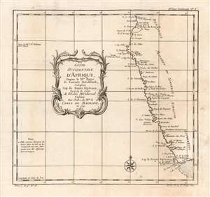
Coste Occidentale D'Afrique, Depuis le XI.e Dégré de Latitude Méridionale, Jusqu'au Cap de Bonne Espérance: Tirée de la Carte de l'Ocean Méridional Publiée Par Ordre de MGR. le Comte De Maurepas en 1739.
$350.00
Acquire
- Digital Map Information
- Suitable for large format printing
- DPI: 600
- File Size: 5.53 MB
- File Type: ZIP / TIFF
- ICC color profile embedded
- Delivered instantly via download link
This is a 1780 Bellin map of the southwestern coast of Africa, covering the coasts of Angola, Namibia, and the Atlantic coast of South Africa, as far as the Cape of Good Hope. Table Bay, Cape Agulhas and the Agulhas Banks are named. The map notes the presence of European forts throughout, and also names kingdoms abutting on the coastline: The Kingdom of Benguela, the Kingdom of Mataman, and the NImaguas. The Khoikhoi pastoralists of southern Africa are also noted, using the pejorative Dutch/English terminology name 'Hottentot'. It includes a notation indicating that the Cape's latitude and longitude had been determined by astronomical observation. At the western extreme of the map, the island of St. Helena appears, This was the 'cursed rock' to which Napoleon would be banished in 1815 to serve out his exile, dying there in 1821. (more details)
Captures Portuguese colonial ambitions in Angola.
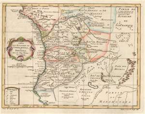
Carte des Royaumes de Congo, Angola, et Benguela. Avec les Pays Voisins.
$350.00
Acquire
- Digital Map Information
- Suitable for large format printing
- DPI: 600
- File Size: 6.1 MB
- File Type: ZIP / TIFF
- ICC color profile embedded
- Delivered instantly via download link
This is a 1780 Jacques-Nicolas Bellin map of west-central Africa. Focusing on the kingdoms surrounding the Congo River, Bellin provides a snapshot of Portuguese colonial dominance in the region. Numerous towns and villages are labeled, some of them Portuguese, some of them African. Short comments provide some information where it was available, such as, concerning the Royaume de Dongo, 'destroyed by the Portuguese.' Or, just below Benguela, where savages or sauvages apparently live, 'it is said that language is not used here.' (more details)