
Arizona - New Mexico (sold)
The rarest of the Texas 'Treaty Map' series.
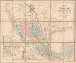
Mapa De Los Estados Unidos Mejicanos Arreglado a la distribucion que en diversos decretos ha hecho del territorio el Congreso General Mejicano.
sold
- Digital Map Information
- Suitable for large format printing
- Full resolution TIFF file
- ICC color profile embedded
- Delivered instantly via download link
The extremely rare 1851 edition of the Jean-Frédéric Rosa Map of Texas, California, and Mexico - considered the rarest of the 'Treaty Maps' used to settle the Mexico-Texas border between 1847 and 1853. This is grand map covering all of Mexico and much the southwestern part of the United States from the Pacific to the Apalachicola River and extending as far north as Great Salt Lake (Timpanogos). It was published in Paris by Jean-Frédéric Rosa on behalf of the Mexican Congreso General in anticipation of renewed negotiations over that part of the southwest that would eventually be annexed to the United States as part of the Gadsden Purchase. The map, generally based upon the 1826 Tanner map of Mexico, offers much of interest, including a recognition of American claims in Texas and Upper California, and multiple border configurations within Texas itself. It is the rarest of the three maps, along with the Tanner and Disturnell, used to negotiate the Gadsden Purchase. (more details)
'Largest scale map of the territory...' - Streeter
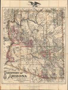
Official Map of the Territory of Arizona.
sold
- Digital Map Information
- Suitable for large format printing
- Full resolution TIFF file
- ICC color profile embedded
- Delivered instantly via download link
This is the first official map of Arizona Territory, published in 1880 by Emil A. Eckhoff and Paul Riecker. Rumsey calls this 'one of the best maps of Arizona as a territory.' It represents the primary cartographic resource during one of the most exciting and romantic periods of Arizona's history - recording the Arizona Silver and Copper mining boom, the early development of the territory's infrastructure and railroads, and the era of frontier lawlessness marked by the Gunfight at O.K. Corral, and other similar events. (more details)
Unrecorded first state of a foundational map with extensive manuscript additions relating to American Indian Reservations established in 1867-8.
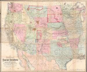
National Map of the Territory of the United States From The Mississippi River To The Pacific Ocean.
sold
- Digital Map Information
- Suitable for large format printing
- Full resolution TIFF file
- ICC color profile embedded
- Delivered instantly via download link
An extraordinary first-edition first-state example of William J. Keeler’s 1867 map of the Trans-Mississippi West - considered the finest post-Civil War railroad era map of the west - with unique manuscript annotations and additions relating to the American Indian Reservation System. This one of a kind historic document was likely the official example retained by the Indian Bureau, and possibly by Keeler himself, to administer and document the development of the American Indian Reservation system through the late 1860s. (more details)
Russian Cold War plans for a nuclear attack on Phoenix.
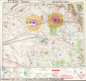
ГЕНЕРАЛЬНЫЙ ШТАБ ФИНИКС. РТ2ПМ Тополь. Воздействие. / GENERAL HEADQUARTERS PHOENIX. RT-2PM-Topol. Impact.
sold
A chilling and thought-provoking 1982 Soviet Cold War map of Phoenix, Arizona, illustrating Russian plans for a nuclear ICBM attack. Two impacts targets are illustrated in manuscript: downtown Phoenix and the Palo Verde Generating Station, one of the largest nuclear power plants in the United States. The map bears the signature of Viktor Chebrikov (Виктор Михайлович Че́бриков; 1923 - 1999), then head of the KGB, as well as stamps showing that it was obtained and translated by American intelligence. (more details)
The essential covered wagon trail map of the American west.
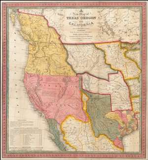
A New Map of Texas, Oregon and California with the Regions Adjoining.
sold
- Digital Map Information
- Suitable for large format printing
- Full resolution TIFF file
- ICC color profile embedded
- Delivered instantly via download link
A stunning example of Mitchell's seminal 1846 pocket map of Texas, Oregon, Upper California, Missouri Territory, the Indian Territory (Oklahoma, though in this example including most of Kansas and Colorado). This important map of Texas is one of the first ... (more details)
The essential trail map of the American west.
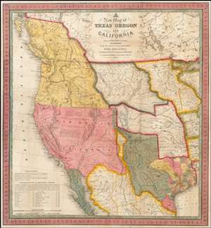
A New Map of Texas, Oregon and California with the Regions Adjoining.
sold
- Digital Map Information
- Suitable for large format printing
- DPI: 300
- File Size: 11.05 MB
- File Type: ZIP / TIFF
- ICC color profile embedded
- Delivered instantly via download link
A stunning example of Mitchell's seminal 1846 pocket map of Texas, Oregon, Upper California, Missouri Territory, the Indian Territory (Oklahoma, though in this example including most of Kansas and Colorado). This important map of Texas is one of the first ... (more details)
The quintessential trail map of the American west.
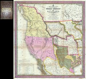
A New Map of Texas Oregon and California with the Regions Adjoining.
sold
- Digital Map Information
- Suitable for large format printing
- Full resolution TIFF file
- ICC color profile embedded
- Delivered instantly via download link
Considered 'the quintessential trail map of the American West' Samuel Augustus Mitchell's 'New Map of Texas Oregon and California' is one of the most important 19th century pocket maps ever issued. In Mitchell's own words This map comprises all that ... (more details)
An exceptionally scarce variant of a cornerstone map of the American west and the finest of its era.
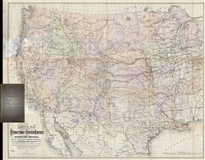
National Map of the Territory of the United States From The Mississippi River To The Pacific Ocean. Madeby the authority of the Hon. O. H. Browning Secretary of the Interior. In the Office of the Indian Bureau Chiefly For Government Purposes under the direction of the Hon. N.G. Taylor, Commisr. of Indian Affairsa and Hon. Chas E. Mix Chief Clerk of the Indian Bureau.
sold
- Digital Map Information
- Suitable for large format printing
- File Size: 46.46 MB
- File Type: ZIP / TIFF
- ICC color profile embedded
- Delivered instantly via download link
A map of the utmost importance and scarcity, this is William J. Keeler's 1868 pocket map of the American west, considered the 'the largest, finest and most detailed map of the West as it was then known.' The map covers from Detroit and Cincinnati ... (more details)
A must-have for the early mapping of the American west.
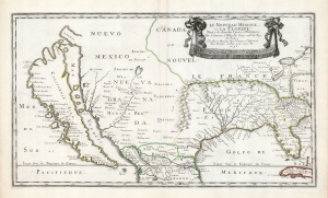
Le Nouveau Mexique, et la Floride: Tirées de diverses Cartes, et Relations. Par N. Sanson d'Abbeville Geogr ordre du Roy. A Paris. Chez Pierre Mariette, Rue S. Jacque a l'Esperance Avec Privilege du Roy, pour vingt Ans. 1656.
sold
- Digital Map Information
- Suitable for large format printing
- DPI: 600
- File Size: 36.2 MB
- File Type: ZIP / TIFF
- ICC color profile embedded
- Delivered instantly via download link
This is a beautiful example of Nicolas Sanson's 1656 map of New Mexico and Florida: the first atlas map to emphasize this geographical focus. It also presented arguably the most influential depiction of California-as-an-island, providing the dominant model of that cartography for the remainder of the seventeenth century, reaching into the eighteenth. (more details)
Rare map of Texas issued just before the Treaty of Guadeloupe Hidalgo.
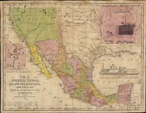
Map of Mexico, Texas, Old and New California, and Yucatan. Showing the principal Cities and Towns, Travelling Routes and c.
sold
- Digital Map Information
- Suitable for large format printing
- Full resolution TIFF file
- ICC color profile embedded
- Delivered instantly via download link
The only known example of the 1848 edition of House and Brown's broadside map of Texas, Mexico, and Upper California, issued at the end of the Mexican-American War (1846 - 1848). The map is centered on Texas, which is presented at its largest, with its western border embracing Albuquerque and Santa Fe, and the stovepipe configuration extending its northern border to 42° N latitude. The map is elaborated by inset maps of Monterey illustrating the Battle of Monterrey (September 21 - 24, 1846) and Veracruz, Mexico. In addition, the Gulf of Mexico is occupied by a large vignette view of the fortress of San Juan de Ulúa, Veracruz. In this edition, Texas is uncolored, emphasizing that it is part of the United States, but Upper California and New Mexico are colored as Mexican intendencias, suggesting this map predates the Treaty of Guadalupe Hidalgo and must therefore have been sent to the presses sometime before February 28, 1848. (more details)
Original manuscript of iconic pictorial map by Pulitzer Prize cartoonist.
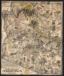
The Picto-Map of Arizona.
sold
- Digital Map Information
- Suitable for large format printing
- File Size: 38.9 MB
- File Type: ZIP / TIFF
- ICC color profile embedded
- Delivered instantly via download link
This is the original pen and ink art, with additional hand color embellishment, of one of the most well-known Golden Age pictorial maps, Reg Manning's 'Arizona', signed and inscribed to fellow editorial cartoonist Jim Williams. The map was drawn in 1935, and copyright registered as the Picto-Map of Arizona, but was not committed to print until the 1938 publication of Reg Manning's Cartoon Guide of Arizona, where it was inserted into a pocket in the back as the 'Cartoon Map of Arizona (more details)
Earliest Acquirable Accurate Map of the Southwest?
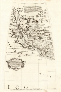
[Untitled Globe Gore of Western North America from the Equator to approximately 50º north].
sold
- Digital Map Information
- Suitable for large format printing
- Full resolution TIFF file
- ICC color profile embedded
- Delivered instantly via download link
This is the globe gore focusing on the American southwest, engraved in 1688 for Vincenzo Coronelli's 42-inch (3 1/2 foot) terrestrial globe, reprinted in 1697 for inclusion in his Libro dei Globi and Isolario. This beautiful engraving is striking in its presentation of the insular California, but this is not its most important feature. Rather it represents the earliest correct depiction of the Rio Grande generally acquirable to the collector. (more details)
A German 49er maps California.
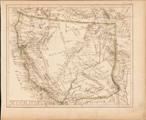
Neu-California.
sold
- Digital Map Information
- Suitable for large format printing
- DPI: 600
- File Size: 6.66 MB
- File Type: ZIP / TIFF
- ICC color profile embedded
- Delivered instantly via download link
A most intriguing German-language c. 1849 California Gold Rush era manuscript map of Upper California. Although drawn by an unknown hand, the map offers a wealth of unique information ranging from early gold discoveries, mines, and indigenous settlements to the very unusual inclusion of the explorer's route of Jedediah Smith. While mysterious, the work suggests it was drawn by a potential German 49er for personal use. (more details)
Most Important Early Map of the New Mexico Territory.
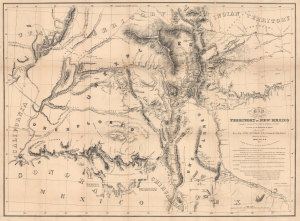
Map of the Territory of New Mexico...
sold
- Digital Map Information
- Suitable for large format printing
- Full resolution TIFF file
- ICC color profile embedded
- Delivered instantly via download link
This is the extremely rare, unpublished 1851 map of the Territory of New Mexico produced by John G. Parke and Richard Kern. Known as the Parke-Kern Map, it was printed within the War Department and separately issued on an individual basis but never included in a Congressional Report, as were other key early maps of the American West. The map was then reprinted several times in the late 19th and early 20th century with no obvious changes, but which can be distinguished from the original plate by very close examination. The present example is one of these later, c. 1900, reissues, which in themselves are still very rare. (more details)
Sanson’s 1650 map of North America and 1656 map of New Mexico seem to the present writer by far the most interesting and important maps … - C. Wheat
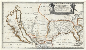
Le Nouveau Mexique, et la Floride: Tirées de diverses Cartes, et Relations. Par N. Sanson d'Abbeville Geogr ordre du Roy. A Paris. Chez Pierre Mariette, Rue S. Iacque a l'Esperance Avec Privilege du Roy, pour vingt Ans. 1656.
sold
- Digital Map Information
- Suitable for large format printing
- DPI: 300
- File Size: 11.08 MB
- File Type: ZIP / TIFF
- ICC color profile embedded
- Delivered instantly via download link
Sanson and Mariette's 1656 first edition map of the central and western part of North America is one of the most important maps ever published pertaining to the American west. This map represents the first time this region has been presented on ... (more details)
Seminal Map of the American Southwest by 'World's Greatest Living Man'.

Carte Du Mexique et des Pays Limitrophes Situes Au Nord et a l'est Dressee d'apres la Grande Carte de la Nouvelle Espagne De Mr. A. De Humboldt et d'autres Materiaux par J.B. Poirson.
sold
- Digital Map Information
- Suitable for large format printing
- DPI: 300
- File Size: 15.17 MB
- File Type: ZIP / TIFF
- ICC color profile embedded
- Delivered instantly via download link
A seminal 1811 map of Mexico and the American West by Alexander von Humboldt. Humboldt, who during his lifetime was considered the 'world's greatest living man,' composed this map during his 1803 sojourn in Mexico. Though often playing second ... (more details)
First maps to name Arizona?
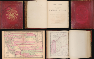
This is the 1860 Richmond-imprint first edition of Johnson's New Illustrated (Steel Plate) Family Atlas. While Johnson's atlases are not, in general, rare, the 1860 Richmond first edition is a genuine rarity. It is one of the only atlases published in the soon-to-be Confederacy prior to the American Civil War (1861 - 1865). It also includes the first two maps to name Arizona, predating the existence of the Arizona Territory by 5 years. In 20 years in the rare map trade, this is the first time we have seen a Richmond-imprint first edition of this atlas. (more details)
Manuscript survey of New Mexico and Colorado Tierra Amarilla Grant - accompanied by an archive of Railroad Engineer.
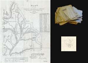
This is an 1877 manuscript map of the Tierra Amarilla Grant in northern New Mexico and southern Colorado. The map depicts the entirety of the grant, from the Navajo River as its northern border to the Nutrias River in the south and from the Laguna de los Caballos in the west to the Chama Mountains in the east. (more details)
Important map illustrating Mexico and Texas just before the 1848 Treaty of Guadeloupe-Hidalgo. Texas at its fullest with stovepipe configuration.
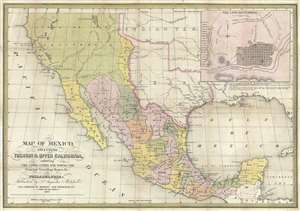
Map of Mexico, including Yucatan and Upper California, exhibiting the Chief Cities and Towns, The Principal Travelling Routes and c.
sold
- Digital Map Information
- Suitable for large format printing
- DPI: 300
- File Size: 13.99 MB
- File Type: ZIP / TIFF
- ICC color profile embedded
- Delivered instantly via download link
This is Samuel Augustus Mitchell's important 1847 map of Texas at its fullest, Mexico, and Upper California. This is one of the most important and striking maps issued to illustrate the Mexican American War. Centered on Texas, Mitchell's map ... (more details)
Details the U.S. government forced internment of over 100,000 Japanese Americans.
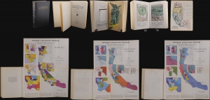
This is a 1943 U.S. government report detailing the forced internment of west-coast Japanese Americans during World War II (1939 - 1945). The reports offers disturbing insights into the racist policies and unfounded paranoia that gripped the nation in the wake of the 1941 attack on Pearl Harbor. (more details)
Early surveying expedition to the American West.
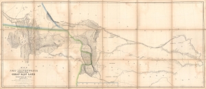
Map of a Reconnaissance between Fort Leavenworth and the Missouri River, and the Great Salt Lake in the Territory of Utah, made in 1849 and 1850…
sold
- Digital Map Information
- Suitable for large format printing
- Full resolution TIFF file
- ICC color profile embedded
- Delivered instantly via download link
A monumental map, matching the landscape it depicts, this is Howard Stansbury's seminal map of the lands between Fort Leavenworth, Kansas, and Pilot Peak (now Nevada), west of the Great Salt Lake. Originally published in 1852 as part of the Stansbury Report presented to the U.S. Congress that year, the present example is mounted on linen and folds into a case, as it was intended for a member of Congress. This is hand-down the finest example we've seen of this map, and if you are considering it for your collection, this is the one you want. (more details)
Independent Mexico with the province of Texas.
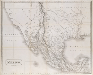
Mexico.
sold
- Digital Map Information
- Suitable for large format printing
- File Size: 2170.02 MB
- File Type: ZIP / TIFF
- ICC color profile embedded
- Delivered instantly via download link
This is an 1828 Henry Coburn map of Mexico, issued just a few years after Mexican Independence (1821) and a few years before the Texan Revolution (1835 - 1836). Published in Britain, this map highlights British interest, mostly investment-driven, in the ongoing Mexican fight for independence, as well as Austin's Town (Austin, Texas), reflecting the growing Anglo-American presence in Texas. (more details)
The first specific map of the west to appear in an American Atlas. Also, the only edition of this map to show the California Gold Region.
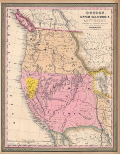
Oregon, Upper California, and New Mexico.
sold
- Digital Map Information
- Suitable for large format printing
- DPI: 600
- File Size: 27.98 MB
- File Type: ZIP / TIFF
- ICC color profile embedded
- Delivered instantly via download link
This is Samuel Augustus Mitchell's 1849 map of Upper California and Oregon, with a highlighted gold region. It is considered one of the most important and desirable mid-19th century American atlas maps. The present examples, is exceptionally beautiful, with a strongly highlighted Gold Region. (more details)
Important Gold Rush map detailing the California Gold Region and showing Texas at its largest.

Map of North America by J. Calvin Smith.
sold
- Digital Map Information
- Suitable for large format printing
- DPI: 300
- File Size: 22.62 MB
- File Type: ZIP / TIFF
- ICC color profile embedded
- Delivered instantly via download link
An extremely scarce 1850 map of North America by J. Calvin Smith. Published to capitalize on the mass westward migrations associated with the 1849 California Gold Rush, this map covers all of North American and Central America from Panama to ... (more details)
The finest commercial map of the American southwest to appear in the early 19th century.
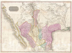
Spanish Dominions in North America Northern Part.
sold
- Digital Map Information
- Suitable for large format printing
- DPI: 300
- File Size: 20.54 MB
- File Type: ZIP / TIFF
- ICC color profile embedded
- Delivered instantly via download link
Possibly the finest commercial map of the American southwest to appear in the early part of the 19th century. Produced by John Pinkerton and based largely on the explorations of Alexander von Humboldt, this map Covers from the San Francisco ... (more details)
The first specific map of the west to appear in an American Atlas. Also, the only edition of this map to show the California Gold Region.
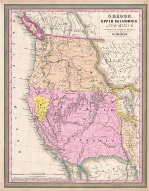
Oregon, Upper California, and New Mexico.
sold
- Digital Map Information
- Suitable for large format printing
- DPI: 300
- File Size: 6.24 MB
- File Type: ZIP / TIFF
- ICC color profile embedded
- Delivered instantly via download link
One of the most important mid-19th century American Atlas maps ever published, this is Samuel Augustus Mitchell's 1849 map of Upper California and Oregon, with a highlighted gold region. The map covers from Vancouver to the Mexico border ... (more details)
The first specific map of the west to appear in an American Atlas. Also, the only edition of this map to show the California Gold Region.
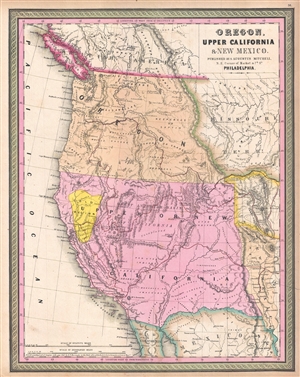
Oregon, Upper California, and New Mexico.
sold
- Digital Map Information
- Suitable for large format printing
- DPI: 300
- File Size: 6.18 MB
- File Type: ZIP / TIFF
- ICC color profile embedded
- Delivered instantly via download link
One of the most important mid-19th century American Atlas maps ever published, this is Samuel Augustus Mitchell's 1849 map of Upper California and Oregon, with a highlighted gold region. The map covers from Vancouver to the Mexico border ... (more details)
The first published representation of the pre-Columbian Aztec pilgrimage from Aztlan (Utah?) to Chapultepec (Mexico City).
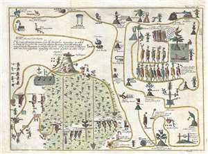
The copy of a antient picture kept by D. Carlos Siguenza in which is drawn and describ'd the road the antient Mexicans travell'd when they came from the Mountains to inhabit the Lake, call'd at present of Mexico, with the Hieroglyphicks signifying the names of places and other things.
sold
- Digital Map Information
- Suitable for large format printing
- DPI: 300
- File Size: 6.11 MB
- File Type: ZIP / TIFF
- ICC color profile embedded
- Delivered instantly via download link
This unusual 1704 map, drawn by Giovanni Francesco Gemelli Careri, is the first published representation of the legendary Aztec migration from Aztlan, a mysterious paradise somewhere to the north of Mexico, possibly in the vicinity of the ... (more details)
The only edition of this landmark map to include the United States.
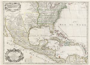
Carte du Mexique et des Etats unis d'Amerique, Partie Meridionale.
sold
- Digital Map Information
- Suitable for large format printing
- DPI: 300
- File Size: 20.63 MB
- File Type: ZIP / TIFF
- ICC color profile embedded
- Delivered instantly via download link
This is the 1783 Dezauche issue of Phillipe Buache and Guillaume D L'Isle's important map of North America and the West Indies. The map covers the United States, Mexico, New Mexico, Central America and the West Indies or Antilles. De ... (more details)
One of the only foreign language maps to identify and name the republic of Texas, not only on the map proper, but also in the title.
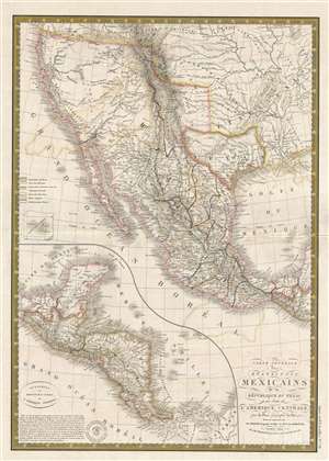
Carte générale des États-Unis Mexicains, de la République du Texas et des etats de l'Amérique Centrale.
sold
- Digital Map Information
- Suitable for large format printing
- DPI: 300
- File Size: 8.98 MB
- File Type: ZIP / TIFF
- ICC color profile embedded
- Delivered instantly via download link
An unusual find, this 1845 French map by Adrien Hubert Brué is one of the only foreign language maps to identify and name the republic of Texas, not only on the map proper, but also in the title. The map is centered the Republic of ... (more details)
Just before the Gold Rush.
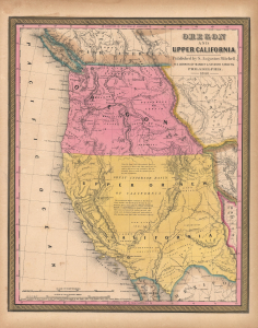
Oregon and Upper California.
sold
- Digital Map Information
- Suitable for large format printing
- File Size: 13.74 MB
- File Type: ZIP / TIFF
- ICC color profile embedded
- Delivered instantly via download link
This is Samuel Augustus Mitchell's 1848 map of Upper California and Oregon. It is considered one of the most important and desirable mid-19th-century American atlas maps, presenting the region immediately after annexation of Upper California (California Alta) to the United States following the Mexican-American War (1846 - 1848) but before the momentous California Gold Rush (1849 - 1850). (more details)
Important Gold Rush map detailing the California Gold Region and showing Texas at its largest.
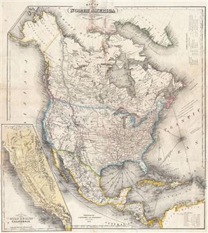
Map of North America by J. Calvin Smith.
sold
- Digital Map Information
- Suitable for large format printing
- DPI: 300
- File Size: 17.84 MB
- File Type: ZIP / TIFF
- ICC color profile embedded
- Delivered instantly via download link
An extremely scarce 1850 map of North America by J. Calvin Smith. Published to capitalize on the mass westward migrations associated with the 1849 California Gold Rush, this map covers all of North American and Central America from ... (more details)