
California (sold)
First printing of one of the most significant and desirable views of San Francisco.
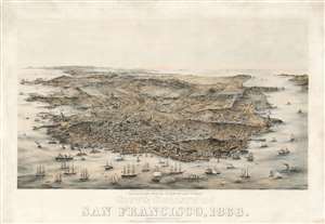
Bird's Eye View of the City and County of San Francisco, 1868.
sold
- Digital Map Information
- Suitable for large format printing
- Full resolution TIFF file
- ICC color profile embedded
- Delivered instantly via download link
An extraordinary Charles Braddock Gifford and William Vallance Gray 3-color chromolithograph bird's-eye view of San Francisco, California, in 1868 - one of the most desirable and influential views of San Francisco ever produced. The view looks southwest on San Francisco Peninsula from an imaginary highpoint to the northeast. The city and bustling harbor are prominent in the foreground while the peninsula's hills and lakes are in the background. The Golden Gate appears at the upper right, and Telegraph Hill at bottom center. (more details)
The rarest of the Texas 'Treaty Map' series.
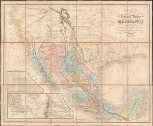
Mapa De Los Estados Unidos Mejicanos Arreglado a la distribucion que en diversos decretos ha hecho del territorio el Congreso General Mejicano.
sold
- Digital Map Information
- Suitable for large format printing
- Full resolution TIFF file
- ICC color profile embedded
- Delivered instantly via download link
The extremely rare 1851 edition of the Jean-Frédéric Rosa Map of Texas, California, and Mexico - considered the rarest of the 'Treaty Maps' used to settle the Mexico-Texas border between 1847 and 1853. This is grand map covering all of Mexico and much the southwestern part of the United States from the Pacific to the Apalachicola River and extending as far north as Great Salt Lake (Timpanogos). It was published in Paris by Jean-Frédéric Rosa on behalf of the Mexican Congreso General in anticipation of renewed negotiations over that part of the southwest that would eventually be annexed to the United States as part of the Gadsden Purchase. The map, generally based upon the 1826 Tanner map of Mexico, offers much of interest, including a recognition of American claims in Texas and Upper California, and multiple border configurations within Texas itself. It is the rarest of the three maps, along with the Tanner and Disturnell, used to negotiate the Gadsden Purchase. (more details)
One of the most significant and desirable views of San Francisco ever published.
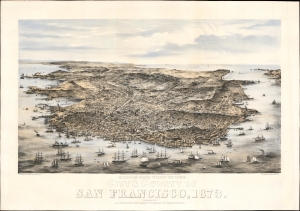
Bird's Eye View of the City and County of San Francisco, 1873.
sold
- Digital Map Information
- Suitable for large format printing
- Full resolution TIFF file
- ICC color profile embedded
- Delivered instantly via download link
This is Charles Braddock Gifford and William Vallance Gray's extraordinary 1873 three-color chromolithograph bird's-eye view of San Francisco, California - one of the most desirable and influential views of San Francisco ever produced. It captures the city in its second distinct phase, having left behind the Gold Rush era and embraced the role of financier of the Pacific Coast, particularly western Nevada's Comstock Lode. (more details)
Unrecorded first state of a foundational map with extensive manuscript additions relating to American Indian Reservations established in 1867-8.
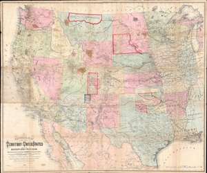
National Map of the Territory of the United States From The Mississippi River To The Pacific Ocean.
sold
- Digital Map Information
- Suitable for large format printing
- Full resolution TIFF file
- ICC color profile embedded
- Delivered instantly via download link
An extraordinary first-edition first-state example of William J. Keeler’s 1867 map of the Trans-Mississippi West - considered the finest post-Civil War railroad era map of the west - with unique manuscript annotations and additions relating to the American Indian Reservation System. This one of a kind historic document was likely the official example retained by the Indian Bureau, and possibly by Keeler himself, to administer and document the development of the American Indian Reservation system through the late 1860s. (more details)
A superb example of a great rarity of San Francisco.
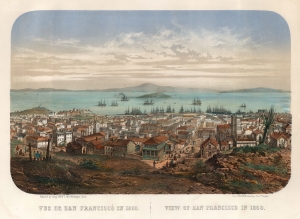
Vue de San Francisco en 1860. / View of San Francisco in 1860.
sold
- Digital Map Information
- Suitable for large format printing
- File Size: 36.57 MB
- File Type: ZIP / TIFF
- ICC color profile embedded
- Delivered instantly via download link
This is an extremely rare c. 1860 Louis Le Breton chromolithograph view map of San Francisco. It was printed in Paris by François-Désiré Gosselin in conjunction with San Francisco publisher Henry Payot. This early iteration of the view is significant for its early - and unique - depiction of Chinese immigration to California, focusing on San Francisco's Chinatown. (more details)
Thorough, early defense of the Sea of the West and the Northwest Passage.
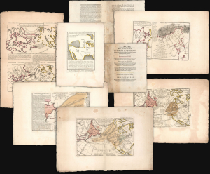
Exposé des Découvertes au Nord de la Grande Mer...
sold
- Digital Map Information
- Suitable for large format printing
- Full resolution TIFF file
- ICC color profile embedded
- Delivered instantly via download link
This is an extremely rare example of Philippe Buache's 1753 Exposé des Découvertes au Nord de la Grande Mer, the essential maps published to support the astonishing geographical theories of Philippe Buache and Joseph Nicolas De l'Isle, presented in August 1752 to the Paris Academie des Sciences. It was then the most complete cartographical defense of Nicolas De l'Isle's 'exposé' of Russian cartographic advances, along with Buache's synthesis of several mappings of the Pacific Northwest, revealing compelling (if ultimately false) evidence of a viable Northwest Passage. These maps were later included in the 1753-1755 Considérations Géographiques, 'the magnum opus of the Delisle-Buache theory of the layout of lands in the North Pacific space,' (Lada-Mocarski, 1969) appearing there in their second states. These six sheets are all first state examples, indicating that the Exposé enjoyed an earlier publication, spurred perhaps by the novelty of Buache and De l'Isle's arguments and the urgency with which the two geographers wished to assuage and rebut critics of their presentation to the Academie. (more details)
The essential covered wagon trail map of the American west.
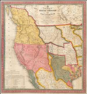
A New Map of Texas, Oregon and California with the Regions Adjoining.
sold
- Digital Map Information
- Suitable for large format printing
- Full resolution TIFF file
- ICC color profile embedded
- Delivered instantly via download link
A stunning example of Mitchell's seminal 1846 pocket map of Texas, Oregon, Upper California, Missouri Territory, the Indian Territory (Oklahoma, though in this example including most of Kansas and Colorado). This important map of Texas is one of the first ... (more details)
...with every building recognizable!
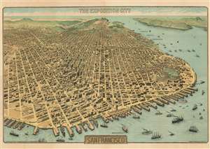
The Exposition City San Francisco.
sold
- Digital Map Information
- Suitable for large format printing
- File Size: 122.73 MB
- File Type: ZIP / TIFF
- ICC color profile embedded
- Delivered instantly via download link
An extraordinary bird's-eye view perspective view and map of San Francisco, risen from the ashes of the 1906 earthquake and fire, ready to retake the world stage by hosting of the Panama-Pacific International Exposition. The view looks westward on San Francisco from a fictional highpoint above today's San Francisco-Oakland Bay Bridge with California Street running dead center. The Embarcadero and docks appear in the foreground, while Golden Gate Park and the Pacific are recognizable in the distance. The Panama-Pacific Exposition, displayed here prospectively, appears at right, near the Golden Gate. Across the bay, in the distance, Mount Tamalpais, with a winding road ascending, is recognizable. The view presents a city fully recovered from a disaster that, just six years prior, destroyed eighty percent of the city. Cartographically the map is noteworthy as it illustrates and names nearly every single building - an astounding achievement and an invaluable record of San Francisco c. 1912. (more details)
The quintessential trail map of the American west.
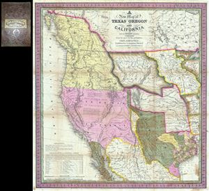
A New Map of Texas Oregon and California with the Regions Adjoining.
sold
- Digital Map Information
- Suitable for large format printing
- Full resolution TIFF file
- ICC color profile embedded
- Delivered instantly via download link
Considered 'the quintessential trail map of the American West' Samuel Augustus Mitchell's 'New Map of Texas Oregon and California' is one of the most important 19th century pocket maps ever issued. In Mitchell's own words This map comprises all that ... (more details)
An exceptionally scarce variant of a cornerstone map of the American west and the finest of its era.
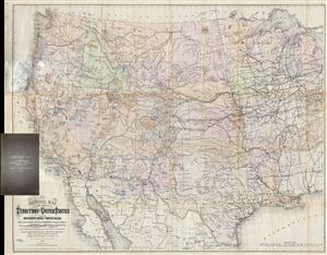
National Map of the Territory of the United States From The Mississippi River To The Pacific Ocean. Madeby the authority of the Hon. O. H. Browning Secretary of the Interior. In the Office of the Indian Bureau Chiefly For Government Purposes under the direction of the Hon. N.G. Taylor, Commisr. of Indian Affairsa and Hon. Chas E. Mix Chief Clerk of the Indian Bureau.
sold
- Digital Map Information
- Suitable for large format printing
- File Size: 46.46 MB
- File Type: ZIP / TIFF
- ICC color profile embedded
- Delivered instantly via download link
A map of the utmost importance and scarcity, this is William J. Keeler's 1868 pocket map of the American west, considered the 'the largest, finest and most detailed map of the West as it was then known.' The map covers from Detroit and Cincinnati ... (more details)
The largest and best specific map of insular California.
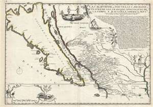
La Californie ou Nouvelle Caroline, Teatro de los Trabajos Apostolicos de la Compa. E Jesus en la America Septe. Dressée sur celle que le Viceroy de la Nouvelle Espagne envoya il y a peu d'années à Mrs. De l'Academie des Sciences.
sold
- Digital Map Information
- Suitable for large format printing
- DPI: 300
- File Size: 16.89 MB
- File Type: ZIP / TIFF
- ICC color profile embedded
- Delivered instantly via download link
A landmark 1720 map showing California as an island and the first published dissemination of Fr. Eusebio Frabcusci Kino's groundbreaking explorations in New Mexico and California. Drawn by Nicolas de Fer, official Geographe de Monseigneur le ... (more details)
Earliest published sea chart focusing on the California coast!
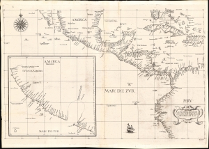
Carta prima generale d'America dell'India Occidentale e Mare del Zur.
sold
- Digital Map Information
- Suitable for large format printing
- File Size: 22.42 MB
- File Type: ZIP / TIFF
- ICC color profile embedded
- Delivered instantly via download link
This is the 1646 first state of Robert Dudley's chart of the middle part of the Americas, illustrating the proximity of the Caribbean Sea and the Pacific Ocean and emphasizing the narrow parts of Central America dividing the two bodies of water. The chart features the western part of the Caribbean, but it is particularly noted for being the first printed sea chart to focus on the Pacific coast, including California. It is, along with Dudley's more narrowly focused charts, the first printed chart of the West Indies and South Florida to employ the Mercator Projection. An inset chart in the lower left focuses specifically on the coast of California, from Baja to Cap Mendocino. (more details)
Outstanding 1849 broadside promoting routes the California Gold Rush.
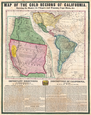
Map of the Gold Regions of California. Showing the Routes via Chagres and Panama, Cape Horn, & c.
sold
- Digital Map Information
- Suitable for large format printing
- DPI: 300
- File Size: 14.37 MB
- File Type: ZIP / TIFF
- ICC color profile embedded
- Delivered instantly via download link
A rare and remarkable example of Ensign and Thayer's 1849 promotional broadside map illustrating routes to and from the California Gold Fields. 'Forty-Niners' traveling across the continent to California faced a daunting and dangerous ... (more details)
A must-have for the early mapping of the American west.
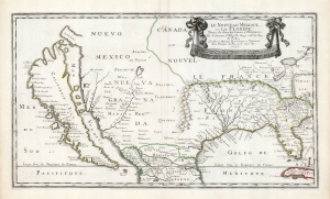
Le Nouveau Mexique, et la Floride: Tirées de diverses Cartes, et Relations. Par N. Sanson d'Abbeville Geogr ordre du Roy. A Paris. Chez Pierre Mariette, Rue S. Jacque a l'Esperance Avec Privilege du Roy, pour vingt Ans. 1656.
sold
- Digital Map Information
- Suitable for large format printing
- DPI: 600
- File Size: 36.2 MB
- File Type: ZIP / TIFF
- ICC color profile embedded
- Delivered instantly via download link
This is a beautiful example of Nicolas Sanson's 1656 map of New Mexico and Florida: the first atlas map to emphasize this geographical focus. It also presented arguably the most influential depiction of California-as-an-island, providing the dominant model of that cartography for the remainder of the seventeenth century, reaching into the eighteenth. (more details)
Mora's rarest and most desirable map.
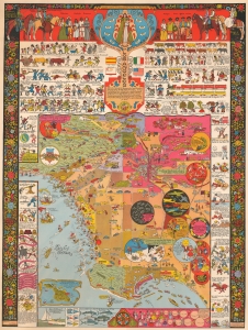
This is a 1942 Jo Mora pictorial map of Los Angeles, California. This is Mora's rarest and most sought-after pictorial map and arguably the best pictorial map of Los Angeles ever issued. It is filled with Mora's unique humor and artistry, which captures Los Angeles' culture, folklore, and history. (more details)
The first appearance of the Marquette-Joliet Mississippi River cartography.
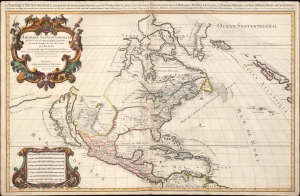
Amerique septentrionale divisée en ses principales parties, ou sont distingués les vns des autres les estats suivant qu'ils appartiennent presentemet aux Francois, Castillans, Anglois, Suedois, Danois, Hollandois, tirée des relations de toutes ces nations par le S. Sanson, geographe ordinaire du roy. 1674.
sold
- Digital Map Information
- Suitable for large format printing
- Full resolution TIFF file
- ICC color profile embedded
- Delivered instantly via download link
An impressive and scarce 1674 map of North America issued by Alexis-Hubert Jaillot, offered here in its first edition, and likely exhibiting preliminary data from the 1673 Marquette-Joliet Expedition. The map covers North America and Central America from Baffin Bay to the Spanish Main. It extends westward past an Insular California to include Terre de Iesso (a speculative mapping of Hokkaido) and eastwards past the Azores to include the British Isles. It includes a striking mapping the Mississippi (Chucagua), that while inaccurate in the southernmost regions, likely reflects Joliet's verbal reports from the seminal 1673 Marquette-Joliet Expedition. (more details)
Mora's rarest and most desirable map.
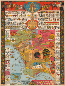
This is a 1942 Jo Mora pictorial map of Los Angeles, California. This is Mora's rarest and most sought-after pictorial map and arguably the best pictorial map of Los Angeles ever issued. It is filled with Mora's unique humor and artistry, which captures Los Angeles' culture, folklore, and history. (more details)
One of the most influential maps in the history of North America.
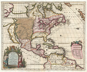
Amerique Septentrionalis Carte d'un tres grand Pays entre le Nouveau Mexique et la Mer Glaciace Dediee a Guilliaume IIIe. Roy de La Grand Bretagne Par le R. P. Louis de Hennepin Mission: Recol: et Not: Apost: Chez c. Specht a Utreght 1698.
sold
- Digital Map Information
- Suitable for large format printing
- DPI: 300
- File Size: 13.5 MB
- File Type: ZIP / TIFF
- ICC color profile embedded
- Delivered instantly via download link
A map that fundamentally impacted the cartographic history of America, this is the 1698 Friar Hennepin map of North America. Covering all of North America from the Equator to the Arctic, this map is remarkable on a number of levels ... (more details)
Rare map of Texas issued just before the Treaty of Guadeloupe Hidalgo.
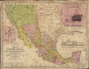
Map of Mexico, Texas, Old and New California, and Yucatan. Showing the principal Cities and Towns, Travelling Routes and c.
sold
- Digital Map Information
- Suitable for large format printing
- Full resolution TIFF file
- ICC color profile embedded
- Delivered instantly via download link
The only known example of the 1848 edition of House and Brown's broadside map of Texas, Mexico, and Upper California, issued at the end of the Mexican-American War (1846 - 1848). The map is centered on Texas, which is presented at its largest, with its western border embracing Albuquerque and Santa Fe, and the stovepipe configuration extending its northern border to 42° N latitude. The map is elaborated by inset maps of Monterey illustrating the Battle of Monterrey (September 21 - 24, 1846) and Veracruz, Mexico. In addition, the Gulf of Mexico is occupied by a large vignette view of the fortress of San Juan de Ulúa, Veracruz. In this edition, Texas is uncolored, emphasizing that it is part of the United States, but Upper California and New Mexico are colored as Mexican intendencias, suggesting this map predates the Treaty of Guadalupe Hidalgo and must therefore have been sent to the presses sometime before February 28, 1848. (more details)
Cowboy Culture, by a cowboy.
![1933 Jo Mora Evolution of the Cowboy Life Rodeo Poster [First Edition]](/mm5/graphics/00000001/M/Cowboys-mora-1933-2-M.jpg "1933 Jo Mora Evolution of the Cowboy Life Rodeo Poster [First Edition]")
The legendarily rare 1933 first edition of Jo Mora's 'Evolution of the Cowboy' is considered his most iconic and influential work. The image celebrates all things cowboy, from the rodeo to saddles, steers, and chuckwagons. It is worth noting that Mora became a cowboy himself, and his depictions of cowboy life, the Salinas Rodeo, and the surrounding culture exhibit realism grounded in experience. (more details)
Earliest Acquirable Accurate Map of the Southwest?
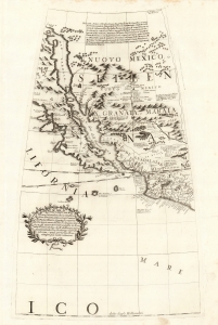
[Untitled Globe Gore of Western North America from the Equator to approximately 50º north].
sold
- Digital Map Information
- Suitable for large format printing
- Full resolution TIFF file
- ICC color profile embedded
- Delivered instantly via download link
This is the globe gore focusing on the American southwest, engraved in 1688 for Vincenzo Coronelli's 42-inch (3 1/2 foot) terrestrial globe, reprinted in 1697 for inclusion in his Libro dei Globi and Isolario. This beautiful engraving is striking in its presentation of the insular California, but this is not its most important feature. Rather it represents the earliest correct depiction of the Rio Grande generally acquirable to the collector. (more details)
San Francisco devastated.
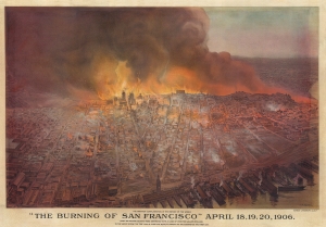
'The Burning of San Francisco' April 18, 19, 20, 1906. The Greatest Conflagration in the History of the World.
sold
- Digital Map Information
- Suitable for large format printing
- File Size: 138.02 MB
- File Type: ZIP / TIFF
- ICC color profile embedded
- Delivered instantly via download link
This is a c. 1906 Schmidt Lithograph Company bird's-eye view of San Francisco burning after the 1906 Great San Francisco Earthquake. It is the best and most dramatic contemporaneous illustration of the Great Fire. (more details)
A German 49er maps California.
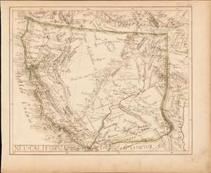
Neu-California.
sold
- Digital Map Information
- Suitable for large format printing
- DPI: 600
- File Size: 6.66 MB
- File Type: ZIP / TIFF
- ICC color profile embedded
- Delivered instantly via download link
A most intriguing German-language c. 1849 California Gold Rush era manuscript map of Upper California. Although drawn by an unknown hand, the map offers a wealth of unique information ranging from early gold discoveries, mines, and indigenous settlements to the very unusual inclusion of the explorer's route of Jedediah Smith. While mysterious, the work suggests it was drawn by a potential German 49er for personal use. (more details)
'An advance of the first importance' - Wheat
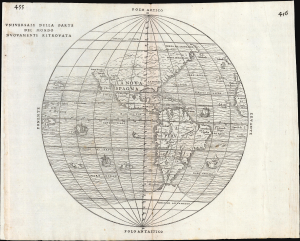
Universale Della Parte De Mondo Nuovamente Ritrovata.
sold
- Digital Map Information
- Suitable for large format printing
- File Size: 10.16 MB
- File Type: ZIP / TIFF
- ICC color profile embedded
- Delivered instantly via download link
This is Giovanni Battista Ramusio's scarce 1556 map of the Americas. It appeared in Ramusio's Navigationi et Viaggi, the first collection of explorers' first-hand accounts of their travels. It is among the earliest detailed representations of the Western Hemisphere, and was the first overall printed map of America to include placenames from Coronado's travels of 1540-1542. Wheat hailed this inclusion as an advance of the first importance, so far as the mapping of the American West is concerned. (more details)
Most Important Early Map of the New Mexico Territory.
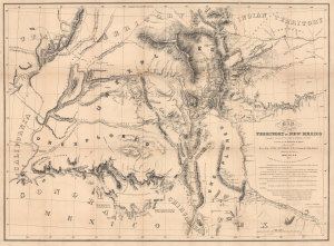
Map of the Territory of New Mexico...
sold
- Digital Map Information
- Suitable for large format printing
- Full resolution TIFF file
- ICC color profile embedded
- Delivered instantly via download link
This is the extremely rare, unpublished 1851 map of the Territory of New Mexico produced by John G. Parke and Richard Kern. Known as the Parke-Kern Map, it was printed within the War Department and separately issued on an individual basis but never included in a Congressional Report, as were other key early maps of the American West. The map was then reprinted several times in the late 19th and early 20th century with no obvious changes, but which can be distinguished from the original plate by very close examination. The present example is one of these later, c. 1900, reissues, which in themselves are still very rare. (more details)
The first map made by Chinese Americans of San Francisco for the Chinese community.

Map of San Francisco Chinatown. / 美國三藩市華僑區: 詳細圖 / Meiguo Sanfan Shi hua qiao qu : xiang xi tu.
sold
- Digital Map Information
- Suitable for large format printing
- File Size: 22.69 MB
- File Type: ZIP / TIFF
- ICC color profile embedded
- Delivered instantly via download link
An extraordinary record of the early 20th century Chinese experience in San Francisco, this is a rare 1929 map of San Francisco's Chinatown by the San Francisco based Kuomintang (KMT) nationalist J. P. Wong (黃華培, Huang Huapei). This is the first map of Chinatown to be produced by Chinese-Americans for Chinese-American use, and accordingly identifies primarily Chinese-owned businesses and organizations. The map was printed on behalf of the 'Chinese Six Companies' who used it to collect dues, but it was also used by the Tongs, criminal gangs who similarly employed the map to support their extortion racket. (more details)
Sanson’s 1650 map of North America and 1656 map of New Mexico seem to the present writer by far the most interesting and important maps … - C. Wheat
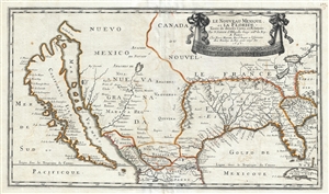
Le Nouveau Mexique, et la Floride: Tirées de diverses Cartes, et Relations. Par N. Sanson d'Abbeville Geogr ordre du Roy. A Paris. Chez Pierre Mariette, Rue S. Iacque a l'Esperance Avec Privilege du Roy, pour vingt Ans. 1656.
sold
- Digital Map Information
- Suitable for large format printing
- DPI: 300
- File Size: 11.08 MB
- File Type: ZIP / TIFF
- ICC color profile embedded
- Delivered instantly via download link
Sanson and Mariette's 1656 first edition map of the central and western part of North America is one of the most important maps ever published pertaining to the American west. This map represents the first time this region has been ... (more details)
Seminal Map of the American Southwest by 'World's Greatest Living Man'.

Carte Du Mexique et des Pays Limitrophes Situes Au Nord et a l'est Dressee d'apres la Grande Carte de la Nouvelle Espagne De Mr. A. De Humboldt et d'autres Materiaux par J.B. Poirson.
sold
- Digital Map Information
- Suitable for large format printing
- DPI: 300
- File Size: 15.17 MB
- File Type: ZIP / TIFF
- ICC color profile embedded
- Delivered instantly via download link
A seminal 1811 map of Mexico and the American West by Alexander von Humboldt. Humboldt, who during his lifetime was considered the 'world's greatest living man,' composed this map during his 1803 sojourn in Mexico. Though often ... (more details)
First edition of a foundational chart.
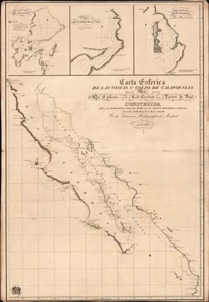
Carta Esferica de las Costas y Golfo de Californias llamado Mar de Cortes Que Comprende desde el Cabo Corrientes hasta el Puerto de S. Diego.
sold
- Digital Map Information
- Suitable for large format printing
- File Size: 26.15 MB
- File Type: ZIP / TIFF
- ICC color profile embedded
- Delivered instantly via download link
A spectacular 1825 1st edition of the Felipe Cardano y Bauzá / Dirección Hidrográfico foundational nautical chart or maritime map of Baja California and the Gulf of California. This important chart is the basis for much of the subsequent mapping of this region and is reflected in subsequent French and English charts. Coverage extends along the west coast of Mexico from San Diego, California, to Cabo Corrientes, Jalisco, Mexico, including all of modern-day Baja, the Gulf of California, and the Sonora and Sinaloa coasts. (more details)
'An advance of the first importance' - Wheat
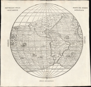
Universale Della Parte De Mondo Nuovamente Ritrovata.
sold
- Digital Map Information
- Suitable for large format printing
- File Size: 7.62 MB
- File Type: ZIP / TIFF
- ICC color profile embedded
- Delivered instantly via download link
This is Giovanni Battista Ramusio's scarce 1565 map of the Americas. It first appeared in Ramusio's 1556 Navigationi et Viaggi, the first collection of explorers' first-hand accounts of their travels. It is among the earliest detailed representations of the Western Hemisphere, predated only by the 1540 Münster and the extremely rare 1554 Bellère map. This was the first printed map of America to include placenames from Coronado's travels of 1540-1542: Wheat hailed this inclusion as 'an advance of the first importance, so far as the mapping of the American West is concerned.'
Ramusio commissioned Giacomo Gastaldi (1500 - 1566) to compose this map, along with the others appearing in the Navigationi et Viaggi; that much of its detail agrees with the western portion of Gastaldi's 1546 world map supports this. (more details)
Ramusio commissioned Giacomo Gastaldi (1500 - 1566) to compose this map, along with the others appearing in the Navigationi et Viaggi; that much of its detail agrees with the western portion of Gastaldi's 1546 world map supports this. (more details)
One of the first charts of California as an island!
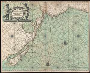
Pascaerte van Nova Hispania Perv en Chili.
sold
- Digital Map Information
- Suitable for large format printing
- DPI: 300
- File Size: 13.62 MB
- File Type: ZIP / TIFF
- ICC color profile embedded
- Delivered instantly via download link
An example of Joannes van Loon's important 1661 map of the western coast of America including California as an Island. This is one of the earliest and rarest nautical charts to embrace the Insular California convention. The map is oriented to the east, as navigators sailing for the important Mexican silver port of Acapulco from Far East would have experienced the approach. The title cartouche, in the upper let, features two simply dressed farmers with cycles, presumably a stylized attempt at indigenous Americans. (more details)
One of the most graphically striking maps of the San Francisco Bay area.
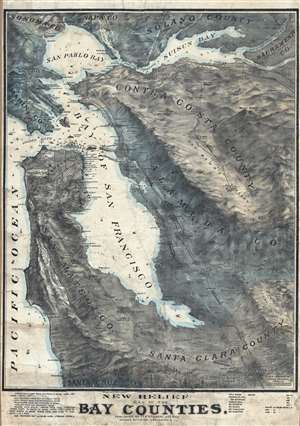
New Relief Map of the Bay Counties.
sold
- Digital Map Information
- Suitable for large format printing
- File Size: 63.9 MB
- File Type: ZIP / TIFF
- ICC color profile embedded
- Delivered instantly via download link
One of the more graphically striking maps of the San Francisco Bay Area to appear in the early 20th century This is a scarce 1905 Whitaker and Ray wall map of the San Francisco Bay Area. The map covers the entire Bay Area, from ... (more details)