
Florida
Beginnings of American commercial chart publishing.

General Chart of the West Indies from the latest Marine Journals and Surveys.
$30,000.00
Acquire
- Digital Map Information
- Suitable for large format printing
- DPI: 600
- File Size: 50.2 MB
- File Type: ZIP / TIFF
- ICC color profile embedded
- Delivered instantly via download link
An important c. 1789 - 1794 nautical map of the West Indies, Florida, the Bahamas, and the Gulf of Mexico littoral by Osgood Carleton and John Norman. This is the second edition of John Norman's first published nautical chart, representing one of the first instances of post-Revolutionary American commercial chart making, predating the publication of the Clark Pilot by several months. (more details)
Finest colonial-era map of the American southeast.
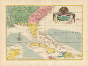
A Map of Carolina, Florida and the Bahama Islands with the Adjacent Parts.
$21,000.00
Acquire
- Digital Map Information
- Suitable for large format printing
- DPI: 600
- File Size: 46.7 MB
- File Type: ZIP / TIFF
- ICC color profile embedded
- Delivered instantly via download link
A beautiful 18th-century example of Mark Catesby’s 1743 map of the southeastern parts of North America. This map is considered one of the finest colonial-era maps of the American southeast. The present example is a 1771 third edition of the map. (more details)
First specific map of Florida.
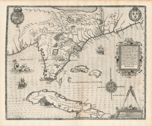
Floridae Americae Provinciae Recens and Exactissima Descriptio Auctore Iacobo Le Moyne cui Cognomen de Morgues, qui Laudonierum…
$10,000.00
Acquire
- Digital Map Information
- Suitable for large format printing
- Full resolution TIFF file
- ICC color profile embedded
- Delivered instantly via download link
…the most remarkable and important map, which has been preserved from the sixteenth century maps, of that part of the East Coast which lies between Cape Hatteras and Cape Florida … the first French map to show Florida … considered the most important map of Florida. - Johns Matthews BaxterA map of extraordinary rarity and seminal importance, this is one of the earliest and most influential maps of the American southeast ever published. Drawn by the French artist Jacques Le Moyne de Morgues c. 1565 and published by Theodore de Bry in 1591, this magnificent map details the Florida peninsula and Carolina coast from Cuba to the Bahamas, to 'Prom Terra flag' or, as it is known today, Cape Lookout near Beaufort, North Carolina. (more details)
First published image of New Orleans.
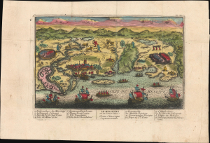
Le Mississipi ou la Louisiane dans l'Amerique Septentrionale.
$9,500.00
Acquire
- Digital Map Information
- Suitable for large format printing
- Full resolution TIFF file
- ICC color profile embedded
- Delivered instantly via download link
This is a rare c. 1720 Chéreau broadside leaflet map-view of the Gulf of Mexico littoral, just a few years after New Orleans was founded. It is likely the earliest printed view of New Orleans - though admittedly, it is not an accurate representation of the city at the time. The map was issued as a propaganda leaflet to promote New Orleans and French Louisiana, and thus coverage extends east to encompass most of the Florida Panhandle. It is among the earliest maps to include a view of New Orleans and the indigenous peoples of the Gulf. The present example is the first state, with extraordinary period color. (more details)
Early Spanish nautical mapping of Florida.
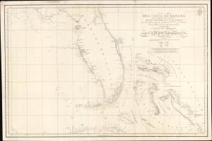
Nueva Carta del Canal de Bahama que comprehende tambien Los de Providencia y Santaren con los bajos, islas, y sondas al Este y al Oeste de la Peninsula de la Florida...
$5,000.00
Acquire
- Digital Map Information
- Suitable for large format printing
- DPI: 600
- File Size: 814.37 MB
- File Type: ZIP / TIFF
- ICC color profile embedded
- Delivered instantly via download link
A strikingly engraved 1807 Spanish nautical map of Florida and the Bahamas (Lucayas) published in Madrid by the Spanish Dirección Hidrografía. It is among the earliest modern nautical charts to focus specifically on Florida and was based on the 1799 observations of Dionisio Alcalá Galiano (1760 - 1805) aboard the ship San Fulgencio. (more details)
Main Trade Route of the Caribbean.
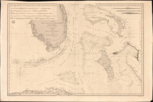
Carte des Canaux de la Providence et de Bahama. D'après la Carte en deux feuilles de E. Blunt de 1847.
$4,000.00
Acquire
- Digital Map Information
- Suitable for large format printing
- Full resolution TIFF file
- ICC color profile embedded
- Delivered instantly via download link
This is a large-format 1851 nautical chart or map of southern Florida and the Bahamas, focusing on the Bahama Banks, produced by the French Dépôt de la Marine. Based on a 1847 chart by American hydrographer Edmund Blunt, the chart represents the most detailed hydrographic information on these notoriously tricky waters available at the time. The map marks a point of rising French trade and activity in the Gulf under the Second Empire. (more details)
At the height of the Haitian Revolution, when a former slave's rise to power that undermined the foundations of the plantation system.
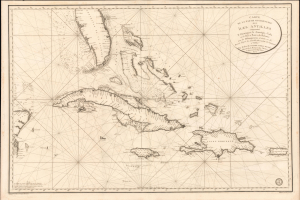
Carte de la Partie Occidentale des Îles Antilles Comprenant St. Domingue, La Jamaique, Cuba et Îles et Bancs de Bahama avec les Débouqumens de toutes ces Îles Dressée d'apres les nouvelles Observations des Espagnols et Publiée Par Ordre du Xontre-Amiral Decrès Ministre de la Marine et des Colonies au Dépôt général de la Marine, en 1801.
$4,000.00
Acquire
- Digital Map Information
- Suitable for large format printing
- Full resolution TIFF file
- ICC color profile embedded
- Delivered instantly via download link
A striking 1801 French Dépôt de la Marine nautical chart of Florida and the Greater Antilles, encompassing Cuba, the Bahamas, Hispaniola, Puerto Rico, and Jamaica. Issued at the height of the Haitian Revolution, the map coincides with the rise of the former slave and revolutionary Toussaint Louverture, who had just unified Hispaniola under his authority, sending shockwaves through the slaveholding societies of the Atlantic world. Published as Napoleon Bonaparte prepared his massive Saint-Domingue Expedition to reclaim France's richest colony, this chart reflects the sudden strategic importance of the Caribbean's sea lanes, making it an artifact of one of history's most transformative revolutions. (more details)
Revolutonary War Florida Rarity.
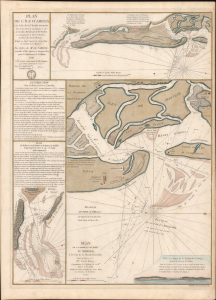
Plan de l'île d'Amelia à la Côte de la Floride Orientale. / Plan de la Barre et et de l'entrée de la Riviere de Nassau. / Plan de la Barre et du port d'Amelia, à la Côte de la Floride Orientale.
$3,850.00
Acquire
- Digital Map Information
- Suitable for large format printing
- Full resolution TIFF file
- ICC color profile embedded
- Delivered instantly via download link
This is a rare 1779 American Revolutionary War map of Amelia Island, Florida, issued by Antoine de Sartine (1729 - 1801) and Jean-Nicholas Buache de Neuville (1741 - 1825). The chart was issued following the 1778 Treaty of Alliance, in which France formally recognized the United States and offered to aid the fledgling country against the British. Early in the war, French aid was primarily maritime. The Dépôt de Marine recognized the need for better nautical charts and began compiling and improving British charts of the North American coastline. (more details)
A foundational map of the America Southeast and the first to use the term 'Tegesta' to identify peninsular Florida.
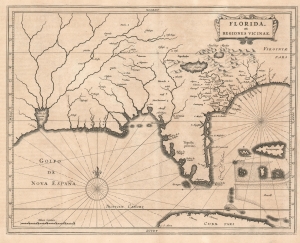
Florida, et Regiones Vicinae.
$3,500.00
Acquire
- Digital Map Information
- Suitable for large format printing
- DPI: 600
- File Size: 8.77 MB
- File Type: ZIP / TIFF
- ICC color profile embedded
- Delivered instantly via download link
One of the great foundational maps of the American southeast, this is Johannes de Laet's 1630 map of Florida. At the time, Florida referred to a vast region extending from Virginia to the Mississippi Valley, and this map correspondingly covers that region. De Laet based the map on a variety of sources, particularly on Cornelius Claesz's 1602 interpretation of Jacques Le Moyne's map of 1591, the Abraham Ortelius-Hieronymo de Chaves map of 1584, and the Mercator-Hondius map of 1606. (more details)
By the greatest German cartographer of the 19th century.
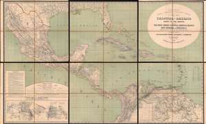
H. Kiepert's Karte des Nördlichen Tropischen America. A New Map of Tropical - America North of the Equator Comprising the West - Indies, Central - America, Mexico, New Cranada and Venezuela.
$3,500.00
Acquire
- Digital Map Information
- Suitable for large format printing
- Full resolution TIFF file
- ICC color profile embedded
- Delivered instantly via download link
This is a large and impressive 1858 map of Florida, the Gulf of Mexico, Central America, the West Indies, and northern South America, compiled by Heinrich Kiepert, the greatest German cartographer of the 19th century. The map presents the region in detail, with color coding to differentiate between countries and a key situated in the lower left. (more details)
Classic Dutch Map of the Caribbean.
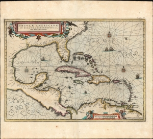
Insulae Americanae in Oceano Septentrionali cum Terris adiacentibus.
$3,000.00
Acquire
- Digital Map Information
- Suitable for large format printing
- Full resolution TIFF file
- ICC color profile embedded
- Delivered instantly via download link
This is a beautiful 1637 example of Jan Jansson's 1636 map of the Caribbean Islands and the adjacent coastlines of North and South America. It is among the most beautiful maps of the region produced in the first half of the 17th century. Moreover, the present example is in superb condition with gorgeous, bright original color. (more details)
Rare updated chart of Florida's West Coast and Cuba.
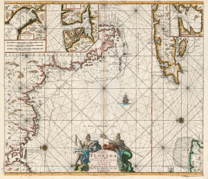
Pas kaart Van de Boght van Florida Met de Canaal Tusschen Florida en Cuba.
$2,500.00
Acquire
- Digital Map Information
- Suitable for large format printing
- DPI: 600
- File Size: 78.13 MB
- File Type: ZIP / TIFF
- ICC color profile embedded
- Delivered instantly via download link
This is a striking, original-color example of Gerard van Keulen's thoroughly updated 1723 version of 'the first sea chart of the eastern portion of the Gulf of Mexico detailing the west coast of Florida' (Burden). It is an exceptionally rare chart that appeared late in the van Keulen record, exhibiting meticulous and important revisions unique to this edition. (more details)
Promoting the Sunset Islands.
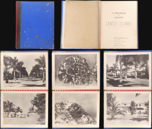
This is a 1938 Sunset Island Company and Stephen A. Lynch Jr. pictorial portfolio of the Sunset Islands, Miami Beach, Florida. The promotional volume was published in a limited edition for Sunset Islands property owners and prospective owners. The present example, signed by Lynch and Mobley, was presented to the business mogul and philanthropist Joseph John Fretwell (1850 - 1938). The 50-page spiral-bound volume features photographs of fabulous Sunset Islands estates. (more details)
The United States for the curious Swede.
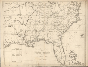
Southern Section of the United States including Florida etc. by John Melish.
$2,400.00
Acquire
- Digital Map Information
- Suitable for large format printing
- File Size: 17.01 MB
- File Type: ZIP / TIFF
- ICC color profile embedded
- Delivered instantly via download link
This is a rare 1824 Swedish map of Florida and the Southeastern United States published by Axel Leonard Klinckowström after the scarce 1816 map of John Melish. The map accompanied Klinckowström's Tocqueville-style narrative, expounding on the United States for Swedish audiences. (more details)
A fine decorative map depicting colonial America during the Spanish War of Succession.
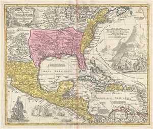
Regni Mexicani seu Novae Hispaniae, Floridae, Novae Angliae, Carolinae, Virginiae et Pensylvaniae, nec non Insularum, Archipelagi Mexicani in America Septentrionali.
$2,400.00
Acquire
- Digital Map Information
- Suitable for large format printing
- Full resolution TIFF file
- ICC color profile embedded
- Delivered instantly via download link
This is a 1715 J. B. Homann's decorative map of Mexico, Florida, New England, the West Indies, and the Mississippi Valley (Louisiana). Centered on the Mississippi River Valley, Homann's map depicts from Sinaloa (Mexico) eastwards to the Atlantic Coast and from the ... (more details)
Colonial rivalries in early America - fine original color.
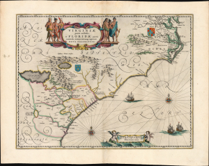
Virginiae Partis australis, et Floridae partis orientalis, interjacentiumqus regionum Nova Descriptio.
$2,250.00
Acquire
- Digital Map Information
- Suitable for large format printing
- Full resolution TIFF file
- ICC color profile embedded
- Delivered instantly via download link
This is Willem Blaeu's map of Virginia and Florida, engraved in 1638 and appearing here in an early, 1642 Appendix issue of the map in beautiful original color. This classic Dutch map, which encompassed the Carolinas and what would become Georgia and part of Florida, has been called 'the most correct map of this area yet to appear.' (Cumming) (more details)
Golden Age of Caribbean piracy.
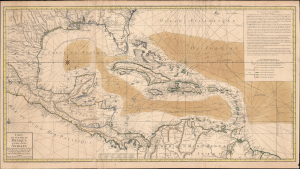
Carte du Golphe du Mexique et des Isles Antilles.
$2,000.00
Acquire
- Digital Map Information
- Suitable for large format printing
- Full resolution TIFF file
- ICC color profile embedded
- Delivered instantly via download link
A fine example of the 1780 Dezauche edition of Buache's important nautical map of the Caribbean, Gulf of Mexico, Florida, and West Indies at the end of the Golden Age of Caribbean Piracy. (more details)
Cold War, Civil Rights, Anti-Communism.
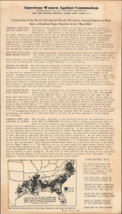
Communists Incite Racial Uprising and Bloody Revolution Among Negroes of Dixie / Seek to Establish Negro Republic In the 'Black Belt.'
$2,000.00
Acquire
- Digital Map Information
- Suitable for large format printing
- File Size: 6.35 MB
- File Type: ZIP / TIFF
- ICC color profile embedded
- Delivered instantly via download link
This is the only known example of a c. 1940 anti-Communist persuasive broadsheet and map of the U.S. South published by the organization American Women Against Communism (A.W.A.C.). The sheet details and denounces a supposed international Communist plot to create a 'Negro Republic' in the 'Black Belt' of the South. (more details)
First Atlas Map of the Caribbean in its First Printing
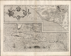
Culiacanae, America Regionis Descriptio./ Hispaniolae, Cubae, Aliarumque Insularum Circumiacentium, Delineatio./ Cum Imp. et Regio./ privilegio decennali 1579.
$2,000.00
Acquire
- Digital Map Information
- Suitable for large format printing
- Full resolution TIFF file
- ICC color profile embedded
- Delivered instantly via download link
This is a superb, first-edition example of Ortelius' 1579 map of Cuba and the Caribbean, combined with his map of the Viceroyalty of Culiacan in Northwestern Mexico. While Ortelius' Theatrum had been in print since 1570, it was not until 1579 that this map was added to the book. This example exhibits a bold, sharp strike resulting from the youth of its plate; it is consequently very desirable. (more details)
The Allies' 'Trampoline to Victory'
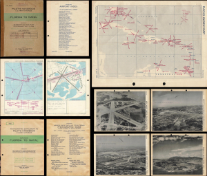
Pilot's Handbook U.S. Army Air Forces Florida to Natal / Photographic Supplement to Pilot's Handbook U.S. Army Air Forces Along Route Florida to Natal.
$1,950.00
Acquire
This is a rare 1945 restricted / confidential pilot's handbook and photographic supplement prepared by the U.S. Army Air Force's Aeronautical Chart Service. Containing several dozen aeronautical charts and photographs of airfields, it guided pilots along the World War II-era South Atlantic route that ferried supplies from Florida, over the Caribbean, to Brazil, across the Atlantic Ocean, and finally to Allied armies in the field. (more details)
Thirteen Colonies on the Brink of Revolution.
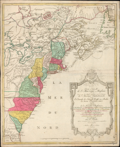
Carte Nouvelle de L'Amerique Angloise contenant tout ce que les Anglois possedent sur le Continent de L'Amerique Septentrionale savoir le Canada, la Nouvelle Ecosse ou Acadie, les treize Provinces unies
$1,800.00
Acquire
- Digital Map Information
- Suitable for large format printing
- Full resolution TIFF file
- ICC color profile embedded
- Delivered instantly via download link
This is an uncommon 1776 French-language map of the Thirteen Colonies and emerging United States by Augsburg cartographer Matthias Albrecht Lotter, published at the outbreak of the American Revolutionary War. Drawing heavily on French cartographic traditions, the map presents British North America at the very moment the colonies declared independence and the United States began to take shape. Issued two years before France formally entered the Revolutionary War on the American side, it captures the continent on the cusp of a geopolitical transformation that would redraw North America. (more details)
The dominant 17th century depiction of the American Southeast.
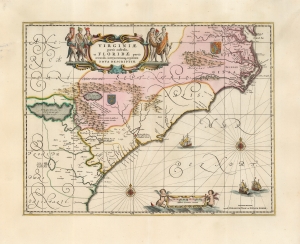
Virginiae Partis australis, et Floridae partis orientalis, interjacentiumque regionum Nova Descriptio.
$1,800.00
Acquire
- Digital Map Information
- Suitable for large format printing
- Full resolution TIFF file
- ICC color profile embedded
- Delivered instantly via download link
This is Jan Jansson's beautiful map of Virginia and Florida, engraved in 1639, appearing here in an attractive example of its c. 1694 restrike under the imprint of Gerard Valk and Peter Schenk. This classic Dutch map, encompassing the Carolinas and what would become Georgia and part of Florida, was derived from that of Willem Blaeu, which has been called 'the most correct map of this area yet to appear' (Cumming). Blaeu's map was sufficiently authoritative for Jansson to make an extremely faithful copy. Both cartographers' maps would have a long print life. (more details)
Legend Meets Latitude - the myths and facts of sunken treasure.
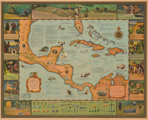
Map of Sunken Treasure. History of Piracy and Spanish Gold Fleets Old Wreck Locations Recovered Treasure Salvate, Identification Florida and the Caribbean.
$1,800.00
Acquire
A wonderful, richly-toned 1959 Jay Scott Pike and Fred Logan pictorial map of Florida, the Caribbean, and the West Indies, celebrating sunken treasure, pirate history, and underwater exploration. In general, although replete with stereotypical swashbuckling pirate imagery, the map challenges the romanticism of piracy and seeks to bridge the gap between fantasy and historical fact. The map is signed and dedicated to 'George and Jane' by both authors. Jay Scott Pike was a well-known and influential pulp comic artist known for his mastery of the female form. Fred Logan was a renowned underwater cinematographer and archeologist. (more details)
Charting an 1867 Spanish voyage around the Caribbean.
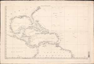
[West Indies, Florida, Gulf of Mexico]
$1,750.00
Acquire
- Digital Map Information
- Suitable for large format printing
- Full resolution TIFF file
- ICC color profile embedded
- Delivered instantly via download link
This is a scarce c. 1838 Direccion Hidrografia nautical chart or maritime map of the West Indies, Florida, the Gulf of Mexico, and the Caribbean. Centered on Hispaniola, the map covers from Cape Hatteras, North Carolina, to the Equator, and from the Pacific coast of Central America to the mouth of the Amazon River. Manuscript notates throughout follow the 1867 voyage of a Spanish ship. (more details)
Finest obtainable Colonial Era map of the Gulf Coast around the Mississippi Delta and Louisiana.
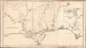
Carte de la Louisiane.
$1,400.00
Acquire
- Digital Map Information
- Suitable for large format printing
- DPI: 600
- File Size: 933.1 MB
- File Type: ZIP / TIFF
- ICC color profile embedded
- Delivered instantly via download link
A lovely example of the important 1732/52 map of the Gulf Coast and lower Mississippi River Valley by Jean Baptiste Bourguignon d'Anville. The map is significant as the largest and most comprehensive map of the Gulf littoral to appear during the French period of Louisiana. (more details)
Early Glimpses of Mexico, California and the Gulf Coast.
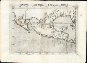
Nueva Hispania Tabula Nova.
$1,250.00
Acquire
- Digital Map Information
- Suitable for large format printing
- Full resolution TIFF file
- ICC color profile embedded
- Delivered instantly via download link
This is Girolamo Ruscelli's 1561 Nueva Hispania Tabula Nova, an early and influential map of what would become Mexico, California, Texas, and Florida. Ruscelli's work is an enlarged and improved version of the 1548 map of the same region by fellow Venetian Giacomo Gastaldi. Apart from the Gastaldi, Ruscelli's map is the earliest to focus so closely on the southern parts of what would become the United States and is one of the earliest acquirable maps to reflect Spanish exploration and colonization in the Americas. Overall, along with the map covering the East Coast north of Florida, this is among the earliest maps to focus on North America. (more details)
First Specific Printed Maps of Florida and Peru.
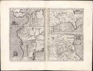
Peruviae Auriferae Regionis Typus./ La Florida./ Guastecan.
$1,250.00
Acquire
- Digital Map Information
- Suitable for large format printing
- Full resolution TIFF file
- ICC color profile embedded
- Delivered instantly via download link
This is an elegant example of Ortelius' 1584 engraving that includes the first specific map of Florida, the earliest specific map of Peru, and the first map focusing on the Guastecan province of Mexico. The map is a prime example of Ortelius' strength, not only as a mapmaker, but also as a compiler. All these maps combined here are relevant to each other in that they all derive from Spanish sources and reveal parts of the Spanish Empire in America, despite Spain forbidding the production and dissemination of such maps. Two of these maps credit specific Spanish sources, reflecting Ortelius' position as geographer to the king of Spain. Antwerp was part of the Spanish Empire at the time, and it is a testimony to Ortelius's far-reaching network of contacts throughout Europe that he was able to obtain maps such as these for publication. (more details)
One of the Earliest Charts of the Bahamas: a Pirates Playground.
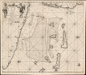
Pas Kaart Vande Noord Oost Kust van Cuba en d'Oost Kust van FLORIDA vervaatende de Canal van Bahama met de Bahaamse Eylende Door Vooght Geometra…
$1,200.00
Acquire
- Digital Map Information
- Suitable for large format printing
- DPI: 600
- File Size: 28.67 MB
- File Type: ZIP / TIFF
- ICC color profile embedded
- Delivered instantly via download link
A bold example of Claes Jansz Vooght and Johannes Van Keulen's 1684 nautical map of the Straits of Florida. Issued at the peak of the Golden Age of Caribbean Piracy (c. 1650 - 1730), this is the first published nautical chart to specifically detail these waters. (more details)
Wonderful pictorial map of Key West.
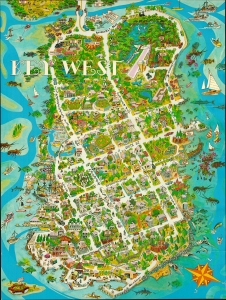
This is a comical 1976 Robert G. Carawan pictorial map of Key West, Florida. (more details)
Centerpiece of the Florida Keys.
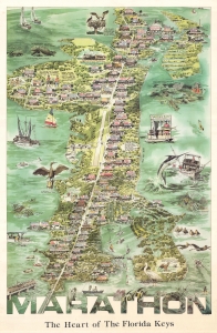
A delightful 1985 pictorial view and map of Marathon Key, Florida, drawn by the illustrator Ron Weaver. In addition to highlighting local businesses, the map depicts scenes from Key life, flora, fauna, and folklore. (more details)
War and Privateering in the West Indies.
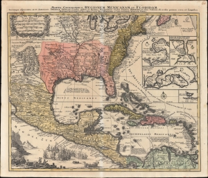
Mappa Geographica Regionem Mexicanam et Floridam Terrasque adjacentes, ut et Anteriores Americae Insulas, Cursus itidem et Reditus Navigantium versus flumem Missisipi et alias Colonias ob oculos ponens cura et sumtibus.
$1,000.00
Acquire
- Digital Map Information
- Suitable for large format printing
- File Size: 28.51 MB
- File Type: ZIP / TIFF
- ICC color profile embedded
- Delivered instantly via download link
An old-color example of Mattheus Seutter's c. 1740 map of North America below the Great Lakes, including Mexico and the Caribbean. It reflects improvements in European cartography of the New World in the late 17th and early 18th centuries, as well as the ongoing competition between colonial empires, namely the contemporaneous War of Jenkins' Ear (1739-1748). (more details)
One of the Earliest Specific Maps of Mexico.
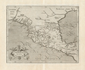
Hispania Nova.
$1,000.00
Acquire
- Digital Map Information
- Suitable for large format printing
- DPI: 600
- File Size: 19.23 MB
- File Type: ZIP / TIFF
- ICC color profile embedded
- Delivered instantly via download link
This is Cornelis Wytfliet's 1597 map of Mexico, one of the first maps of the region overall and the first to appear in an atlas dedicated to the Americas. (more details)