ACCOUNT CONTACT MY CART
  • AUTHENTICITY GUARANTEED - We sell only original antique maps.
  • Geographicus Rare Antique Maps
  • 0
Geographicus Rare Antique Maps
646-320-8650| Orders| My Account
0 Shopping Cart

Shopping Cart

Your cart is currently empty.
Shop
  • New Inventory
  • Maps by Region
    • WORLD MAPS
      • World Maps
      • Western Hemisphere
      • Eastern Hemisphere
      • Polar
      • Australia Polynesia
    • UNITED STATES
    • NORTHEAST
      • Maine - Vermont - New Hampshire
      • Massachusetts - Connecticut - Rhode Island
      • Boston
      • Washington D.C.
      • New York
      • New York City
      • New Jersey
      • Pennsylvania
      • Maryland - Delaware
      • Virginia - West Virginia
      • Michigan - Wisconsin
      • Ohio - Indiana
      • Illinois
      • Kentucky - Tennessee
    • SOUTHEAST
      • North Carolina - South Carolina
      • Kentucky - Tennessee
      • Georgia - Alabama
      • Florida
      • Arkansas - Louisiana - Mississippi
    • WESTERN UNITED STATES
      • Minnesota - North Dakota - South Dakota
      • Arkansas - Louisiana - Mississippi
      • Texas - Oklahoma
      • Idaho - Montana - Wyoming
      • Arizona - New Mexico
      • Utah - Nevada - Colorado
      • California
      • San Francisco
      • Washington - Oregon
      • Alaska - Hawaii
      • Kansas - Nebraska - Iowa - Missouri
    • AMERICAS
      • North America
      • South America
      • Canada
      • Mexico and Central America
      • West Indies and Caribbean
      • Western Hemisphere
    • EUROPE MAPS
      • Europe (whole)
      • European Cities
      • England - Scotland - Ireland
      • France
      • Holland - Belgium
      • Germany - Poland - Czech Republic
      • Italy
      • Austria - Switzerland - Hungary
      • Greece - Balkans
      • Russia - Eastern Europe
      • Denmark - Scandinavia
      • Spain - Portugal
      • London
      • Paris
    • AFRICA MAPS
      • Africa (whole)
    • ASIA MAPS
      • Asia (whole)
      • China - Japan - Korea
      • Beijing
      • Shanghai
      • Hong Kong / Macao
      • India - Nepal
      • Southeast Asia
      • Singapore
      • East Indies
      • Central Asia - Tibet
      • Asian Cities
      • Middle East (whole)
      • Holyland - Israel - Palestine
      • Arabia - Persia
      • Turkey - Ottoman Empire
      • Persia - Afghanistan
  • Maps by Type
    • Favorites
      • New Acquisitions
      • Kevin's Favorites
      • One-of-a-Kind
    • GENRE
      • Bird's-Eye Views
      • Celestial - Lunar
      • Fantasy
      • Nautical
      • Persuasive Cartography
      • Pictorial
      • Ukiyo-e
      • War Maps
    • FORMAT
      • Atlases
      • Broadsides
      • Cartifacts
      • Folding
      • Manuscript
      • Photography
      • Wall Maps
    • CITY PLANS
      • Asian Cities
      • Beijing
      • Boston
      • European Cities
      • Hong Kong / Macao
      • London
      • New York City
      • Paris
      • San Francisco
      • Shanghai
      • U.S. Cities
      • Washington D.C.
    • EVENTS
      • American Revolutionary War
      • American Civil War
      • World War I
      • World War II
      • French and Indian War
    • BEYOND EUROPE
      • Arabic Maps
      • Chinese Maps
      • Korean Maps
      • Japanese Maps
      • Ottoman Maps
      • Russian Maps
  • CARTOGRAPHERS
  • RESTORATION
  • BLOG
  • SELL US YOUR MAPS
Hide filters Show filters

Florida

  • View
  • 12 /
  • 24 /
  • All
1789 Osgood Carleton / John Norman Nautical Map of the West Indies, Florida, Gulf of Mexico Quick View

1789 Osgood Carleton / John Norman Nautical Map of the West Indies, Florida, Gulf of Mexico

28.5 x 39.75 in

$30,000.00

1743 / 1771 Catesby Map of the American Southeast: Florida, Georgia and the Bahamas Quick View

1743 / 1771 Catesby Map of the American Southeast: Florida, Georgia and the Bahamas

17 x 23.75 in

$21,000.00

1591 De Bry and Le Moyne Map of Florida and Cuba Quick View

1591 De Bry and Le Moyne Map of Florida and Cuba

14 x 18 in

$12,000.00

1720 / 1770 Chéreau / Basset Map of the Gulf Littoral and New Orleans - 1st View of New Orleans Quick View

1720 / 1770 Chéreau / Basset Map of the Gulf Littoral and New Orleans - 1st View of New Orleans

7.25 x 10.5 in

$7,500.00

1807 Direccion Hidrografia Nautical Chart or Map of Florida and Bahamas Quick View

1807 Direccion Hidrografia Nautical Chart or Map of Florida and Bahamas

24 x 36 in

$5,000.00

1863 Copley Blueback Chart of the West Indies Quick View

1863 Copley Blueback Chart of the West Indies

29.75 x 69.5 in

$4,000.00

1770 Jefferys Map of Amelia Island, Florida Quick View

1770 Jefferys Map of Amelia Island, Florida

21 x 25 in

$4,000.00

1630 De Laet Map of Florida and the American Southeast Quick View

1630 De Laet Map of Florida and the American Southeast

12 x 14.5 in

$3,500.00

1858 Kiepert Map of the Gulf of Mexico, the West Indies, Central and South America Quick View

1858 Kiepert Map of the Gulf of Mexico, the West Indies, Central and South America

39 x 64.5 in

$3,500.00

1723 Gerard Van Keulen Nautical Map of Florida and Cuba - rare 5th state Quick View

1723 Gerard Van Keulen Nautical Map of Florida and Cuba - rare 5th state

20.5 x 23.25 in

$3,000.00

1637 Jansson Map of the Caribbean Sea and the Gulf Coast (Latin Appendix Edition) Quick View

1637 Jansson Map of the Caribbean Sea and the Gulf Coast (Latin Appendix Edition)

15 x 20.5 in

$3,000.00

1780 Buache Map of the West Indies, Florida, and the Antilles Quick View

1780 Buache Map of the West Indies, Florida, and the Antilles

20 x 37 in

$2,500.00

1824 Melish / Klinckowström Map of the Florida and the Southeastern United States Quick View

1824 Melish / Klinckowström Map of the Florida and the Southeastern United States

16 x 21 in

$2,400.00

1715 Homann Map of North America and the West Indies Quick View

1715 Homann Map of North America and the West Indies

19.5 x 23 in

$2,400.00

1603 Ortelius Map of Cuba, the Caribbean, and Northwestern Mexico Quick View

1603 Ortelius Map of Cuba, the Caribbean, and Northwestern Mexico

15.5 x 19.5 in

$2,000.00

1639 / 1694 Jansson / Valk / Schenk Map of Carolina, Georgia, Florida, Virginia Quick View

1639 / 1694 Jansson / Valk / Schenk Map of Carolina, Georgia, Florida, Virginia

15 x 19.5 in

$1,800.00

1838 Dir. Hidrografia Nautical Chart / Map of West Indies / Caribbean / Florida Quick View

1838 Dir. Hidrografia Nautical Chart / Map of West Indies / Caribbean / Florida

27.75 x 41 in

$1,750.00

1776 Lotter Map of the United States at the Outbreak of the Revolutionary War Quick View

1776 Lotter Map of the United States at the Outbreak of the Revolutionary War

24 x 19.5 in

$1,700.00
1826 Depot de la Marine Nautical Chart or Maritime Map of the U.S. Gulf Coast Quick View

1826 Depot de la Marine Nautical Chart or Maritime Map of the U.S. Gulf Coast

24 x 36 in

$1,500.00

1695 Van Keulen Map of Florida, Cuba, and the Bahamas Quick View

1695 Van Keulen Map of Florida, Cuba, and the Bahamas

20.25 x 23.25 in

$1,500.00

1752 Anville Map of the Gulf Coast and Mississippi River Delta Quick View

1752 Anville Map of the Gulf Coast and Mississippi River Delta

21 x 37 in

$1,400.00

1953 Robiquet Nautical Map of the East Coast of the United States Quick View

1953 Robiquet Nautical Map of the East Coast of the United States

28.25 x 41.24 in

$1,350.00

1914 Florida East Coast Railway Railroad Map of Florida Quick View

1914 Florida East Coast Railway Railroad Map of Florida

40 x 16 in

$1,200.00

1747 Bowen Map of Mexico, California, Florida and the West Indies Quick View

1747 Bowen Map of Mexico, California, Florida and the West Indies

14 x 16.75 in

$1,200.00

1918 World War I Propaganda Poster w/ View Map of Florida Quick View

1918 World War I Propaganda Poster w/ View Map of Florida

41.5 x 27.5 in

$1,200.00

1976 Carawan Pictorial Map of Key West, Florida Quick View

1976 Carawan Pictorial Map of Key West, Florida

24.5 x 18.5 in

$1,200.00

1801 Depot de la Marine Nautical Map of Florida, Cuba, Bahamas, Santo Domingo Quick View

1801 Depot de la Marine Nautical Map of Florida, Cuba, Bahamas, Santo Domingo

24.25 x 37.5 in

$1,200.00

1985 Ron Weaver Pictorial Map of Marathon Key, Florida Quick View

1985 Ron Weaver Pictorial Map of Marathon Key, Florida

36.5 x 24.5 in

$1,100.00

1740 Seutter / Lotter Map of Mexico, Louisiana, Florida, the Caribbean Quick View

1740 Seutter / Lotter Map of Mexico, Louisiana, Florida, the Caribbean

19.5 x 22.5 in

$1,000.00

1597 Wytfliet Map of Mexico Quick View

1597 Wytfliet Map of Mexico

9 x 11.25 in

$1,000.00

1689 Coronelli map of the Caribbean Islands Quick View

1689 Coronelli map of the Caribbean Islands

10 x 17 in

$1,000.00

1866 Spanish Direccion de Hidrografia Map of Florida Quick View

1866 Spanish Direccion de Hidrografia Map of Florida

39.35 x 25.75 in

$950.00

1788 Bowen / D'Anville Map of the Gulf Coast and Mississippi River Delta Quick View

1788 Bowen / D'Anville Map of the Gulf Coast and Mississippi River Delta

12 x 19.5 in

$950.00

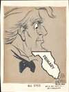
1972 Herc Ficklen Manuscript Political Cartoon Map of Florida - Democratic Primary Quick View

1972 Herc Ficklen Manuscript Political Cartoon Map of Florida - Democratic Primary

12 x 9 in

$950.00

1671 Ogilby / Montanus View of St. Augustine, Florida Quick View

1671 Ogilby / Montanus View of St. Augustine, Florida

10.5 x 13.75 in

$850.00

1958 Odum and Sanford Pictorial Treasure Map of Florida Quick View

1958 Odum and Sanford Pictorial Treasure Map of Florida

16.5 x 19 in

$850.00

1671 Ogilby / Montanus View of Fort Caroline (Jacksonville, Florida) Quick View

1671 Ogilby / Montanus View of Fort Caroline (Jacksonville, Florida)

11 x 12.5 in

$750.00

1985 Baeza Pictorial View of Key West, Florida Quick View

1985 Baeza Pictorial View of Key West, Florida

23.75 x 33.25 in

$650.00

1926 Poole View of the Gulf Coast from New Orleans to Florida Quick View

1926 Poole View of the Gulf Coast from New Orleans to Florida

7.25 x 31 in

$650.00

1845 Butler Land Office Map of Florida Quick View

1845 Butler Land Office Map of Florida

22.5 x 25.5 in

$650.00

1976 Desormiers Pictorial View of Miami and Miami Beach, Florida Quick View

1976 Desormiers Pictorial View of Miami and Miami Beach, Florida

27.75 x 41 in

$600.00

1926 Hawkins Urban Planning Map of Sebring, Florida Quick View

1926 Hawkins Urban Planning Map of Sebring, Florida

35.5 x 19.25 in

$600.00

1851 Putnam Public Survey Map of Florida Quick View

1851 Putnam Public Survey Map of Florida

22 x 25.5 in

$550.00

1943 Nathan Mayo / George Way 'After Victory' WWII Promotional Map of Florida Quick View

1943 Nathan Mayo / George Way 'After Victory' WWII Promotional Map of Florida

15 x 15 in

$500.00

1947 White Political Cartoon in Favor of Tampa Annexation Referendum Quick View

1947 White Political Cartoon in Favor of Tampa Annexation Referendum

12.25 x 10.5 in

$500.00

1917 'Yard-Long' Photographic View of Tampa, Florida Quick View

1917 'Yard-Long' Photographic View of Tampa, Florida

5.5 x 34.75 in

$500.00

1967 Pictorial View of Rainbow Springs, Florida Quick View

1967 Pictorial View of Rainbow Springs, Florida

20.5 x 33.5 in

$500.00

1940 Suchy Pictorial Map of Key West, Florida Quick View

1940 Suchy Pictorial Map of Key West, Florida

17.5 x 22 in

$500.00

1946 Skacel Cartoon Map of Florida Quick View

1946 Skacel Cartoon Map of Florida

17.75 x 11.75 in

$475.00

1925 Brochure, Temple Terrace Estates and Golf Course, Tampa Region, Florida Quick View

1925 Brochure, Temple Terrace Estates and Golf Course, Tampa Region, Florida

9.25 x 4 in

$450.00

1744 Bellin Map of the Bay of Pensacola, Florida Quick View

1744 Bellin Map of the Bay of Pensacola, Florida

7.75 x 11 in

$450.00

1809 Dirección de Hidrografía Map of the Mouth of the Nassau River, Florida Quick View

1809 Dirección de Hidrografía Map of the Mouth of the Nassau River, Florida

7.25 x 10.75 in

$450.00

1980 Travieso Pictorial View of Latin America, Eastern Air Lines Quick View

1980 Travieso Pictorial View of Latin America, Eastern Air Lines

24 x 17.75 in

$400.00

1971 Russ Smiley Pictorial Fishing Map of South Florida Quick View

1971 Russ Smiley Pictorial Fishing Map of South Florida

22 x 30 in

$400.00

1930 View of Bayfront Park, Miami, Florida Quick View

1930 View of Bayfront Park, Miami, Florida

6.75 x 28 in

$400.00

1905 Bureau of Soils Map of Leon County and Tallahassee, Florida Quick View

1905 Bureau of Soils Map of Leon County and Tallahassee, Florida

29.5 x 43.5 in

$400.00

1938 Friedman Cartoon Pictorial Map of Florida Quick View

1938 Friedman Cartoon Pictorial Map of Florida

16.375 x 19.625 in

$400.00

1955 Mahn / Scen-o-tour Pictorial Bird's-Eye View Map of Miami, Florida Quick View

1955 Mahn / Scen-o-tour Pictorial Bird's-Eye View Map of Miami, Florida

22 x 27 in

$400.00

1945 Miami Chamber of Commerce City Plan or Map of Miami Beach, Florida Quick View

1945 Miami Chamber of Commerce City Plan or Map of Miami Beach, Florida

24 x 9 in

$400.00

1980 Murphy Realty Map of Sanibel and Captiva Quick View

1980 Murphy Realty Map of Sanibel and Captiva

10.5 x 16.25 in

$375.00

1953 General Drafting Pictorial Tourist Map of Florida Quick View

1953 General Drafting Pictorial Tourist Map of Florida

33.5 x 24 in

$375.00

1956 General Drafting Pictorial Map of Florida Quick View

1956 General Drafting Pictorial Map of Florida

33.5 x 24 in

$375.00

1931 Tourism Brochure of Miami and Miami Beach Florida (Features 3 Maps) Quick View

1931 Tourism Brochure of Miami and Miami Beach Florida (Features 3 Maps)

14.75 x 8 in

$350.00

1994 Vernon Pictorial Map of St. Petersburg, Florida Quick View

1994 Vernon Pictorial Map of St. Petersburg, Florida

30 x 22.5 in

$350.00

1980 Henry Hird Map of St. Augustine, Florida Quick View

1980 Henry Hird Map of St. Augustine, Florida

33 x 22.5 in

$350.00

1928 Florida Grower Pictorial Promotional Map and Brochure, Florida West Coast Quick View

1928 Florida Grower Pictorial Promotional Map and Brochure, Florida West Coast

21 x 16.25 in

$350.00

1909 Bureau of Soils Map of Marianna and Environs, Florida Quick View

1909 Bureau of Soils Map of Marianna and Environs, Florida

30.75 x 35.25 in

$350.00

1905 Bureau of Soils Map of Jefferson County, Florida Quick View

1905 Bureau of Soils Map of Jefferson County, Florida

43.25 x 29 in

$350.00

1975 Mountain Group Pictorial Map of Sarasota, Florida Quick View

1975 Mountain Group Pictorial Map of Sarasota, Florida

23 x 35 in

$350.00

1936 Florida State Road Department Road Map of Florida Quick View

1936 Florida State Road Department Road Map of Florida

27.25 x 27.75 in

$300.00

1683 Mallet Map of the Bahamas Quick View

1683 Mallet Map of the Bahamas

6.5 x 4.25 in

$300.00

1947 Tyn Cobb Map of Orlando and Winter Park, Florida Quick View

1947 Tyn Cobb Map of Orlando and Winter Park, Florida

34 x 19.75 in

$300.00

1947 Way Pictorial Tourist Map of Florida Quick View

1947 Way Pictorial Tourist Map of Florida

25.5 x 30 in

$300.00

1950s Rand McNally Pictorial Road Map of Florida Quick View

1950s Rand McNally Pictorial Road Map of Florida

39.75 x 17.75 in

$300.00

1960 U.S. Weather Bureau Hurricane Tracking Chart Quick View

1960 U.S. Weather Bureau Hurricane Tracking Chart

18.25 x 21.5 in

$250.00

1922 Southern Railway System Railroad Map of Florida Quick View

1922 Southern Railway System Railroad Map of Florida

28.25 x 17.5 in

$250.00

1922 Bay Publishing Co. Map of Tampa, Florida Quick View

1922 Bay Publishing Co. Map of Tampa, Florida

8.5 x 9 in

$250.00

1943 Dade County Newsdealers Bird's Eye View Map of Miami Beach and Miami, Florida Quick View

1943 Dade County Newsdealers Bird's Eye View Map of Miami Beach and Miami, Florida

19.75 x 31.5 in

$250.00

1945 American Automobile Association City Plan or Map of Miami and Miami Beach, Florida Quick View

1945 American Automobile Association City Plan or Map of Miami and Miami Beach, Florida

17.75 x 15.75 in

$250.00

1970 Florida Keys Printing and Publishing City Plan or Map of Key West, Florida Quick View

1970 Florida Keys Printing and Publishing City Plan or Map of Key West, Florida

14.25 x 21.75 in

$250.00

1926 Horne City Plan or Map of Summerall Park Heights, Tavares, Florida Quick View

1926 Horne City Plan or Map of Summerall Park Heights, Tavares, Florida

12 x 12.25 in

$250.00

1954 Lenz and Smith Bird's-Eye View of Tampa Bay and West Florida Quick View

1954 Lenz and Smith Bird's-Eye View of Tampa Bay and West Florida

16.75 x 21.75 in

$250.00

1954 Beach Products State 'Map-Nap' of Florida Quick View

1954 Beach Products State 'Map-Nap' of Florida

6.5 x 7.5 in

$225.00

1849 Greenleaf Map of the West Indies Quick View

1849 Greenleaf Map of the West Indies

11 x 14 in

$225.00

1942 AAA Pictorial Road Map of Florida Quick View

1942 AAA Pictorial Road Map of Florida

23.25 x 17 in

$200.00

1955 Pictorial Promotional Placemat of Florida Quick View

1955 Pictorial Promotional Placemat of Florida

9.5 x 13 in

$200.00

1953 Highway Strip Map of St. Johns River Trail, Florida Quick View

1953 Highway Strip Map of St. Johns River Trail, Florida

17.75 x 4 in

$200.00

1985 Gousha City Plan or Map of Tampa and St. Petersburg, Florida Quick View

1985 Gousha City Plan or Map of Tampa and St. Petersburg, Florida

34.25 x 18 in

$200.00

1970 Pictorial Tourist Map of Florida Quick View

1970 Pictorial Tourist Map of Florida

18 x 16 in

$200.00

1960 Florida Board of Parks Pictorial Tourist Map of Florida Quick View

1960 Florida Board of Parks Pictorial Tourist Map of Florida

18 x 16 in

$200.00

1989 Azchetko Pictorial Map of Saint Augustine, Florida Quick View

1989 Azchetko Pictorial Map of Saint Augustine, Florida

31 x 21.25 in

$200.00

1940 Rand McNally and Pure Oil Map of Florida Quick View

1940 Rand McNally and Pure Oil Map of Florida

26.5 x 29.25 in

$190.00

1937 Griffith Advertising Pictorial Tourist Map of St. Petersburg, Florida Quick View

1937 Griffith Advertising Pictorial Tourist Map of St. Petersburg, Florida

18 x 16 in

$175.00

1867 Mitchell Map of Florida (w/ Mobile, Alabama inset) Quick View

1867 Mitchell Map of Florida (w/ Mobile, Alabama inset)

12 x 14 in

$160.00

1961 Real Estate Brochure with Pictorial Map of Cape Coral, Florida Quick View

1961 Real Estate Brochure with Pictorial Map of Cape Coral, Florida

9 x 12 in

$150.00

1950 Orange Blossom Trail Association Highway Map of Florida Quick View

1950 Orange Blossom Trail Association Highway Map of Florida

18.25 x 4 in

$150.00

1976 Monroe County Advertising Map of the Florida Keys and Key West Quick View

1976 Monroe County Advertising Map of the Florida Keys and Key West

17.75 x 23 in

$150.00

1953 Griffith and McCarthy Tourist Map of St. Petersburg, Florida Quick View

1953 Griffith and McCarthy Tourist Map of St. Petersburg, Florida

17.75 x 12 in

$150.00

2014 Bell Pictorial Map of Vero Beach, Florida Quick View

2014 Bell Pictorial Map of Vero Beach, Florida

21.25 x 14.5 in

$150.00

1954 Polk County Commissioners Pictorial Map of Polk County, Florida Quick View

1954 Polk County Commissioners Pictorial Map of Polk County, Florida

18 x 23.5 in

$150.00

1964 Dolph and Florida State Turnpike Authority Map of Florida Quick View

1964 Dolph and Florida State Turnpike Authority Map of Florida

23.75 x 8.75 in

$150.00

1954 Mayo Pictorial Map of Florida Quick View

1954 Mayo Pictorial Map of Florida

17.5 x 24 in

$150.00

1973 Tom Sawyer Diner Pictorial Placemat Map of Florida Quick View

1973 Tom Sawyer Diner Pictorial Placemat Map of Florida

9.25 x 14 in

$150.00

1955 Journal Publishing Real Estate Promotional Map of St. Petersburg / Tampa, Florida Quick View

1955 Journal Publishing Real Estate Promotional Map of St. Petersburg / Tampa, Florida

7.25 x 15.25 in

$150.00

1961 General Drafting Pictorial Map of Tampa and St. Petersburg, Florida Quick View

1961 General Drafting Pictorial Map of Tampa and St. Petersburg, Florida

24 x 16.75 in

$125.00

1953 Rand McNally Road Map of Florida Quick View

1953 Rand McNally Road Map of Florida

28.75 x 17.5 in

$125.00

About Geographicus
Geographicus Rare Antique Maps specializes in fine and rare antiquarian cartography from the 15th to 19th centuries. Our extensive and continually updated inventory of authentic historic maps is available for exploration through our online gallery. We provide high-resolution imagery and in-depth research for each item. We proudly share our expertise with collectors, institutions, and anyone with a passion for cartographic history.
About Us
  • About Geographicus
  • Media & Press
  • FAQ
Services
  • Restoration
  • Appraisals
  • Have a map to Sell?
  • Mailing List
Customer Resources
  • Map Resources
  • Acquisition Policy
  • Terms & Conditions
  • Privacy Policy
  • About Geographicus
  • Cartographer Biographies
  • Antique Map Blog
  • Acquisition Policy
  • Terms & Conditions
  • Privacy Policy
  • Frequently Asked Questions
  • Map Resources
Contact
  • 923 Putnam Ave Brooklyn, NY 11221 (map)
  • 646-320-8650
  • Email Us

Copyright © 2025 Geographicus Rare Antique Maps | Geographicus Rare Antique Maps

HOME
SHOP
CART
LINKS
LINKS×