
Florida (sold)
First printed nautical chart of the Gulf of Mexico and Florida.
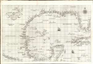
Carta particolare della Baia di Messico con la Costa.
sold
- Digital Map Information
- Suitable for large format printing
- Full resolution TIFF file
- ICC color profile embedded
- Delivered instantly via download link
A seminal production, this is a fine first-edition, first-state example of Sir Robert Dudley's 1645 - 47 maritime map of the Gulf of Mexico, the first printed nautical chart of that region. It is also the first to be printed using Mercator's Projection - thus making it the first to be practical for actual navigation. Likewise it is also the first to accurately indicate prevailing winds and ocean currents in the Gulf. Coverage extends from the Pacific Coast of Mexico to eastern Florida, and from Galveston Bay (Texas) to modern day Belize and the Bay of Honduras), inclusive of the Yucatan Peninsula and western Cuba. The whole is stunningly engraved in Antonio Francesco Lucini's masterful Italian baroque hand, complete with fine calligraphy and idiosyncratic styling. (more details)
One of the rarest maps of the American southeast
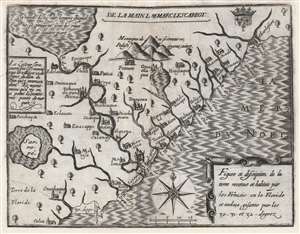
Figure et description de la terre reconue et habitée par les François en la Floride et audeça, gisante par les 30-31 - et 32 - degrez.
sold
- Digital Map Information
- Suitable for large format printing
- DPI: 600
- File Size: 10.61 MB
- File Type: ZIP / TIFF
- ICC color profile embedded
- Delivered instantly via download link
One of the great unobtainable maps of early attempts to settle North America. This is Marc Lescarbot's 1612 map of the American Southeast, one of the earliest specific maps detailing modern-day Florida, Georgia, and South Carolina. It chronicles 1562-1565 French attempts to establish a Huguenot colony in the region. Coverage extends roughly from 30° to 33° N, covering parts of modern-day Florida, Georgia, and South Carolina. (more details)
Mars, the God of War, look on as Fame proclaims the of the Birth of the United States.
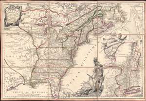
Carte de l'Amerique Septle. pour Servir a l'Intelligence de la Guerre Entre les Anglois et les Insurgents.
sold
- Digital Map Information
- Suitable for large format printing
- Full resolution TIFF file
- ICC color profile embedded
- Delivered instantly via download link
This is a rare 1777 Jean-Baptiste Jacques de Beaurain map of the United States during the American Revolutionary War, issued in anticipation of French entry into the war on the side of the revolutionaries. The map includes a bold illustration of the goddess Ossa (fame) unrolling an expansive map of the Theater of War in the Hudson corridor, proclaiming the newly formed United States. Mars, the god of War, looks on, shield and torch in hand, his arsenal ready - much like France itself. This map is thus an instrument of propaganda intended to prepare the public for French participation in the American Revolution - an event which followed in early 1778. (more details)
Rare Broadside Map chronicling the last resurgence in piracy in the West Indies.
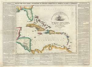
Map of the West Indies, and the History of Piracies Committed on American Seamen and Commerce. / To the Gallant Officers and Seamen of the American Navy, the Protectors of our Commerce in the West India Seas this Map Is Respectfully Inscribed by the Publishers. / West Indies, from the latest and best authorities.
sold
- Digital Map Information
- Suitable for large format printing
- DPI: 300
- File Size: 20.03 MB
- File Type: ZIP / TIFF
- ICC color profile embedded
- Delivered instantly via download link
A remarkable, separately issued, and extremely rare 1825 broadside map by Nathaniel and Simeon Smith Jocelyn of New Haven, Connecticut, responding to the last great outbreak of West Indian piracy between 1817 and 1825. It responds with gratitude to the defending ... (more details)
The most influential map of Florida ever printed.
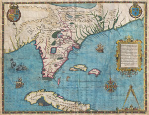
Floridae Americae Provinciae Recens & Exactissima Descriptio Auctore Iacobo Le Moyne cui Cognomen de Morgues, qui Laudonierum …
sold
- Digital Map Information
- Suitable for large format printing
- DPI: 300
- File Size: 13.89 MB
- File Type: ZIP / TIFF
- ICC color profile embedded
- Delivered instantly via download link
…the most remarkable and important map, which has been preserved from the sixteenth century maps, of that part of the East Coast which lies between Cape Hatteras and Cape Florida … the first French map to show Florida … considered the most important map ... (more details)
Important colonial period map of the American Southeast - with seashell and coral cartouche!
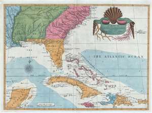
A Map of Carolina, Florida and the Bahama Islands with the Adjacent Parts.
sold
- Digital Map Information
- Suitable for large format printing
- DPI: 300
- File Size: 9.49 MB
- File Type: ZIP / TIFF
- ICC color profile embedded
- Delivered instantly via download link
A fine example of Mark Catesby’s rare 1743 / 1771 map of the southeastern parts of North America. This map is considered one of the finest maps of the colonial era American southeast. The map covers from the Mississippi River and from Cape Charles and Cape Henry to Jamaica, including all of North Carolina, South Carolina, Georgia, Florida, Louisiana, Cuba, Hispaniola, the Bahamas, Porto Rico, and parts of the Yucatan. Among other features, the map is notable for its remarkable cartouche design, which includes shells, corals, and seaweeds indigenous to the Americas. The map is furthermore an important reference for early forts, Indian tribes, English factories, and more in the southeast. The river systems of Georgia and Carolina are particularly impressive in their detail. (more details)
Official planning map by St. Petersburg, Florida.
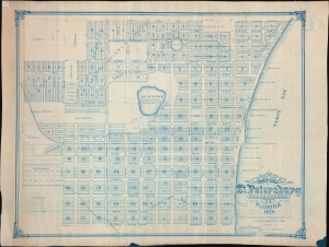
Map of the City of St. Petersburg Hillsborough Co. Florida 1906.
sold
- Digital Map Information
- Suitable for large format printing
- File Size: 2444.3 MB
- File Type: ZIP / TIFF
- ICC color profile embedded
- Delivered instantly via download link
An extraordinary 1906 wall map of St. Petersburg, Florida, issued at the height of its early 20th century development as a railroad and tourist town. The map was drawn by St. Petersburg's City Engineer, John Poore Titcomb, who took the position in 1901 and, in the year this map was issued, supervised the 1906 construction of the city's first sewer system - as identified here. (more details)
Earliest known example of the first Official Map of Miami Beach.
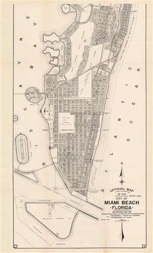
Official Map Adopted November 3, 1920 of the city of Miami Beach Florida.
sold
- Digital Map Information
- Suitable for large format printing
- File Size: 37.39 MB
- File Type: ZIP / TIFF
- ICC color profile embedded
- Delivered instantly via download link
This is Robert M. Davidson's 1925 map of Miami Beach, Florida - the earliest known example of the first official planning map of Miami Beach, drawn at the height of construction in Miami Beach and the apex of the Florida Land Boom. The map was first drawn by Davidson, Miami Beach's first City Engineer, in 1920, with the present example bearing the date of February 1925. The map covers from 42nd Street to South Point, covering modern day South Beach and parts of Mid-Beach. The map reveals the early planning and lotting of Miami Beach, noting sub-divisions, individual lots, parks, hotels, and golf clubs, and elite developments such as 'Star Island'. Although very large as is, the present map is only the 'South Half' of the full map, although no surviving examples of the 'North Half' are known, and it may not have been issued at all. (more details)
Proposed Masonic African American community near David City, Florida.
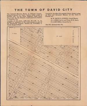
The Town of David City.
sold
- Digital Map Information
- Suitable for large format printing
- File Size: 17.6 MB
- File Type: ZIP / TIFF
- ICC color profile embedded
- Delivered instantly via download link
A unique c. 1920 broadside map promoting the development of an all-African American town, 'David City', in Putnam County, Florida. The city was planned by the African American Masonic Lodge of Jacksonville, for settlement by its members, on the abandoned site of a female-operated African American Masonic convalescent home. The map provides unique insight into the role of African American philanthropy and values in northern Florida in the early 20th century. (more details)
First Official Map of Miami Beach.
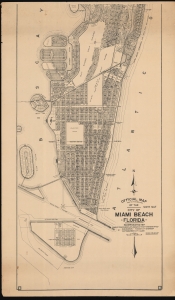
Official Map Adopted November 3, 1920 of the city of Miami Beach Florida.
sold
- Digital Map Information
- Suitable for large format printing
- File Size: 98.16 MB
- File Type: ZIP / TIFF
- ICC color profile embedded
- Delivered instantly via download link
This is Robert M. Davidson's 1929 map of Miami Beach, Florida - the first official planning map of Miami Beach, drawn at the height of construction in Miami Beach and the apex of the Florida Land Boom. The map exhibits significant advances over the 1925 first edition, including the Sunset Isles development, Peninsula Terminals lots, Flamingo Park has been redesignated as 'Flamingo Golf Course (until 1931)', and dramatic development along Alton Road near 41st Street, among many other changes. (more details)
Early urbanization of Pinellas County.
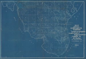
Map of Lower Pinellas Co. Florida Included in Townships 31 and 32 South of Ranges 15-16-17 east Compiled by R. C. Prather.
sold
- Digital Map Information
- Suitable for large format printing
- File Size: 234.12 MB
- File Type: ZIP / TIFF
- ICC color profile embedded
- Delivered instantly via download link
An extraordinary 1913 Ralph Carlyle Prather cyanotype map of the southern part of the Pinellas County Peninsula, near Tampa, Florida. It illustrates the early urbanization not only of Tampa Bay and Pinellas County, but also of the wider Florida Land Boom that would reach its peak 8 year later. (more details)
Unrecorded chart of Florida and the Greater Antilles.
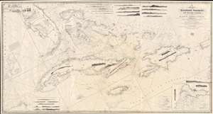
A New Chart of the Windward Passages and Bahama Islands, With the Islands of Hayti, Jamaica, Cuba, etc.
sold
- Digital Map Information
- Suitable for large format printing
- DPI: 600
- File Size: 81.76 MB
- File Type: ZIP / TIFF
- ICC color profile embedded
- Delivered instantly via download link
A rare and unusual 1848 John Purdy / Richard Holmes Laurie Blueback nautical chart or maritime map of Florida, the Bahamas, and the Greater Antilles - here in its only known surviving example. Oriented sharply to the northeast, the chart offers expansive coverage, embracing all of peninsular Florida, Cuba, the Bahamas, Hispaniola (Santo Domingo / Haiti), Jamaica, and Puerto Rico. The map exhibits some manuscript nautical annotations regarding lighthouses in the Bahamas and Cuba, but it is faded and unreadable. Insets detail important ports, including Havana, New Providence (Nassau), Matanzas, Guantanamo, the Morant Kays, and Kingston (Jamaica). (more details)
The second 'official' published map of Miami.
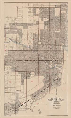
The Official Plat 'City of Miami' Florida.
sold
- Digital Map Information
- Suitable for large format printing
- File Size: 33.53 MB
- File Type: ZIP / TIFF
- ICC color profile embedded
- Delivered instantly via download link
This is the 1920 second edition of the first official plat map of Miami, published at the height of its development during the Third Florida Land Boom. The map lays out the streets and development of Miami from roughly Northeast 39th Street to Kloeber Bay Fronts and illustrates streets, parks, private property holdings, hotels, utilities and more. It exhibits additional manuscript work dividing the city into 25 zones, as well as identifying Highland Park and the home of someone named 'Mary Louise' on SW Fourth St. (more details)
First view of New Orleans.
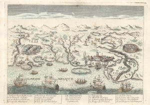
Le Mississipi ou la Louisiane dans l'Amerique Septentrionale.
sold
- Digital Map Information
- Suitable for large format printing
- File Size: 4.43 MB
- File Type: ZIP / TIFF
- ICC color profile embedded
- Delivered instantly via download link
This is a rare c. 1779 Basset / Chéreau broadside leaflet map-view of the Gulf of Mexico littoral c. 1720, just a few years after New Orleans was founded. It is likely the earliest printed view of New Orleans - though admittedly, it is not an accurate representation of the city at the time. The map was issued as a propaganda leaflet to promote New Orleans and French Louisiana. It is indeed one of the earliest maps to include a view of New Orleans and the indigenous peoples of the Gulf. The present example is the second state, issued in late 1770s by Basset to capitalize on French public interest in the American Revolutionary War (1775 - 1783). (more details)
Official planning map by St. Petersburg, Florida - 2nd state.
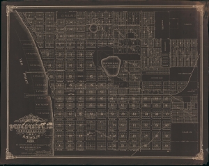
Map of the City of St. Petersburg Hillsborough Co. Florida 1906.
sold
- Digital Map Information
- Suitable for large format printing
- File Size: 90.03 MB
- File Type: ZIP / TIFF
- ICC color profile embedded
- Delivered instantly via download link
An extraordinary 1908 wall map of St. Petersburg, Florida, issued at the height of its early 20th century development as a railroad and tourist town. The only other known example of this map is a 1906 edition previously offered by Geographicus (StPetersburg-titcomb-1906). The present map features several major updates, including the additional developments of Lake Park, Lake Side, Richland Park, Glover, Plunket, and a row of commercial properties on First Street. The sewage lines, evident on the 1906 edition, are here removed to focus on other development.The map was drawn by St. Petersburg's City Engineer, John Poore Titcomb, who took the position in 1901. (more details)
A must-have for the early mapping of the American west.
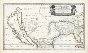
Le Nouveau Mexique, et la Floride: Tirées de diverses Cartes, et Relations. Par N. Sanson d'Abbeville Geogr ordre du Roy. A Paris. Chez Pierre Mariette, Rue S. Jacque a l'Esperance Avec Privilege du Roy, pour vingt Ans. 1656.
sold
- Digital Map Information
- Suitable for large format printing
- DPI: 600
- File Size: 36.2 MB
- File Type: ZIP / TIFF
- ICC color profile embedded
- Delivered instantly via download link
This is a beautiful example of Nicolas Sanson's 1656 map of New Mexico and Florida: the first atlas map to emphasize this geographical focus. It also presented arguably the most influential depiction of California-as-an-island, providing the dominant model of that cartography for the remainder of the seventeenth century, reaching into the eighteenth. (more details)
Manuscript Whaler's Annotations in Gulf of Mexico.
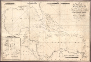
Blachfords, New General Chart of the West Indies, Including the Caribee and Virgin Islands, Porto Rico, St. Domingo, Jamaica and Cuba. The Windward Passages gulfs of Florida and Mexico, Bay of Honduras, And Coast of Colombia Compiled from the best Authorities, Including the surveys of Mr. A. de Mayne R.N., Mr. Lockwood etc.
sold
- Digital Map Information
- Suitable for large format printing
- File Size: 113.86 MB
- File Type: ZIP / TIFF
- ICC color profile embedded
- Delivered instantly via download link
A spectacular 1838 / 1843 Blachford blueback nautical map of the West Indies, including Florida, the Gulf of Mexico, the Caribbean, and Central America. This beautiful map features pencil manuscript annotations in the Gulf of Mexico that strongly suggest whaling. (more details)
Citrus boomtowns. Modern ghost towns.
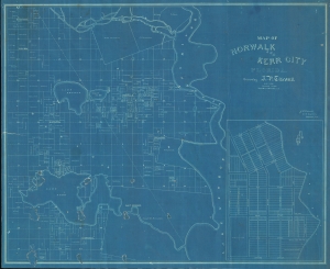
Norwalk and Kerr City Florida.
sold
- Digital Map Information
- Suitable for large format printing
- File Size: 930.67 MB
- File Type: ZIP / TIFF
- ICC color profile embedded
- Delivered instantly via download link
This is a unique c. 1886 cyanotype map of Norwalk and Kerr City, Marion County, north central Florida, by Civil Engineer John Poore Titcomb. The map provides a unique overview of the short-lived Citrus Boom communities west of the St. John's River before the disastrous freezes of 1894-95, highlighting property owners, including the mapmaker, throughout. (more details)
Original art for iconic Fort Myers travel poster.
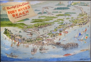
This W. Harold Hancock's c. 1975 original artwork view of Fort Myers Beach (Estero Island), Florida. (more details)
An open invitation to Piracy?
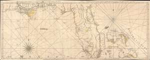
The Coast of West Florida and Louisiana. / The Peninsula and Gulf of Florida or Channel of Bahama with the Bahama Islands.
sold
- Digital Map Information
- Suitable for large format printing
- DPI: 600
- File Size: 44.18 MB
- File Type: ZIP / TIFF
- ICC color profile embedded
- Delivered instantly via download link
This is the 1775 first edition of Thomas Jeffreys' seminal map of Florida and the Gulf Coast - considered the first large-scale map to address the region in any detail. The map is significant for its accessible delineation of Florida and the Gulf, but is made more interesting through its graphic illustration of the Spanish Treasure Fleet and its route from Havana, around Florida, and then through the Bahamas - an unspoken but open invitation to pirates and privateers. (more details)
The most important and influential map of Virginia and Carolina to appear in the 17th century.
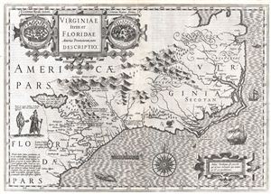
Virginiae Item et Floridae Americae Provinciarum, nova Descriptio.
sold
- Digital Map Information
- Suitable for large format printing
- DPI: 300
- File Size: 12.17 MB
- File Type: ZIP / TIFF
- ICC color profile embedded
- Delivered instantly via download link
Published in 1606 by the Mercator – Hondius firm, this is the most influential map of the southeastern part of North America to emerge in the 17th century and the first map to depict by Virginia and Florida. entitled, 'Virginiae Item et Floridae', Hondius’ ... (more details)
The Heart of North America from the Finest Globemaker of the 17th Century.
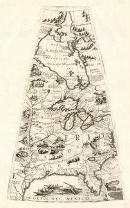
[Untitled Globe Gore of North America from the Tropic of Cancer to the Arctic Circle].
sold
- Digital Map Information
- Suitable for large format printing
- Full resolution TIFF file
- ICC color profile embedded
- Delivered instantly via download link
This is a beautiful 1688 Vincenzo Maria Coronelli globe gore focused on North America east of the Mississippi and west of the Chesapeake, engraved Coronelli's masterpiece 3 1/2 foot globe. The copperplate was adapted in 1697 for inclusion in Coronelli's bound atlases, masked off between the Tropic of Cancer and the Equator to fit book format. The gore covers most of North America east of the Mississippi, spanning from the Tropic of Cancer to the Arctic Circle. Thus, it shows the northern Gulf Coast, Florida, Chesapeake Bay, the Mississippi River (after La Salle), the Great Lakes, and Hudson's Bay. The geography is substantively the same as that on Coronelli's two-sheet America Settentrionale. Although that map bears the date 1688, it was not actually published any earlier than 1690 and it is very probable that the globes represent the earlier appearance of this geographical information. (more details)
Most spectacular pictorial map of Florida.
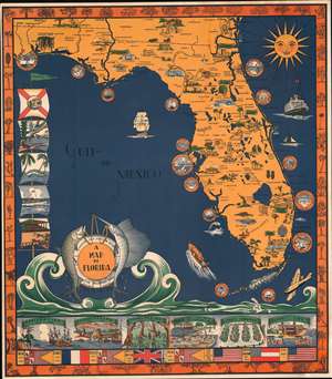
A Map of Florida.
sold
- Digital Map Information
- Suitable for large format printing
- File Size: 56.36 MB
- File Type: ZIP / TIFF
- ICC color profile embedded
- Delivered instantly via download link
A scarce 1935 Eleanore and Richard Foster chromolithograph map of Florida - the most spectacular pictorial map of Florida we have seen. The map is designed on a nautical theme: the sea splashes at the base of the map, forming a cartouche supported by fish and framed by a lifesaver. Coastal cities, including St. Augustine, Daytona Beach, Vero Beach, Palm Beach, St. Petersburg, Miami, Key West, and Fort Meyers, among others, are framed by ship portholes. Smiling from the upper right, the sun shines on the peninsula. Within Florida, both natural resources (pineapples, strawberries, etc.), resort fun (golfing, polo, baseball, sunbathing), and architectural wonders are illustrated. The Overseas Railroad, here in its last year of operation before being destroyed by the Labor Day Hurricane, steams towards Key West. Along the left, Flags illustrate Florida scenes, including alligators and palm trees. A limited breakdown of Florida history appears along the bottom. The border work, in orange, highlights Florida fauna. (more details)
One of the earliest illustrations of Florida resort life.
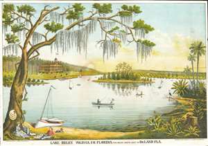
Lake Helen Volusia, Co. Florida Five Miles South East of DeLand Fla.
sold
- Digital Map Information
- Suitable for large format printing
- File Size: 32.56 MB
- File Type: ZIP / TIFF
- ICC color profile embedded
- Delivered instantly via download link
This is a c. 1884 Loudon Underhill Dodge chromolithograph view of Lake Helen, Florida - perhaps the first illustration of resort life near Orlando. The view illustrates the idyllic lake set within Florida's rich wilderness. The impressively grand Harlan Hotel sits majestically on lake's bank. Boats ply the waters, and a couple happily fishes in the foreground. On the lower left, a group have beached their sailboat and are enjoying a willow-shaded picnic. Their dog lounges nearby and appears to be keeping an eye on the alligator sunning itself to the right. A stork stands on a fallen tree not far from the alligator, and rich flora, including a nopal (indigenous to Florida), surround them. The map's title references nearby DeLand, Florida. The founder of DeLand, Henry Deland, named Lake Helen after his daughter. (more details)
New cartography in the wake of the Seminole Wars.

The Bahama Banks and the Gulf of Florida.
sold
- Digital Map Information
- Suitable for large format printing
- File Size: 63.88 MB
- File Type: ZIP / TIFF
- ICC color profile embedded
- Delivered instantly via download link
This is a scarce, detailed, and elegant 1848 nautical chart or maritime map of Florida and the Bahamas by E. and G. W. Blunt. Blunt's chart, which first appeared in his 10-sheet 1827 maritime atlas, represented the height of nautical mapping in and around the Florida peninsula prior to the U.S. Coast Survey in the 1850s. (more details)
Supplying the Confederacy through the Blockade.
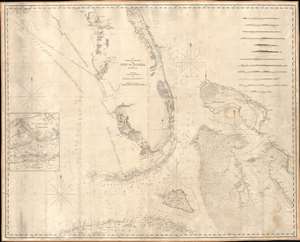
The Bahama Banks and Gulf of Florida, by Edmund Blunt.
sold
- Digital Map Information
- Suitable for large format printing
- Full resolution TIFF file
- ICC color profile embedded
- Delivered instantly via download link
A scarce, detailed, and highly attractive 1847 blueback-style nautical chart or maritime map of Florida and the Bahamas by Edmond Blunt and his sons E. and G. W. Blunt featuring notes and annotations suggestive of use by a Confederate blockade runner. The map offer unique insight into the supply line and trade routes of the Confederacy during the American Civil War. The chart covers Florida from 29°37' N, or, roughly speaking, from the latitude of Lake George south past the Florida Keys (then called the Florida Reef), as far as Cuba and from the longitude of Cape St. George eastwards to include the Bahama Islands. It offers limited inland detail but a fine mapping of coastal regions and countless depth soundings, especially around Tampa Bay, the Florida Keys, and throughout the Bahama Banks - a notoriously dangerous area for ships even with such a fine chart as this. Twelve shore profiles decorate the upper right quadrant. (more details)
Extraordinary and rare blueback nautical chart of the East Coast.
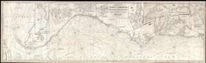
Chart of the Coast of America, from New York and Philadelphia, to the Strait or Gulf of Florida, and from thence to the Mississippi.
sold
- Digital Map Information
- Suitable for large format printing
- Full resolution TIFF file
- ICC color profile embedded
- Delivered instantly via download link
An utterly spectacular and sprawling 1850 John Williams Norie blueback nautical chart or maritime map depicting the North American coastline from New York to the Florida Keys. The map is oriented to the west, as a navigator from Europe would approach the ... (more details)
Scarce early American nautical chart of Florida with an inset of Key West.
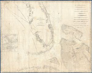
The Bahama Banks and the Gulf of Florida.
sold
- Digital Map Information
- Suitable for large format printing
- DPI: 300
- File Size: 65.76 MB
- File Type: ZIP / TIFF
- ICC color profile embedded
- Delivered instantly via download link
A scarce, detailed, and highly attractive 1848 nautical chart or maritime map of Florida and the Bahamas by e. and G. W. Blunt. The chart covers Florida from 29°37' N, or, roughly speaking, from the latitue of Lake George south past the Florida Keys ... (more details)
Scarce nautical chart of the Gulf Coast.
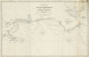
The North Coast of th Gulf of Mexico from St. Marks to Galveston.
sold
- Digital Map Information
- Suitable for large format printing
- DPI: 300
- File Size: 15.24 MB
- File Type: ZIP / TIFF
- ICC color profile embedded
- Delivered instantly via download link
An extremely scarce 1865 nautical chart or maritime map of the Gulf Coast by e and G. W. Blunt. This map, though titled ‘From St. Marks to Galveston' in fact only follows the coast from St. Marks to the Delta of the Mississippi River – suggesting ... (more details)
A c. 1720 map guide to English piracy and privateering in the West Indies.
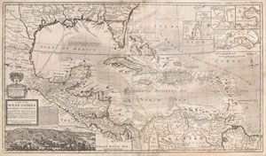
A Map of the West-Indies or the Islands of America in the North Sea; with ye adjacent Countries; explaining what belongs to Spain, England, France, Holland &c. also ye Trade Winds, and ye several Tracts made by ye Galeons and Flota from place to place. According to ye newest and most exact observations, by Herman Moll, Geographer.
sold
- Digital Map Information
- Suitable for large format printing
- DPI: 300
- File Size: 39.29 MB
- File Type: ZIP / TIFF
- ICC color profile embedded
- Delivered instantly via download link
One of the most remarkable and intriguing maps of the West Indies to appear in the 18th century. This is Herman Moll's superb circa 1720 mapping of the West Indies, Caribbean, Gulf of Mexico, Mexico, and the Spanish Main. Monumental in proportion, ... (more details)
The most detailed early atlas of Miami.
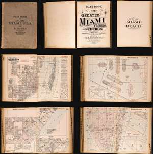
Plat Book of Greater Miami Florida and Suburbs from Official Records, Private Plans and Actual Surveys.
sold
This is the rare and significant 1925 first edition of the G. M. Hopkins atlas of Miami and Miami Beach. The atlas contains the most detailed early maps of Miami Beach. While, in most cases, insurance atlases like this volume are not significant, the opposite is the case of the G. M. Hopkins' Miami Atlas. Short of rare official maps and unobtainable manuscripts, it represents the earliest obtainable maps of Miami Beach, and to a lesser extent, Miami. As a point of reference, although there are earlier development maps, the first official map of Miami Beach was not drawn until 1920 and not committed to print until 1925 - the same year this atlas went to press. (more details)
A plat book of Miami on the eve of American involvement in World War II.
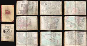
This is an extraordinary and rare 1936 - 1940 G.M. Hopkins Company cadastral plat atlas of Miami and Miami Beach, Florida - as such chronicling the development of Miami's iconic art deco architecture. The atlas consists of 53 maps, 40 of Greater Miami and 15 of Miami Beach. Coverage is detailed and extensive, including downtown Miami, Coral Gables, Little Havana, Edgewater, the Art Deco District, Ocean Drive, the Lincoln Road Mall, Star Island, Venetian Island, Hibiscus Island, Palm Island, Belle Isle, Indian Creek, etc. The detail throughout is outstanding, naming theaters, office buildings, hotels, public utilities, private properties, golf courses, racetracks, and much much more. This atlas was designed for use by the insurance industry to help assess property risk and value. Moreover, the maps were intended to be updated and revised as properties changed with labeled cutout pastedowns. Most, if not all, of the maps in this atlas exhibit such changes, bringing the plat book current to roughly 1973. (more details)